Though I am enjoying the beautiful “enchanted forest” of Newhalem Creek Campground, I am feeling the urge to “get high.” I know there are some incredible mountains around, but it seems as if most of them are hidden. Newhalem is only 500 ft in elevation, so any type of vista is tough to find through the thicket of trees.
It’s now the weekend, which means I have all day to hike. I am more of an endurance hiker than a speed hiker, so I like to do “big hikes” and take my time. Stop along the way, take photos, bask in the beauty, stop for a leisurely lunch, and just make a day of it with the mountain.
During my Friday lunch break, I hike up to the Newhalem Visitor’s Center to have a chat with the Ranger Man and get some suggestions for the weekend. I explain my criteria. “I like a loop trail or a ridgeline hike. Five to six miles is my sweet spot, but I will push it if there is something worthy to see.” He responds, “You are willing to push it? Good! Then I have just the hike for you! It is my very favorite hike in the park….Maple Pass. It has the most incredible views. I was just up there last week, and the wildflowers are still in bloom.” Say no more…
Did I mention already I am a slow hiker? I like to go at my own pace, not one set by someone else. If I am trying to keep someone else’s pace, my focus turns to labored breathing and cadence rather than appreciating the awe inspiring beauty around me. As the saying goes, “Unless you are the lead dog, the scenery never changes.” And I don’t like to lead the group either, because I don’t like the sound of encroaching footsteps crunching behind me. So no offense to my traveling community of friends, but today I have decided I am going to treat myself to a long, slow solo saunter up the mountain.
As I am doing my research on the hike, a little face appears below my bedroom window. It is Gayle, coming to ask if I want to walk into town. I tell her of my plans for the Maple Pass hike. As she is walking away, I think about calling after her and asking if she wants to go. After all, Jim’s Achilles sprain is still bothering him, so he is taking some time to heal. But I feel like my speed would be a hindrance, and she will not want to be gone all day. Not 10 minutes later, the little face reappears beneath the window. I don’t have to ask…she asks for me, “Would you mind??” I reply, “I would LOVE to have you join me, as long as you know it is going to take me all day to do this hike. You’d better bring a book.”
Now Gayle is about the most advanced hiker I have ever had the pleasure to hike with, so already I know there will be no problem in keeping pace with her. That is impossible! And I certainly know I won’t need to worry about the crunch of footsteps behind me. 😉 So I am thrilled to have her come along. We pile our gear in the Tracker, put the top down, and putter off for the 38 mile drive up the mountain to the Maple Pass trailhead. The weather is a glorious start to a spectacular day.

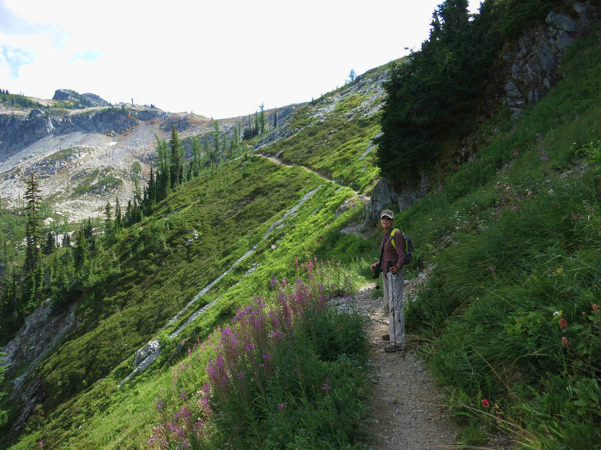
Gayle is a happy hiker

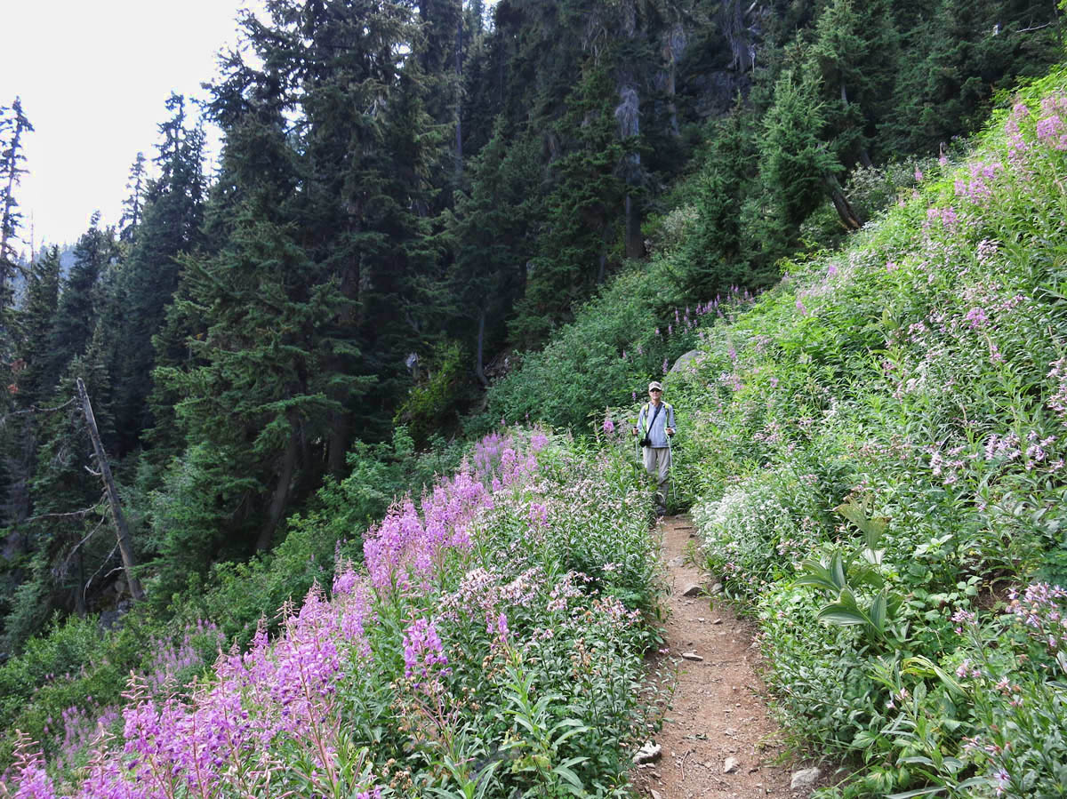
Through the Fireweed

Beautiful patch of Fire weed below
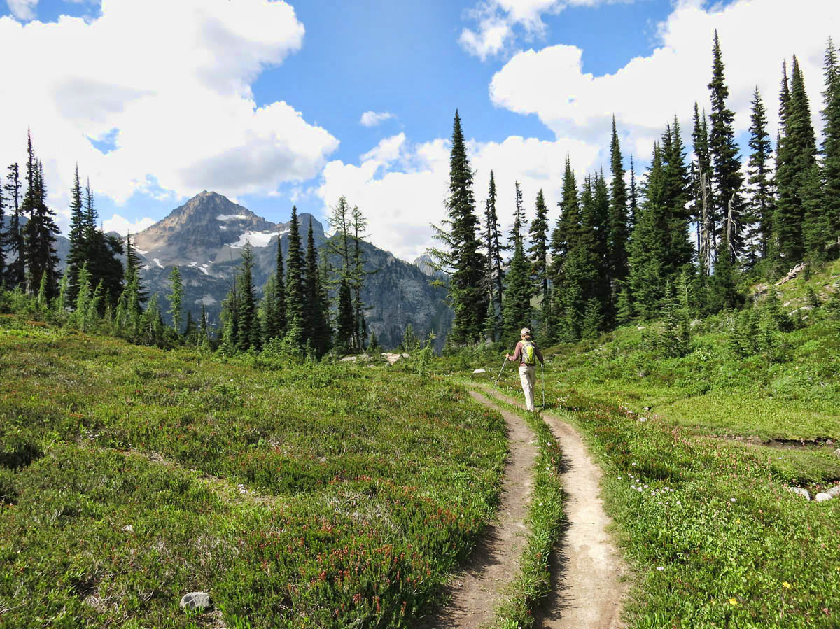
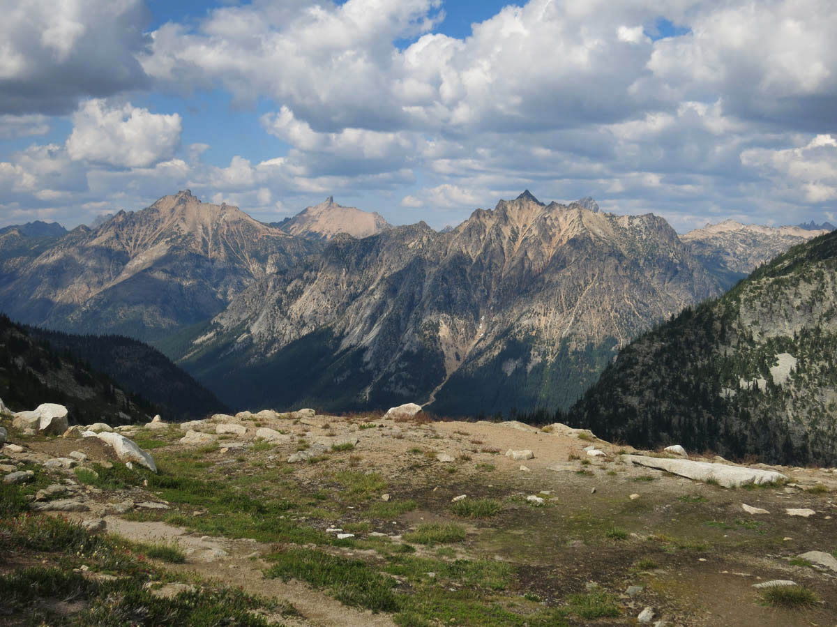
The Maple Pass trailhead is in the same parking lot as Rainy Lake, so the lot is packed with hardly an empty space. I find a perch to park the Tracker, and we start out on the hike. This is a 7.5 mile loop, 2,100 elevation gain, so right out of the parking lot, we begin the climb. But the air is cool…downright chilly, which makes it easier to climb.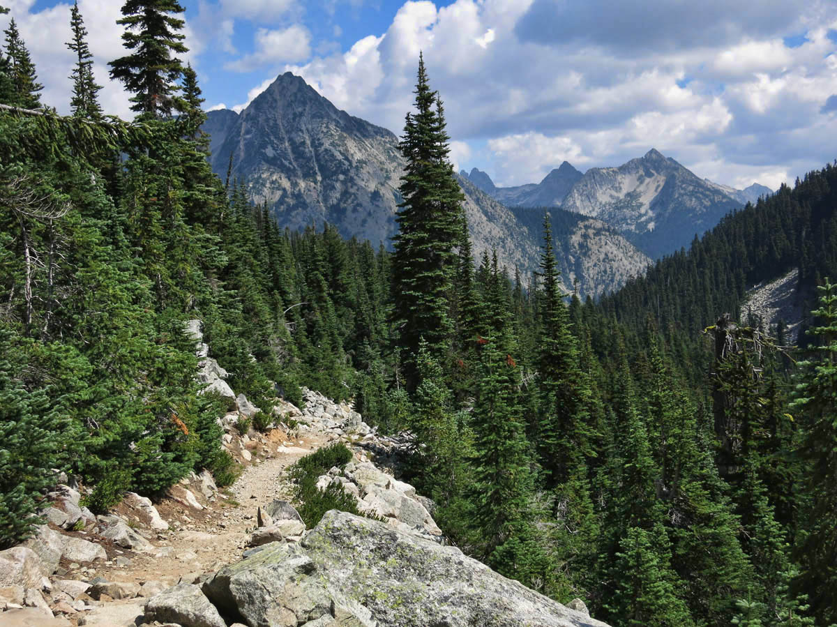
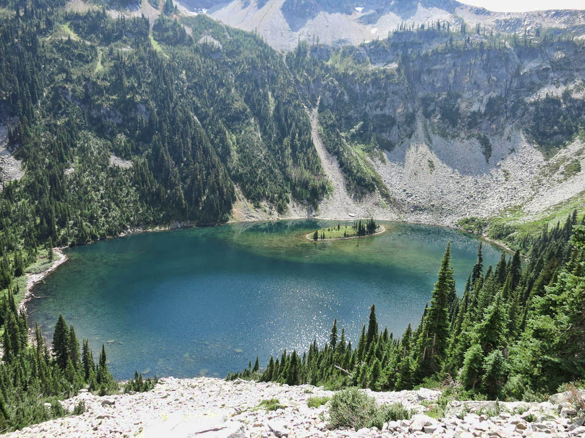
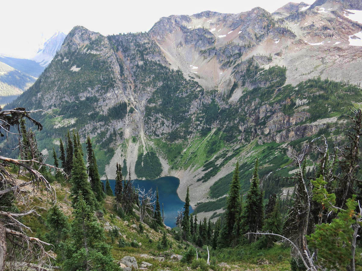
Beautiful Lake Ann comes into view
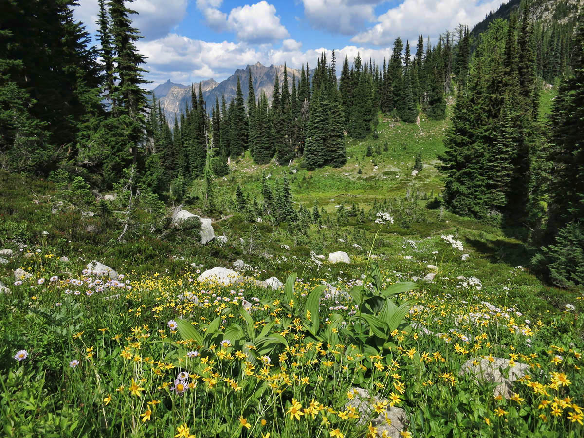
The trail starts in a thickly wooded forest with the smell of fir trees, and shade of giant hemlocks and cedar. Soon, we break into a meadow filled with purple fireweed. This is the first time I have seen this flower up close, and the size and color are impressive. The photo stops are frequent, and I am grateful for the opportunity to catch my breath, as I feel the effects of the altitude at only 4,600 ft. And I still have another 2,000 to go! As I am snapping photos, some guys stop and ask, “Is this your first time to do this hike? Just wait. You ain’t seen nothin’ yet!”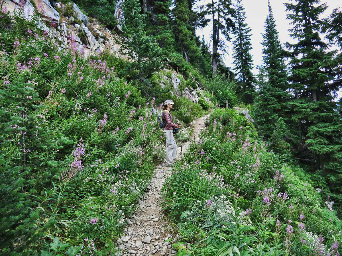
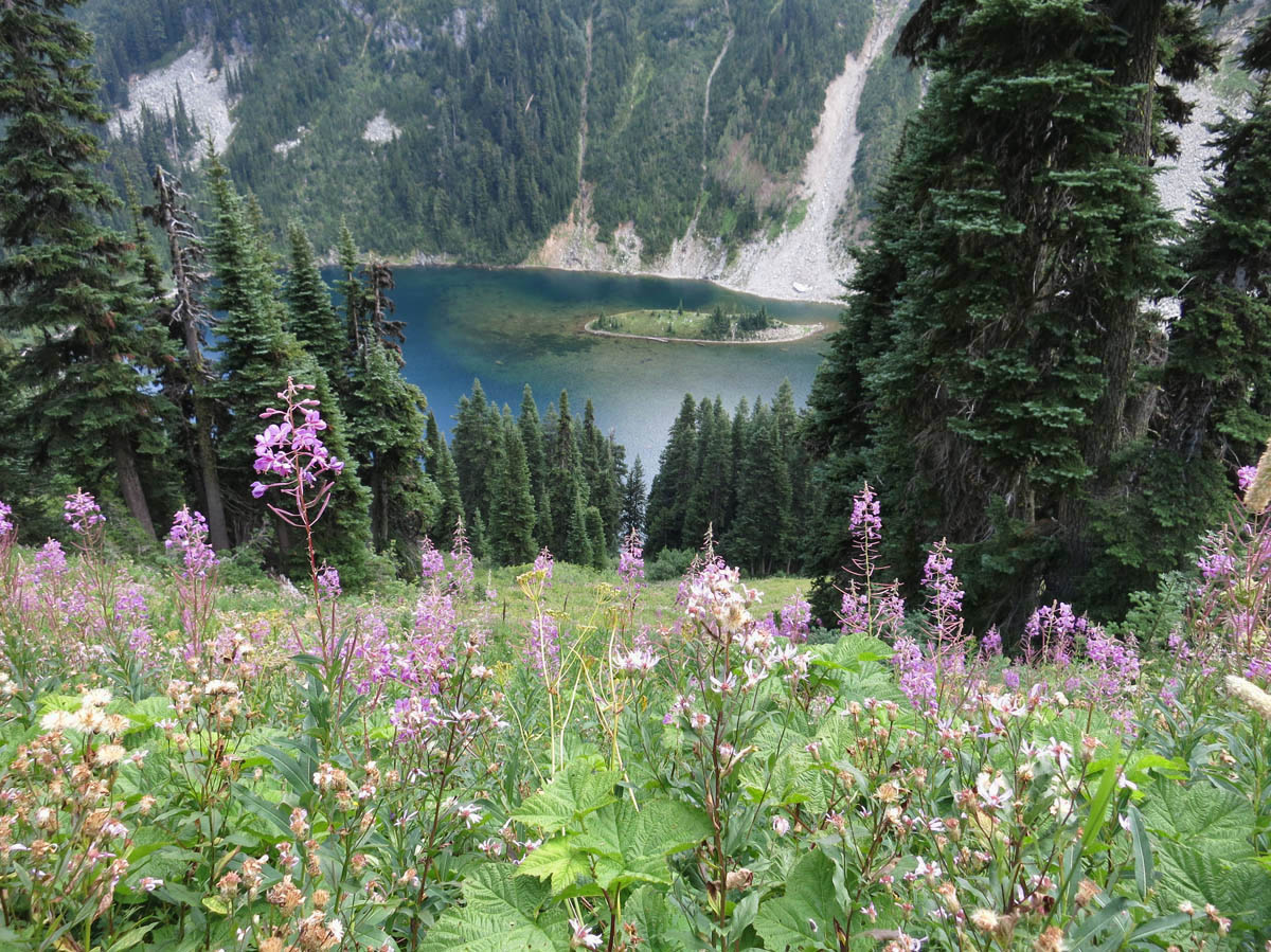
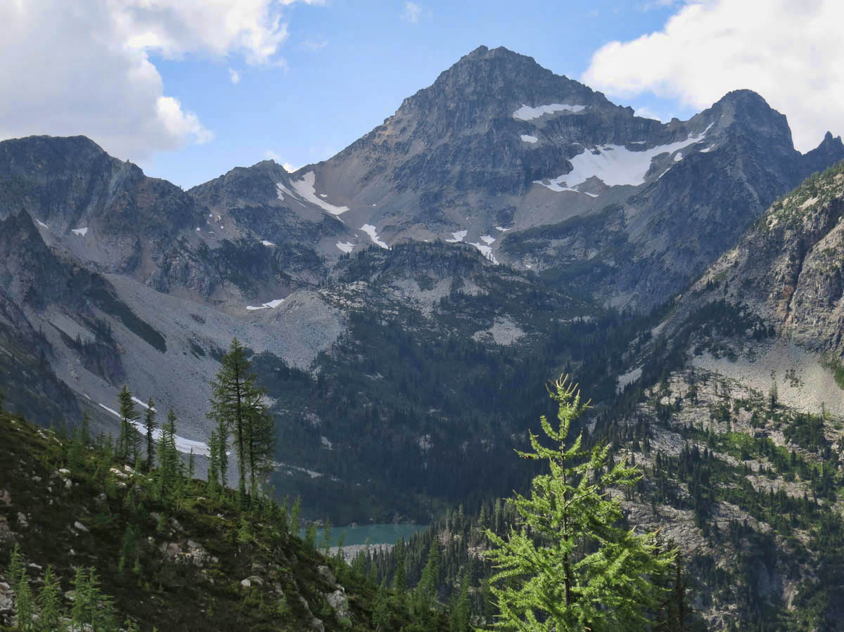
Soon, the clear emerald green Lake Ann comes into view. There is the option to hike down to the lake, but we continue climbing, as the Maple Pass trail skirts the “cirque,” or bowl around the crater lake. By now, we have worked up an appetite, so we find some suitable shade to stop for lunch, and enjoy our PB&J overlooking the gorgeous lake. We are both in awe of the stunning views, and still only halfway there!

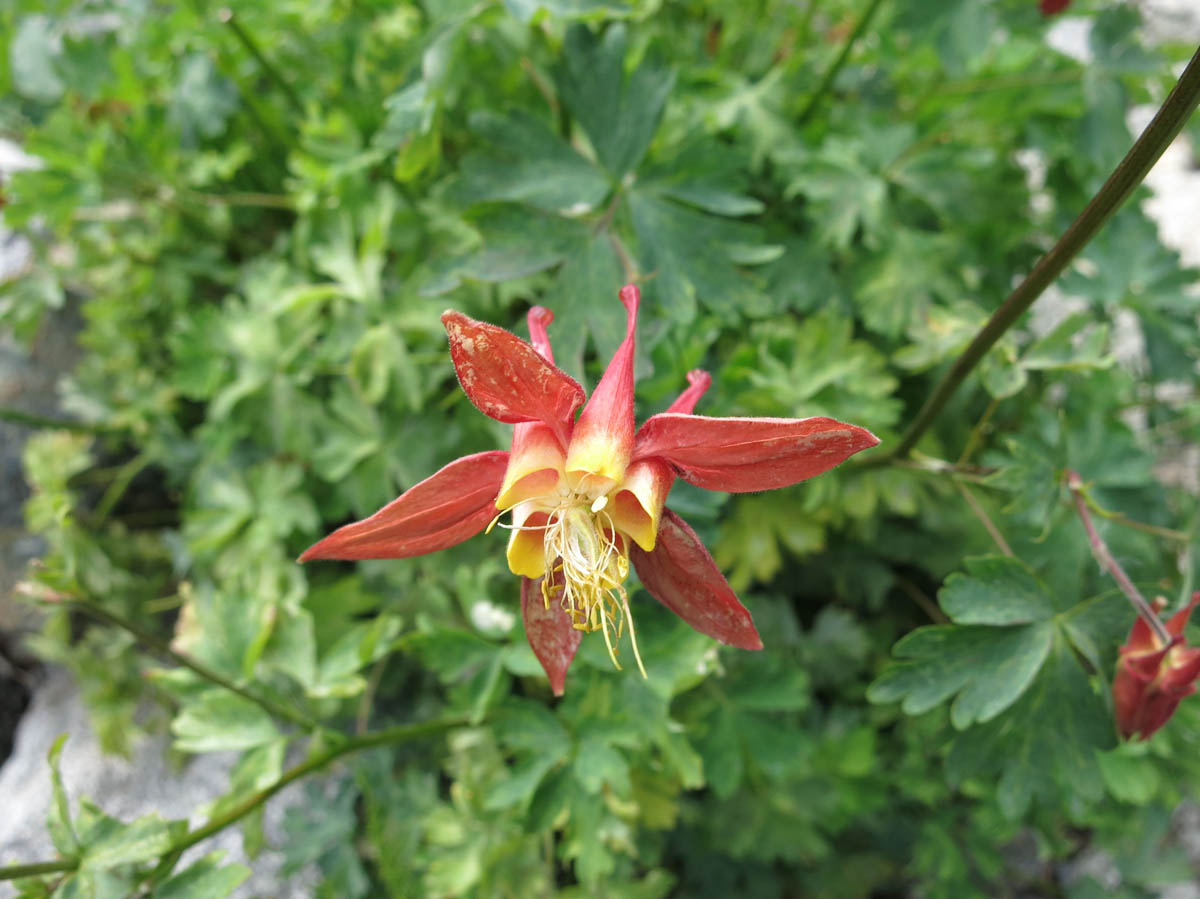
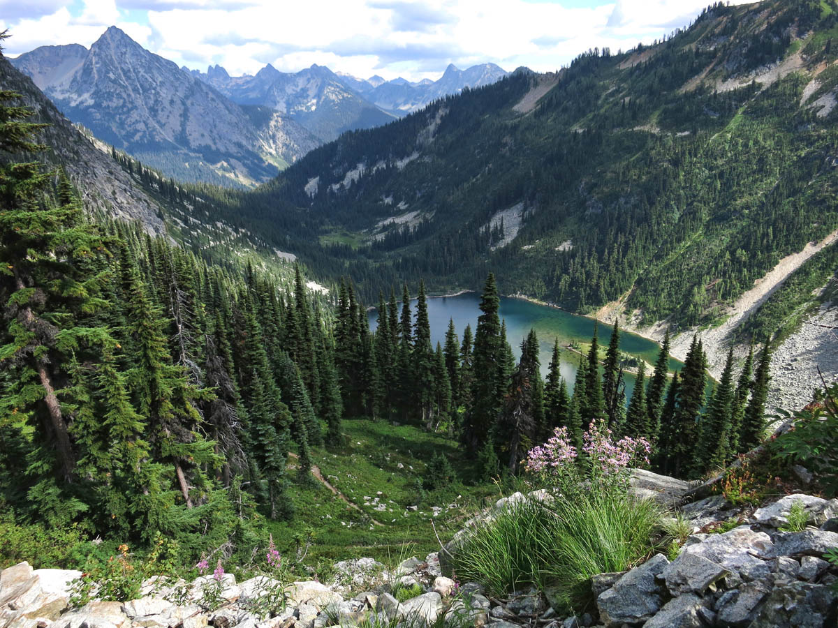
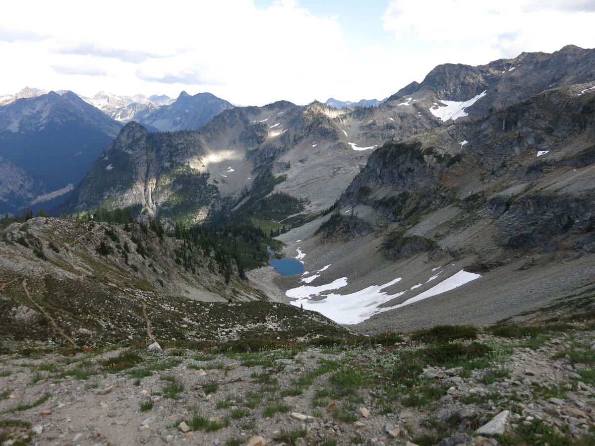
We come to the gorgeous Heather Pass, which is about two thirds of the way up. There are fields of yellow and white wildflowers and red Indian Paintbrush in the little meadow overlooking a blue glacial lake below.
Gayle hiking across Heather Pass
Heather Pass
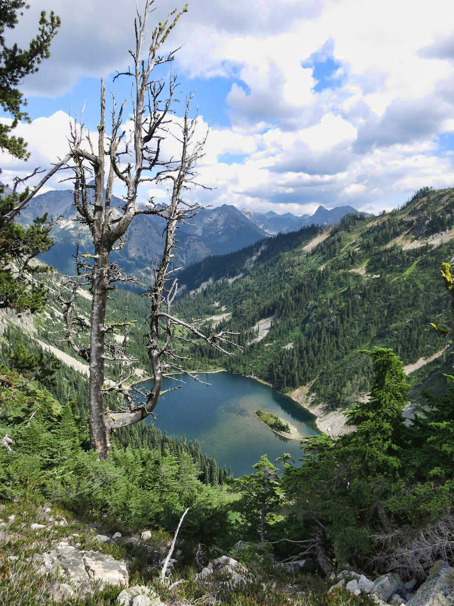
Hard to see in the photo, but there is a small glacial lake below.
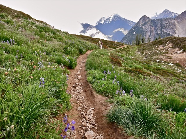
As we are approaching the steepest part of the climb, I pass a woman who is carrying a child on her back. I ask “How are you making this climb? I can’t get myself up the hill, let alone with a child on my back.” She replies, “I have given it over to God.” Now I am not a religious person, but I do believe we have available to us far greater power than we realize, so I use this mantra to get me up the hill. By now, Gayle is out of sight, and I am glad she is not there to hear me wheezing.
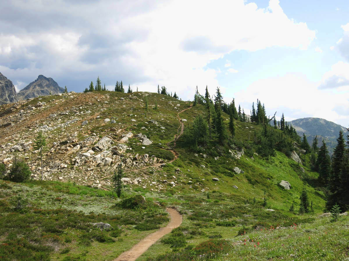
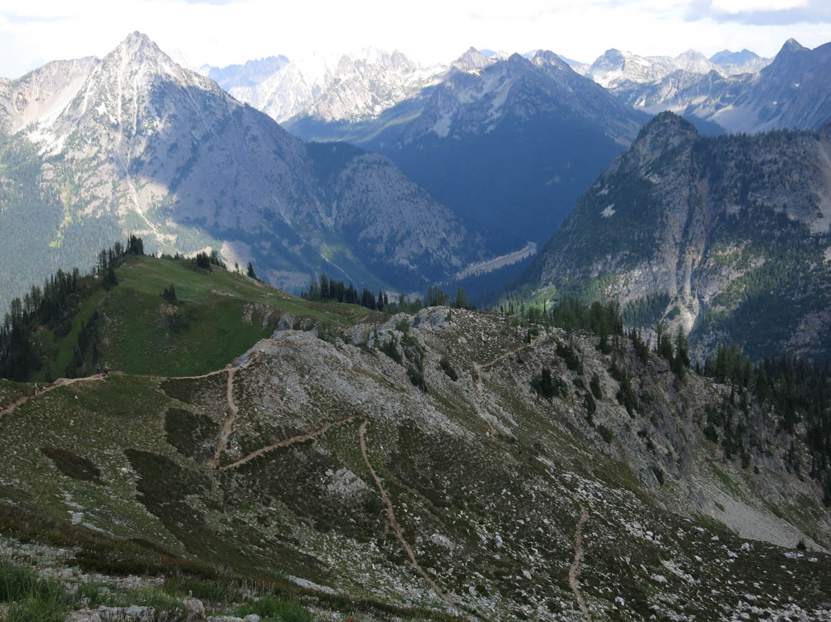
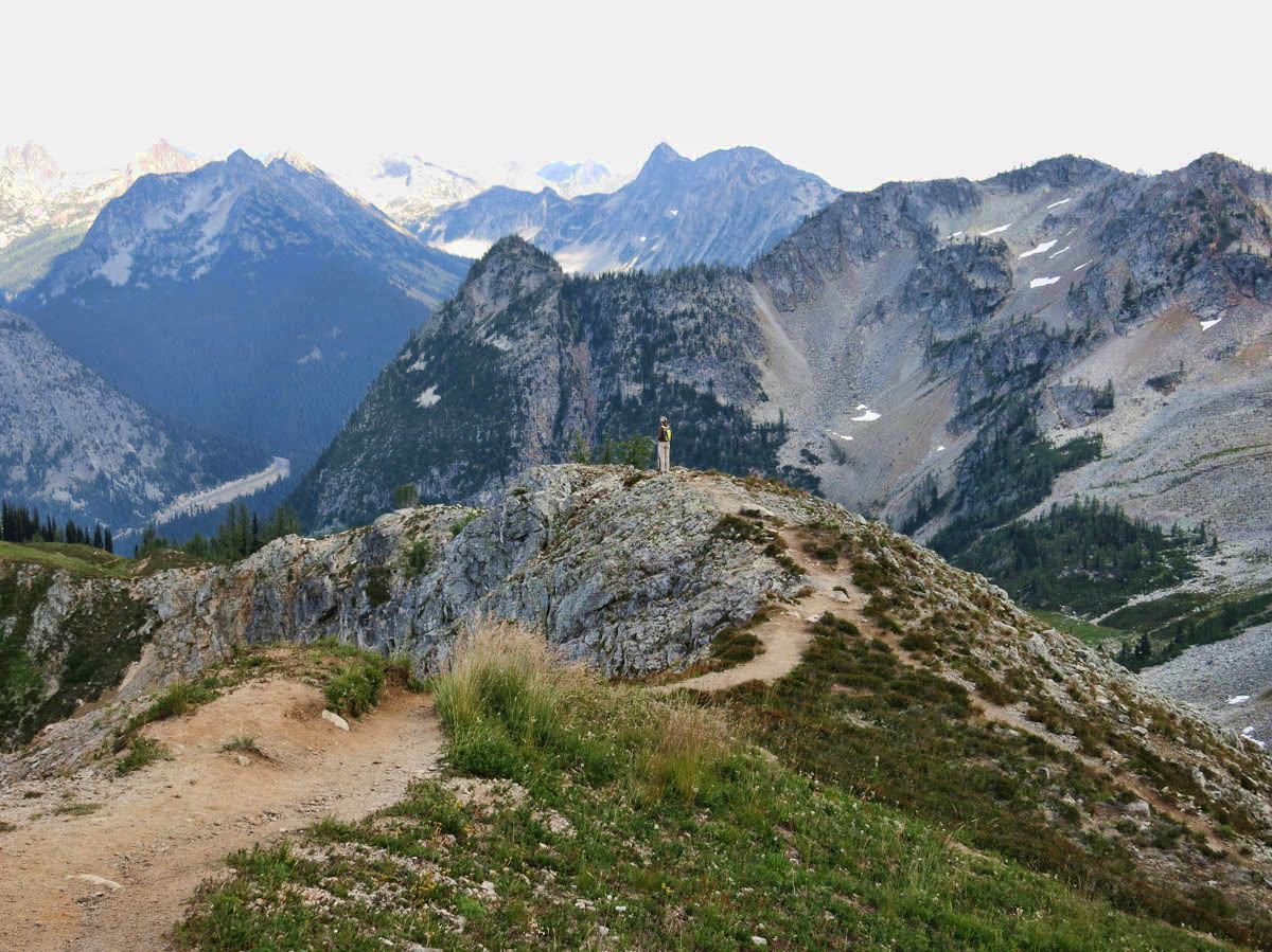
The Maple Pass trail circles the ridge around Lake Ann
Gayle tries to break it gently, “I think we are going up there”
Once we hit the open area of Maple Pass, there is still another ¾ of a mile climb to reach the highest point, and it is STEEP! But what a knock-out of a view! Complete 360 degree mountains! Oh, I am flying high! So I push on to the top, where Gayle is waiting. We stand and marvel at the majesty that surrounds us. I am so glad she has come along, as having her there to share in the elation only enhances the experience.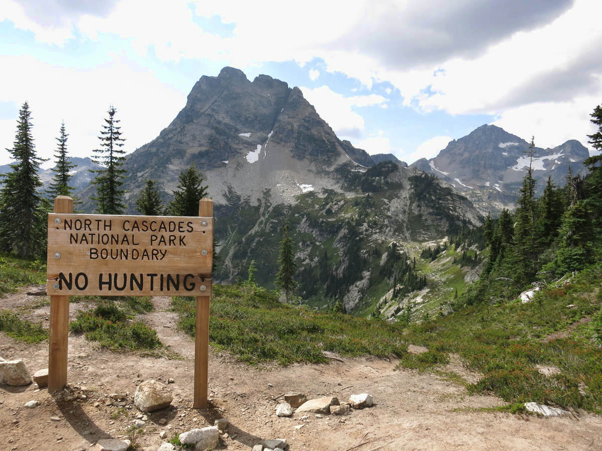
If you follow the trail all the way up, just to the left on the horizon…that speck is Gayle.

There is a 70 year old man at the summit who tells me that 49% of the glaciers in the Continental US are in this park, and he points to several of them. Then he takes off down the hill at a speed that makes my head spin, as he is out of sight in a matter of minutes.
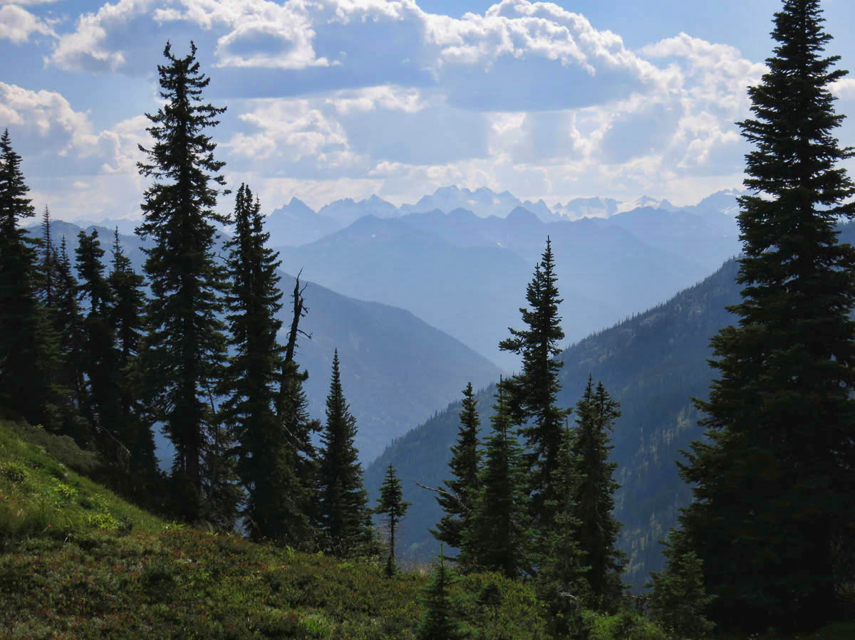
Looking across the Cascades where several of the glaciers are located.
Now, we must begin our descent down the steeper side of the mountain. I notice the sun is starting to drop low in the sky, so we can’t tarry too long. I do my best to keep up with Gayle, as I really want to be off the mountain before dark. LOL!
Switchbacks down the steeper side of the loop trail
The trail starts out with steep switch-backs, then skirts another alpine lake with a massive waterfall that we can hear from a good distance. The last mile and a half are through thick forest, and we hear all the spooky sound effects to add to the eerie atmosphere.
I swear, the hardest part of the trail was returning to the asphalt ADA accessible path, as it felt like it would never end. Finally, we are back to the Tracker by 6:00pm. It has taken us almost five hours to do the 7.5 mile hike, but we both are basking in the glow of one of the most beautiful hikes either of us have done in a long while.
As we arrive back at the campground, I ask Gayle, “How long would this hike have taken you and Jim?” Thankfully, she answers with just a smile…
Gayle out on the edge, basking in the beauty
That’s what the North Cascades is all about!
We must be on about the same wavelength Suzanne.
No, no, after thinking about it and going back over the photos, I’ve decided I might actually slow you down. Five hours for a 7.5 mile, 4000 ft elevation change mountain hike with such great scenery and so many distractions sounds pretty ambitious!!
And those ADA sections of trail!! They’re so much of a tease at the end of a long hike. I’d much rather just stumble along and be surprised that I’m back at the van than to be promised I’m almost there because ‘almost there’ so often turns out to be so much farther than that.
Love the photos and now I have one more pin in my map. Don’t know if I’ll ever manage to make it to all these pins but to hack up an old Irish toast, ‘May I die before running out of pins’.
greg
What a spectacular hike. I so wish that I physically could have done it. Your pictures are wonderful….I’m so glad you we able to do the hike and take me along in your back pocket!
Well I am super impressed. You are becoming a hiking maniac….7.5 miles of steep up and down with altitude. Solid stuff! And it was well worth the views, from your pics. Nicely done.
Nina
What an experience!
Spectacular! After your last post about all the dams and high-power electric lines running thru the Cascades, I was ready to write off this one as something undeserving of National Park status, but these photos demonstrate its worthiness. What a glorious day you both must have had!
Thank you for letting me “tag along” on such a wonderful hike! Hope we can do it again soon.
Gayle
What a fantastic hike & gorgeous vistas! THIS is North Cascades NP–so happy you found it! And hey–you & Gayle rock!
You sound like my kind of hiker! Hubby and I are sighing over your photos; they are fabulous! Although I know this hike would likely kick my butt I am putting it on the list for our hopeful WA trip next year. Thanks so much for a great post!
SO JEALOUS but so very glad you shared as it is now another for MY bucket list!!! Woohoo! Stunning views and isn’t it amazing what adreneline gets going when you see such beauty! I hike like you do – I always say I’m a “journey” hiker not a “destination” hiker.
That is one gorgeous trail. Those steep, high altitude hikes are lung busters for sure. It’s always a good thing when you hike a really tough hike and the payoff is truly worth it…looks like this one surely was worth it! Having never heard of this Nat’l Park before, it is now on my list thanks to you and your group for finding it for me!
WOW!!!
Makes me want to yodel…
Remarkable photos! What an amazing hike. We love long hikes with elevation, but I am a super slow hiker. You sure are seeing some beautiful country this summer.
I was on my knees on the Cascade Loop .. look what being a lazy assed ol woman caused me to miss…. absolutely exquisite photography …. oh… sigh
My hero 😉
John — Yes, I am very grateful I got to see this part of the park, as none of that was visible from the road.
Greg — Well, it was only 2,100 elevation gain, but it felt like 4,000! LOL! I toast to your Irish saying!
Karen — You are welcome in my back pocket any day! Thanks for following along. Glad you enjoyed the pics. It was my first day with the new camera, and I could have stopped to read the manual, but that would have taken too much time. haha!
Nina — Thanks! It was all that training on the Dungeness trail that got me there. 😉
Kim — Yes, one of my best summer memories, I think.
Lynne — This same ranger recommended a couple of other very scenic hikes,. I was just running out of time, but definitely a hikers paradise, if you don’t mind a little “vertical.”
Gayle — I was really glad you were there to share. Thanks for being so patient with my pace, and making it such a spectacular day!
Dawn — Thanks for the nice comment! Yes, I think I would like to explore more of this park one day…especially since it is a NP with 4G!
LuAnn — Thanks to you and hubby for your nice compliments. Yes, if I can do it, so can you! It was really just the top 3/4 mile that was so steep. The rest was gradual.
Sherry — Thanks, my Montana friend! I like that “journey hiker” comment. My problem is, once I get started on the journey, I want to see the final destination, and then I am hurting on the way down! But it was worth it!
Lisa — You and Hans would love the hiking trails there. Big pay-offs at the top! And there were more where this one came from. And pretty uncrowded for a NP!
Allen — It is funny, because we laughed about that yodeling goat herd song from the Sound of Music on the way up the Thunder Knob trail.
Karen — I am starting to enjoy the longer ones more and more. I just have to stop and rest occasionally, but I think the scenery is worth it!
Carolyn — Thanks for your nice compliments, and for paving the way before me. I learned about most of these places from your 2012 odyssey in Homer!
Wow, nothing like getting caught up on your posts and seeing photos like these to get me relaxed. Thanks for doing the hard part.