All comforts aside at the Pine Near RV Park, the thing that really kept me anchored in Winthrop for three days was my insane job. I had scheduled 10 days off on vacation to visit Glacier National Park. I always say you don’t really take a vacation from my corporate job…you just shove a week’s worth of work to either side. Once clients realize you are leaving, they start piling on the “one last thing before you go” list.
It was also a much longer drive from North Cascades to Glacier National Park than I had anticipated. It was a gorgeous drive along the Jocko and Flathead Rivers, following the expansive Flathead Lake just outside of Kallispell, with its 160 miles of shoreline. It seems as if I wound around this lake for a whole day. Between fueling up and provisioning stops, I felt like I would never get there.
Once I finally reach Glacier National Park, I walk into the Apgar Visitor Center and announce, “I have just arrived here having done no research whatsoever. I need lots of quick-launch advice, please!” After our obligatory talk about “solo hiking in bear country,” she recommends Avalanche Lake hike as one not to be missed. “Though you probably won’t have to worry about bears there…it will be crowded. It is our most popular hike on the west side. But still so worth it!”
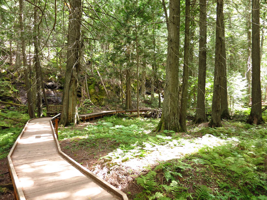
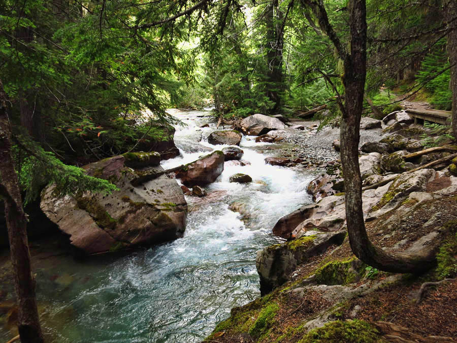
The Trail of Cedars Loop leads to Avalanche Lake Trailhead
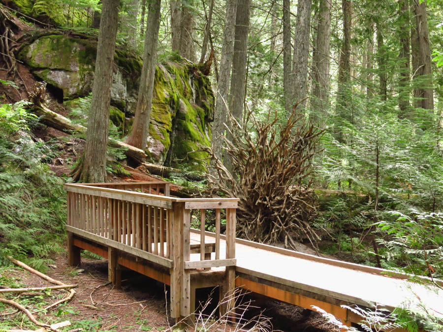
Have a seat and admire one of nature’s sculptures.
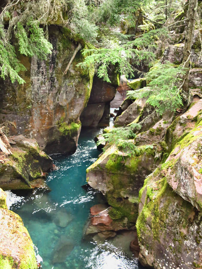
Avalanche Gorge
The trailhead for Avalanche Lake is about 10 miles up the Going to the Sun Road from Apgar Campground. The trail begins at the end of the .75 mile “Trail of The Cedars,” an interpretive path along an expansive boardwalk through 500 year old western hemlocks and red cedars. Since the western side of the park is on the far eastern reaches of the Pacific Northwest maritime climate, growth of these trees reaches up to 100 feet tall and 7 feet in diameter.
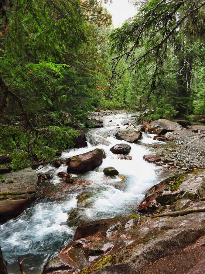
Trail follows Avalanche Creek. You can’t always see it, but you can hear it.
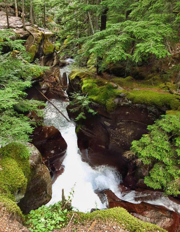
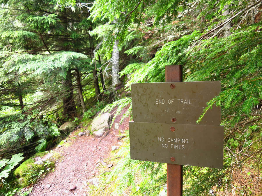
Just after the footbridge over Avalanche Creek is the trailhead for the 1.6 mile Avalanche Lake trail, making this a 5.5 mile hike out and back. The trail quickly begins a moderately steep climb that offers some stunning views of Avalanche Gorge. I stop to marvel at the powerful water colored by glacial silt, thundering down this narrow canyon as it slams into the serpentine walls.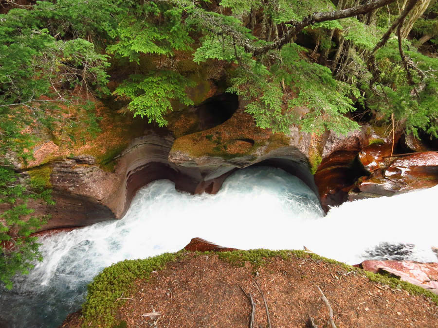
The ranger was right….it is a popular hike! The Trail of The Cedars boardwalks are lined with slow walkers and loud talkers. But I am in luck. Halfway to Avalanche Gorge, it starts to sprinkle. By the time I reach the Avalanche Lake trailhead, we are in a full blown rain shower. All manner of rain gear starts to appear on the trail, from brightly colored umbrellas to Hefty Cinch Sacks with arm holes.
I have never minded hiking in the rain, especially when it is through a thick forest. The smells and sounds are heightened by the dripping evergreen boughs and fragrant wet needles on the forest floor. I welcome the rain, as it seems inversely proportionate to the number of people on the trail. The more rain drops, the fewer hikers, until I am alone in the soggy forest. Yes, I am soggy too, but the silence is worth it!
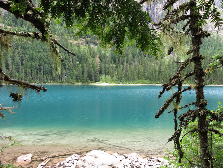
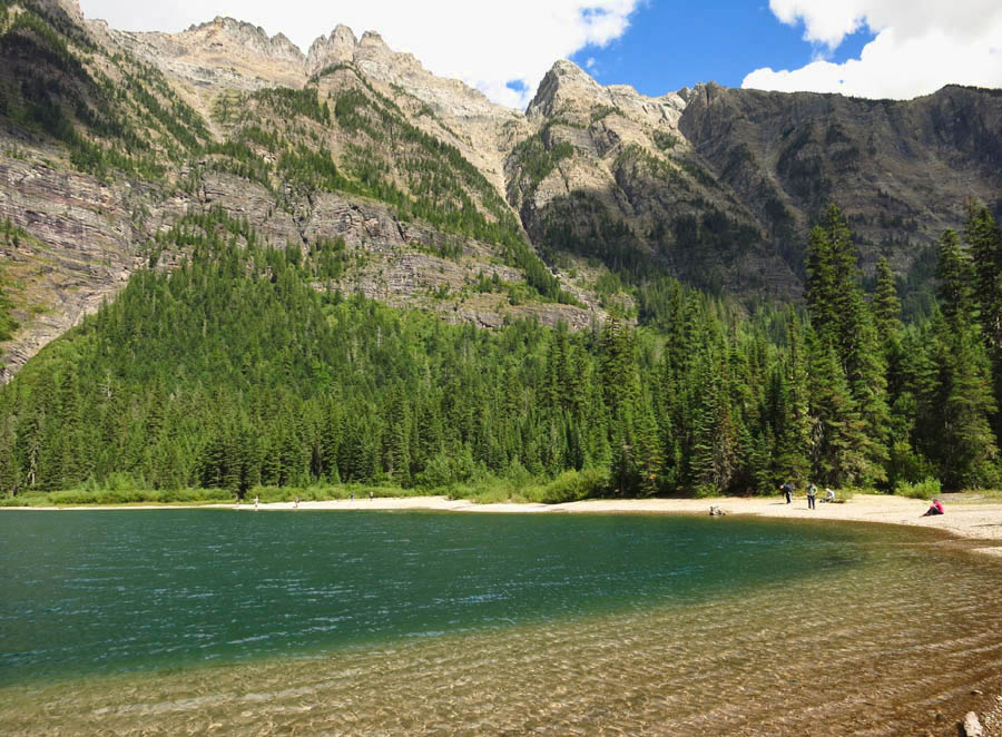
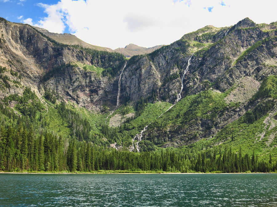
I can tell by the breaks in the clouds that this is just a passing sun shower, so I press on to Avalanche Lake. Soon, I begin getting a glimpse of the mountains and aquamarine lake through the trees. I start walking faster in anticipation of the view. I come to the head of the lake, and the trees open up to reveal a stunning “bowl” of stark mountains, with waterfalls cascading down into the glacial blue lake.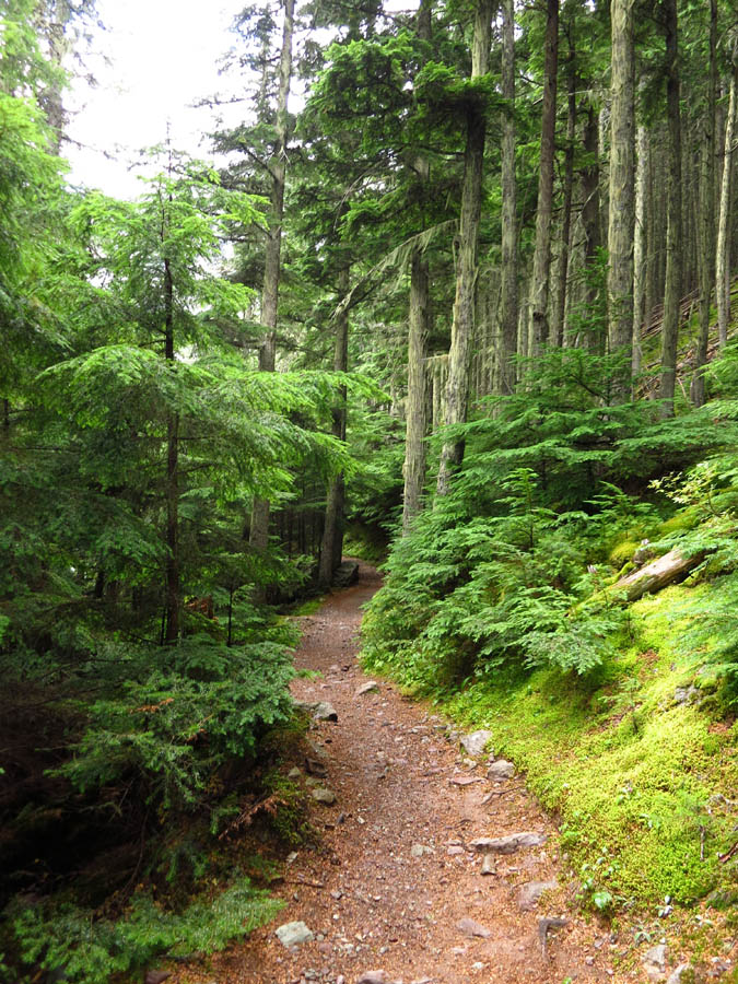
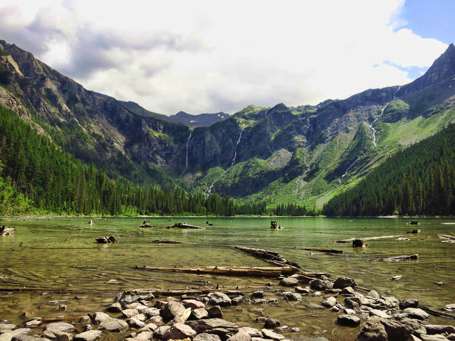
First glimpse of Avalanche Lake at the head, near natural “picnic area.”
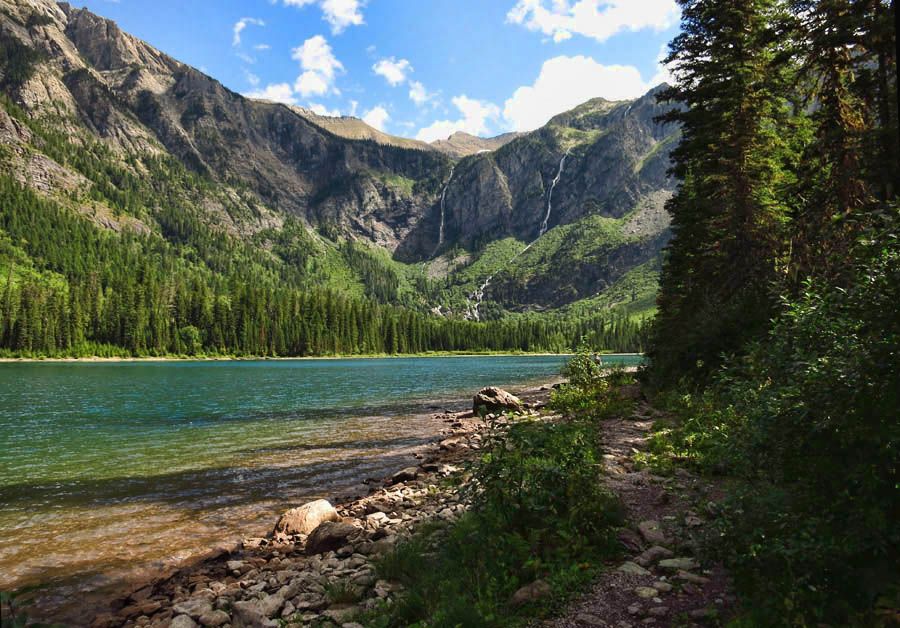
There are actually two trails alongside the lake, an informal lake shore trail, and a more defined one above through the trees.
I continue on along the western shoreline to the foot of lake where the trail ends. I go as far as I can along the beach, hoping to find access to the waterfall, but the brush becomes too thick. I turn and retrace my steps back to the large open area at the head of the lake.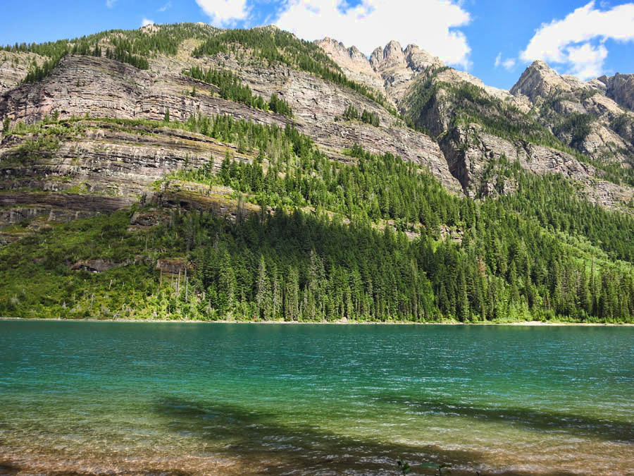
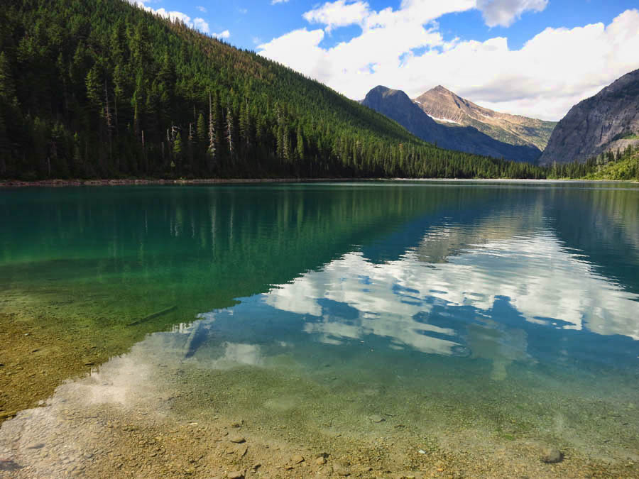
There are numerous logs and giant boulders just perfect for a lunch stop. By now the sun is out and warming my skin while drying my clothing, still damp from the rain. I find a large, slanted rock to stretch out and enjoy my crunchy peanut butter with marionberry jam sandwich. I don’t typically take long rest stops on hikes, but the sun and clouds are competing to cast varying moods across the lake. So I stretch out on the sun-baked rock to watch the show.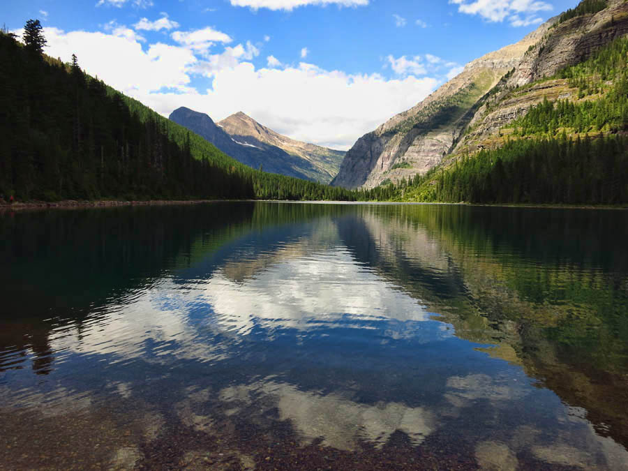
As I sit with this magnificent theatre in front of me, I think back to my childhood, of road trips to visit the National Parks. My Dad was a wanderer, and we got to tag along for the ride, as he was always pushing the boundaries of how far he could drag his family along on impromptu vacations in between crop harvests. Though we made it to many of the National Parks such as Yellowstone and Tetons, our road trips never took us this far north. My parents would have adored my RVing lifestyle, but instead made the choice to spend their money putting three kids through college. As I sit on this rock, I wish they had some of this beautiful Avalanche Lake scenery…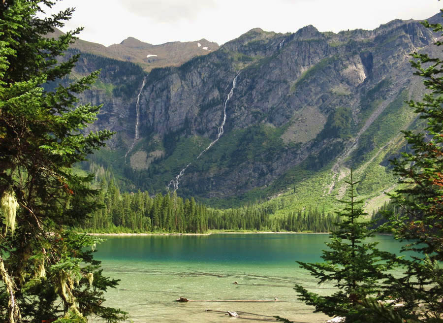
(Wildlife sightings bigger than a breadbox = 0)
This brings tears to my eyes! We are enjoying this beautiful scenery, though, through your fantastic pictures! I wouldn’t change anything if I could. We have three great kids that have offered the world outstanding individuals, of which Dad and I are very proud!! Keep enjoying life and taking those awesome pictures!
Love you very much,
Mom
Well, thankfully, your parents (and we) have your blog and beautiful photographs to enjoy of this very-photogenic park! I just had time for the Trail of Cedars and to snap the Gorge shot, but now that I see what’s up the trail…I need to go back! Thanks for sharing your great day.
What can I say. Lonely Planet missed a trick by not taking you on. I’m sitting on the banks of the Moselle drinking a very nice Cotes de Rhone and watching the barges go by.
Suzanne, We hiked this trail last August and saw a black bear within the first 5 minutes of the trail! It cross right in front of us about 30 feet away. You need to do the highline trail, park your car at the top and hike 11 miles mostly downhill and take the shuttle back up to your car. Have fun!
I think the reason we saw a bear on this trail was we got a pretty early start so there were very few people on the trail ahead of us. Though every time I think that, then we see a bear in some busy parking lot in the middle of the day…go figure!
Beautiful place and photos!
Sweet!
Beautiful! Can’t believe how much I’m already missing the narrow, moss lined, thumbling creeks of the northwest.
It was raining the day bobbie and I hiked that trail, too. It did help keep the crowds back in camp, tho. It will start snowing up there any day, if not already. It is so much fun to follow your adventures through photos and prose. Keep it up.
The challenge will be to sate your audience when back home :)) That sound you heard was a “gauntlet” being thrown down :)))))
Box Canyon Mark
You are right on about corporate life, especially when your employer is preaching “leaner” or “work smarter” or some other Dilbertese slogan. Glad to see that you were able to take one of the park’s classic walks. When you go back, try the Granite Park chalet trail. It’s a delight!
Tom the Awning Fixer
Mom — What a sweet thing to say! Love you too!! xxx
Lynne — There were so many “whats up the trail” spots in Glacier I could have stayed two more weeks. Definitely a park worthy of another visit!
Dave — It sounds like you are the one writing the LP! I love that you are reading my blog on the Moselle River. LOL! Will there be photos forthcoming?
Hans — I had hoped to hike the Highline, but unfortunately the weather didn’t hold. Reason enough to return!
Lisa — I think you are right about the timing. I purposefully waited until mid-day as they said trail encounters were more likely early morning or late in the evening.
DW — Thanks! And thanks for all the “assist” with the camera research!
Kim — Agreed!
John — It is hard for me to leave it behind as well. What a summer it has been!
BC Mark — If I could write about “family dynamics” back home, that challenge would be easily met. 😉
Tom, my Awning Fixer — I toyed with making that hike, but the “easy” way was 15 miles long! I definitely want to go back some time and stay in the lodge, where I can break it up into two 7 mile days. I have done several hiking lodges where the only way in is to hike in, and always enjoyed this experience, so more incentive to return to Glacier one day!
Big fat sigh!