My original intent for standing in line at the Arches Visitor Center when the Fiery Furnace tickets became available was to ask the Ranger about the Devil’s Garden Trail. I read in the park newspaper that it is an excellent chance to get up close and personal with eight different arches!

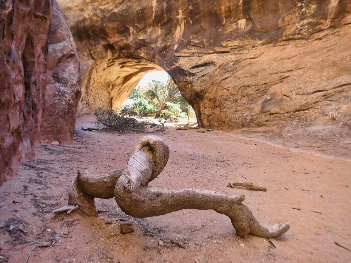
Tunnel Arch

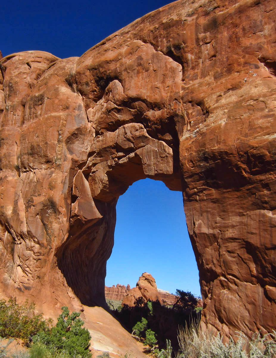
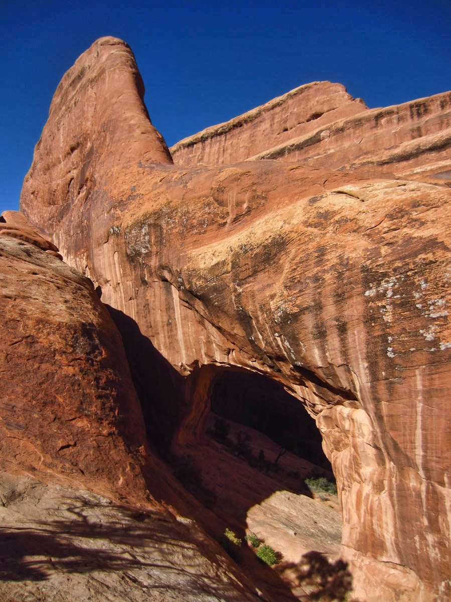
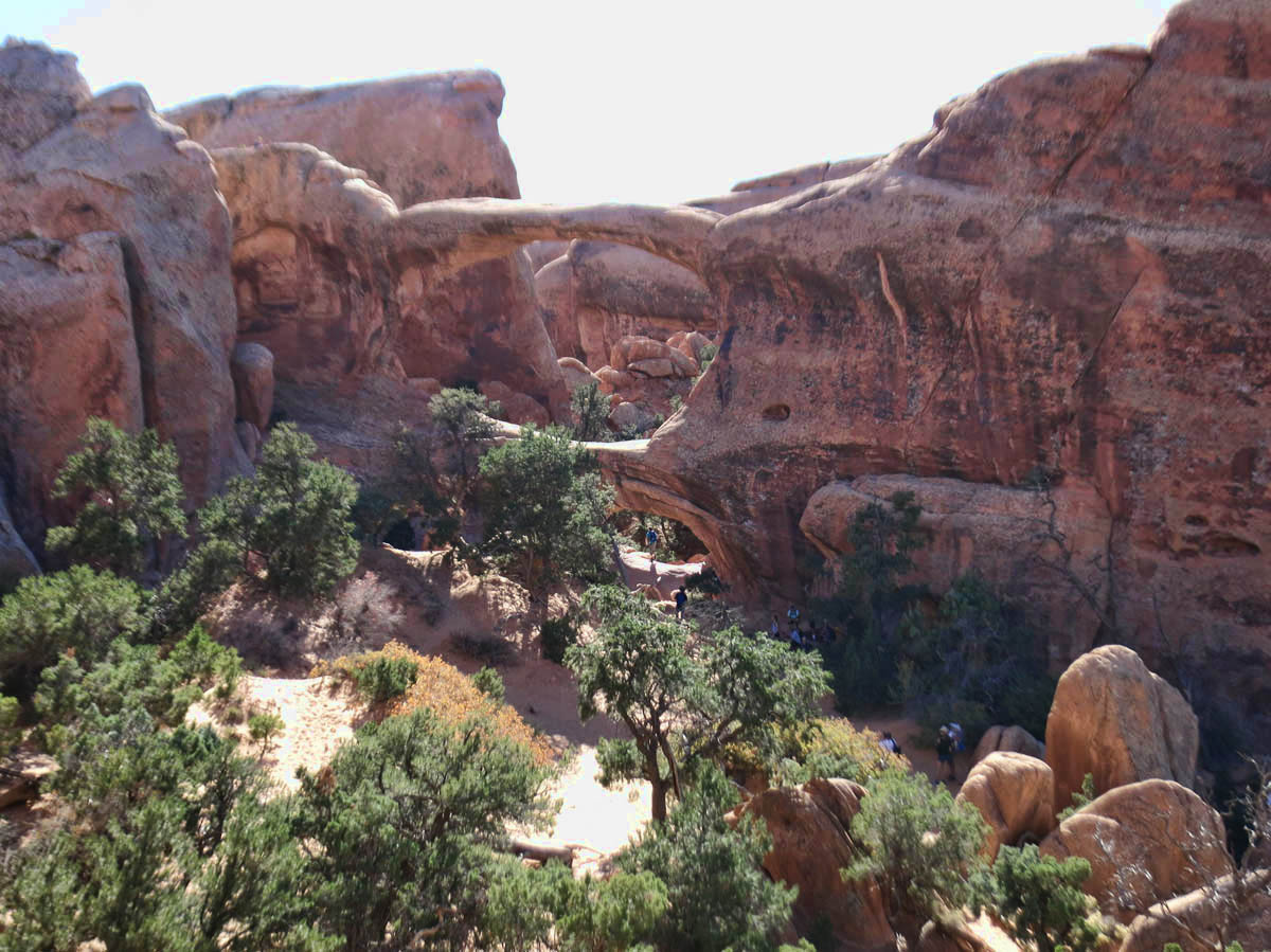
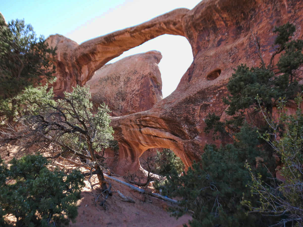
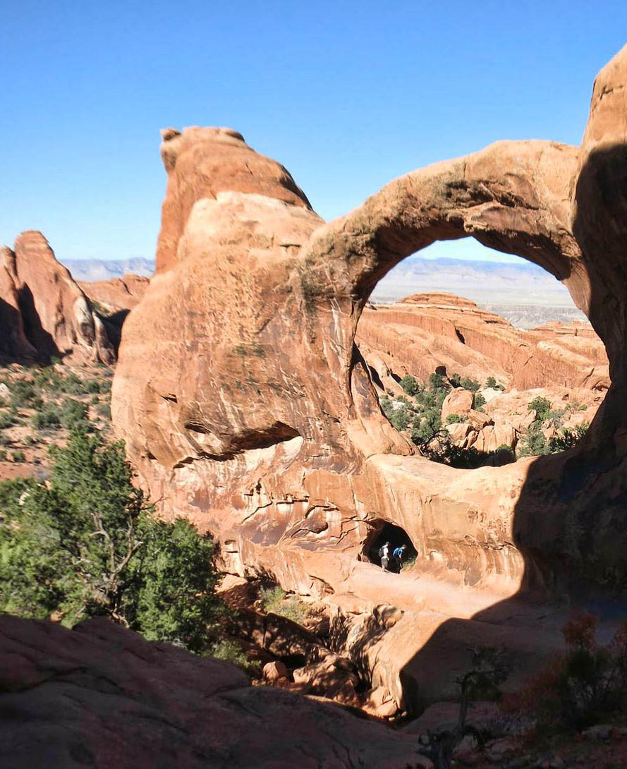
Partition Arch has two openings

Looking through the larger window of Partition Arch
But I also read there are some challenging spots along the primitive side of the loop. So I ask the Ranger, a young woman who looks to be about 18. She has a very monotone, expressionless delivery, as if she is reading from a script: “Two thirds of the way around the primitive loop, there’s a pothole. You will need to wade through waist-deep water. Some try to go around, but I don’t recommend it. We did a search and rescue there last week.” Well, gee. Thanks for the warning. At least it was a rescue and not a “recovery!”
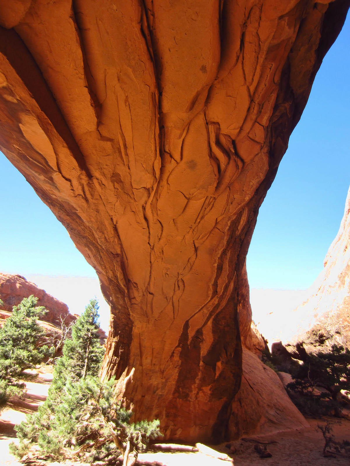
Pine Tree Arch
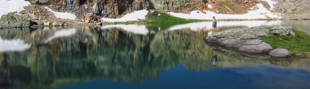
Arches National Park has the densest concentration of arches in the world. They are formed in the entrada sandstone when water dissolves layers causing “fins” or upright shelves, and sandstone erodes beneath them. The NPS website has a great explanation on exactly how it happened that so many arches formed in one location. In order for an arch to be classified as “official,” it must have a light opening of at least 3 feet in one direction. An arch is defined by soil eroding from beneath, while a natural bridge is caused by water erosion.

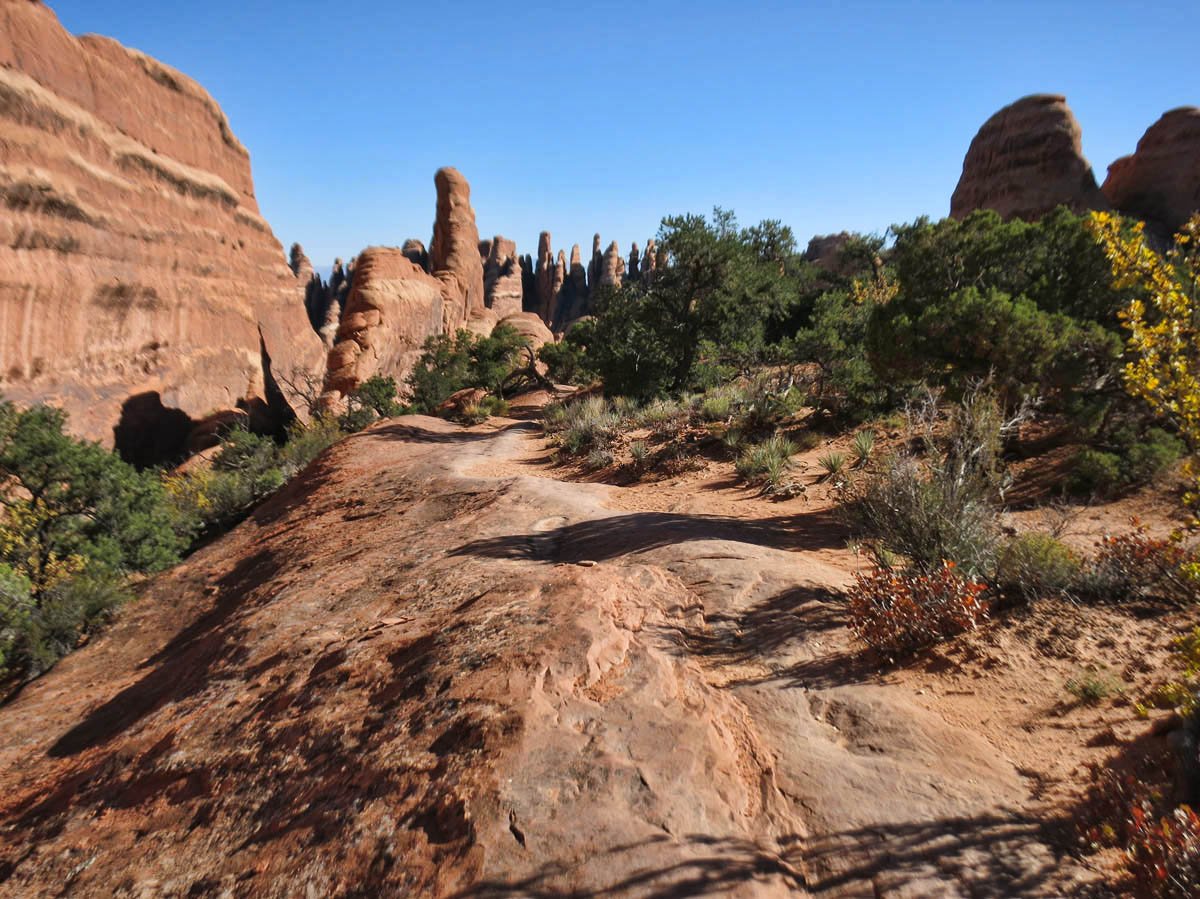
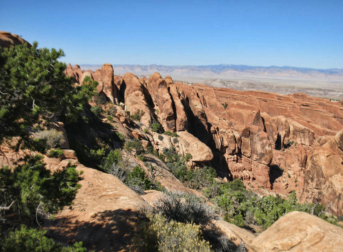
Fin Canyon
At 7.2 miles, the Devil’s Garden is the longest maintained trail in the park, and the second most popular, eclipsed only by Delicate Arch. I decide to go clockwise, because the trail starts out paved, pedestrian, and packed, but supposedly crowds die out after the first mile. And I get a late start because I reached the Visitor’s Center and realized I had forgotten my hiking socks, so I had to go into Moab for an $18 pair of socks. 😉

Why does the trail have to follow the top of the fin? It’s a long way down, or at least so it seems!
Private Arch. Entrance looks like a ship stack.
The main attraction in the Devil’s Garden trail is Landscape Arch at 290 feet across, reported to be the longest spanning arch in North America. The trail once passed underneath the arch, but has since been closed due to falling rocks. It is so thin; I wonder how much longer it will be the main attraction along this trail.
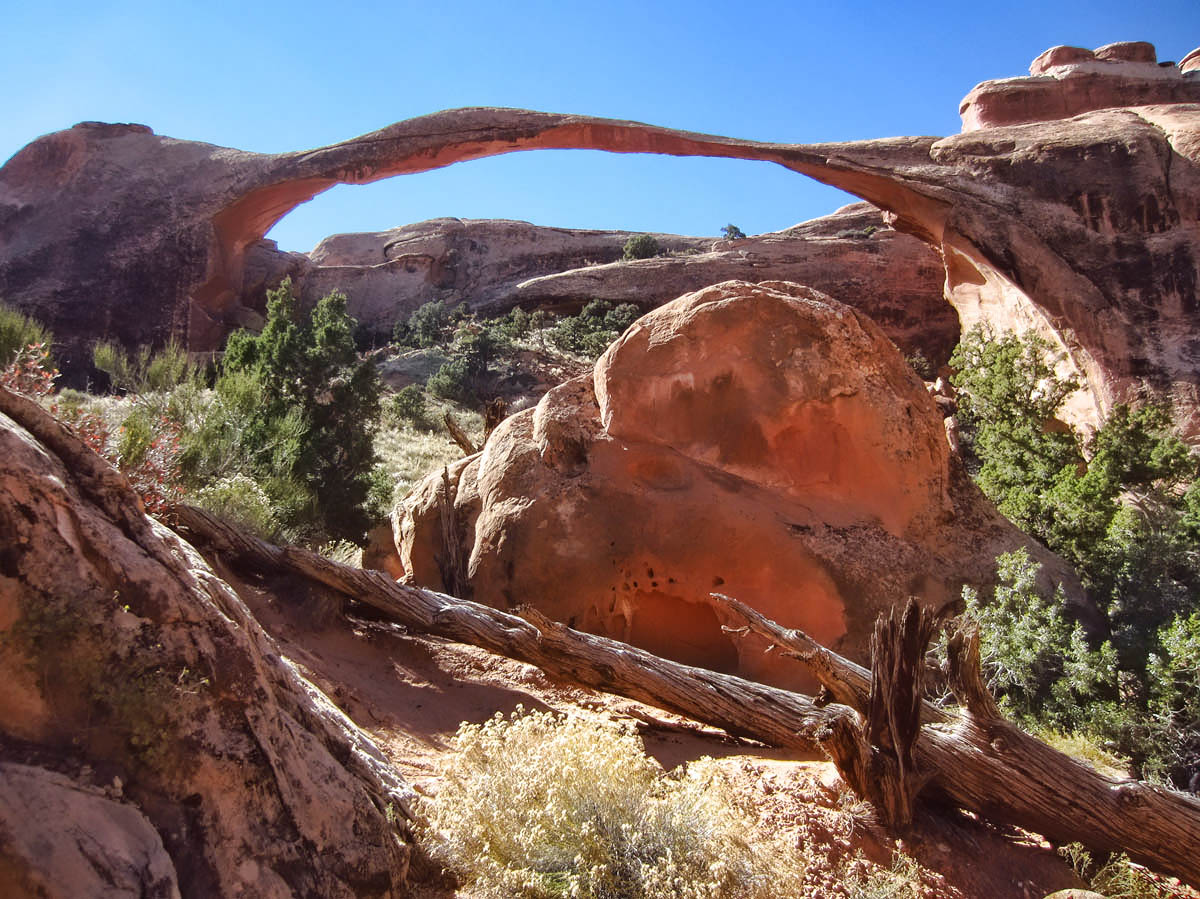
Landscape Arch, longest span in North America.

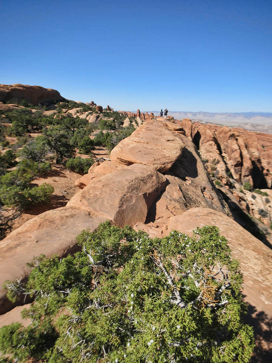
More elevated trail. Feeling like the skywalk!
There are spurs off to lesser known, but equally impressive arches along the way. My favorite of these is Navaho Arch, which opens up to a quiet little alcove with a nice little sitting area to reflect and ponder the spiritual reverence that must have given this place its name. The Native Americans would have surely considered such a place sacred.
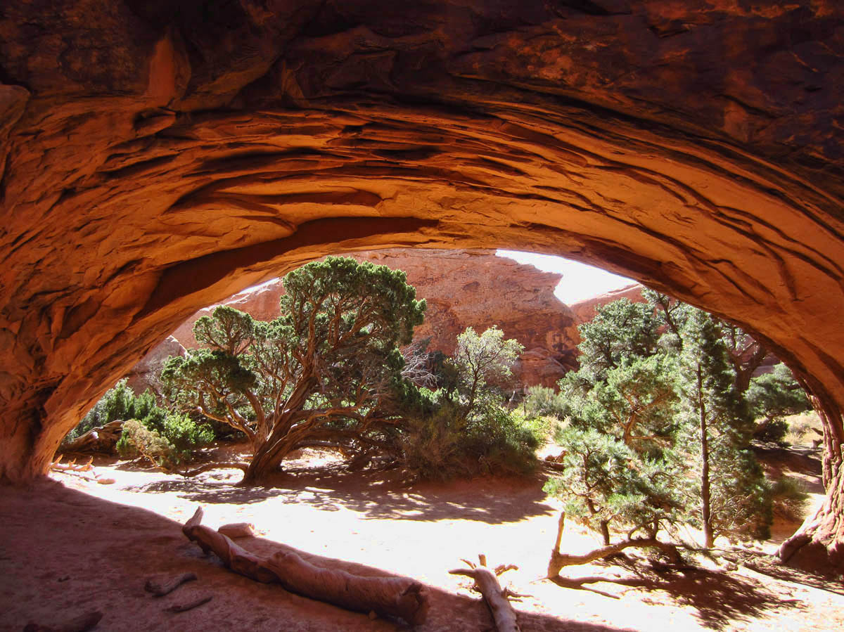
Navaho Arch
“Have a seat on my knee.”
The final “big ticket” arch is “Double O,” but one has to work to get there! The trail follows a couple of very narrow fins with a 40 ft drop on either side. Both fins are approached going uphill, which is incentive enough for me to continue on the “primitive” loop, as I do not want to backtrack downhill on those fins!
Double O Arch from trail across the fin.
Double O Arch
Looking from the back side of Double O. Note people in smaller arch below for size perspective.
The back side of the loop is a bit more challenging than I anticipated. The trail cairns (small piles of rocks) are not consistently placed. They are either too frequent or none to be seen, so navigation is more challenging. Following others footsteps is not always certain either, as I even briefly follow a couple of other hikers who turn out to be lost. It takes a good bit of scrambling and sliding over slick-rock in some places. Suffice it to say I learn a valuable lesson on why you need a good fitting, sturdy pair of hiking pants when sliding down steep faces of slick rock. Two words, “Road Rash!”
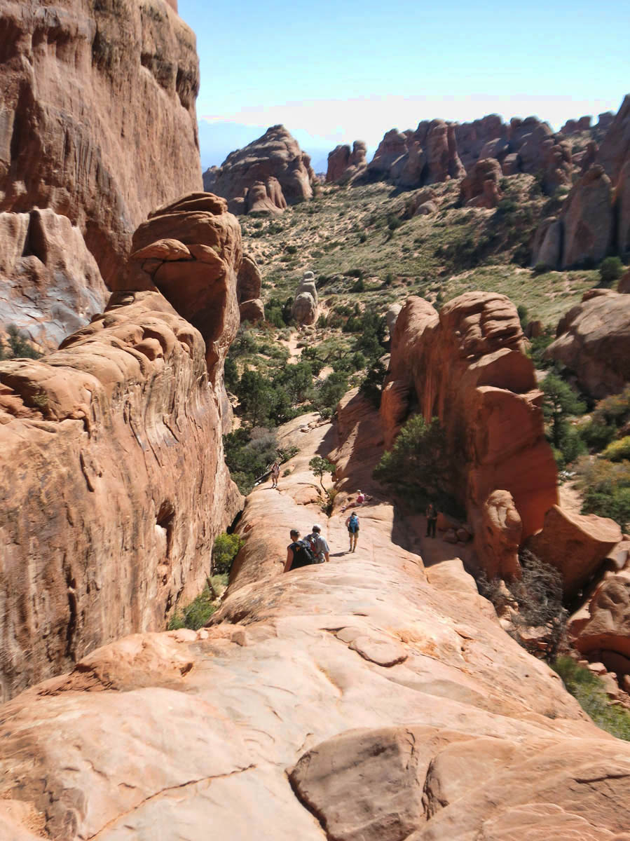
Fin portion of trail is up, up, up.
“Fins to the Left. Fins to the right, and I’m the only bait in town!”
 As I near the bottom third of the loop, I finally come to the milestone I have been anxious about all day, the “pot hole,” which the Ranger described as having to navigate waist-deep water, otherwise risk a search and rescue. When I see it, I burst out laughing. I have been worrying about this all day? As I skirt around the ridge on the right, I think perhaps the Devil has made a deal with the young Ranger…to scare people out of his garden!
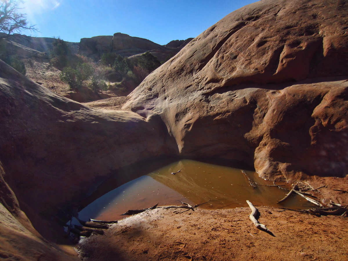
The big, bad, scary pothole.
Excellent hike and narrative! Jim and I are putting Moab on the list for next year. I’m happy that the 4 feet of water turned out to be nothing.
That is too funny! I was anxiously waiting to see what this pothole was like…seriously! I didn’t remember any water when we did this hike.
I see you had the same problem in the same area we had trouble getting down since there weren’t any markings. Yup! Need good double padded butt pants!
This is a cool hike, though, isn’t it! We actually found 11 arches. We found one as we wondered off trail that no one mentioned anywhere. We named it “John’s Arch!”
Glad you didn’t let the ranger deter you nor forgetting your socks:)
I am so impressed that you did this on your own. You rock girl! If I never get there I can die happy having enjoyed this hike through your eyes and words.
Did you get out of Gearheads with just a pair of socks? It may be the most tempting outdoor store that I’ve ever been in & we really appreciate their free filtered water.
LOL at all the water you had to cross. GREAT pictures of the arches. That’s what we thought about landscape arch too. Not sure how long until it is just too thin to stand. So glad we both got to see it. This is another of the hikes we had to skip being forced to leave early. Hope we get back to take it. I think doing it “backwards” is the best idea.
Your photos and comments are just the best – we were in Arches, Canyonland and area in 1999 – your pictures have reinforced just how beautiful that area is – totally awesome. I wanna go back…….
Hans and I did this hike in 2007, counter clockwise,and loved it! No water in any potholes though!
I have been having issues with comments on your blog lately. The last two posts I couldn’t see the comment area at all, this time my first try didn’t go through…hopefully this time will work!
I look forward to your blog every time you post. Did you realize your photos seem to be increasingly more crisp and colorful. Whatever you’re doing, keep it up and thanks for exciting me.
Wow, I am so impressed by your hike, prose and pictures! I have never even heard of a lot of the arches which you visited. It is not nice to envy, but I envy your experiences at this park.
peace and thanks
Hi, Allison! — I would like to return to the Moab area, as I feel I only scratched the surface. Already Mark is saying, “But you didn’t see the goooood parts.” haha!!
Pam — And I even carried a pair of water shoes with me that entire hike! Can you believe? I am not sure if I was glad or sad there was no wading!
Contessa — You are the brave one with the week you have ahead of you!
John — The question should really be, “Did you get out of Moab with only one trip to Gearheads?” No! 😉
Sherry — I am glad you and David at least got to see Landscape arch before you headed back. I think the others will be there for a couple more hundred years. 😉
Sandy — Thanks so much for the nice comments! It is a great place!
Lisa — Thanks for letting me know about the comments. I can’t recall…are you guys Apple or PC?
GypsyLarry — Thank you so much for the very nice comment! They are indeed exciting places, and I try not to take seeing them for granted!
Allen — If my prose and pictures get better, it is only because your comments keep getting nicer. Thank you, and my best to Deede!
PC
hah! .. the ranger didn’t know with whom he was dealing with here… AGAIN gorgeous hike and pictures and taking me where I’ll never … and I never say never … will go !
you do concern me going on such terrain by yourself but then .. you’ll do it and you are experienced but … as you said ….
“Fins to the left ~ fins to the right and I’m the only bait” … HAHaaaaaa