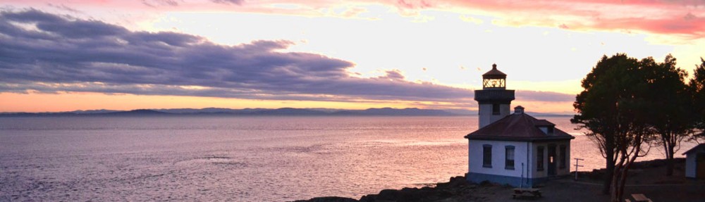
What’s in my bucket these days is rain. Lots and lots of rain. No, make that flash floods. I feel as if I have hopscotched the State of Utah for an entire month, chasing favorable weather. From the scorching heat of the Green River and Moab, to the flash flood warnings in Cedar Mesa, Utah has not been easy this year. I have said hello and goodbye to the same set of friends so many times I no longer get a lump in my throat with a trembling lip at the first touch of a farewell embrace.
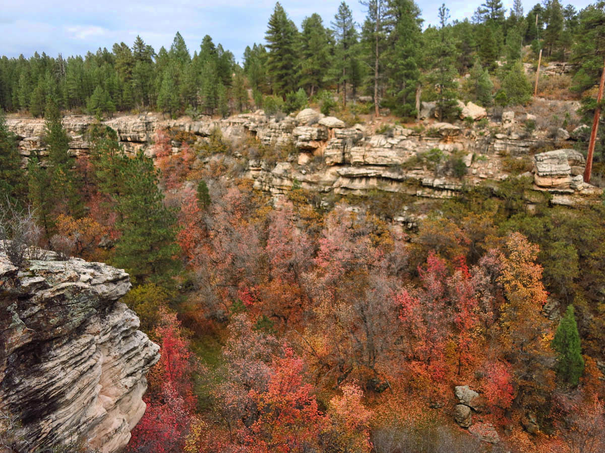
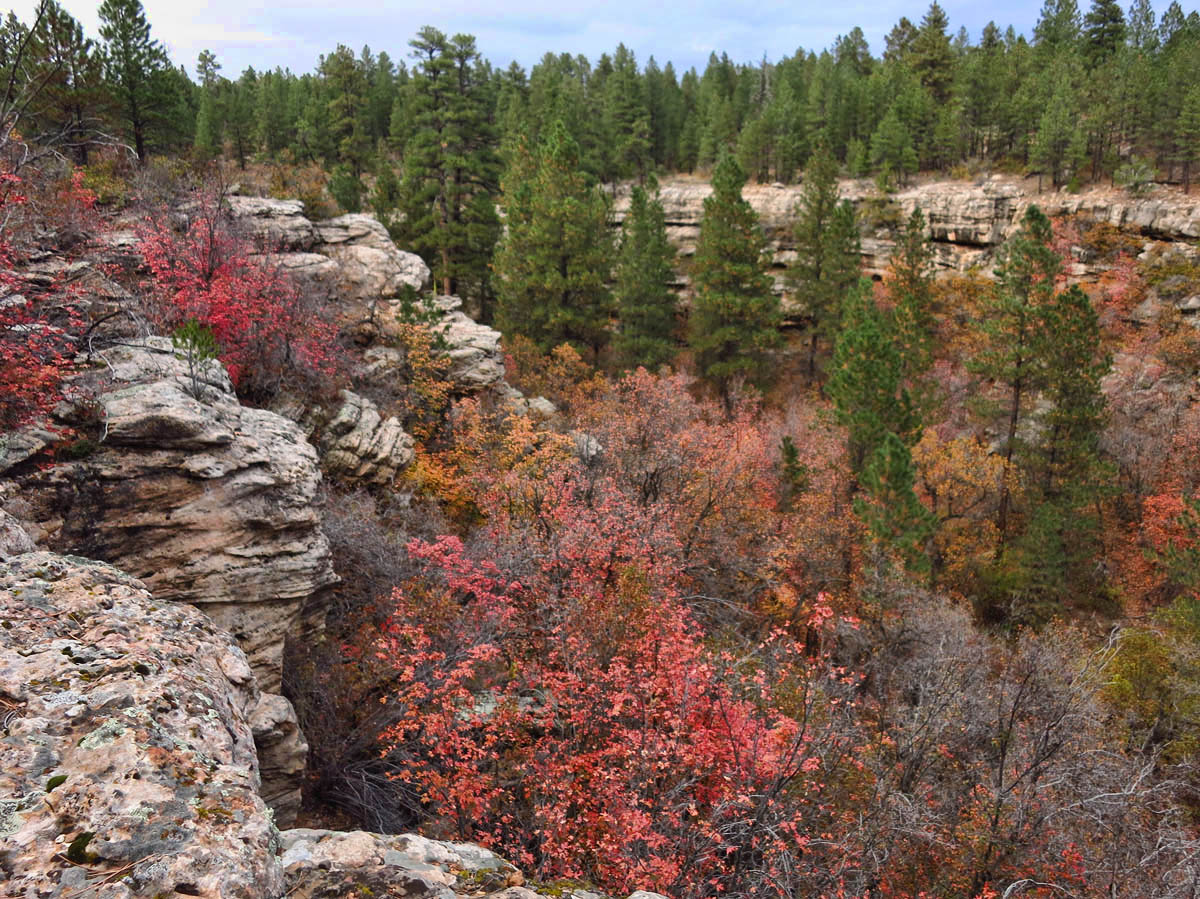
Sure signs that summer is over in Devil’s Canyon, UT
Elevation of 7,400 is chilly in the Manti – La Sal National Forest
I rejoin the gang in Devil’s Canyon Campground, waiting out the weather and the UAE weekend. In the middle of nowhere, yet right on top of Hwy 191 just north of Blanding UT, it ends up feeling like a hell in its own right. Rain, fog, cold and falling leaves serve as an unwelcome jolt of reality that summer is really over. I have gone kicking and screaming from shorts and flip-flops in Canyonlands, to fleece and wool socks overnight. And not just any fleece, mind you. Shades of Day-glo orange to fool me into a false sense of safety as shots ring out at dawn on the first day of deer season. My time here has become a cruel and uncanny game with the rain clouds in that every time I put my shoes on to go for a walk, the pelting of rain drops on my roof starts up again as if to tap out “Not so fast! You’ve had your summer. It’s our season now!”
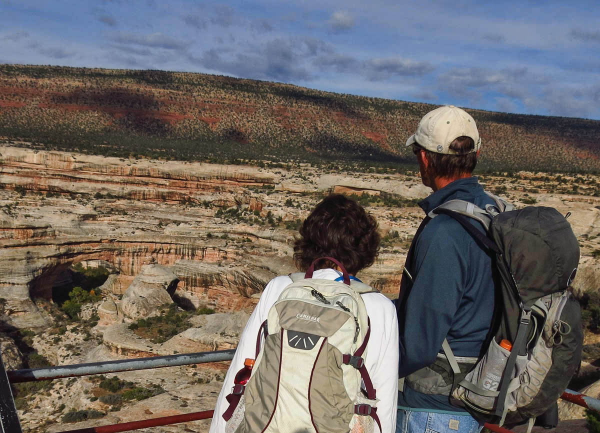
Box Canyon Mark and Bobbie meet me for a hike at Natural Bridges Monument .
We plan to do the 9 mile “bridges loop” through the canyon, visiting all three of the natural bridges.
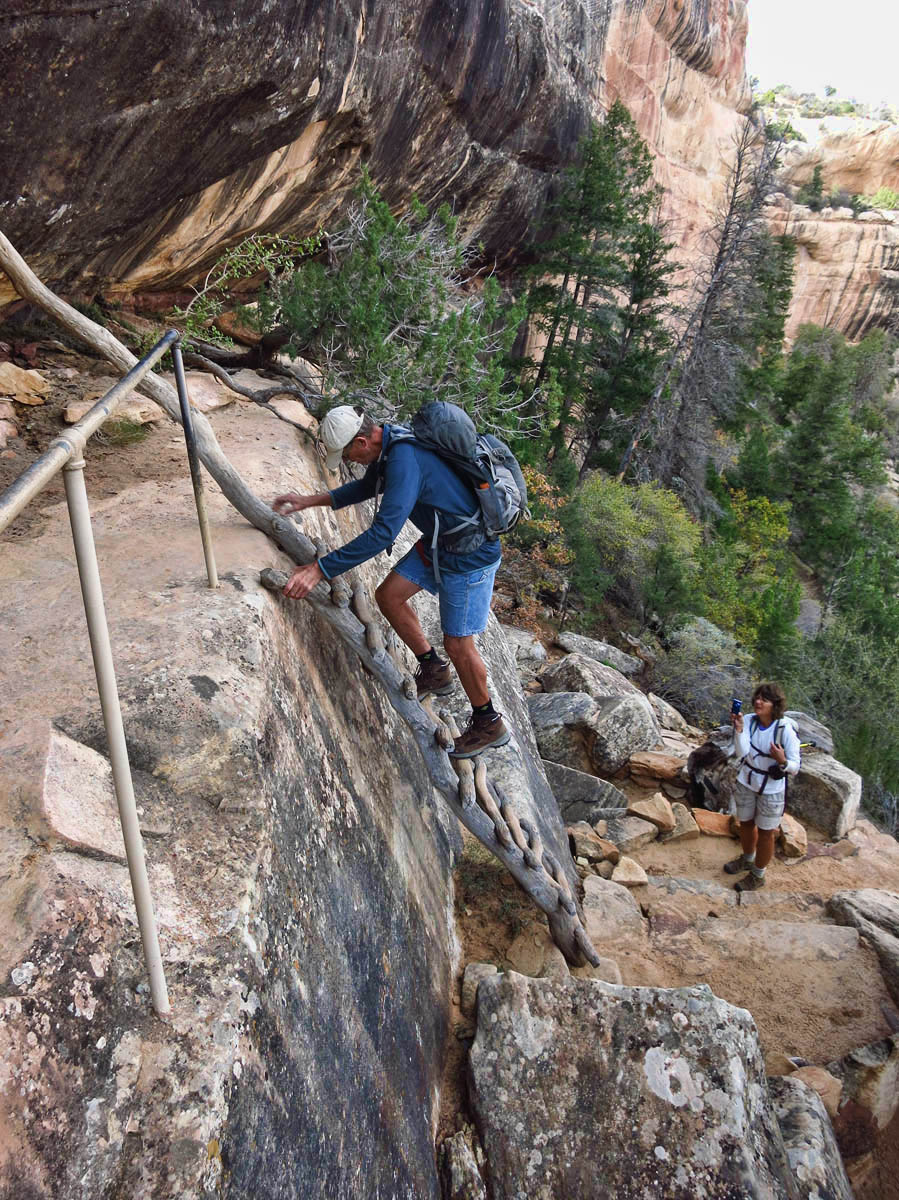
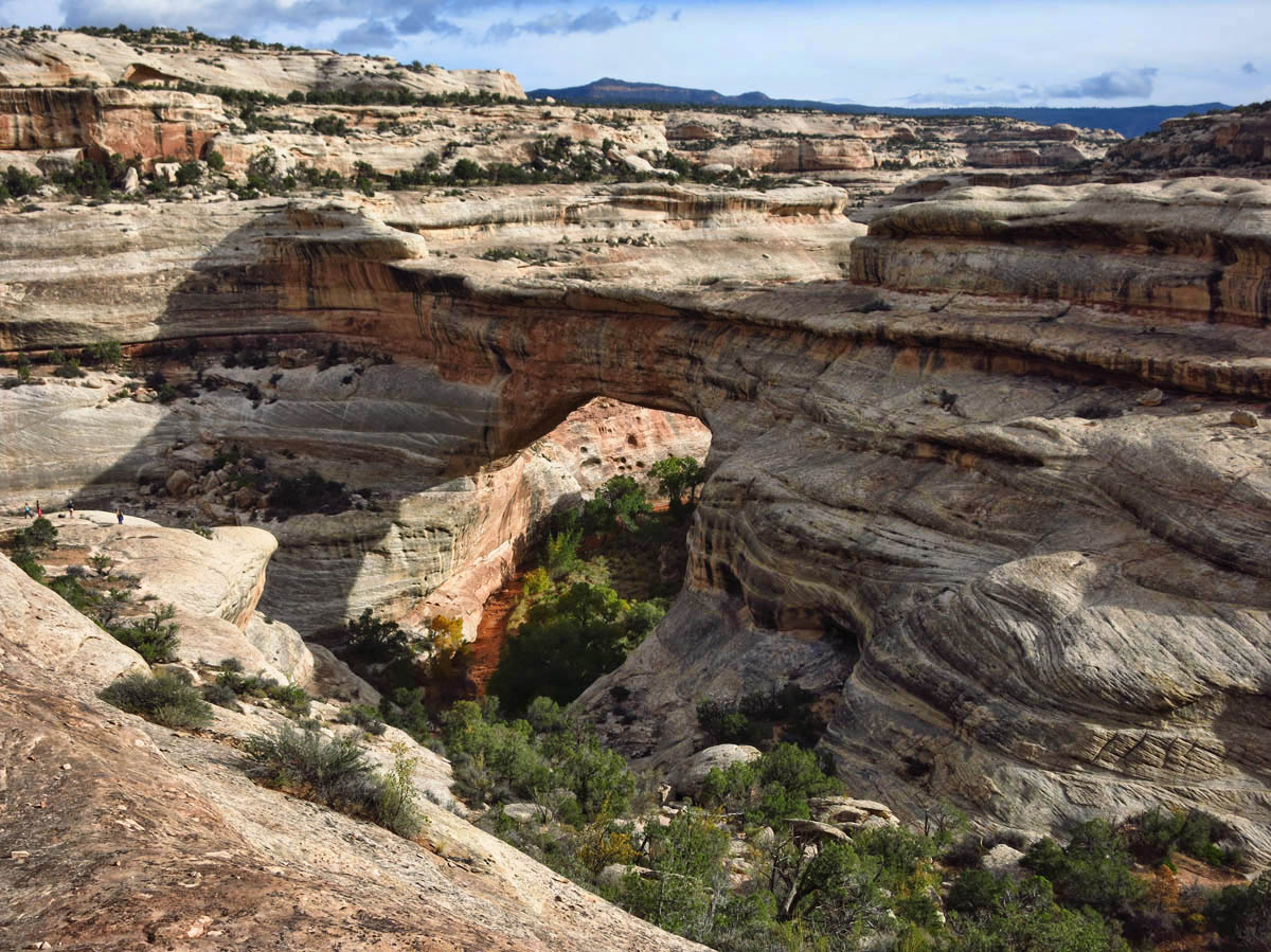
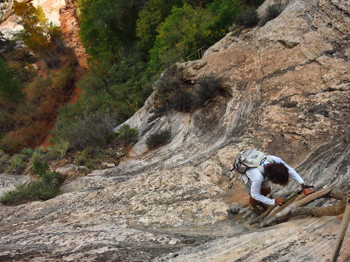
First bridge on the loop is “Sipapu” bridge, which has the steepest decent to reach White Canyon, with a series of steps and ladders.
Sipapu Overlook.
Cabin fever overcomes me on Sunday, so I take a drive into Blanding. As the most populated city in all of San Juan County, it weighs in with a whopping count of 3,000 residents, most of whom are Native American from nearby Ute and Navajo reservations. But the only relief from cabin fever comes in the form of an A&W Rootbeer Float. Everything else is closed. Even the local museum and the grocery store. Rolled up. The only things open in town are the gas stations, a Subway, a Family Dollar, and a rather large bowling alley. There must be some really good bowlers in this town, given the disproportionate size of the facility. Not being a bowler, I opt for pursuing the aisles of $5 Halloween costumes at the Family Dollar.
Bridges are different than arches, in that they are formed by water as opposed to erosion, consequently there are far fewer bridges
The ranger recommends entrance at Sipapu and exit at Owachomo, due to the steep descent.
Sipapu Bridge is the world’s second largest natural bridge, and largest in the park.
Height, 220′, Span 268′, Width 31′, Thickness 53′
Monday comes, and more rain in Devil’s Canyon Campground. Finally, “the gang” has had enough. Debbie blasts out before the first rays of dawn. Mark and Bobbie soon follow, and Laurelee and I are fast on their heels. It may be the first time I ever left a campground BEFORE check-out time.
The loop trail crosses the muddy stream in White Canyon many times

Bobbie hurdles a mud puddle the consistency of peanut butter with ease and grace. Me? Not so much!
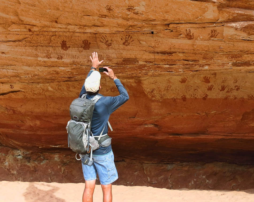
Petroglpyhs, or fingerpaints?
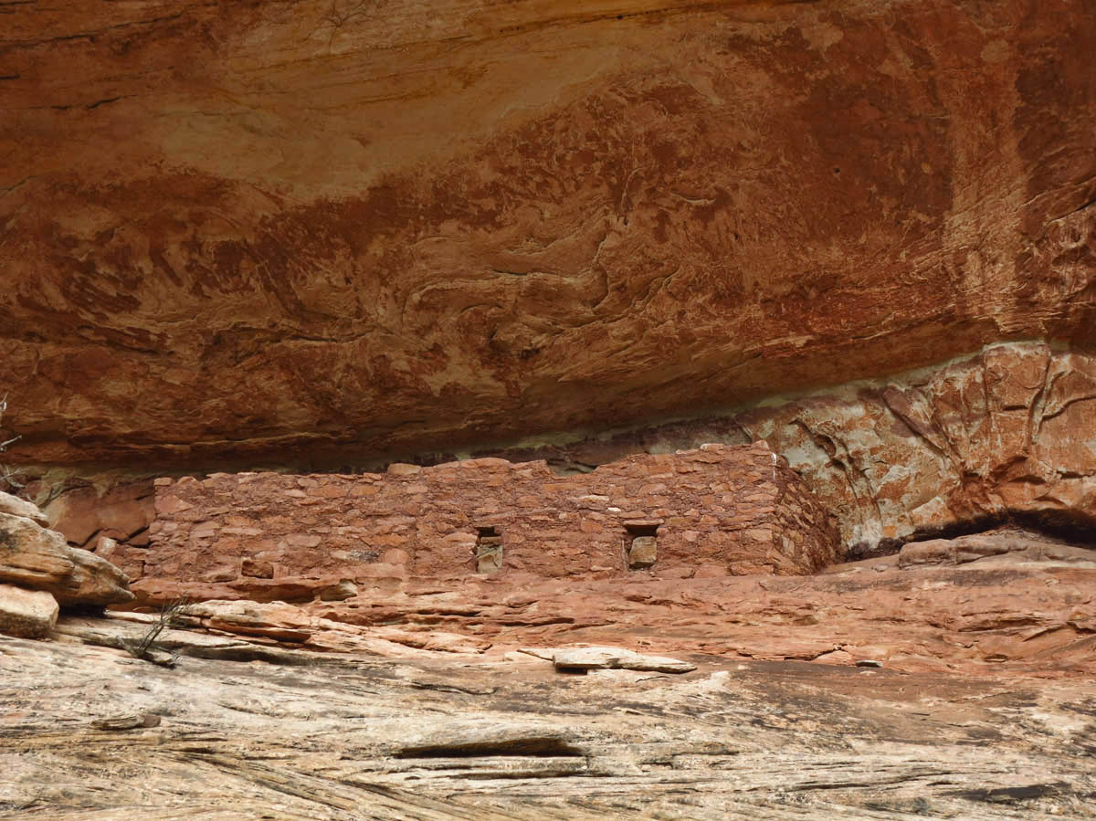
Horsecollar Ruin, believed to be inhabited 700 years ago by ancestral Puebloans.
We are an indecisive lot about next destinations. The ultimate goal is Virgin, Utah, just outside of Zion National Park. But how to get there can turn into a cluster at the first sign of a map unfolding. Some base their destination choices on conveniences, namely internet connection and comfortable roads, or “pet friendly” locale. Others base it on weather, choosing to follow the sun…but only to a tipping point up to 72 degrees at which time it is back up to elevation. As for me, I am a card-carrying “bucket list tourist,” weather and connectivity be damned!
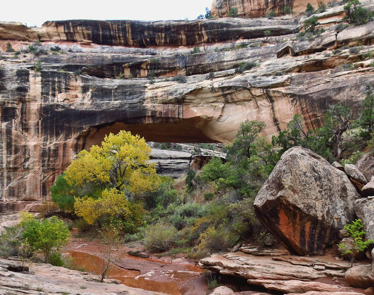
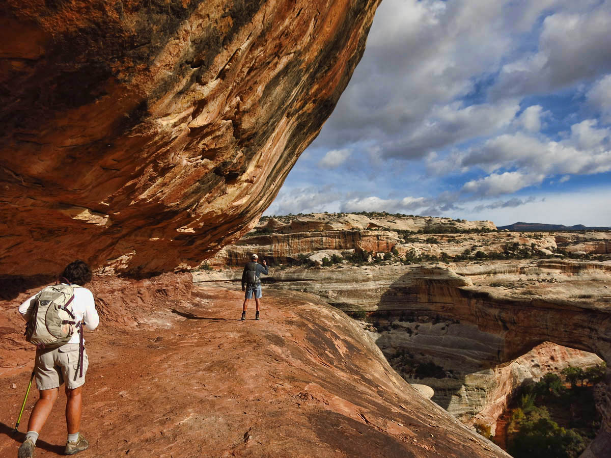
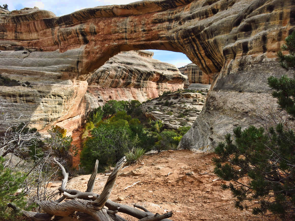
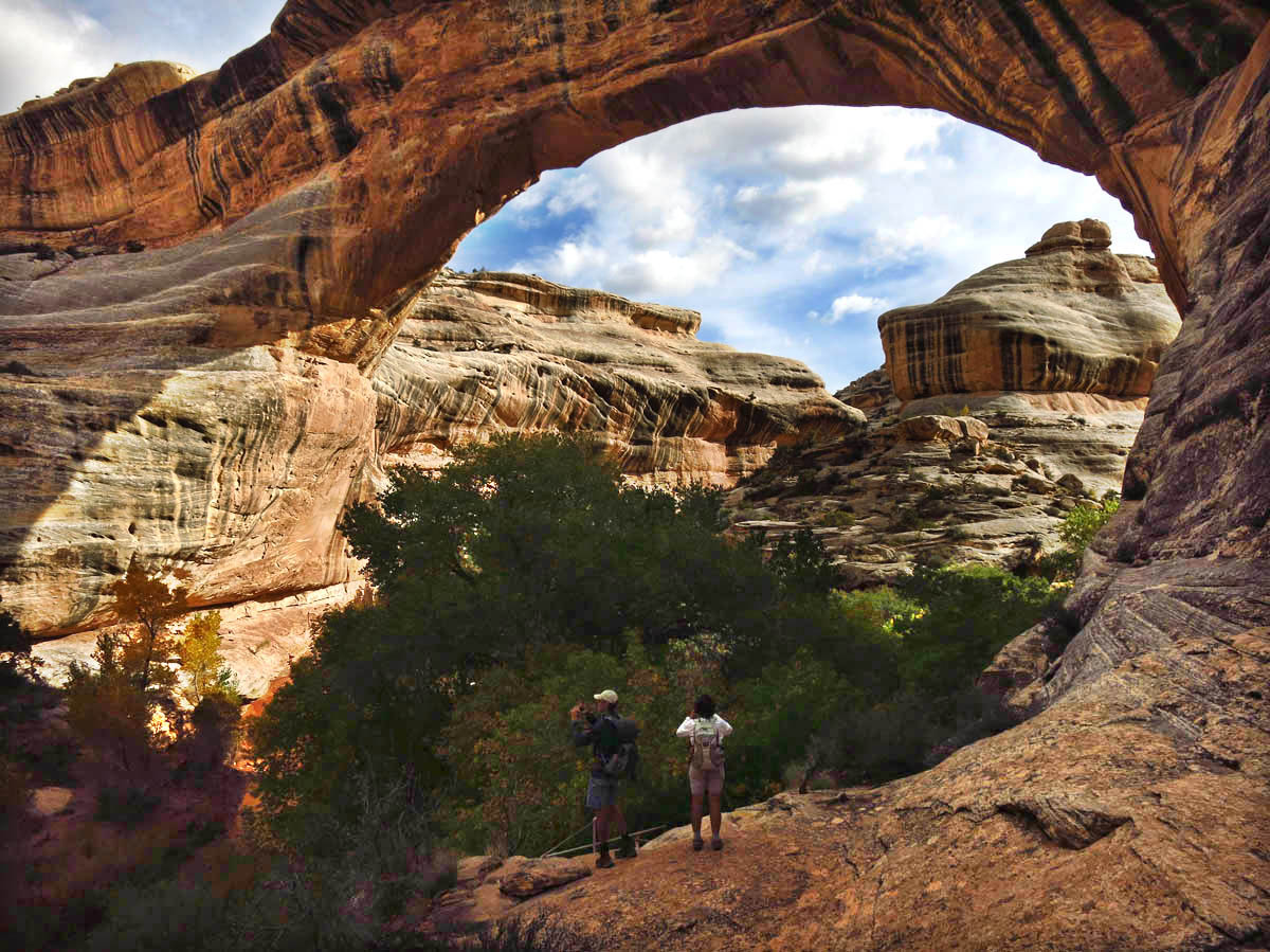
Kachina Bridge is the second in the loop, about halfway in between Sipapu and Owachomo.

Kachina is the world’s third largest natural bridge, and newest in the park. Height 210′, Span 204′, Width 44′, Thickness 93′
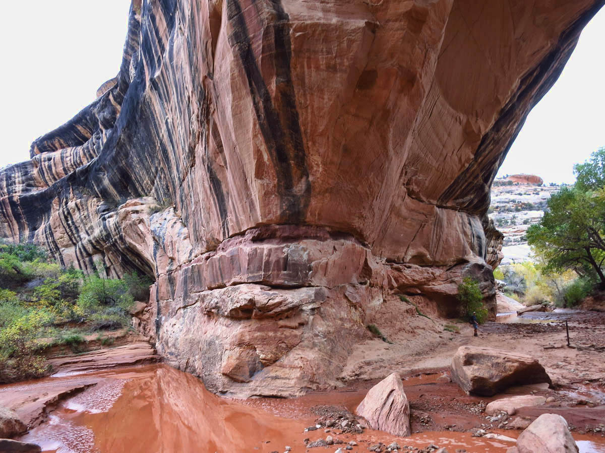
One of the massive bridge abutments of Kachina Bridge.

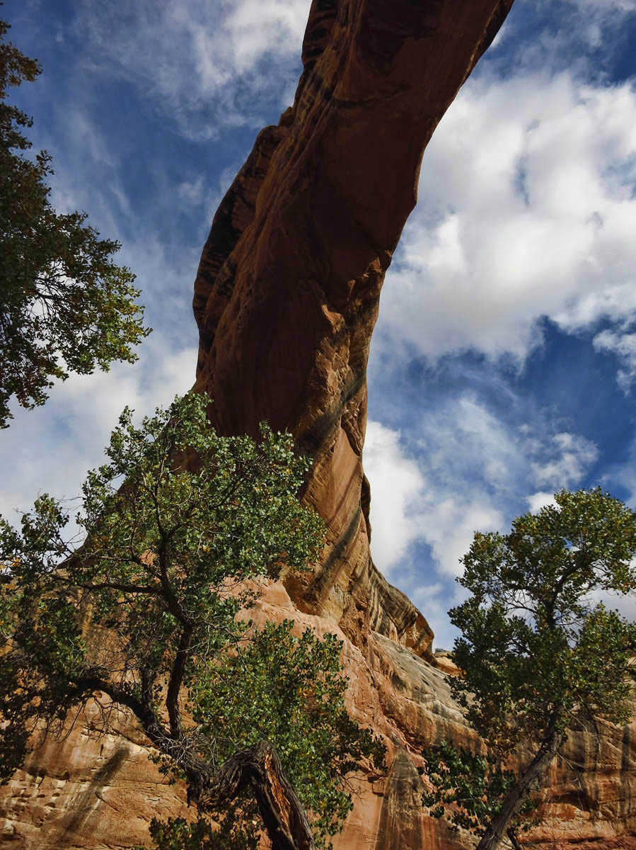
One last glimpse of Kachina Bridge as we are run out of the canyon by a mounting storm with lightning close by.
Through some of these vacillating destination discussions, I suspect I may not be the only one who is not a “fan of the caravan!” As much as I love meeting up with friends from hiking to Happy Hour, when it comes to planning and plotting the course to move up to five rigs to the next place, finding primo boondocking spots with 4G connectivity, dry gravel roads with off-leash pet areas, stellar hiking trails nearby, and blue skies and sunshine is enough to send me running back into the forest without my Day-glo orange!
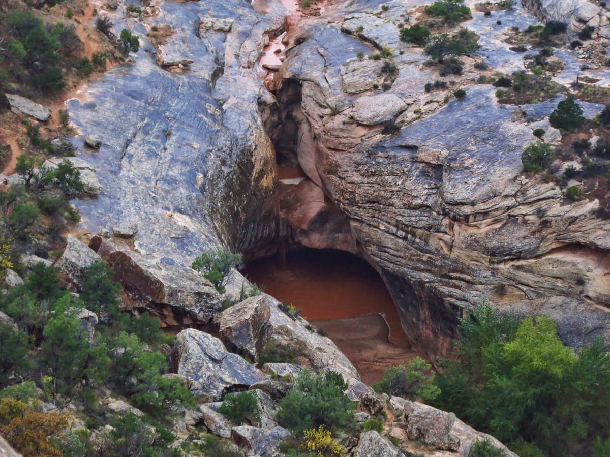
The pour over near the convergence of White and Armstrong Canyons…in the rain.
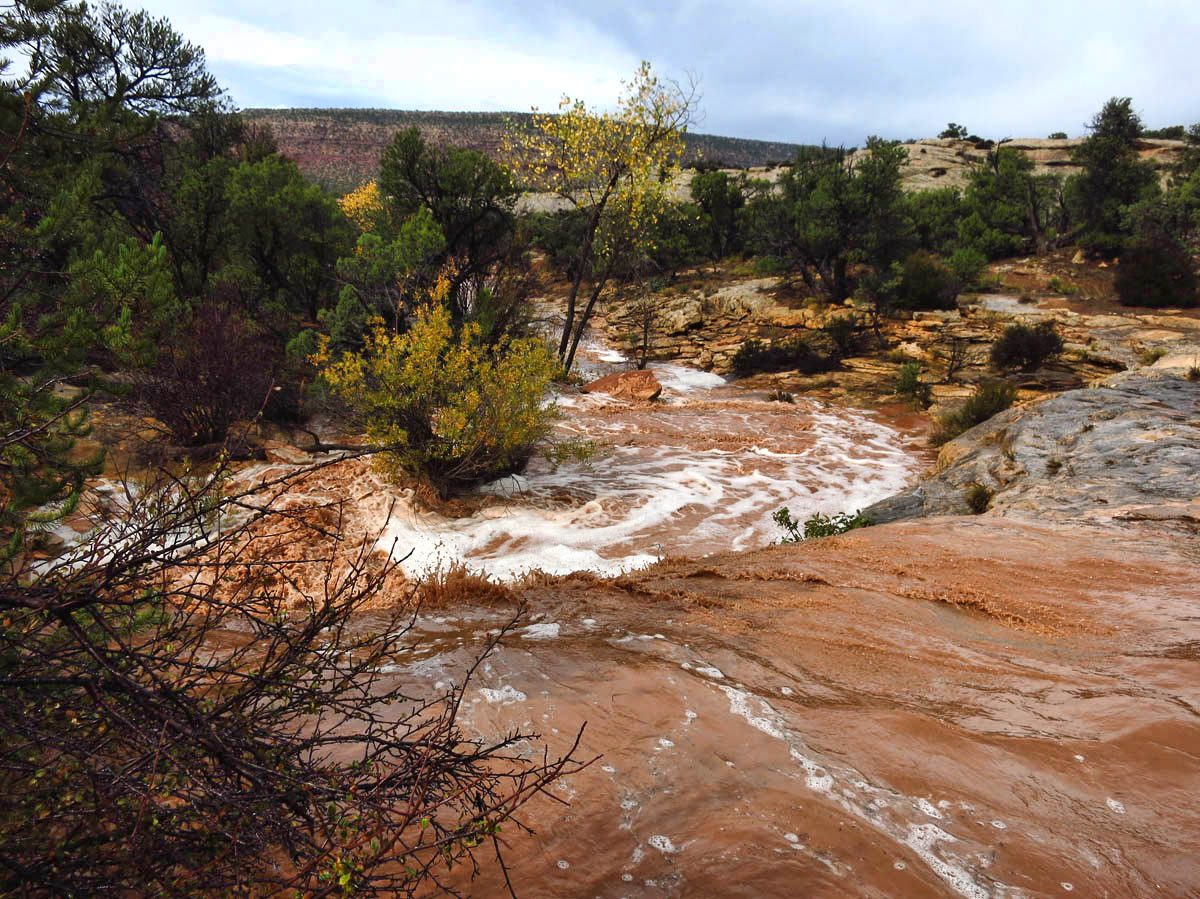
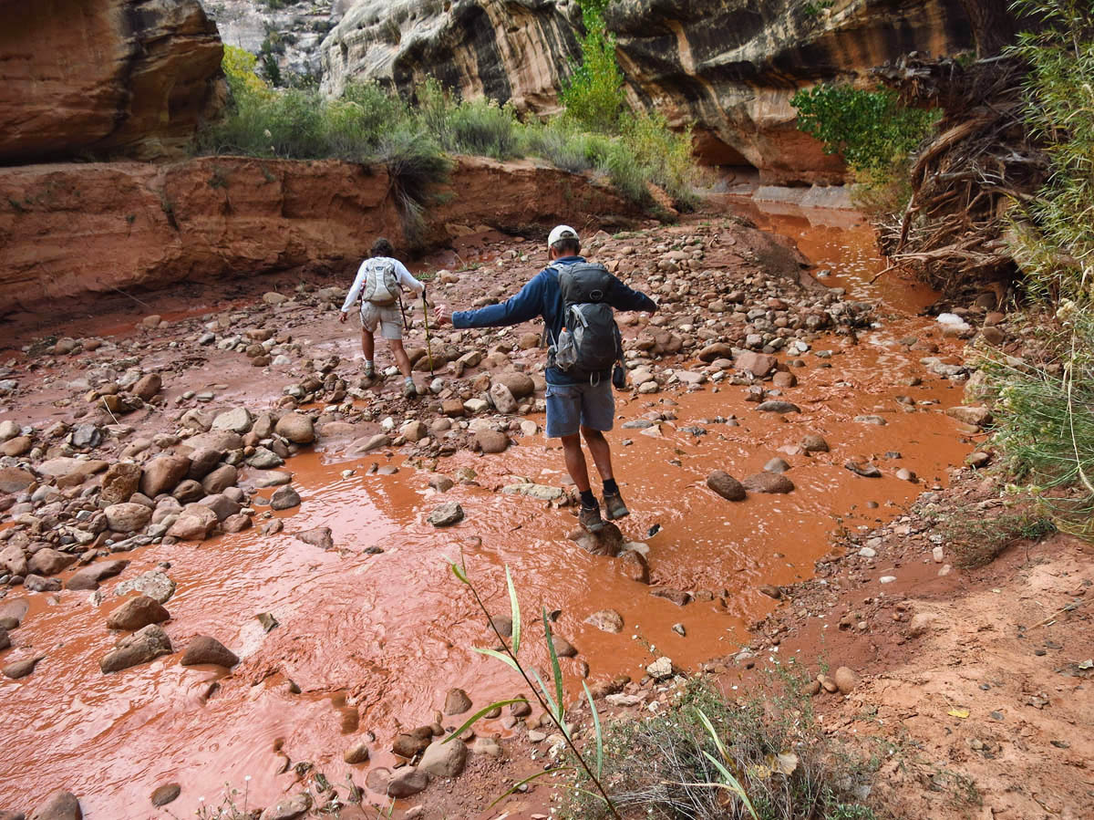
We have to cut our loop hike short, and cut back across the mesa top. Unfortunately, we come upon a wash now filled by the flash flood. No way around but through…boots and all.
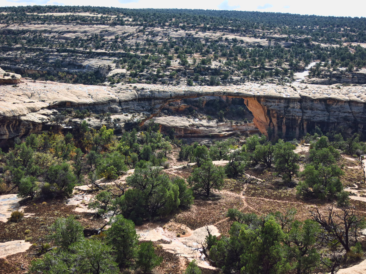
We have to settle for an abysmal view of the third bridge, Owachomo, thinnest and oldest of the bridges from the overlook. Height 106′, Span 180′, Width 27′, Thickness 9′. From this viewpoint, I vow I will return to complete the loop, but alas, the unrelenting forecast has a different plan.
So we all agree to follow our own desires, and reconvene in Virgin “whenever.” It’s a plan I can follow. So I am off again solo in my never ending pursuit to empty my bottomless bucket full of lists…with the hope of not filling it up with more rain!
“”Add to your Bucket List as if you are going to live forever, then attack it like as if you were going to die tomorrow.” ~ Mark Johnson
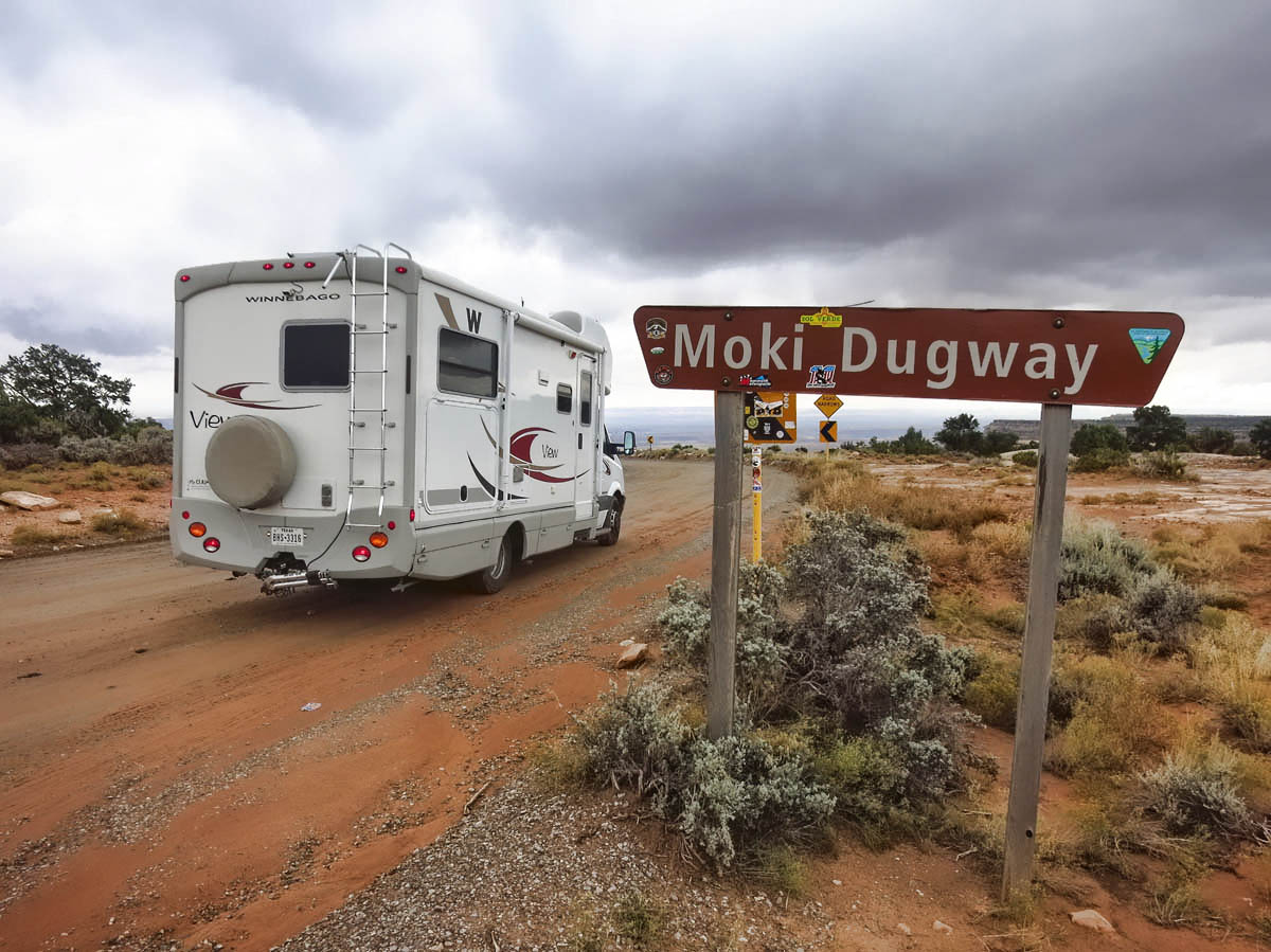
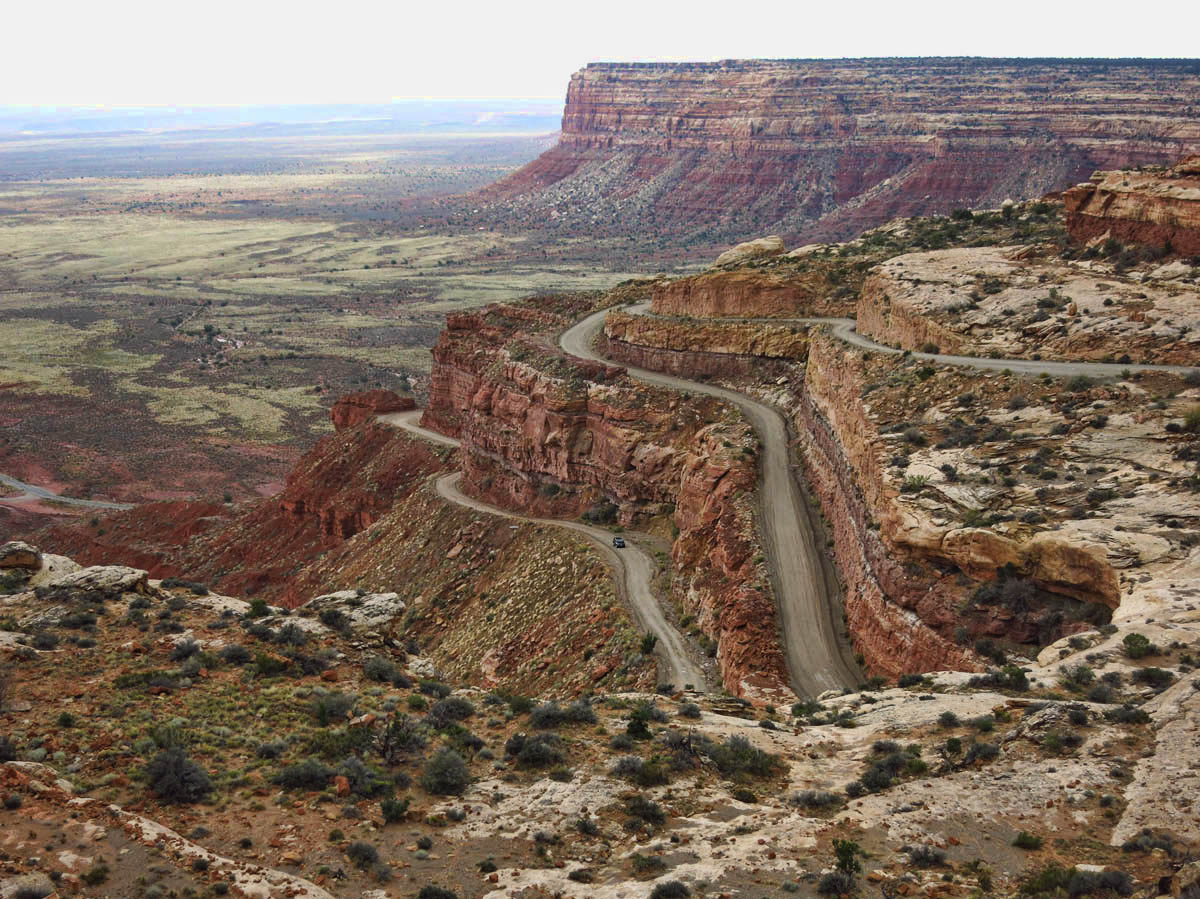
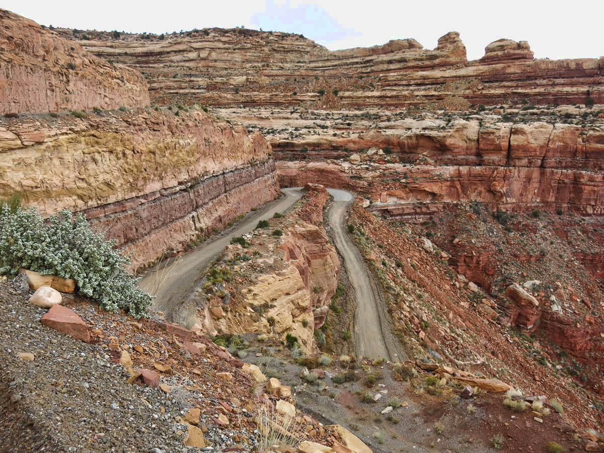
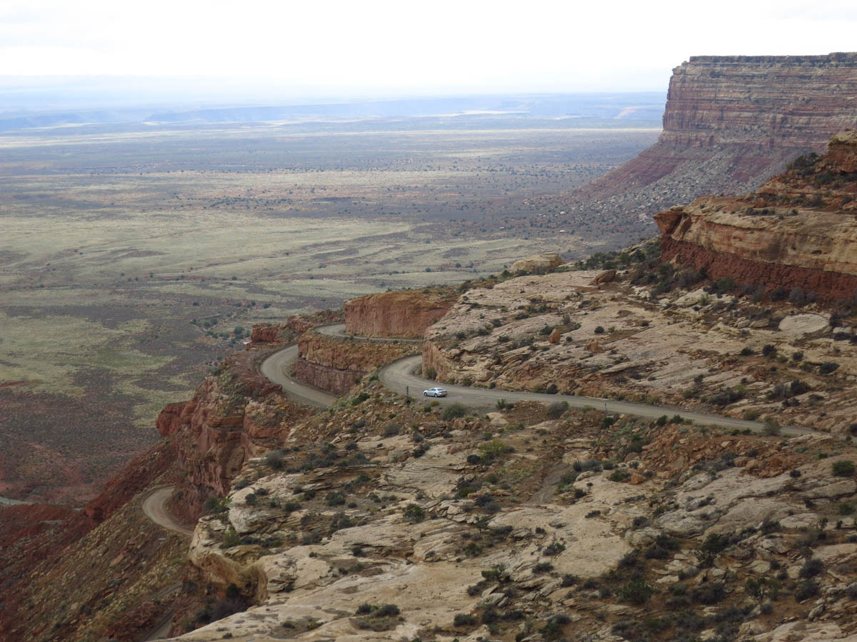
Moki Dugway, considered one of the most “dangerous roads” stands between me and my bucket list items.
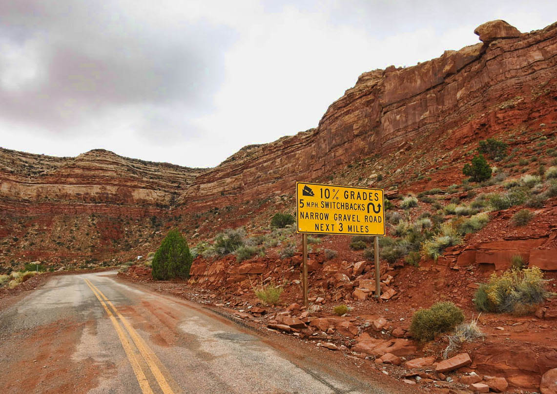
It’s 3 miles of steep, gravel switchbacks at 10% grade.
Either “gut up” and drive down it, or go over 40 miles around.
I research it first, and read, “a staggering, graded dirt switchback road carved into the face of the cliff edge of Cedar Mesa.”
I an feeling comfortable until I meet an oncoming car who flashes his lights and wags his finger “No! No!” at me through his windshield! WTH?
Don’t let that shatter your confidence!
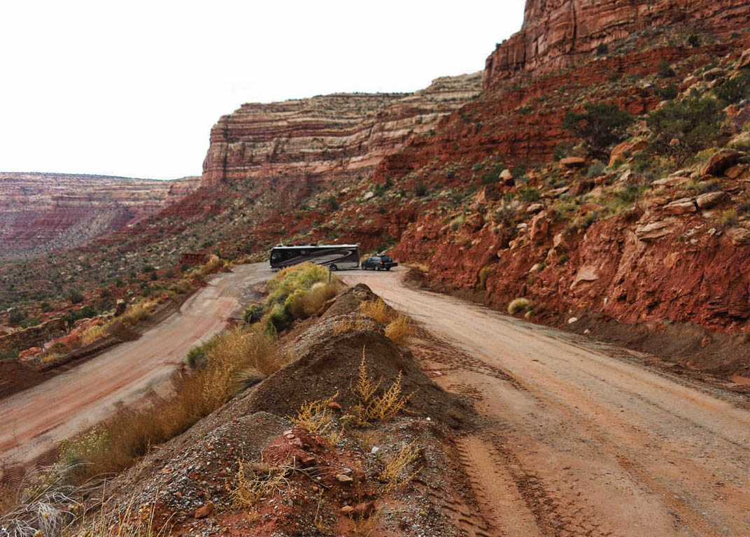
If this big diesel pusher can make it, what am I worried about??
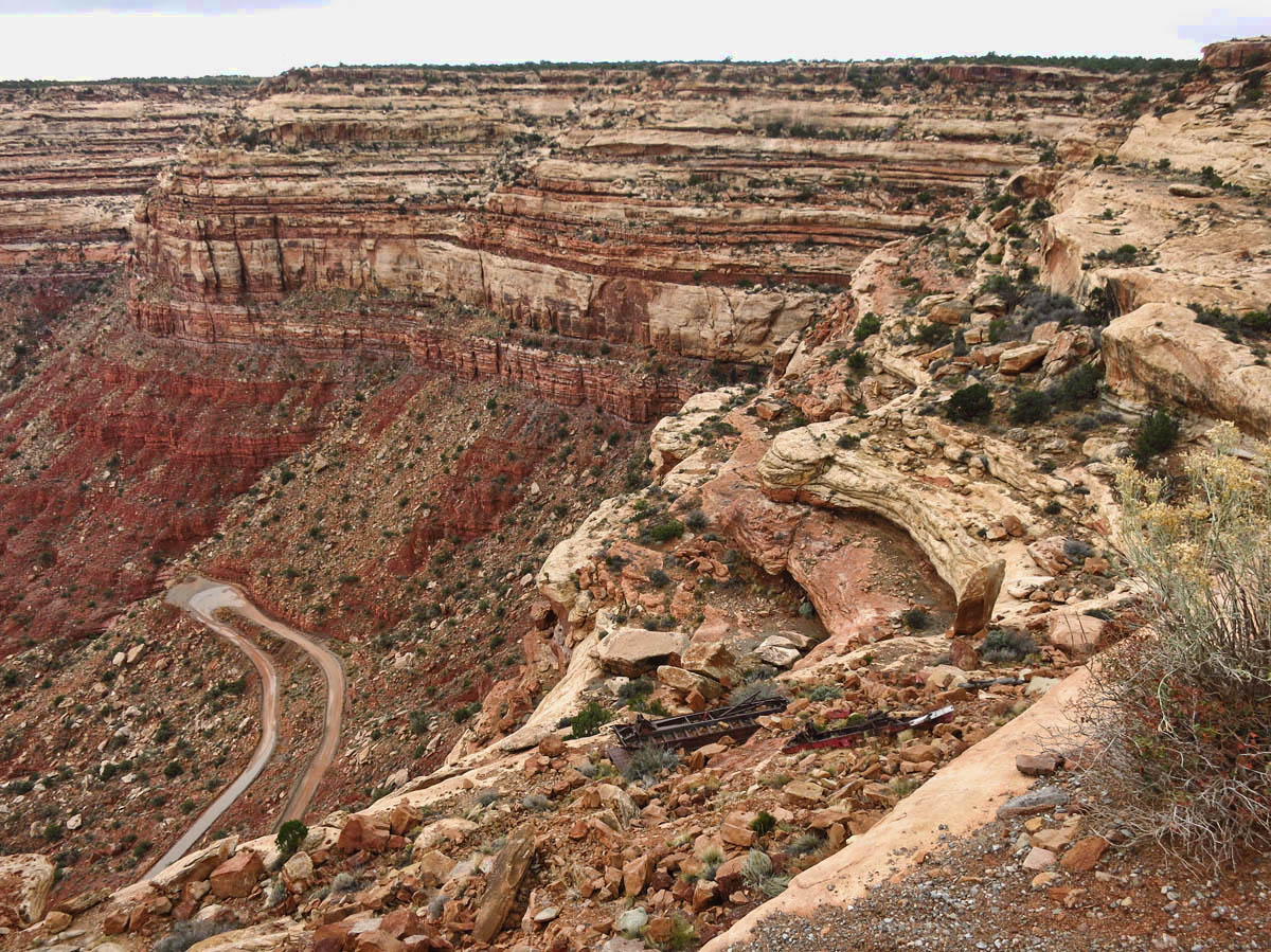
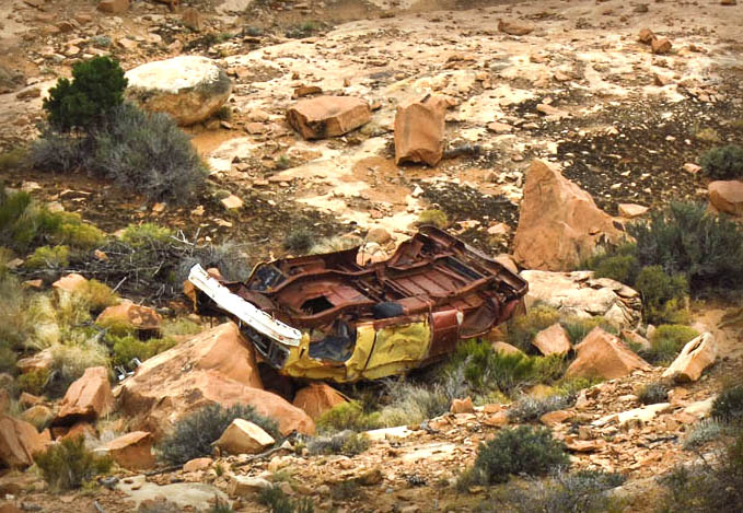
More carnage over the edge. I decide to do reconnaissance first in the Tracker.
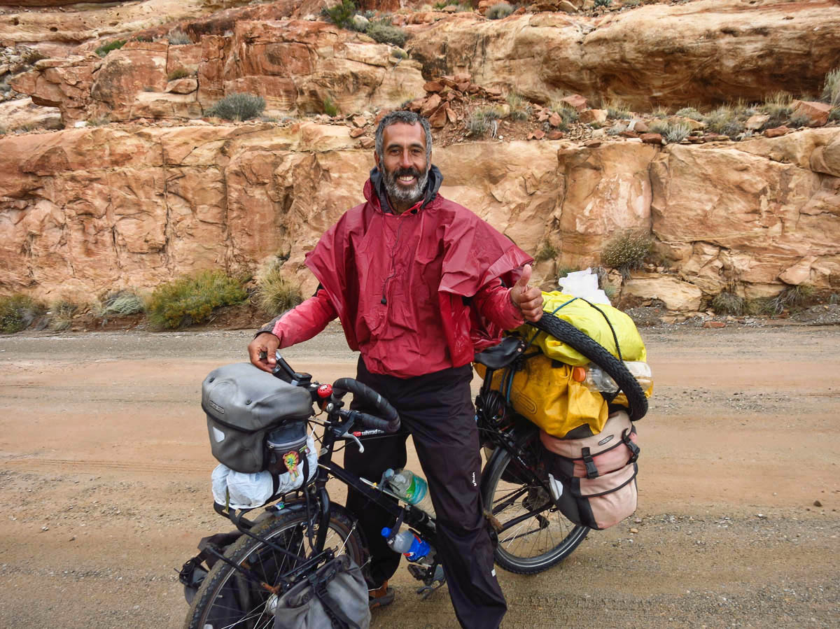
This is Francesco from Valencia, Spain. He has been riding through the USA for 2.5 years, most recently from Alaska. He helps calm my nerves.

Three miles down 1,200 ft of steep, gravel switchbacks, and I am humming Jan and Dean’s lyrics, “First Gear! It’s alright! Second Gear, I lean right. Third Gear, hang on tight! Faster….it’s alriiiight!”
As much as we hated leaving, I must say I was happy to get out of the rain last week.
Looks like you’ll have to leave Natural Bridges in your bucket so you can go back another time and hike to Owachomo Bridge.
And in regards to the Moki Dugway, Jim says when has he ever steered you wrong? 😉
Maybe I can talk you into it when I also have to go back and cross off Muley Point! haha!
The car-nage on Moki Dugway looks intimidating.
Beautiful scenery on the bridges hike, it must have been a little scary fording the flash flood!
We were fortunate the rain in Moab was sporadic enough we could get out for a while each day. We’re looking forward to this stretch of clear weather!
Lisa, I have to admit, it was a bit intimidating. But it was fairly level and only shin-deep. I was more afraid for my “electronics” (iphone, InReach, and two cameras) so I will be adding a small dry bag to my day pack. Wish I was still there near Moab’s GearHeads!
Can’t wait to see what you guys get into as you head south!
I know what you mean about the rain. Out of the 9 days we’ve been in Grand Canyon, I think it’s rained on 7 of them. It’s a record wet for this area, and just the beginning I think of El Niño. Last time we had a big El Niño year the whole SW was wet aaaaaall winter.
Nina
Oh, Nina, I hope not! I like a little rain thrown in occasionally, but like my rig, I am “solar powered”
You are brave to tackle the Moqui Dugway with your motorhome, we didn’t even do it with a 4×4 Toyota in dry weather. But guess that’s a good excuse to go back. Nice to see the sun shinning this morning in Kanab. I’m getting itchy feet to hit the road to somewhere.
Gaelyn, it wasn’t that bad, really! I have been on worse boondock roads recently! You aren’t leaving town just as I get there are you? 😉
Coordinating travel plans with full and quasi full timers is not unlike herding cats.
And as for someone with two of the most “rogue” cats I have ever seen, you should know! 😉 I miss Sophie and Elvis…
Strange that I had to tap on pictures and get a different picture underneath to match your narrative. Road pictures made me pucker up and I wasn’t even there!
Noticed your sticker on the windshield expires the end of this month. Where do you get mail? Just wondering how you’ll get your new one.
Happy travels!
Hi, Reta — in this post, pictures don’t match the narrative. I didn’t have any photos to go with my gloomy, rainy mood, and I didn’t have enough “story” to go with the Natural Bridges Monument hike, so I combined them into one post. Can you see the captions below the photos? That tells the narrative for the photos.
Mom gets my mail, but it is a bit of a conundrum now that I can’t get the registration without the inspection. Before the rules changed last year, I could do it all online. But now of course that has changed in that I must have the vehicles inspected first. I guess I will be crossing the state line back into Texas under the cloak of darkness. 😉
Register your vehicle in NM. They don’t require a state inspection.
Use my address & tell the DOT you rent a room from me.
Just an idea. You’d only have to come here once and get NM plates for your vehicles.
We have all ours registered here because it’s cheaper than Texas.
Wading torrents and driving down the Moki Dugway in an RV towing a car. Wow! Well done and glad you got thru it all. This song came into my head as I finished your post. 😉 https://www.youtube.com/watch?v=Z1L0XEgFb00
J. Dawg, that song made me laugh out loud! That’s the easy stuff. The hard part for me is always standing still! And “getting level!!” 😉
You certainly do get to see some wonderful sights when you go off road. Great photos. Thanks.
Thank you, Pamela. Wish I were brave enough to go off road more often, especially here in scenic Utah were there is beauty around every bluff!
Wow! I can’t believe the water on the loop in Natural Bridges! We hiked that a couple years ago. Great fun, no water (a small stream near the second bridge), so the sand was very dry and deep. Sure made for a leg burning since the loop is a very gradual six mile up hill climb to the third bridge. I didn’t realize that til I saw how close we were to the top when we reached the third bridge and felt my lead legs. That’s a whole lot of water. Glad you were able to make it out:)
Friends work for a while and are great to have, but I so understand the need for time away. Where are you heading? Maybe Bluff and the ruins?
Hi, Pam — We tried to do some of the hiking to the ruins, but the rain was making us all nuts. My boots were soaked, and I had mud on everything! But in retrospect, I wish I had waited it out another day or two, as I would have loved to see that area, especially the “House of Fire.”
You had me puzzled for a while with your three letter abbreviation UAE weekend, which to me is United Arab Emirates….why are you celebrating this I thought. All was clarified by going back to your previous post UEA…Google clarified this for me. TLA’s are a nightmare. What a great cyclist, I take my hat off to him.
Hi, Dave. Yes, American Express was the master at TLAs. We even had a dictionary for them. LOL! I should have spelled it out, and I think I even got it backwards…Utah Education Administration, also known as “hunker down and hide” weekend. haha! Yes, I enjoyed talking to the cyclist. He was inspiring…
So glad you did the Dugway! Mo and I did it in our 26 footer without a problem. Love that road. Drove it the first time in February of 1991, in my little Ford truck, having slept in pouring rain the night before at the Goosenecks with lots of condensation inside the metal canopy accompanying the rain outside. I was scared, it was muddy and crazy and I was all alone. I’ll never forget the first time ascending, and the times after that when I shared that special place with a soul friend descending to the Valley of the Gods for our annual trek to red rock country. Cancer took that friend, but your photos brought her back to me. You have no idea what your blog does for me, Suzanne.
And you have no idea what your comment did for me, Sue. I was having a very low day yesterday as a result of an email that came from my late brother’s best friend, which also “brought him back to me.” Your comment lifted me up. Thank you.
We have been to Natural Bridges National Monument twice. Both times we climbed down and back up to/from all the natural bridges. Next time we go I’d definitely like to hike the loop.
I must say, being from Texas where we can get heavy rainfall all at once, I wouldn’t have crossed that raging creek. Our motto in Texas is, “Turn around, don’t drown.” Too many people get swept away in raging flood waters.
Wow! Steve and I were glued to your pictures and narration – you obviously made it to the bottom – just riveting. That could have been us in the diesel pusher. Soon come!
Stay warm and dry!
Luv ya!
Another group of amazing photos! I am also “solar powered” but like everyone else here in California, we eagerly anticipate the rain…just a little bit at a time! What is that about “beggars and choosers?”