
Back in February while camped in the middle of Anza Borrego State Park, I came across a news article that President Obama had just signed 1.8 million acres of southern California wilderness into National Monument status; Mojave Trails National Monument, Sand to Snow National Monument, and Castle Mountains National Monument, doubling the number of acres of public lands protected during his time as president. His administration has protected 265 million acres of land and water, more than any other president in American history.
Although protection of these lands can lend itself to controversy due to the bureaucracy involved, the positive outcome is that it raises awareness of the areas in need of preservation, from endangered wildlife habitat, pathways for migratory birds, and protection of our nation’s history. And, it gives people like me more room to play. 😉
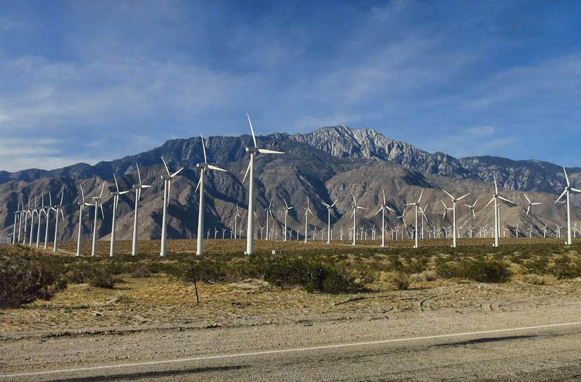
“Windmill Farm” just outside Whitewater Preserve. Protection of public lands will prevent further such farms from being built in bird’s migratory path.
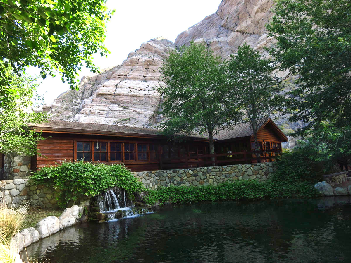
Visitor Center at Whitewater Preserve.
At the time, I had never heard of these three areas in the California desert. Now, just two months later, I have spent a good bit of time in two out of the three. The Mojave Trails National Monument, where I spent a week exploring tall dunes, the largest Joshua Tree forest in the world, and learned about the history of the Mojave Trail. And now, just outside of Palm Springs, I seek respite from the urban expansion of Palm Springs in the Sand to Snow National Monument.
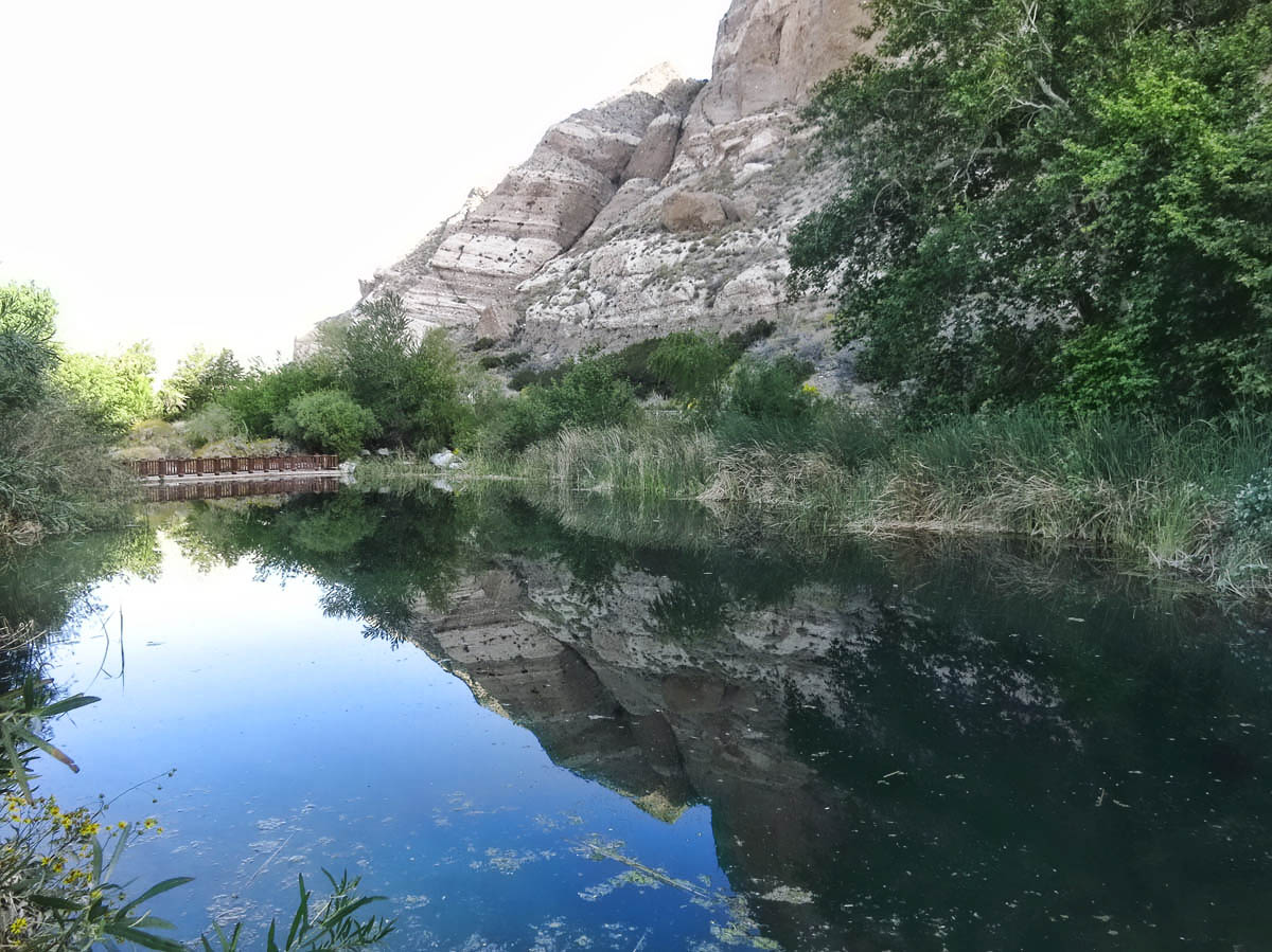
Trout ponds within the Preserve
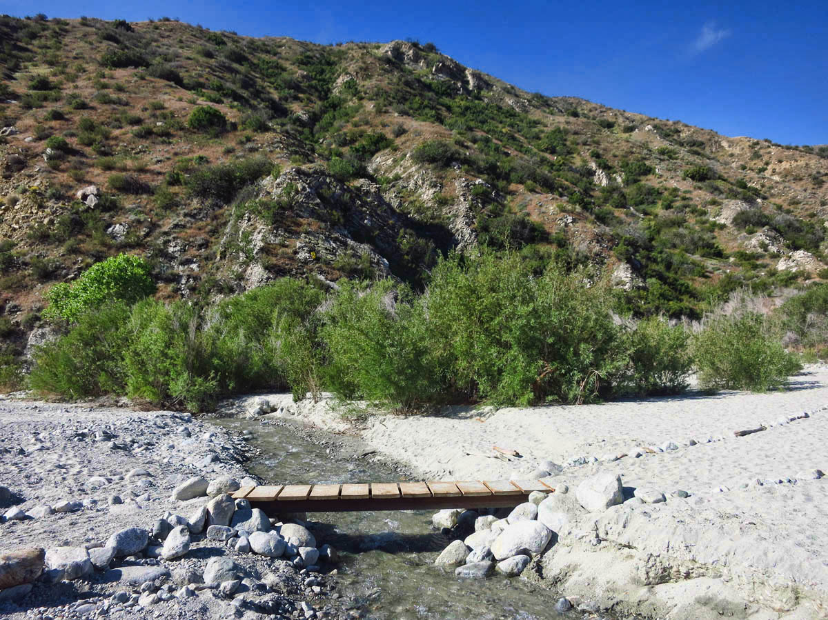
Narrow stream of the Whitewater River
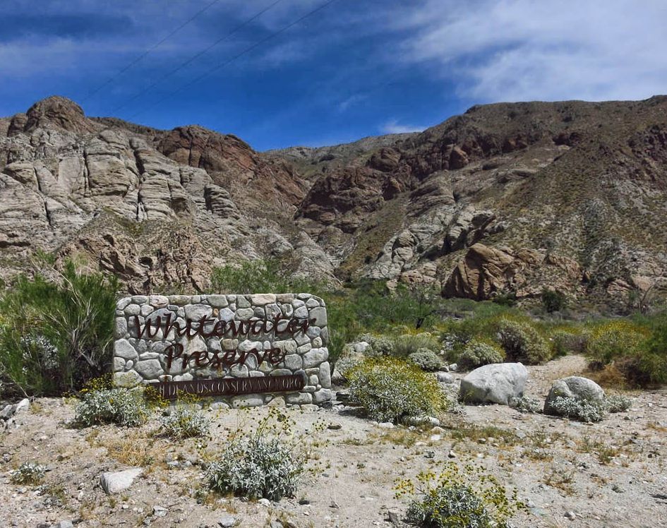
Friend and fellow blogger Sue Malone recommended that while in Palm Springs, I visit the Whitewater Preserve, an area just 10 miles outside of Desert Hot Springs. Sue tells me there are some nice hiking trails in the Preserve. In doing further research, I see that the elevation of Whitewater Preserve is 2,000 ft higher than Desert Hot Springs, (which at 95 degrees, feels like the Gates of Hell right now!) So I get an early start to take advantage of the cool morning, and take a drive through the “windmill forest” to visit the Preserve.
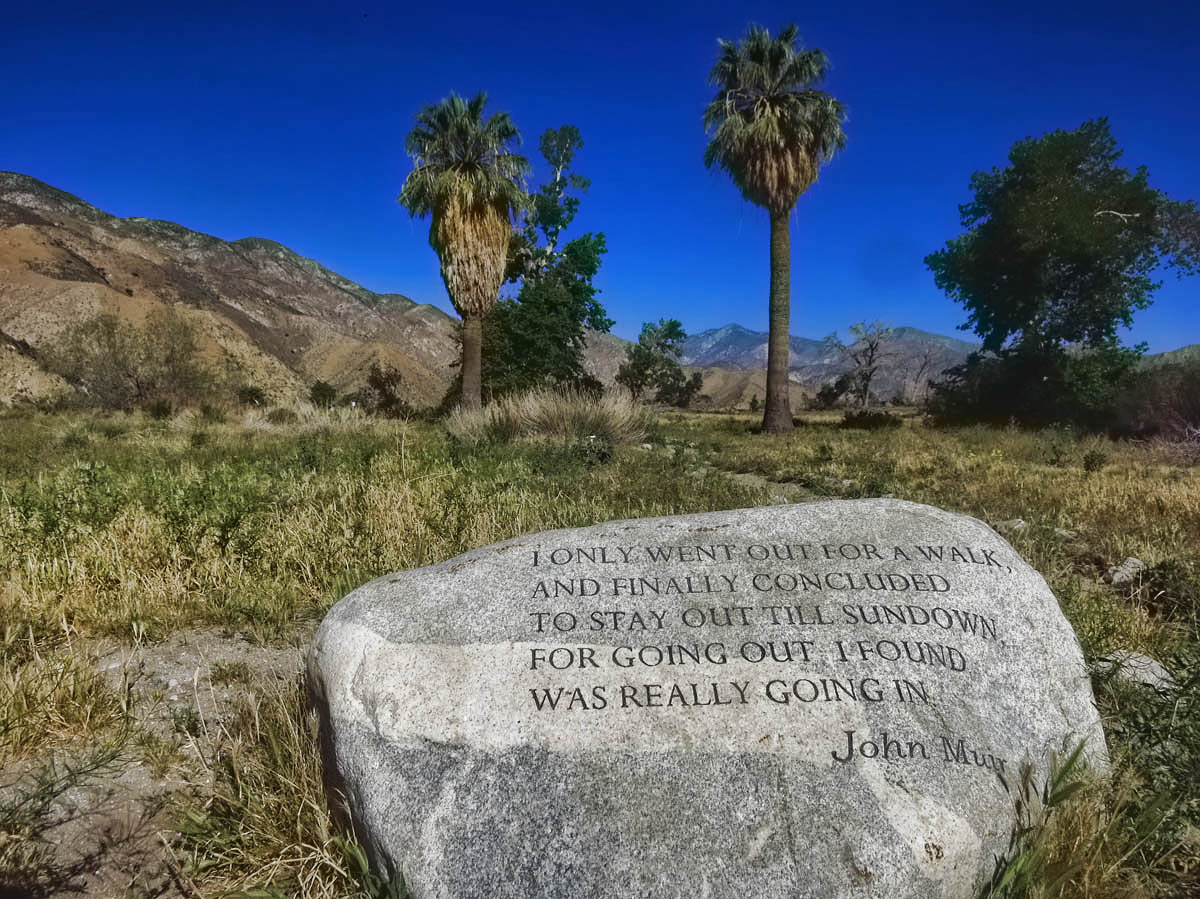
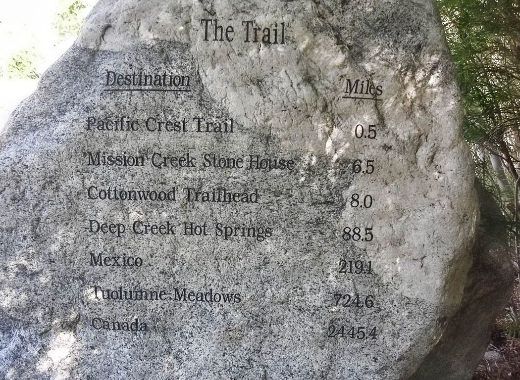
This is not one of those hokey trail signs with directional arrows saying “Tokyo, 5,474 miles,” or “Rio de Janerio, 6,300 miles.” Distances to Canada and Mexico are the northern and southern terminus of the Pacific Crest Trail.
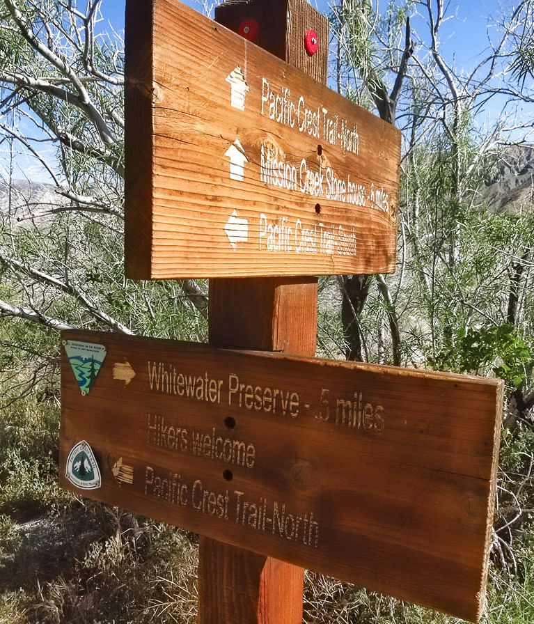
Whitewater Preserve trail head along PCT stating “Hikers Welcome!”
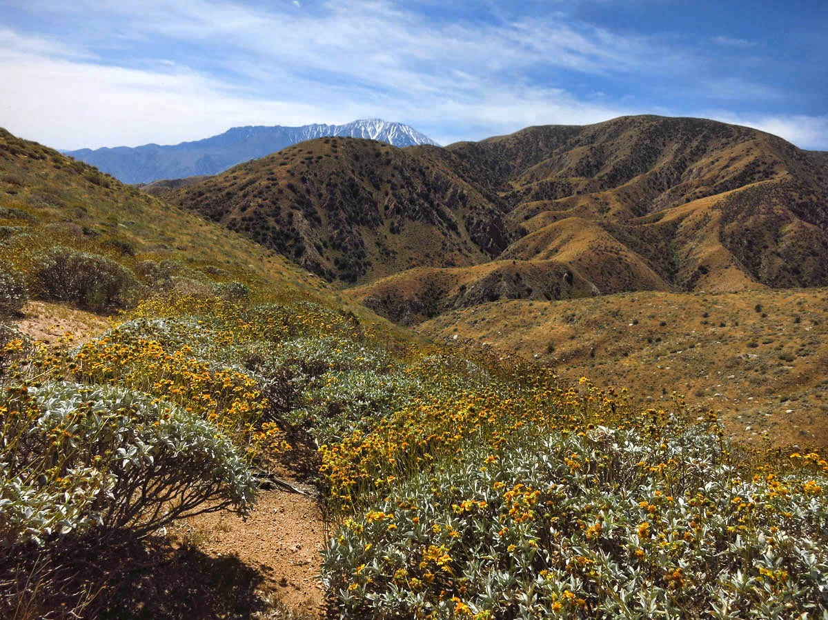
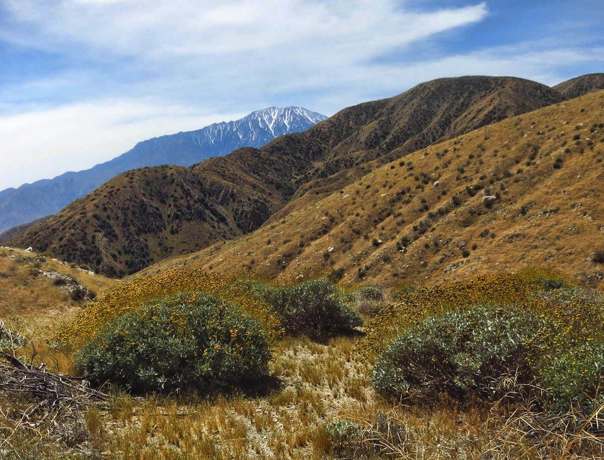
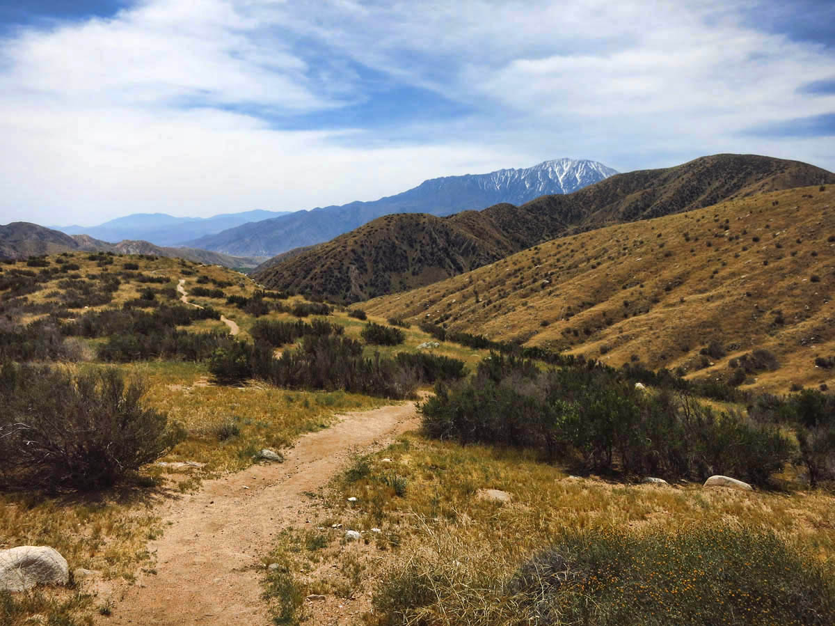
The Sand to Sea National Monument encompasses the Sonoran Desert all the way up to Mount San Gorgonio, Southern California’s tallest peak, linking the San Gorgonio Wilderness to Joshua Tree National Park and the San Bernardino National Forest. The Whitewater River as well as the Whitewater Preserve fall within the boundaries of this new monument. Cutting through the heart of the Preserve is a 25 mile stretch of the Pacific Crest Trail, made “wildly” popular by the recent book and movie, Wild.
Switchbacks up the Canyon View Loop Trail.
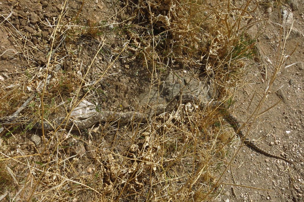
Do you see what I see? He is well camouflaged, no? “I come in peace.”
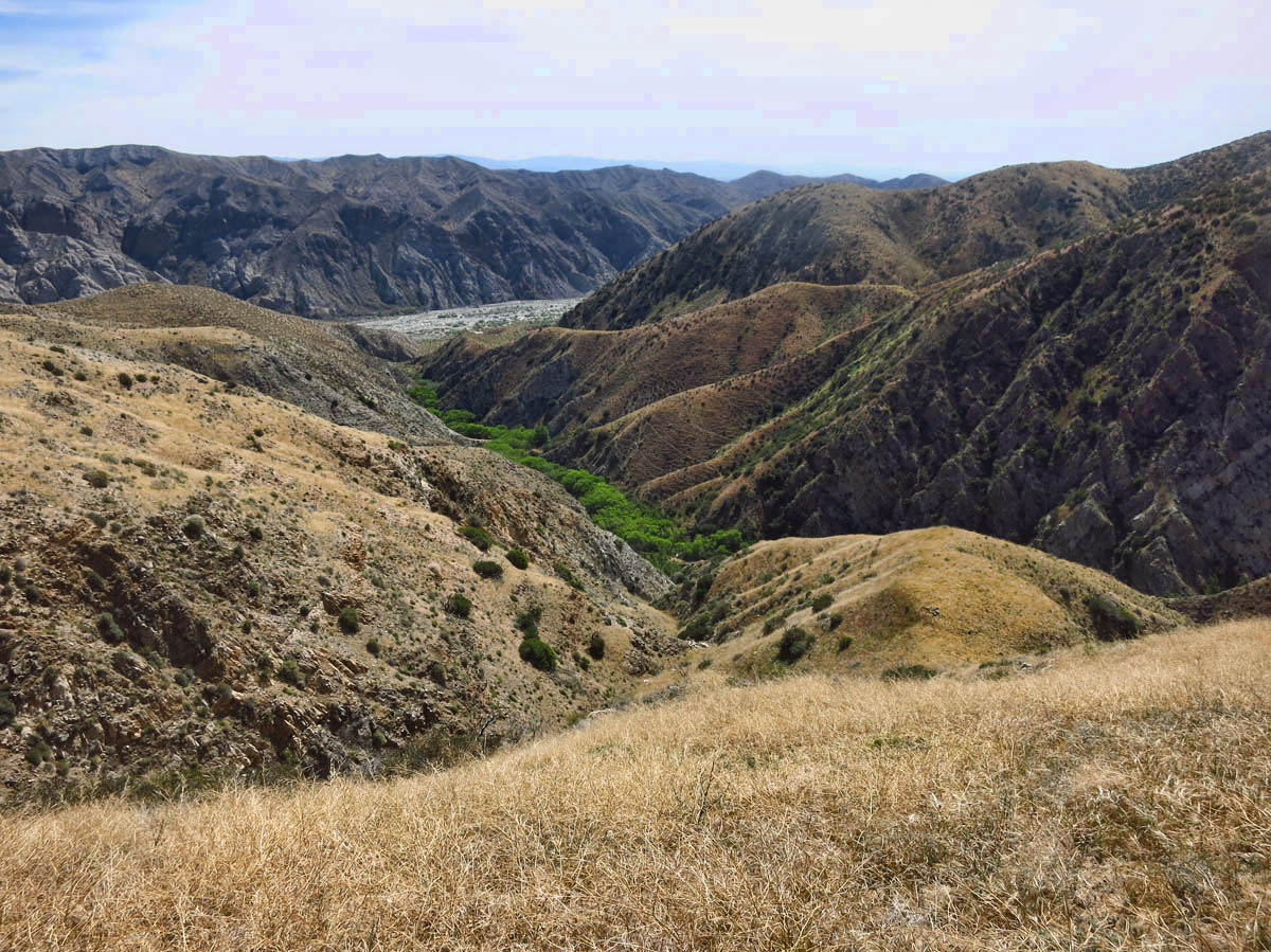
The Preserve is named for the Whitewater Canyon, which flanks the Whitewater River, South California’s longest river. Though at this point, it is just a narrow stream, it feeds the trout ponds that cascade down from the beautiful Visitor’s Center and shady picnic grounds.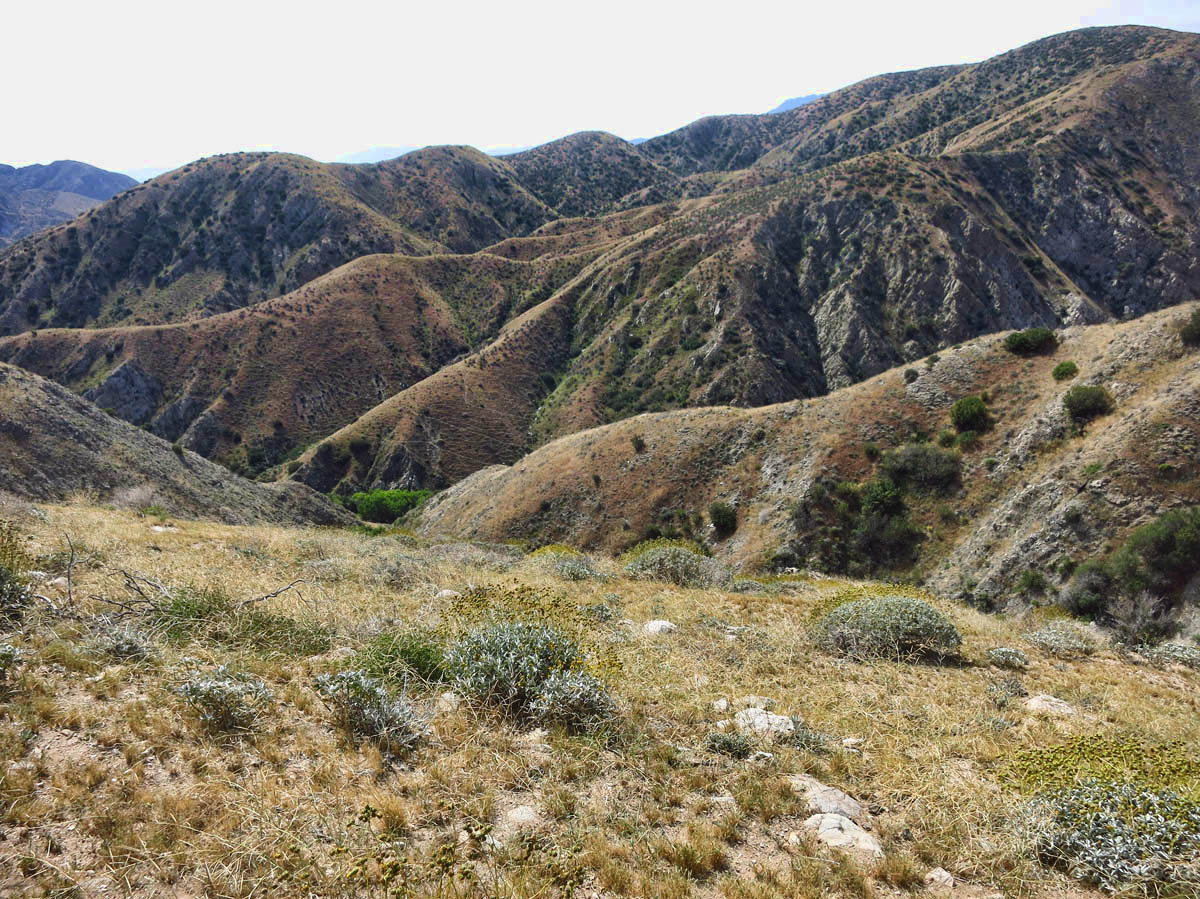
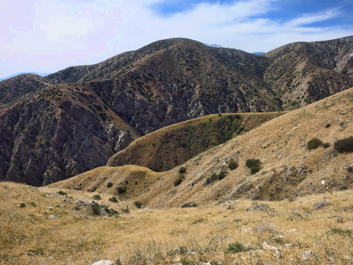
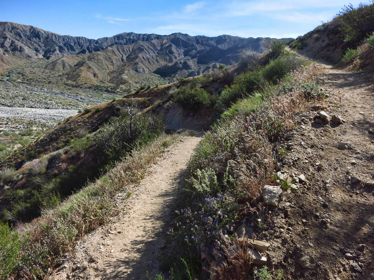
My intent is to hike the Canyon View Loop Trail, a 3.75-mile hike with 650 feet of elevation gain. It begins crossing the Whitewater river, then ascends up some moderately steep switchbacks to the ridge overlooking Whitewater Canyon.
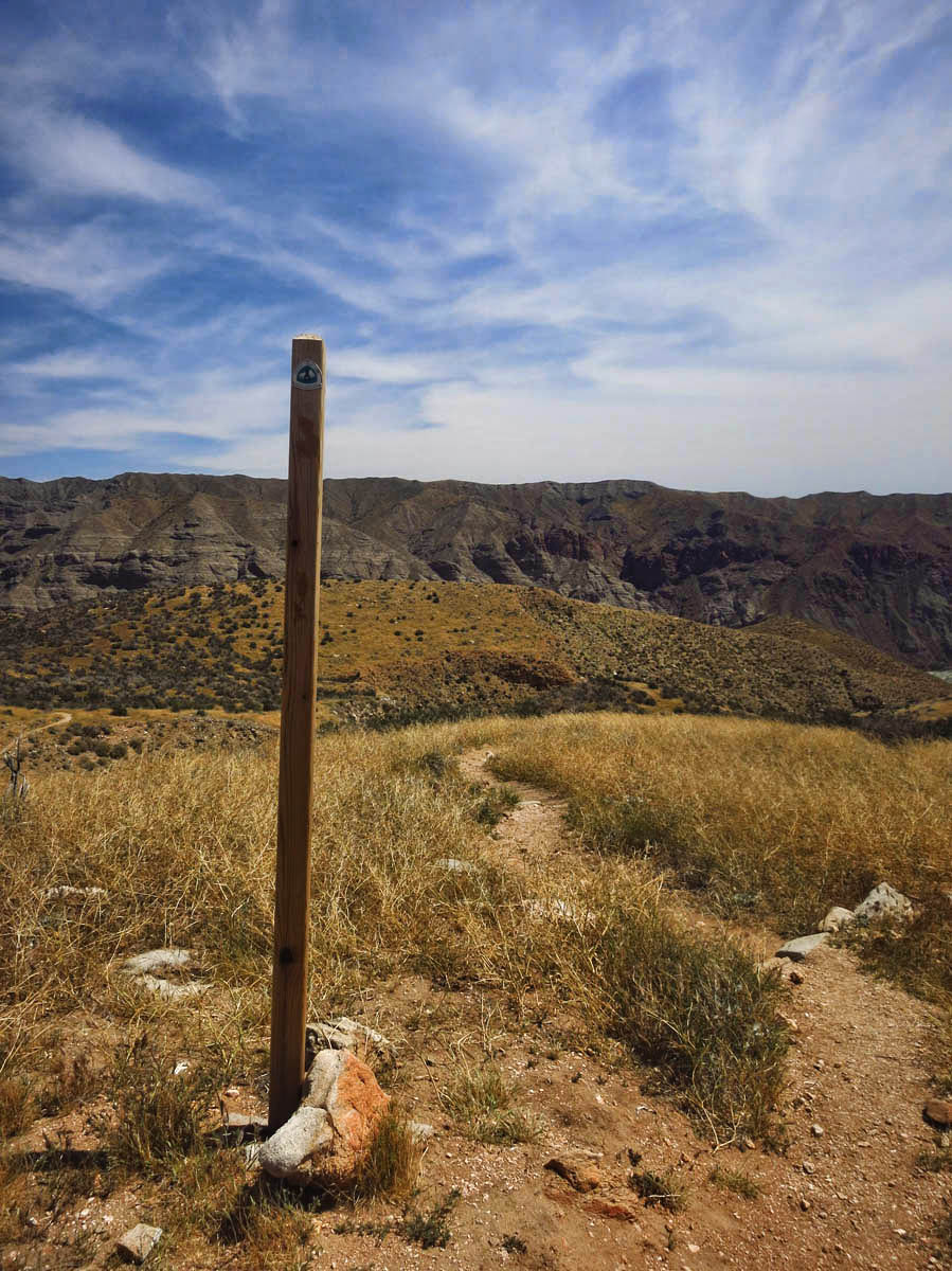
The trail is marked by tall posts about 7 ft tall. I wonder if the height is to prevent hikers from removing the “PCT” triangle markers. If so, attempts were unsuccessful.
About 1.5 miles into the hike, I intercept the Pacific Crest Trail. I confess to being a bit “star struck” after having both read the book and seen the movie Wild about Cheryl Strayed’s emotional journey along this trail. I am seeking a longer hike, so I decide to head south on the PCT and walk the “wild” for a while.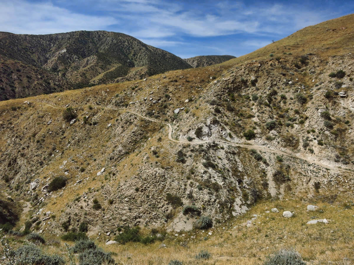
This section of the trail is COVERED in Brittlebrush. Unfortunately, I am too late for the blooms, as the yellow buds have died.
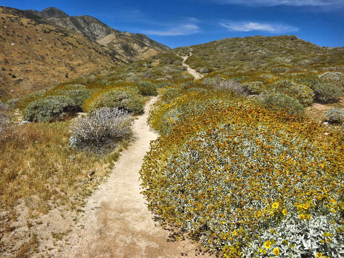
Someone please go back early next spring and take a photo of all these Brittlebushes in bloom!
The thin, sinuous ribbon of the narrow trail along the side of the mountain is compelling. I am fascinated to stand on a trail that would take me from Mexico all the way to Canada on foot. Every twist and turn beckons me to go “just a little further.” In no time at all, I am three miles down the trail from the junction with the Canyon View Loop.
Snow-streaked mountain view beckons me closer.
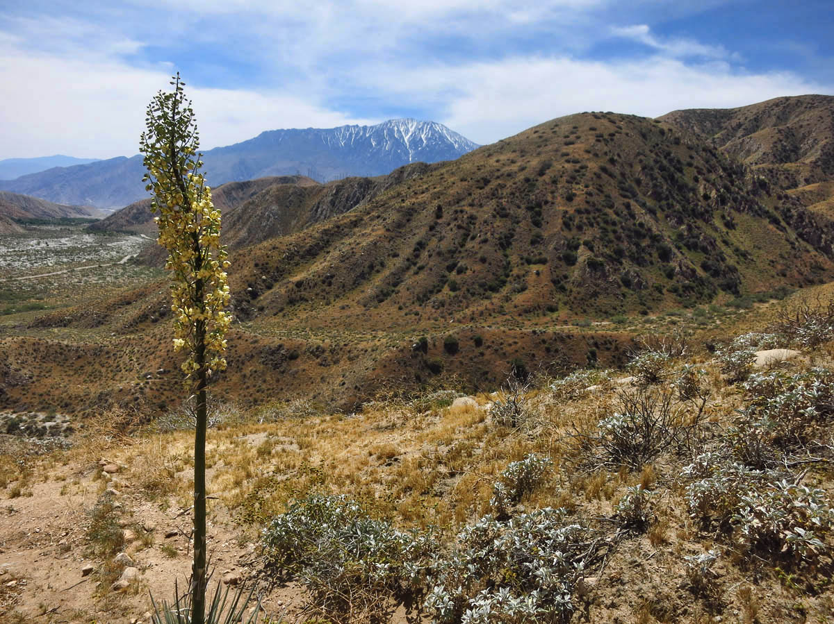
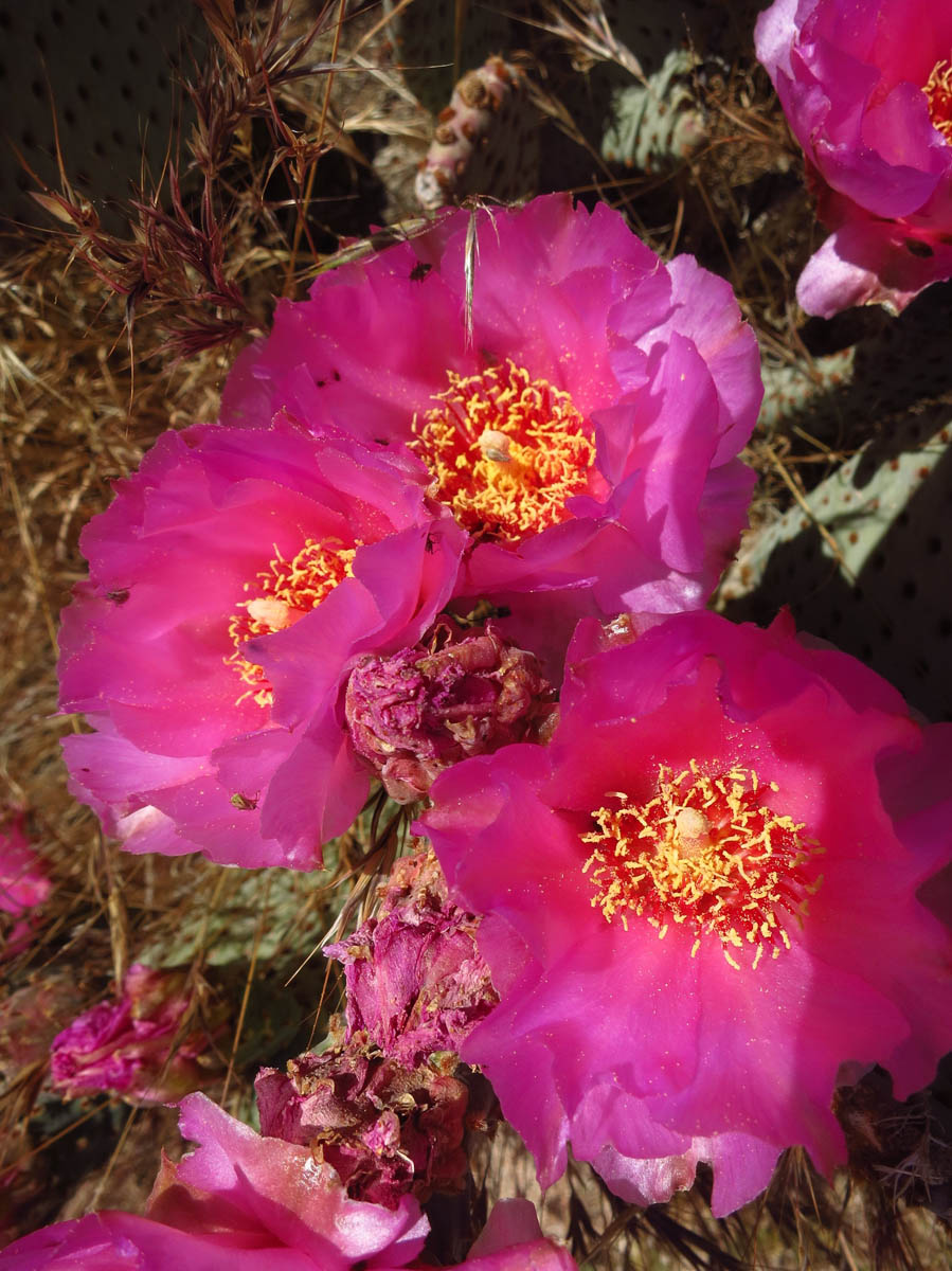
I stop for lunch on a ledge overlooking a canyon tributary below lined with a vein of green trees. There are Beavertail cactus blooming nearby. I haven’t seen another soul since I turned at the junction. The snow-streaked mountain grows more visible the further I walk. With the sun on my shoulders and winds blowing through the low golden grasses whispering as they brush my boots along the trail, it’s easy to see how Cheryl “Strayed” into the Wild…
Maybe tackle the PCT in pieces.
It’s easy to see how a person could get hooked on the PCT, Suzanne. The scenery is amazing, and it just keeps unfolding as you go. Very nice!
Jim
We walked one of the trails in Whitewater in December but we went north, your trail looks prettier. The Ranger said that about 300 people attempt the mammoth 2,663 mile walk each year, after the movie came out about 500 people attempted it but I wonder how far they all got?
I have “traveled with you” via your photography on so many of your hikes. I enjoy the landscapes, natural wonders and thoughts you share. Your independence and courage are admirable. Several of your hikes had me wondering about seeing Saaa-nakes! [Emphasis definitely added] Not my favorite creature. I was so glad your photograph kept it well camouflaged and I continued the photo journey comfortably. Quite fascinating to see your intersection of a portion of the Pacific Crest Trail. I have not seen Wild yet so I have no visual reference of the PCT. From your eyes, it is easy to see how one could get started and keep promising to go just a little further, a little further……..with each new view. Thanks for another great hike!
Long ago I was one of those off-road explores in the area, so it is with mixed feelings I am glad this area is being protected for all to enjoy. It is amazing what thrives where reliable water is found.
Sounds like you’re looking for a place to park the rig for a while, while you take a walk on the wild side.
Beautiful area, I miss hiking in the west.
We hiked that loop while in Desert Hot Springs. It was a fun loop. The top was so green. We didn’t go off on the PCT but we did hike part of the trail while we were staying in San Diego. Our daughter came to visit and we just had to be Cheryl Strayed for a while, too! Jessica wanted her photo taken with the PCT sign. We hiked the Morena Butte Trail and part is the PCT. Loved the book! I first read it before I started hiking and it was an Oprah Book Club book. Then after I got into hiking I had to read again because I looked at it differently.
Whitewater Preserve was on our list but we ran out of time. Didn’t even realize it was part of the new Sand to Sea NM. On our next visit to the Palm Springs area we will definitely go there. Looks like some nice hiking!
Beautiful trail, I would love to see it while in bloom.
The PCT start to finish would make a nice “chapter” in your “book.”
You are teaching me so much about the state we now call home. Perhaps we can go to that section of the PCT next spring and take some photos of the brittlebush in bloom. Really great to see you last night Suzanne.
Loved “Wild” — the book, more than the movie. Made me want to get out and hike the PCT, although I think I’m too spoiled now by our RVing life, and will have to content myself with adventurous day hikes and not so much pain. And maybe an overnight backpacking adventure here and there. :-)) You’re right, it’s hotter than hell around Desert Hot Springs/Palm Springs even this early in the year. We experienced it last March — gorgeous, but also brutal when hiking and biking. Lovely photos.
Beautiful story, didn’t realize it was so close to PS, or that you were still in the area!! I need to travel with you my friend, love your prose. Thank you for allowing me to join your travels!
I’m with Mark. IF there was ever someone who would be great on the PCT, it is you. Gonna add it to your bucket list, Suzanne?? Glad you enjoyed Whitewater. I somehow knew it would be a great respite for you from the valley floor.
Mexico to Canada……WOW! How about I start you off in Mexico and then meet you in Canada.
You have indicated that you might walk the Grand Canyon Rim to Rim. You may have seen many reports from others, but if not you may enjoy the report and pictures of John Sparks (60 +/-) of his approx. 19 hour/25 mi trip.
http://walkingrimtorim.blogspot.com/
Always enjoy your stories and pictures, thanks.