As much as I love Guanajuato, there are days that the “verticality” of it all starts to get to me. Everything is either up or down, including the three stories of the house where I am staying. The callejones are steep, the buildings stacked on top of one another, and I can’t see up over the “rim of the bowl” that is the valley of Centro. If I let myself start thinking about it, I can imagine the walls of the valley closing in. I feel the overwhelming urge to take my arms and push against the opposing hills so I can see out. A “verticalilty attack” has me feeling a little like Rapunzel up in the tower who has just pulled out all her hair.
When I get an email from newly made friends asking if I am interested in a Saturday hike, I’m all over it. The chance to get out in the “wide open spaces” among trees and hilltop vistas is just the cure for which I have been longing. We will be starting our hike in the small town of Santa Rosa, about an hour outside of Guanajuato, reached by public bus.
Climbing up and out of Guanajuato on the bus to Santa Rosa.
Getting out of the “bowl” and seeing hilltops is a breath of fresh air, literally!
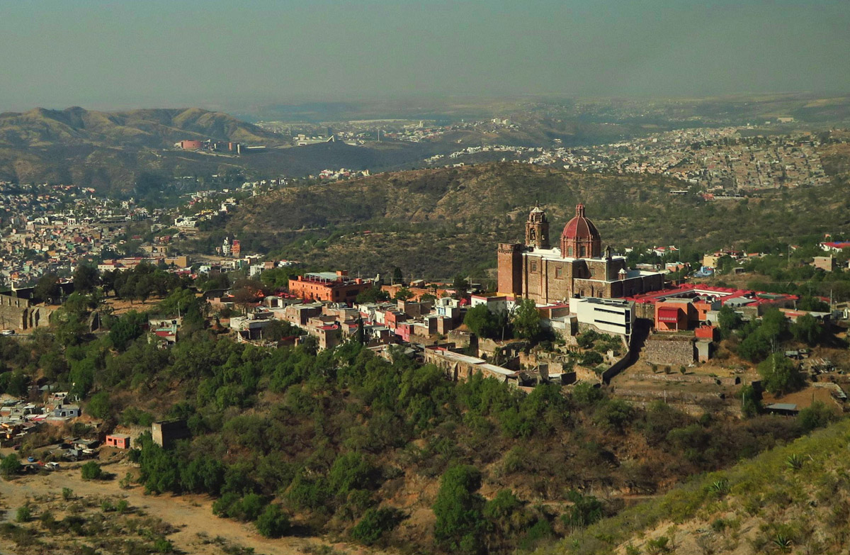
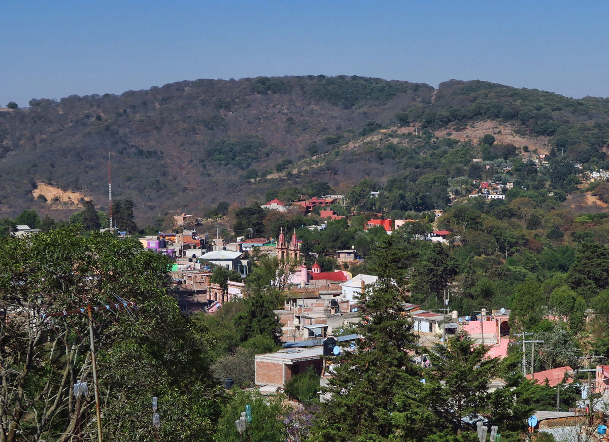
The little town of Santa Rosa only has about 1,000 inhabitants. Like most Mexican towns, Church marks the center of town.
Santa Rosa, elevation 8,500 ft, is a small mountain hamlet on the side of the highway to Dolores Hidalgo. Although it has only about 1,000 inhabitants, it’s notorious for two things, its majolica pottery and its no-label mescal, bought from the Conserva shop in town. But we will be sampling neither, as we are there for a ramble through the hillside.
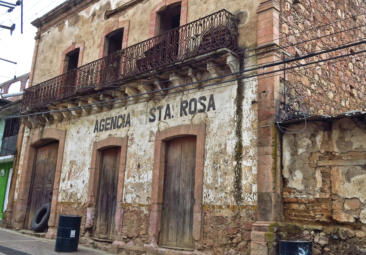
We are headed out of town for the hike, but I vow to return to do more exploring in this photogenic town.
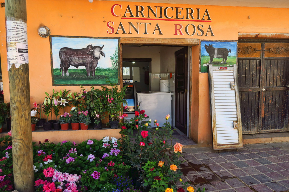
The local butcher and plant shop.
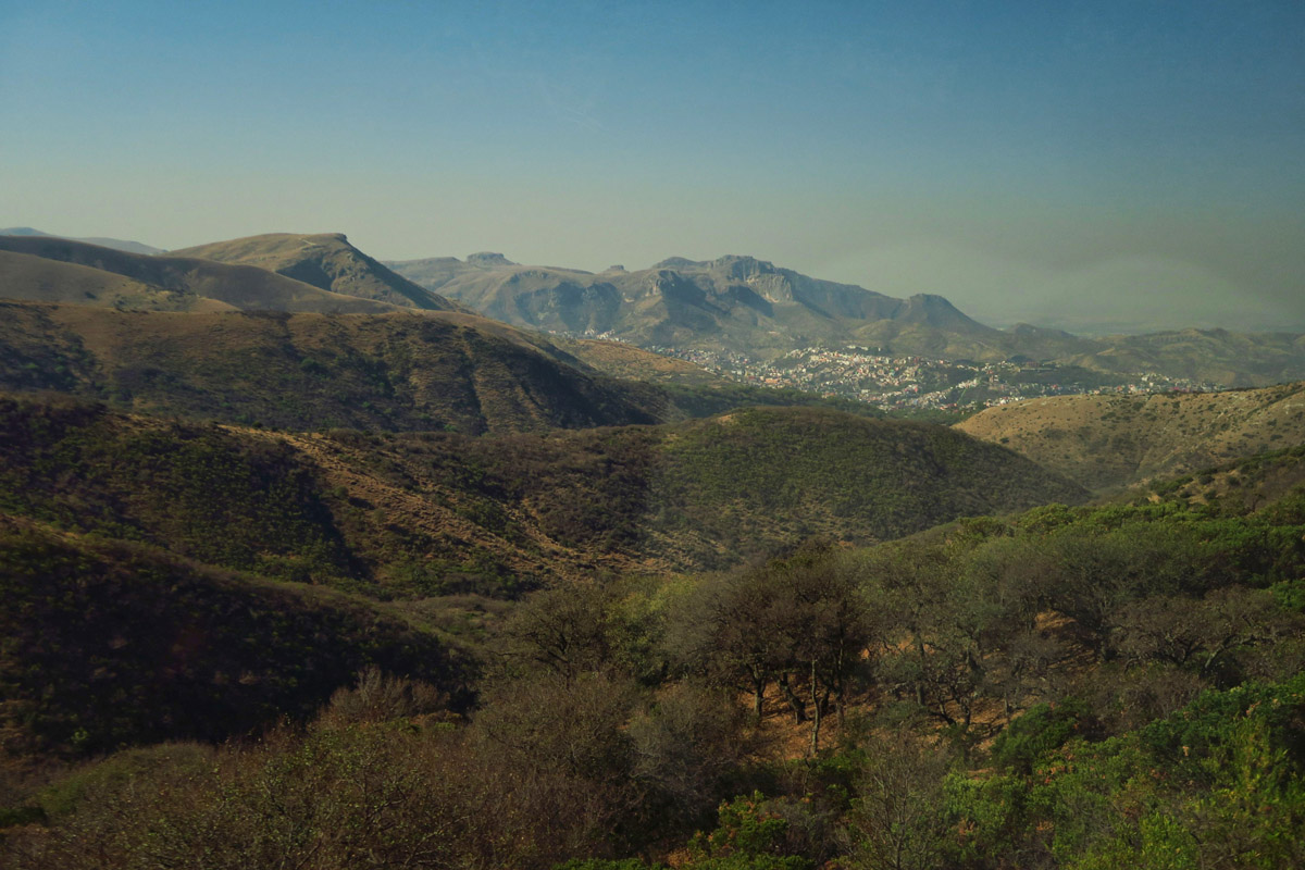
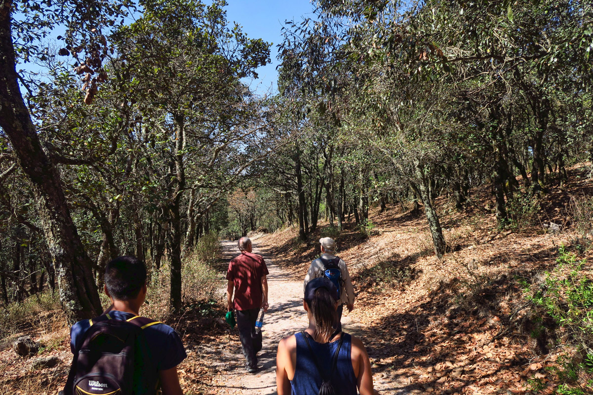
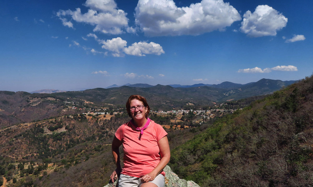
It’s quite a climb up the steep cobblestone streets to get out of the small town, but soon we are seeing beautiful views overlooking the town with the twin steeples of the church punctuating the landscape below. The plan is to hike a loop of about five hours of walking. (Note to self: when fast-paced hikers give duration of a hike in hours rather than distance, do the math!) There will be a “safe” turn around point after around three miles where one could easily find their way back down to the town. After that, one is committed to sticking with the group, both for navigational reasons, as well as to avoid a constant uphill on the return. Our destination is the “pressa” or dam. Once we reach the top of the bluff, we will descend steadily down to the dam, then circle back into town.
Climbing up out of town, we stop at an overlook. You can see the church steeples below.
As much as I am enjoying the town of Guanajuato, it feels so good to be back amidst Nature!
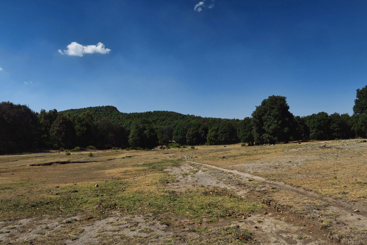
Wide open fields are used for grazing livestock.
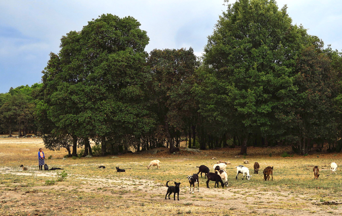
“High on a hill is a lonely goatherd. Lay ee odl lay ee odl-oo”
Breathing is difficult on the steep climb out of town. A couple of times I contemplate turning around, as I once again find myself struggling to keep up with a group of long legged, fast paced hikers, particularly at over 8,000 ft. But I vow not to quit until at least the first designated turning point.
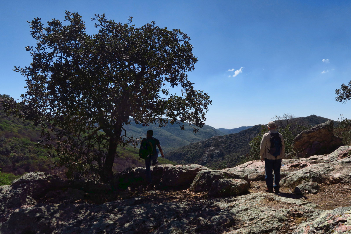
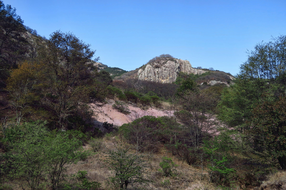
By the time we reach the first bluff, I am flying high. Oh, it feels blissful to be among tall trees that have not been landscaped to look like topiary trees. And vast vistas with multiple hilltops in view, with the only signs of traffic and congestion being the many animal trails worn in all directions. Pure nature, cow pies and all.
We reach the first overlook at about 1.5 miles up.
It feels so good to be on a hike again, in spite of my lack of breath at 8,500 ft.
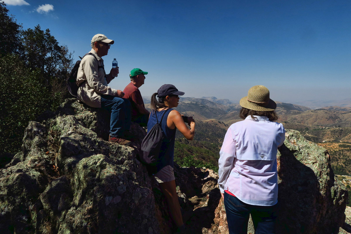
The second overlook. Last chance to turn around, returning back downhill into town.
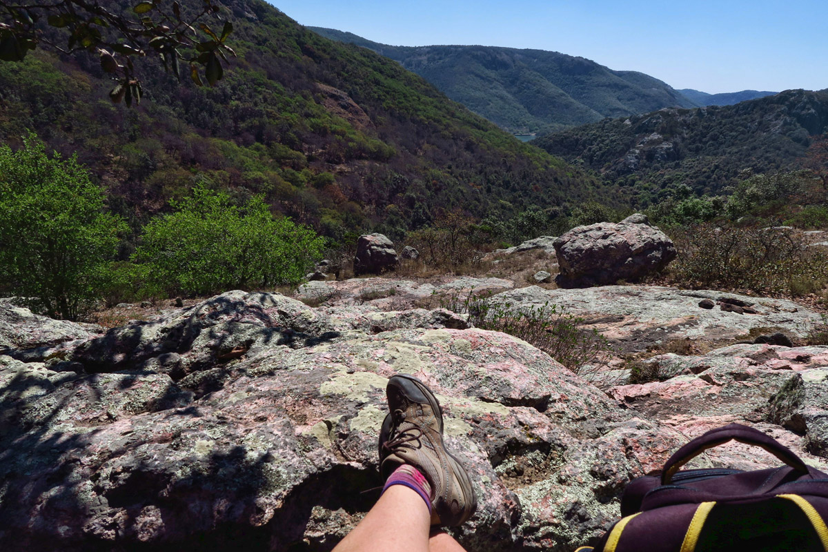
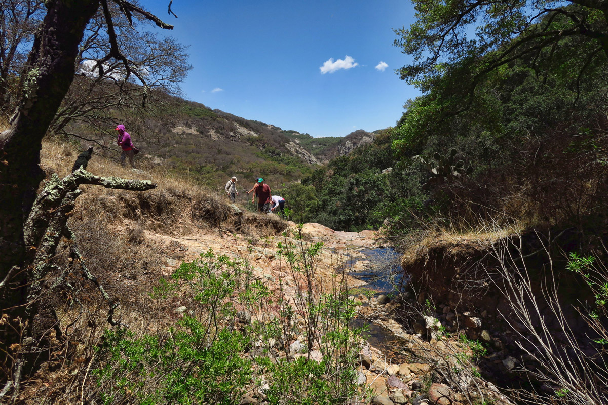
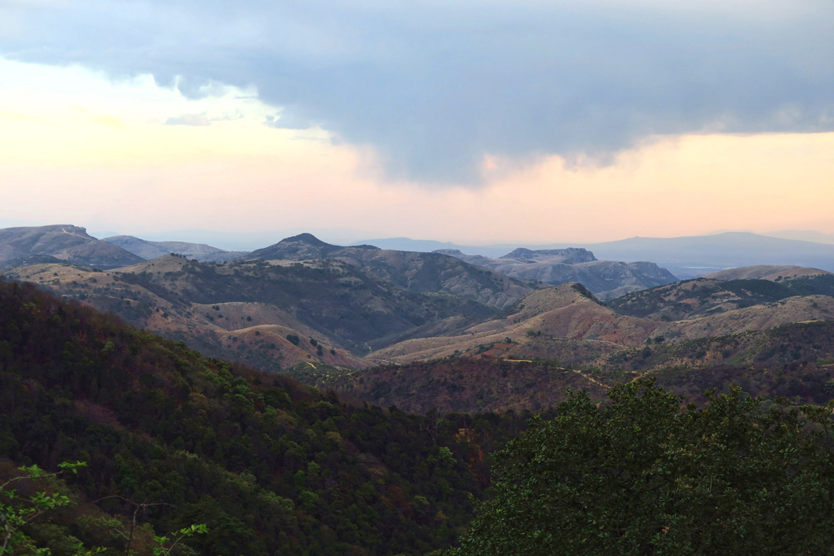
Thinking of Pam’s “Lunch with a View.” If you look far into the V of the mountains, you will see a small dot of blue. That is the dam where we are headed.
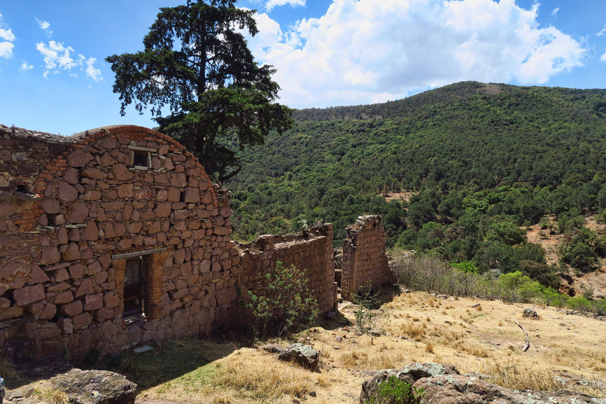
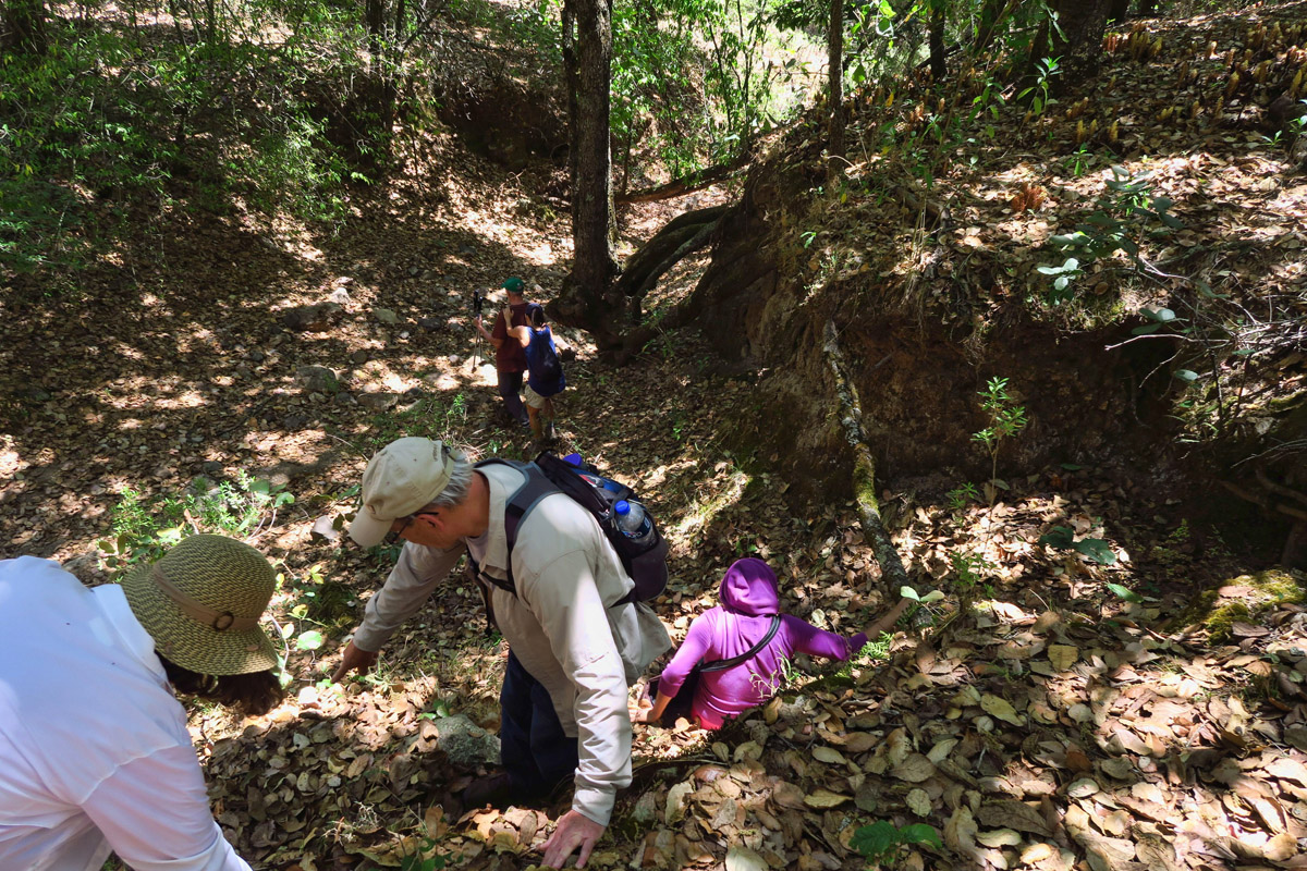
Our leader has done this hike twice. He knows to veer to the left of the old, abandoned hacienda. But given that most of us have never been this way before, we cannot resist the urge to explore the grounds of what appears to have once been a working farm. So we drop down into the valley to get a closer look. As one of the guys is circling the crumbling stone structure, he shouts back, “Hey, guys, I think someone might me living here.” We back off from our snooping and peering in openings, when a shrunken old man appears, hobbling on a cane. I am grateful there are native Spanish speakers along with us on the hike, as we learn he lives here with his son. But something has been lost in translation, as soon another son appears. Then another. Then two women come out to chat. They are as intrigued by our visit as we are about their lifestyle.
Our designated translators ask if there is a better way to reach the Pressa. Much conversation is exchanged, the net being there is a much more scenic route than the one we have planned. They make it sound so easy. Just follow the old road until we reach the creek, steering left toward the mountain. As if there were only one…one old road, one shallow creek, and one mountain! Wrong.

We go off trail to explore what appears to be an abandoned hacienda.
The old stone walls beckon us to explore beyond.
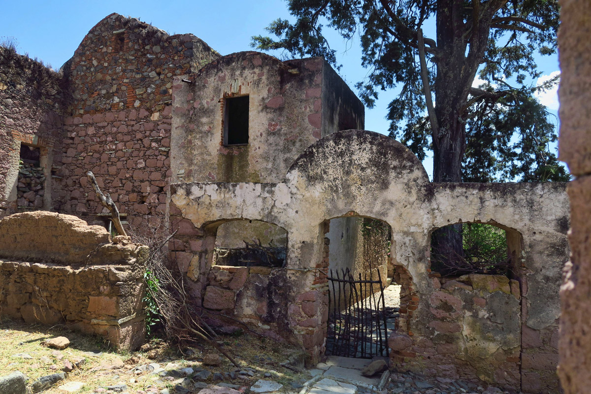
Our first clue it might be inhabited…a working gate.
In following the creek, we soon reach a dead end. A dry waterfall that plunges straight down an estimated 50 feet. Cliffed out, and no place to go. By now, our 5 hour round trip hike has turned into a 5 hour one way. We begin calculating our options. Having planned for a much shorter hike, we are all into our water reserves. While several of the less weary head out to scout possible routes up and over the hilltops, the rest of us sit and wait. And rest. I go over the “self rescue” items in my pack, all resting comfortably back in the Winnie a thousand miles away. I’ve got a few pecans left and about half a liter of my “reserve” collapsible bottle of water.
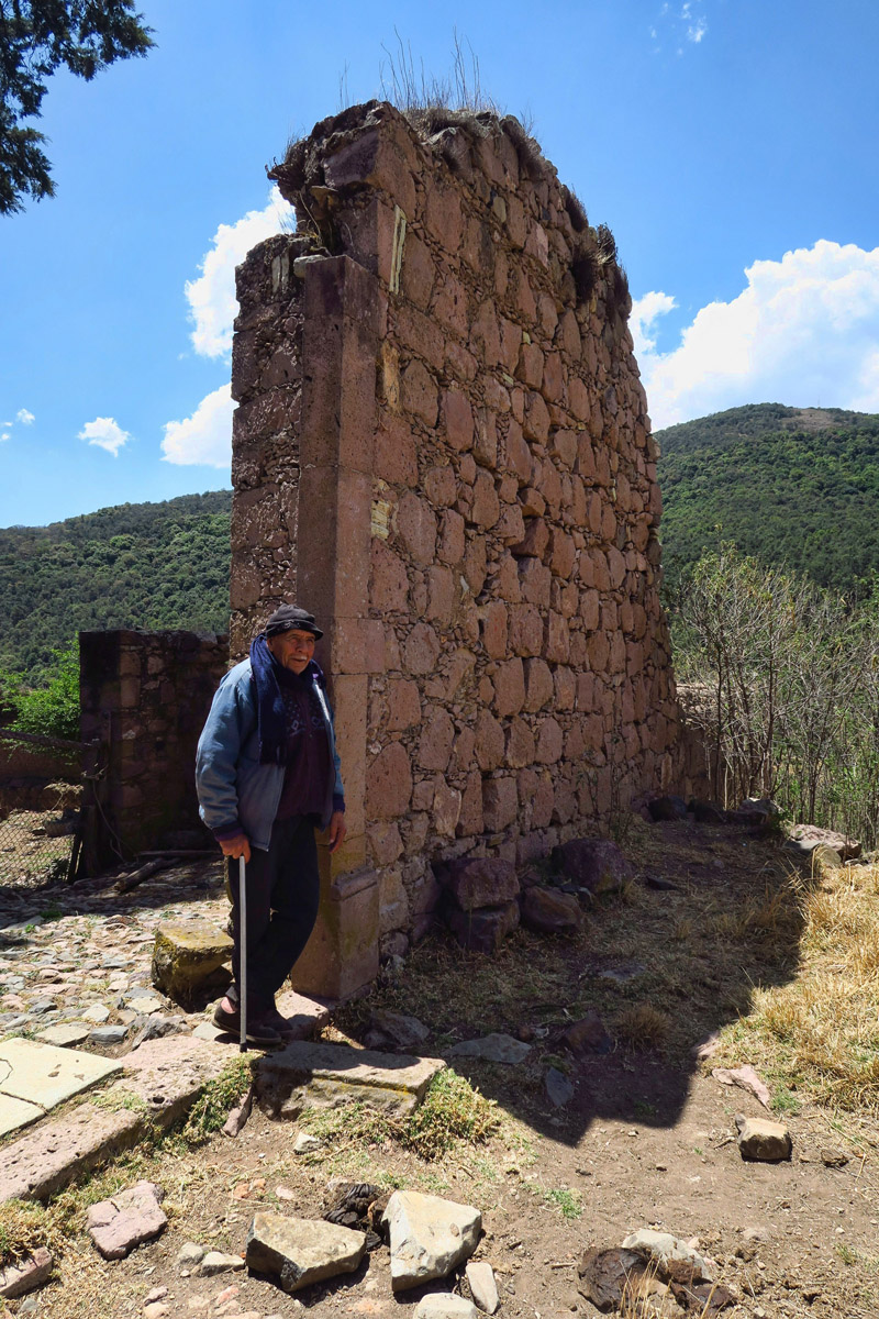
This hobbling little old man appeared and invited us into the hacienda.
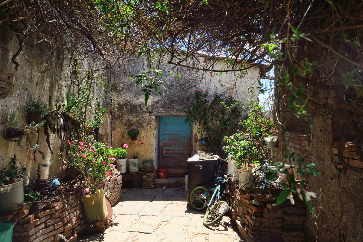
This empty courtyard soon filled with family members.
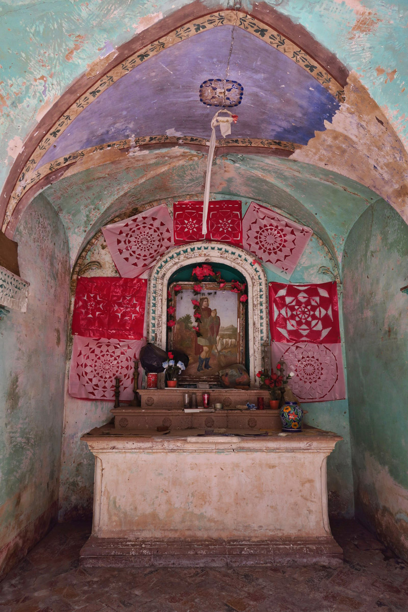
The old hacienda even has an altar. No electricity though, and we never did figure out the source of their water. Spring?
However, there is one other “survival tool” I have brought along with me…my Backcountry Navigator App on my phone. Though I have no maps loaded for Mexico (still can’t locate them online) I have turned on the tracking which shows we are not making a loop, but in fact moving further in the opposite direction. This squiggly red line alone is enough to validate that we are way off course.
Following the directions of the hacienda inhabitants requires some scrambling to get down the dry riverbed.
We’ve now walked about seven miles. The group ahead shouts back, “We can’t go any further. Cliffed out by a dry waterfall.”
No options but to turn around and go back UP the way we came.
One by one, the scouts all return with bad news. Having bushwhacked up the hillsides, there appears to be no other way but back the way we came…seven miles, all uphill. Bringing great relief, clouds roll in to shield us from the sun’s intense heat, which also relieves our dwindling water supply. We stop back at the hacienda to ask for water. As it is from an unknown source, some choose to drink while I opt out. I still have some water, and knowing where we are at this point, I decide girardia or Montezuma’s Revenge is not worth the risk. Having hiked a total of over 14 miles, we reach the little town of Santa Rosa at 8:00pm, just minutes shy of sundown.
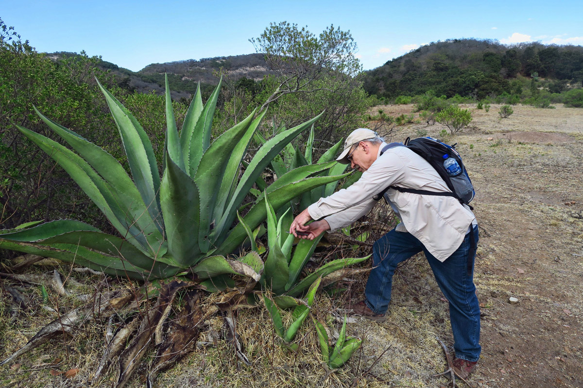
Fellow classmate Rob, half-jokingly decides to look for water in the agave plant, “just in case.”
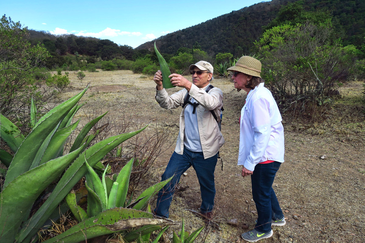
Nope. It’s dry. So much for our survival rating!
Thank goodness clouds rolled in to cool things off!
In thinking through the events of the day on the bus back to Guanajuato, I contemplate what I did right versus what I did wrong. As for the “wrongs,” well, I blindly followed in a place where I had never hiked before, without so much as a map. And I could have brought a little more food. Since I am rarely hungry for more than a Clif bar when hiking, I could have planned for a worst case scenario. As for what I did right? I turned on the tracking device, and I brought twice the amount of water I thought I would need.
Thankfully, all’s well that ended well…leaving me basking in the afterglow of a much needed immersion in Nature.
Tercero Dia in Classe de Cocina
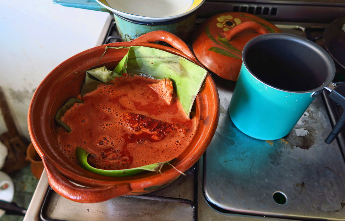
On our third day in cooking class at Escuela Falcon, we make “Cochinita Pibil,” a Mayan dish from the Yucatan region. Cochinita means “baby pig,” which is typically roasted in banana leaves. Since class is only 60-90 minutes long, we won’t be roasting a baby pig underground. But we will be using banana leaves to cook the chunks of pork on the stovetop in a clay pot.
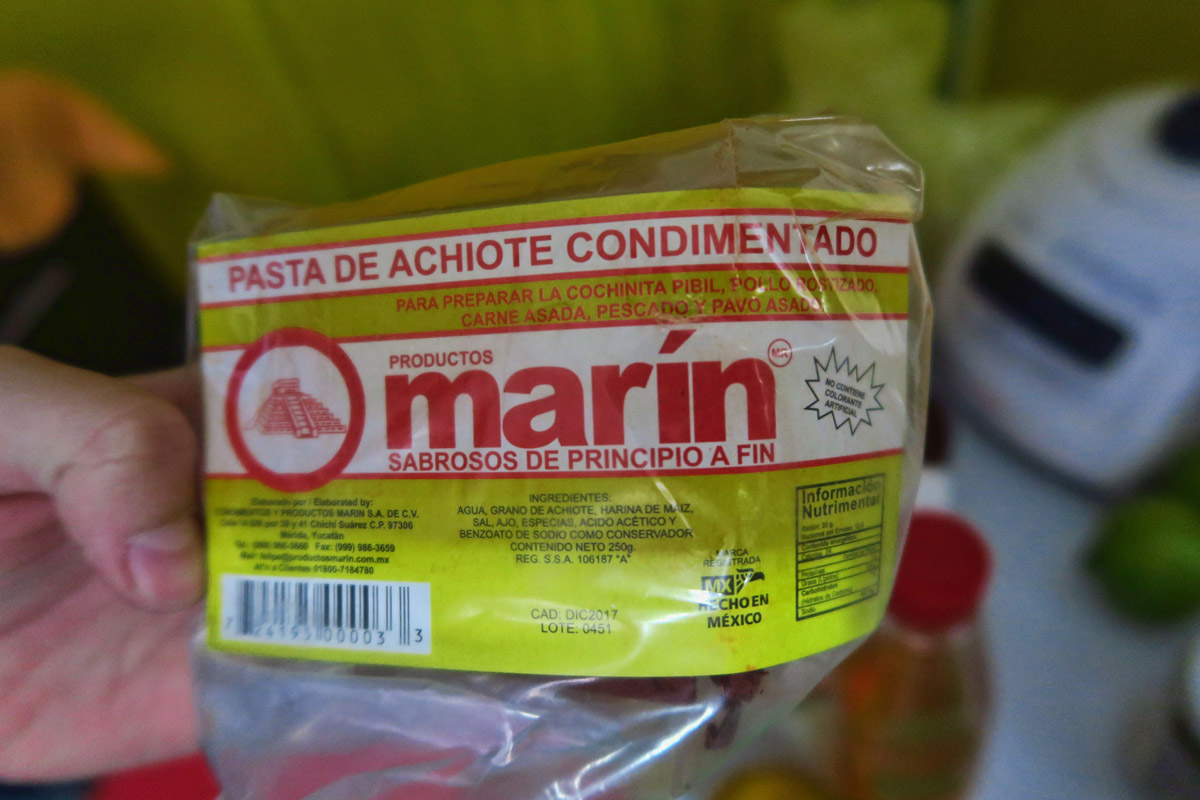
I always wondered what gave some Mexican meats like tacos al pastor, for example, their bright orange color. In my cooking class, I learn of a spice, achiote, also known as annatto. It is a bright orange paste made from the ground seeds of the achiote tree, which gives a bit of a peppery nutmeg taste. It is also used as a food additive in come cheeses to give more of an orange color to what would otherwise be a white cheese. Today, we will be using it in a marinade for the pork, along with juice from oranges and limes, a little vinegar, garlic and onion.
To top off the roasted pork wrapped in tortillas, we make a salsa called “Xin Pek,” thinly sliced red onion with oregano and chopped habanero peppers, marinated in vinegar. This Mayan word means “breath of the dog,” because the habaneros leave you panting!
MMM Nice photography!!!
Another beautiful post my friend!!! Enjoy your time while my summer will be filled with a retired husband and a teenager!
That Backcountry Navigator app can sure come in handy! Wonder how that hike would have turned out had you not been tracking your route…
You were very smart to carry a little extra! Sounds like quite an intense day on the trail. But, I can see how it would be fabulous to finally be back out in nature!
Cochinita pibil is a favorite!
Whilst you might be feeling penned its good to have those friends who know the area and get you out and about, probably to places you wouldn’t find on your own.
Ha! Sounds like most of our hikes… 🙂
and
Guanajuato is my kind of place :).
Box Canyon, Ouray, where Verticality reigns supreme, and is the only hiking option.
I love the old man’s hacienda!!!!
mark
Smart girl with the extra water.
Honestly, I would have been tempted to hang out in Santa Rosa sipping on the no name mescal whilst the others hiked, but then I would have missed the old man’s hacienda…what a cool place to uncover! Thanks for the info on achiote, the orange hued spice. I’ve never had Cochinita Pibil but I love tacos al pastor. So happy to read you all made it safe back down the mountain and that you were wise to pack more than enough aqua for the trip. 🙂
We explored Dolores Hidalgo but had no idea that there was hiking in the area. So glad you had your navigation app with you. It could have been a much different day without it. I would love the cooking classes that you are taking.