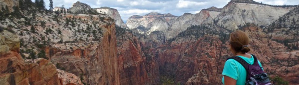
The weather has been gray and drizzly since leaving Bonavista, but the forecast shows a brief window of relief. So I b-line it for the Skerwink Trail. It will mean hiking in the late afternoon, but it’s the only rain-free window for the next 24 hours, so I’m going for it. The trail is reported to have some muddy, slippery stretches along the cliffsides, and I don’t want to walk it in the rain.
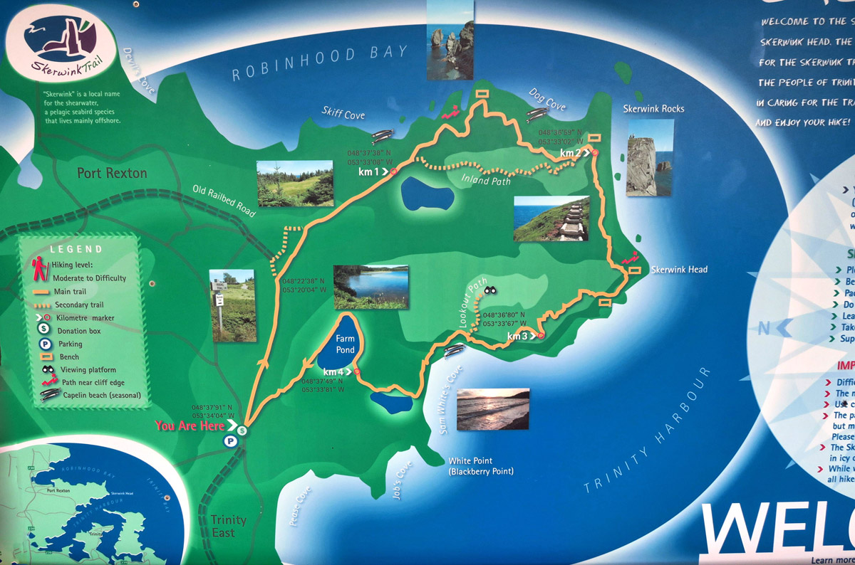
The Skerwink Trail is a 5.3km/3.5 mile loop that skirts the perimeter of Skerwink Head, between Trinity Bay and Port Rexton’s Robinhood Bay. For what it’s worth, to quote another “listicle,” Travel & Leisure lists the Skerwink in it’s “Top 35 Hikes in North America and Canada.”
The trail is named for the Skerwink, medium sized seabirds who make their summer residence on the coastal cliffs of the North Atlantic throughout the summer months. They make the long voyage to their breeding grounds in the Falkland Islands, making them among the furthest migrating birds. They are also one of the longest lived, with documented specimens living 55 years.
The trail is rated moderate to difficult because of several steep climbs up stairs to reach the top of the Head. However, I would call it more like easy to moderate. If you can climb a couple of flights of stairs, you can do the Skerwink Trail!
Sea stacks, bald eagles, whales, wildflowers, a pond, a beach, and a lighthouse, it’s easy to see how they say it has more scenery per linear foot than any other Newfoundland trail.
Hope you enjoy the hike!
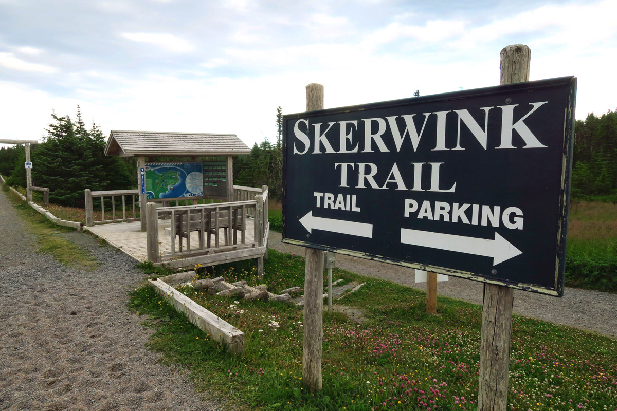
Parking at the Skerwink Trailhead is limited, so get there early, or arrive for a late afternoon hike.
Recommended direction is clockwise for optimum views.
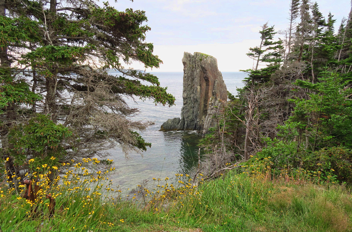
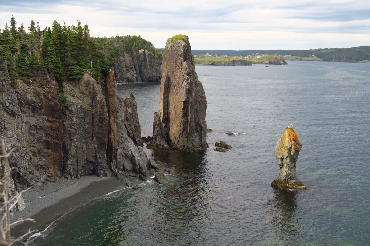
Right away, the trees open up and beautiful tall sea stacks come into view.
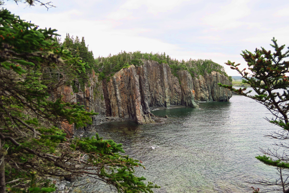
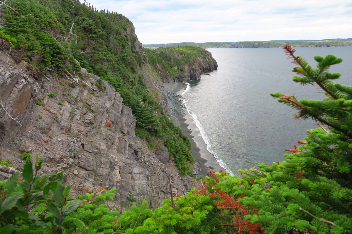
The side of the Skerwink Head trail facing the harbour of Port Rexton is very steep and rugged.
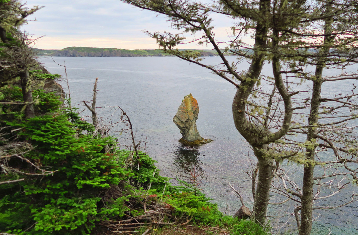
I keep saying it, but I’ll say it again, the water is so clear here!
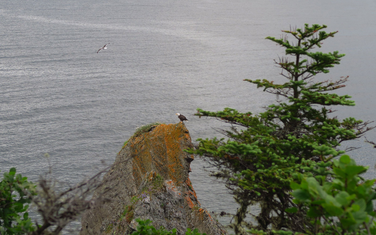
I am standing there watching a couple of gulls on the top of this rock, when all of a sudden they take off, and this guy moves in to take their place as the gulls take off (upper left in photo.)
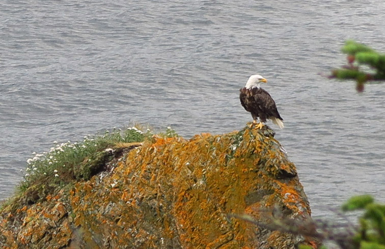
I decide I’ll sit for a while and watch him until he takes off.
I try to wait him out, thinking maybe he is hunting.
I finally give up and move on, or it’s going to get dark.
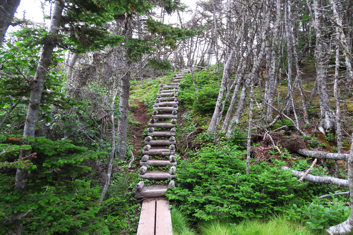
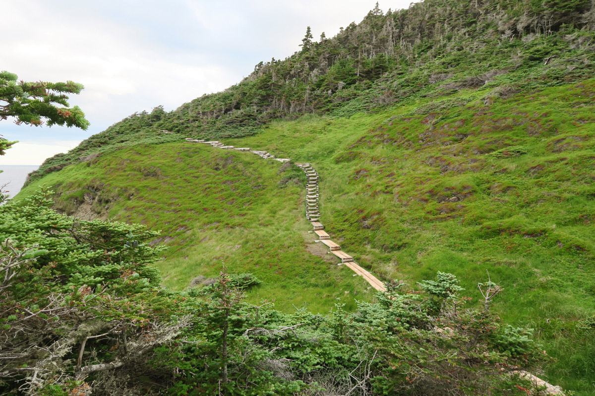
There are a lot of stairs along the trail as it climbs up and over the headlands.
The sun is frustrating as it rarely comes out from the cloud cover, yet I can see it just offshore.
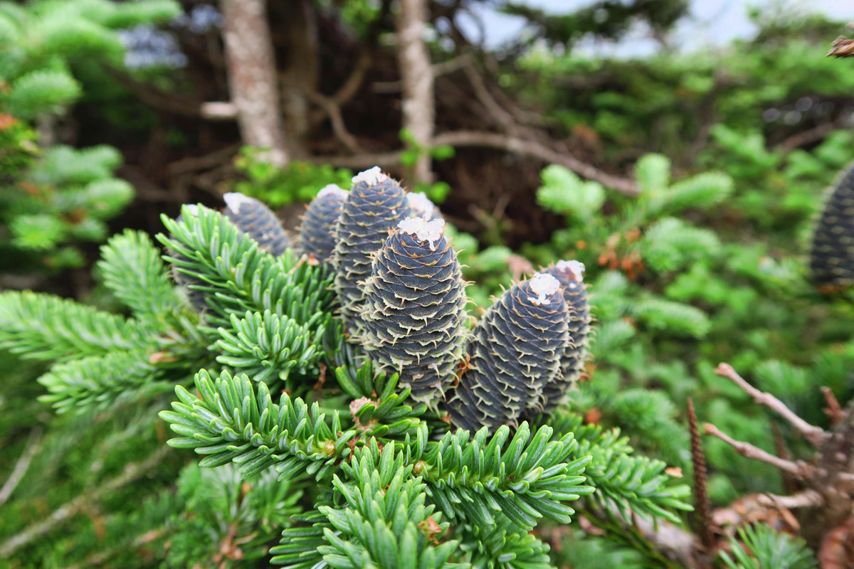
Firs differ from other conifers in having erect, cylindrical cones that stand up like candles.

Lots of up and down on this trail.

Looks like flying monkeys could come out of this forest.
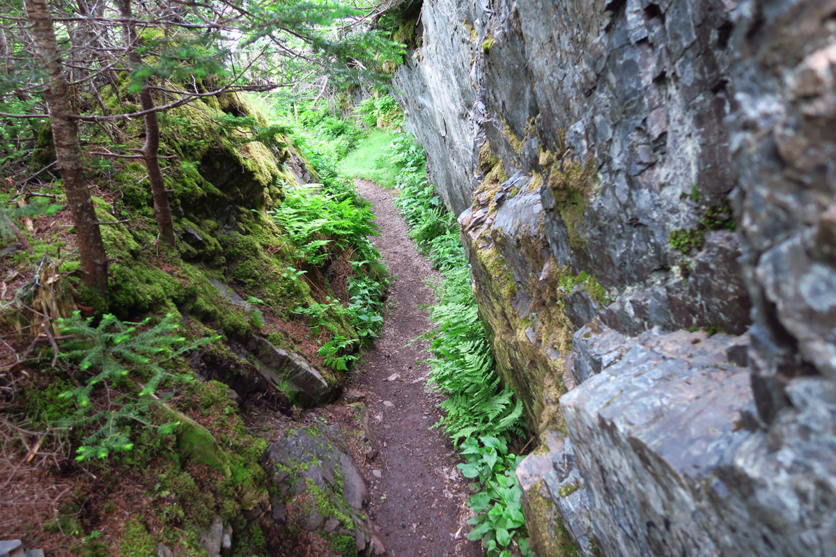
Down through the crack…
My bald friend is back, and he’s brought a friend…can you spot them?

A blurry zoom and cropping shows there are two hanging out on the dead tree branches.
As I near the crest of Skerwink Head, the sun makes a brief appearance.
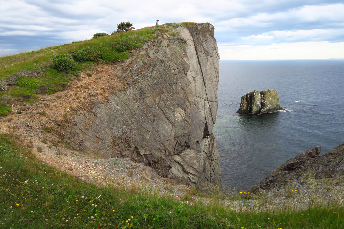
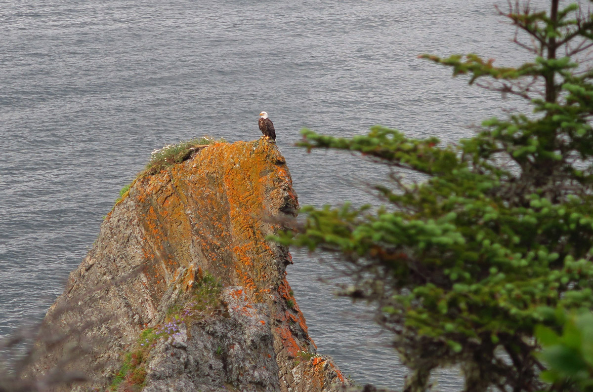
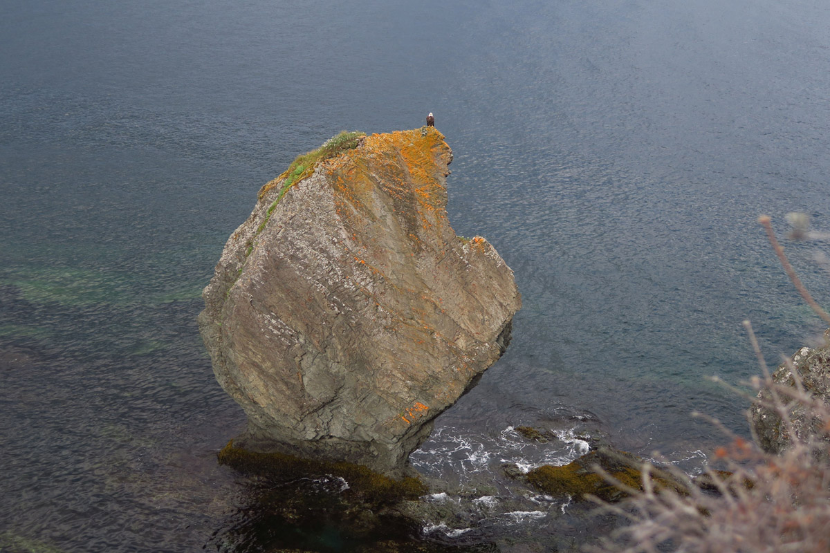
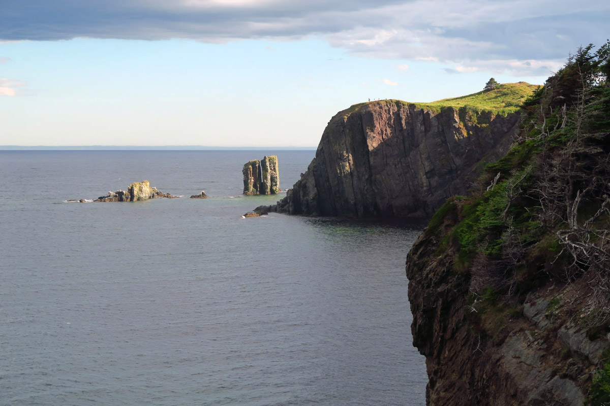
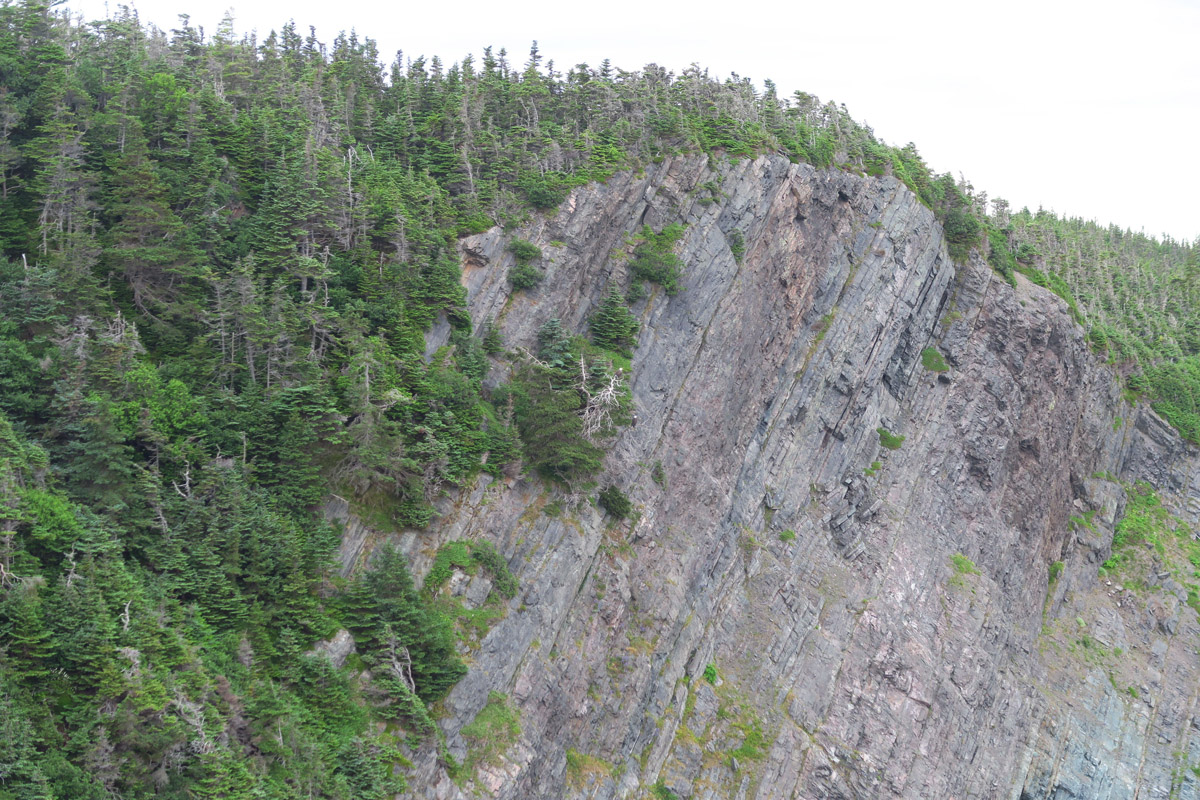
Skerwink Head — Note man on top for scale.

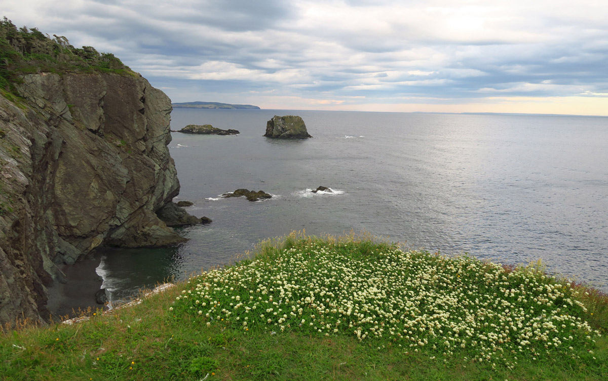
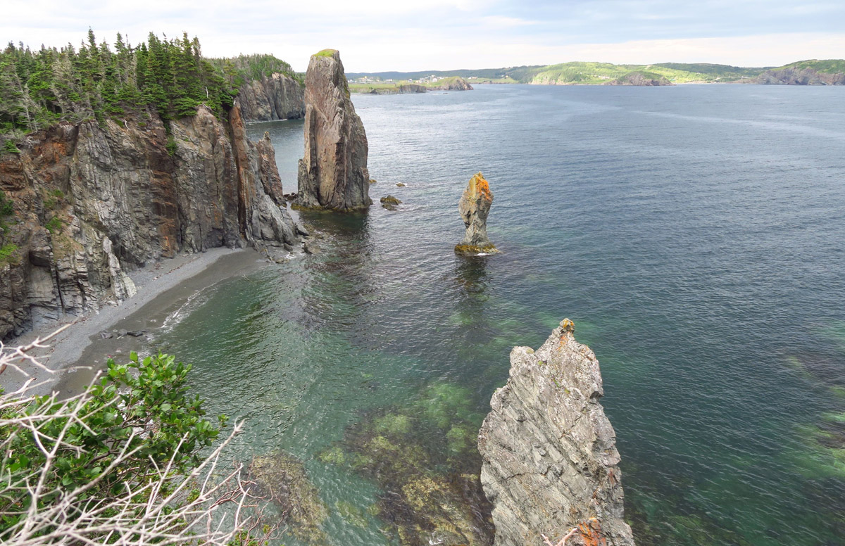
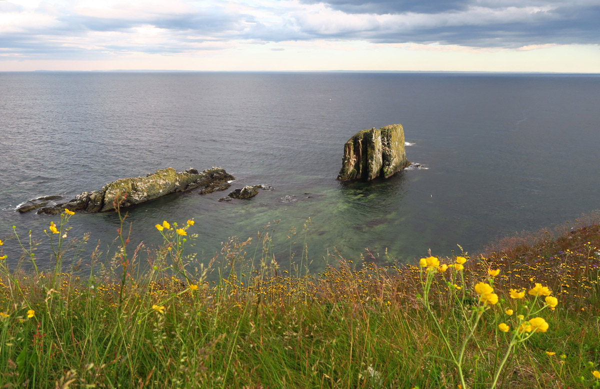
Skerwink rocks offshore. There are whale spouts out there, but too far for my camera.
Much of the trail is flanked by what Newfies call “tuckamore,” short, thickly matted spruce or fir trees that grow in coastal areas. Though stunted in stature, they may be several decades old.

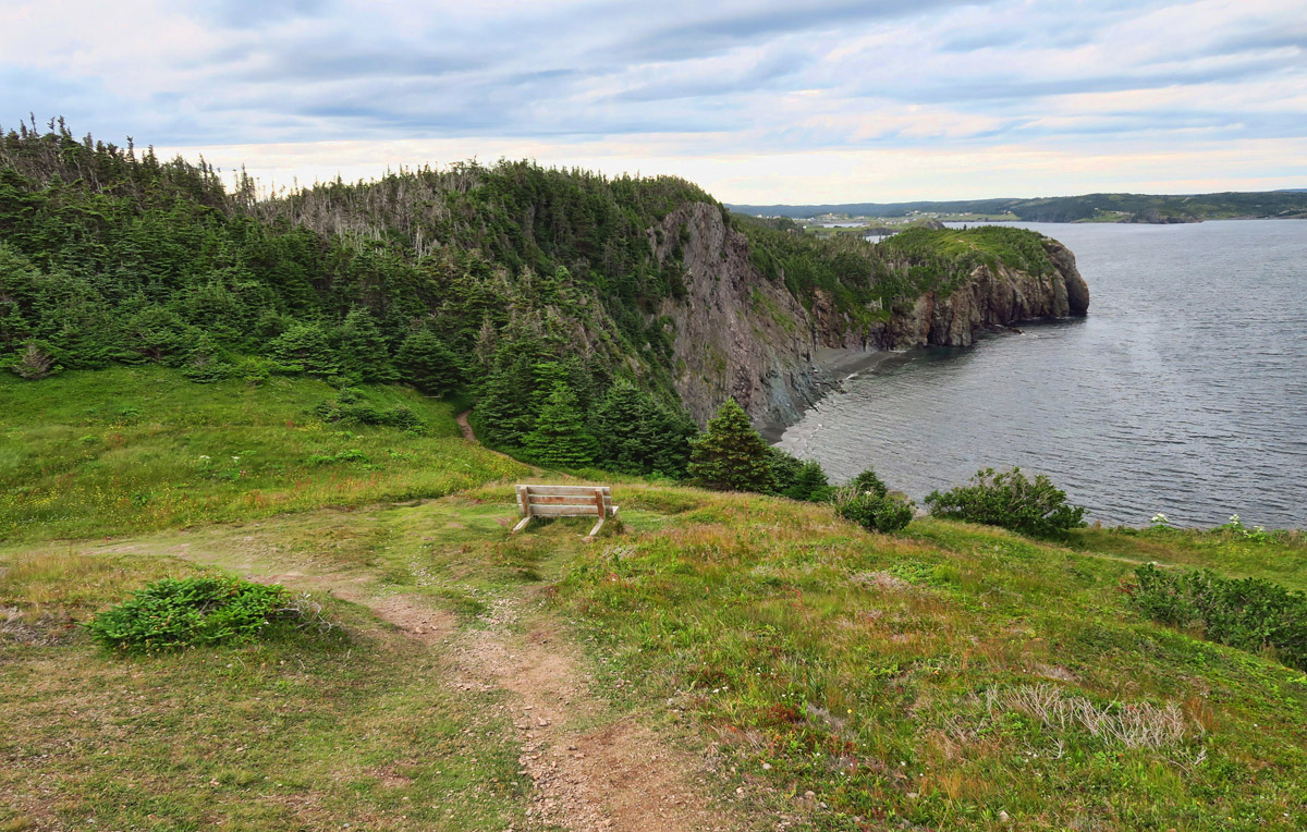
Finally, I have rounded the top of Skerwink Head, and am headed around the other side to Trinity Bay.
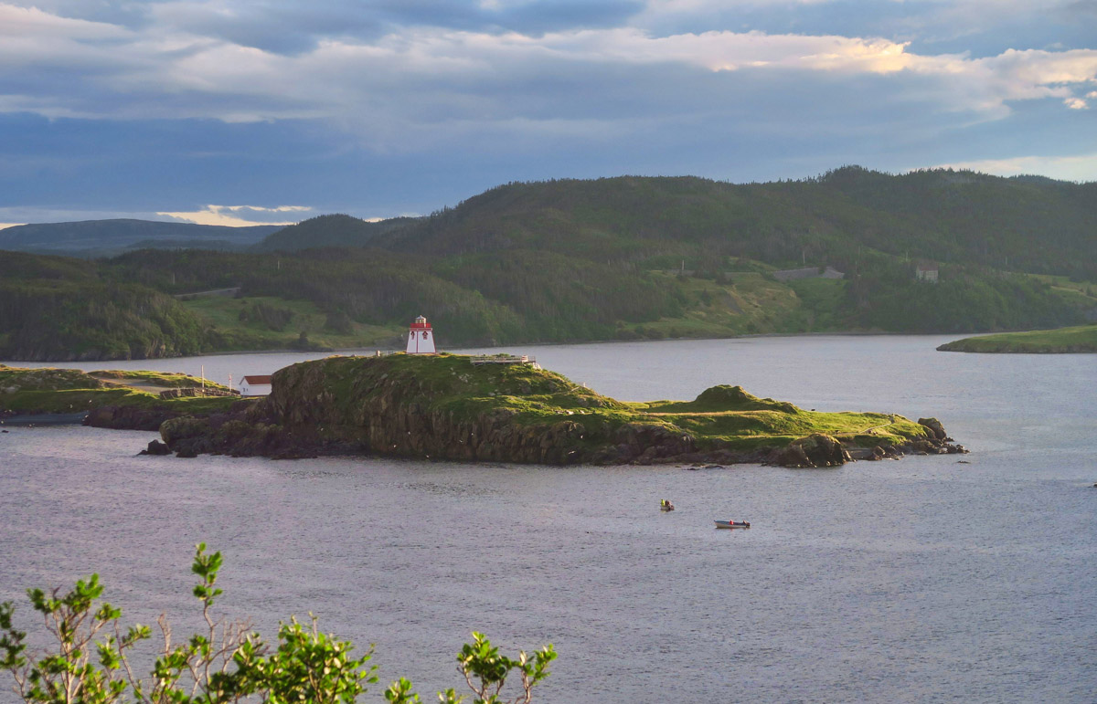
Fort Point Lighthouse in Trinity Bay
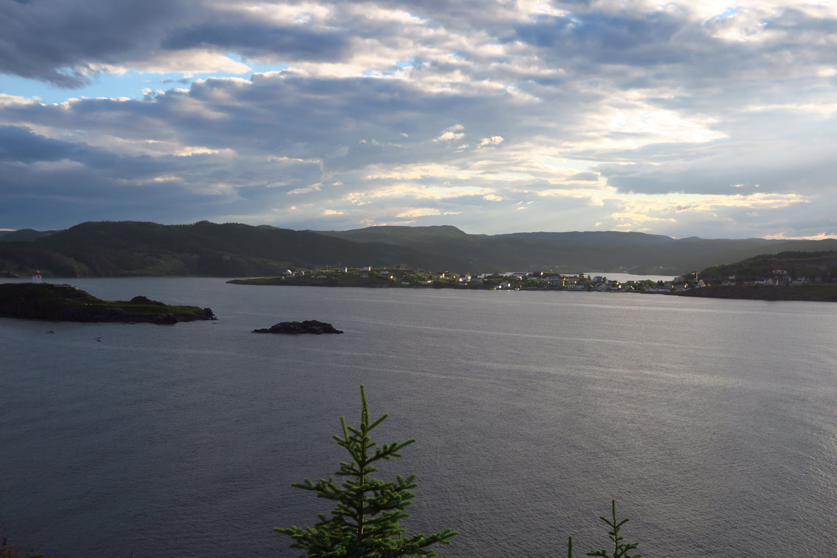
The sun drops beneath the cloud layer and lights up the buildings in Trinity Harbour.

Although I do encounter a few sprinkles, thankfully the squalls remain just offshore. Note two here on the horizon.

Nearing the spot where the loop rejoins the outbound.
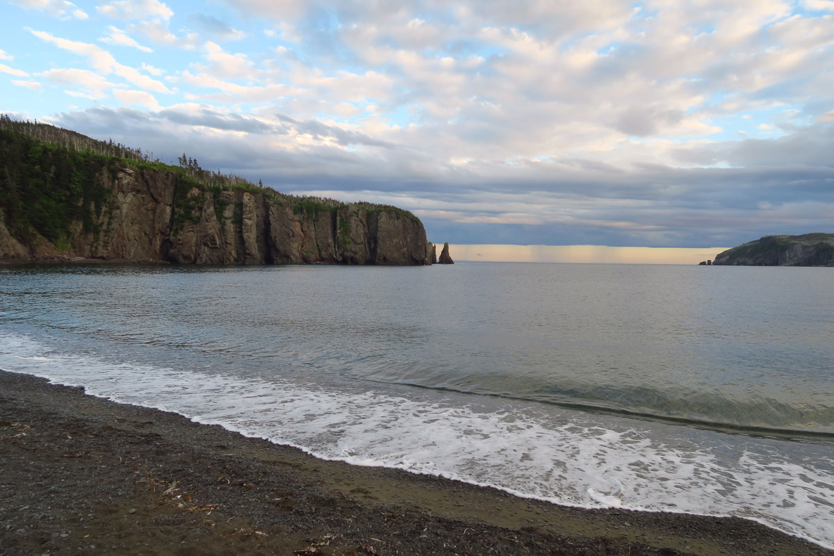
Sam White’s Cove

Evening sky reflecting in Farm Pond.
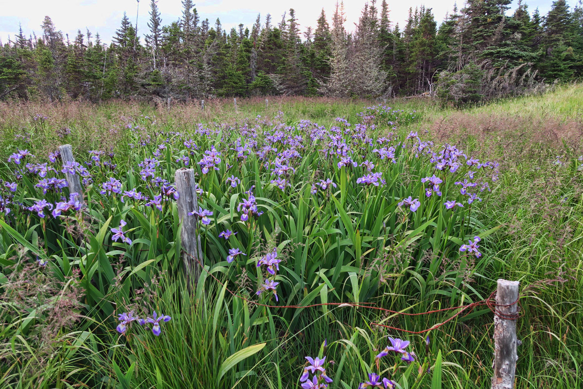
Wild Iris

Back at the Winnie, parked for the night at the Anglican Church. The sign says parking is allowed any day but Sunday. It’s a very restful boondock!
I’ve been following your Maritime adventure and have to say it has been addictive – I can’t wait to see the next post and view the pictures of what’s around the next corner, across the water, the next treat you have to share! I’ve wanted to visit this area, but now I know it has to happen. What a wonderful adventure this has been and I look forward to what’s next! Thanks so much for sharing!
Totally agree with you Cheri!
So, did you have any trouble finding places to boondock? How many nights did you have to stay at campgrounds? Also would be interested in your experience in find free dumping stations. You’re probably aware there are sites to post information about sites for camping and dumping.
Hi, Frank. I had no trouble at all finding boondocking spots, but as you will see in my next post, some of them were a bit unconventional. 😉 Since I am the only one onboard, I don’t have to dump all that often, so I used the really fancy ones (seriously!) found inside the National Parks. I’ll do a recap when I wrap up Newfoundland on my boondocking stats. Thanks!
Again, thanks for posting. I am hoping to go there next summer.
Each post out does the last post in beauty. You are seeing some good stuff.
Thank you my dear friend for taking me along with you on this special hike. Sadly I requite handrails to do stairs however I still mange to be somewhat mobile other wise.
What a pyerfect hike! Nina
Beautiful trail, but where were the skerwinks??
Wow, what a lot of work went into putting all those steps into those ups and downs on that trail. I guess that my walker requires that your pictures and words shall have to be our experience on this beautiful walk. Thanks.
This was one of my favorite hikes in NL!! I’m enjoying your pictures & blog.
Loving this trip with you!! Such an awesome hike. How cool spotting not one but two bald eagle!
Ohhhhhh, how we miss our favorite new found land. Glad you got to do this hike, we could not find a place to park. We are crossing back into the States today and still are wistful about our time on this magical island. Thanks!
Ed and Marti
Thanks for taking us along….such beautiful, unspoiled scenery!