Moving south along the Avalon Peninsula, I want to visit Newfoundland’s newest UNESCO World Heritage Site, the ecological reserve at Mistaken Point. This landmark got its ominous name from sailors who mistook the southernmost point for having rounded the point of Cape Race on their way into the port of St John’s, but instead slammed into treacherous rocks. There are some 50 shipwrecks still preserved in the icy waters off the shore of Mistaken Point.
But Mistaken Point now has new notoriety, “Home to fossils of the oldest complex multicellular life forms found anywhere on earth.” In 1967, a Geology graduate student and his assistant from Memorial University of Newfoundland were on the edge of Mistaken Point’s craggy shoreline mapping the rock when they came upon a slab imprinted with almost 10,000 fossils.
This new UNESCO World Heritage site is location to low-relief fossils of soft-bodied creatures that lived from 580 to 560 million years ago, when all life was in the sea. Their forms were encased and therefore preserved by layers of volcanic ash, similar to Pompeii. This small area is thought to contain more specimens of Ediacara-type impression fossils than the sum total of every museum collection in the world, and the oldest large and architecturally complex organisms in Earth’s history. In the early 80’s, the area was protected as Mistaken Point Ecological Reserve. In July, 2016, it earned UNESCO World Heritage protection.
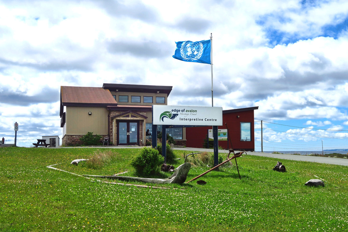
Edge of Avalon Interpretive Center, proudly flying their new UNESCO World Heritage flag.
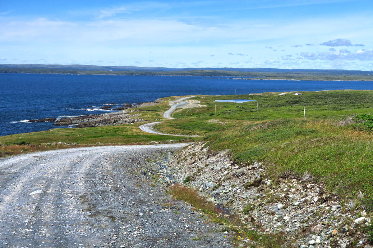
The ulcer-inducing road to Mistaken Point.
The road to the Cape is very scenic, if you can take your eyes off dodging pot holes.

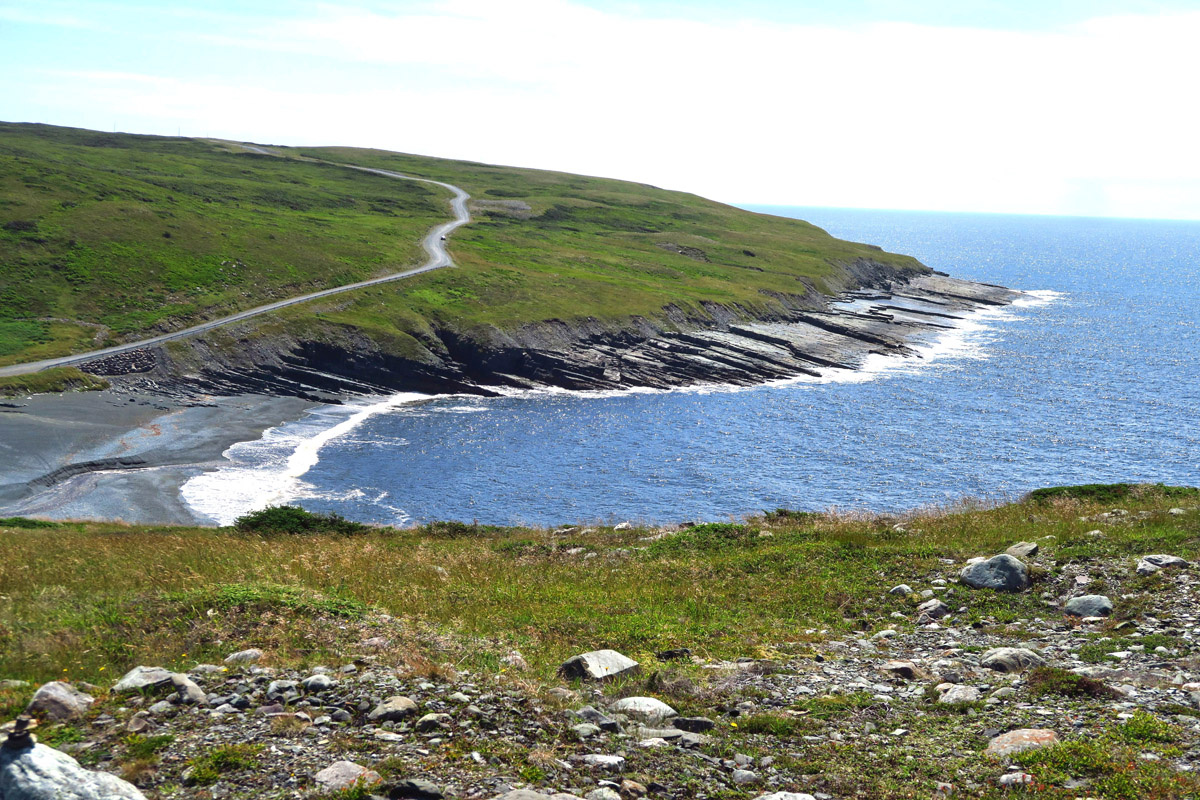
This photo doesn’t look all that bad…but you need to add the soundtrack of things crashing in the kitchen.
Back at the Avalon Visitor Center prior to my stop in St John’s, I picked up a two page information sheet about this location. One can only visit via guided tour offered only once per day. Reservations are “strongly advised,” as the tour books up in advance. The brochure cautions “This trail is rated as a moderately difficult hiking trail. There are uneven and wet surfaces, and some scrambling over rocks. The overall distance (6 km) may pose the greatest challenge for some. Sections of the trail are muddy, wet and often slippery.”
But the trail conditions are not what concern me….it’s the road getting there. The brochure states the guided tour involves a drive down a rough gravel road, but it does not state that the drive must be made “in one’s own vehicle.” It isn’t until I arrive to check in for my reserved tour that I learn I will need to drive my Winnie down this road to reach the start of the tour.
To this point, I haven’t missed the Tracker in the least, and in fact, have been relieved that I’m not dragging it over Newfoundland’s horribly rough, potholed roads. But with Mistaken Point, I may have finally reached the limit on places I can visit in the Winnie.
I stop by the Edge of Avalon Interpretive Center to quiz the staff on the condition of the road. He tells me, “It’s bad.” I ask if he can define “bad,” and in turn, he asks me questions about the Winnie. “How big? Does it have rear-wheel drive? Dualies?” Finally, he leans back in his office chair, folds his hands behind his head, and gets a wicked smirk on his face and says “Oh, you’ll make it down there alright. But the question is, can you make it back? he he!” I am not amused…
I would have scrapped this idea altogether, but for three reasons. One, he tells me the first part of the 12 mile road is the worst, and it only gets easier after “The Hill.” There is one rather steep, rutted out section that is his only concern. After that, the road levels out, and though there are pot holes and washboard all the way, there are no deep ruts like “The Hill.” Two, he tells me there are plenty of places to turn around if I think I can’t make it. And Three, the Cape Race lighthouse is just another 3 miles further down this God-forsaken road. I could ask to ride with one of the other tour participants, but of course, I want to see this lighthouse worse than the fossils!
The tour group is meeting at 1:00pm to caravan to the trail head, but I leave early to get a head start. I tell the leader that if he doesn’t see me at the trail head, it’s because I decided the road was too rough. He assures me once again that there will be a place to turn around if “The Hill” proves to be too daunting. But this is another instance of perception, like when you ask a non-RVer, “Is it level??” Level to the non-RVer is not the same as level to a person carrying around a $1.5K refrigerator in their vehicle. The Interpreter’s interpretation of turnaround spots is not the same for his UNESCO SUV as for my five tons, six tires, and 24 feet.
I start out with a great sense of dread, but continue to remind myself that I can turn around at any point that I am out of my comfort zone. But before I realize it, I’m staring down the ruts of The Hill with no turning around and no turning back…It’s brutally steep, narrow, and rutted, but there’s nothing I can do at this point but keep going. As Winston Churchill said, “When you’re going through hell, keep going!”
Once I am at the bottom of the hill, I start looking for a place to turn around. But what’s the point? The guide at the Interpretive Center seems to be right…it only gets better from this point. The only reason to turn around would be to get it over with, so I can stop worrying about getting back up that damned hill! But then I would miss the reason I had endured the worst of it. So I take Winston’s advice…I keep going.
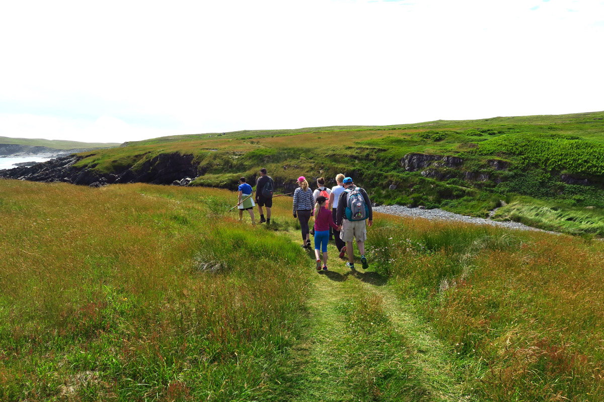
It’s a very scenic 6km (3.5 mi) hike out to the fossil site.
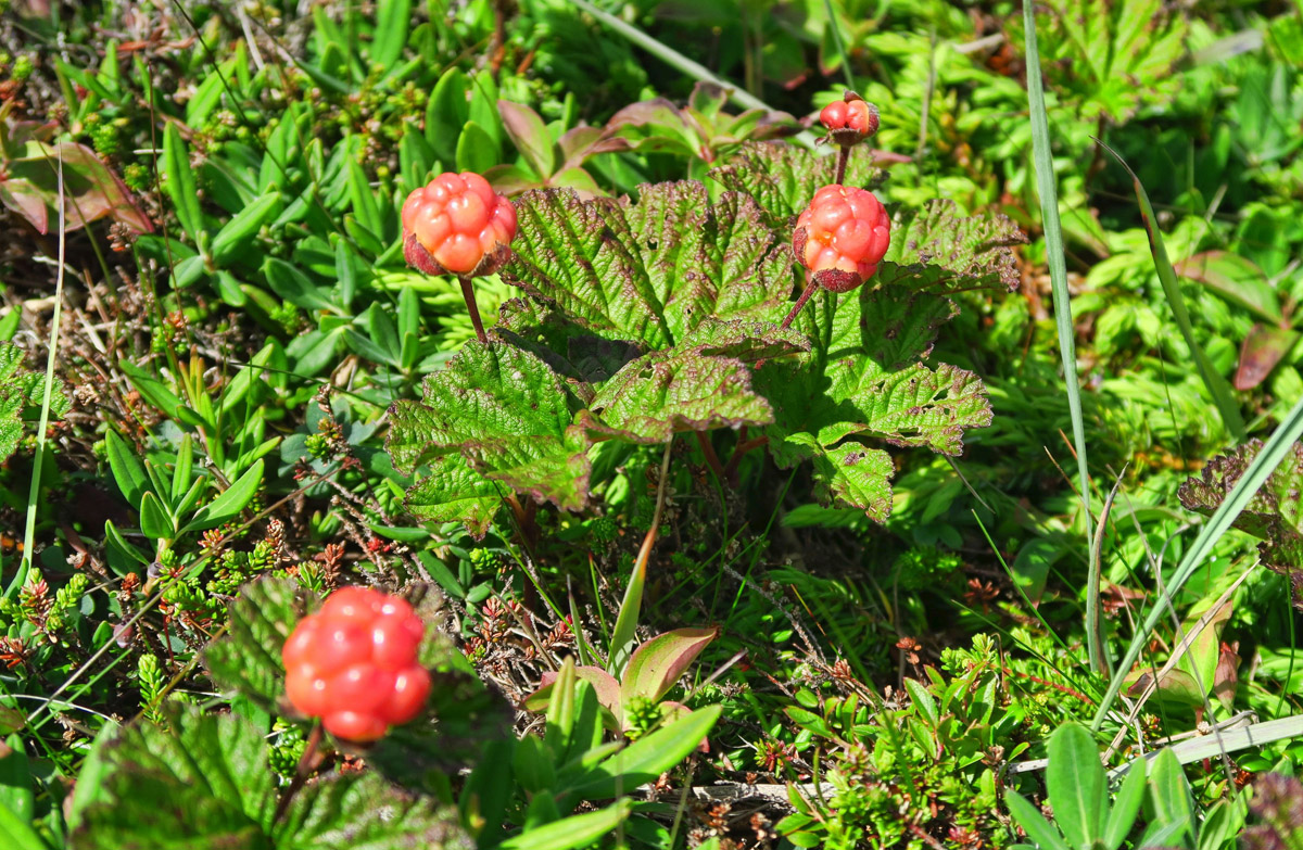
Newfoundland’s most famous fruit, the “Bakeapple,” also known as Cloudberry. It tastes like a cross between a raspberry and an apricot.

Cinnamon fern covers the hillsides.
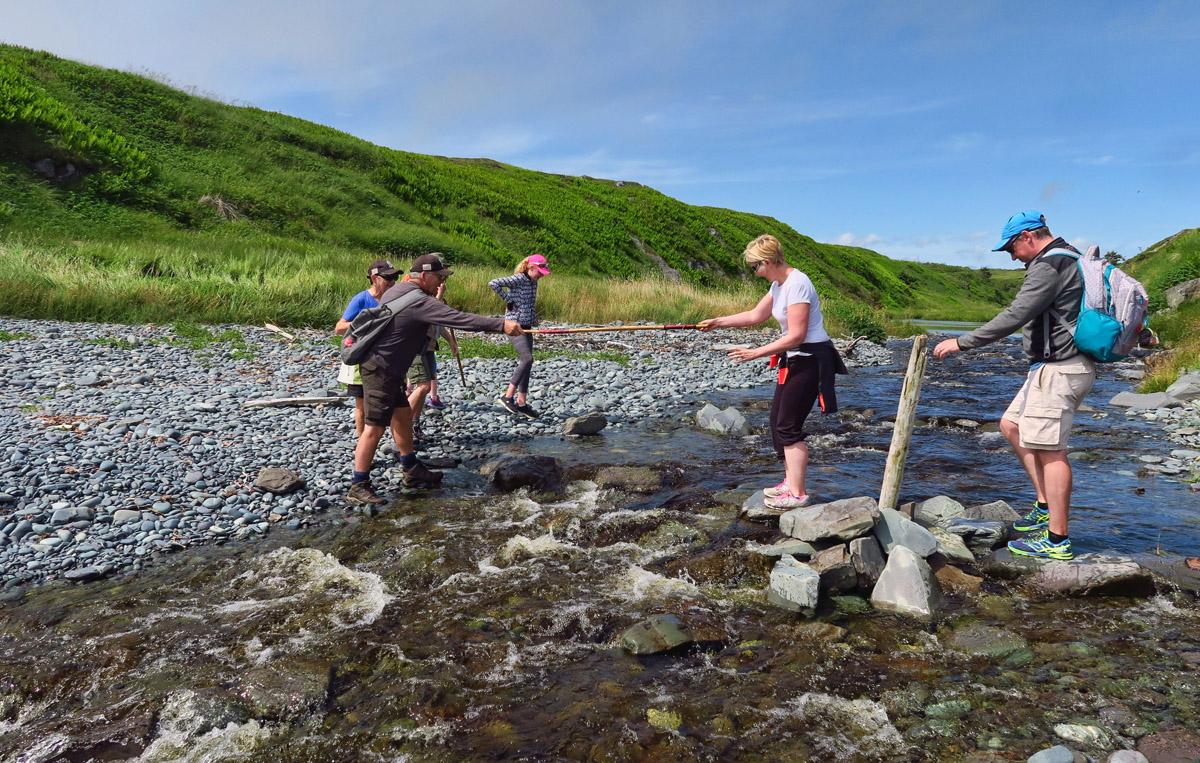
We must ford a stream with potential for wet feet, for which I fortunately have much experience. 😉
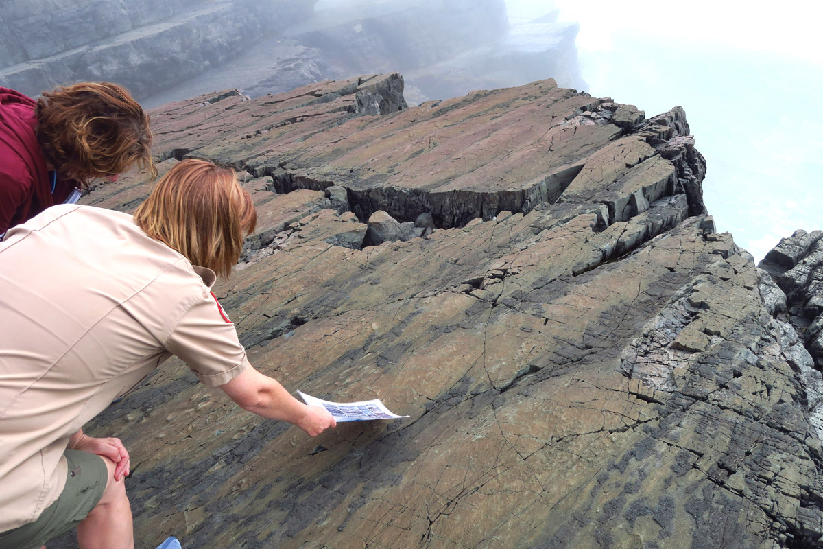
There are many stops along the way, where our interpretive guide tells us about the geology of the area.
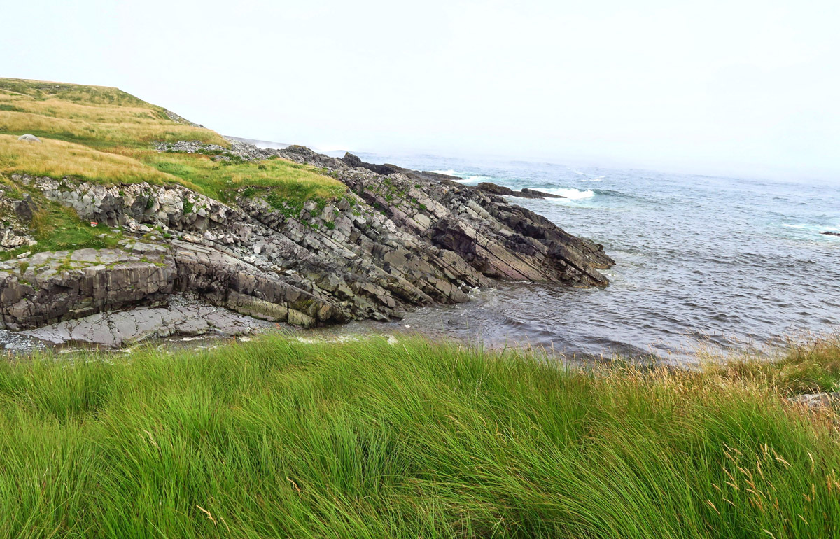
Here you can see some of the layers of rock, similar to where the fossils are located.
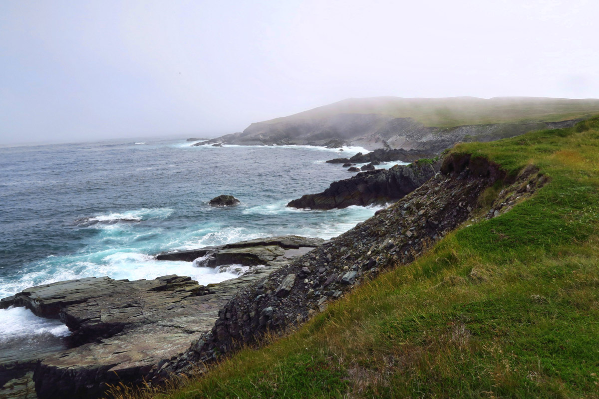
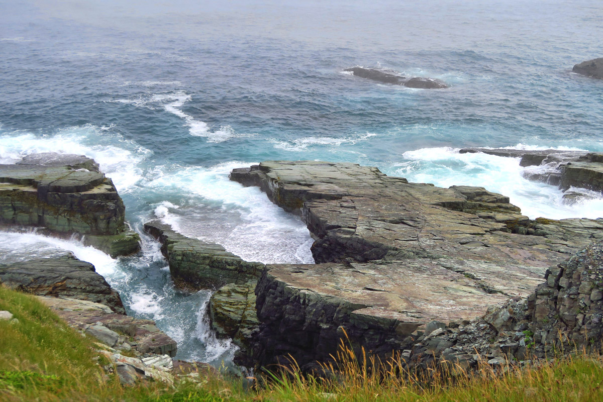
It has been a bright sunny day, but as we get closer to the ocean, the fog rolls in.

There are a couple of seals bobbing nearby, but too far for my camera’s eye.
Anyone can visit the Mistaken Point Ecological Reserve, but the actual UNESCO section of the reserve can only be accessed with a guide. This four-hour tour is offered once per day at 1:00pm for 24 people. The tour books up days in advance so we are a full group, but thankfully they break us up in two groups of twelve.
We make many stops along the way to talk about geology, the flora and fauna, and how the fossils were discovered. Once we arrive at the site, we learn more about how they are being preserved. We are to remove our shoes and put on the pair of “Bama Booties” that we were issued back in the Interpretive Center. Laminated cards are handed out to identify each type of fossil.
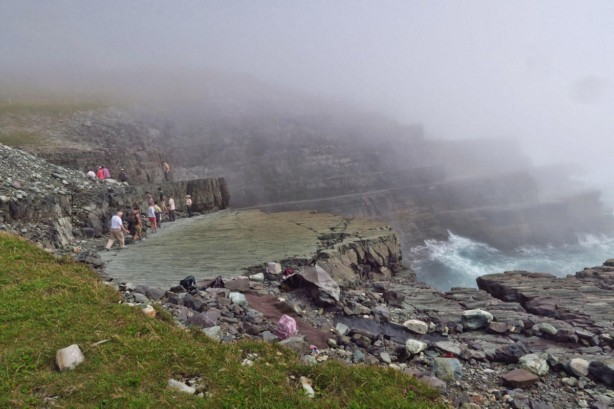
Here, you can see by the people that there are two levels of rock, both which contain over 7,000 fossils.

Fog is rolling in, which makes the edge look a bit eerie.
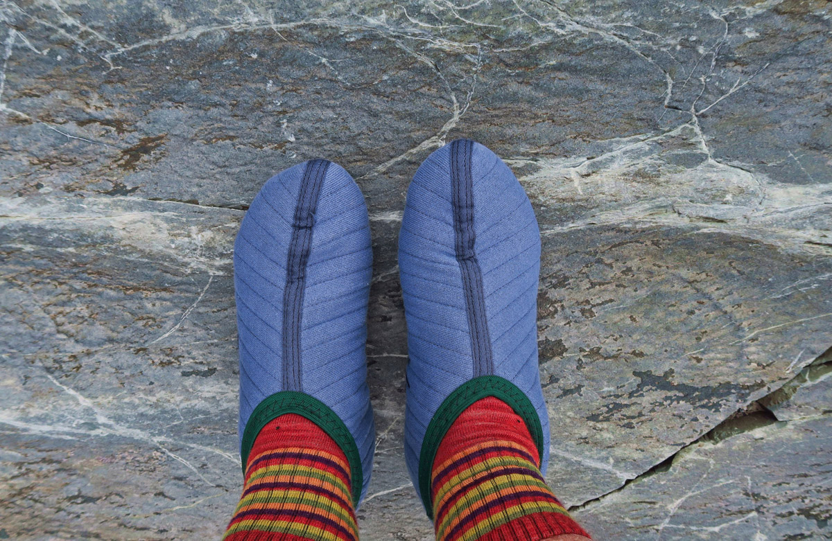
We are issued “Bama Booties,” mine paired with socks straight out from under Dorothy’s house.
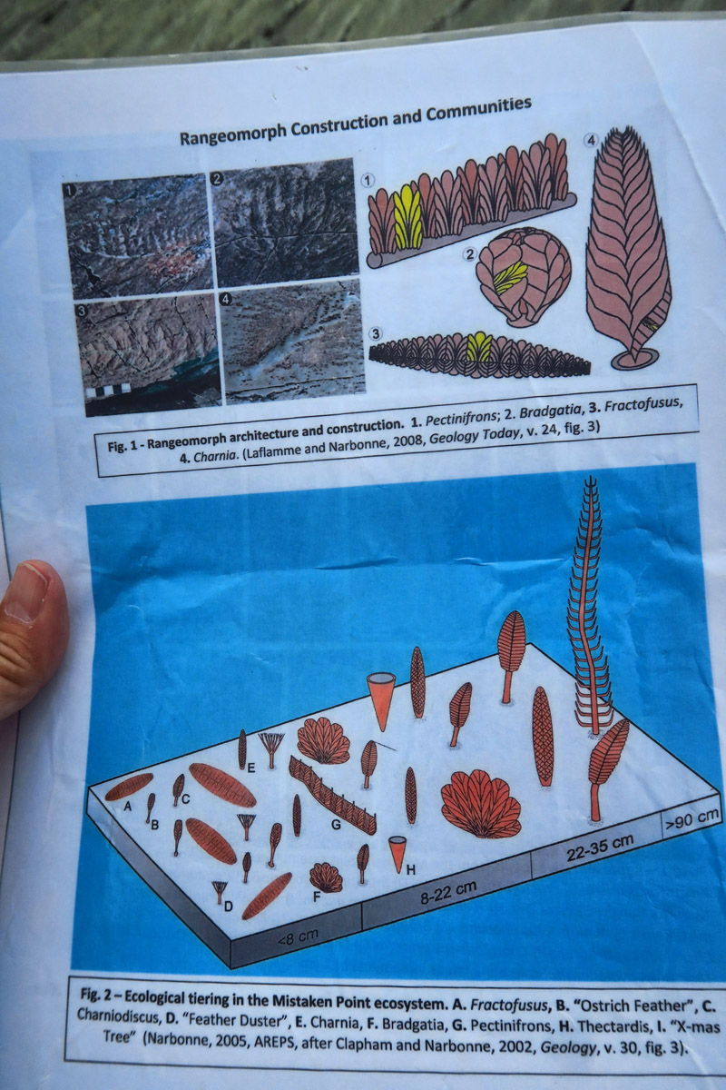
Laminated cards are also handed out to help us identify the fossils beneath our feet.
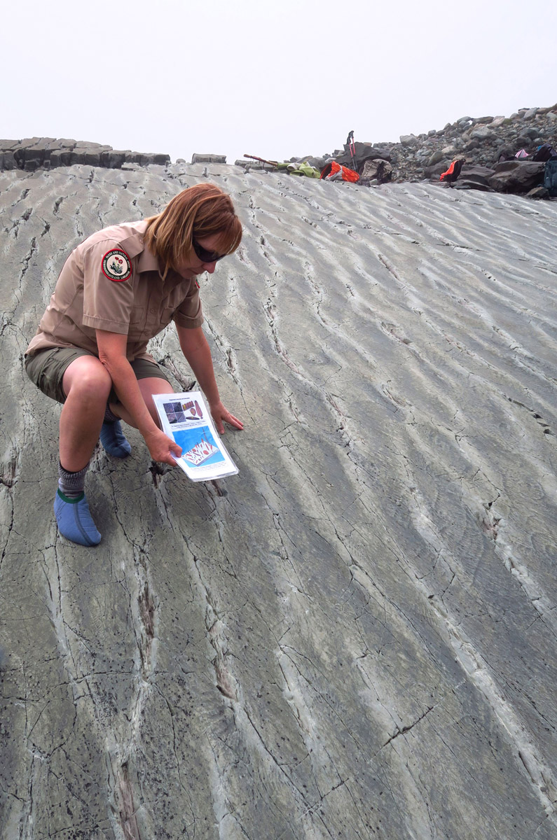
Our interpretive guide Edwina shows us examples to look for…
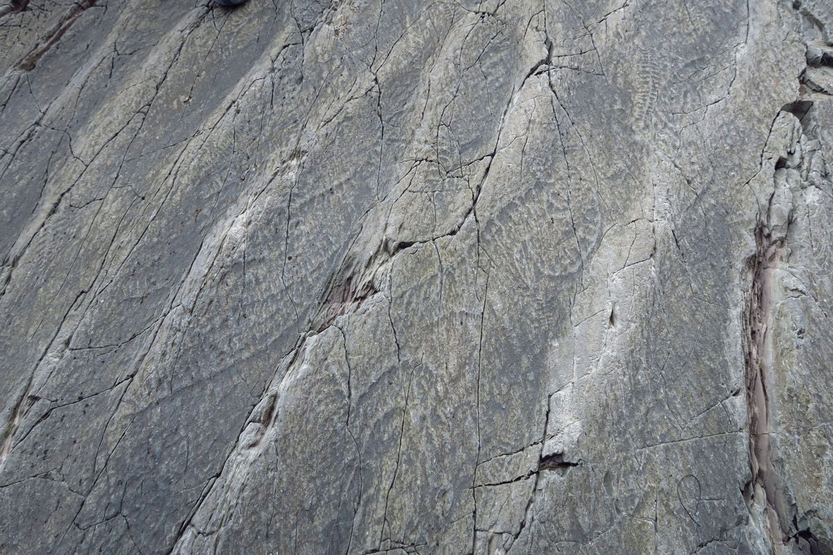
Although I am not much of a “rock hound,” I must say standing on this slab of rock with 500 million year old embossed lifeforms beneath my sock-feet is pretty awe-inspiring. By now, thick fog is rolling in, making these slanted slabs jutting out into the raucous and raging sea seem a bit “otherworldly.” It’s a heady experience.
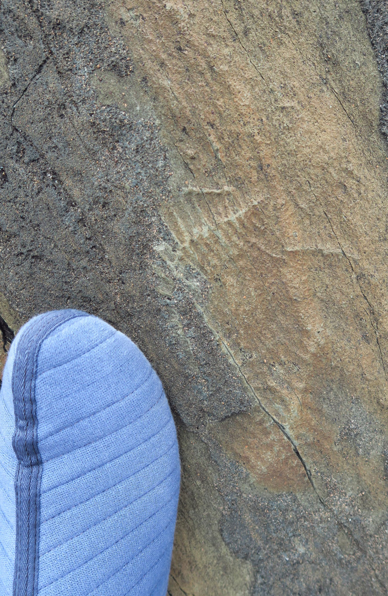
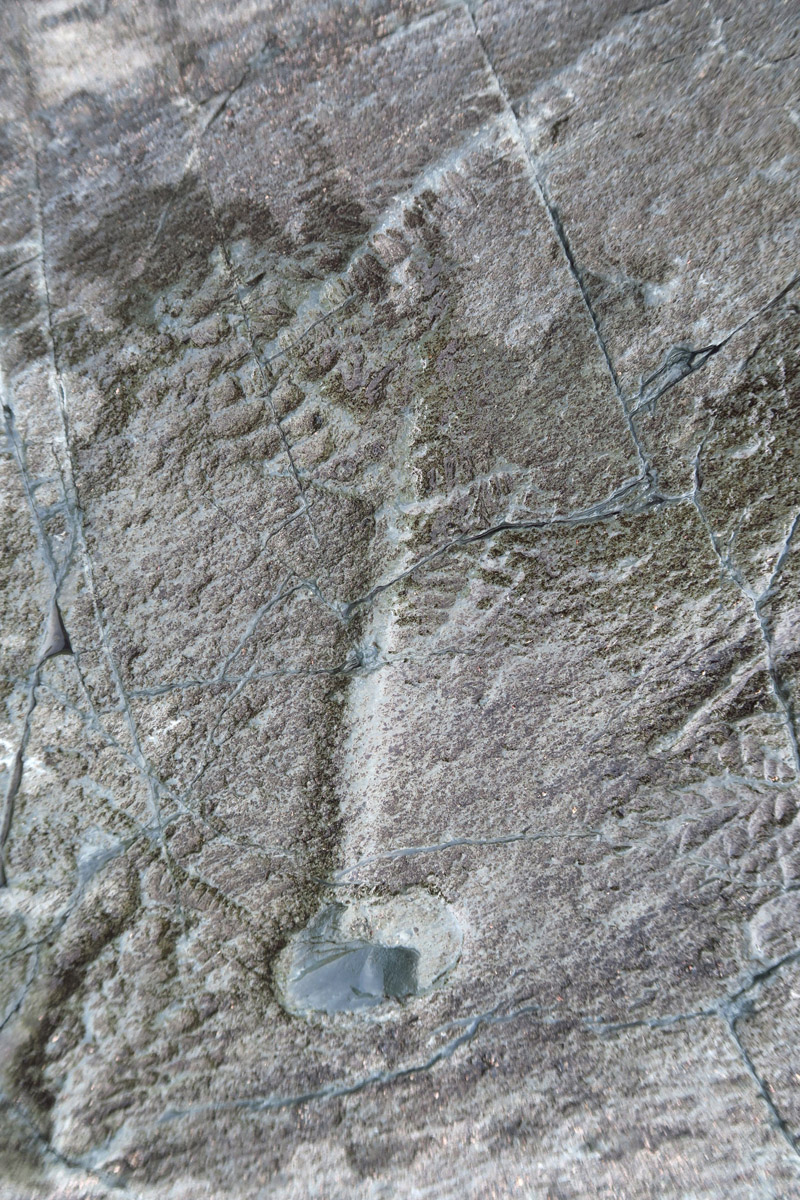
Foot included for scale.
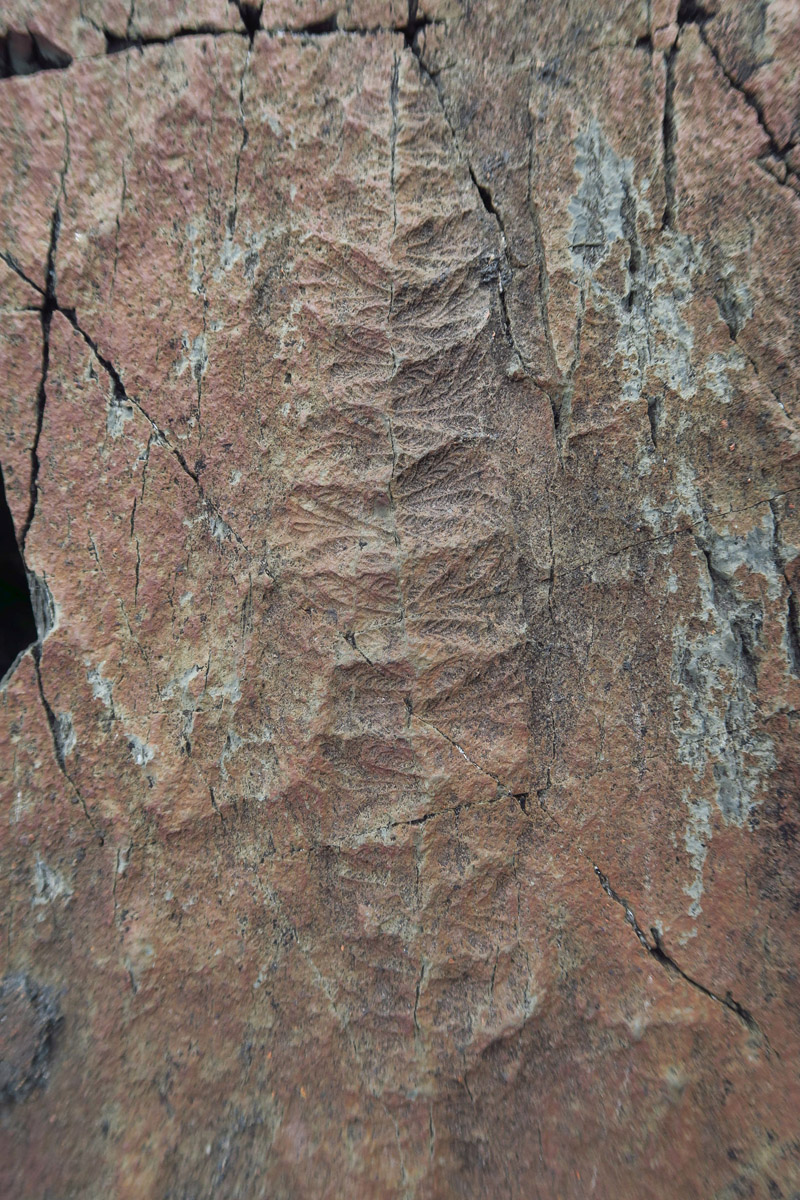
The “fronds” are most common.
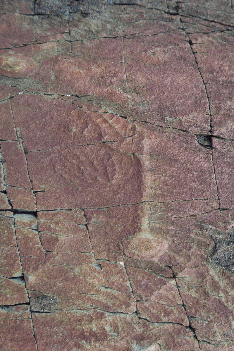
This “sucker” at the bottom of the stalk is how they attached themselves to the sea floor.
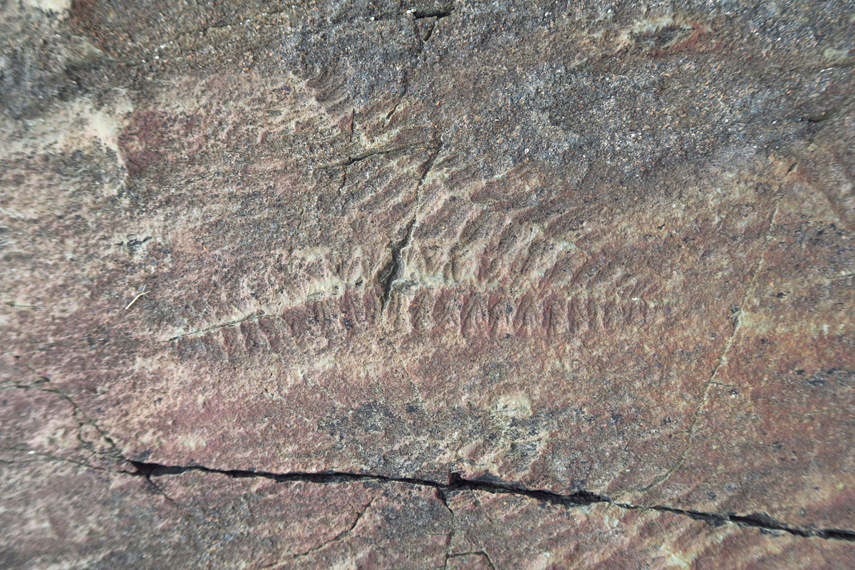
Broad tracts of ancient seabeds were covered in volcanic ash, leaving these impressions of communities of organisms.
Some of the examples found are up to two feet long.
Edwina tells us of the efforts undertaken to validate the age of the fossils required to earn the UNESCO protected status.
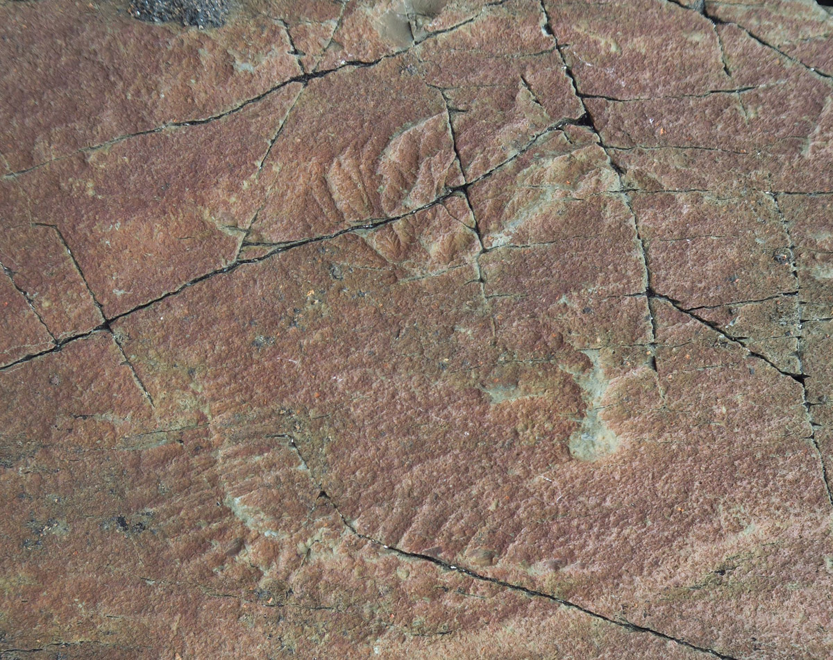
Some are more like “cabbage leaves” like the one near the top of the photo.

In Darwin’s Theory of Evolution, he states “To the question of why we do not find rich fossiliferous deposits belonging to these…periods prior to the Cambrian system, I can give no satisfactory answer’. He believed they would eventually be uncovered.

This genre of fossils are believed to be the solution to “Darwin’s Dilemma” of the lack of fossils in sediment from the Precambrian period. (c. 4500 – 542 Mya)
After the tour, I decide since I am this far down the hellacious road, what’s another three miles of washboard, gravel, and ruts? Seeing Cape Race is too much of a lure to turn back. So I keep going…
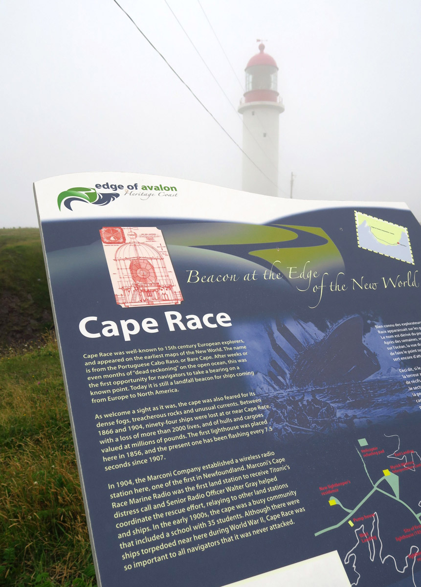
Cape Race represents one of world’s most notorious landfalls, located on the southeast tip of Newfoundland. It marks the shortest route between North America and Northern Europe. Due to the rocky shoals and harsh weather, it is one of the worst places in the world for shipwrecks. Between 1866 and 1904, ninety-four ships were lost nearby with a total loss of more than 2,000 lives, earning it the reputation as an “ocean graveyard.”
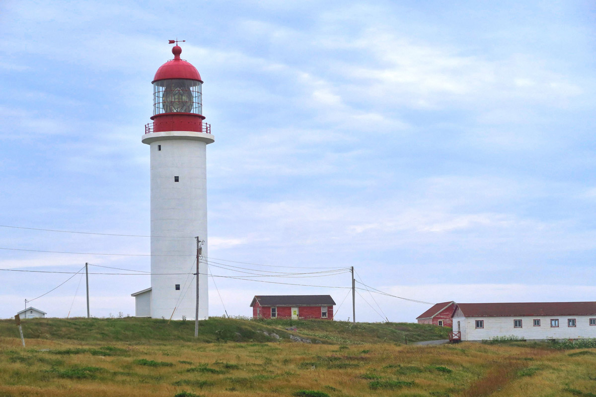
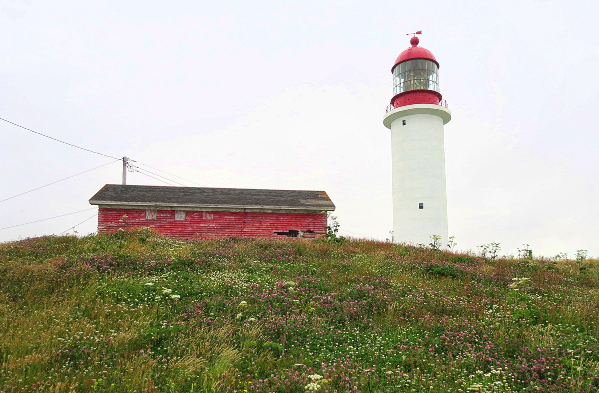
Such a notorious point should have an equally notorious landmark, right? Of course, why else would I be here? 😉 Cape Race Lighthouse, built in 1907, marks the first landfall light for vessels crossing the North Atlantic. The original light, acetylene gas lamps, could be seen from a distance of 19 miles offshore, making it the most powerful light built up to that time.
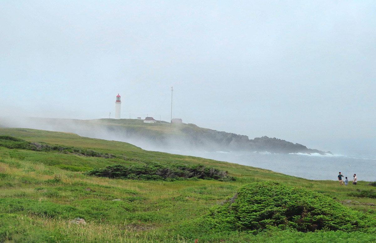
Approaching the Cape in the fog…
“Beacon at the Edge of the New World.”

Such a stunning view!
This is the “Grand Dame” of all Canadian lighthouses I have seen combined. Forget all the cutsie little “pepper-pot” wooden charm. Never mind the National Historic sites with restored lightkeeper residences. As one of the last remaining fully “manned” structures, this lighthouse means business. The Devil Wears Fresnel.
Anyone who is a fan of lighthouses knows the main attraction centers around what’s in the lens room. The golden “cache” is a Fresnel lens, ranked in order with the First Order being the largest, down to the Sixth Order. But Cape Race has the rare breed of Fresel lens known as a “hyper-radiant lens.” At over 15 ft tall, this lens is the largest Fresnel ever manufactured, and is quite rare. It’s rotating clockwork mechanism floats on a vat of mercury. There is only one other in North America, at Makapuu Point on Oahu, Hawaii. It is massive!
Here you can tell proportionately that the lens is huge!

This rare “hyper-radiant” Fresnel lens is larger than a First Order.

Warning signs on the door to the lighthouse warning of “Mercury in the bath.”
Cape Race is also the location of the Marconi wireless station who on April 14, 1912, first received Titanic’s distress call, “Titanic 41.46N, 50.15W. We have struck an iceberg.” There is a museum on site containing examples of wireless equipment, and a replica of the original log from that event.
As I stare at this noble structure out here in this inhospitable location, I contemplate my efforts in getting the Winnie here along this nightmare of a road, and imagine what it must have been like to haul the materials out to build this beacon of steel and concrete back in 1907. It would have been done on the backs of both man and beast.
Fog is closing in fast, soon to be followed by darkness. My original intent was to boondock in the shadow of Cape Race Lighthouse, but I can’t relax for worrying about getting back up “The Hill.” Rain is in the forecast for tomorrow, and this road is bad enough without the added element of mud. So I put on some classical music to sooth my frayed nerves, and mentally prepare for the hour it will take me to go 12 miles. With the exception of the light keeper, I am the last to leave the point.
About two miles down the road, out of the corner of my eye, I catch a glimpse of an orange glow light up on my instrument panel. In a split second, a jolt of adrenaline courses through my veins, and every possible scenario of how I am going to get the Winnie back to civilization soon follows. Both hands firmly gripped on the steering wheel to brace myself, I look down to the computerized panel with an overwhelming sense of dread.
It’s a warning light for low windshield wiper fluid. Not funny, Winnebago. Not funny!
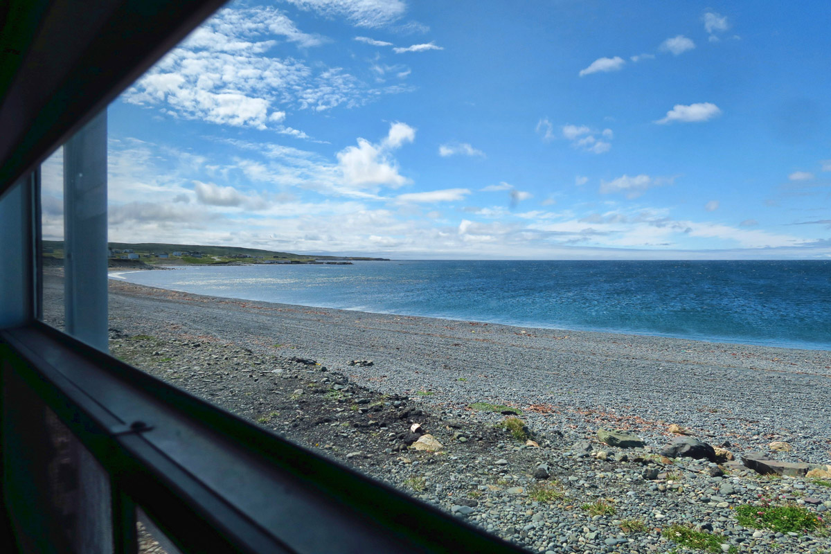
View out my bedroom window of my “consolation boondock” near the Edge of Avalon…it’s not in the shadow of the lighthouse, but not a bad view. And the soothing soundtrack of the sea was just what I needed to calm (as the Newfies would say) “me nerves!”
At least it seems the horrible road was worth the drive. I’m sure your heart must have stopped when you saw that light come on!
What a horrible road. But that Fresnel!!! Wow! Worth it methinks.
Nina
All I can say is WOW! Those fossils! That road! As always, beautiful pictures and thanks for sharing with us.
Fabulous post! We missed Cape Race because it was pea soup thick fog and raining… Glad to have an account of what we didn’t get to see. Lucky you!
Wiper fluid!! Geez! I bet you had a beer or two or three once you reached your boondock site! Fingers crossed nothing was damaged on that incredible journey.
Really awesome photos, looks like a cool trip. Thanks for the share.
Once again thanks for your bravery, sense of adventure and love of light houses. Seeing that lens at the top of the light house was fantastic for me with only a picture to look at, I can only imagine how beautiful and impressive it looked being there. A four wheel drive truck camper looks like a good choice from here.
Thanks!
You are braver than I. Love the lighthouse!
Have you ever considered a Tiger – 4×4 small RV?
These lovely photos are only eclipsed by your intrepid resolve to capture…photographs and memories. Thank you, Suzanne, and thank you, Mr. Croce.