There are two ferry options to leave Newfoundland returning to Nova Scotia. The first is the “short ferry,” a six hour passage into Port Aux Basque on the western side, back the way I came. Then there is the “long ferry” that leaves from the eastern side of the island. I have decided to take the long ferry back for several reasons. I don’t want to backtrack on the Trans Canada Highway, driving the same interior road again. And I really enjoyed the six hour passage coming over. I wasn’t ready to get off the ship. It’s rare for me to get to “ride” versus “drive,” and I enjoyed watching the ocean roll by from the comfort of my reclining seat. But most importantly, returning via the long ferry will allow me to continue on down around the Avalon Peninsula a bit further.
The long ferry only runs three days a week. It books up for RVs in advance and even further if you want to reserve a cabin. So I have put a reservation date on the calendar. Already I am starting to feel the pressure of the countdown. I still have a list of places I want to see before the Winnie turns into a pumpkin.
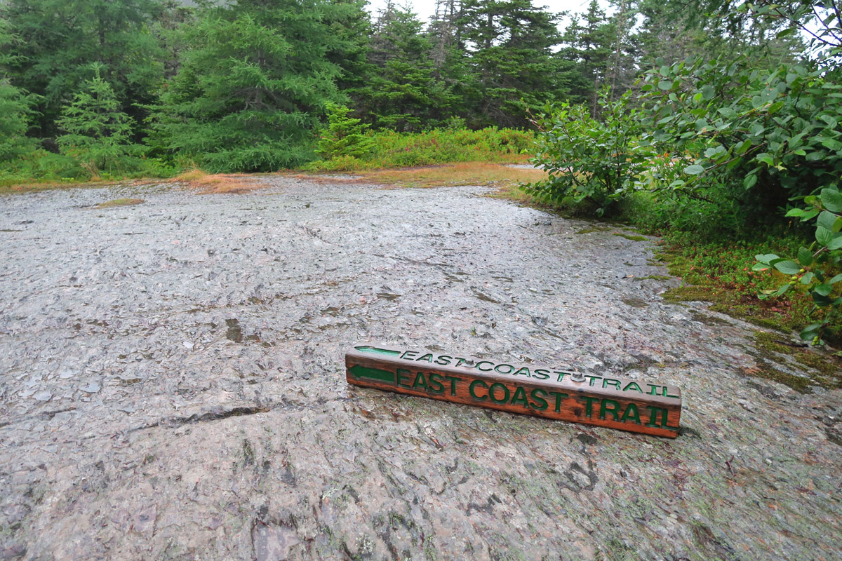
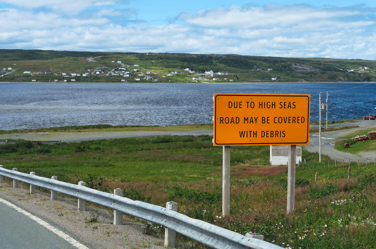
Interesting placement of the trail sign….hard to miss that one!
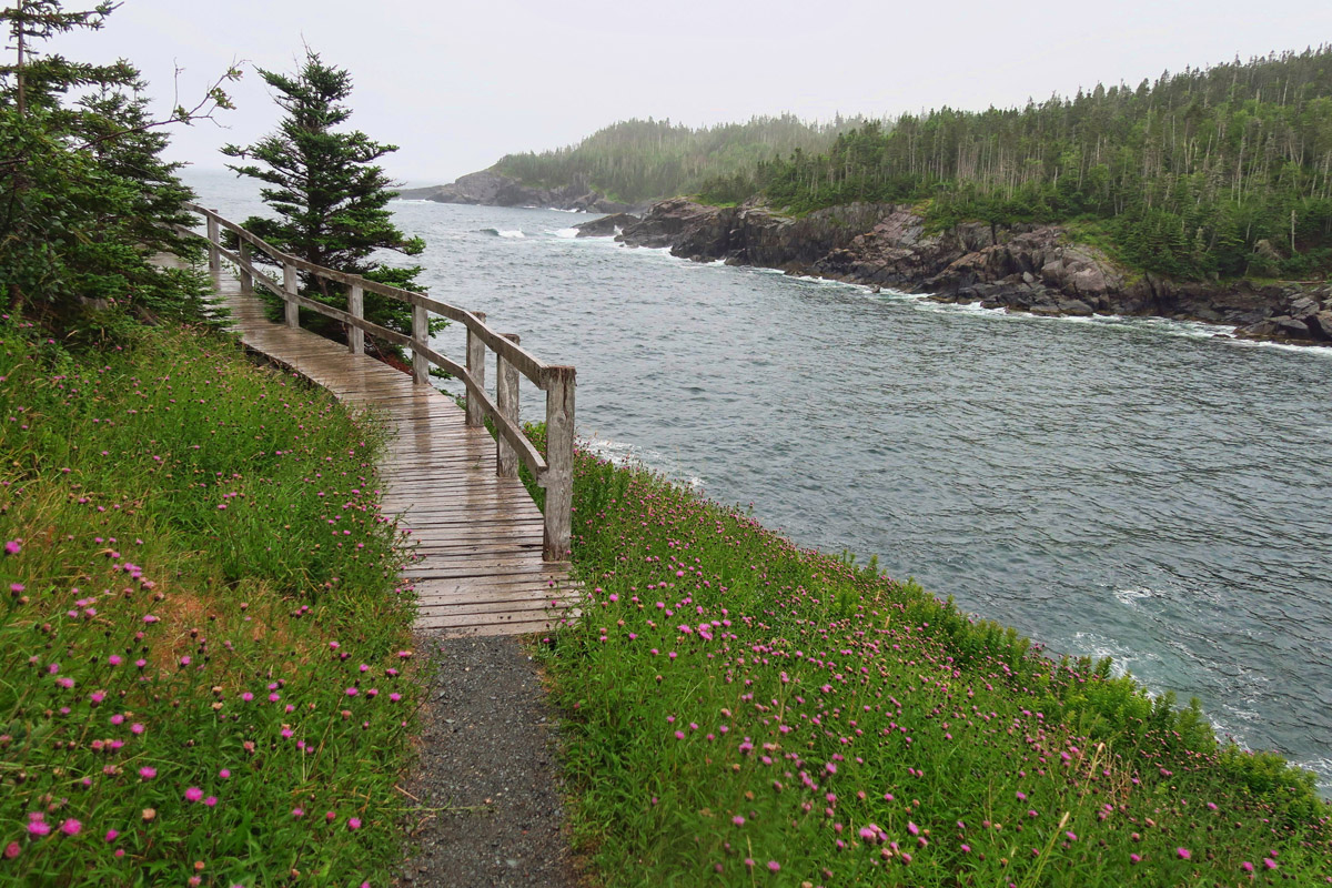
East Coast Trail skirts the coast for 190 miles.
One such place is the East Coast Trail, a series of trails connected along Newfoundland’s easternmost coast. It’s 190 miles of developed trail through 30 coastal communities wrapped around scenic coves. I had originally planned to park the Winnie and do some “Inn to Inn” hiking along this trail, but time is running out, so I have to settle for a day hike instead. But did it have to be the worst weather day in the entire month I’ve been in Newfoundland?
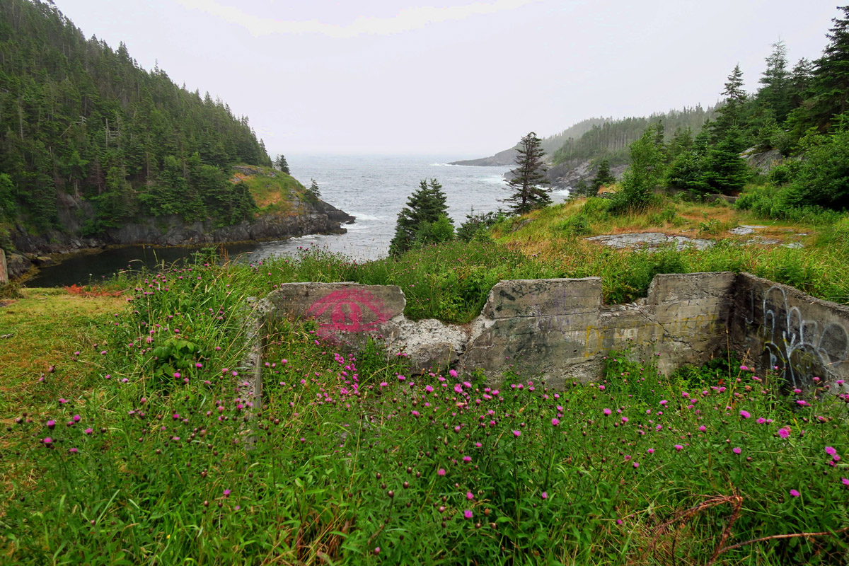
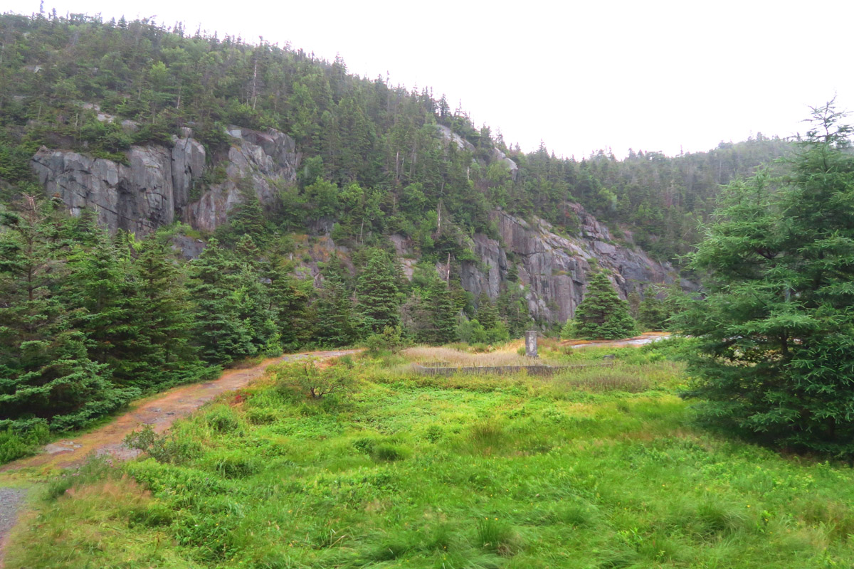
This section of the trail runs through the abandoned settlement of La Manche. Like so many fishing settlements, foundations and fireplaces still stand to mark what once was a community.
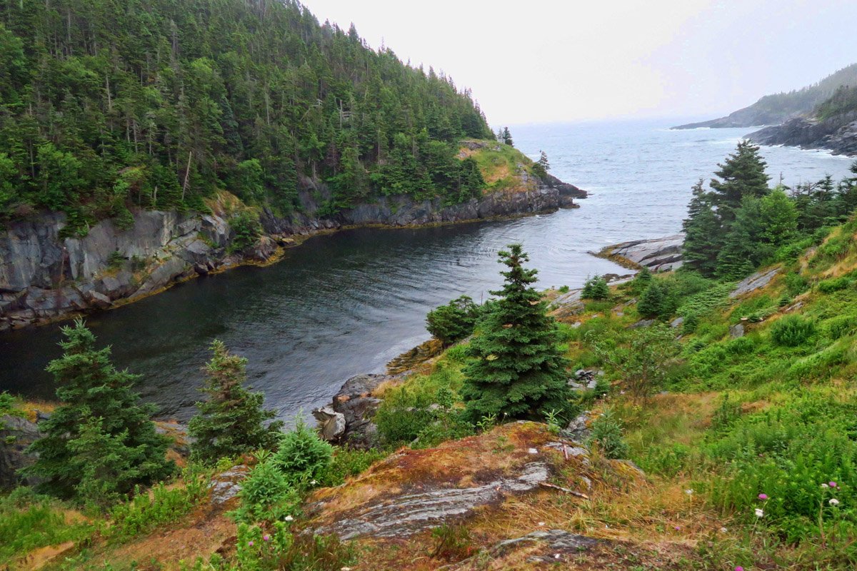

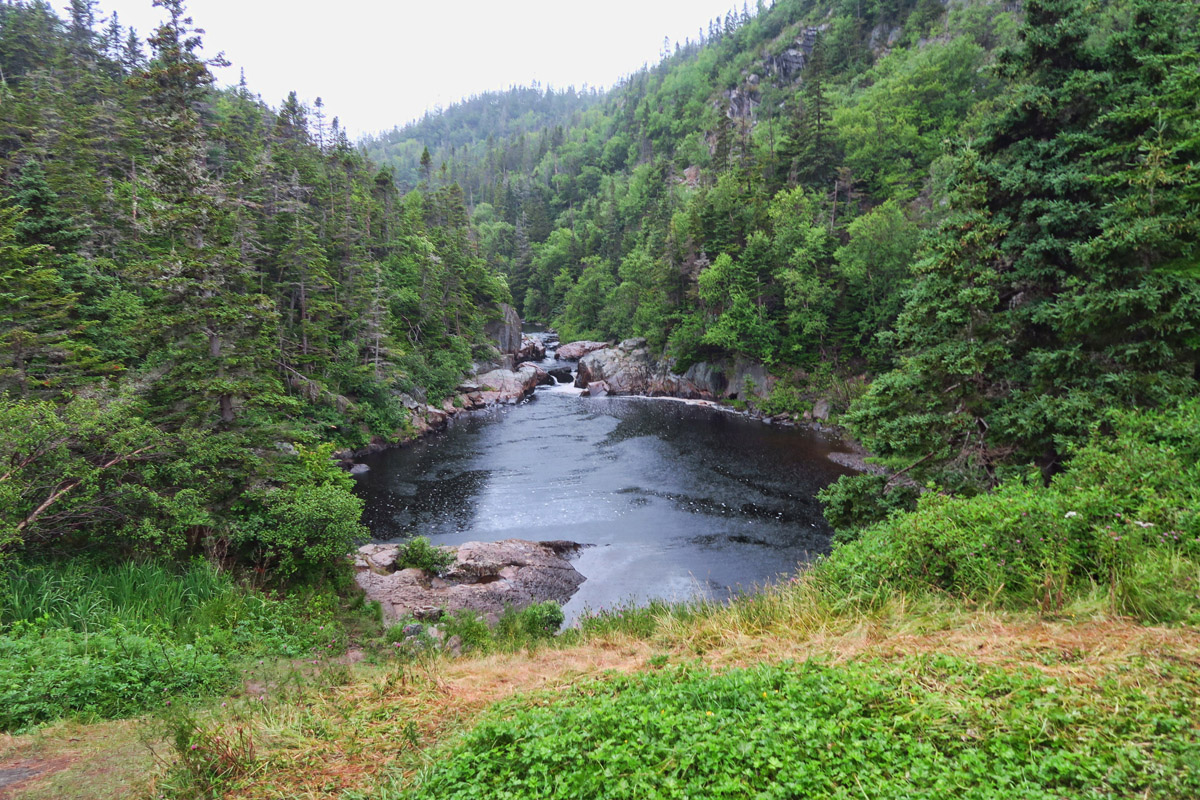
I chose the stretch of trail that goes through the abandoned settlement of La Manche. First settled in the 1840’s, the community reached its peak in 1961 with a church, a school, and a population of 54. In the winter of 1966, a storm demolished the network of wharves and the suspension bridge that crossed the inlet, leading to the collapse of the community. Although the community never recovered, in 1999, the East Coast Trail rebuilt the 50 ft suspension bridge.

Nearing the La Manche 50ft suspension bridge.

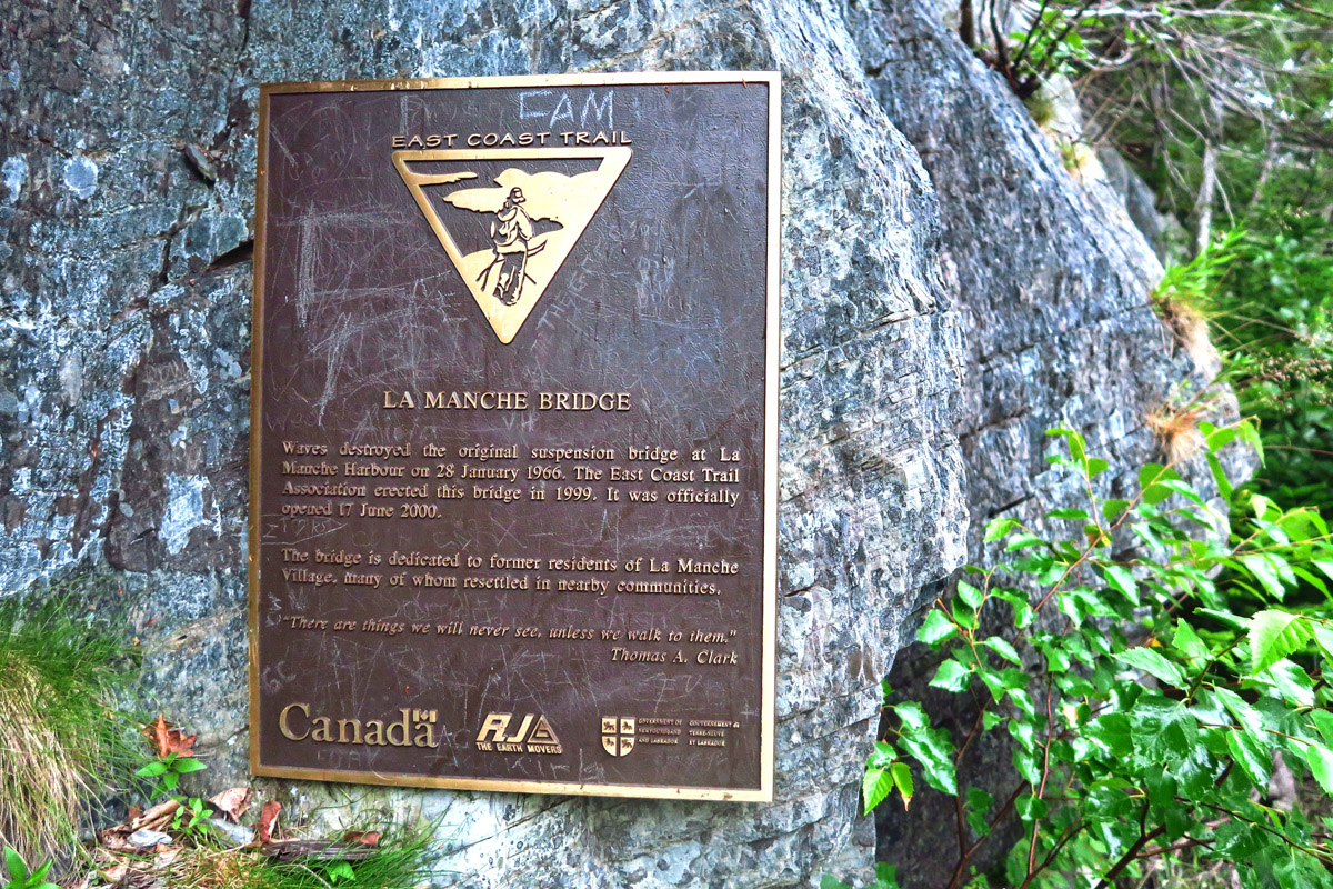
I love the inscription at the bottom of the plaque, “There are things we will never see unless we walk to them.”
In reading about highlights along this trail, it was this suspension bridge that caught my eye…or more specifically, the commemorative plaque mounted at the entrance which states, “There are things we will never see unless we walk to them.” This inspires me to walk to the bridge, for all those who can’t.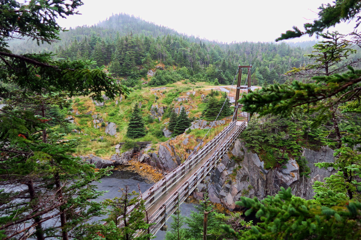
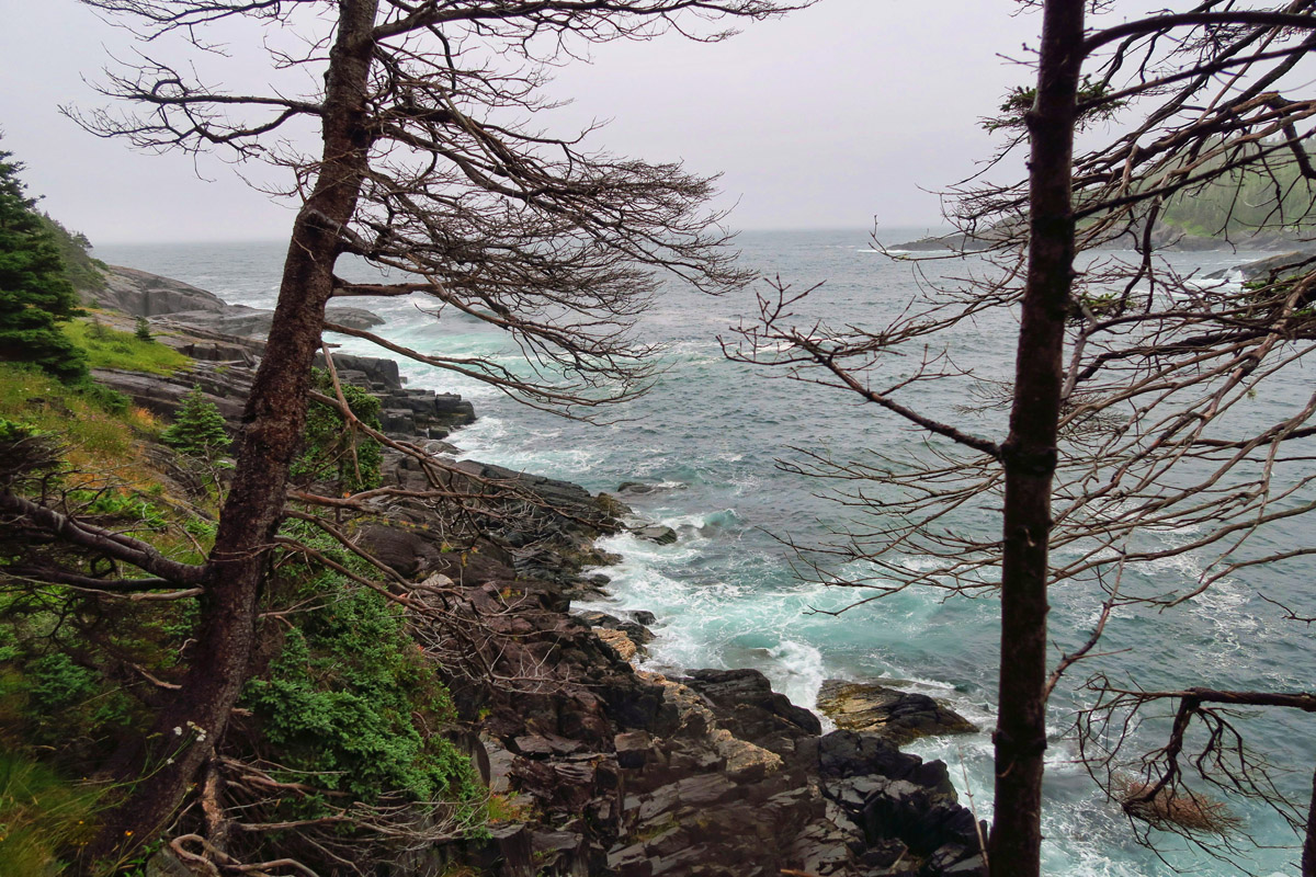

Determined not to let the rain thwart my plans to hike this trail, I cover myself in wicking wear and Goretex. However, Mother Nature has a few other curve balls up her sleeve. It won’t be the torrential downpour that turns me back, but rather the rip-roaring lightning storm hiding above the low-lying clouds, causing the dull gray sky to unexpectedly light up like a disco ball at Donna Summer’s Last Dance. It’s tough to tell which direction lightening is coming from when a layer of fog hangs low overhead, concealing the storm clouds. I’ll never forget that suspension bridge..Not because I walked to it, but because I RAN back across it!
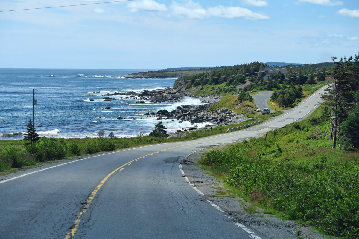
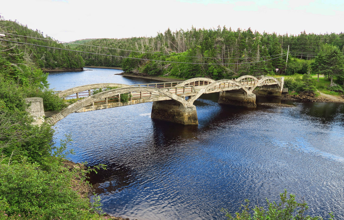
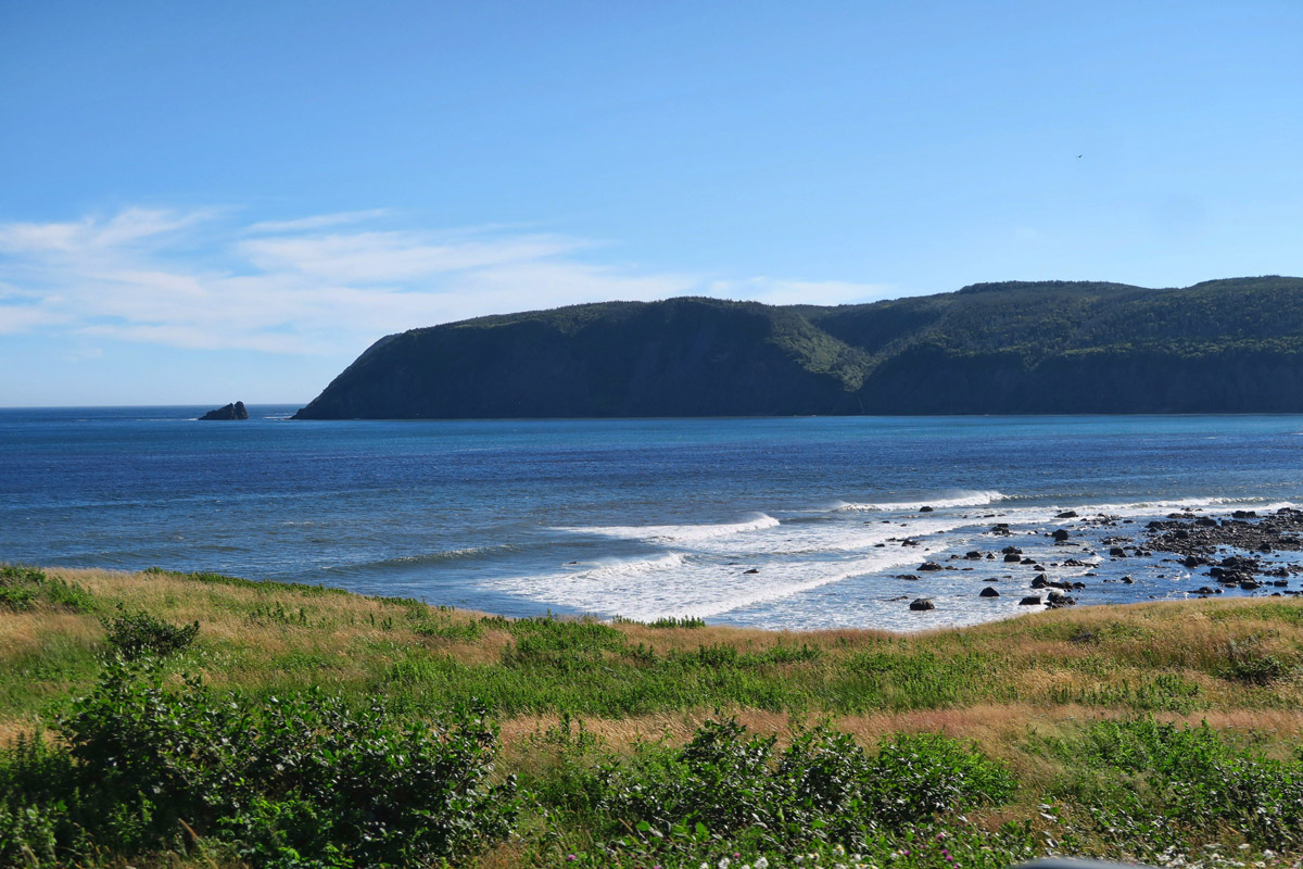
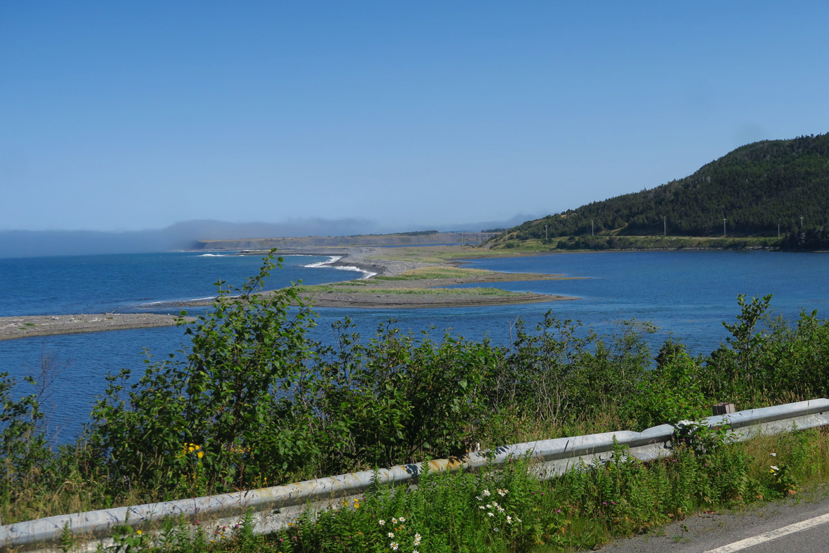
More views of Newfoundland’s beautiful coastal roads.
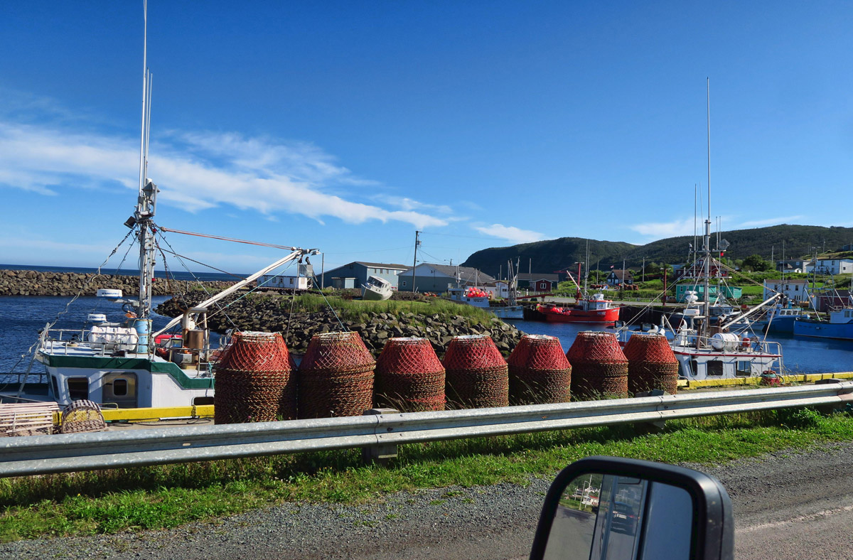
There are no highways around the little coastal towns…you must drive right through them. This one, lined with giant crab traps for catching snow crab

Many roadsides and hillsides are covered with Fireweed. Though so beautiful, it’s bittersweet. A friend once told me, “Once the blooms reach the tip, summer’s over.”
Another “must do” spot on my list that requires a bit of walking is Cape St Mary’s Ecological Reserve. As I continue in my never ending cycle of “Awwwh, Man! These roads SUCK!” followed by an “Oh, WOW! That was SO WORTH IT!” Cape St Mary’s is no exception. The road to get around this part of the Avalon Peninsula is real gut-buster, but once I reach the turnoff, the 13 mile road into the reserve is level and smooth, though only one lane.
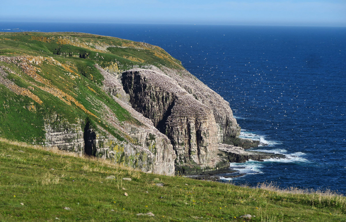
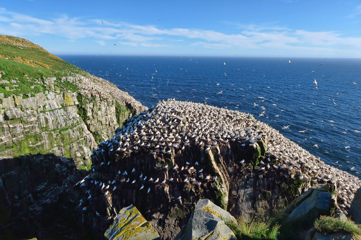
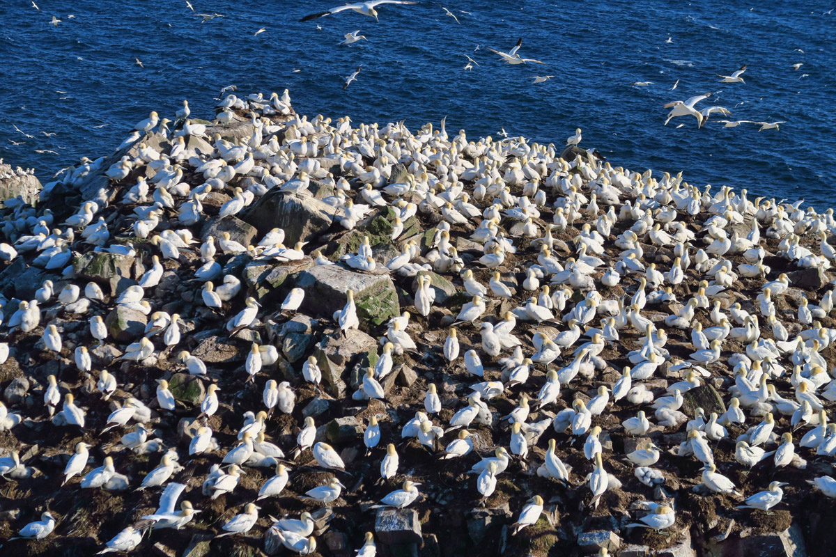
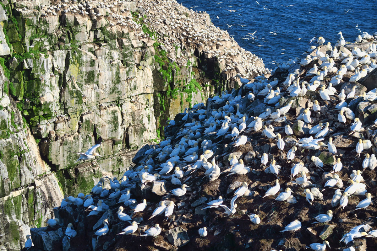
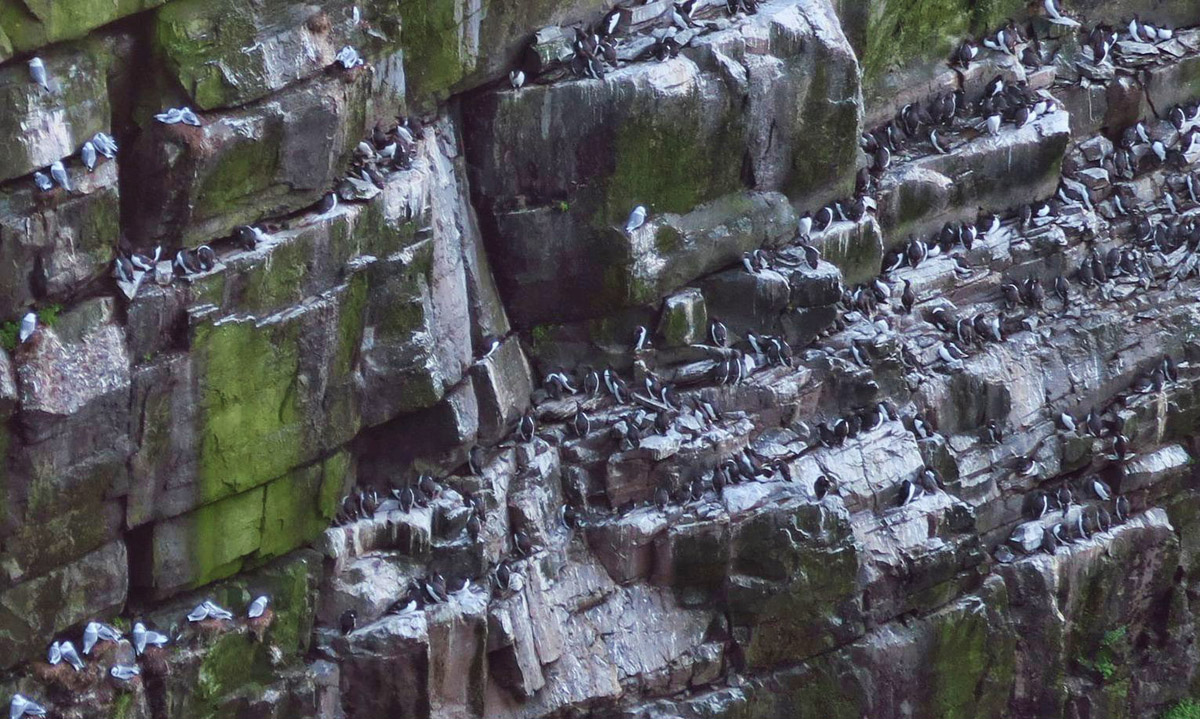
Cape St Mary’s is billed as “the most accessible seabird rookery in North America.” This stretch along the southernmost coast of Newfoundland is home to a variety of over 70,000 pelagic seabirds including northern gannets, razor-bills, black-legged kittiwakes, black guillemots, thick-billed murres, and common murres, all of which live the bulk of their lives offshore, returning to the same spot for the annual breeding season. Less than a mile from the Interpretive Center up and over rolling tundra, the path dead ends at “Bird Rock,” a 300 ft high monolith jutting up from the sea just 50 feet offshore.

Cape St. Mary’s Interpretive Center.
It’s a little less than a mile walk out to “Bird Rock.” Note the flurries off the edge…
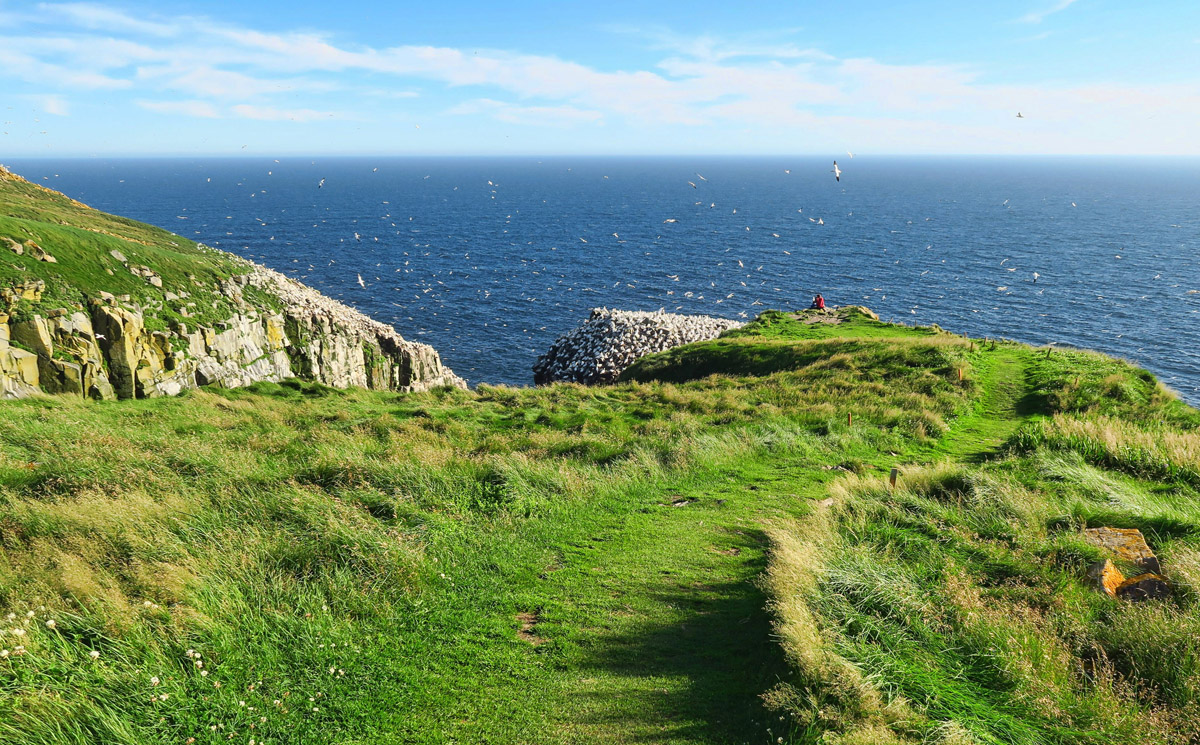
The path deadends 50 ft from the northern gannet colony.
Although a variety of birds live in dwellings along the vertical cliff face, the main Bird Rock is covered by an estimated 20,000 pairs of northern gannets. Upon approach along the path, you hear them first, smell them second, and see them third. Cresting the hill as Bird Rock comes into view, it looks like a snow flurry out over the water. Their soaring and swarming overhead and around the edge of the steep rocks with their nearly six foot wingspan is dizzying enough to convert even the most sure footed to acrophobia. So I drop on all fours to fully ground myself, then inch toward the edge, finding a sturdy rock to sit while watching their mesmerizing dance.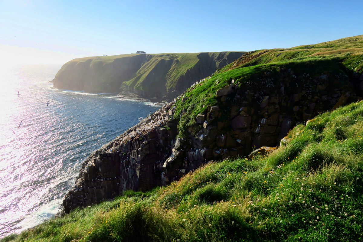
The “aroma” reminds me of the penguin rookeries of Antarctica.
Northern gannets mostly inhabit the flat top of the rock…
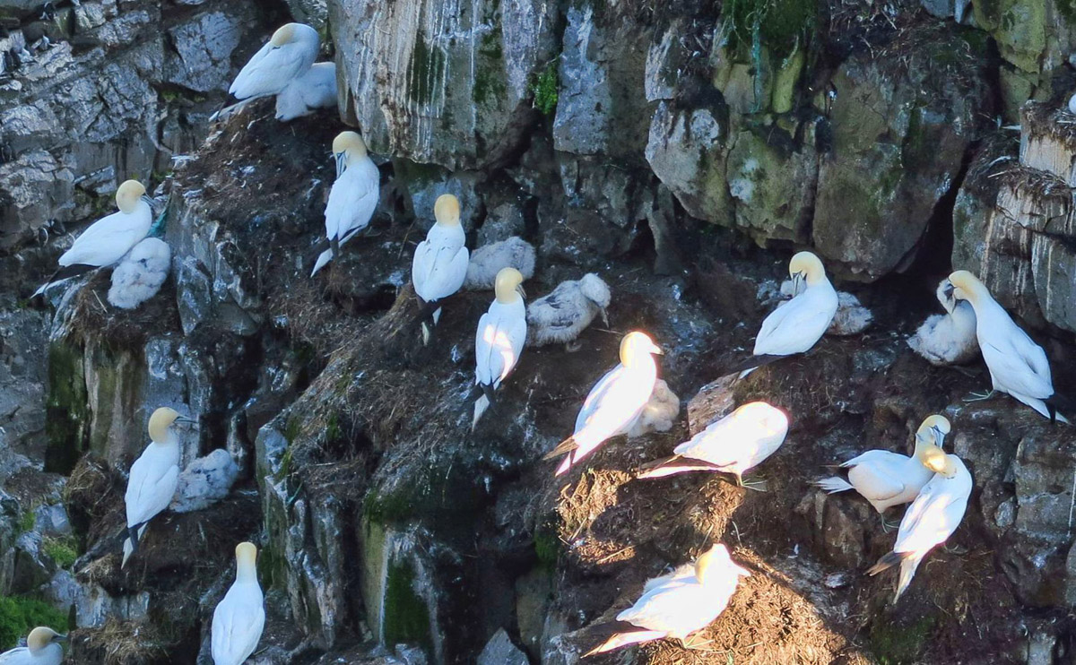
…however, many of the nests are on the cliff, away from other predators. Note all the fuzzy gray chicks…
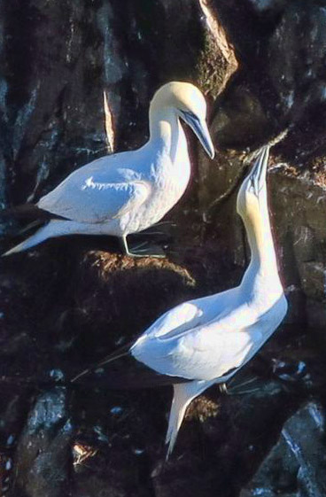
These powerful birds can reach speeds of up to 40mph in flight, but when diving toward the surface, can reach velocities up to 60 mph, plunging to depths up to 130 ft. They are so sleek and elegant in flight, gliding overhead, then tucking into dive position to pierce the surface of the ocean like an arrow. But the land interaction is equally entertaining watching as they extend their long craning necks, seemingly shaking their heads “No” while guarding their nests. Watching the preening and feeding of their fledglings makes this perch feel like being in a 3-D National Geographic film.
One gannet remains on the nest at all times. This move is called “skypointing,” signaling to the mate the intention to leave the nest, signaling the mate to take over nest duty.
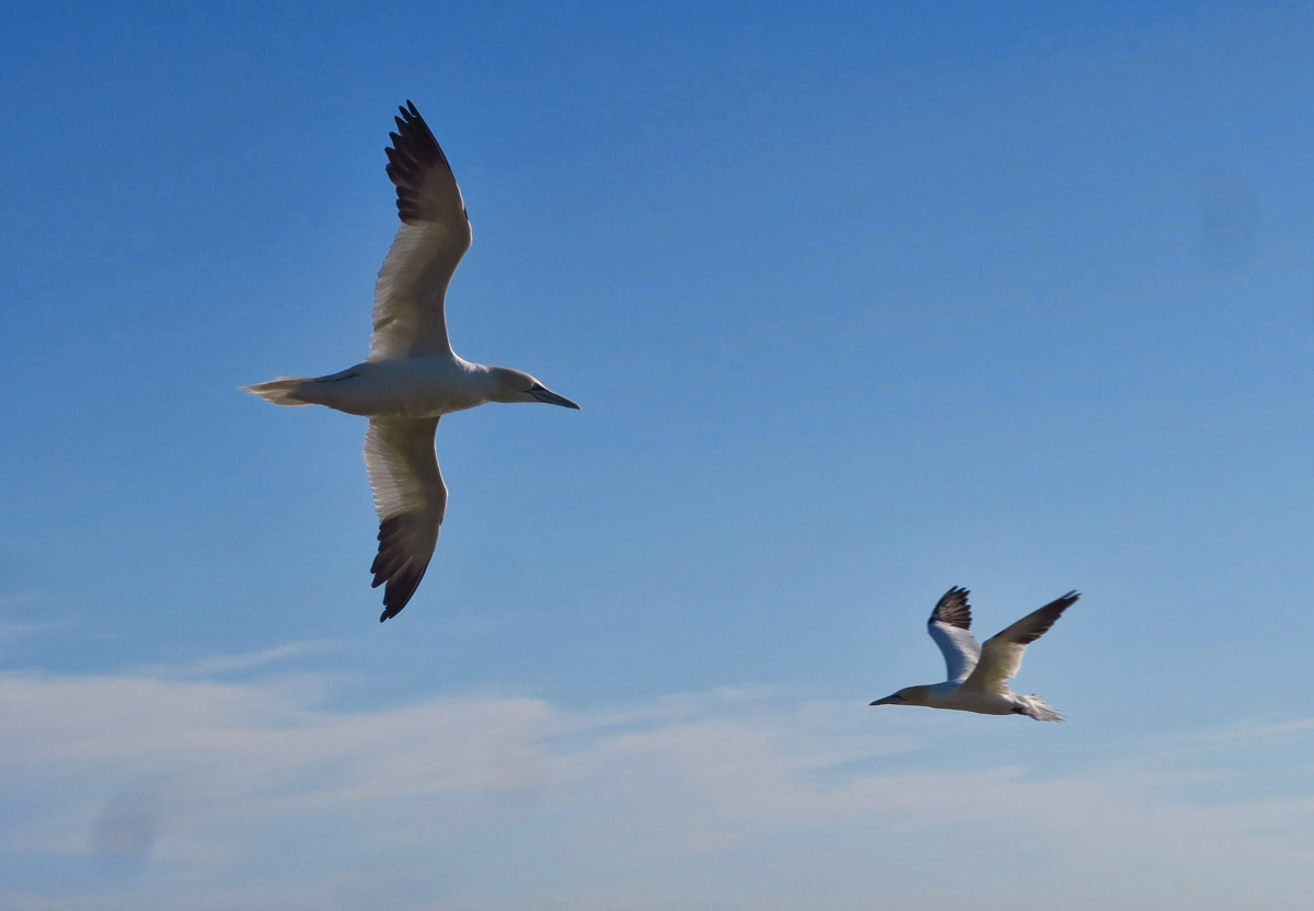
So graceful and elegant in flight with their black wing-tips.

“Okay, everybody line up! Kittiwakes to the left, Murres to the right!”
Like so many scenic spots along the Avalon Peninsula’s coast, St Mary’s offers an added bonus…a lighthouse. It took a year for seas to be calm enough to land the lighting apparatus for the lighthouse back in 1860. The structure has seen many façade changes over the years, from original brick to cast iron, and finally encased in it’s current octagonal shape of reinforced concrete.

Another idyllic boondock spot.

View from the View bedroom window.
I’ve lucked out upon arrival at the Cape on a clear, blue sky day. This area is notorious for its fog which happens 200 days out of the year. During an in depth conversation with the interpreter, I have revealed that I am driving the only RV in the parking lot, after which she mentions that she is on duty at 8:00am tomorrow morning. So I figure I’d better ask if it’s okay to boondock in the parking lot. “Sure!” she assures me. “It’s common.”
Soon after, a van full of family pulls into the parking lot to join me. But that’s not good enough. Instead, they move down onto the lower level, parking right up next to the lighthouse, photo-bombing my pictures of the lighthouse. I can’t help but snicker at 4:00 am when the fog horn lets out its first forceful wail of a wake-up call, followed 15 minutes later by the sound of the van’s engine starting up and low-beams making their retreat through the fog…
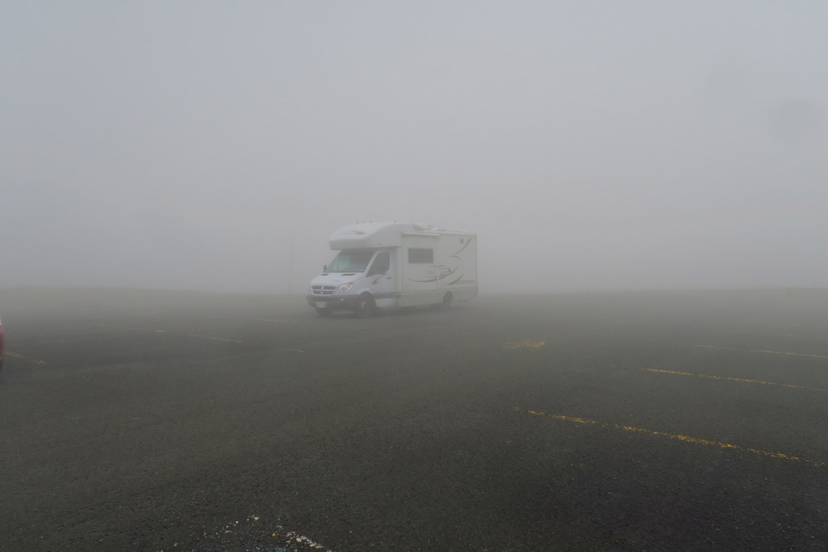
This is the scene I awake to the next morning…I can’t even see the Interpretive Center at the end of the sidewalk.

Why every lighthouse needs a fog horn…
Your last two posts have been outstanding but when aren’t they 🙂 Thank you for taking me along on your walk . Even though I live in Canada I doubt that we will ever return to the Maritimes. Based on what you have been posting we missed the best.
East coast, west coast, USA, Canada…how is a person supposed to decide which way to go?? I’ve decided to keep a binder of the places I’ve been with all my notes and recommendations…and another with the places I hope to see someday! Thanks Suzanne…I think binder #2 may be full quickly from reading about your travels. Thank you!
Stunning scenery and very similar to Wales or Scotland. To me the weather just adds to the beauty of it, and to thoroughly enjoy the area you have to get out there in the “appropriate clothing”. Great descriptions of the thunderstorm and the bit about the RV family and the lighthouse made me smile.
It’s such fun to read about places we didn’t get to, and I agree that sign says it all! Fog shrouded lighting must have been terrifying but the walk photos are lovely. Thanks for the “ride along”!
Who needs a travel guide when all they have to do is read your posts. I have enjoyed this trip to the Maritimes and now have it on my bucket list. While I understand the family vacations, nothing drives me crazier than inconsiderate people. Thanks Suzanne for a great trip. Safe travels.
Haven’t commented in a while. Life has interrupted! Thanks so much for all the photos of the Maritimes (I have to confess I’ve never even heard of them). AND, thanks for crossing the suspension bridge for all of us who no longer can walk or run that far! Onward.
We had a good laugh at the van moving at 4 am. Another great one. We had planned on taking both ferries, it just seems to make sense as I hate back tracking. I loved your description of the sea birds and their pictures and thanks for taking that trail over the bridge for those of us who cannot.
Awesome trip you are having, great incentive for us, hopefully next year.
What spectacular scenery! You’ve made really good use of your month on the Rock!
While the introspective inscription on the plaque is heart warming, my favorite line from this post is the description about the sky lighting up…”like a disco ball at Donna Summer’s Last Dance”…As the last remaining fervent lover of disco music in the entire world I always appreciate a reference to those fab tunes from the late 70’s. “Don’t Leave Me This Way” “I Love The Night Life” “Funkytown”, and, of course “Last Dance”… 🙂
My bonus daughter in Alaska makes awesome fireweed jelly!!!