Moving from south to north along the Oregon coast, the next historic lighthouse in my sights is Cape Arago. I check to see if it is close enough from Bandon to make a run after work one day, particularly since I work Central Time hours, and can start out as early as 3:00pm. I consult my “Oregon Coast Lighthouses” State Parks brochure to find that it is only about 25 miles north of Bandon, up a smaller two lane road, so I wouldn’t even be backtracking all that much when I continued on up Highway 101 come the weekend.
But then, I see the bad news. “Cape Arago is not open to the public. An overlook a quarter mile south offers a good view.” HUH???? An overlook?? A quarter mile away? That’s as close as I can get??
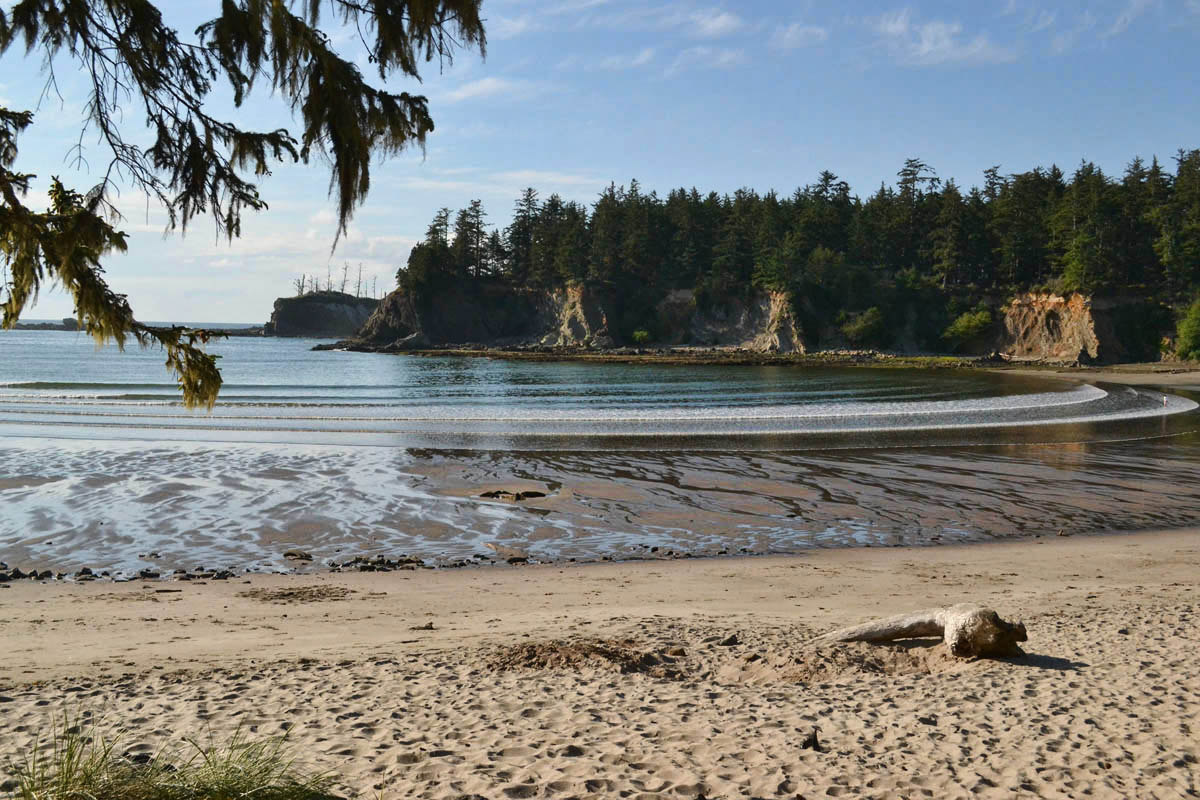
Sunset Bay State Park
I decide to park at Sunset Bay State Park, a scenic, serene little cove, very atypical from the rough wave action along the Oregon Coast. There is a trail linking Sunset Bay with nearby Shore Acres State Park, and it is from this trail that I have my best chance of getting a shot of the Cape Arago Light.
I hike out the quarter mile toward Shore Acres, and get a glimpse, but think, “Surely this can’t be it. There has to be a better view.” I have two cameras in my bag, and this is the best shot I can get.
I have to squint to see it!
One camera is wide angle, but the zoom is broken. The other is a DSLR, but at only 55mm lens, it is not powerful enough. I am irritated and frustrated! Why? It’s just a photo of an empty building. I cannot explain, other than to say that “I can’t FEEL it from here!”
I keep walking down the trail, but I am getting further away. The aspect is getting worse, not better, so I turn around and head back to the car. Perhaps there is another trail on the north side of Sunset Bay.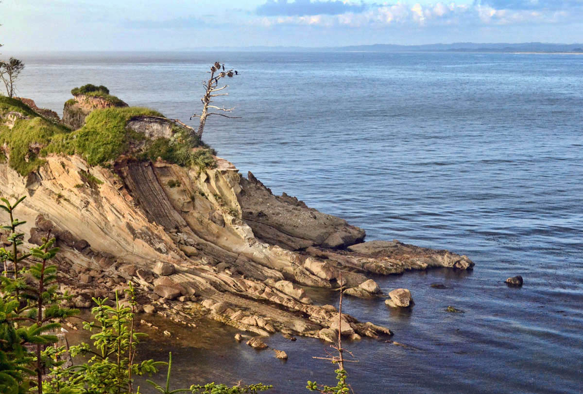
I remember seeing a road named “Lighthouse Road,” upon my approach to Sunset Bay, so I try that first. It is a “Dead End, Private Drive, No Trespassing, Chain-linked Fence, Keep Out, This Means You!” kinda road. Turns out, the Cape Arago Lighthouse has been deeded back to the Confederated Tribes of the Coos, Lower Umpqua and Siuslaw Indians, and it is now considered private property. Okay, I respect that. But if I can just find a closer view…
I drive back down to Sunset Bay. As I pull into the parking lot, there is a couple parked near the end. I notice they have Oregon plates. The window is down, so I approach. “Excuse me. Are you guys from around here?” “Yeah, sorta…how can I help?” “I am wondering if there is a path on this side that’ll get me a closer view of the lighthouse?” “Yes, but it’s not an official trail. You’ll have to do some navigating through the brush. Just head up this bluff, keep your eye on the path, and keep to the left.”
Halfway up the bluff on an ankle-busting, tree-rooted path along the cliff, I am really wishing for those dee-luxe hiking boots back in my car. I see a clearing through the brush, but it looks more like a deer trail than it does a human trail. But the cliff-side path has ended, and there is no other way except into the woods, or back to the car. So into the woods, I go.
I decide I will only go in so far as to not lose sight of the cliff’s edge. About the time I have decided it is too risky, I notice a small, orange plastic ribbon (the kind they use for marking trees to be cleared) dangling from a limb overhead. I think it is odd to see such a marking in such thickly wooded area. Why just this tree? Then, I look ahead in the distance, and I see another! They are leading me through the forest! (Yes, but leading me to WHAT, my family is worrying!)
The underbrush is thick, but I can still see the daylight of the cliffside path through the trees behind me, so I keep going. I am bushwhacking my way through tall shrubs, low hanging limbs, and downfallen trees, but I never lose sight of the orange ribbons. I do wonder what this could lead to, but then how is it really any different than a blazed hiking trail? I tell myself I will keep following it, but the minute I lose sight of the next marker, trail or no trail, I will turn around.
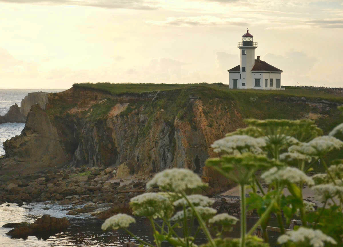
Finally, after what seems like an hour, but is probably only 15 minutes, I can see a clearing. I come to what looks like an old abandoned road. To the left, I see it!!
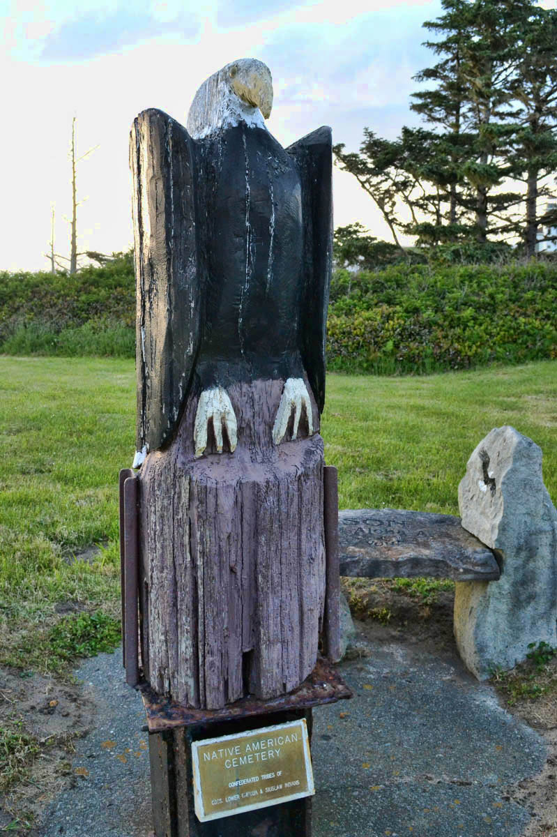
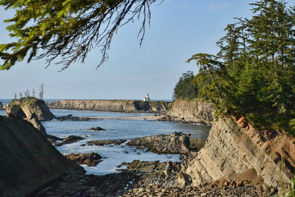
Native American Cemetery Marker
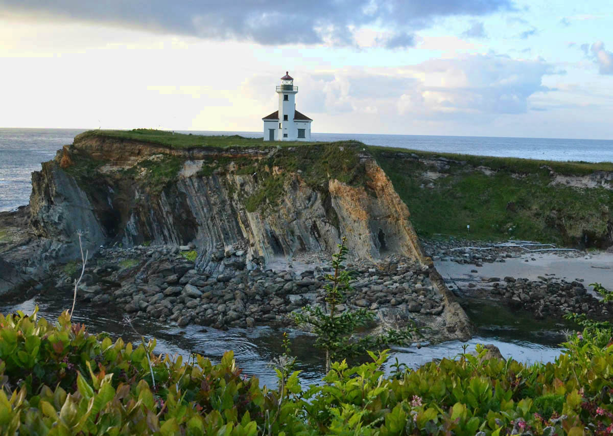
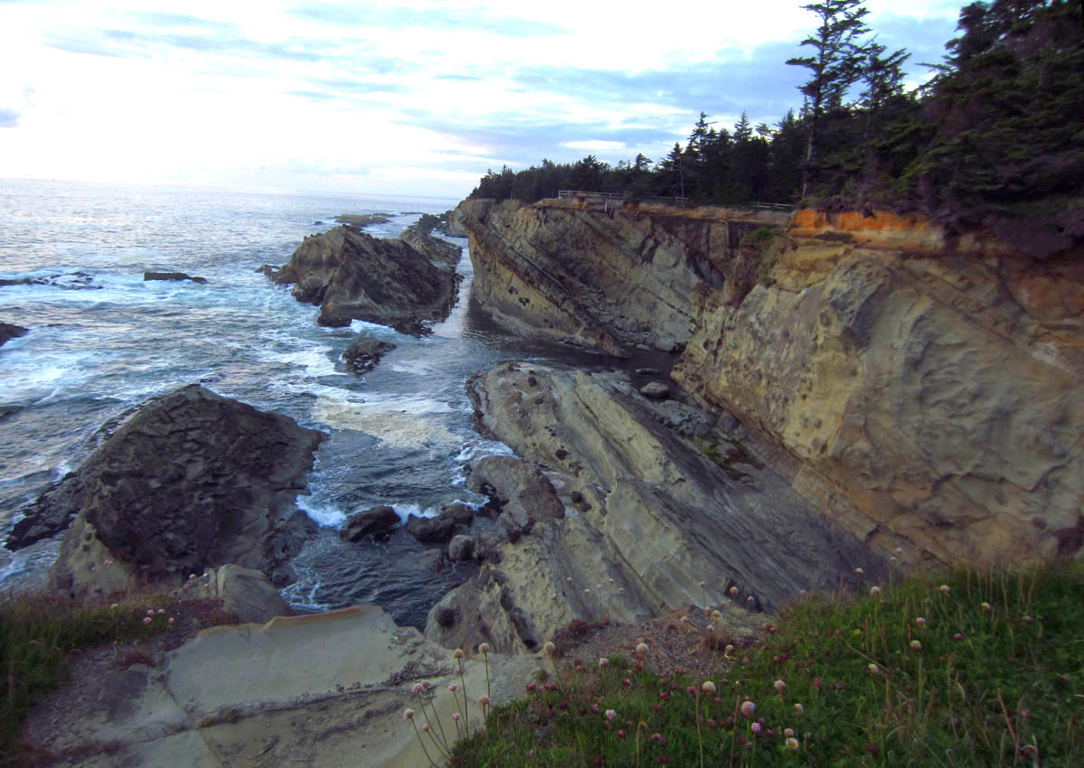
The now inactive lighthouse stands on an island with no access.
There in the beautifully landscaped clearing is a Native American cemetery. And just beyond the clearing, a beacon, on isolated, illusive, forbidden territory, standing stoically alone on its own island….Cape Arago Light.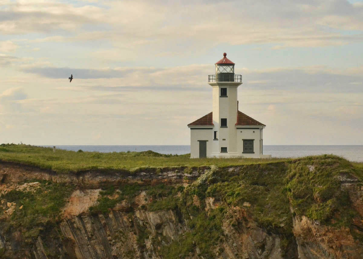
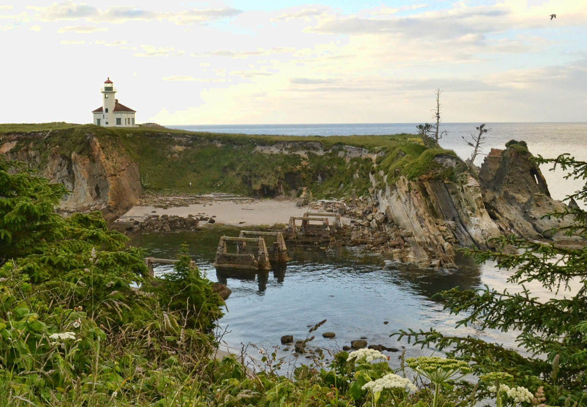
Note concrete trestle from old wooden bridge to island.
I take what must be a hundred photos, all which look exactly alike, but I keep on until I am satiated.
Hoping not to have to retrace my “bushwhacking path,” I follow the old abandoned road for a while, until I realize I am on the inside of the “Dead End, Private Drive, No Trespassing, Chain-linked, Keep Out, This Means You” fence. I see a small path off to the right, and hope that it leads to an opening around what appears to only be a façade of a fence. I have to cut across the back of someone’s lawn like a paparazzi, wearing a black hoodie with a Nikon camera around my neck, and I wonder if someone is watching me from their bedroom window thinking “There goes another nut…”
Now having my Cape Arago Quest satisfied, I decide to continue on to explore Shore Acres State Park. A crossroads sign along the path indicates “Botanical Gardens” to the left, “Simpson Beach” to the right. I have about 30 minutes before sundown, so I decide to see if the gardens are open. There is no gate, so I stroll through. I am completely blown away by what I find here on the edge of the sea cliff. I would have never expected a formal garden at the beach!
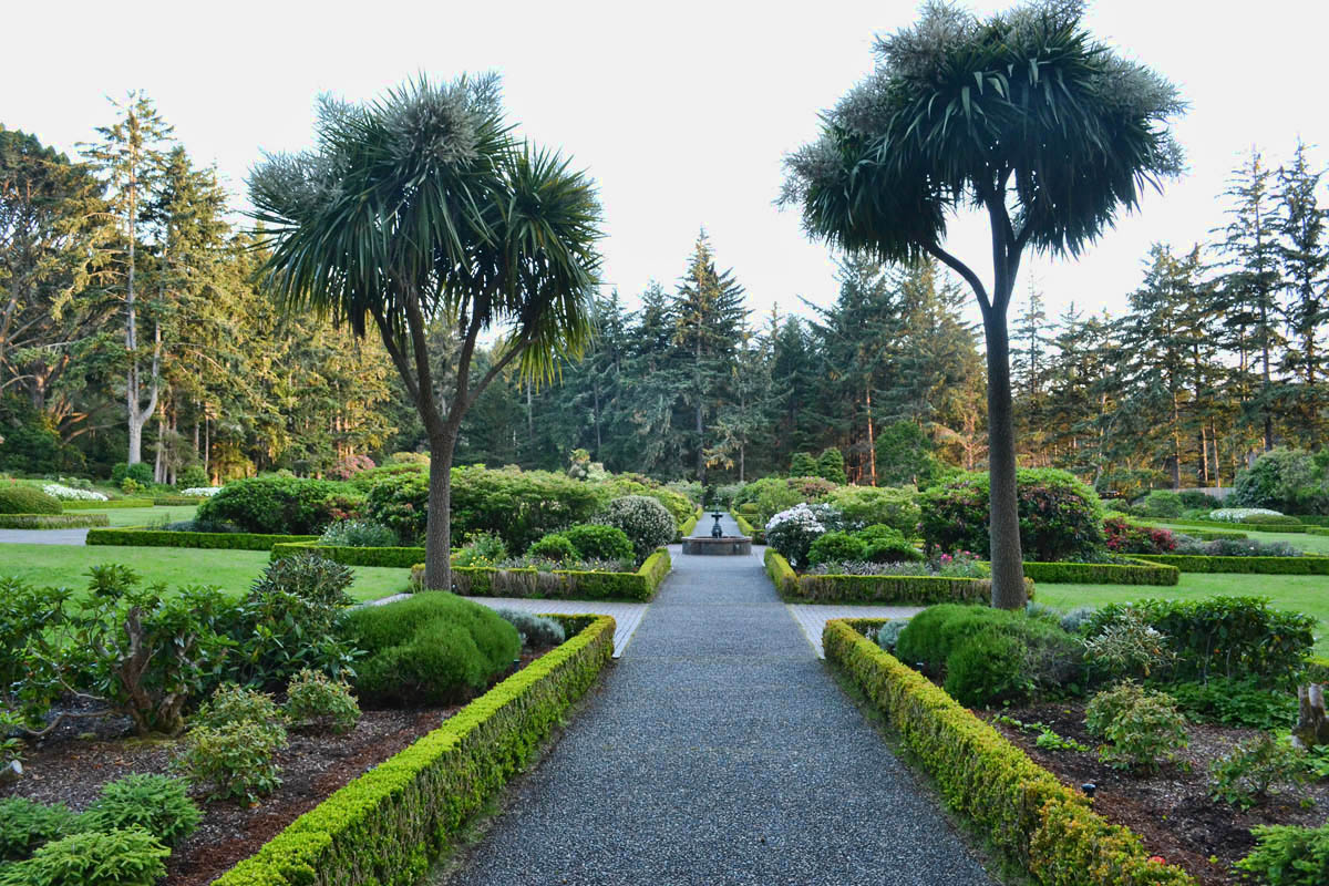
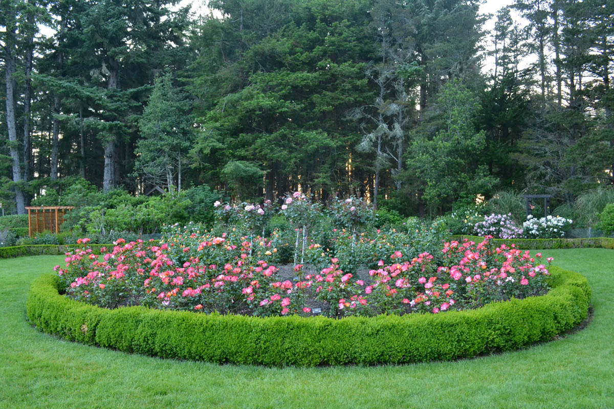
This beautiful garden was built in 1906 as a part of the Simpson Estate. The three story mansion no longer stands, but the gardens and lily pond were restored and maintained, just steps from the sea cliff. Once more, I find myself in a magical place, all alone, as there is not another car in the entire park.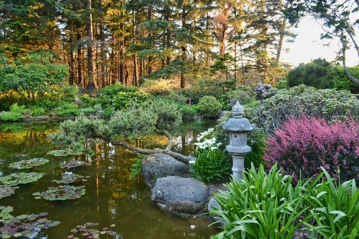
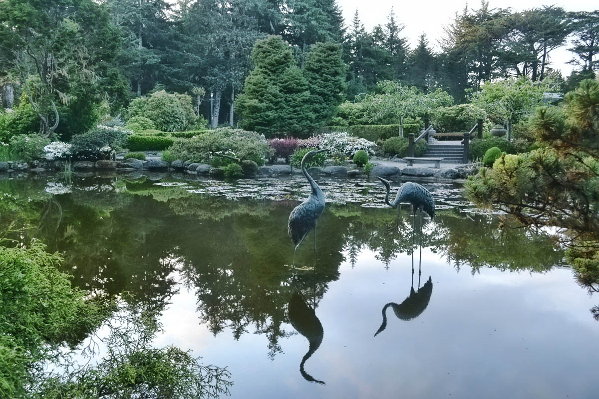

Simpsons Beach, Shore Acres State Park
I head toward Simpson’s Beach in time to grab a few photos from the overlook before sundown. But the park gate is locked promptly at 9:00pm, and I can see the Ranger’s truck approaching. So I have to leave this magical place all too soon…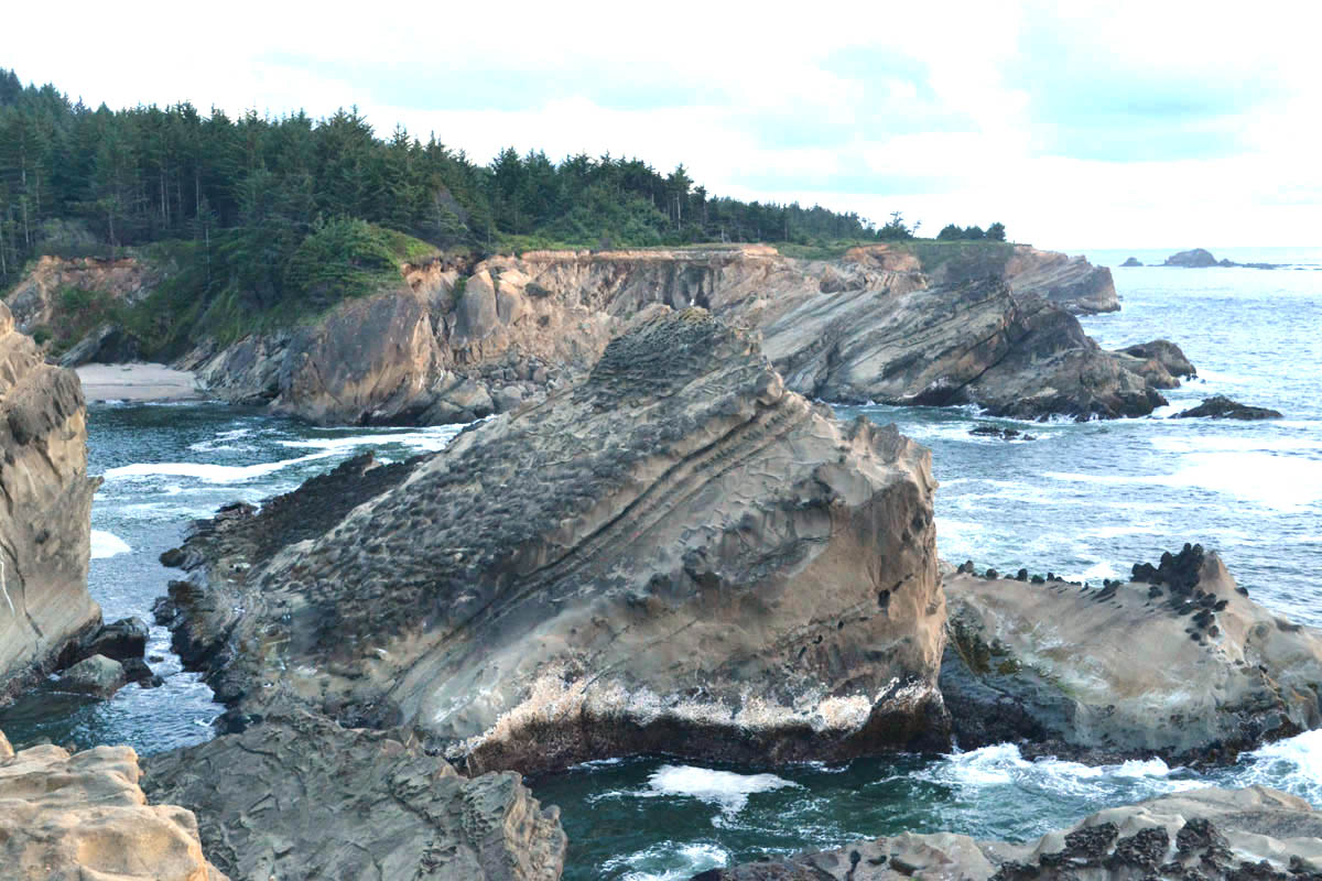
(Note: No bloggers were harmed during making of this post. Had I been hatcheted in the woods by an axe murderer, my family knows my credo: “I’d rather die while I’m living than live while I’m dead.”)
Those are great photos of the lighthouse. You are probably only one of few who make it to that point. Clearly you need to keep those hiking boots on your feet at all times just in case!
Gayle
Spectacular lighthouse shots (even if it was forbidden fruit, I’m sure you were a quiet and respectful paparazzi while on those grounds). That garden looks like a wonderful find too! Wow! Just beautiful and to think you enjoyed it all to yourself! Lots more gardens to come when you get up to Portland, Seattle & Victoria, but all of those are better known and will be a lot more crowded with tourists!
What an amazing post! I am thrilled you were able to get and share photos of the lighthouse. The idea of its being left unmaintained makes me sad, though.
And what a stunning surprise the garden was!
Wow what a day! I’m with you. Lighthouse caching at any cost. Really well done given the odds. Gorgeous pictures. And then a state park with beautiful formal gardens that outlasted the house. Clearly you are living right!
Awesome! I have NEVER gotten that close a shot of Cape Arago lighthouse. You clearly found the perfect hidden pathway.
Nina
You are “Driven” when it comes to mining all the “Gold” near camp 🙂
You need a “Failure is not an Option” Tee Shirt…and maybe some more stealth gear.
Box Canyon Mark
What an adventure! Those gardens were such an amazing surprise when we happened upon them a few years ago. It’s one of my favorite places on the OR coast. If you ever have a chance to get back to that beach during the day the tidepools are incredible there.
Argggghhh! The gardens and the lighthouse – but not Simpsons Reef? The largest pullout for seals, elephant seals and other pinnipeds along the Oregon/Washington coast – thousands of barking seals just off shore! And trails down to some great tide pools all around cape Arago. If you didn’t explore that, yout must go back. Right now. Seriously, get in your car . . .
You really really wanted to feel that lighthouse and persevered. So many times during your story I know that I would have given up. You have impressed me once again. The photos were worth it. That garden is spectacular. Love your credo.
Found you through Jim and Gayle’s blog and on what is apparently the perfect post . Your little bushwhacking trip to find the lighthouse is exactly the kind of adventure I live for too! I’ll start back-reading your blog and am going to snag a copy of your book for my Kindle also.
Those lighthouse shots were TOTALLY worth it. Loved this tour – part of Oregon I’ve yet to see.
Jim and Gayle — Yes, I need to keep the hiking boots on at all times, in case I have the good fortune to run into (or behind! LOL!) you guys again!
Lynne — Yes, I have “done” Seattle, Portland, and the Butchart Garden in Victoria, but I just didn’t expect to stumble upon such a thing on a cliff-side path!
Tinycamper — There is talk of putting the lighthouse back in service one day, or at least making it accessible to the public. Of course, the bridge will need to be rebuilt. At least it is on the register of historic places, so we know it will get some TLC…
Sherry — Your term, “Lighthouse caching” made me laugh! I am gonna steal that one! 😉
Nina — Let’s hope they open it up some day — what a great place to host!
BC Mark — If I don’t start getting an earlier start, I am gonna have to add some night vision goggles to my stealth gear. 😉
Lisa — I REALLY wanted to return to that beach, in fact, I almost stayed another week in Bandon just to do so. All the footprints told me there must be very little wind there. So I was going to hike in with a book and a beach chair. Next time! (Seems like I am saying that a lot lately, i.e. your beautiful Lassen Volcanic pics!)
Anne H — You made me laugh! Okay, I am making a U-turn… Actually, I did stop at Simpson’s Reef, but the sun was long gone, and so it was too late to hike down. But I did sit up on the overlook for a good long while listening to the cacophony of barking louder than any pack of dogs I had ever heard! What a magical place, indeed…
Contessa — Thanks for the comment, mi amiga. Somehow, though, I get a sense you never give up that easily. 😉
Pam — Thanks so much for the nice comment! I have followed NomadicNewfies too, as you guys always end up on “my kinda hikes!” Thanks for following along and supporting my “labor of love,” i.e. the book!
Sherry — The Oregon coast has been a complete surprise to me. Yes, I have heard others rave about it, but I just didn’t expect it to all be so accessible, right off the highway for the entire length of the state! Thanks for following along!
Jimmie Buffett had it right about living and dieing!