
The downside of staying in Slab City longer than I planned is that I am now approaching Joshua Tree National Park during the Perfect Storm; Spring Break, Easter Weekend, and the annual blooming of the Joshua Trees. But I don’t want to delay. I was headed to Joshua Tree last spring when I learned of my brother’s demise, and had to abort the plan driving the 1,367 miles home to Texas. So it’s still a National Park not yet crossed off the Bucket List. Crowds or not, I must go!
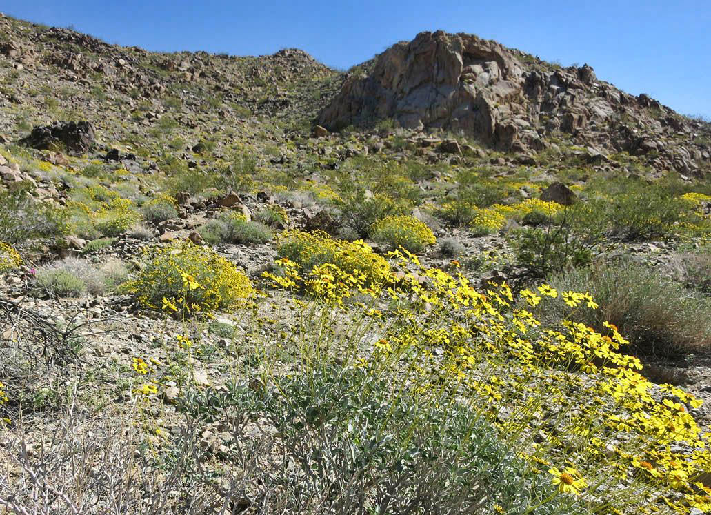
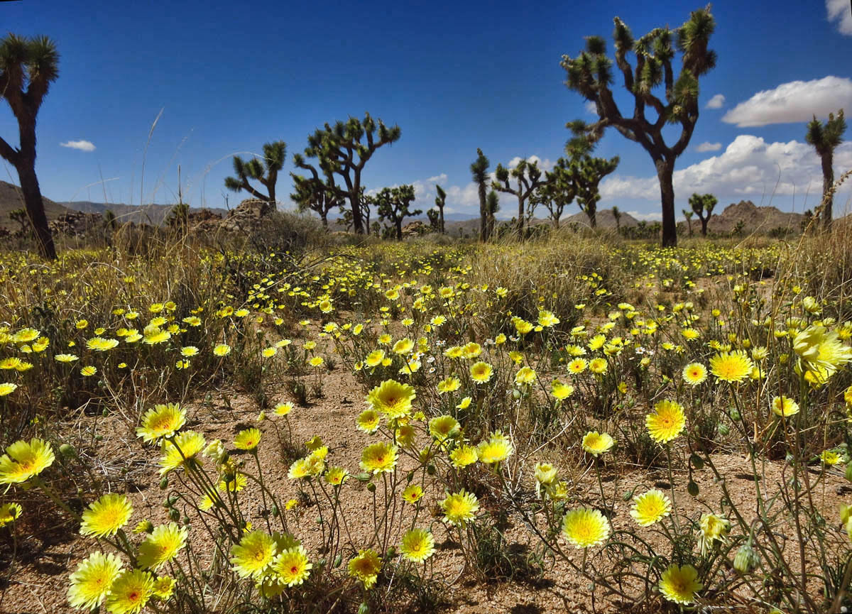
Approaching from the south, fields of yellow unfurl.
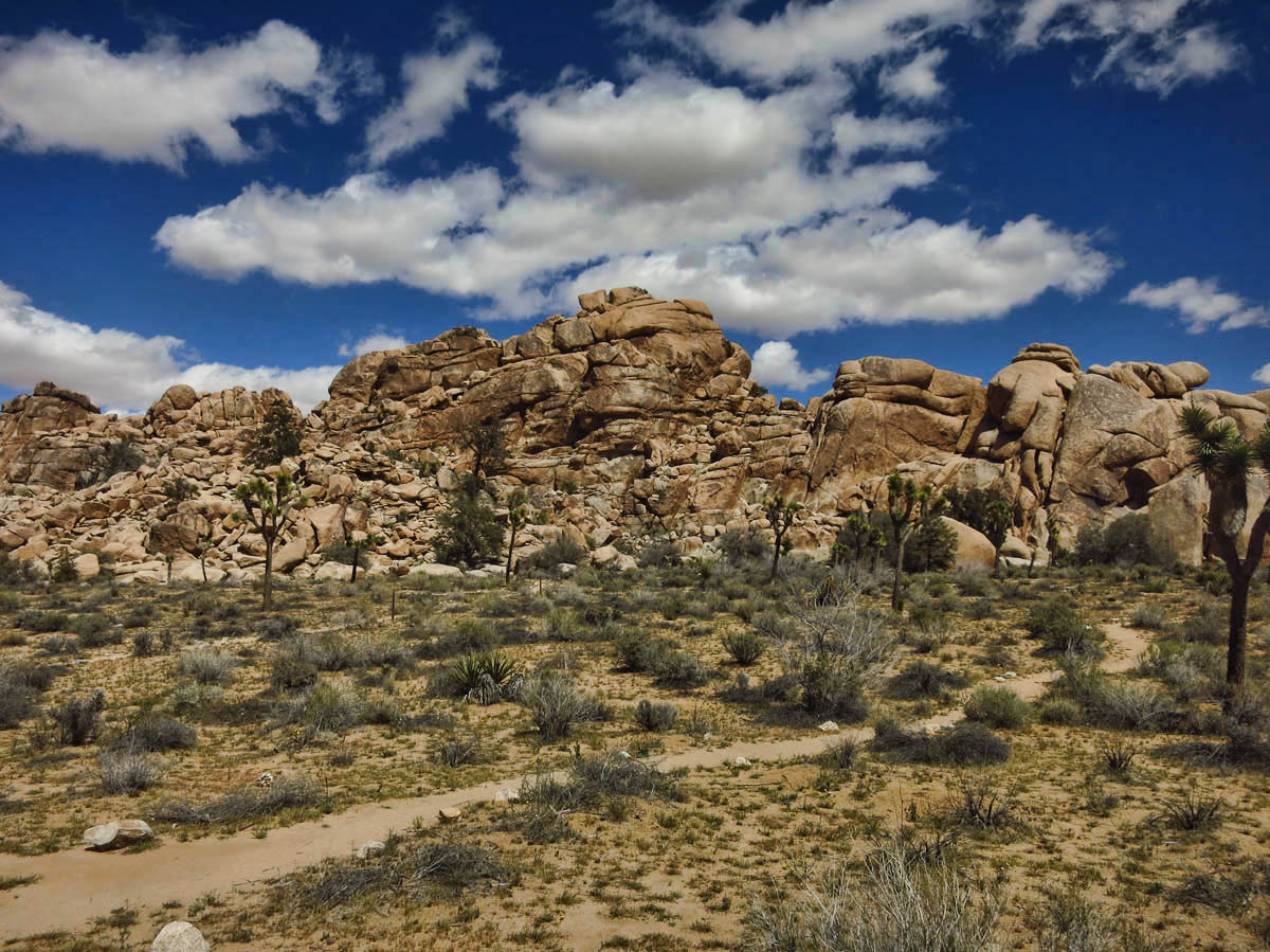
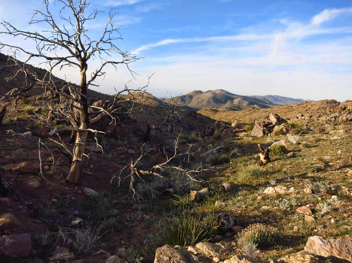
The south side of the park is considered “low desert” with Sonoran-type vegetation.
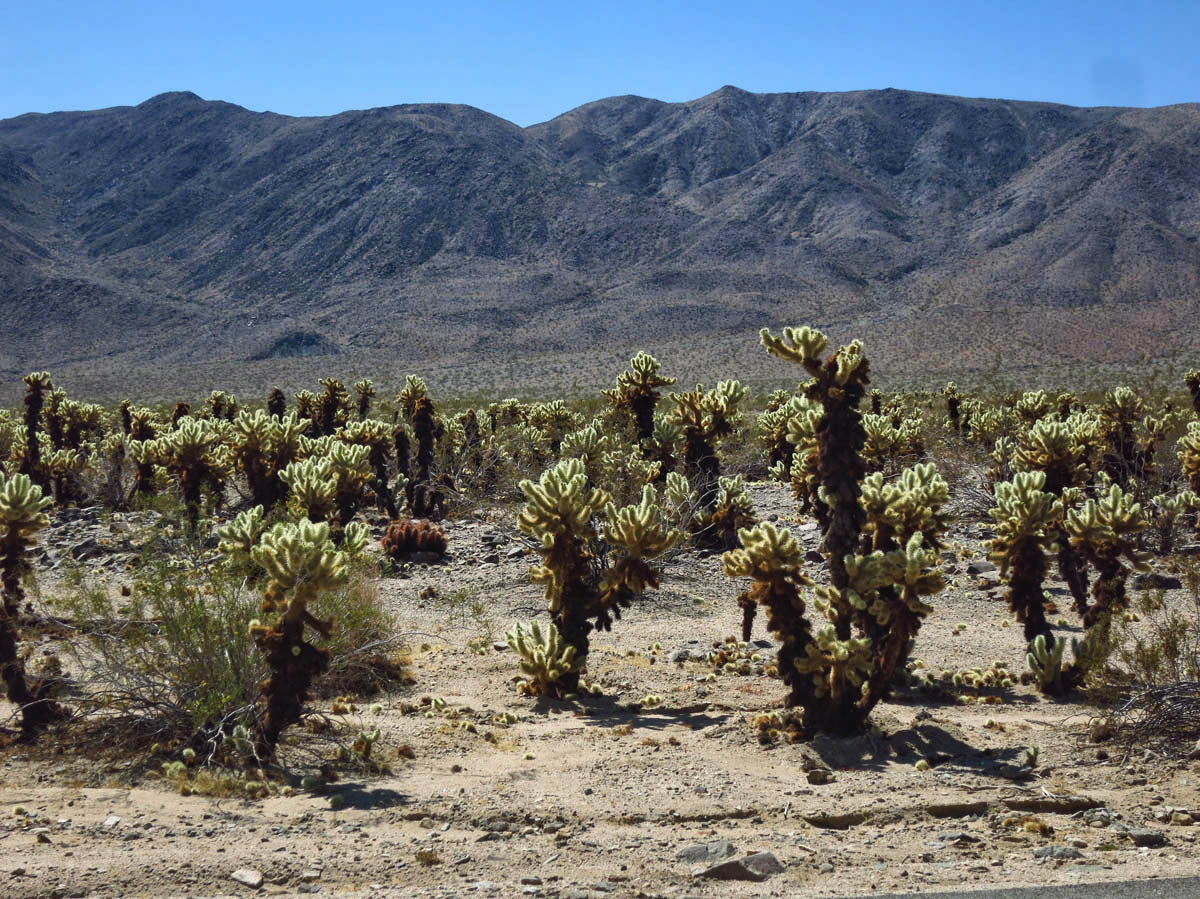
Cholla Garden
After fleeing the flies of the Salton Sea, I stop for a night in the south boondocking area just outside the park near I-10. I figure I will get an early start, and see if I can get lucky with a first come, first served campsite inside the park. Not only is the prospect of a campsite laughable, I can’t even find space in a pull-out! It’s disappointing that out of three Visitor’s Centers in this park, none have more than two curbside spaces to accommodate a towing RV!
Why am I suddenly craving baked potatoes?
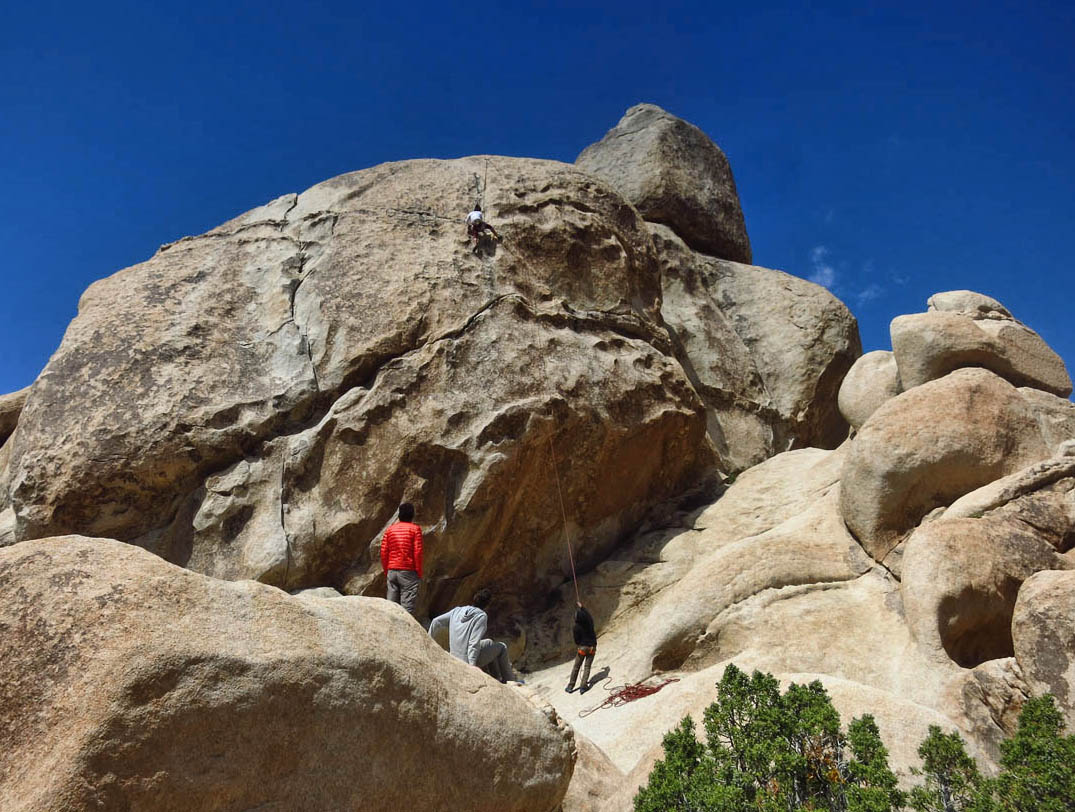
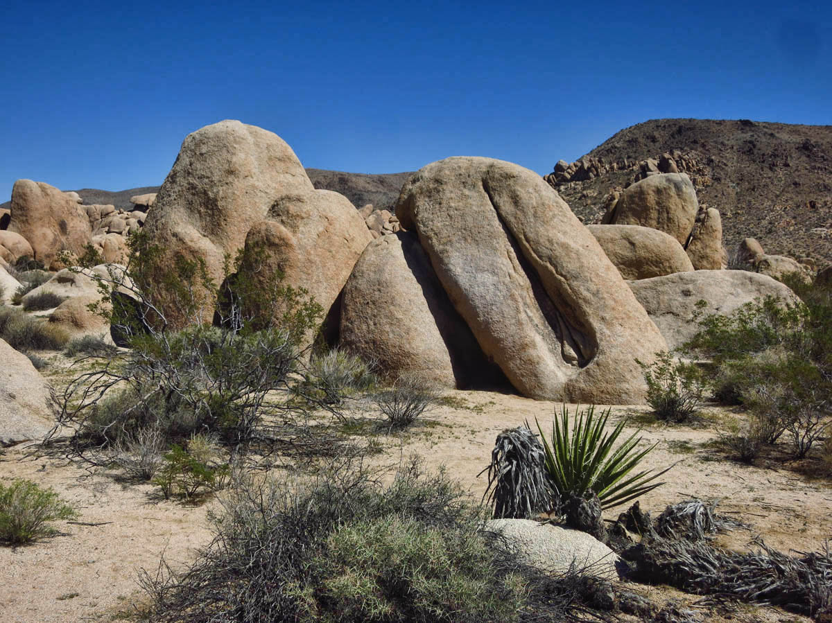
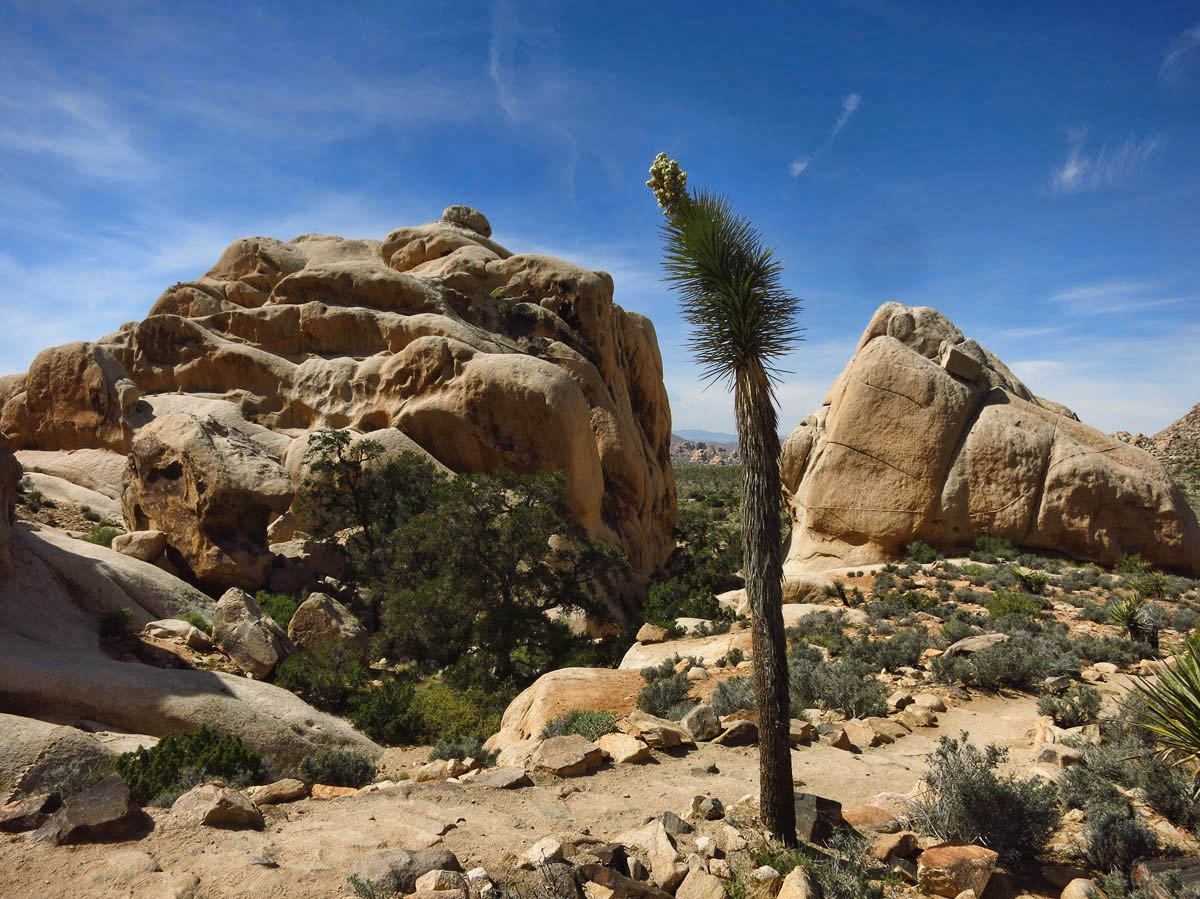
Joshua Tree is a favorite among rock climbers. Note climber almost to the top of largest rock.
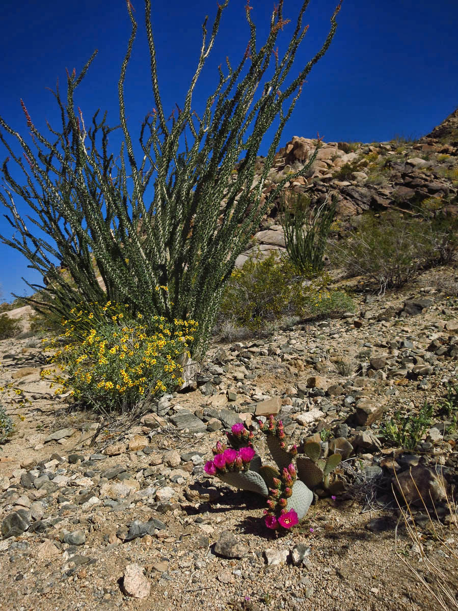
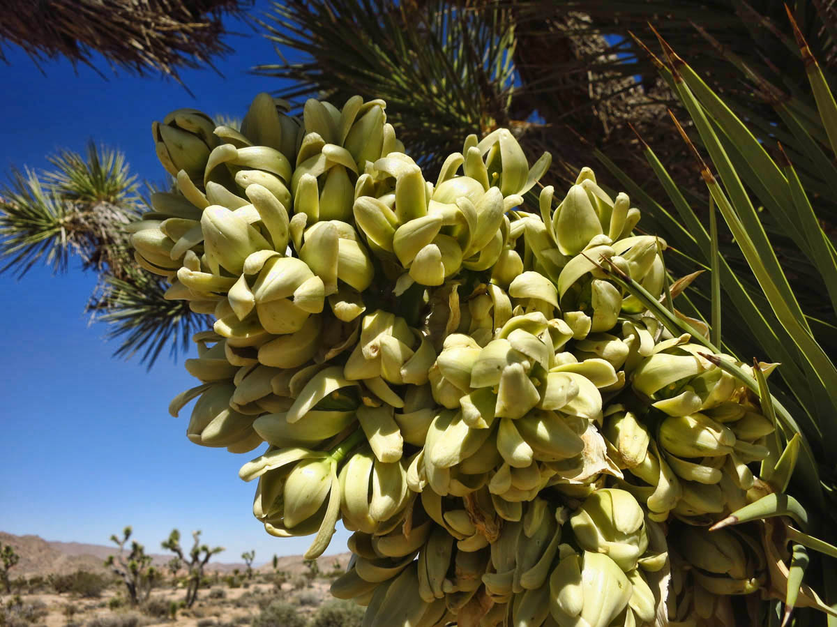
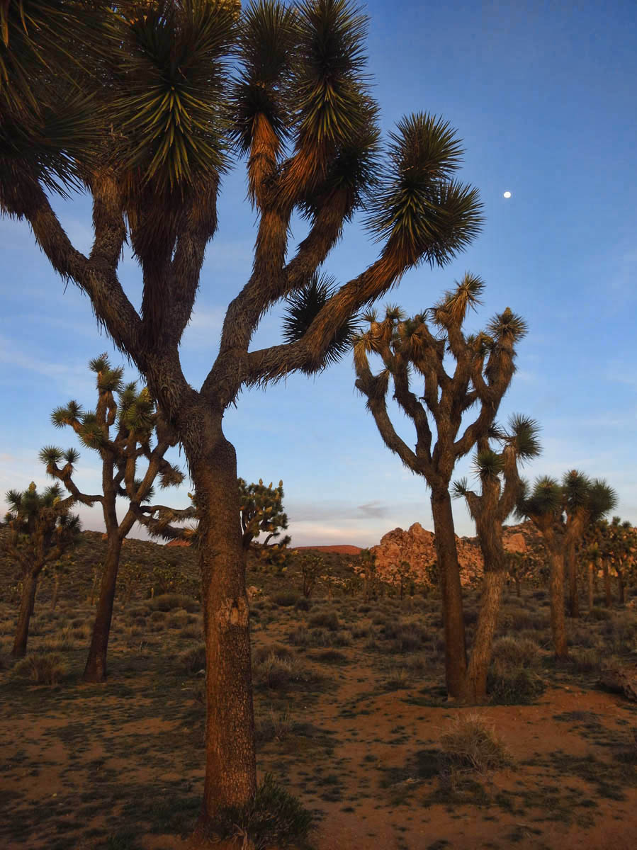
Still, the drive through the park is beautiful, and I marvel at the change in topography as I cross the delineation between the two deserts. The south end, or Colorado Desert is a blanket of yellow, with sunshine yellow Sun Cups blooming on the desert floor and the Brittlebushes upholstered in lemon yellow polka dots. I get excited over seeing what I think is my first blooming Joshua Tree, but later learn they are Mojave Yucca. The elevation in the south end of the park is too low for Joshua Trees. It will be another 30 miles and 3,000 ft before I see my first Joshua Tree. And yes, they are blooming like crazy! 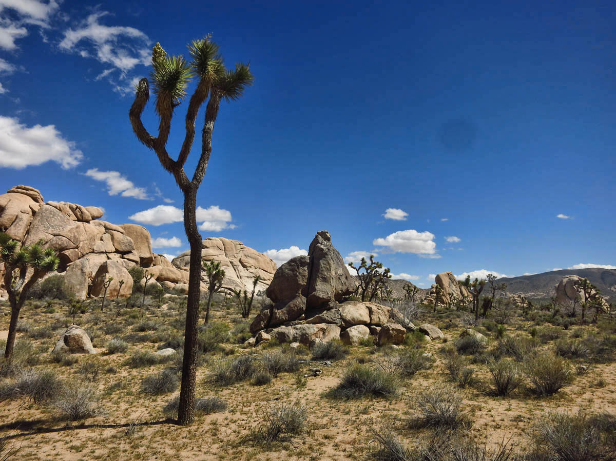
It’s a steady, gradual incline up a scenic, winding two lane park road to the western side of the park, and as advertised, the topography as I cross over to the Mojave Desert is vastly different. I head toward the western entrance, which I have read is the most scenic part of the park. It’s almost 70 miles from the south side of the park to the western entrance, and I am glad I have approached from the south, as the scenery improves the further I drive west.
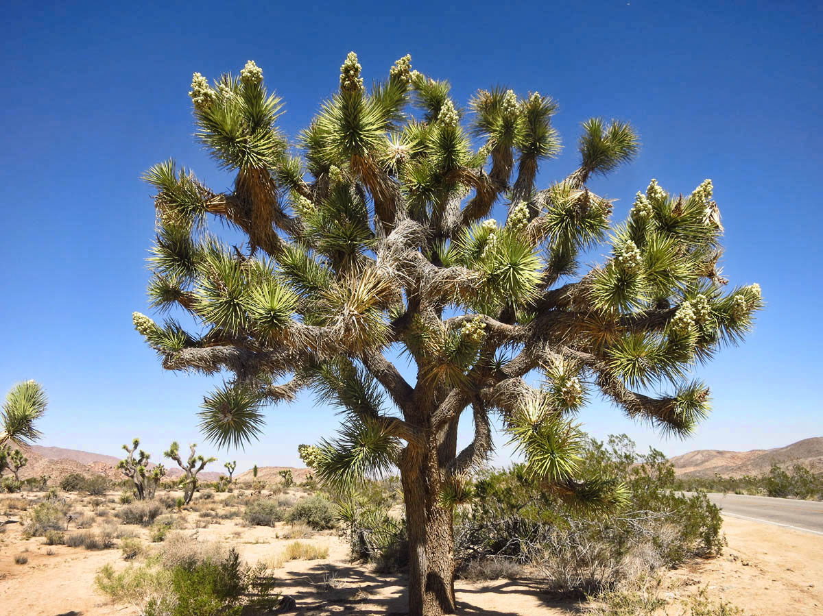
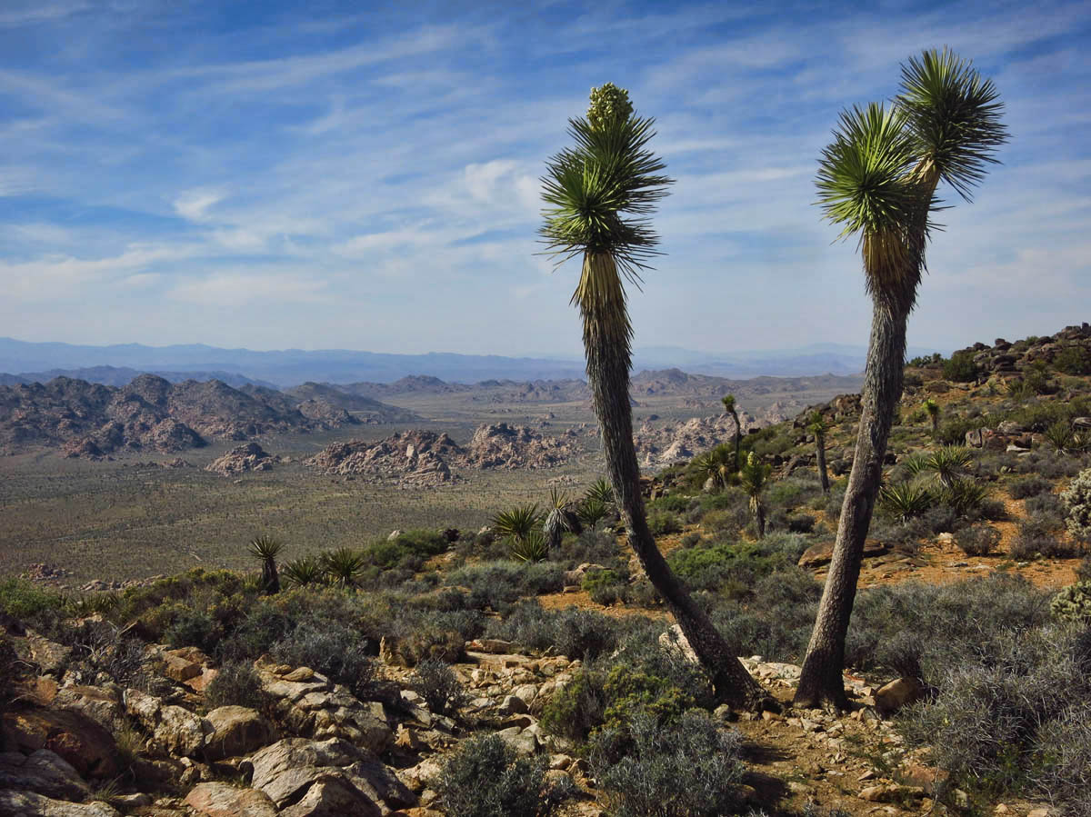
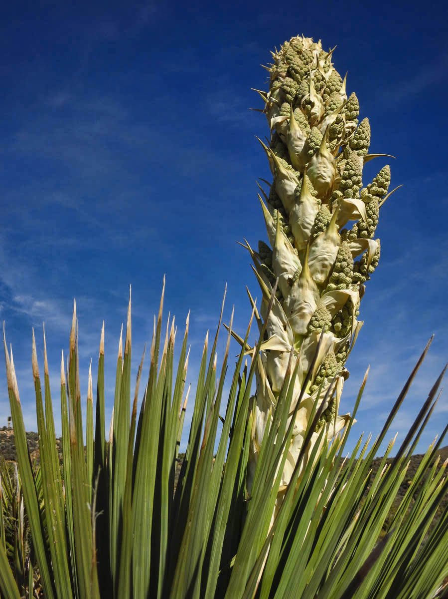
Joshua Trees named by Mormon settlers for outstretched arms that reminded them of the prophet Joshua.
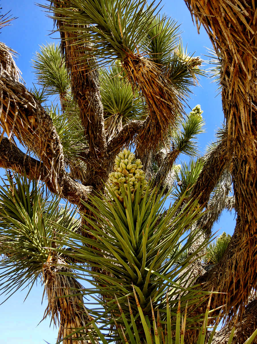
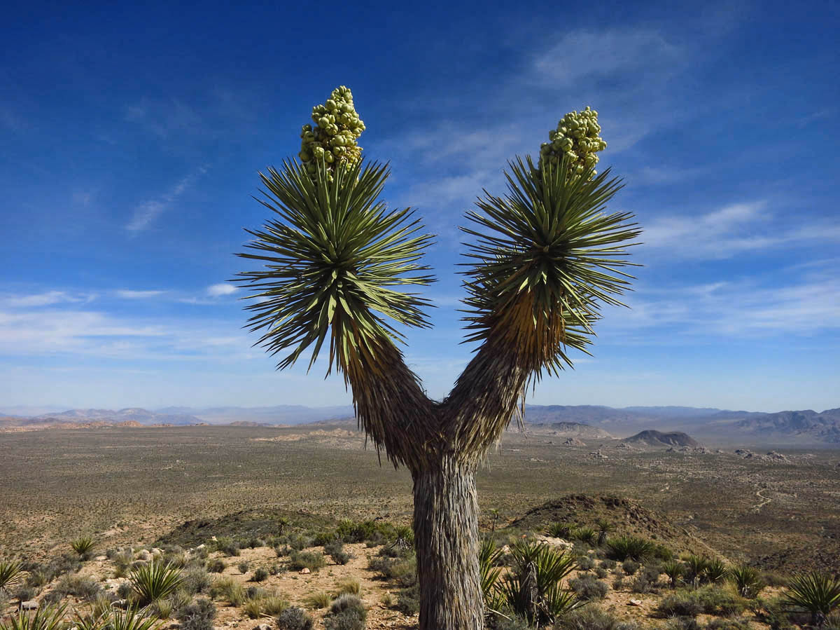
Trees don’t branch off until after they have bloomed.
About halfway through, the stark rugged mountains of the south end flatten out, as the landscape is punctuated by giant granite boulders looking like Chernobyl-grown oven roasted Golden Idaho potatoes, stockpiled intermittently across the landscape. Now at higher elevation, I begin to see the tall, spindly, Joshua Trees, arms outstretched in a twisted, distorted, ghostly-like stance. Most of them have enormous beefy blooms at the end of each arm. These trees were named by the Mormon settlers who thought the outstretched arms resembled the prophet Joshua, beckoning to the promised land.
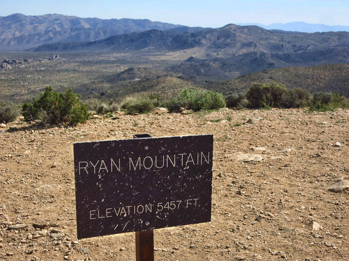
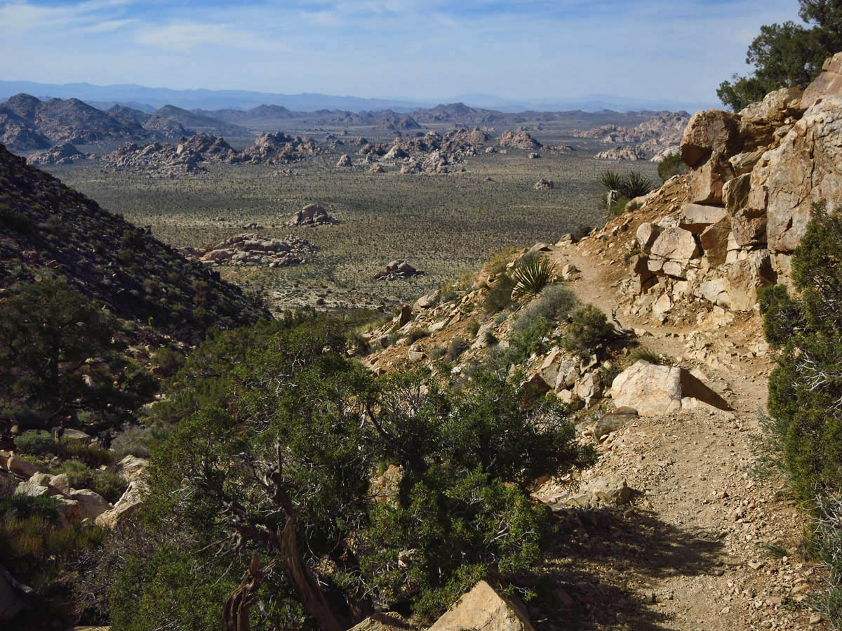
View from Ryan Mountain Summit
I stop at Jumbo Rocks Campground to have a look, but it is more like Jumble Rocks, as the boulders are covered in crawling kids and RVs parked so far out into the road it is difficult to even drive through. I knew going in the campground was full, but I wanted to do some reconnaissance for a potential return visit. But getting through this campground between kids playing in the street, bicyclers, people crossing without looking, or opening their doors into oncoming traffic is like running the gauntlet. I drive straight to the north “overflow” camping on Sunfair Road, a dust bowl of a dry lake. But it’s only 10 miles back into the park, so I will make this my base for exploring.
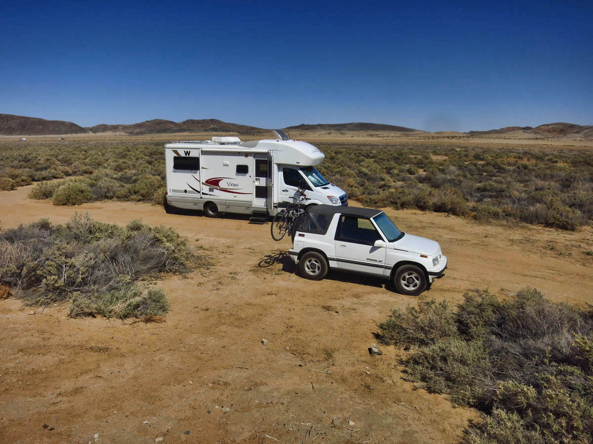
North boondocking near dry lake bed.
Although I did a good bit of walking in Slab City and the Salton Sea, I am in need of some elevation gain, so I pick my first hike based on incline. Unfortunately, Ryan Mountain is also listed in the Park Newsletter as “one of the most popular hikes in the park.” It’s a steady stream of 20 somethings traveling en masse. On the heels of the “Generation Y’ers” or Millenials, I guess this next group will be referred to as “Generation Z.” Though I think a more fitting title for these kids would be “Generation E” for “entitlement.” I have never met a ruder group of hikers. They do not stop to yield, neither uphill nor down. Intent on taking their party up the mountain with them, they travel with tinny music blaring from their smart phones that sounds more like a tin can of rocks than “Rock.” And I counted six different groups traveling on NP trails with dogs…two of those off leash. I think this is unfair to those who observe NP rules, thereby forced to choose between leaving their pets behind or forgoing the hike. I would have liked to do as Ranger Gaelyn does and “turn them around,” but my luck, I would be cited for impersonating an officer. 😉
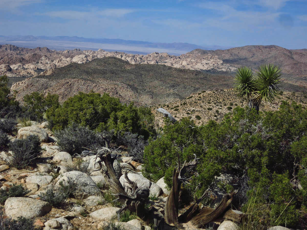
Ryan Mountain is only a three mile hike, so I decide to fit in one more 4 miler to Lost Horse Mine. This trail leads up to an old gold mine that was in operation from 1893 to 1908. The Ranger recommends this as “a good place to see Joshua Trees.” Unfortunately upon arriving down the long, dirt road to reach the trailhead, I see a sign that says that the Joshua Trees along this trail burned in the 450 acre fire of 2009. I can’t help but wonder if the Ranger has been on the trail since then…
Trail to Lost Horse Mine
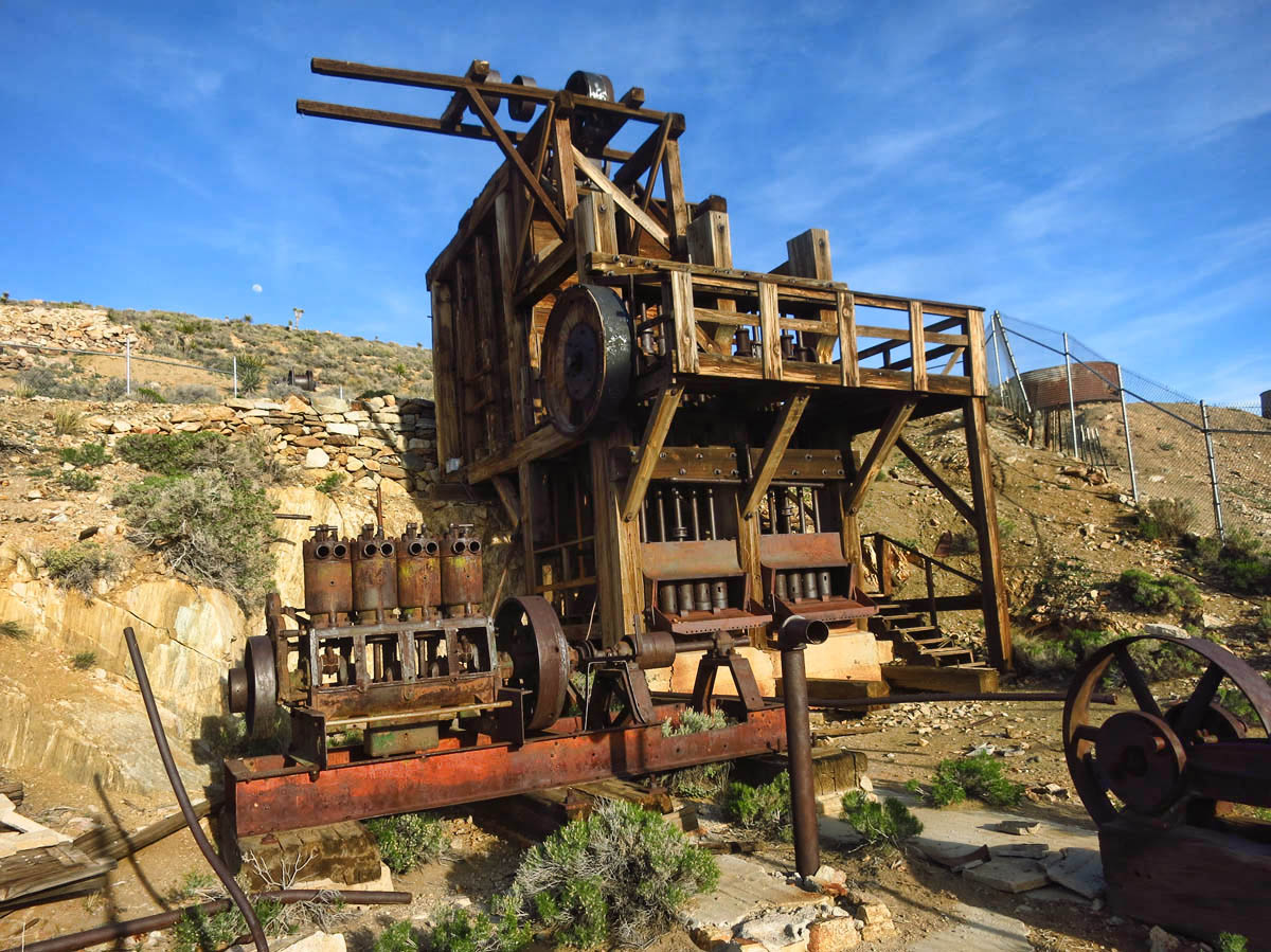
Mining claim was discovered while looking for a “lost horse.”
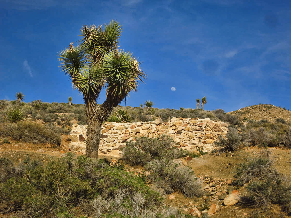
Stone walled tank used for water storage for the mine.
It’s only Friday, and the Spring Break and weekend crowds are sure to get worse before they get better. I get word that friends Jim and Gayle are hunkering down in the Mojave Preserve until March Madness subsides. I decide to head north, leaving further exploration of Joshua Tree for a quieter time… 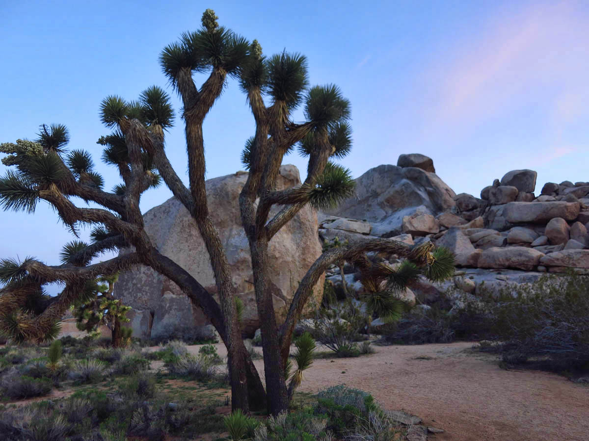
Am mesmerized by the beautiful photos of the area. It looks way better than I remember. The penultimate photo is a stunner! I am trying to learn a few new tricks in Photoshop, so, con su permiso, I would like to use it as a test bed for my “larnin” session. It will stay “in house”.
Virtual hugs,
Judie
Judie — I would be honored…though I had to look up the word “penultimate,” LOL! So I got the gift of a new word in return. 😉
Re: crowding in the park. We know, we know. Corinne and I are constantly saying “why aren’t all of these people at work?” It’s spring break week (still) and Furnace Creek is full to overflowing.
I liked that boondocking on the south side. Not so much the north except for close to the park. Look for a great farmers market in the town I think weekends. VC area parking for RVs way too often have cars parked in it. Bad year for National Parks. I’m boycotting all but where I am. Best look to other public lands. Tell those rule breakers you’re an off duty Park Ranger. Works for me. Besides, it’s your park too. When you go back try for White Tank camp. It’s smaller than Jumble Rocks. (I had to look up penultimate also. Thanks Judie for the new word.) thanks for the plug.
We ran into that exact group when we hiked up Potato Chip Rock in Dec 2014. Boy, talk about self centered!! And who hikes with blaring music!! I believe every other group had loud music playing. Not fun!!
You photos are spectacular!! Love that park:)
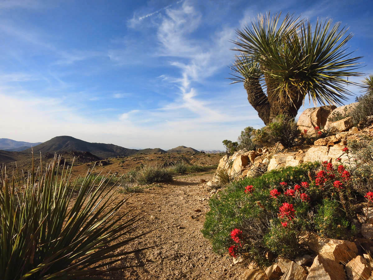
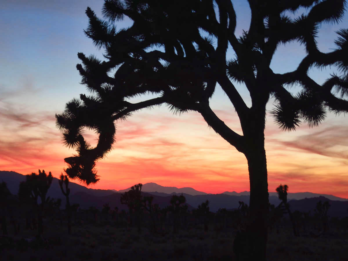
Great last picture, was it a spontaneous shot or did you have to wait?. Looking at your pictures of the expansive countryside its hard to imagine it be overcrowded there. I wonder what you would make of our UK campsites in peak season?
Hi, Dave — Thanks for the compliment. It was literally a case of careening off to the side of the road, grabbing the “point and shoot,” jumping out of the car and running out amidst the trees before it was too late. 😉 It was a funny scene, as there was a line of cars exiting the park, all who did the same thing. People just pulled over where they were, illegally parked, grabbed their cameras and stole the moment.
I will readily admit that after living in the congested, over-populated eastern cities for most of my life, I have become hopelessly spoiled by the wide open spaces of the west. But being in those wide open spaces can also feel confining when you see miles and miles of nothing but land, yet there are no remaining spaces where you are allowed to park your car. 😉
March and April really are the most difficult months for us fulltimers I think. We had crowds at local county parks, fortunately they subsided on the weekdays…
At least you got a taste of the beauty of Joshua Tree!
Beautiful photos and you have captured the wonderful light of evening. Very nice. Thank you.
I detest hiking in crowds, particularly those that are noisy and rude to boot! We haven’t spent much time in Joshua Tree but I’m sure we will in time, given the proximity to JH. After talking to Jim and Gayle about some of the hikes you all did in the Mohave Preserve, I think that is first on the list.