Where can you sit poolside and bake in the 90+ degree sunshine in a lounge chair one day, and hike in snow the next without ever packing a bag? Why, Palm Springs, CA, of course!
I say my goodbyes to Jim and Gayle in the Joshua Tree south boondock, with plans to meet up further north this summer. We are off to pursue our mutual passions, which for me means soaking in Desert Hot Springs, while they are off in pursuit of more Pickleball.
I didn’t realize Palm Springs has the highest gay population per capita in the US.
The Eighty’s called…
Two for the price of one.
I have long been intrigued about the Palm Springs Aerial Tramway. What on earth is a big tram system like this doing in the desert? So I am eager to experience the ride up. Besides, Palm Springs is in for another heatwave over the weekend with temperatures predicted to spike to 96 degrees. I can’t believe I am doing something so touristy as a tram ride on a Sunday, but it is “hot, hot, Africa hot,” and I need a rush of cool air.
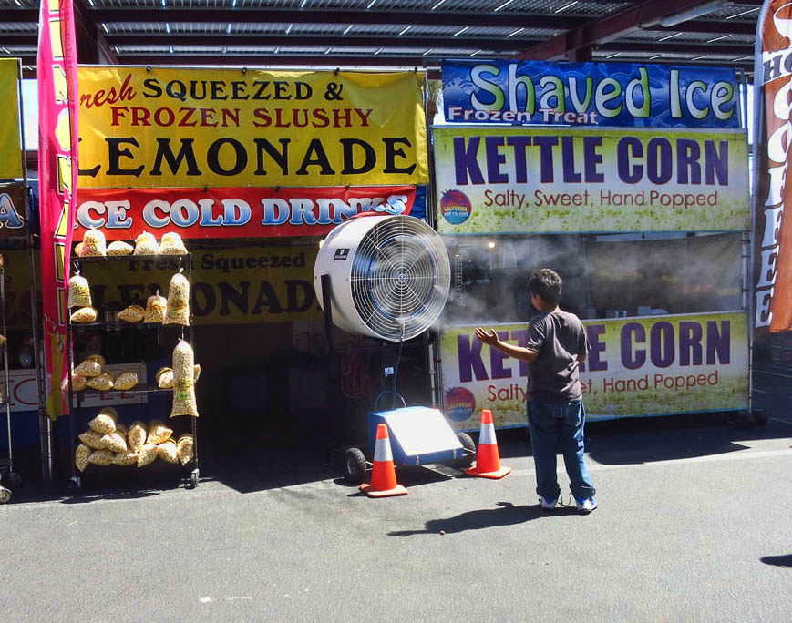
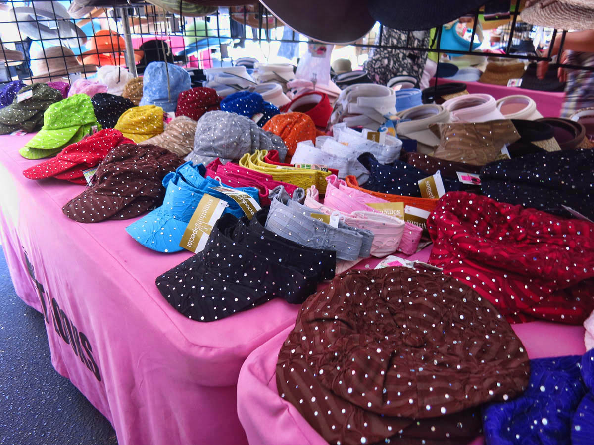
Finding a cool spot in the Saturday Street Fair is not easy, but it can be done!
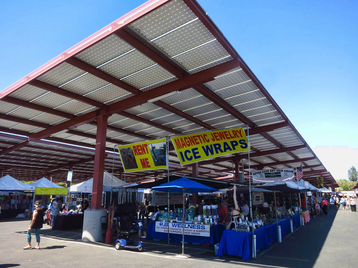
Check out the roof of solar panels overhead.
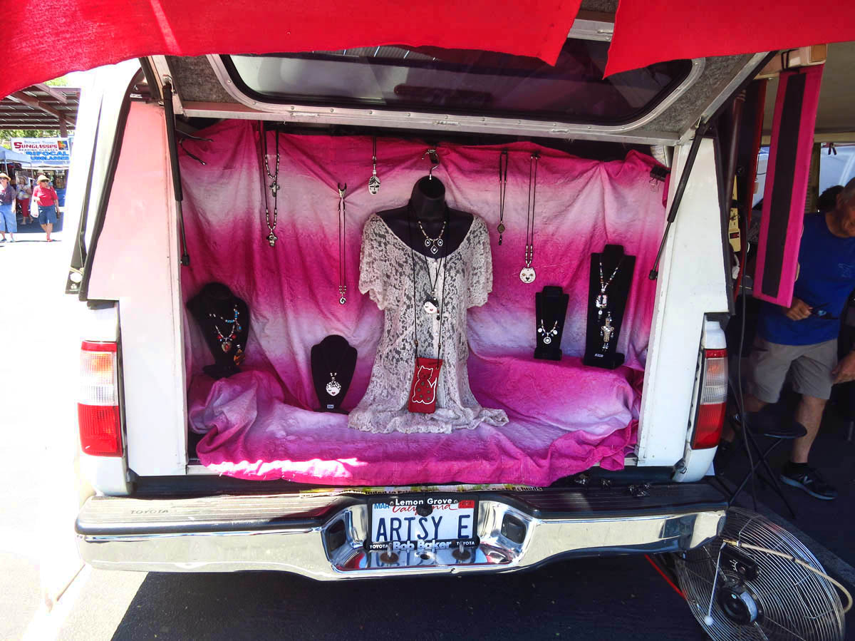
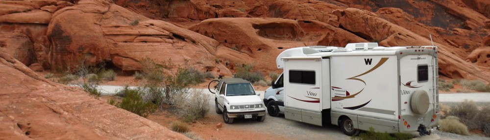
Best use of SUV hatch back yet!
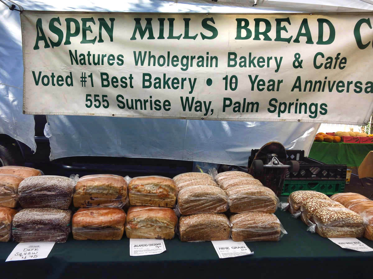
Gayle tipped me off to the Carrot Raisin Walnut bread. YUM!
I do some research to see what hiking opportunities might there be two and a half miles up the “Tallest Tram in the World,” and I learn that not only is there hiking, but there are over 50 miles of trails up there! I could hike all the way to nearby Idyllwild! With a little advance planning, I could have even met Jim and Gayle, now in nearby Jojoba Hills, for lunch. But there is also one little factor that will determine how far I can go….SNOW??
I get an early start. It’s so hot back down in Desert Hot Springs that I plan to spend the greatest part of the day at the top in the cool mountain air. Even if I can’t go any further than the Nature Walk, I’ll hang out during the heat of the day in “The Lookout Lounge.”
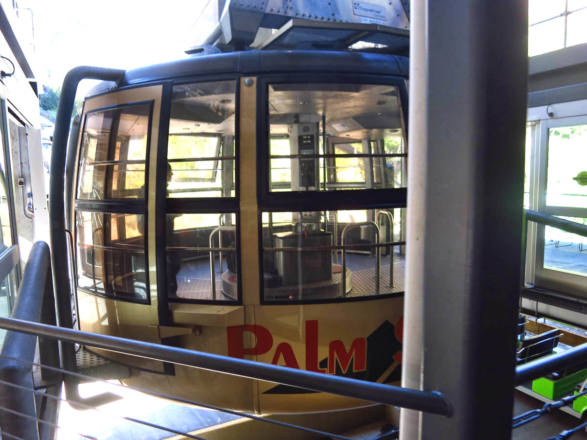
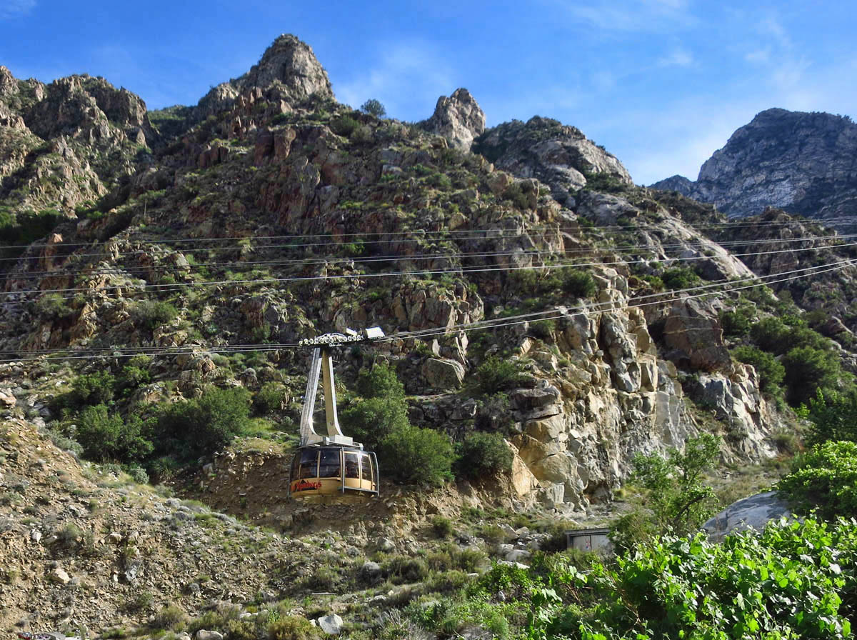
Palm Springs Aerial Tramway
Tram will ascend 2.5 miles in only 10 minutes.
Only two cars on the tramway alternate routes.
But I soon find out it’s going to be an expensive escape! The $25 tram ticket to the top, I can justify. It’s a pricey piece of construction, obviously. But it’s the additional $5 price gouge to park in a lot in the middle of nowhere that really irks me. Good thing I have just driven 4 miles up a steep “turn-off-your-air-conditioner-to-avoid-overheating” hill to get here, otherwise, I might have turned around in protest.
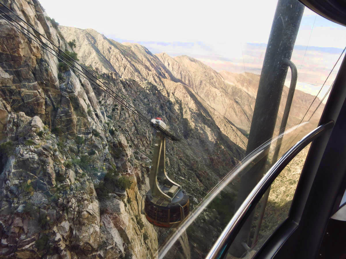
The tram will take just 10 minutes to travel two and a half miles, starting at an elevation of 2,643 feet, ending at the Mountain Station, elevation 8,516 feet. I race to be in the best position possible, alongside an open window facing back down the hill so I can get some good photos on the ride up, only to learn that it is a rotating car! Riding in one of two opposing cable cars, we will make a 360 degree rotation up the mountain. Albeit impressive, it’s also a bit disorienting as my feet move while the hand rail is stationary. I have ridden many trams, but never one that rotates!
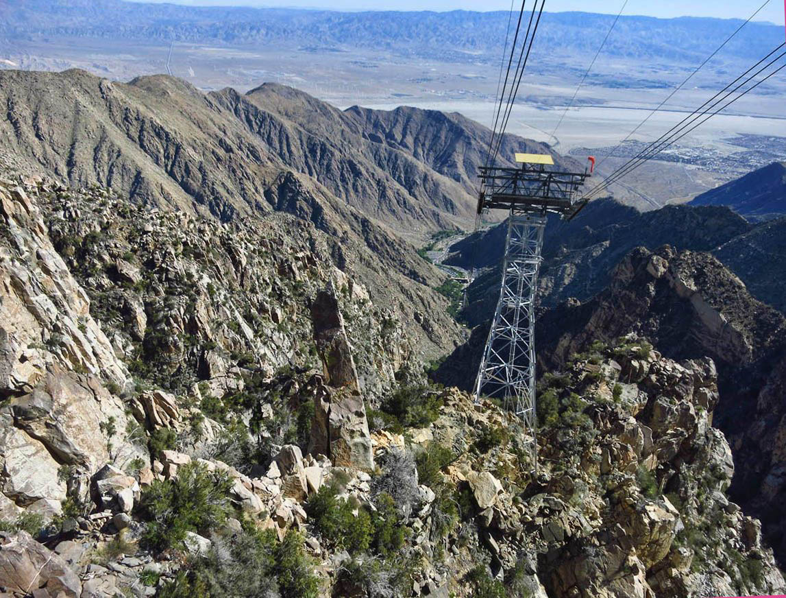
The yellow platform with red windsock is helicopter pad.
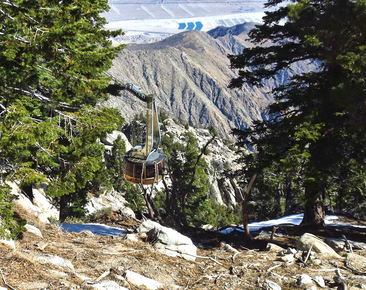
Look through the trees to see the tram car on approach.
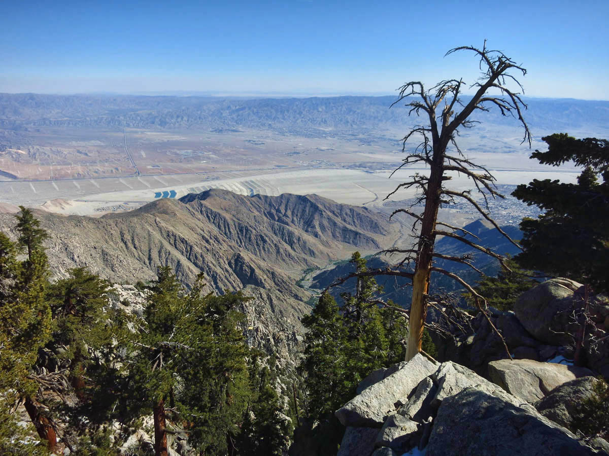
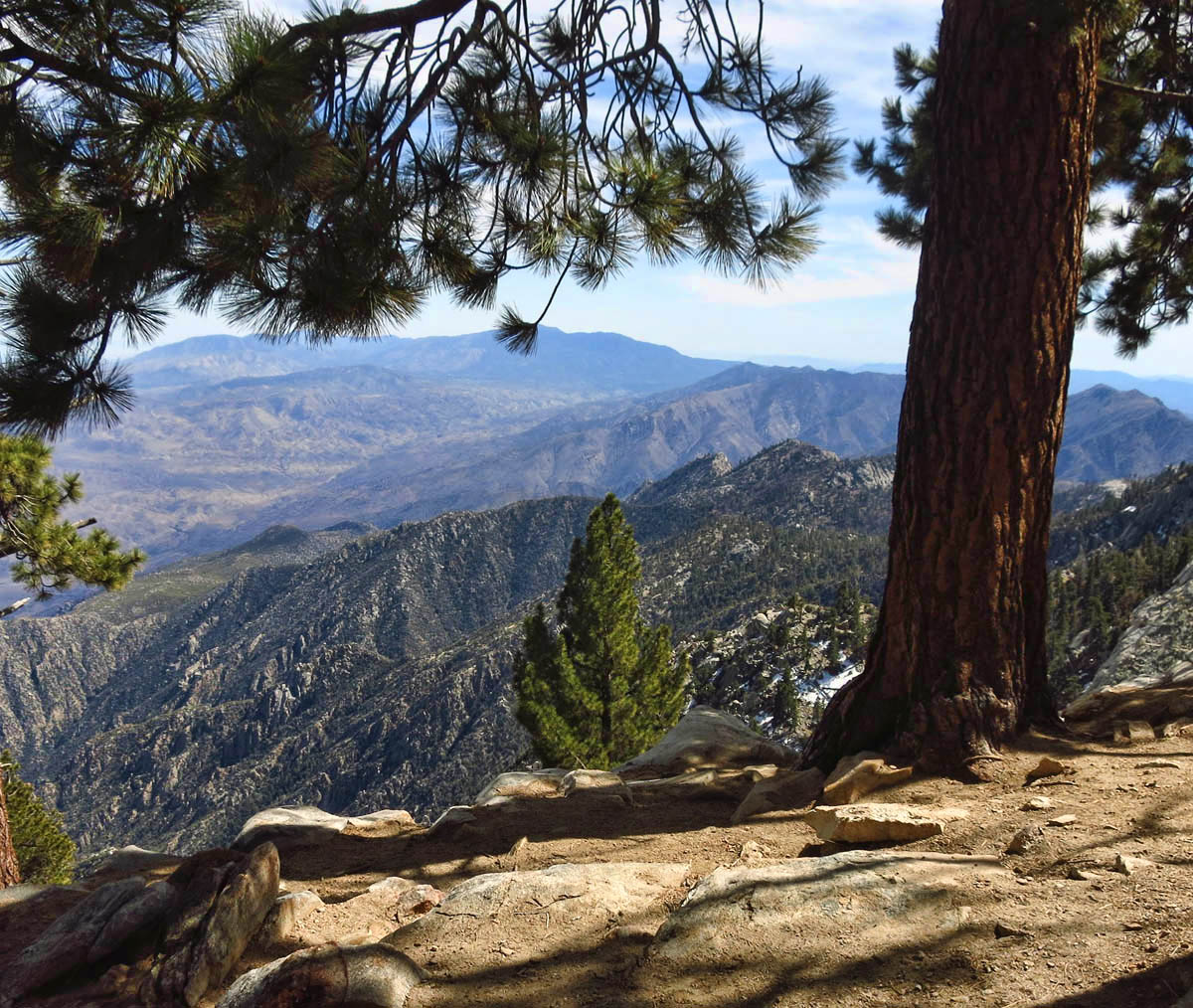
View from Mountain Station, elevation 8,516 ft.
It’s a brisk 45 degrees when I arrive at the top, and though I was looking forward to some cooler air, I am not sure I expected this big of a drop. Thankfully, I’ve extra layers in my pack.
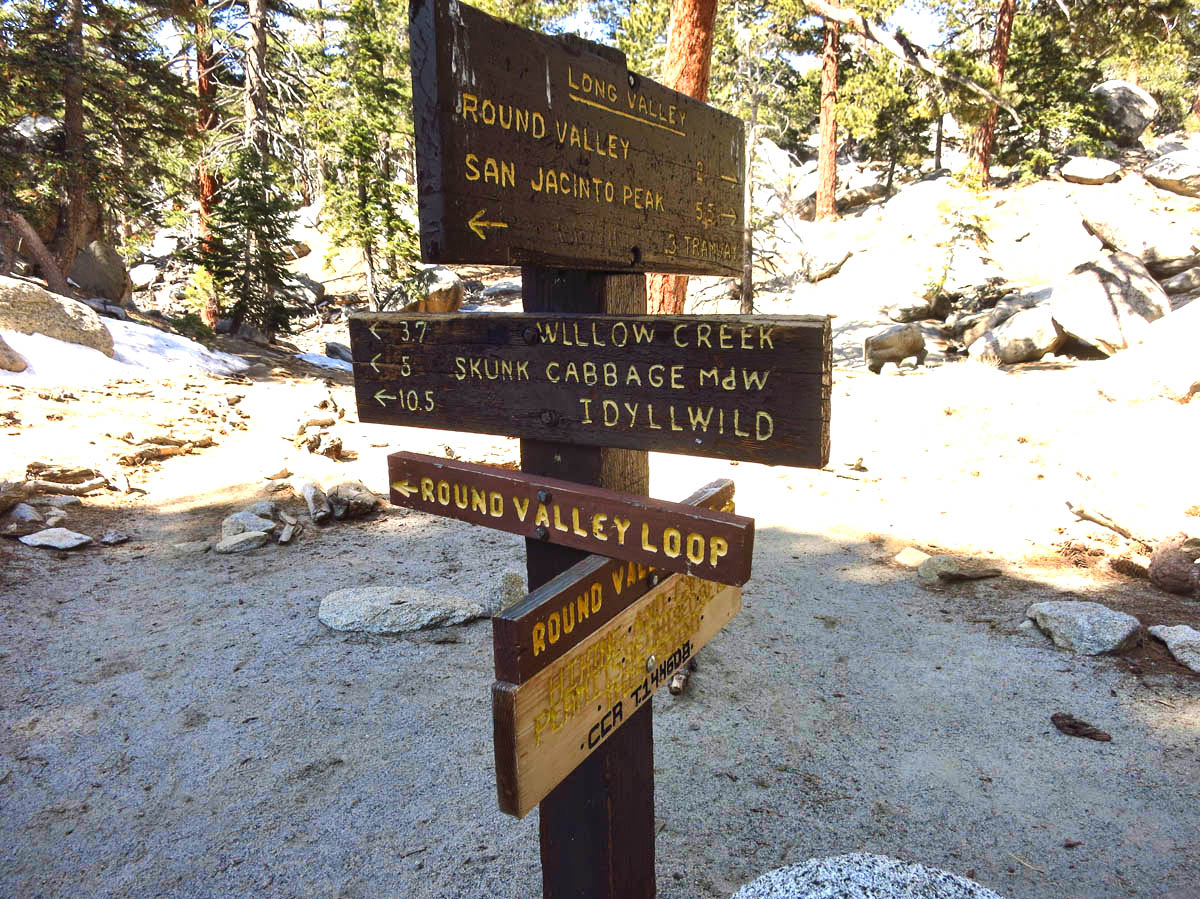
Even though it is only 9:30am on a Sunday, already the top of the mountain is beginning to get crowded with foreign tourists. I head first for the exhibits, as I know the crowds are only going to get worse throughout the day. Once I have satisfied my curiosity by touring the Mountain Station facilities and the overlooks, I head down Long Valley to the Ranger Station in Mt. San Jacinto State Park. In order to go beyond the Nature Trail, one must obtain a Wilderness Permit from the Ranger Station. There is no fee for the permit.
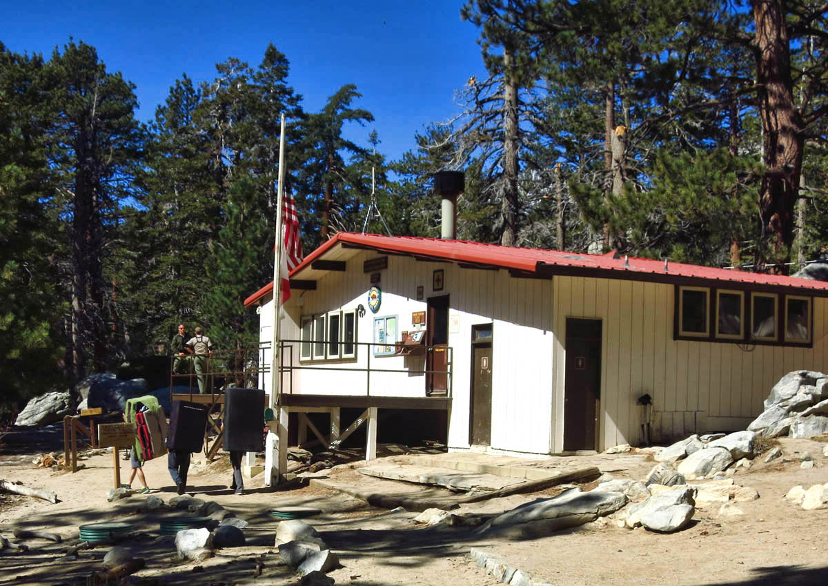
Ranger Station in Long Valley near tram. Large packs on climbers backs are “crash pads.”
I ask the Ranger about trail conditions, and he cautions me that the 5 mile loop trail I hoped to do is covered in snow.
“Since you don’t have micro-spikes or crampons, you might be better off to stick to the 1.5 mile Nature Trail.”
“I had really hoped to complete the loop to Round Valley and back via Willow Creek.”
(Looking condescendingly at my bare legs) “There’s some deep snow up there.”
“I hiked the Mendenhall Glacier in shorts.”
“You are gonna need to cross a stream that’s ankle deep. You’ll get your shoes wet.”
“That’s okay, they’re Goretex.”
“It’s a much more challenging trail now due to the snow we had last week.”
“I’ll go until I reach the boundary of my comfort zone, then I’ll turn around.”
“You’ve got all the essentials?” (pointing to a board that details out the 10 Essentials)
“All that…aaannnd a space blanket!”
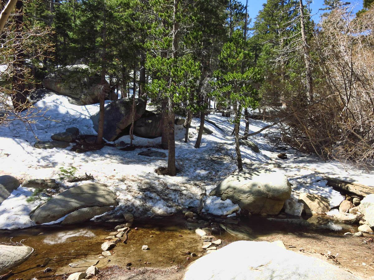
This is the stream crossing where the Ranger said my feet would get wet. umm….no.

Outhouses near Round Valley.
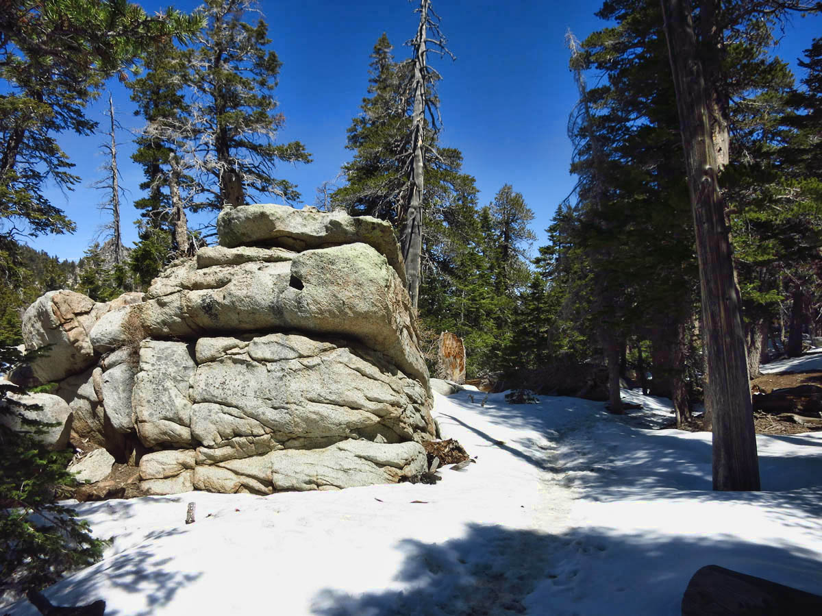
Wilderness Permit now obtained, I head out into the “wilderness” (100 yards from the Mountain Station) where I am delighted to see there is no one on the trails. Right away, I encounter snow, but it is hard packed and easy going for a while. But then, I reach an area where it gets icy, and my boots begin to slip a bit. To complicate matters, it is a pretty steep slope down a ravine leading to the stream. I consider turning back, but stop and think about the throngs of tourists behind me. Where I stand now atop the muffled snow, all I can hear is the running stream below me, while just a few feet back are crying babies, screaming kids, and Asian and Indian (Read my stereotype “LOUD”) dialects. Instead I decide to just take it slow, inching my way along, while cursing my decision to only bring one hiking pole!
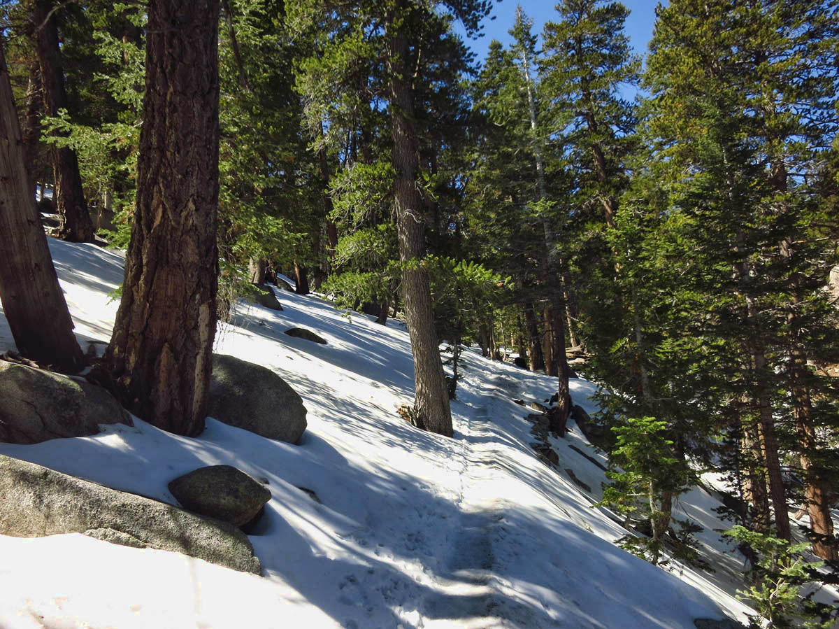
Trail gets a bit icy and dicey here…

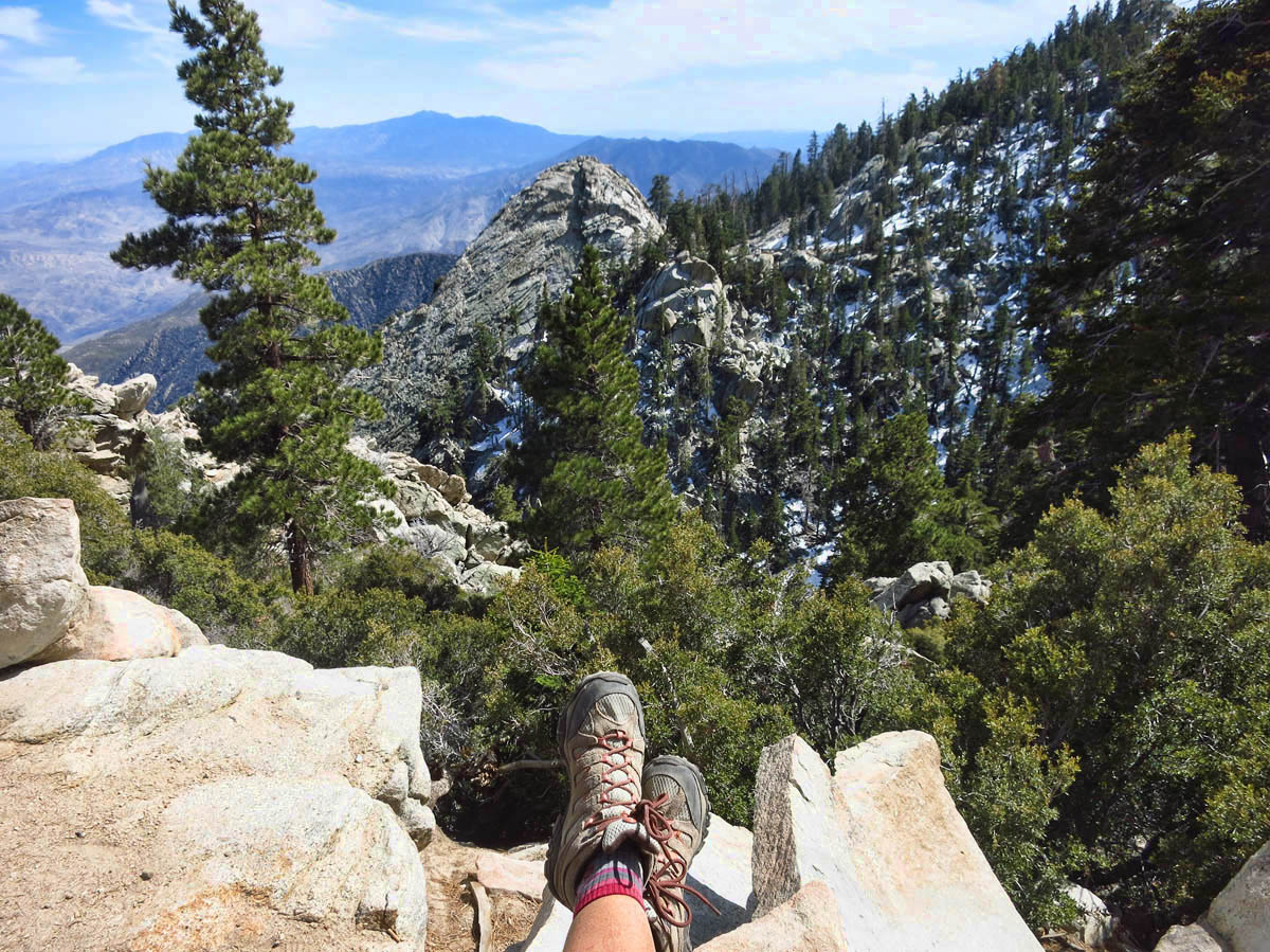
Elev 9,100 ft. I can’t believe Saddle Junction, where Jim, Gayle and I hiked from Idyllwild last year is only 4.3 miles!
Standing in the middle of the “ice field,” I can’t see terra firma ahead of me or behind me. Up ahead a “trail angel” approaches, a micro-spike-wearing State Park volunteer. “Where ya headed?” I tell him I had hoped to do the loop to Round Valley and back via Willow Creek, but am considering whether I should turn around. “You’re halfway through the worst of it. If you’d planned to make the loop, you may as well keep going. Willow Creek gets more sun, so you should be fine on the return.” So after a nice chat about the merits of micro-spikes, I press on.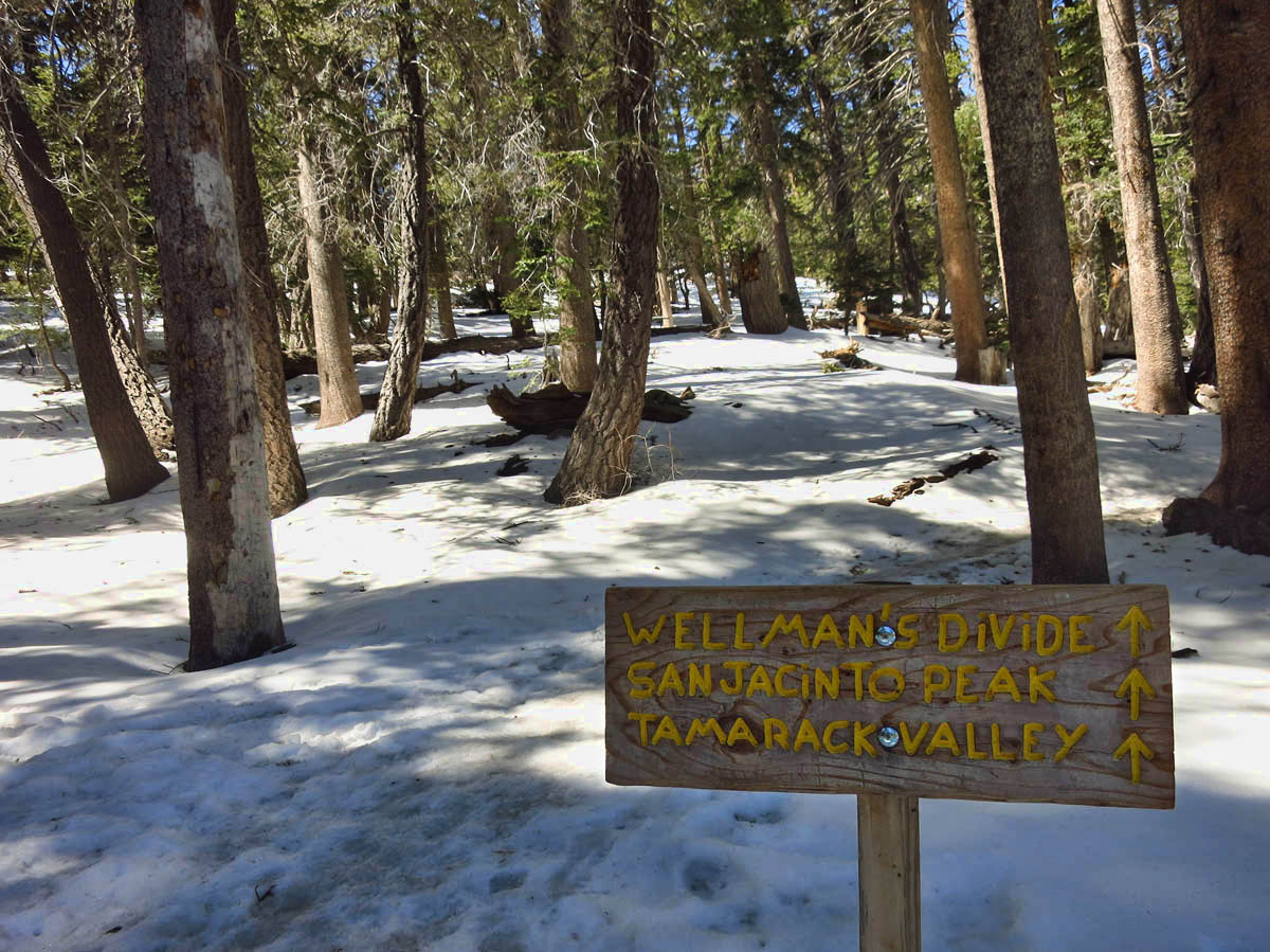
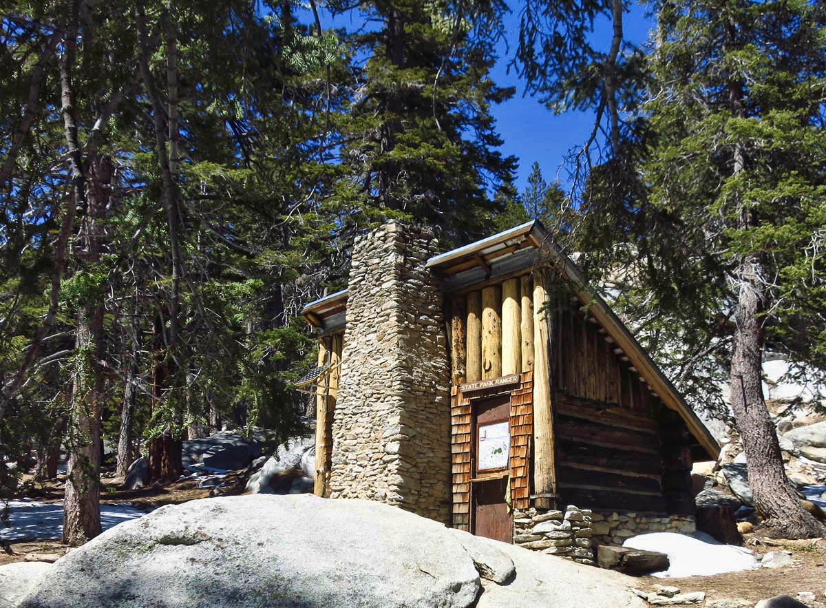
Seasonal Ranger Station
Once I see the “outhouses,” I know I am only a half a mile from the Seasonal Ranger Station in Round Valley, my planned lunch stop. I have the area all to myself, so I find a big, flat boulder in the sun. It’s a glorious day and the weather is nothing short of perfect. By now, it must be approaching the mid-sixties in the sun. As I stretch out and enjoy my lunch, I ponder how this hike has stimulated all five senses. The sights are spectacular. The sound of nothing more than birdsong and my own breath muffled by the snow. The vanilla and butterscotch mixed with evergreen scents of the tall Ponderosa Pines. The feel of the cold snow beneath my boot soles. And the taste of my peanut butter and banana sandwich on carrot, raisin and walnut bread from the Aspen Mills Bakery….all while pondering the crowds just 2.5 miles of snow-crusted trail behind me.
Aerial Tram: Twenty-five dollars
Parking Fee: Five dollars
Solitude in the cool, crisp mountain air? PRICELESS!
For Pam…
Suzanne – that’s a great hike I’ve only done with the throngs in the summer. Glad you took us along on a more peaceful loop. Great ‘Lunch-With-A-View’ with the sun and snow.
What a spot to experience the cool air and heated rock and the tranquility. Thanks for sharing the photos, too.
The tram is like I experienced in South Africa for the ride up to Table Mt. But no snow, which you know would probably stop me. I admire your tenacity. Great peaceful view.
Thanks for reminding me I want to look for a recipe for that carrot raisin walnut bread. It was so good!
You were more prepared than we were when we took the tram. Sneakers, no hiking poles, and no jackets. We didn’t get very far in the snow. Nice that you were able to complete the loop!
What a gorgeous hike! Glad you didn’t let the first ranger dissuade you. Do you have a pair of Yaktrax? Those things are amazing. But who would ever think you would need them when you start off your day at 96 degrees?? Next time we’re in Palm Springs we really need to experience the tram. I wasn’t sure if it was worth the ticket price, but from reading your post and seeing your photos, you’ve changed my mind. 🙂
I had no idea there was that much elevation so close to Palm Springs, or that there is a tram going up there. Looks like a great spot and I’m glad to know that you are now packing a space blanket along with the other essentials!
I love the hikes up there. Solitude just a few hundred feet from the tram. Glad you made the whole loop! If you’re staying at Sam’s check out Flag Mountain right from the RV park. Great hike, few people and lovely views. I’ve got GPS info on the blog.
Nina
Love your lunch with a view photo!! We did that same hike when we were in Desert Hot Springs in the fall. We had snow most of the way to Round Valley (not as much as you had) but it wasn’t too bad with TWO poles:) I was glad we weren’t coming back that way. There was a lot of ice. I was surprised to find no snow on our way back. It was 36 when we got off the tram, but the hiking temps were perfect. And you are right…it was nice and quiet and we were alone:)
Good for you to be well enough prepared to continue on. What are the “essentials” that you wisely had? In the midst of 96 degrees I would pay $25 for cool, quiet,solitude and beauty. But $5 to park? Really does seem ridiculous. Great pictures! Sure hope 90’s isn’t there to stay.
Hi, Sherry — The “Ten Essentials” are; 1.) Navigation (map and compass) 2.) Sun protection (sunglasses and sunscreen) 3.) Insulation (extra clothing) 4.) Illumination (headlamp/flashlight) 5.) First-aid supplies 6.) Fire (waterproof matches/lighter/candles) 7.) Repair kit and tools 8.) Nutrition (extra food) 9.) Hydration (extra water) 10.) Emergency shelter
They actually had a little diorama of these essentials on a poster in the Ranger Station, using GI Joe’s clothes to illustrate #3. 😉
That hike sounds incredible. I absolutely love being high up in the mountains and hearing nothing but the wind going through the pines. To me, there is no sounds more peaceful and relaxing. The tram would be great as well but I think I could do without the rotating.
I’ve hiked San Jacinto many times and that $5 parking fee is new. If you are ever in the area in the fall the 11 RT hike to the top is worth it. It is the easiest 10,000 ft peak bag you’ll ever find (without driving).
We saw the Psychedelic Furs (for free, outdoors!) at Palm Springs Gay Pride festival last year…fun!
Those out houses look interesting. Your last picture, signing off with your boots in the shot, is a good one.
Now that is the way to hike a mountain, tram up and walk down. I usually used to get it backwards. I loved that bread stand. Makes me want to drive to my favorite bread store this weekend in the Berkshires and load up on carbs.
Good to see that you are back to having fun.
peace,
Deede and Allen
I love Palm Springs! Only been once, but loved the warm days, cool nights and the “Rat Pack” vibe. I want to know why you considered Idyllwild and not Skunk Cabbage?!
Also in 2 of your pix, one of the tram, there are blue arrows pointing to the right on the side of the mountain; what in the heck is that??
In all the comments, in all the blogs, in all the internet, and she walks into mine. Hiya, Cuz! I didn’t hike Skunk Cabbage because I get enough of skunks down on the family farm. 😉
I believe those blue arrows are actually solar panels in a very large solar array. Gotta love California! Thanks for checking in! xxx
Glad you decided to persevere as the views look spectacular. We are planning to do some hiking there in the next couple of weeks.