
So what if the mountains are calling but you can’t see them? Would you still go?
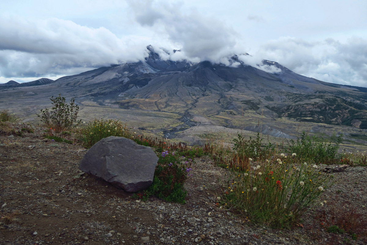
That’s the question I asked myself sitting in the dry camping spot, 50 miles down a lone road from the Johnston Ridge Observatory overlooking the socked-in gray wall of clouds that lie between me and Mt St Helens. “If I can’t see the volcano, is it worth the 100 mile drive?”
I had big plans for this summer, not the least of which was a permit to climb the volcano on the 18th August. It’s a “difficult” rated hike, ten miles round trip with a 4,800 elevation gain. But after my Half Dome Conquest in June, I was feeling confident that I could make at least an attempt at the summit given an early enough start. So permit secured, I researched parking options to get me as close to the trail head as possible.
But then the foot thing happened. It’s as if my body rebelled, telling my mind “We’ll show you who’s boss!” Or if you believe like I do that the mind is more powerful than the body, maybe I had just a twinge of self-doubt. Regardless, the permit period came and went without my goal attained. I did learn one valuable bit of info. There’s a great site out there called purmit.com where Cascades permits can be bought and sold at face value when the allotment is up through the official channels.
So back to the crossroads in the drizzling, foggy, Washington Weather. Do I continue another 50 miles on down State Highway 504, knowing the best I can hope for is a Ranger presentation? Or do I turn north on Highway 505 and continue toward my next destination leaving Mount St Helens on the list to be crossed off at another time? I am literally “at the crossroads.”
When one has a career in the Travel Industry, that career is punctuated by news stories. Employees trade tales of natural disasters like fishermen share stories of the one that got away. “I still remember where I was the day US Air went into the Hudson….I located my passenger even before US Air did!” “I was the first to get the call on the stormy afternoon when Delta 191 went down…I knew even before the teletype came through.” It’s all hands on deck trying to assess what clients might be in the area, whether they be business travelers enroute over the ash cloud, or vacationers staying in the nearby Lodge. It’s easy to recall “Where were you when…?”
On the morning Mt St Helens erupted, I was sleeping. I worked the night shift in Braniff Reservations. I remember waking up to the news on the FM radio and thinking “OH CRAP! MANDATORY OVERTIME” as flights in and out of Seattle cancelled. A few months later, I took a “fam” trip to Seattle with some co-workers hosted by the Seattle Board of Tourism to boost tourism in the area. But the closest I got to Mt St Helens was the souvenir beige pottery coffee mug I bought made from the ash of the volcano.
So yes, Mr. Muir. The mountains are calling. And view or no view, I too must go…
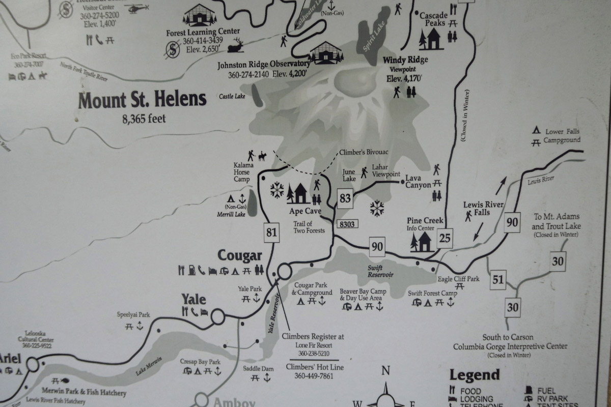
The mountain can be approached from the south or the west. The south route near Cougar Campground is the climbing route, while the observatory is accessed via the western approach.
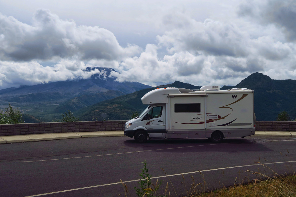
Cloud cover could go either way at this point. I hurry along…
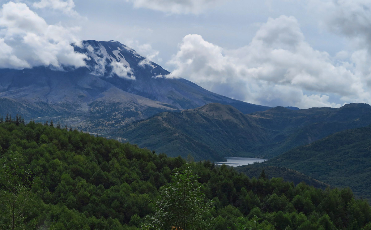
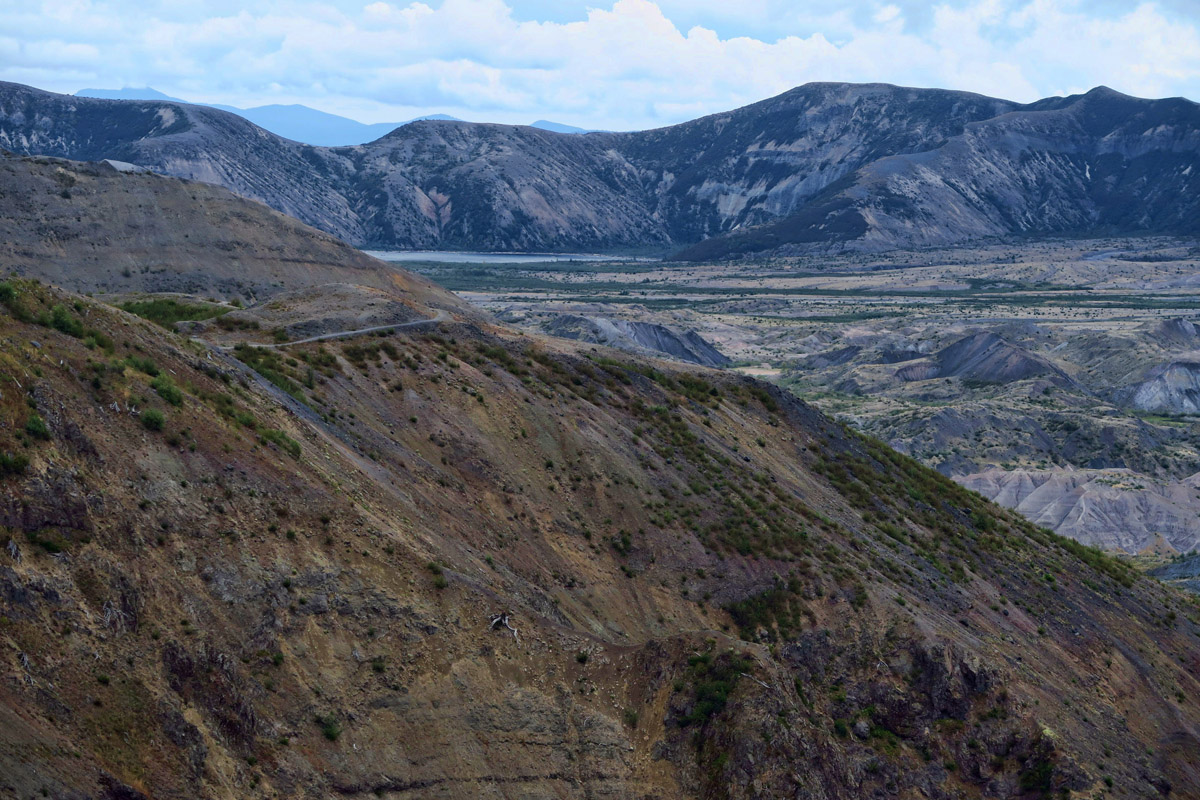
Coldwater Lake in the distance on the right.
Don has moved east for a while to visit an old friend he met in Honduras on his drive down through Central America. Bob now has an organic farm near Bend, OR, and in addition to visiting, Don will also use his garage and tools to install his solar panels.
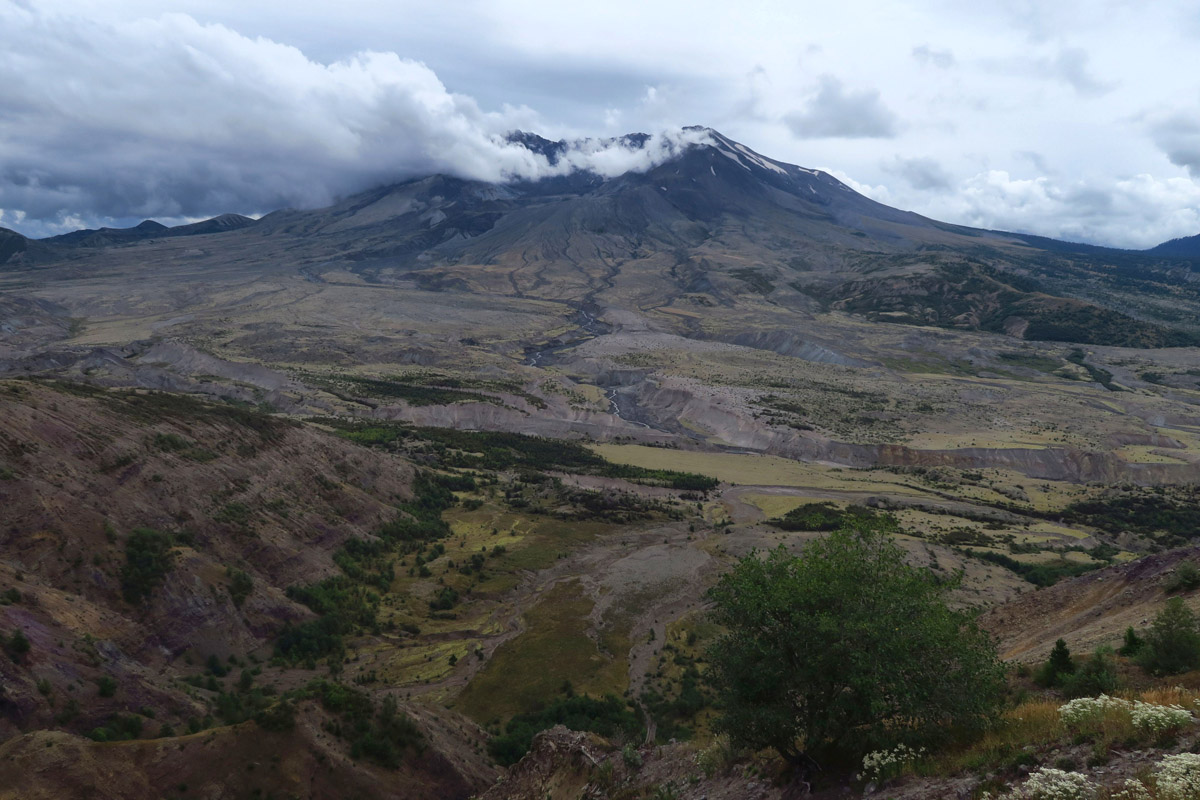
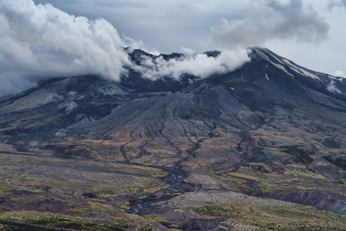
Meanwhile, I am now an “off duty tour guide,” free to meander on my own toward the Olympic Peninsula. So I decide to take a detour and drive down the road toward the mountain. The newly built highway, State Route 504, or “Spirit Lake Memorial Highway” through the Toutle River Valley is worth the drive alone in spite of the low hanging clouds. The frequent turnouts with overlooks of the valley and Elk viewing areas makes for a very scenic drive.
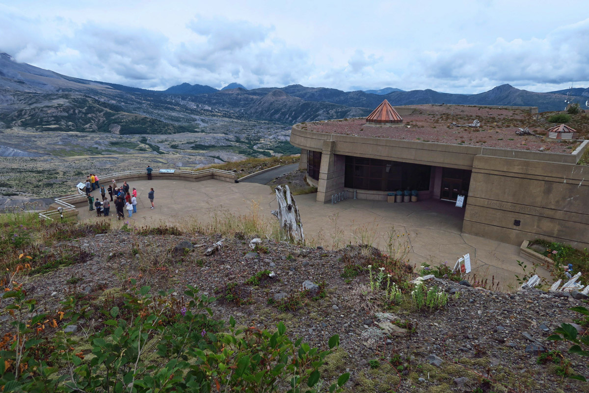
Johnston Ridge Observatory, built 1997 has great exhibits, movies, and hiking trails.

Inside the Observatory is a diorama of the eruption with tiny color-coded fiber optic lights that show the spread of the debris.
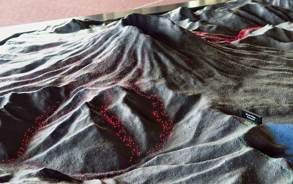
The red lights indicate streams of liquid hot magma.
On May 18th, 1980 at 8:32am, a 5.1 earthquake occurred causing the already compromised north face, weakened and bulging from the building gasses, to slide away. The blast that followed destroyed more than 30 miles of the original highway leading to the mountain when 60 to 600 ft of debris filled the Toutle River Valley, burying the old highway. The eruption blew down more than 230 sq miles of forest in three minutes, burying 14 miles of the Toutle River and its tributaries.
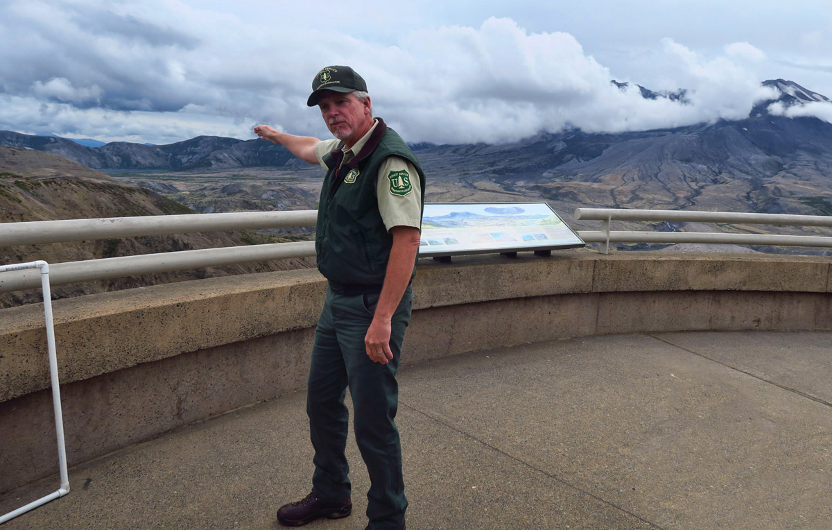
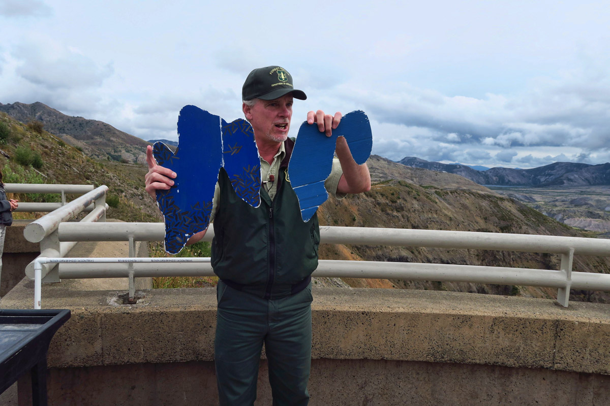
The best thing about the entire visit was USFS Ranger Todd’s excellent, animated talk.
Here, he demonstrates how the eruption changed the size, shape, and depth of nearby Spirit Lake.
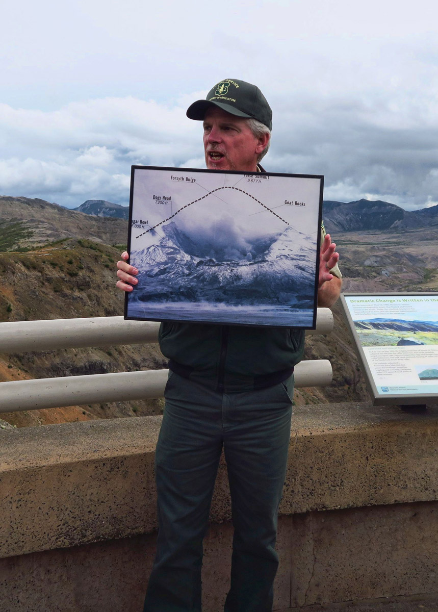
This photo shows original size and shape of the mountain overlaying the new profile.
The new State Highway 504 was positioned further up the hillside to avoid future debris flow. Steps were taken to minimize impact on environment, such as placing utilities underground and bridging over as opposed to crossing through wetlands. The road has many RV friendly turnouts and viewpoints, particularly once you enter the “blast zone.”
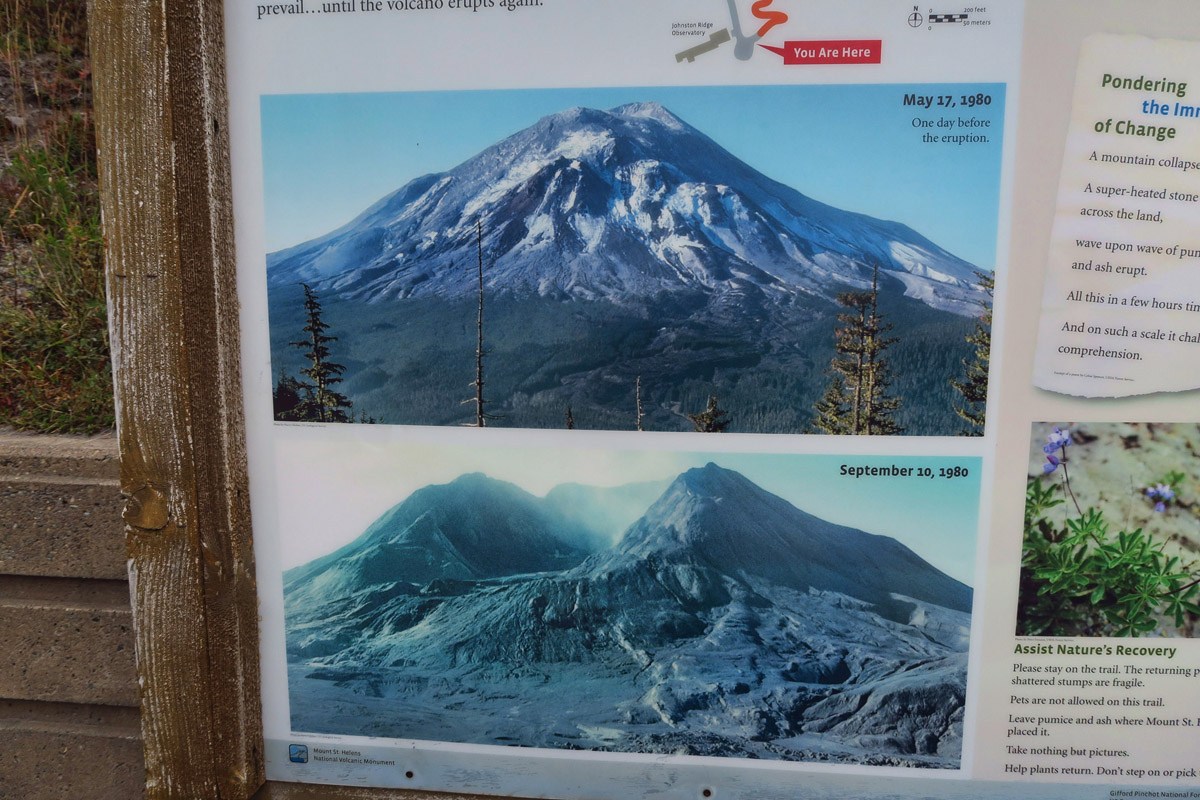
Before and After photos on display inside the observatory.
Everyone loves a good set of stats that “blow you away,” and there is no finer assembly than those that followed when the north face of Mt St Helens crumbed. The lateral blast traveled 300 mph. It caused the surface of nearby Spirit Lake to raise 200 feet and doubled the surface area. The eruption column reached 80,000 ft and dropped enough ash to cover a football field-size column of ash 150 miles high.
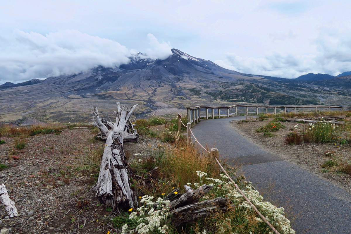
Several hiking trails leave from the observatory, offering great views of the crater.

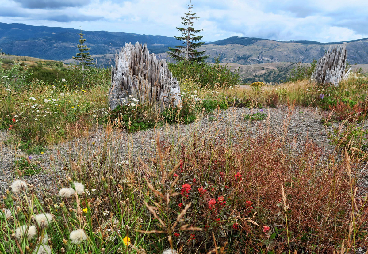
Many stumps from the 100 ft tall trees remain.

Carnage was record-breaking as the blast lobbed 1,314 feet off the top, killing 57 people in its wake, one of those being David A Johnston, volcanologist for whom the observatory is named. David was camped out at an observation post 6 miles away when the volcano blew. His last words were, “Vancouver! Vancouver! This is it!” His remains were never found. An estimated 7,000 deer, elk, and bears also perished.
But of all the facts, figures and trivia found in the Johnston Ridge Observatory, nothing amazes me more than the element of sound….there was none that day, at least not for those who were within 50 miles of the blast. The hole where the vertical eruption occurred was small, directing sound waves upward, and debris in the cloud muffled the blast creating a “zone of silence” within 50 miles. Beyond this 50 mile zone where sound waves did not travel, the blast was heard 575 miles away.
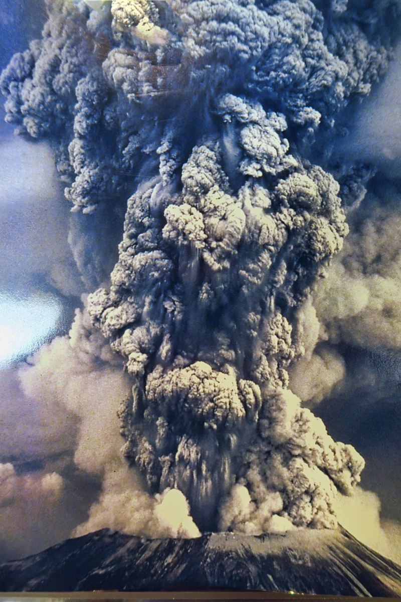
Poster of the eruption column on display in the Johnston Ridge Observatory.

Halfway to the Johnston Ridge Observatory, I stopped at the Forest Learning Center overlook for a view of elk grazing in the now fertile Toutle River Valley. The volunteer at the overlook advised “I think you had better go straight there. I don’t like the looks of those low lying clouds moving in.“ I did get a look at the mountain, albeit through the clouds. But in the case of Mt St Helens, seeing it is only temporary. Due to the size of the swarm of recent earthquakes and mounting dome within the crater, they estimate the volcano will likely blow again within our lifetime.
In high school we fished in Spirit Lake, that beautiful lake is now gone. I was up there both just before (vacation) and after (helping family) the eruption. You can still buy ceramics made from the ash, I might still have some ash in the garage … I took Fran up a couple years ago and there was a new vent forming a new dome inside the crater – pretty cool, hope the weather allowed you to image what detestation is brewing below.
But to answer the query – If ‘the mountains are calling’ … you ‘must go.
Wow, even after all this time I am just in awe of the power of that blast. I never heard about the no sound zone, that it very interesting.
I remember when the mountain blew and my relatives who lived up near Portland , Oregon collected jars of ash ! The ash went for miles and was very thick !! Pretty up there now !
I went many, many years ago but I’d love to go again. Your story really brought that day to life.
Nina
Darn…I wanted to hike there again some day…sounds like it might be a little too risky!
The hike we took to Harry’s Ridge is one of my all time favorite hikes, especially during wildflower season. Darn that plantar fasciitis for keeping you from your goal!
I remember the eruption and how it affected our weather patterns with the coolest summer on record, with day after day of cloud-covered skies and above normal rainfall, which caused widespread crop failures. It certainly was monumental. Hope you get to do the hike.
I lived a severely sheltered life back in May 1980. I had heard about the volcano but being ignorant with little curiosity, I had no inkling of the consequences. Thank you for bringing it all in focus for me, finally after all these years.
Ah, memories. We visited there in 1997 one month after the observatory had just opened. There were some amazing stories and sites to see. The 2nd day we went through Ape Cave, which was supposed to be the longest known lava tube. I remember the kids walking through “lava logs” on the Trail of Two Forests.
thanks for taking us along~ wonderful photos~
Thanks for the great photos and all the information. As many times as I’ve traveled by there, never stopped to look. I keep adding to my bucket list from your posts, this goes right on it.
My vivid memory of that day: sitting at my friends’ Ginnilyn & Rick’s in Winslow on Bainbridge Island, just sitting down with our Sunday morning coffee…then hearing bits and pieces through the day and the days after…I couldn’t grasp the enormity of it then. And now to hear they anticipate it blowing again within our lifetimes, wow.
Happy travels in the Olympics! Hope the weather clears (cleared?) for you.
My father managed a cannery in Yakima WA when Mt St Helens erupted. The ash fell on Yakima so they canned and labeled some souvenir ash. Still have some.
We visited the area on a motorcycle trip many years ago. What a spectacular way to see it. The day we drove up, half of the mountain had low clouds so we didn’t get a full view of the inside. We learned at the VC how few days she actually shows her entire self. But our visit was great and seeing Spirit Lake with the debris still there was amazing. But…on our last day (we always rented a car on our first and last day to see the city) with our rental car all ready, the sky was brilliant blue with not a cloud insight. We decided to make the three hour drive one way to see Mt St Helens in all her glory. Boy was the drive worth it!! Being able to see the center and watch the steam still coming out was wonderful. There was quite a dome in the middle that had rebuilt itself. We then heard on the news months later that there was a minor eruption and the photos showed the new dome gone. What a neat VC! You had a decent view. Thanks for sharing all the interesting facts with everyone. Sure hope your foot heals up real soon. Sorry you missed your hike.
Too bad about not being able to do that hike. You would have made it no problem!
We had a gorgeous, clear day when we visited Mt. St. Helens but I like the clouds in your photos. Looks like the mountain is trying to suck them in.
You met my first Rangering boss, Todd, from my stint at St Helens. He taught me much. And obviously you too. I climbed the mountain way back when and it’s really not that difficult. Except for the last bit of pumice was like walking on marbles. So glad you made the trip. The low clouds add to the drama of the place.
Gaelyn, I knew Ranger Todd seemed special for some reason…now I know! Love that story! Sadly for all the future visitors to Johnston Ridge Observatory, after almost 30 years, Ranger Todd is leaving…headed for Bryce Canyon. Maybe you will see him there!
We weren’t able to see the entire mountain during our visit either. Really enjoyed the VC presentations. We are feeling the same way about the mountains as it has been raining in Chamonix the past couple of days. We plan to take the tram up into the mountains tomorrow and take a hike, regardless of whether the mountain shows herself.