I had never heard of Chiricahua National Monument prior to reading about it on my hiking buddy Mark’s blog back in 2015. I couldn’t even spell it, let alone pronounce it or find it on a map, but one look at those gorgeous canyons full of towering columns, and I quickly added it to my wish list.. Then one by one, my favorite bloggers all posted their own account of hiking “the big loop,” causing my anticipation and determination to visit this otherworldly place to heighten.

The quiet, intimate Bonita Canyon Campground, only 25 sites.
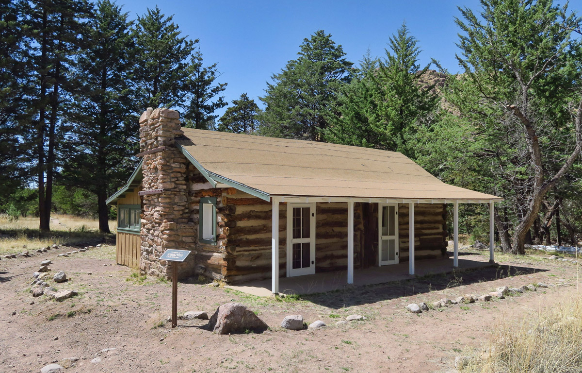
The Stafford Cabin, a 110-year-old log and frame homestead cabin on the grounds of Chiricahua National Monument.
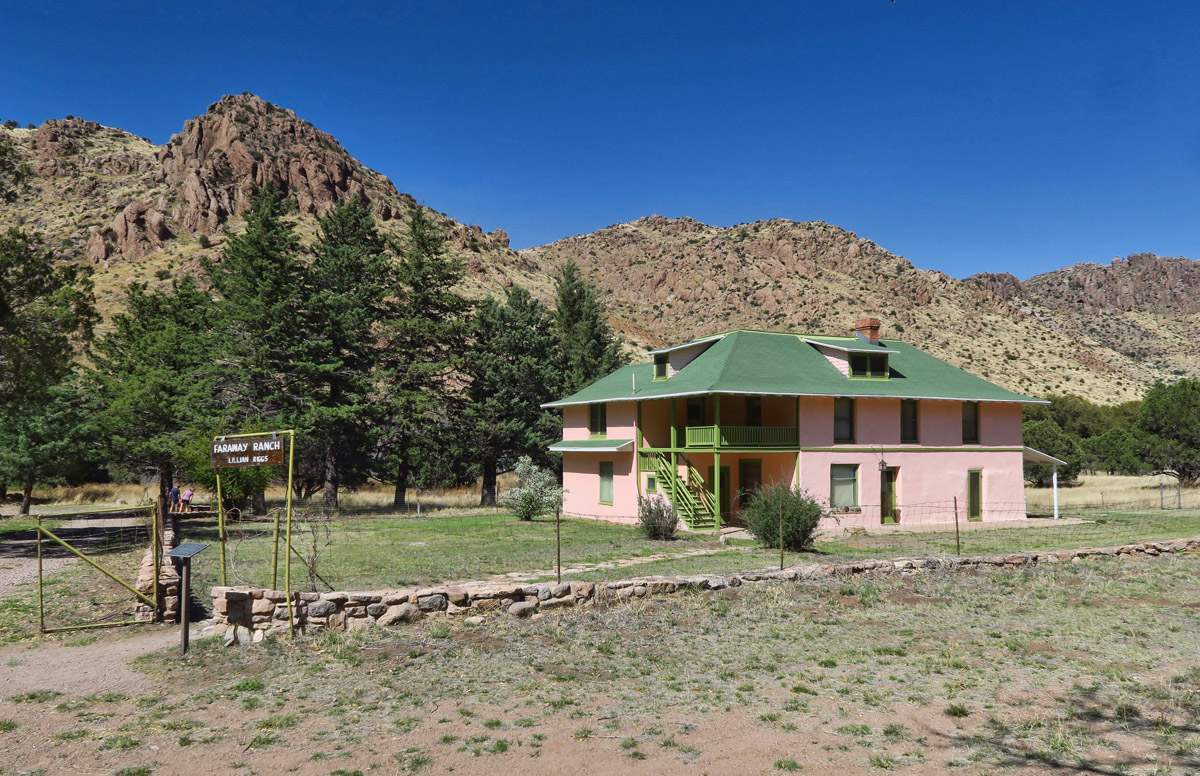
Faraway Ranch was at first a homestead in the late 1800’s, but became a guest ranch in 1917.

Ranger tours offered twice daily inside Faraway Ranch, where most furnishings are original.
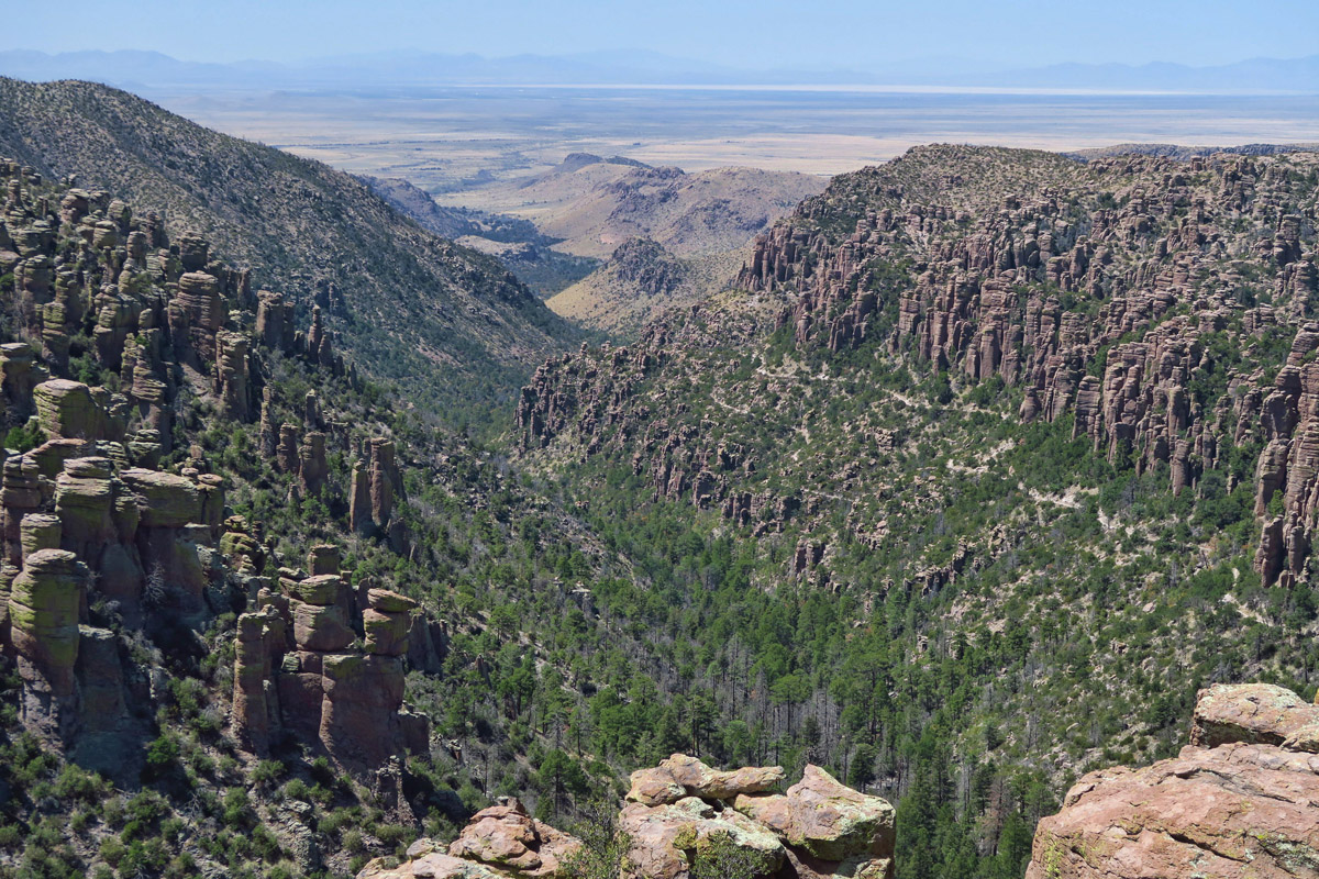
But visiting Chiricahua National Monument is not easy. Located in far southeast Arizona just 60 miles from the Mexico border, remoteness is just one aspect that adds to Chiricahua’s charm. The nearest services (not even a roadside market) are back in Willcox, a 37 mile drive one way. This keeps the crowds down, as the only real attraction is the scenic drive and 17 miles of gorgeous hiking trails where the “crowds” are made up of rocks. Even though the campground was full during my stay, I rarely encountered more than a couple of people per hour while hiking.
Massai Point, top of the 8 mile scenic drive.

Although Chiricahua NM is known as a good place to see wildlife, including javelina and the coatimundi who migrated all the way from South America, this was my only “wildlife” sighting.
The little Bonita Canyon Campground is tight…tight on availability and tight on fit. There are only a few sites that will accommodate RVs, and none over 29 ft. I tried weeks in advance to get three consecutive nights in the same spot, then worried for the remaining weeks leading up to my visit that I would be able to fit. While reserve.gov does describe the sites by length, there is always the factor of overhanging tree limbs and crazy terrain requiring Lego-like construction to reach some semblance of being level. I got lucky and nabbed a site for 3 nights during their March-April peak season, that ideal window after the weather warms up, before the summer monsoons.
Mushroom Rock
It was a tight squeeze backing in. Between the big boulders marking the entry way, the curved driveway, and the large limb overhead, opposed by the drop-off on the opposite side of the pavement, it was a high anxiety challenge even though I had left the Tracker a half a mile back down at the Visitor Center. I rarely need to accept offers of help backing in, but when a kind passerby asked if he could help, I jumped at his offer with relief. I could not have done it without him, as the wrap-around fence and tree limbs hugged the Winnie on both sides, while the boulders behind stopped her from encroaching on the big “back yard.” By some fluke, I had enough sun on my front panel to keep my house batteries above the 90% range.
The campground was mostly filled with tenters, so I was glad I would not be “the campgrounds most hated,” running the generator during breakfast and Happy Hour. (That title belonged to the guy in the travel trailer who stored his generator in the amplifying, reverberating metal bed of his pick-up truck.) I only saw one other rig larger than mine in the campground. He was pulling a 28 ft fifth wheel. He actually drew an audience while trying to navigate the two deep dips in the campground road designed to accommodate runoff.
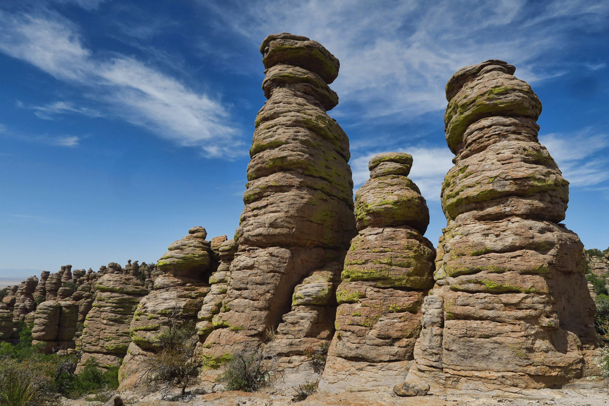
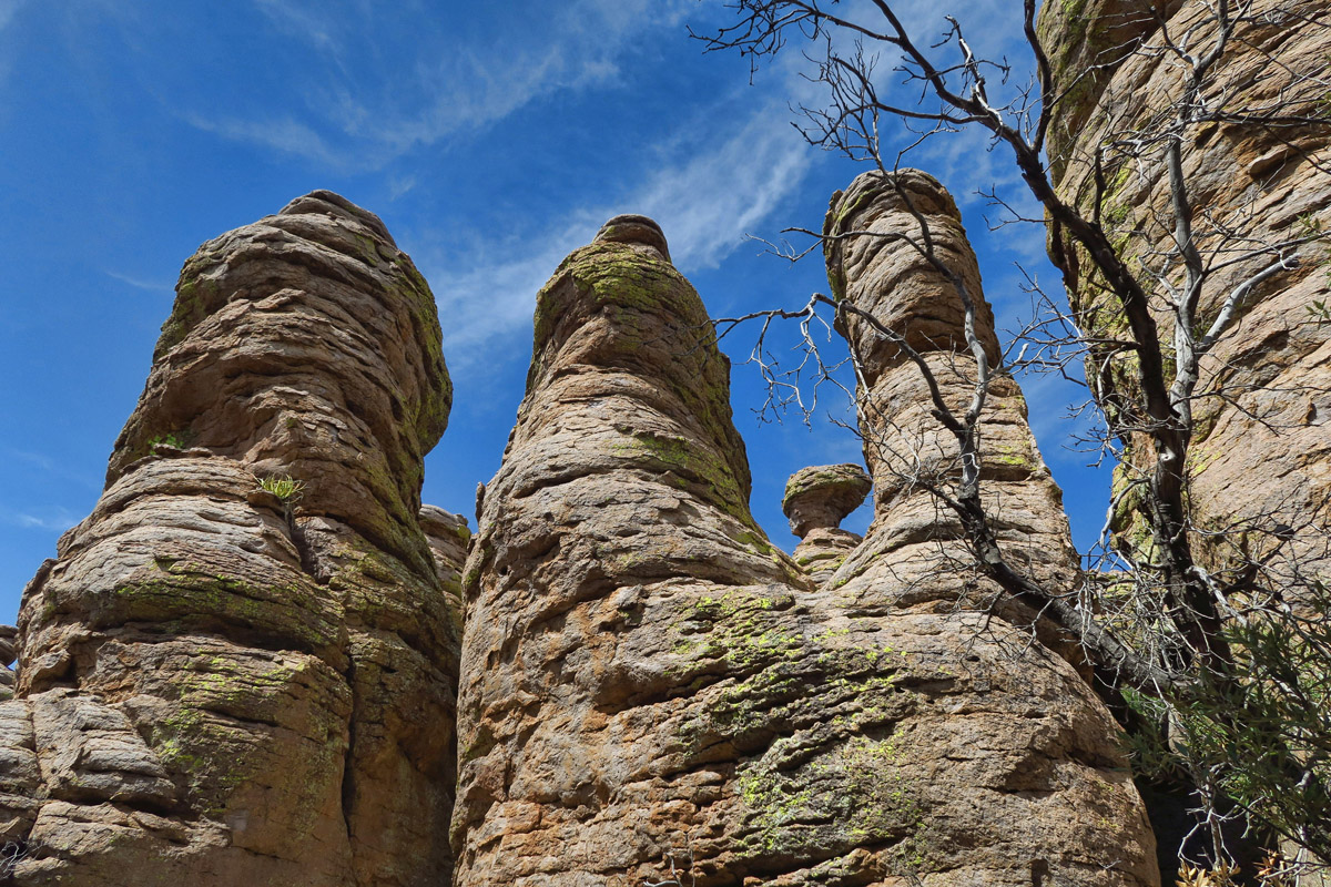
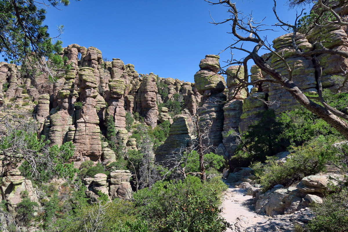
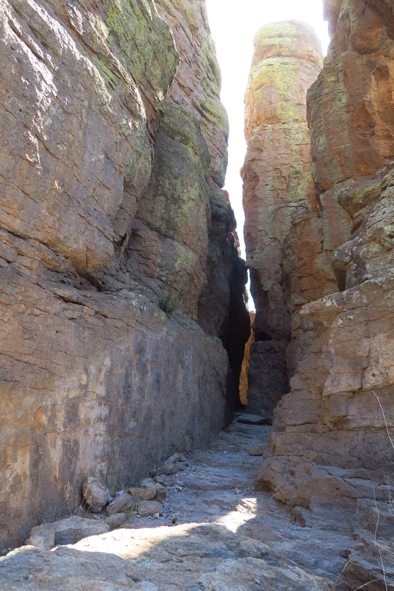
Echo Canyon Trail

This middle column is how I felt after doing the 9 mile hike!

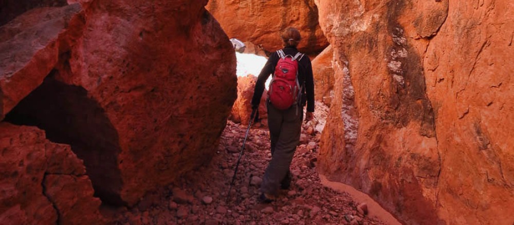
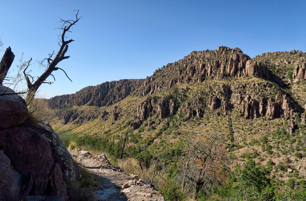
 Chiricahua is a hikers paradise, even offering a one way Hiker’s Shuttle. Every morning at 9:00am, the park service leaves from the visitor’s center and drives through the campground, collecting a total of 14 hikers to ferry up the eight mile Bonita Canyon scenic drive to Massai Point. This one way shuttle allows visitors to enjoy hiking the length of the canyon without having to climb back up. Still, even with a one way shuttle, the shortest hike is five miles back to the campground down through Echo Canyon…nine miles if you start at Massai Point and hike the longer trail around Inspiration Point, looping through the Heart of Rocks. I did both, though the latter took me the better part of a day.
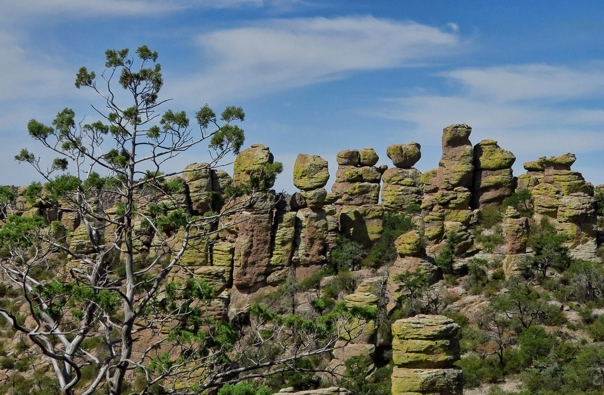
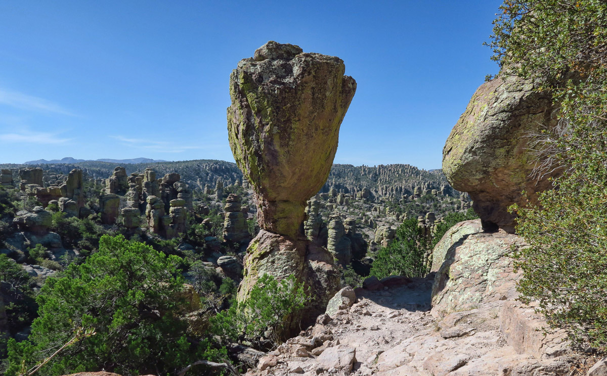
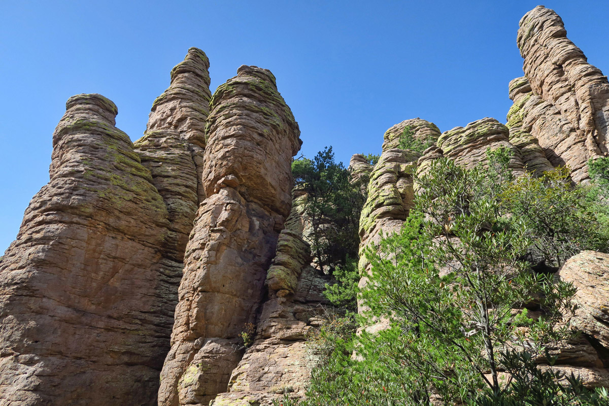
Hiking amidst these giant towers of wind-carved rocks was magical. Although alone on the trail, I couldn’t contain my enthusiasm not to exclaim expletives around every corner, shouting my amazement and appreciation for the astounding beauty throughout “Echo Canyon.”
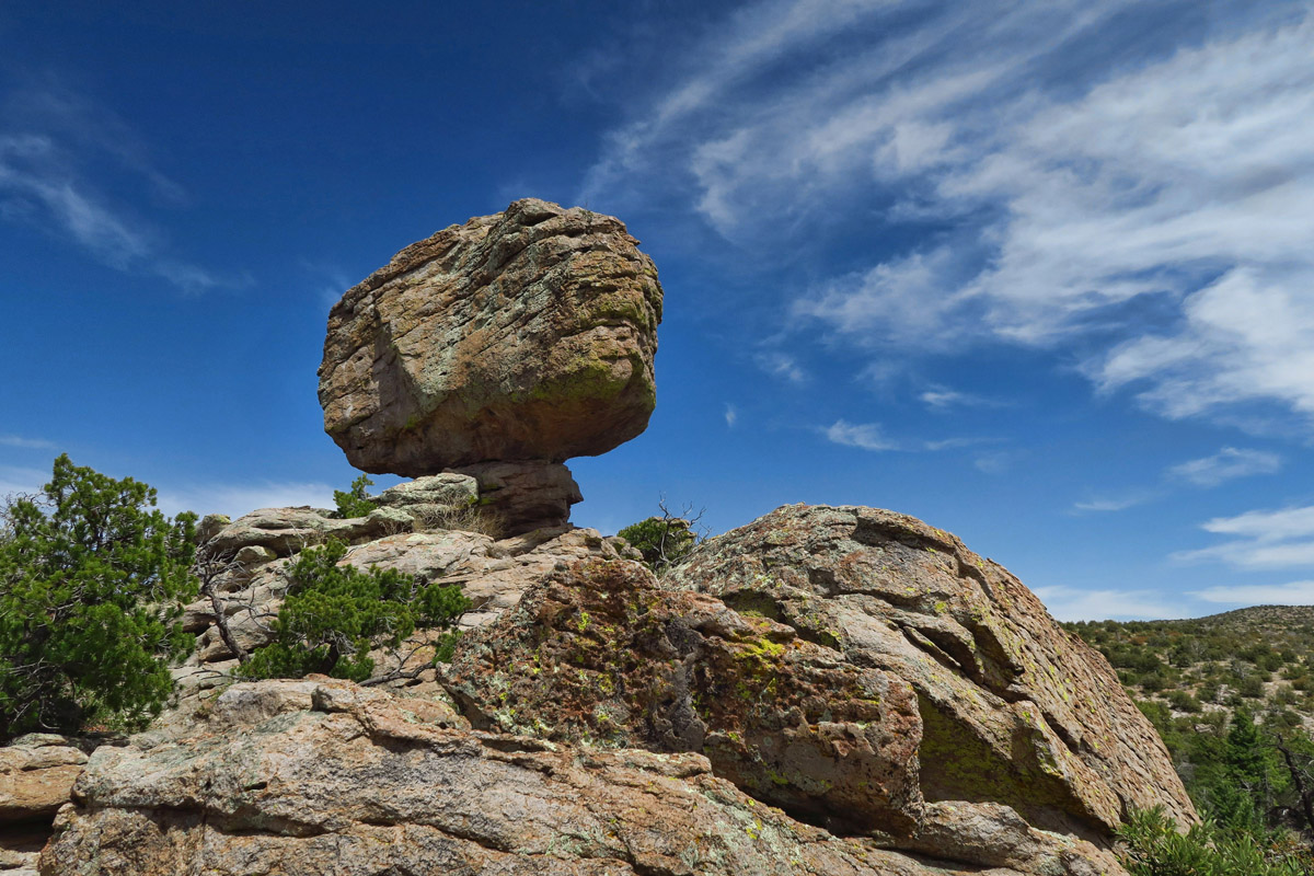
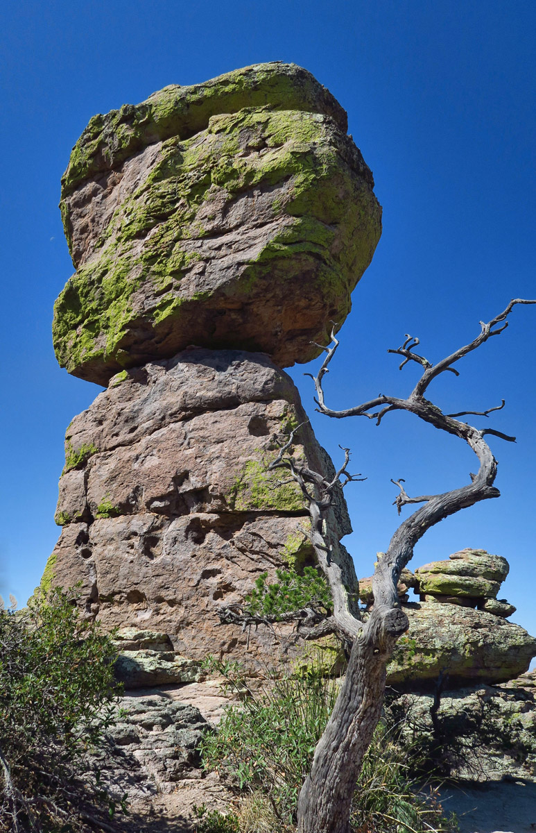
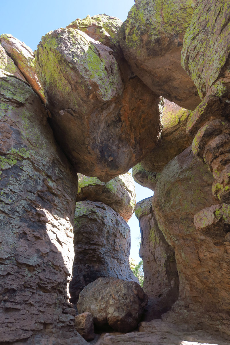
Balanced Rock, but not the “Big Balanced Rock.”
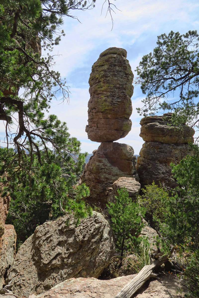
Okay, so this is the “Big Balanced Rock.”
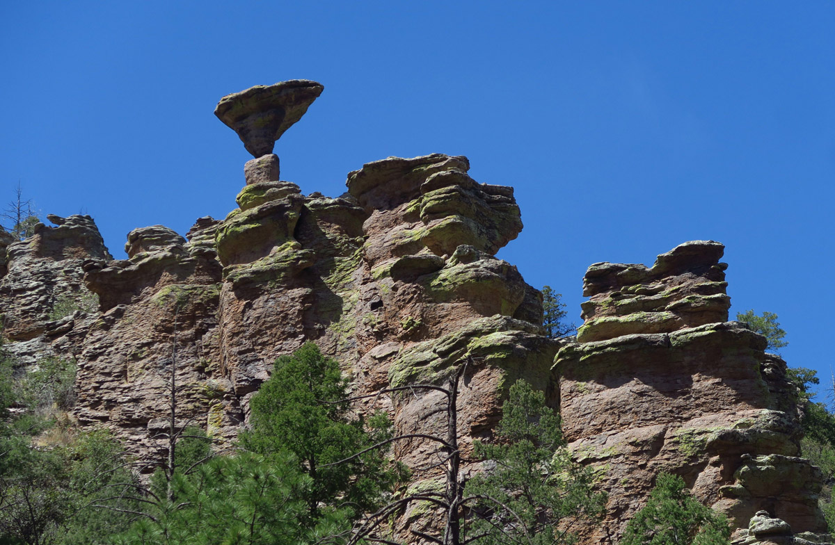
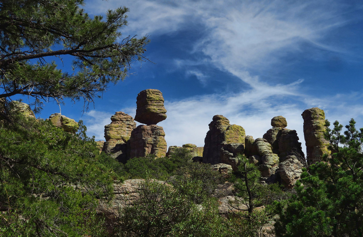
Balanced Pinnacle Rock, another iconic landmark in the park that graces posters from the National Monument.
What makes the trails at Chiricahua even more endearing is to know that most of them, along with the scenic drive and Visitor Center, were constructed by the CCC, the Civilian Conservation Corps. The 180 CCC enrollees came primarily from Texas and Arkansas, and earned a wage of $30 a month (plus room and board and a uniform) for what had to be back-breaking work equivalent to the “rock pile.” Several conversations with others affirm “We need a CCC today!” It would be interesting to see what kind of salary it would take to attract someone to work that hard in today’s world. The camp remained from 1934 to 1940, while they built trails around the canyon, lending imagination and giving names and personality to features throughout the canyon, like “The Old Maid” and “Punch and Judy.”
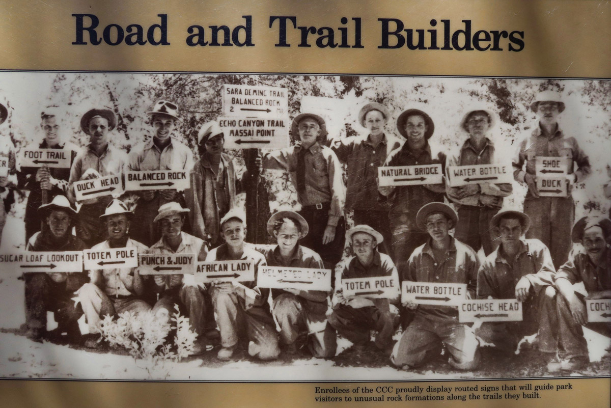
Just some of the 180 men of the CCC that built trails throughout the park from 1934 to 1940. Note signs to indicate landmark rocks.
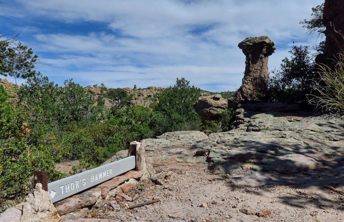
Though the signs have been upgraded, many of the names still remain today. This is Thor’s Hammer.
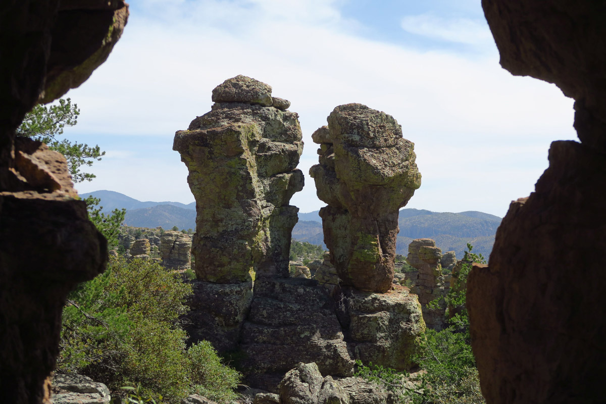
“Punch and Judy” can be found on the Heart of Rocks loop.
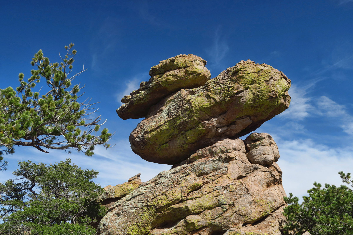
Diving duck, or duck laying an egg as some have suggested.
Thankfully, in 1976, the US Congress protected 9,440 acres of Chiricahua National Monument as “Class I, pristine wilderness.” The information placard along the trail explains, “According to the law, the ‘designated wilderness’ is protected from human developments which alter the land such as roads, buildings, utility lines, and mines.” I am turning into one of those old people who say repeatedly, “Those were the good ole days.”
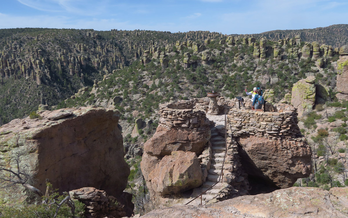
View of Massai Point from the opposing Observation Point
View from Observation Point.

Contemplating “Lunch with a View” by Pam whose boots have gone before me….
But Chiricahua history goes way beyond that time, as it was once part of the Apache Nation, who named it “The Land of Standing Up Rocks.” The Chiricahua Apache were among the most tenacious of warriors, made up of some of the most legendary chiefs during the Apache wars; Geronimo and Cochise, who maintained a stronghold and is believed to be buried in the Dragoon mountains within the monument. Though his body has never been found, one of the nearby mountains bears an eerie resemblance to his profile, ergo the name “Cochise Head.”
In the distance, the mound known as “Cochise Head” for its resemblance of the legendary warriors profile.
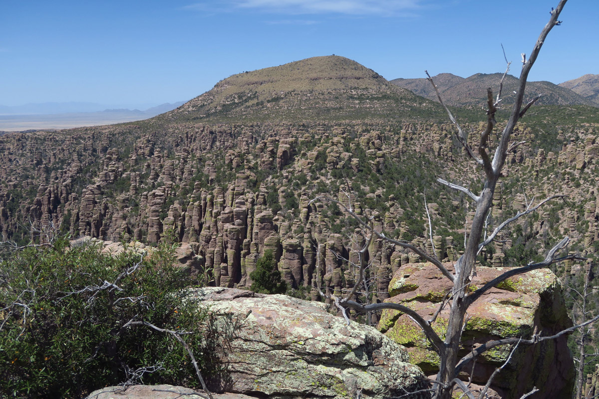
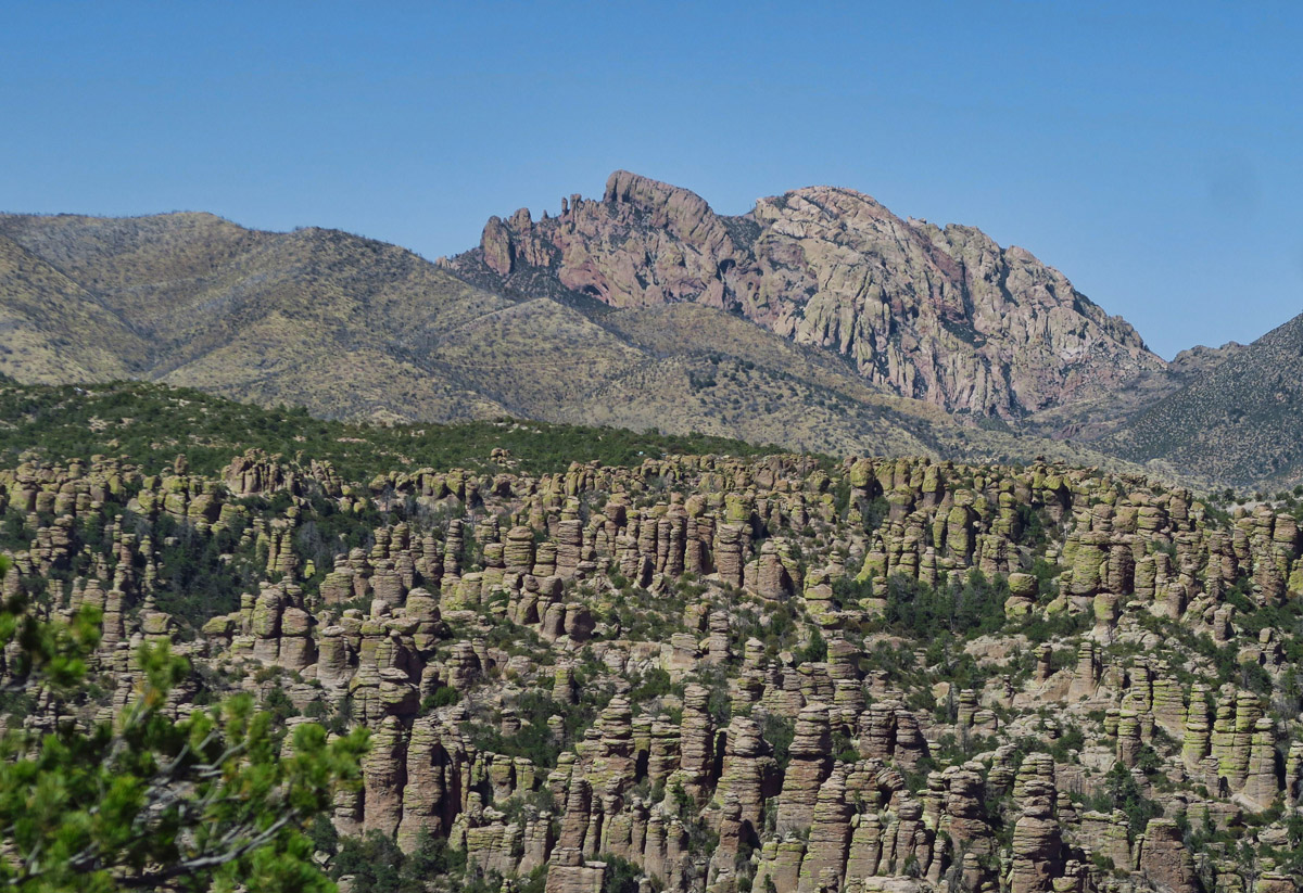
But this is still “modern history” by Chiricahua standards. These rocks sculpted by time from 27 million years go from an eruption of the Turkey Creek volcano. Pinnacles are composed of fused volcanic ash called rhyolite from that eruption. Although the rhyolite is tougher than one would imagine given that it’s volcanic ash, I don’t remember a time when my boots and legs were covered in more dust from a hike. Known as a “sky island,” the long extinct volcano created an isolated mountain range in a grassland sea.
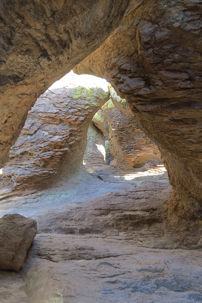
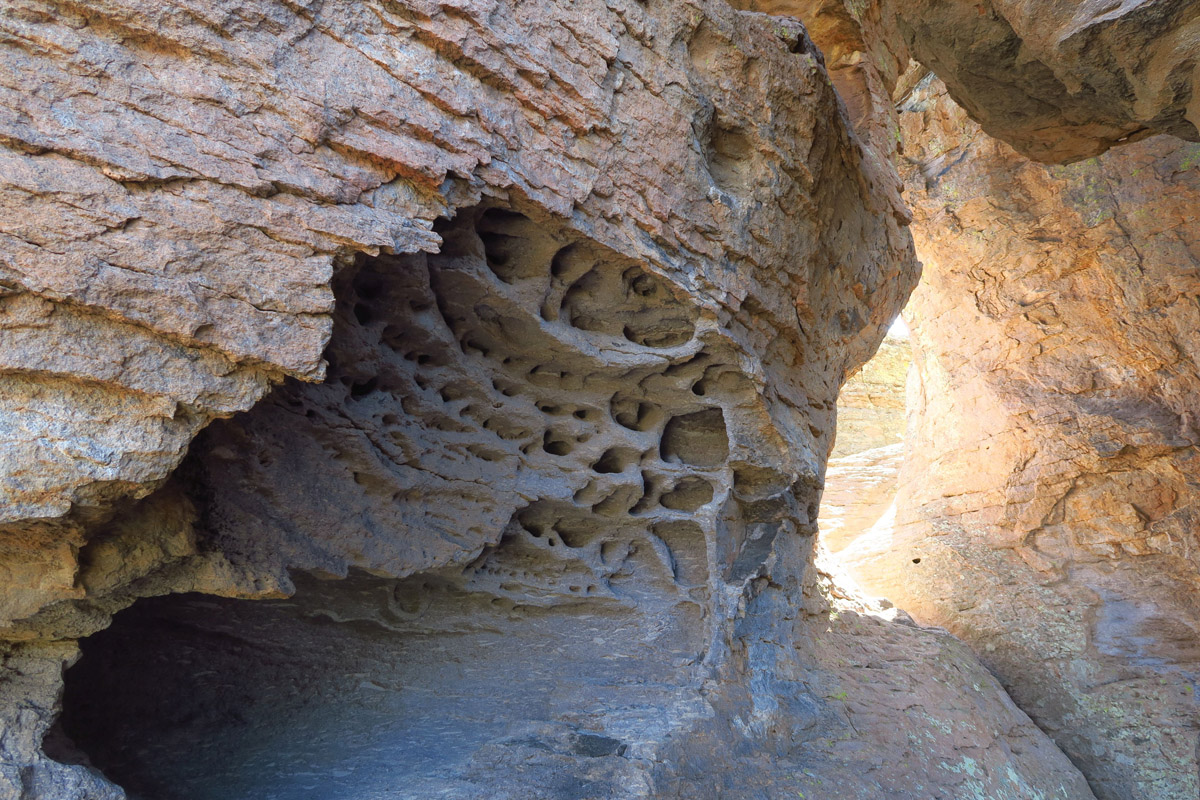
“The Grottos” section of Echo Canyon.
More grottos…don’t get caught here in an earthquake!
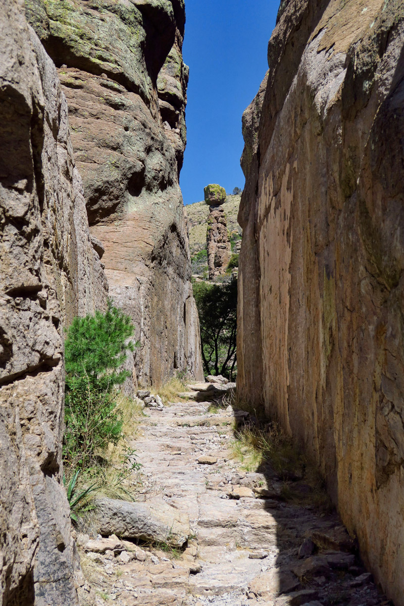
“Wall Street” along the Echo Canyon trail.
Chiricahua National Monument has a fun challenge in play called “I Hike for Health.” They challenge hikers to cover five miles of the park, snapping “selfies” along the way to prove their progress, then stop back by the Visitor Center to collect your “Rock the Rhyolite, I Hike for Health” pin. Though I am not a fan of the selfie, I wanted the pin to add to my Junior Ranger badge collection. 😉
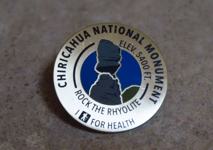
“I Rocked the Rhyolite,” (and unlike the women at the Visitor Center, you have been spared the selfies to prove it!)
I thoroughly enjoyed my three days in Chiricahua National Monument. The weather was perfect, the campground peaceful, and it had to be some of the best hiking I’ve done in a good long while…and in today’s environment where our wilderness and public lands fall under increasing scrutiny, I am able to appreciate it all that much more.
“Our lives need the relief of the wilderness where the pine flourishes and the jay still screams.” ~ Henry David Thoreau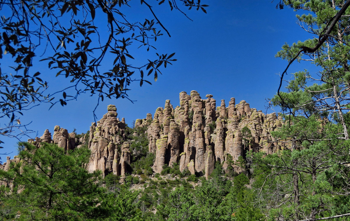

Great photos of a place I have so far only seen in blogs. Also was thinking of you just a couple of days ago, thinking I was going to have to send out the messenger birds again, so am very very happy to see you out hiking in a beautiful place, with the Tracker and your sweet home. Looks Great, Suzanne!
Wow! We have spent time near there, but never taken the time to explore. That will change next time! Thanks Suzanne!
WOWSERS! We knew we were missing something, but had NO IDEA how much. I’m off to see about reservations to take the Sportsmobile up there. Doesn’t sound like a good place to expect to bring a larger rig. Many thanks for the incentive to get our act into gear! As always, your photos and narrative were mesmerizing, and lit the fire under our lazy behinds!
Virtual hugs,
Judie
I feel like I have just visited with you! Thanks for all the great photos, too. I like the Thoreau quote.
Thank you so much for sharing these! Looks awesome! And I look forward to hiking it this year, and to more of your posts.
Thanks again. So glad you’re back..
That is an amazing park. I had never heard of it before. Thank you for blogging again. I travel these interesting and beautiful places through you!
OK, now I have another place to put on my list. It will be years before I get to the Maritimes, but this is practically in my back yard. Well, within 1000 miles, anyway.
I intended to comment on your last post….but will do it here. While I seldom made comments I just want you to know how happy I am to see you posting again. I love your blog….your way of describing the beauty you see and your pictures are fantastic.
This is a very special place, and I love that it is so lightly traveled! I’d like to go back some day in a smaller rig so I could stay in the park. Though, by staying in Wilcox, we also visited Cochise Stronghold and Ft Bowie, which were both wonderful.
Me thinks a ’37 foot class A will have to stay in Wilcox. Therein lies the problem. There is no way I’m gonna drive 37 miles so that I can hike 9 miles, which I likely wouldn’t complete anyway. Guess it will have to be your writings and photos for this one. Looks beautiful, and points out what you don’t see UNLESS you get out there and “Rock the Ryholite “.
You are such a kick Suzanne. I too have been teased by other blogger accounts of Chiricahua and now you add to my desire to visit, and earn another JR badge. I earned a hike healthy pin at Organ Pipe last winter and have seen more parks offering that.
I am another one who now has Chiricahua on the to do list. I don’t think I will take my rig and toad in there though!
Wow, what a beautiful area! Even after reading the name numerous times in your post I don’t think I could spell it!
I’m so happy you’re out on the road again and I get to read your blogs!! I love that park, and had a great time hiking and riding through there years ago!! I’ll never forget the towering spires above me and the sense that I need to stay out of their way! It was a memorable experience! Looking forward to more! Hugs!
This is an amazing place!! We parked at the point and did The Big Loop! We were so tired by the time we got to the Grotto that John wouldn’t even wander around. We had to come back the next day and hike to the Grotto so we could enjoy it. We did the shorter loop to see the part you don’t get on the Big Loop. But this is such a spectacular place. It takes all day to really enjoy all the features and not miss anything. Thanks for the memory:) We need to return again! Spectacular photos!
We managed to get 2 nights at Chiricahua in March. We squeezed our 26-foot Lazy Daze into a tight space that had a view of one of the deep dips. It’s terrible to hear that scraping noise when someone’s rig doesn’t quite make it. But all the trouble is worth it. What a wonderful place.
Thanks Suzanne! Next Year we are going to visit this place again, I wanna see more interesting places and more long hikes
Chiricahua . 2012 my first steps in aerial videos
https://youtu.be/a3ZGnOrw56s
The Chiricahua NM is like no place we have ever hiked before. I just love all the named rock formations. I wish there had been the ability to get a pin for my junior ranger badge when we were there. Looks like I might have to go back. Great photos Suzanne.
On the east side of the Chiricahuas is Portal, AZ. Vladimir Nabokov wrote part of the novel “Lolita” in Portal. He was there studying butterflies.
Deede and I found the Chiricauhuas on one of our drives exploring south east Arizona in 15. We could only do the drive up and back, and it is a real pleasure to see what awesome sights exist on those trails. thanks