I could have easily written an entire blog post about each of my seven days in the Faroe Islands. Every day was filled with unique experiences and spectacular scenery. But this poor blog is so far behind, I am never going to get caught up at this rate, so I am going to hit the highlights of those experiences I most want to remember. So please forgive me as I cram what should be about four or five different blog posts into one!
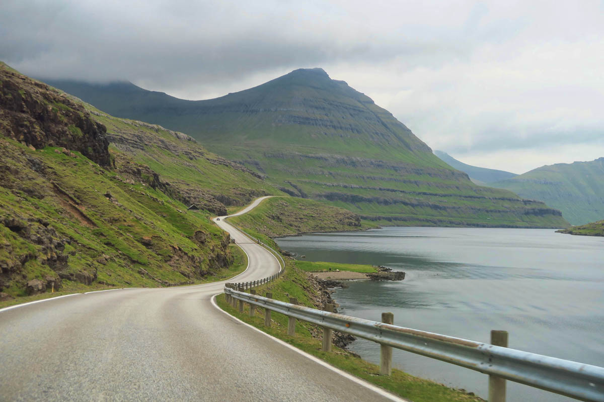
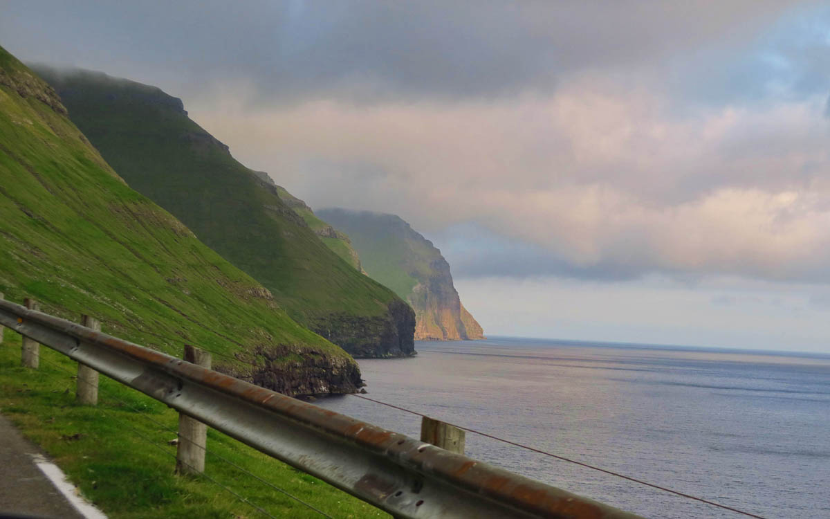
Driving through the Faroe Islands was an experience unlike I have had before. Once you head out to the smaller villages, the roads become one lane, often times with a sheer drop-off on either side. There are turnouts, but you must constantly be watching for oncoming traffic like a game of “chicken” to anticipate who is going to yield right of way, or in worst case, back up! And the sheep always have the right of way!
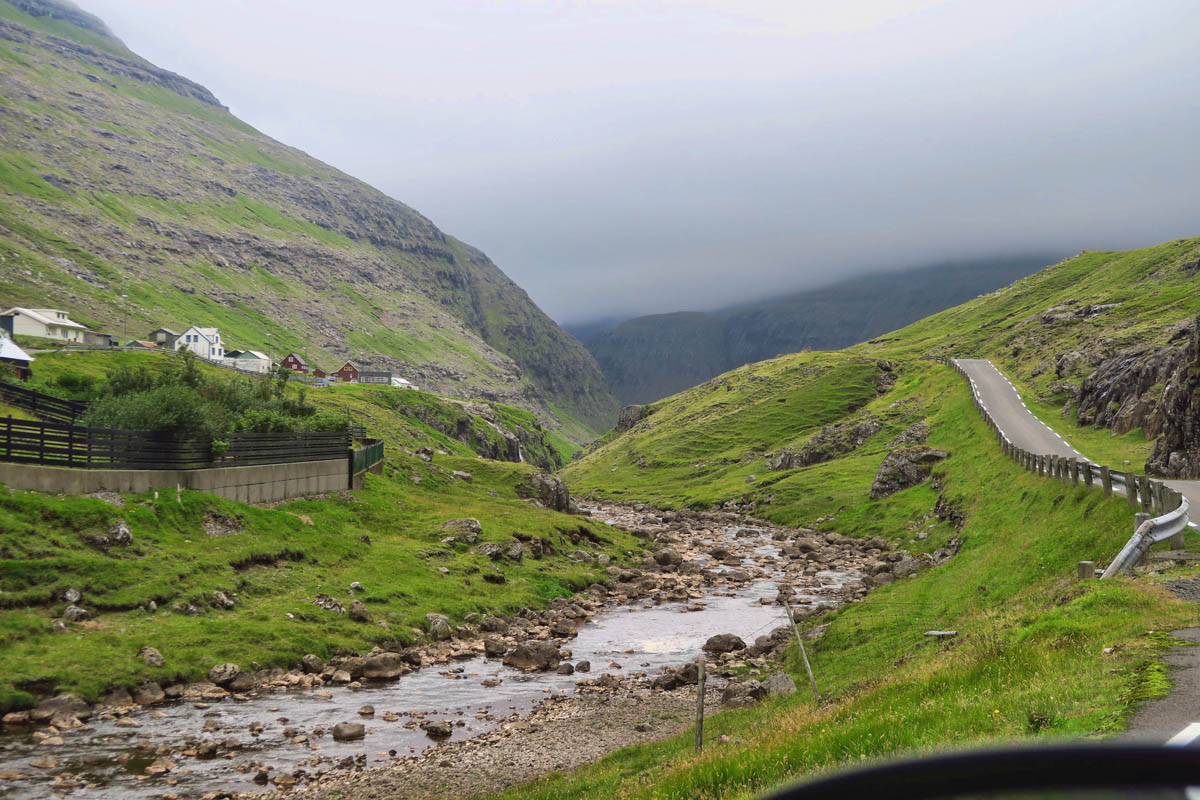
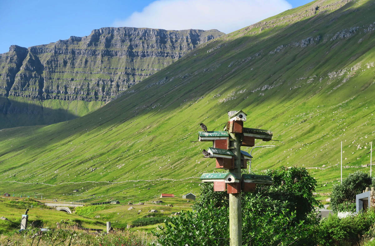
If you like to drive, the Faroe Islands certainly offer some scenic routes.
Scenic routes are labeled “Buttercup Routes,” named after the Faroese national flower.
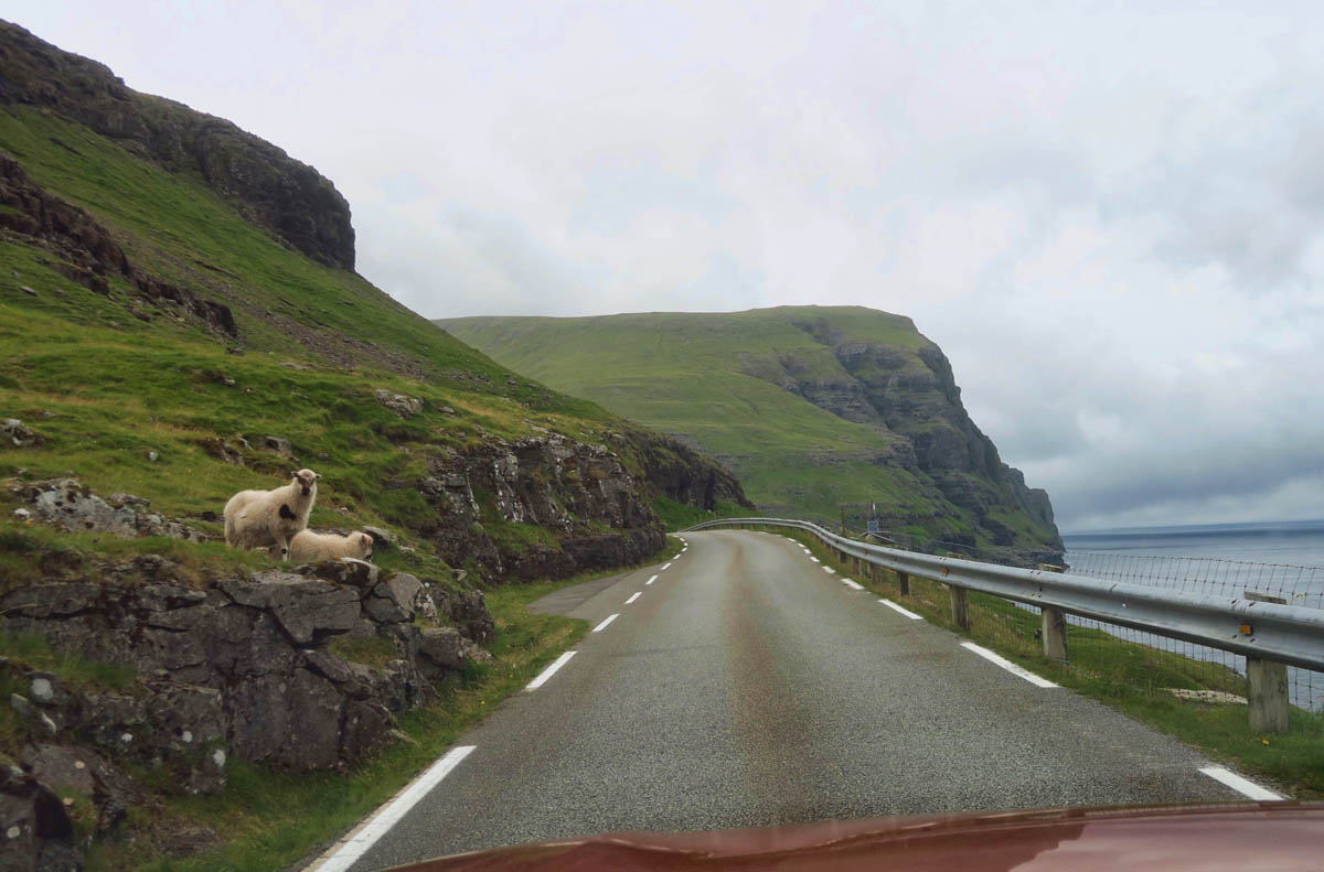
A word of caution, however. Note left side of photo…they lie in wait!
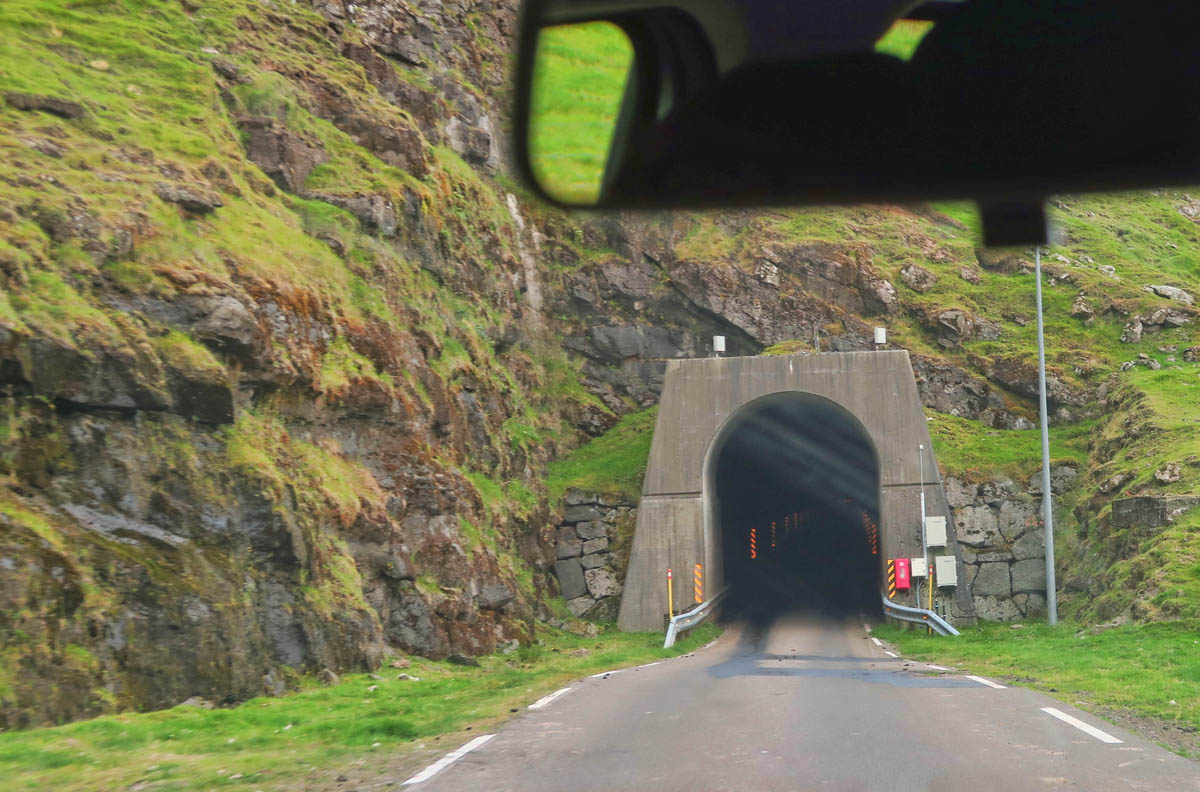
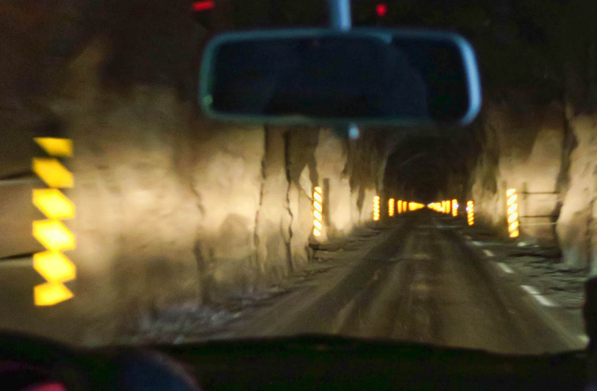
While the Faroe Islands roads are narrow, winding, often one lane and sometimes steep, they are in good shape for a location with such extreme weather conditions. But by far, the most impressive aspect of their road system is their three sub-sea tunnels, the most expensive investment in the Faroe Islands to date. The longest of these tunnels at 6.8 miles (11 km) in length, Eysturoyartunnil, contains the world’s first under sea roundabout, fondly referred to as the “jellyfish.” A Faroese artist decorated the roundabout, as well as the colorful lighting designs in the other two sub-sea tunnels.
Three different tunnels drop down at a 5% grade to 189 meters (620 ft) below the water’s surface, then converge at the under-sea roundabout. Driving through Eysturoyartunnil is a bit stressful with no navigator. It costs a toll fee of 175 Danish krona (around $26USD) each way (less with a yearly subscription.) It’s billed automatically as a camera scans your license plate. So you don’t want to make a mistake and exit the wrong tunnel!
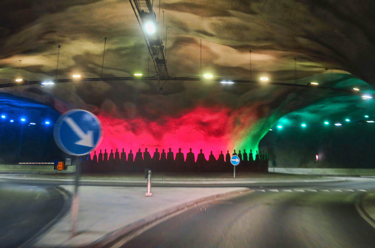
Eysturoyartunnil, an 8 mile tunnel, contains the world’s first sub-sea roundabout. Around the base of the structure, life-size steel figures holding hands are meant to symbolize the Faroese idea that “by joining hands and working together we achieve great things.”
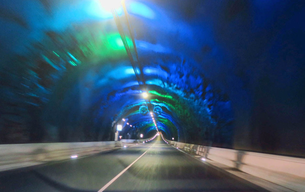
The other two sub-sea tunnels have special lighting in the tunnel. The system even has it’s own FM radio station with special tunes composed by local Faroese musicians
After meeting Lisa and Lynn on the ferry back from Mykines, then running into them again on a hike the next day, we compared notes of our respective trip plans to coordinate another meet-up. We realized we would be overlapping at one of the more remote guesthouses in the village of Gjógv (pronounced like Jake only instead of an “e” on the end, it’s an “f.” Like “Jakf.” It takes some practice.)
As is typical for most small villages in the Faroe Islands, there are no local restaurants, or even food markets for that matter. But the rare exception is the top rated Gjaargardur Guesthouse, which organizes breakfast and dinner for its guests. So the three of us make a plan to meet up for dinner.
The Village of Saksun, Streymoy Island
But I took the long way around to get to Gjógv, traveling to the far northwestern villages of Saksun and Tjørnuvík along the way. I would visit the two remote villages on the island of Streymoy before crossing over to the island of Eysturoy on one of the only bridges linking islands in the Faroes.
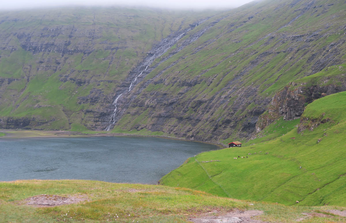
The first of these villages, Saksun is formed where steep hills form an amphitheater flanking the bay below, one time a natural harbor. Sand filled up the bay, making a lagoon accessible by small boats at high tide. At low tide, you can walk on the sand out to the seashore. Unfortunately, my timing was not good, as not only was it high tide, but a rainstorm blew in just as I arrived.
In addition, the walk along the lagoon to the beach is unfortunately on private property. The land owners now impose a 75DKK fee (about $11 USD) just to walk to the shore. So this would be as far as I would go…
The village of Saksun has a population of 13 permanent residents and one very angry farmer. See this tiny red-roofed cabin to the right? Well, somehow, the farmer’s view of the lagoon with his cabin in the foreground has become an Instagram sensation with “influencers” tromping over his fence for the photo of the cabin with the lagoon as a back drop, and flying drones over his cabin. It became quite the controversy as he took matters into his own hands to stop the trespassers.
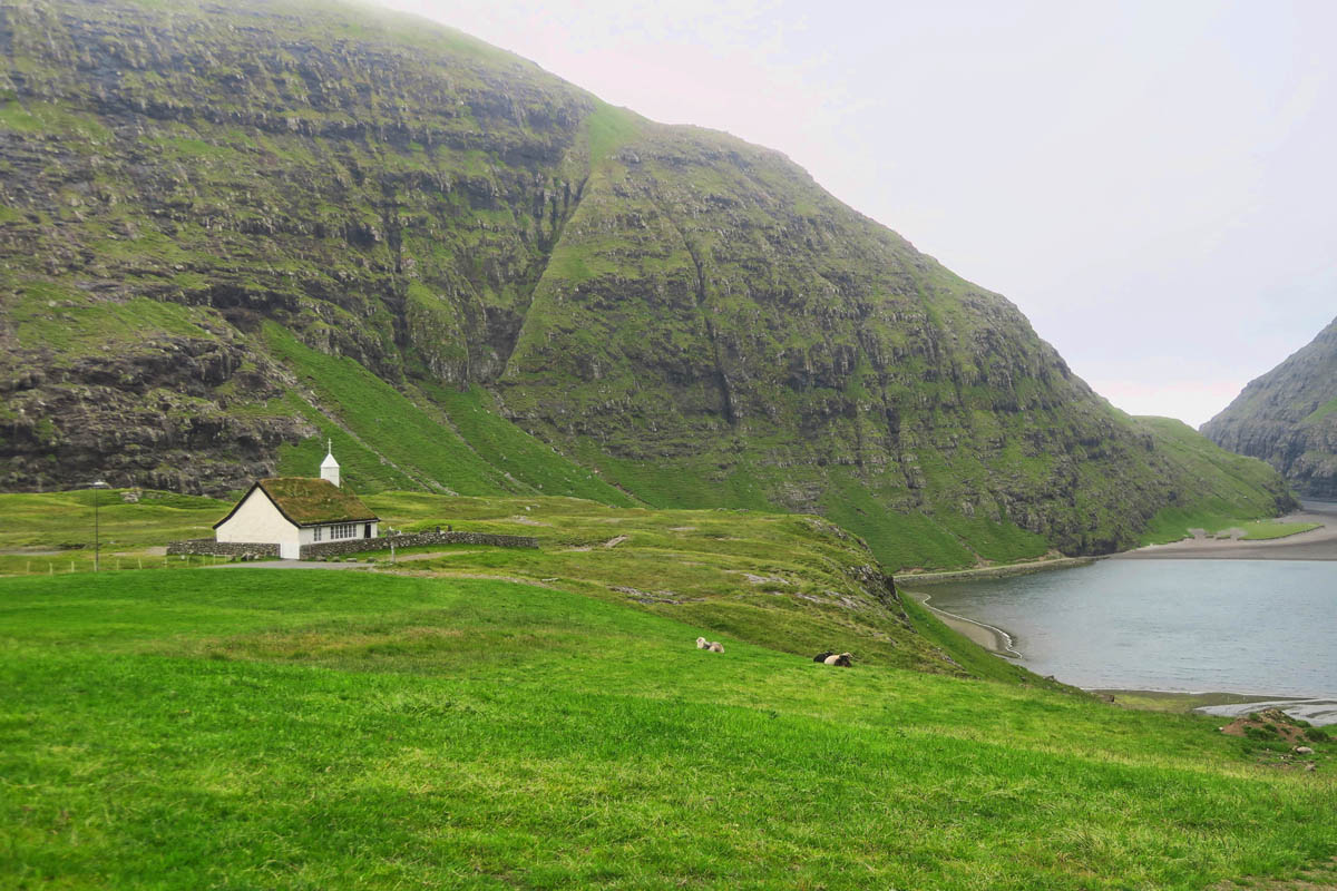
Saksun’s church seems rather large for only 14 permanent residents. Maybe when it was built in 1858, the village population was larger.
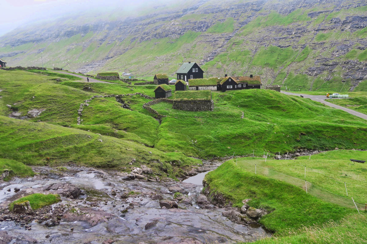
The hiking trail over the mountain pass to the nearby village of Tjørnuvík starts here.
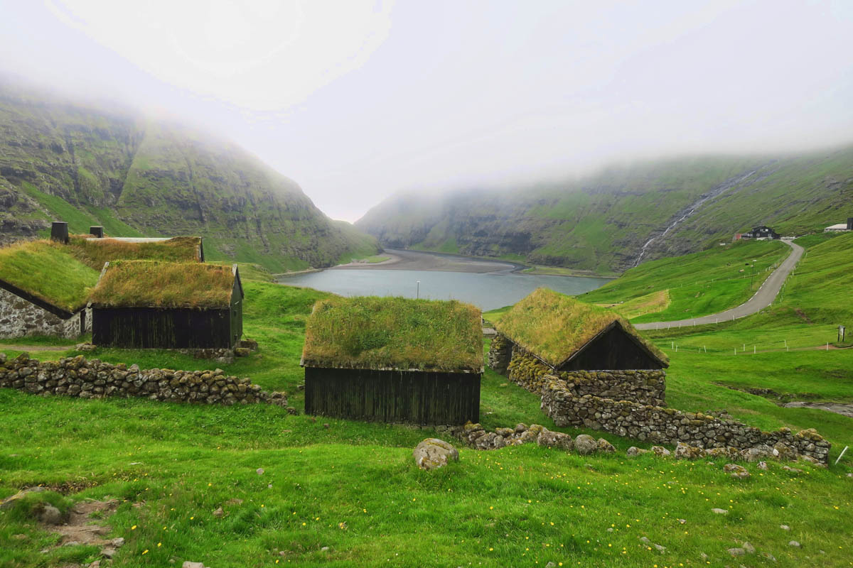
In the distance, you can see the salt water lagoon which becomes cut off from the ocean at low tide.
The Village of Tjørnuvík, Streymoy Island
Just over the mountain from Saksun is Tjørnuvík, one of the oldest villages in the Faroe Islands. Viking graves have been found in this valley, proving it has been inhabited since the first Vikings settled in the Faroes. A 4 mile hiking trail connects the two, up over the mountain pass. However, one would need a ride back, or hike up and over, round trip.
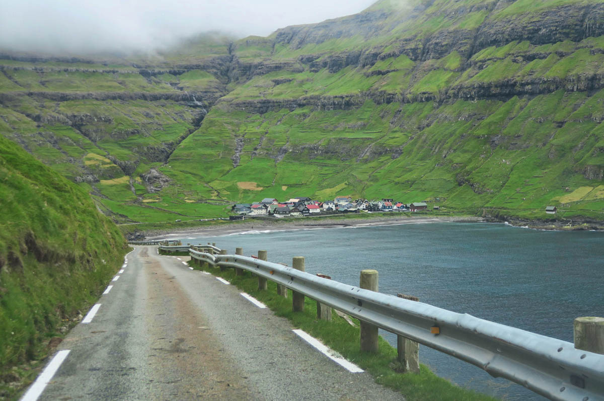
Another nail-biter of a narrow road drops down into the village of Tjørnuvík. It’s a bit bigger than Saksun, as it has around 55 permanent residents.
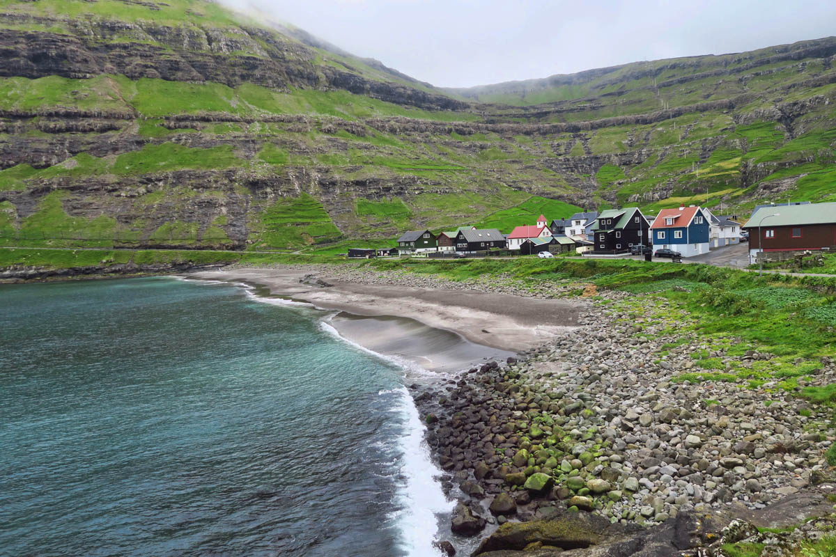
The village faces the open sea, which makes for some crazy waves in certain weather conditions. Strange as it sounds, surfers come from all over the world to surf the enormous waves during storms in this tiny cove! There is even a surf shop here that rents gear.
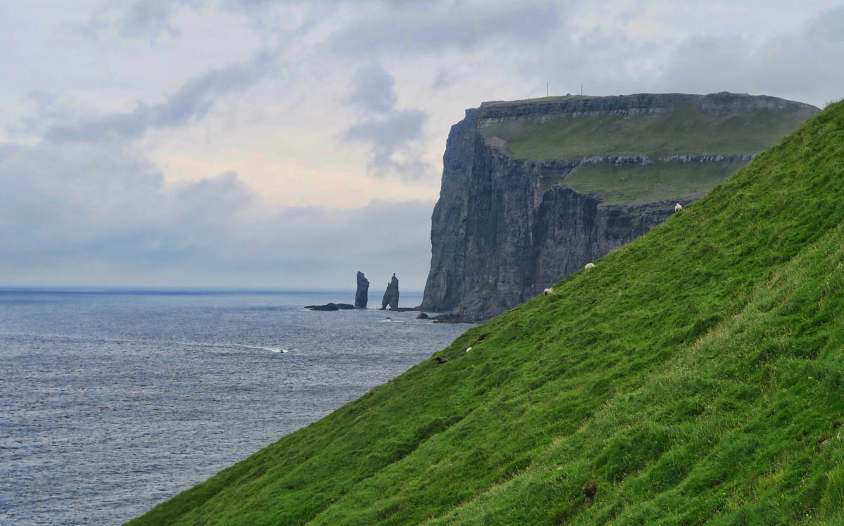
Tjørnuvík is also known for its two freestanding rocks known as Risin (the Giant) and Kellingin (the Witch.) Folklore has them turned to stone while trying to drag the Faroe Islands back home to Iceland.
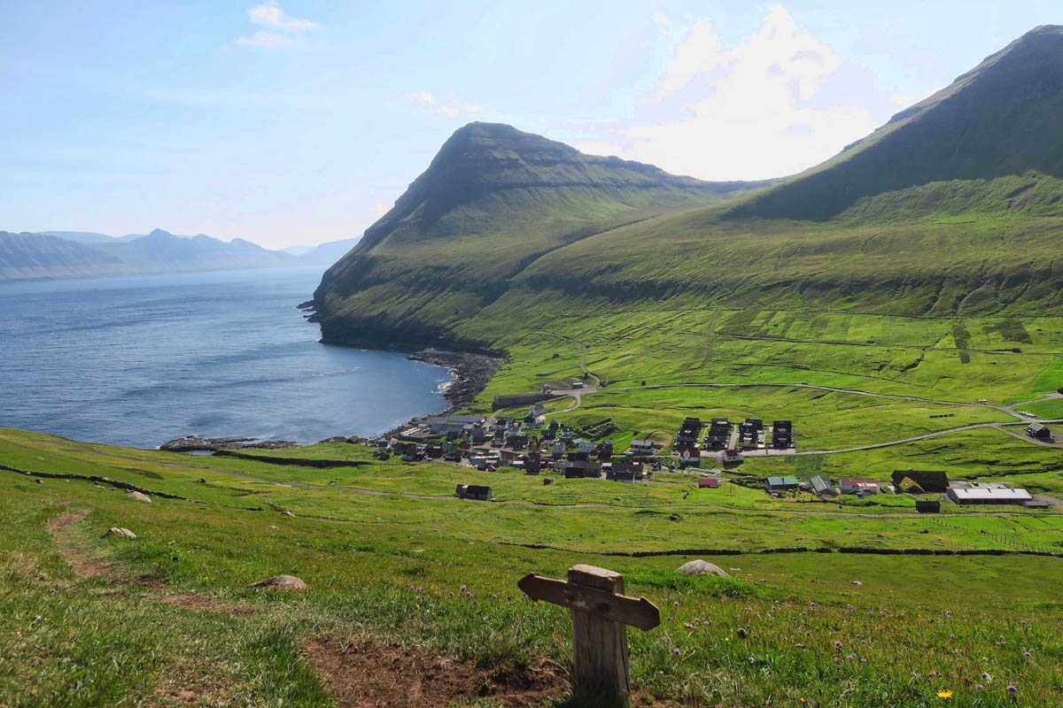
The Village of Gjógv, Eysturoy Island
I can only describe the drive to Gjógv as being like finding my way toward the Lost Horizon to the idyllic hideaway of Shangri La. Traveling up the hairpin curved, single lane roads cresting the emerald green hills, dropping down into deep valleys, passing waterfalls alongside shimmering bays was an evocative indicator that I was headed some place special. Couple that with a visit to the unique Gjaargardur Guesthouse where I was meeting Lisa and Lynn for dinner, and it felt like the start of one of those mystery novels where people meet up in one of those remote destinations that seem “too good to be true,” and so the plot thickens. After eating peanut butter sandwiches for a couple of nights in a row, I was equally excited about having a legit restaurant meal for a change!
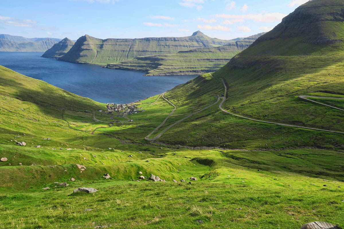
While so many of the drives in the Faroe Islands were gorgeous, none so much as this narrow switchback road on the way to Gjógv.
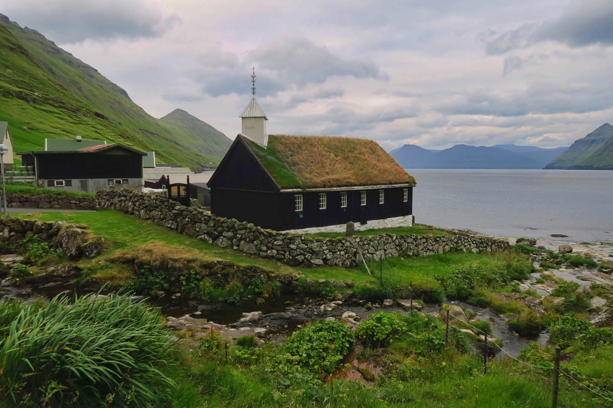
Passing through the village of Funningur on the way to Gjógv, I stop to see the Funningur Church, inaugurated in 1847, one of the 10 traditional old wooden churches in the Faroe Islands.
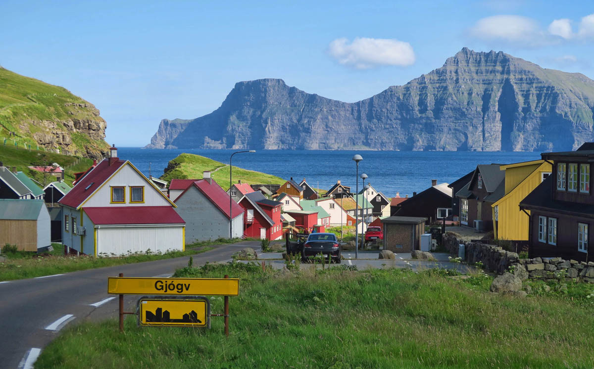
Entering the village of Gjógv, a name that means “gorge,” named for the gorge that makes up the 650 ft long natural harbor.
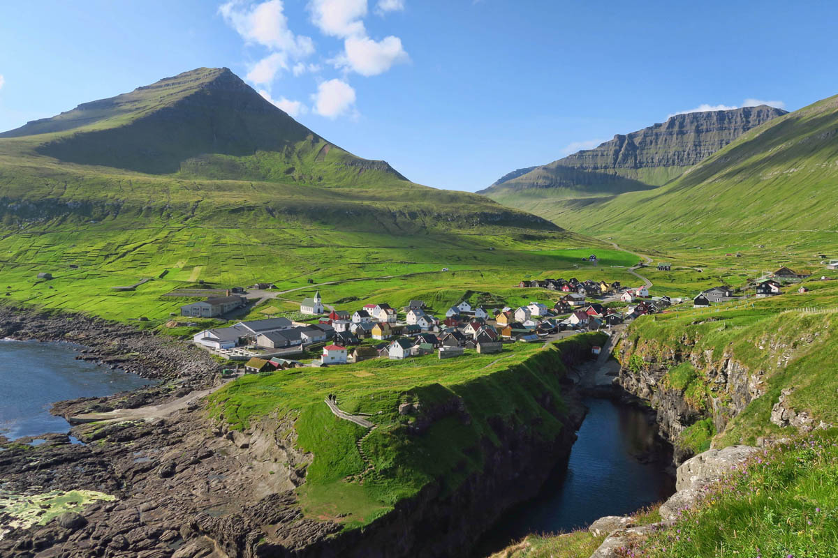
The first record of the village dates from 1584, but it is believed to be much older than that.
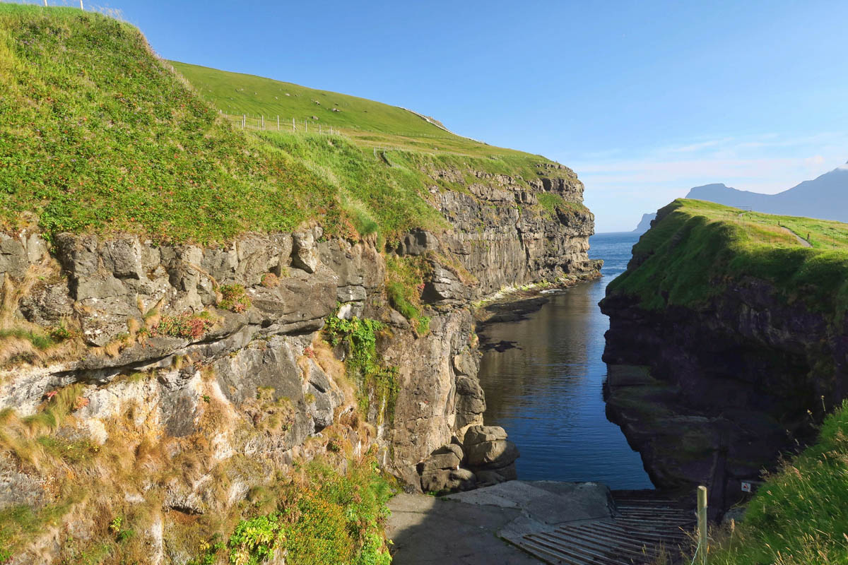
A ramp known as the Gjógv incline railway operates a narrow-gauge line from the low-level harbor inside the gorge, up a steep incline to the boathouses of the upper village.
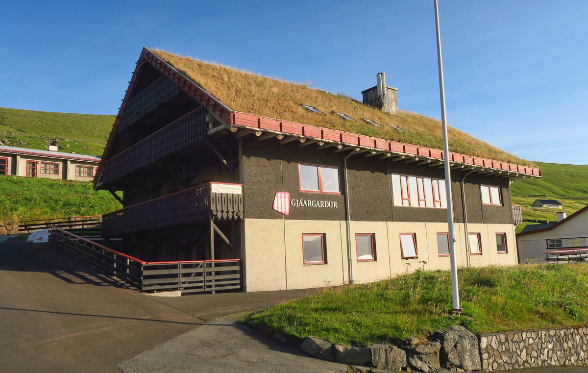
One of the first places you come to in the village of Gjógv is the quaint and cozy Gjaargardur Guesthouse.
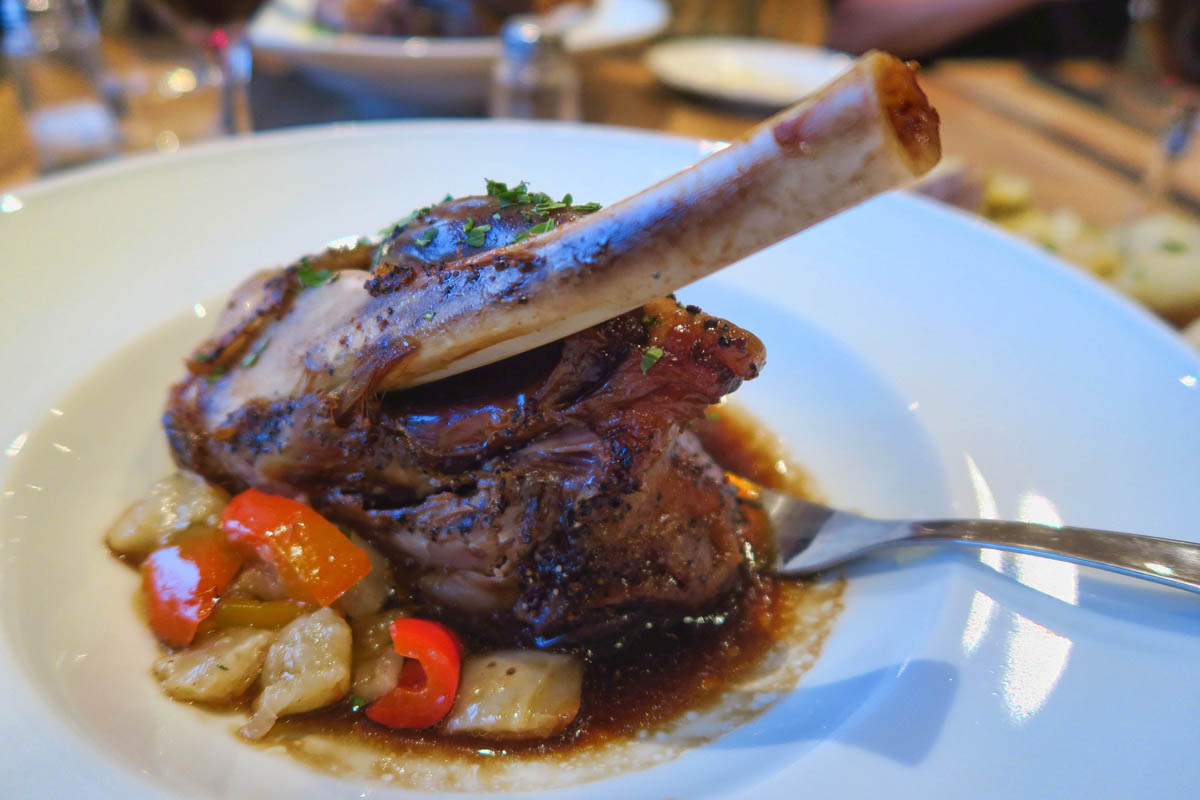
I meet Lisa and Lynn here for a rare proper dinner after too many meals of PB&J sandwiches.
All small villages in the Faroe Islands are charming, but a night or two spent at the Gjógv Gjaargardur Guesthouse is not to be missed!
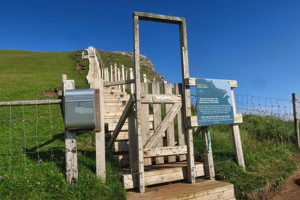
Like most villages, there is a beautiful hike leading up to the cliffs edge. This one has an honor system nominal fee to cover building and maintenance of this massive staircase leading up…seems like the Stairway to Heaven.
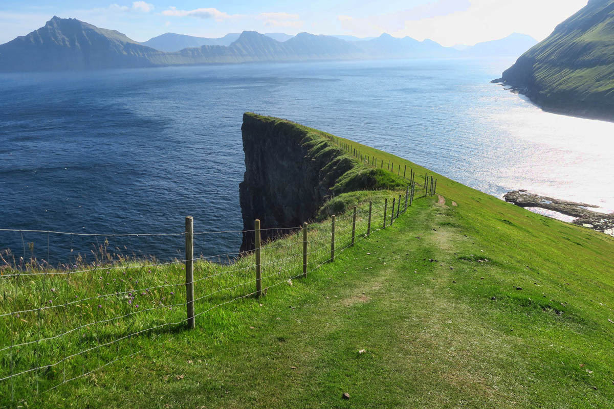
The views from the top on this fine day are magnificent!
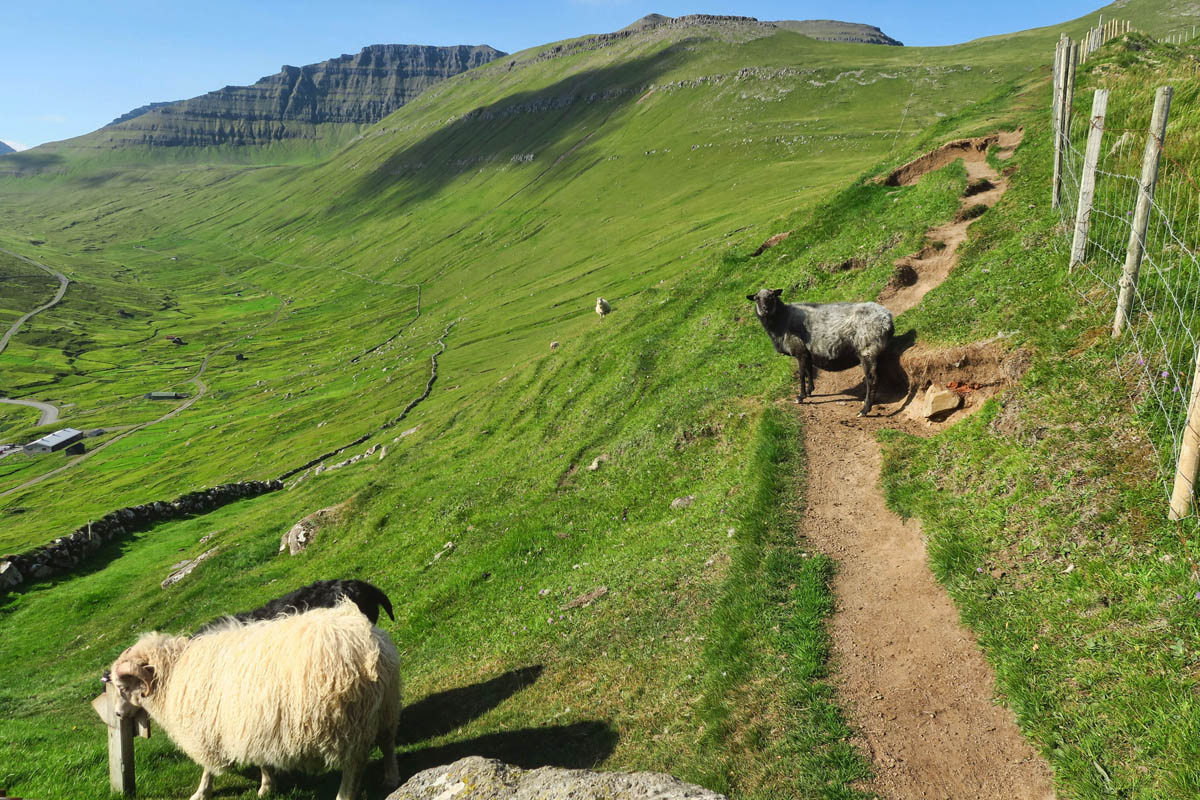
The sheep were laying down, blocking the trail. I don’t think they are happy about having to move.
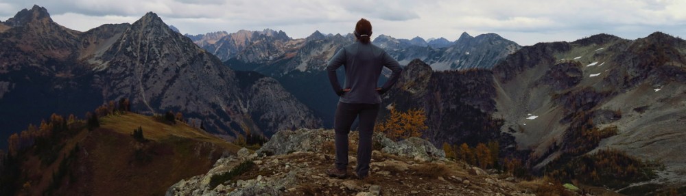
This hike occurred on my deceased brother’s birthday. I always do a scenic hike to commemorate this date. I think he would have approved.
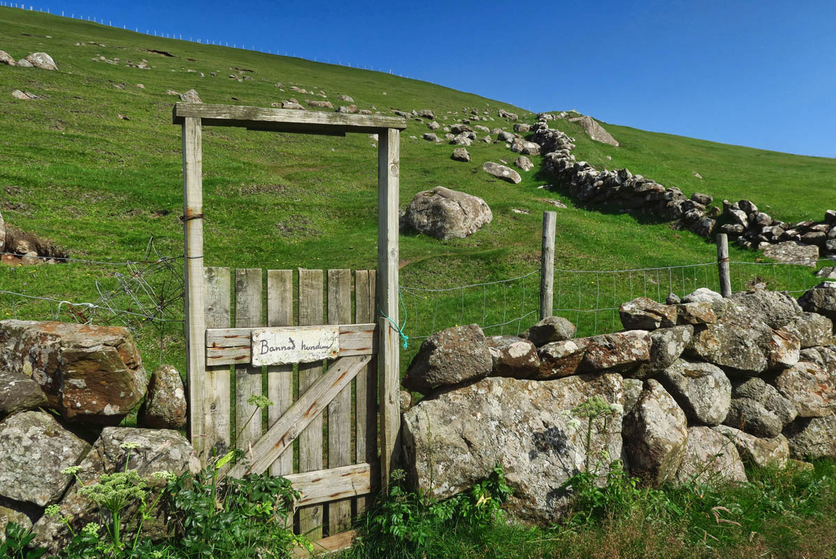
Gates in the Faroe Islands always seem to be particularly scenic.
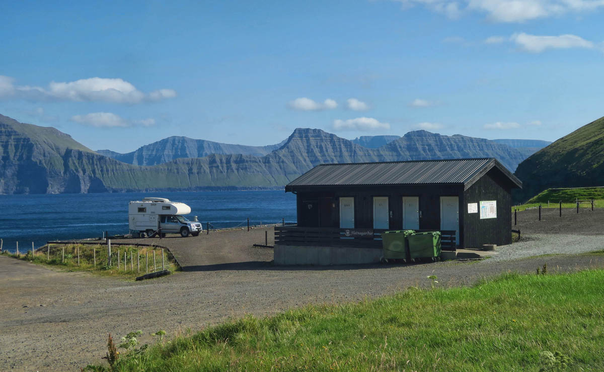
How is this for a lovely campground?
Kallur Lighthouse, Kalsoy Island
By now, Lisa, Lynn, and I had formed a kinship, and decided to embark on a couple more adventures together. The most ambitious of these involved getting up at 6:00am to be first in line for the ferry to Kalsoy, which only holds 17 cars. We carpooled for this trip across this long, narrow island to do the popular hike to the lighthouse.
Kalsoy is nicknamed the “flute island,” because it is long and slender with only one road running through four very narrow, one-lane tunnels. You don’t exactly need a map when there is only one road!
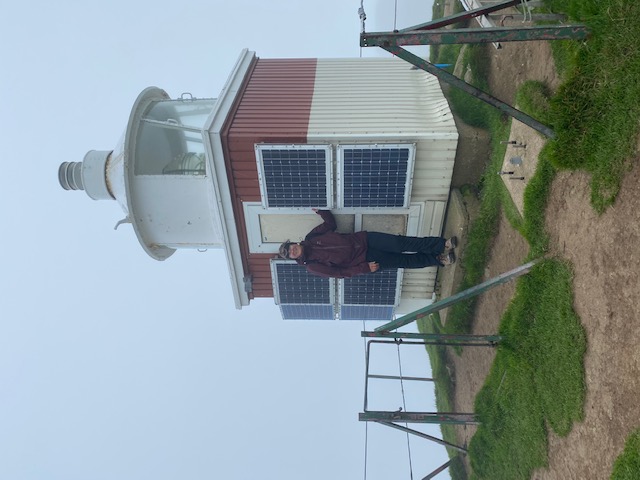
At the northernmost point of the road through Kalsoy Island is the tiny village of Trøllanes, start of the hike to Kallur Lighthouse. From this lighthouse, built in 1927, some of the most iconic views of the Faroe Islands can be seen. Theoretically.
A bit of movie trivia, the northernmost point of Kalsoy is also where the ending scenes of the most recent James Bond movie, No Time to Die were filmed. While I won’t be the spoiler here, suffice it to say that as a life-long 007 fan, I was none too happy about the ending, especially after having waited 18 months to enter a movie theater!
The most notable caution heard repeatedly about the Faroe Islands is the rapidly changing weather, which we experienced firsthand on our hike to the lighthouse. We started out on a beautiful, blue sky day. By the time we reached the top of lighthouse, a one hour hike, gale force winds, pelting rain, and pea soup fog had rolled in just as we neared the top. Sadly, this prevented us from getting some of the typical iconic shots from the ridge-line hike, as the high winds made the knife’s edge trail out onto the promontory just too dangerous. It was in fact, “no time to die.”
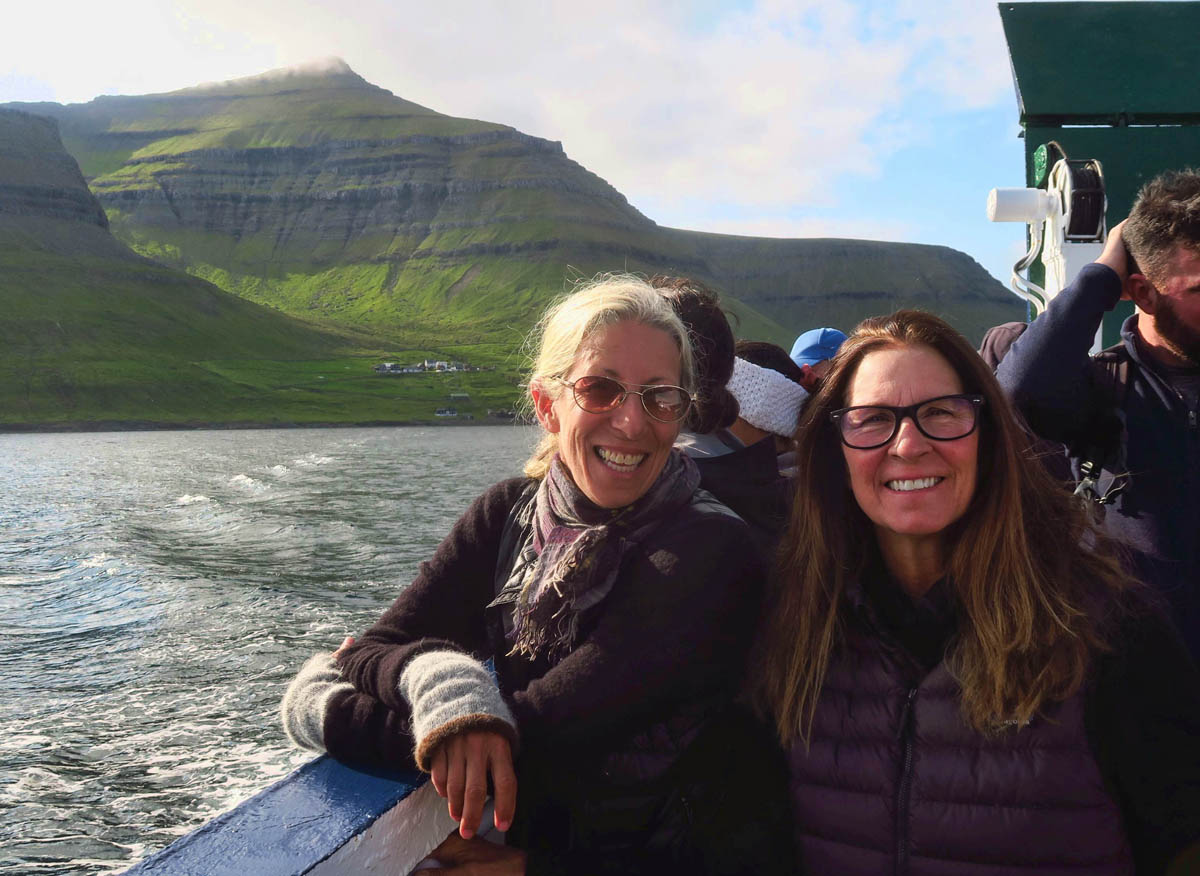
Lynn and Lisa on the Kalsoy Island ferry,
There is only one road that runs the length of the long, narrow island of Kalsoy. No way to get lost!
However, the one-lane tunnels are terrifying! I am so grateful Lisa is driving!
Dark, narrow, and only partially surfaced with very few places to pull out for oncoming traffic. While it’s only 2km (1.25 miles,) it’s still a butt pucker of a road!
This cabin in the village of Mikladalur is for rent…
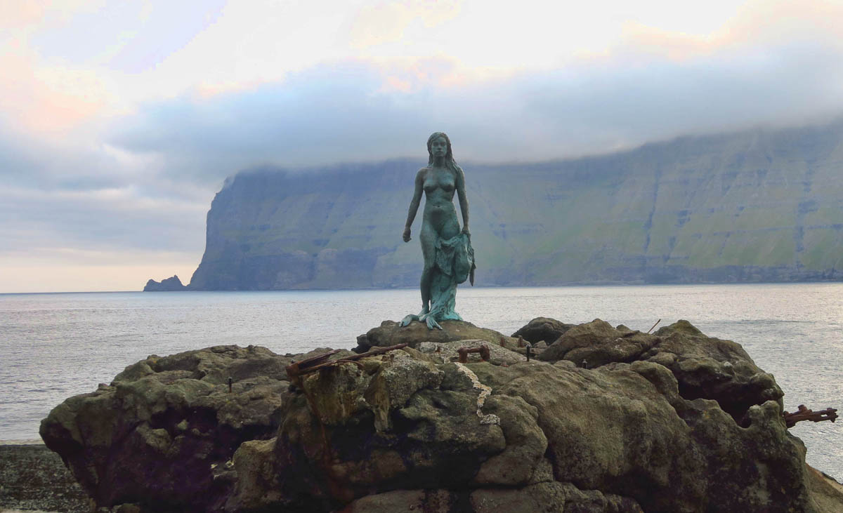
Along the way, we stop in the village of Mikladalur to see the “Seal Woman.” Faroese have a lot of legends of which this is one, MUCH too long to explain here, but can be found by searching “The Seal Woman of Mikladalur.” The story involves the demise of young men who fall to their death in the sea, even today. The bronze and steel statue is built to withstand 13m (45ft) waves, the tallest yet is documented at 11.5m (37ft.)
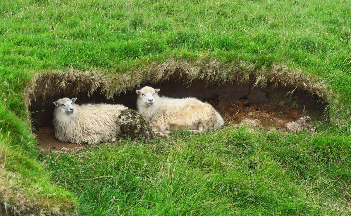
No hike in the Faroe Islands is complete without sheep. These little hidey-holes start out naturally, but the sheep burrow deeper to cull out shelter from the wind and weather.
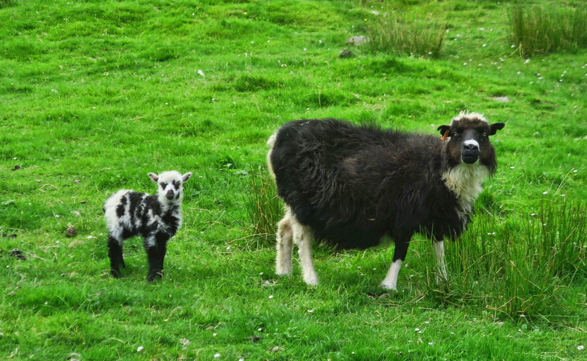
I have said it once, I will say it again…the Faroe Islands have the most attractive sheep I have seen! (as far as sheep go!)
As we climb higher and higher, the weather gets worse and worse. I wish you could hear the sound of my pants legs fluttering as I hold on for Lisa’s photo!
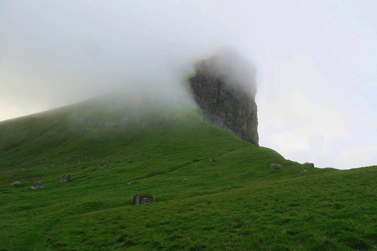
Unfortunately, all the iconic views of this dramatic black rock promontory are obscured by fog. This was as good as it got!
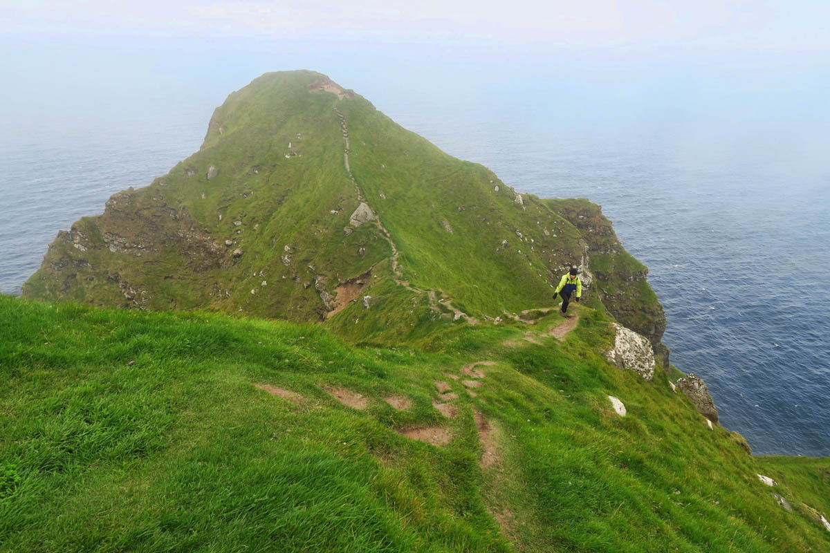
Lisa heads out on the knife’s edge trail for a view looking back at the lighthouse, and is almost blown off the mountain by what we later learned was 50 mph gusts. She turns around and proclaims it “no time to die!”
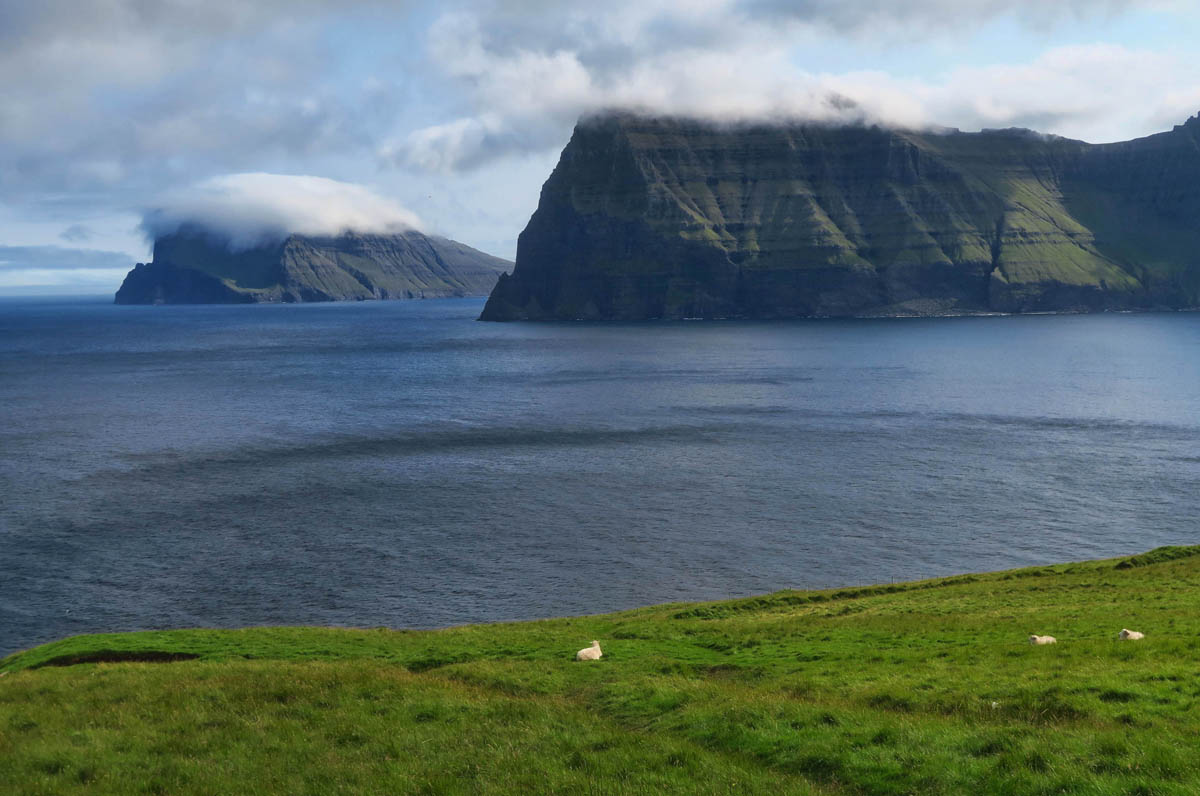
We nicknamed the mountain in the distance “Toupee Island” for its lenticular cloud on top.
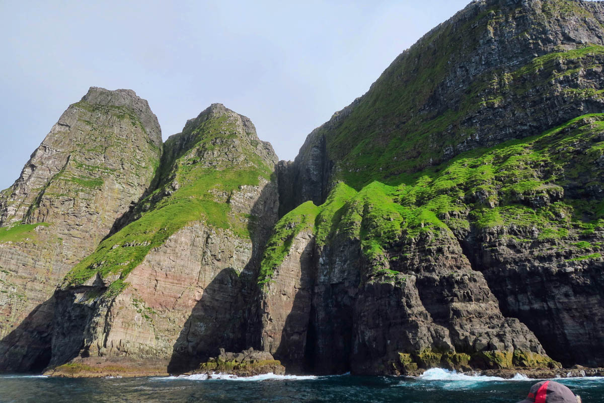
Vestmanna Sea Cliffs, Streymor Island
Lisa, Lynn, and I manage to cram one more adventure in before my 8:00pm departure on the Smyril Line Ferry. We book a last minute boat trip to the Vestmanna Sea Cliffs. These cliffs are known for their sea bird nesting grounds, but by now, it’s September and most of the birds have flown the cliff. Still, the dramatic shoreline made for some spectacular scenery from the boat as we entered caves, grottoes, arches, and cruised along shoreline only seen by boat…or by sheep.
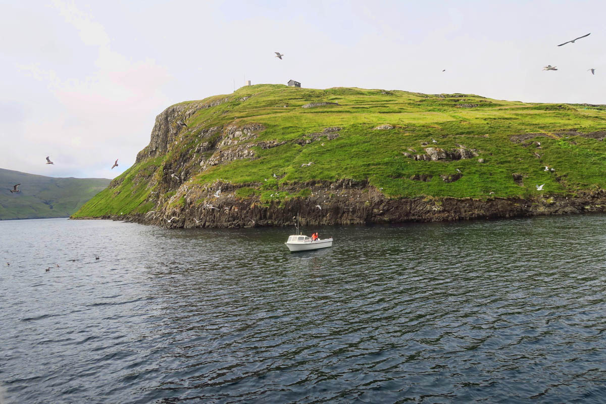
Note all the birds flocking around this fishing boat. Unfortunately, they would be the only birds we saw on the Vestmanna Bird Cliffs boat tour.
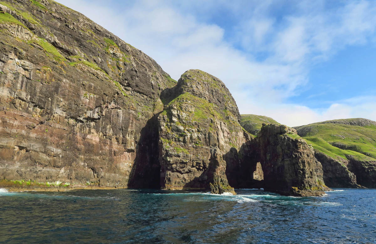
While the birds had flown the nest, the tour was still worth it for the scenery.
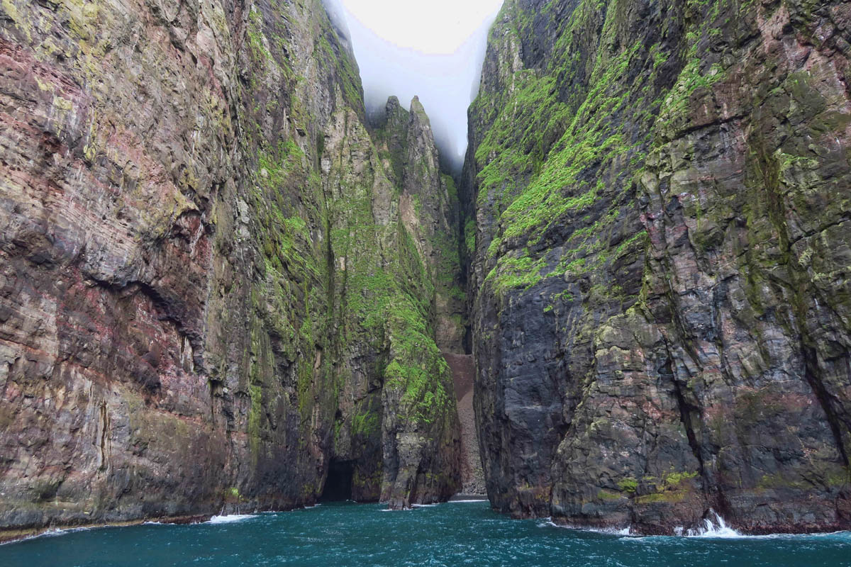
The boat was able to squeeze up into some pretty tight spots.
Boat was a bit crowded, otherwise it was a pleasant tour.
After one last dinner of spicy miso soup, I said my goodbyes to Lynn and Lisa, with the promise to meet up for more adventures again one day. The two of them are headed in the opposite direction to Iceland, while I am back on the Smyril Line ferry bound for….Denmark!
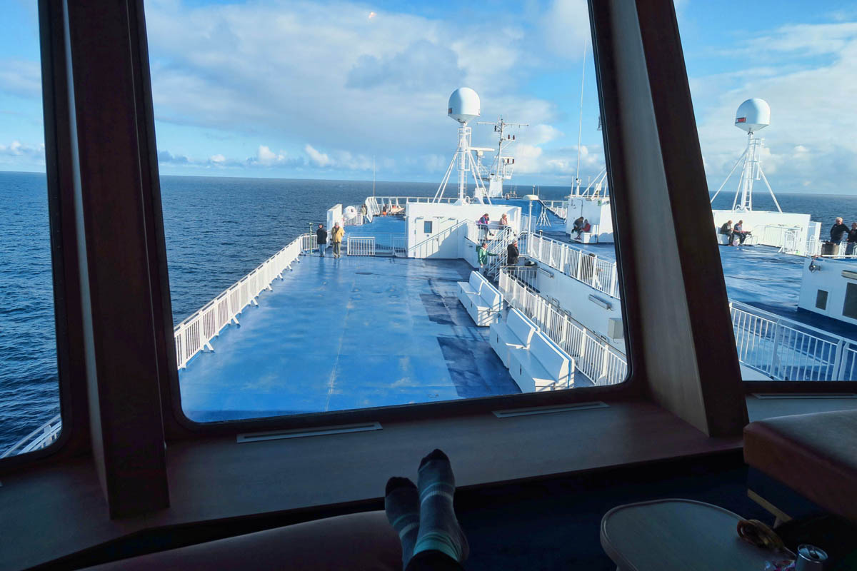
My view from the Smyril Line Ferry top deck chaise lounge. I hope the next 50 hours don’t go too fast!
Wow! Sunshine! 🙂
I KNOW, right???
WOW is that beautiful! After your first posting about the Faroe Islands I went sightseeing with the little google map man and spent so much time “wondering around the islands” that I actually recognized not only some of the scenes you posted but the roads! I will say even sitting here in my chair in my family room those one way tunnels scared the heck outta me. What a wonderful trip!
LOL…while I was wondering about, I meant wandering 😉
Oh, I thought maybe you were listening to one of my favorite Christmas albums by Barbra Streisand which has the song “I wonder as I wander.” LOL!
Thanks, Marti. I hope you and Ed get to wander the Faroe Islands yourselves one day. And if not, well, we know of an equally beautiful spot just a short ferry ride away, right?
Hi Lynn
I have a question
Why are the buildings/ houses covered with most,?
Village of Tjørnuvík for example
Hi, Agnes, It’s Suzanne here. Lynn was the friend I met on the boat.
These are known as “turf” houses, and it is a tradition that dates back to the Viking times. The sod on the roof acts as insulation to keep the houses warm in the winter and cool in the summer. As you can tell from the photos, there are hardly any trees at all on the Faroe Islands. So the sod is much cheaper than lumber and traditional insulation.
Thanks for the question, Agnes, and for following along!
Like several other commenters; Wow! Incredible scenery, incredible pictures, incredible trip! The roads into Tjørnuvík and Gjógv are beyond words!
Gorgeous scenery for sure and I’m sure Stephen would’ve approved. Looking at those full-of-wool sheep, I had to think: those sheep need shearing by the seashore! (Sorry)
Such magnificent scenery! I always look forward to your beautiful, thoughtful posts!
I continue to be wowed and impressed with your driving and photography talent.
It’s fun to be an arm chair traveler, ha.
So much emerald green. Beautiful. That tunnel gave me the creeps just reading about it. Crazy “jellyfish” roundabout. How nice that you had a couple days with travel companions. What an adventure, Suzanne. I had so much fun traveling with you. Looking forward to Denmark.
How do residents buy groceries, clothing, and etc? Is there a big shopping mall on one of the islands? Although one of the most beautiful places I have ever seen, it seems like such a difficult place to live. Do they raise their own food? How does this work?
Whoa! That under-sea roundabout! The “Seal Woman” (which reminds me of the “Lorelie” over the Rhine River in Germany, a place of mystical romance which I visited several times as a kid living in that country)! The exciting excursions! It’s like you absolutely *were* in a movie, Suzanne! I imagine this seven day adventure will forever rank high in your memory bank for years to come. And, as an avid 007 fan, something tells me I might not like the ending of the latest installation. James Bond simply cannot die…there is no time for it!