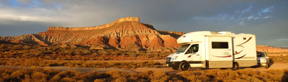
As I continue on across the southern part of Utah, I am getting ever closer to Kanab, present home of one of my favorite bloggers, Gaelyn, better known as “Geogypsy.” I began following Gaelyn’s blog during one of her visits to South Africa. We corresponded this past spring as I was making my plans to visit the Grand Canyon North Rim. She was very helpful in giving me some advice for my lofty goal to hike the “Rim to Rim.” Unfortunately, life took a different turn, and I had to cancel those reservations as I made my way back to Texas.
But I continue to enjoy her blog, so I sent an email asking if she was available for a meet-up. We agreed to meet at the kiosk on Houserock Valley Road in between Page and Kanab, and hike the “Upper Buckskin,” exploring some of the wilderness areas along the Paria River.

Moon over bizarre rock formation beside Hwy 163 just north of Kayenta.
Home near Paria River Contact Station
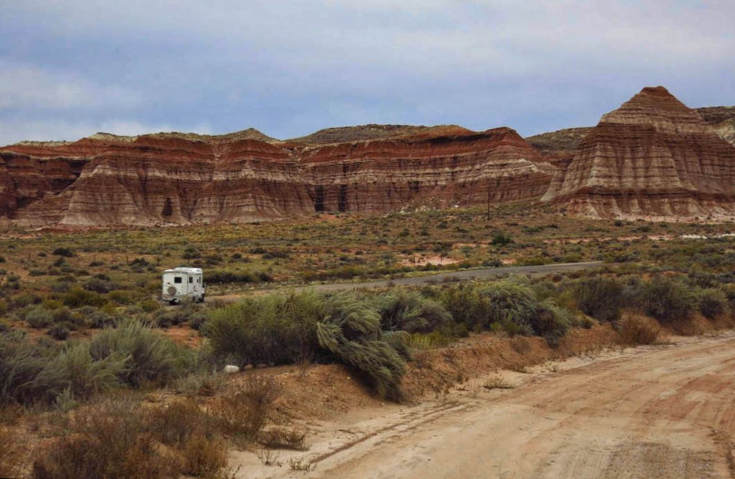
Before we meet for our hike, I want to do some reconnaissance on the conditions of Houserock Valley Road which is notoriously bad, and the recent torrential rains cannot have helped. This is the heavily traveled, rarely maintained road to access the extremely popular hike, The Wave. So I head down the rough, rocky, rutted road to see if the little Tracker is up for the eight mile trip.

Houserock Valley Road can be a bit “unforgiving.”

Upper Buckskin Gulch
Halfway to Wire Pass, I come upon a shuttle driver with a van full of backpackers. The driver has buried the trailer hitch in the sand while dipping down one of the deep gullies near the Buckskin Gulch trail head. A guide from Paria Outpost coming from the opposite direction stops to assist. Once the van is freed, I ask the guide about the conditions of the road in front of me. He replies, “You shouldn’t have any problem in that (nodding toward the Tracker.) But if you do, just stop right here. This is a beautiful place! You can hike up to Ed Maier’s Secret from here.”
“Who is Ed Maier?” I ask, “and more importantly, what is his secret?” I am instantly intrigued… The guide just gets back in his van, nods toward the trail head with a smile and says “You should go find out!” as he drives off.
Once back to the boondock spot, I google to try to find more about this hike called “Ed Maier’s Secret” as if the guide has thrown down some sort of gauntlet. I can find little mention of it outside of a few photos and one amateur video.
Sandstone Tee-pee Rocks
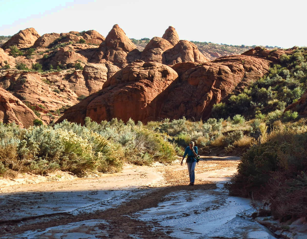
 The next morning, Gaelyn, Bill and I meet at the kiosk off Hwy 89 at 9:30am on a beautiful clear, crisp fall morning. We drive to the Upper Buckskin trail head, then hike a mile or two up the wash when I decide to pose the question that’s been on my mind. Bill, a long-time resident of Kanab is retired from the BLM where he spent many years surveying these wilderness areas. If there are secrets up here, he is sure to know…
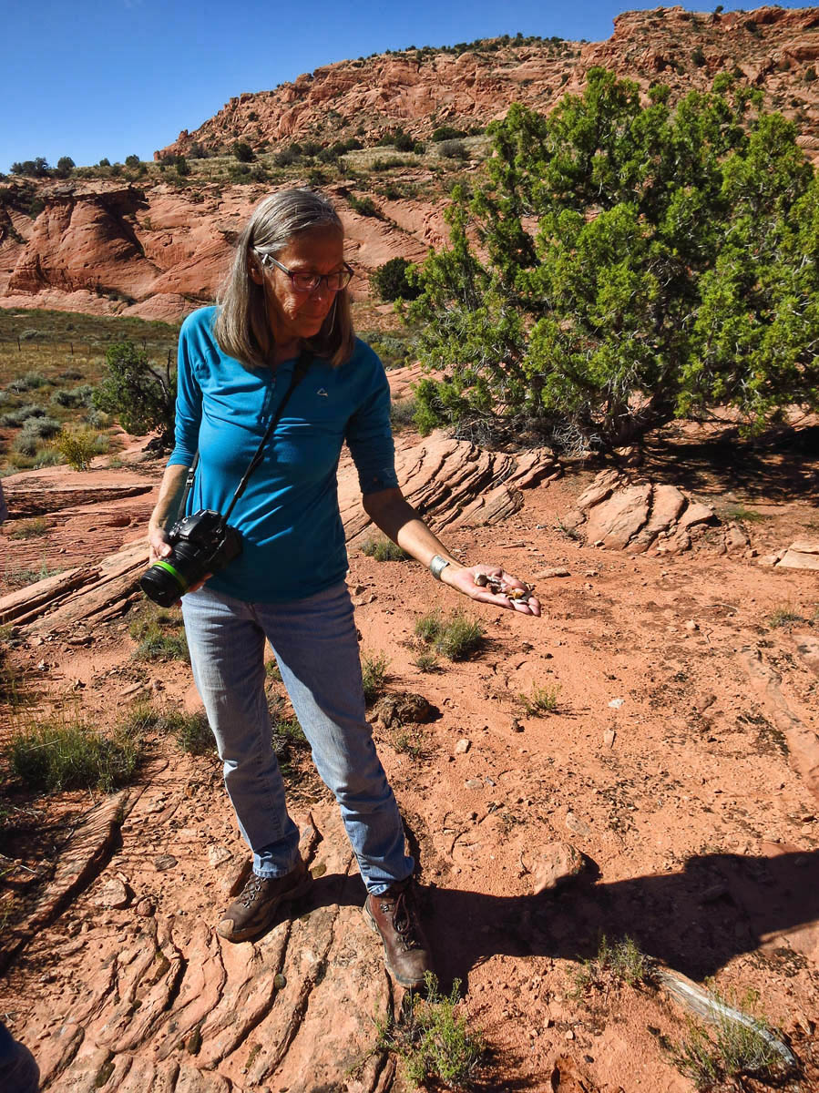
Gaelyn, the Park Ranger, never stops “interpreting.” She tells me “We are standing on a lithic site.”
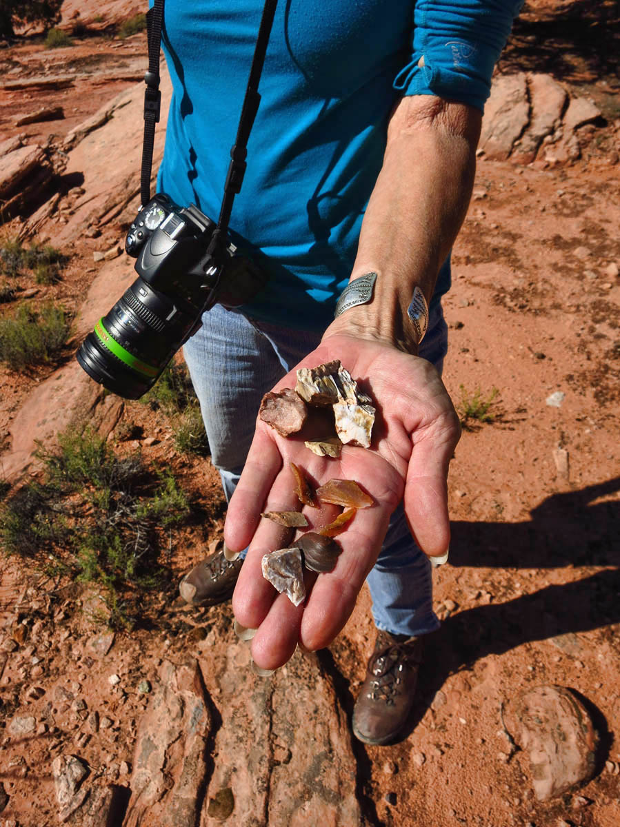
Small fragments of flint-like stone or agate indicate “knapping” the lithic process of creating tools (arrowheads) from stone.
“Have you guys ever heard of Ed Maier’s secret?” I ask. They both look at each other and chuckle. Then they begin to tell the story of how this “secret” got its reputation by a youtube video. Now, destination-focused hikers like me are obsessed with finding the “secret.” In a moment of self-examination, I realize I have bitten, hook, line and sinker.
As we walk further down the wash, I continue to ask questions about the “secret.” I have always prided myself on being one to enjoy the journey, not the destination, so I am a little surprised at myself over my obsession to find the source of the secret.
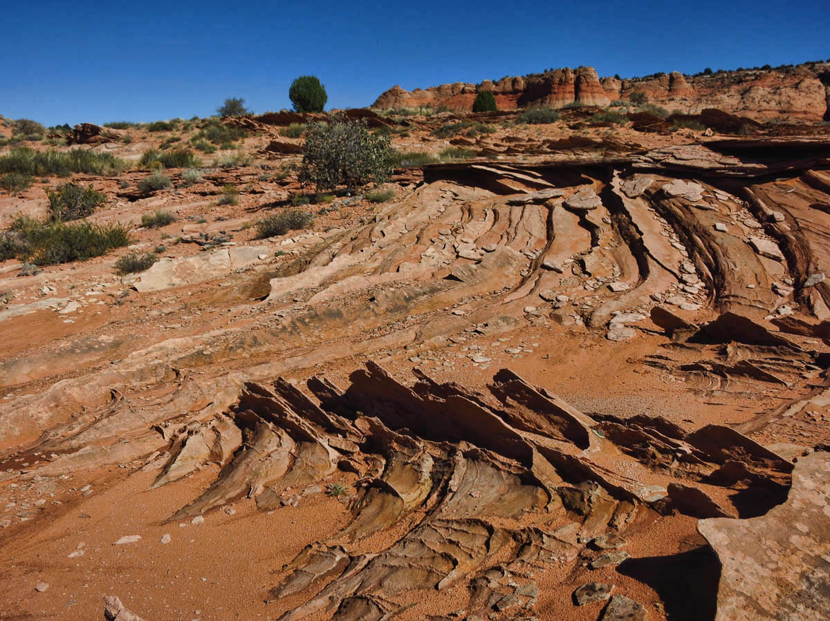
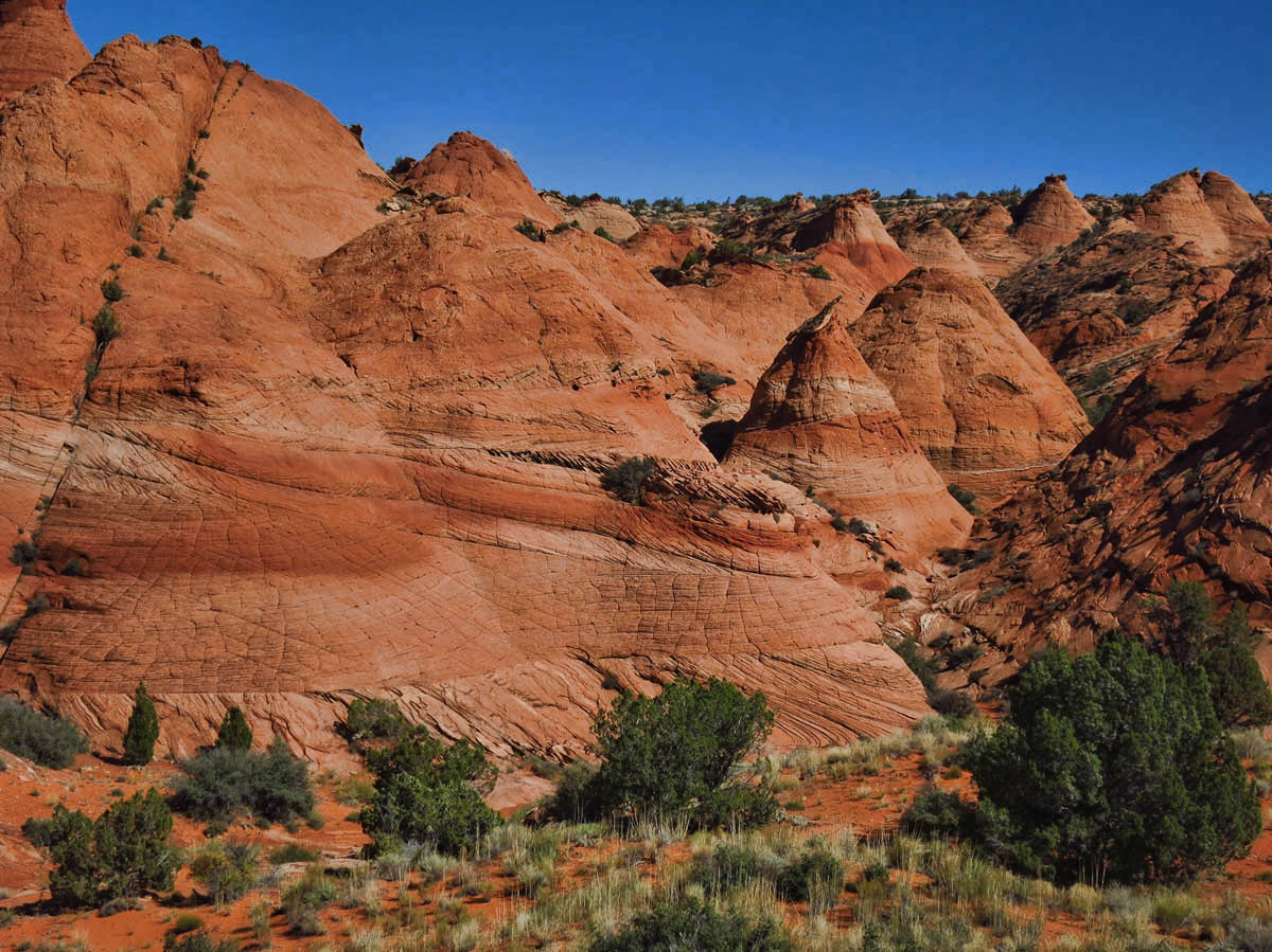
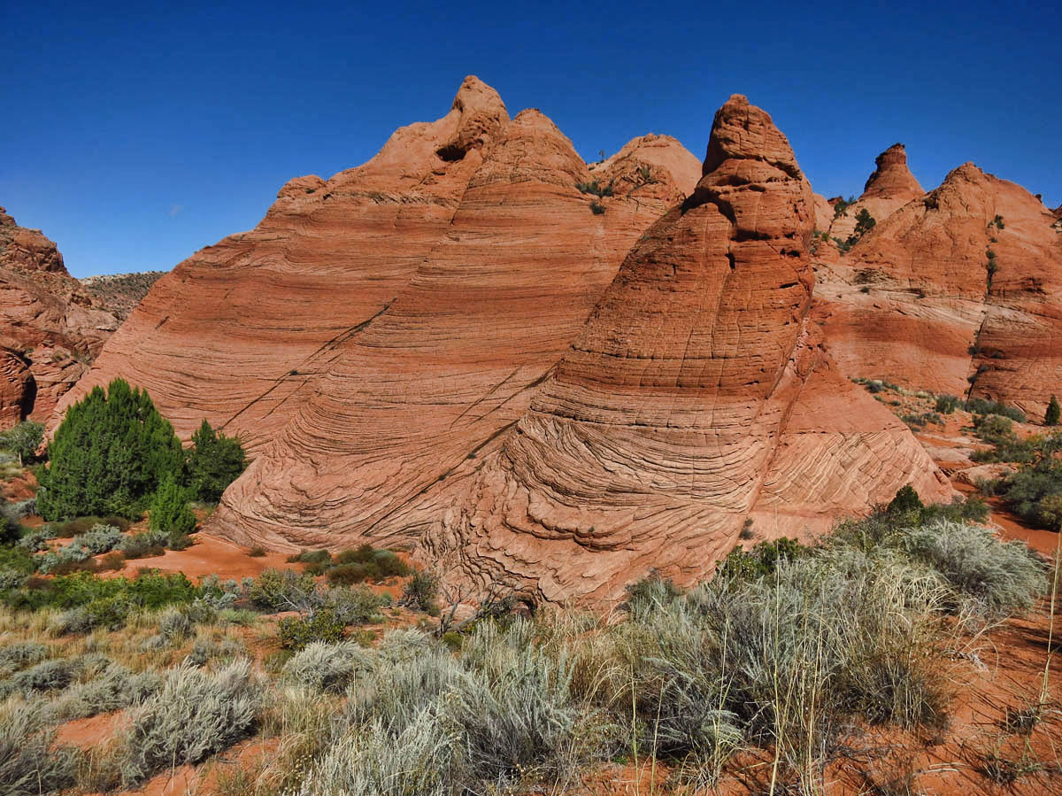
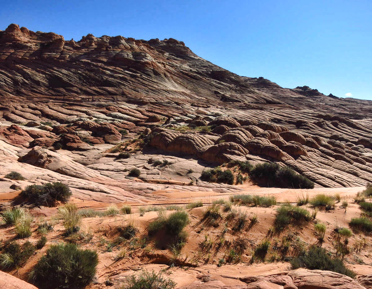
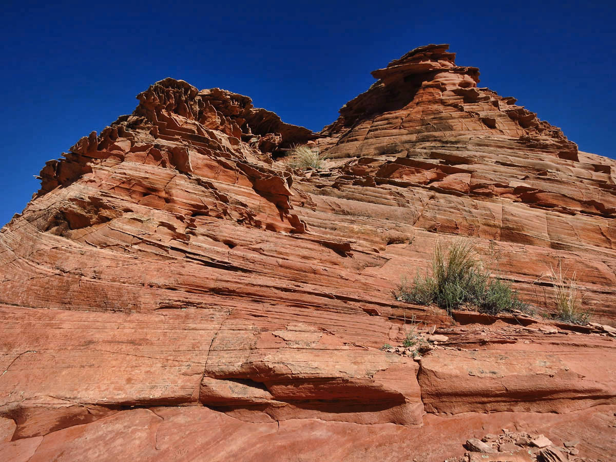
“Fins” emerge from the ground, getting increasingly larger as we walk toward the ridge.

“Pillows” of sandstone.
With each probing question, Bill and Gaelyn gently guide my thoughts back to the beauty that surrounds me, reminding me that if I continue to focus on this secret destination, I will miss the reason we are here…to enjoy the day in this beautiful wilderness. With every few feet, we come to a different formation, and they tease me that we can name each of these our own secret! Okay, okay, I get it! I have fallen prey to “destination marketing.”
“Brain rocks.”

Row of very delicate, unusual fin formations.
As we stop for lunch, I settle into the day to soak in the glorious colors of vermilion, cobalt blue, and sage of the layers of red rocks and lush green vegetation contrasting with cloudless sky overhead. I contemplate the remoteness of this wilderness that knows no boundary from my line of sight.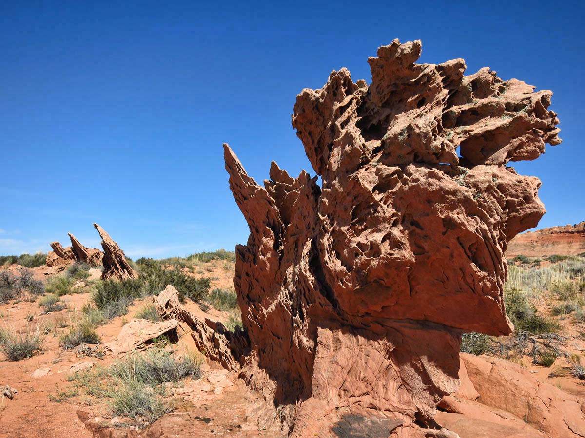
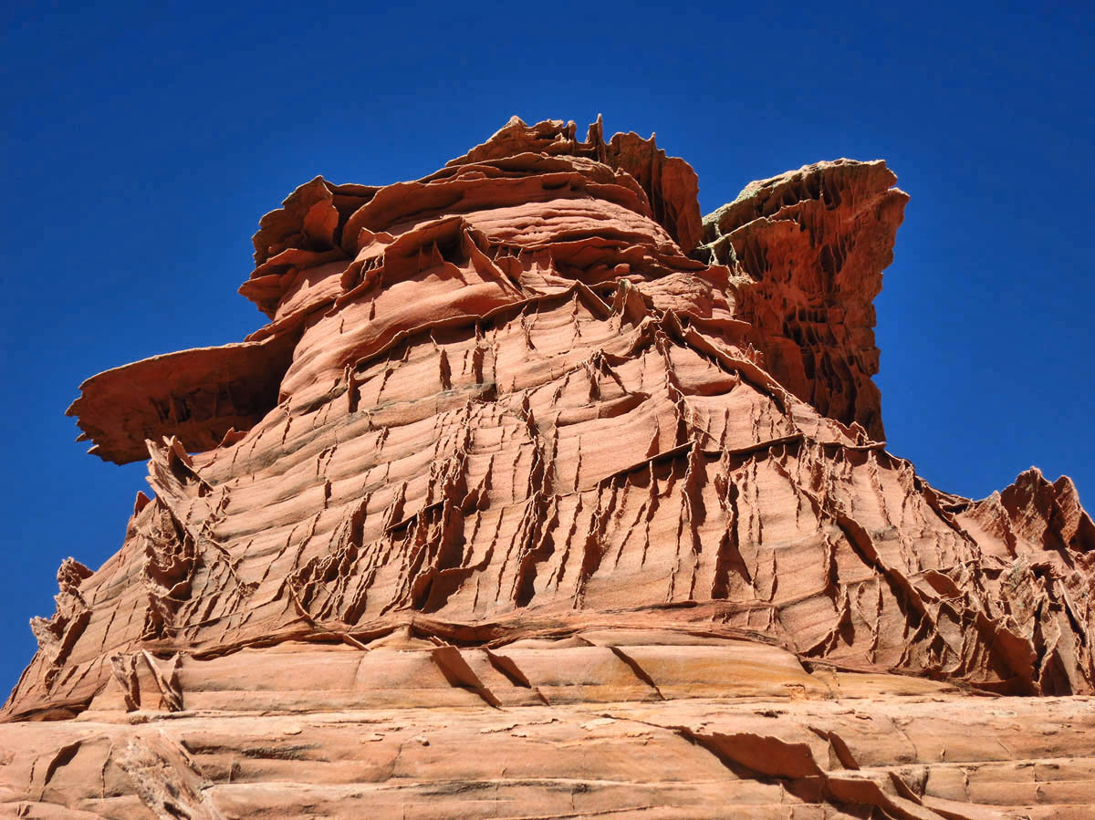
As I look around me, I begin to recognize some of the landmarks I have seen on the youtube video. Behind me is a flank of tall rocks resembling tee-pees. In front of me are fascinating sandstone mounds shaped like pillows, with larger ones behind that look like a brain. I climb a little higher, marveling at the “fins,” delicate thin layers of sandstone that appear to be so fragile, the thump of a finger would send them all aflutter.
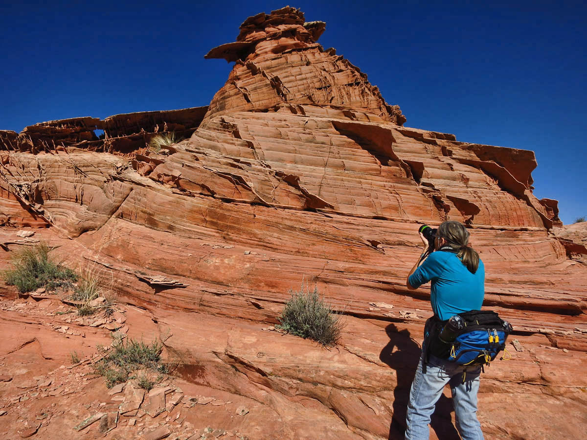
Ranger Gaelyn in action. I ask her a dozen questions about “The Hat.” 😉
Any one of these recognizable landmarks would be worthy of a secret destination. But put them all together and they make one hell of a journey. The exact location of where I stand? I could tell you, but Bill and Gaelyn swore me to secrecy. 😉

“Those who dwell among the beauties and mysteries of the earth are never alone or weary of life” ~Rachel Carson
Love your post and your photos are really pretty……….so much pretty stuff to see in the desert redrocks and every formation is unique.
Thanks for the comment, Ami. Yes, there is beauty everywhere you look in southern Utah!
Always nice to read a different perspective on the secrets that abound. I shall carry to my grave where Suzanne’s Secret is hidden. Great time.
This made me laugh out loud, Gaelyn. Yes, a great time indeed!
We have not explored the Paria/Buckskin area…yet. Obviously it must go on The List! There is something about these other worldly landscapes that just sucks us in…
Lisa, I have a sneaking suspicion you and Hans would like the next hike I am about to post about. 😉
I went through this secret thing with Mark!! It took me three trips to find one secret and tons of miles on my feet. So here’s the plan…when we get to this area in the spring, you come along, as well, and guide us!! Perfect don’t you think! Then we’ll celebrate with that Belching Beaver Peanut Butter Stout after:)
I am such a sucker for these unusual rock formations. Boy, you saw some amazing forms…totally cool!!! This is an area we have yet to explore. The Grand Escalante area is soooo huge!!! And not real Big Rig Friendly.
If you “show,” you get to go 🙂
BCB Mark
Hopefully, Mark, we will “show” at some point when at least some of the Red Rock Gang is around:)
Let me guess, Pam….”Tripod Rocks?” haha!! Unfortunately the Grand Escalante is not is very 2WD friendly either. Fortunately the Tracker has more nerve than its driver. But oh so much to explore!
Yes, the tripod rocks!!! That’s why we are so glad we sold the motorcycle so we could tow a Jeep! We have been able to do many hikes and take others with the Jeep. As a matter of fact, the Jeep took us right to the parking area of today’s hike. Many have to hike in the last half mile. We do realize that most of Grand Escalante needs at least high clearance, we are ready:)
I found myself getting trapped into a “bucketlist” of must see places. I don’t really want to travel like that now that I have been doing this for 4 years. I am still workamping and will prob work for 2 more years and then hope to just wander around without a plan. Have you read any books by the “Silver Gypsy”? Years ago used books were available on Amazon. She wandered around in her 25′ motorhome without a car, stopping anytime she saw a brown sign. I believe she traveled this way for 20 years.
Hi, Teri — I have tried that wandering approach on some of my travels, but what usually happens is I find I am wandering some ordinary street while a “wonder of the world” was just one street over, and I missed it! So that’s why I like my “lists.” 😉 Thanks for the book suggestions. I have not heard of “Silver Gypsy” before, but it sounds right down my alley!
NO WAY. Suzanne’s Secret??? This is too much.
Why, yes, Roxi…didn’t you hear? I have a DVD, “Suzanne’s Secret” coming out soon. haha!!
What an interesting and different looking place! Fascinating geology, secret or not. Thanks for the beautiful and informational blog. I really enjoy it.
Thank you for always such nice compliments, Pamela. It helps fuel my fire to continue posting!
Those jagged red rock formations look like coral reef… what sculptures of nature you found! Hopefully spring will be drier, and we’ll try again on our way home.
Box Canyon Mark
BC Mark — Coral reef is a good way to describe them. Best I could come up with is “vertical eroded rocks.” That’s why you’re the writer and I am just the reporter. 😉
I Love Kanab ! The home of Best friends animal society. If you like cats and dogs , you really should spend a day or more there. They have a nice tour of the facility and they also have a great veggie/vegan lunch for employees and visitors at the cafe on their property.
Hi, Susan — Yes, I am familiar with Best Friends. They do SUCH great work there! I have known several people who volunteered, and even got to meet Sasha, a Best Friends dog on the hike. She was a sweet girl!
We drove down the house rock highway. We wanted to find the rock which looks as a house as well as the buffalo herd. We even brought our roller skates. We didn’t find either so the skates stayed in the car. We traveled a lot of miles but did not see any of the fascinating rock formations you showed us, so once again, thanks. We took an interesting road up to the Kanab plateau and the highway which takes one to the beautiful lodge at the edge of the canyon. We could not stay there as we didn’t make reservations a year ahead so we stayed at Jacob Lake motel and cabins. Good food, but don’t ask them to make a sandwich for your days travels. Night time we shall search our those formations. Thanks for sharing.
Hi, Allen — there may be two House Rock’s as there is no “highway” here, just a really bad, bumpy dirt road. So you have got my curiosity up with the roller skates now…do tell!
No problem, we were in Arizona and you in Utah.
Giggle.