The Channel Islands National Park is one of our least visited parks in the National Park system. Ranger Erin at the beautiful Robert J. Lagomarsino Visitor Center in Ventura Harbor tells me that of all the visitors that come to the center, only 10% actually travel by boat to set foot on the islands, as one need go no further than the mainland Visitor Center to get their National Parks Passport Stamp. Of those 10% who do take the boat trip, only a lesser percentage stay overnight. My assessment is of that small group, even less leave the Scorpion Cove area. What that translates to is feeling like I had the entire island to myself. I hiked 24 miles in three days, and saw a total of five other people.
No doubt this will all change once summer arrives…or even the weekend. But for now, I relish in the mid-week solitude of the barren “shoulder season.”
I hope I never forget the feeling of roaming across those grassy rolling hills, wandering along the paths that cling close to the cliff’s edge, or hiking up above the low lying clouds roiling over the hilltops like billowing smoke from a block of dry ice. Ethereal.
When I was a young girl, the film adaptation of Emile Bronte’s “Wuthering Heights” was a huge hit. I remember weeping as the heroine Cathy runs across the moor to the craggy cliffs calling after the brooding bad boy “Heathcliff!” played by a very young, dimple chinned Timothy Dalton. The rolling hills of Santa Cruz remind me of such a setting, as I know I could shout out to “Heathcliff,” and no one would hear me. I could walk for days across this island, taking in the change of flora and fauna, from the golden grain grasses left behind by the sheep farmers, their tassels swaying in the sea breeze, through the scrub oaks, home of the endemic Island Scrub Jay found nowhere else on earth, to the gnarled and twisted, lichen covered pine trees up on the high ridge trail where the sea mist blows in enough moisture to nourish blooming lupine. What a magnificent place to have all to myself!
I map out the hikes I want to do during my three day visit. My plan is to hike to Potato Harbor and loop back around Cavern Point the first day. The second day, I will hike to Smuggler’s Cove, a 7.5 mile hike on the heels my kayaking trip. This will leave the longest and most difficult hike, El Montañon, for the third and final day. That will give me the entire day to do the 8 mile >1,800 ft elevation gain to the summit, with plenty of time for lunch at the top to enjoy the view.
But I didn’t count on the kayaking tour lasting until after 3:00pm. No way can I make the 7.5 miles to Smuggler’s Cove and back by dark. Especially not after having paddled for four hours. So my only option is to combine the two hikes in the third free day. This will mean a very early start, several rest stops, and a meal or two on the trail. This now leaves the afternoon free following the kayak tour to hike an additional trail, the shorter 5 mile Scorpion Canyon Loop.
Here they all are, in their absolute splendor:
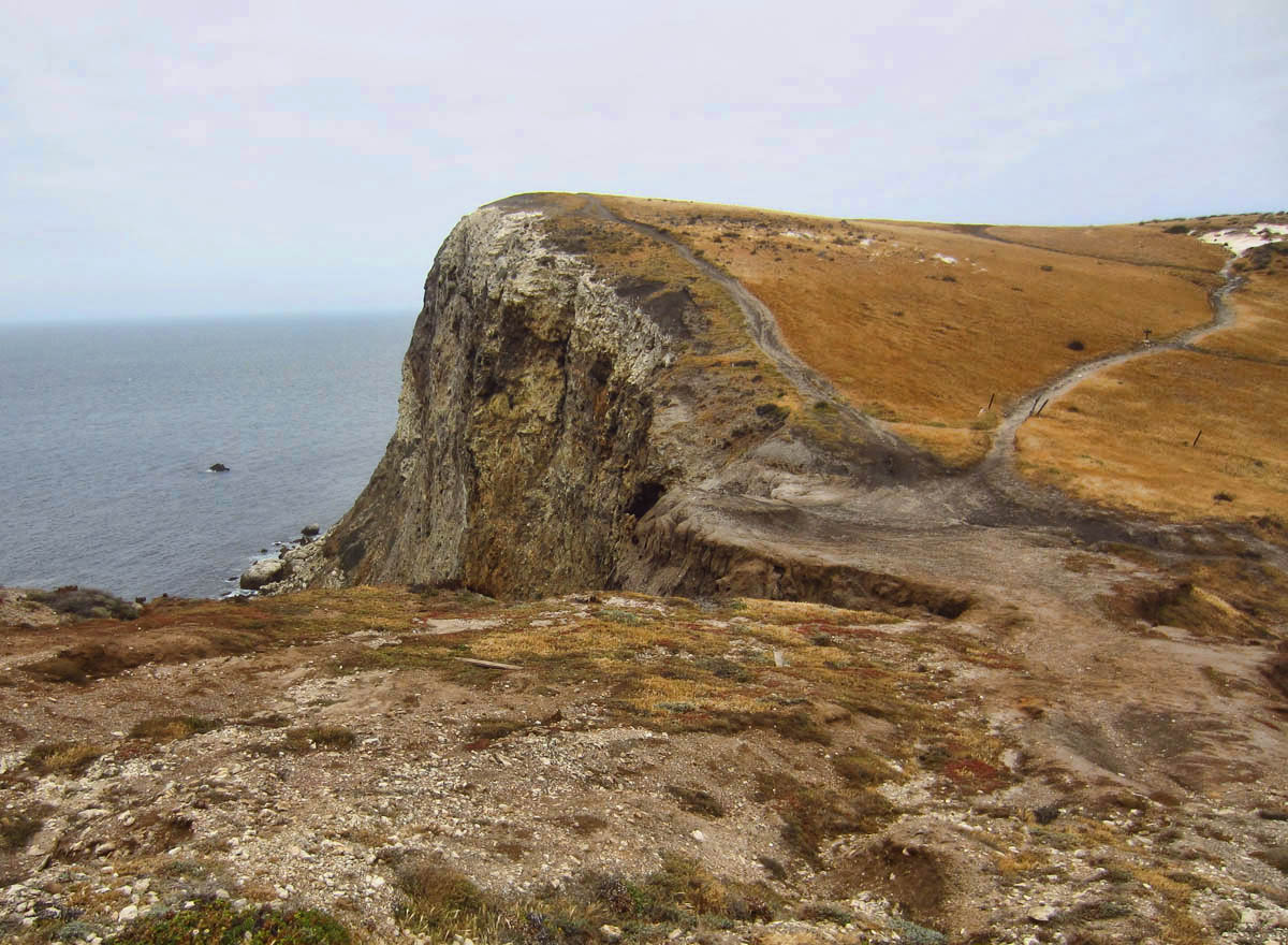
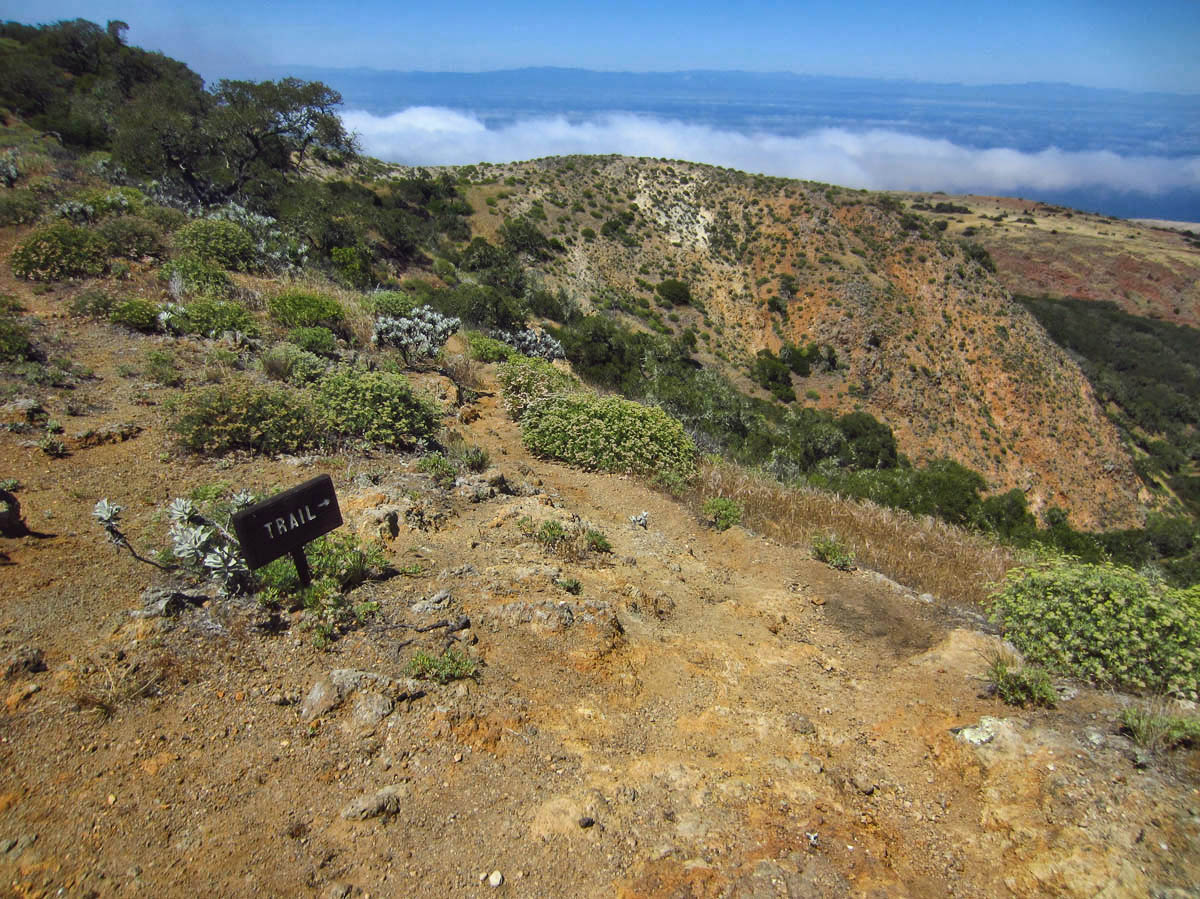
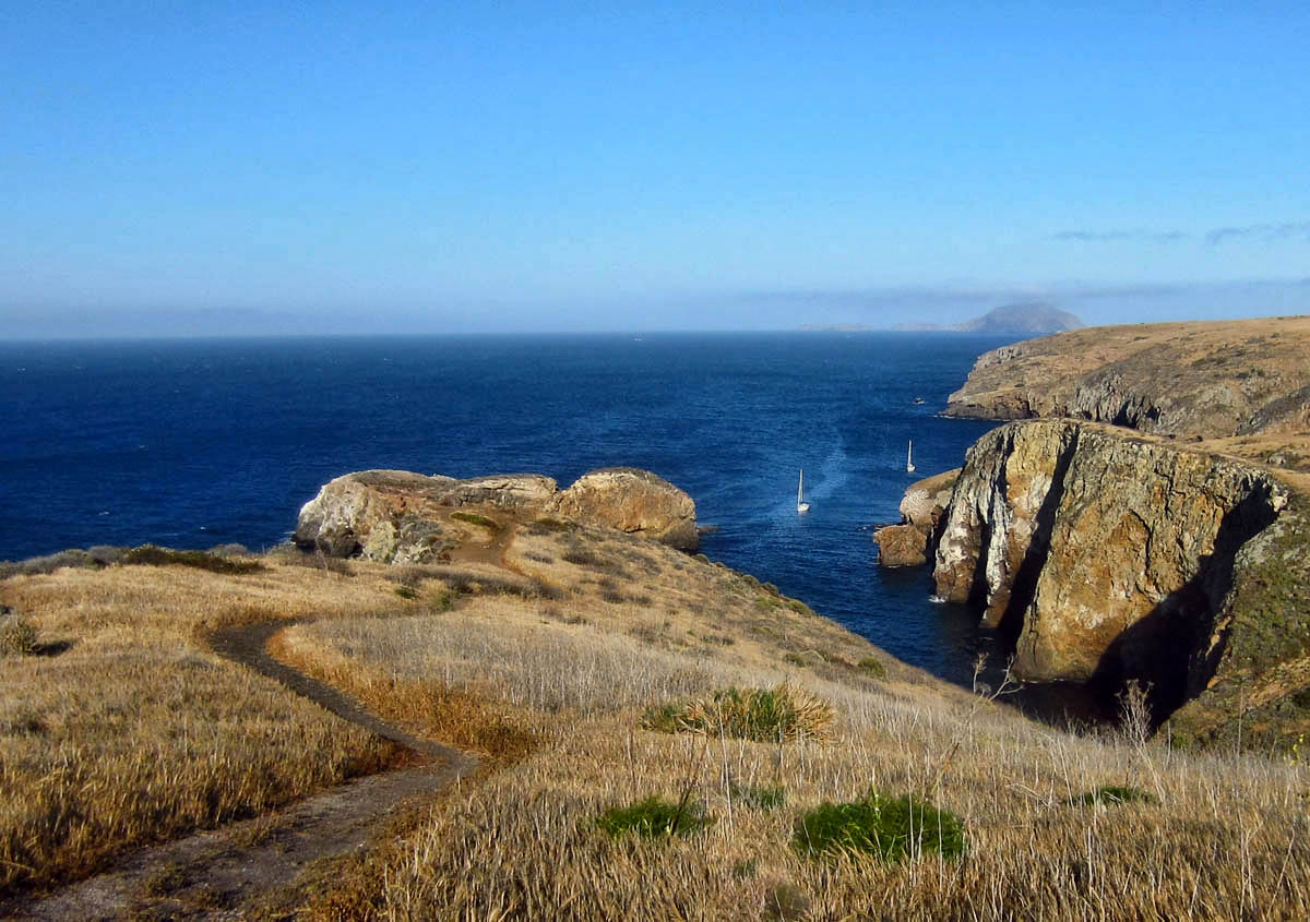
Day One: North Bluff Trail to Potato Harbor, return via the Cavern Point Loop: 6 miles
North Bluff Trail headed toward Potato Harbor.
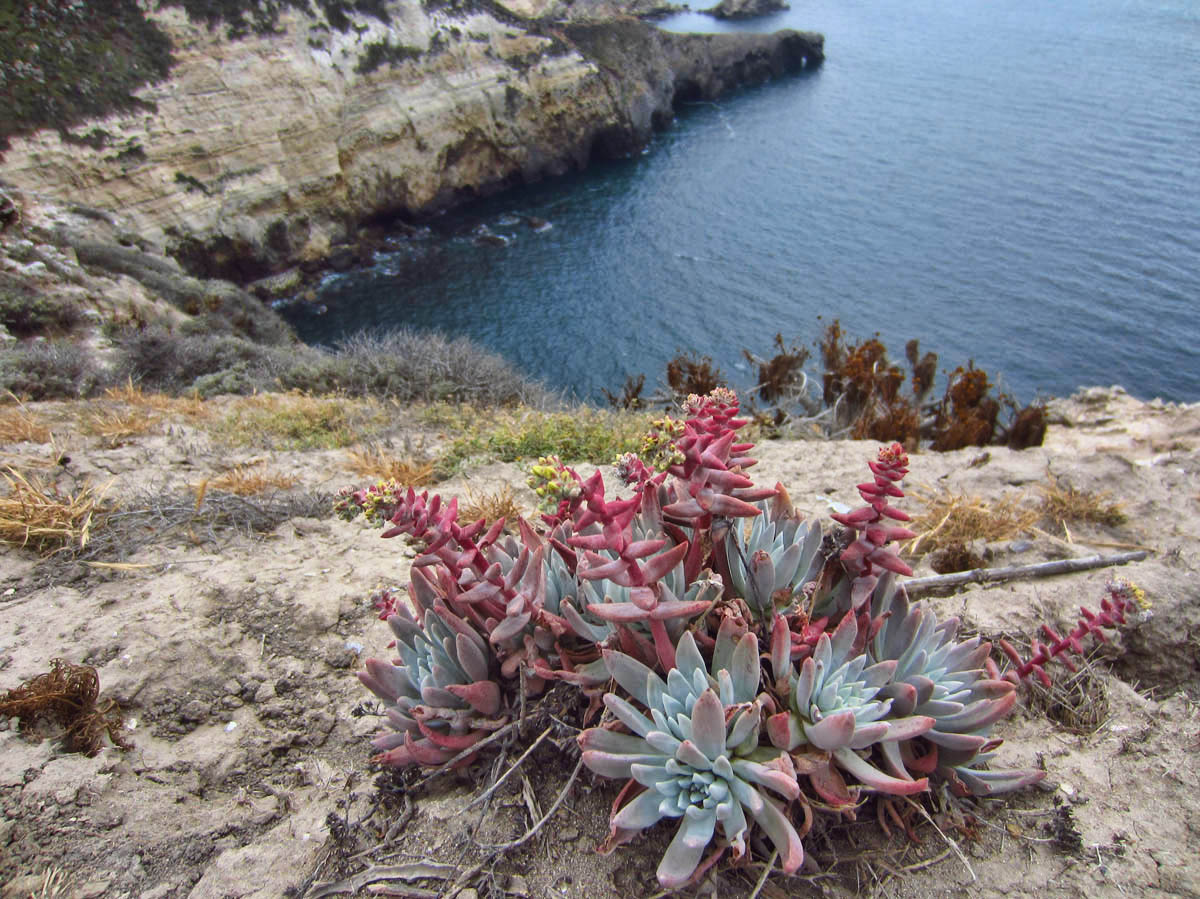
This is the “Santa Cruz Island Live Forever,” endemic and threatened species known also as “Dudleya nesiotic.” I like it’s common name better!

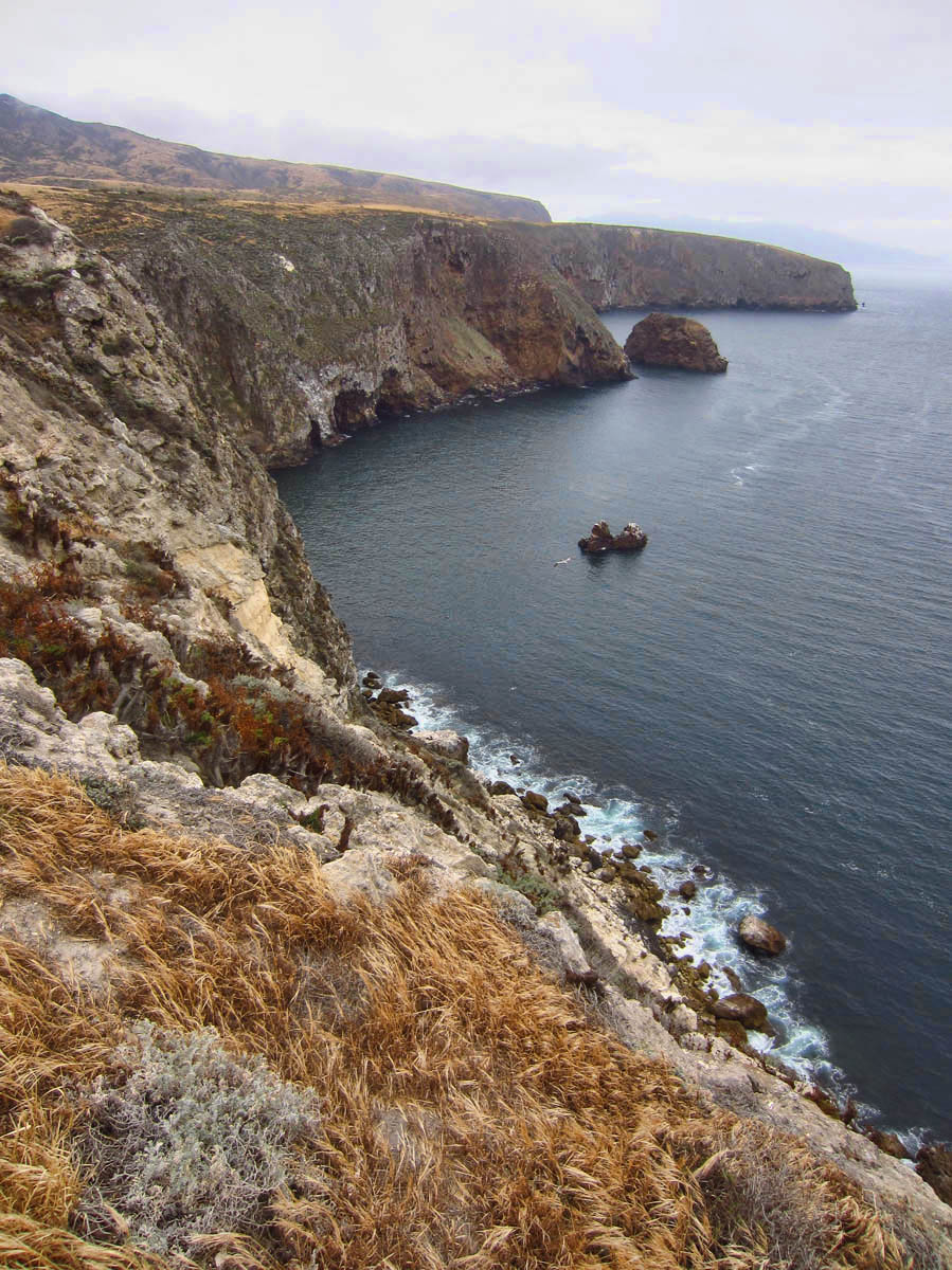
North Bluff Trail
Potato Harbor

Other side of Potato Harbor

Returning back along North Bluff Trail
Cavern Point Loop
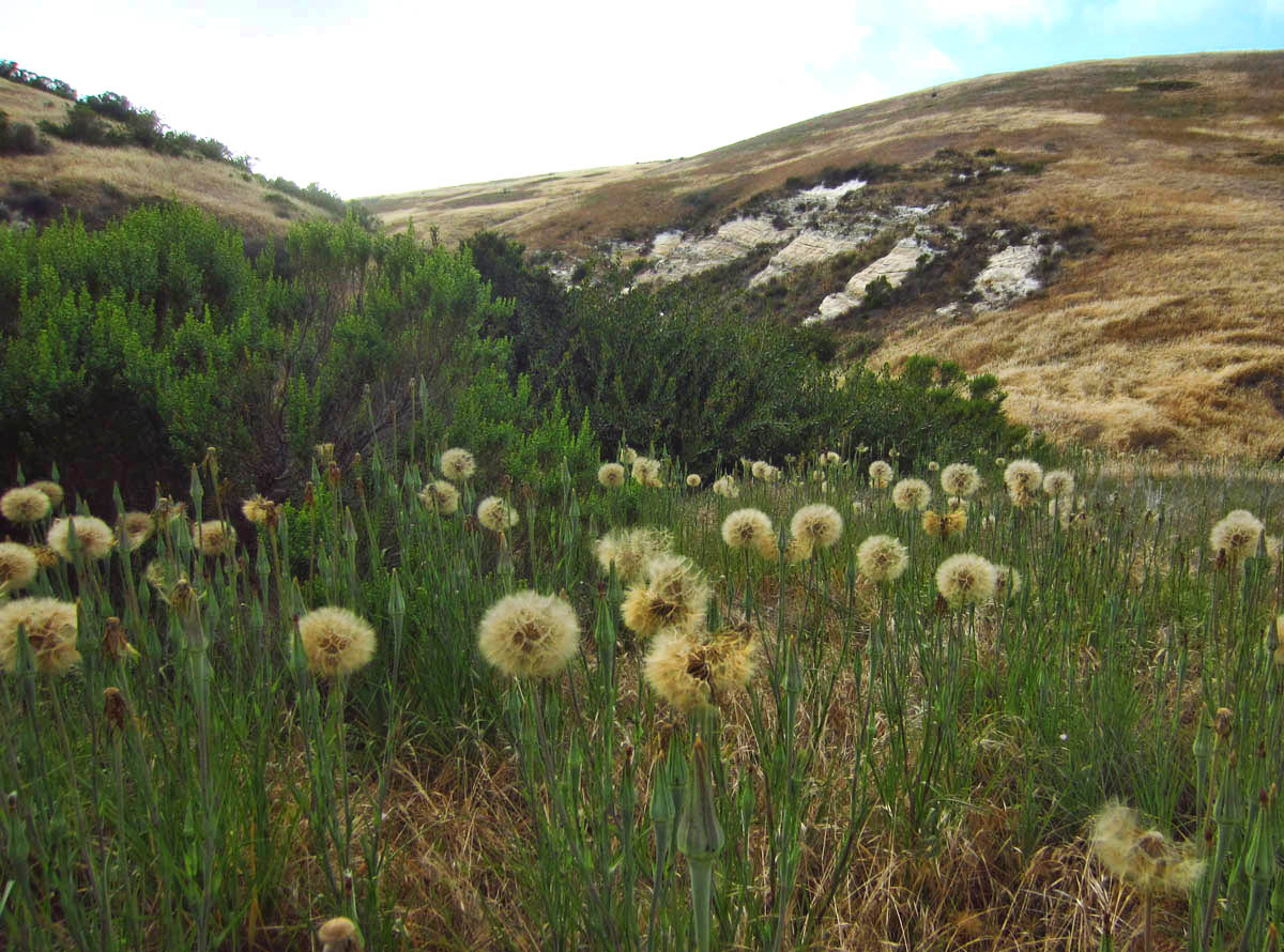
Day Two: Scorpion Canyon Loop Trail, 5 miles
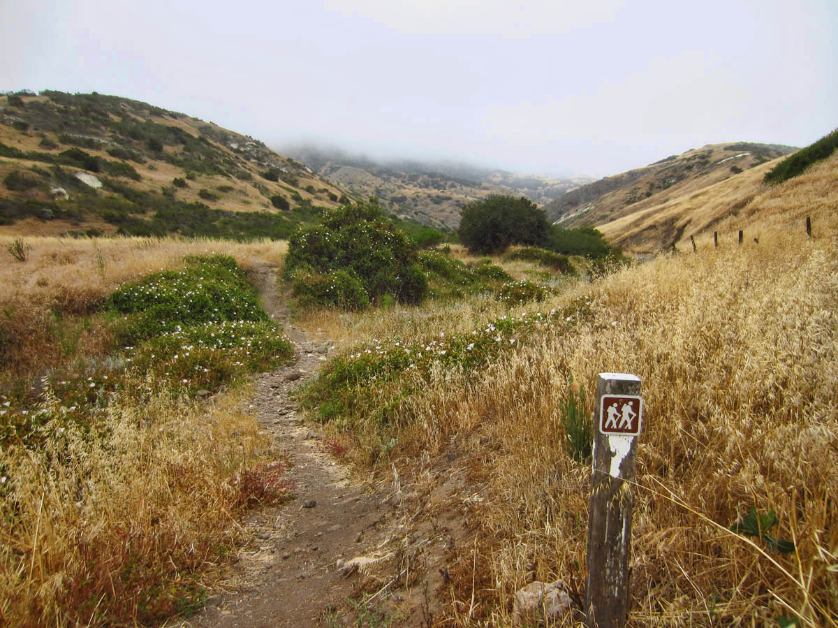
Heading out from the campsite to Scorpion Canyon.
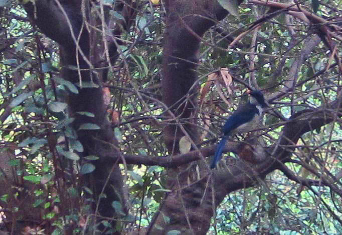
The trail passes through scrub oak, home of the Island Scrub Jay, found only on Santa Cruz. Larger and more colorful than relative, California Scrub Jay. Terrible picture, but look for the blue feathers on right. I never identified a rare bird before…my first “lifer.” LOL!
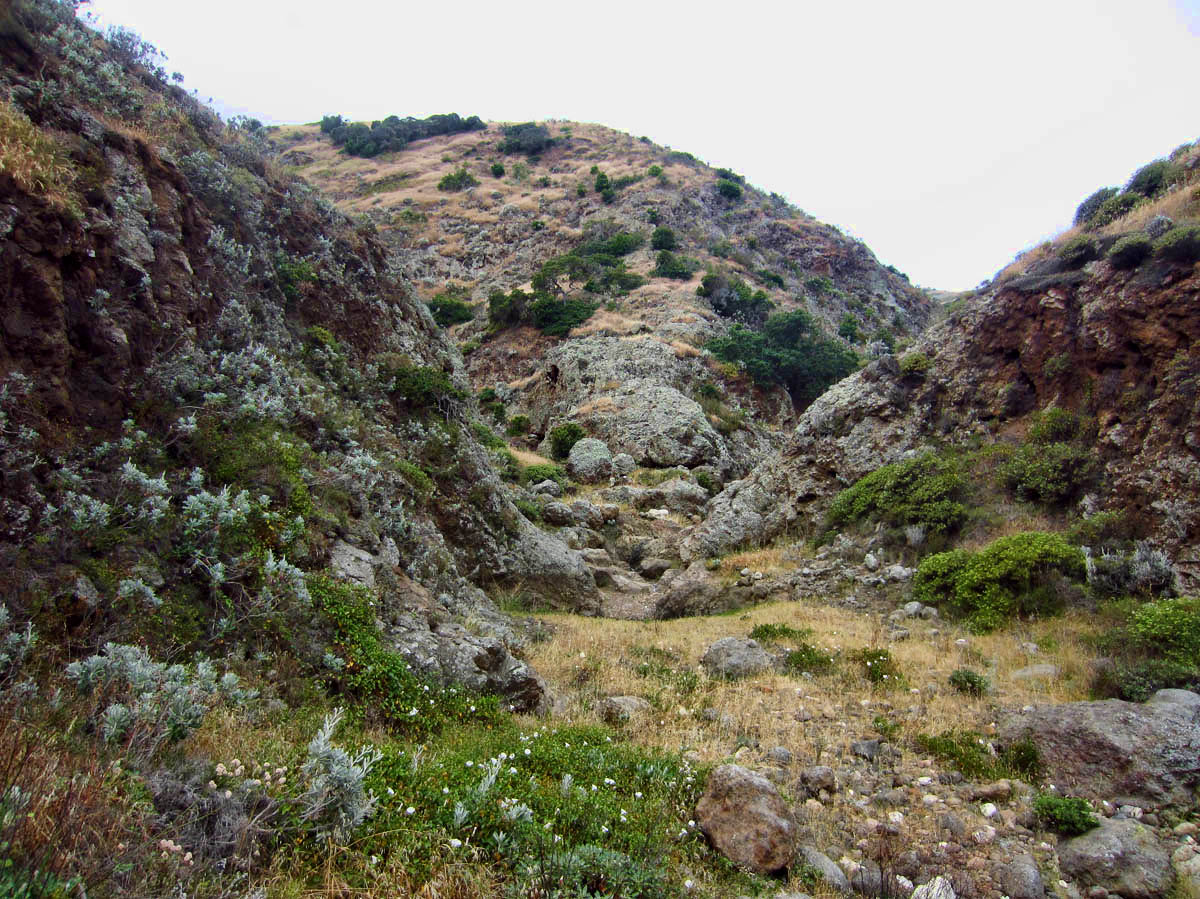
Scorpion Canyon
Overlooking Scorpion Canyon

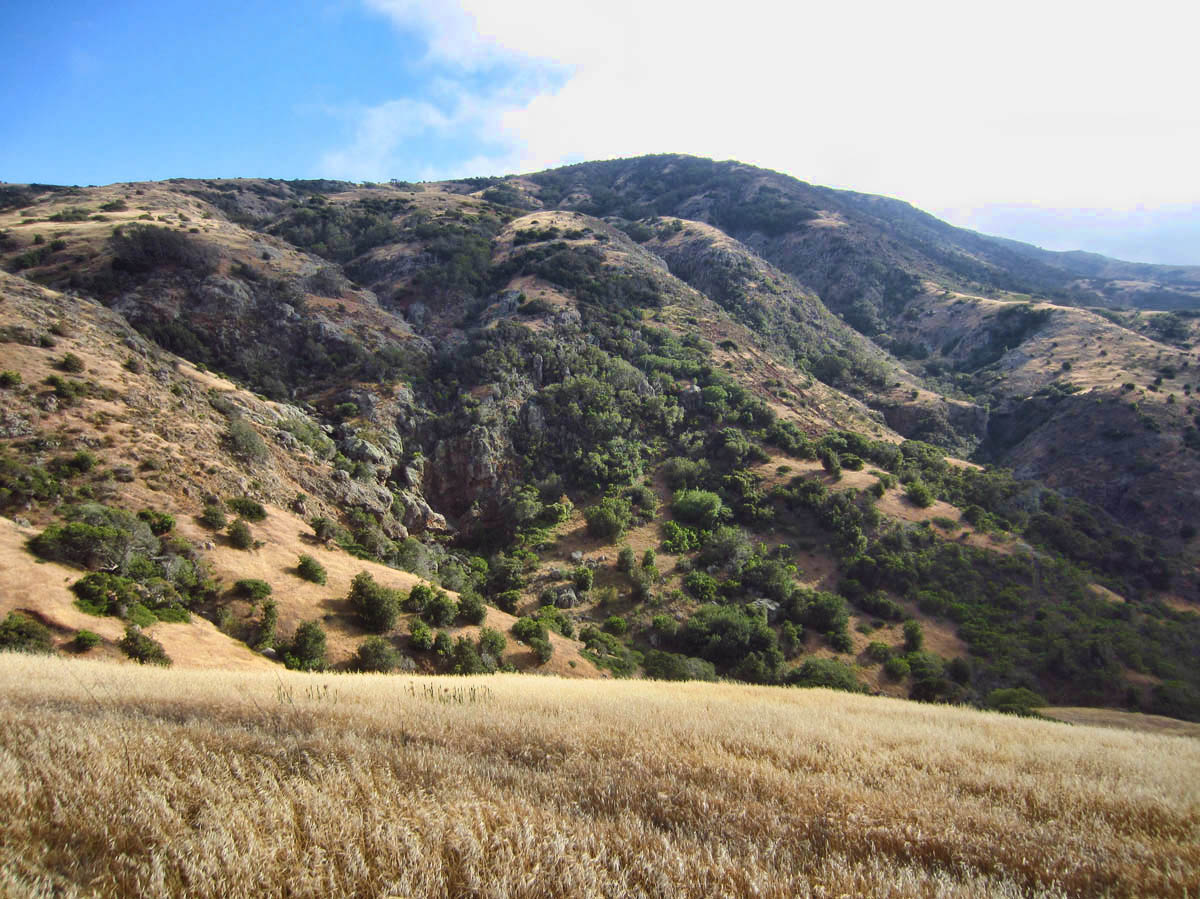
Making the loop. Ahead is Montañon Peak at 1808 ft.
Day Three: Smuggler’s Cove to junction of “Old Oil Derrick.” From junction to Montañon Peak and back via Smuggler’s Cove Road, 14 miles
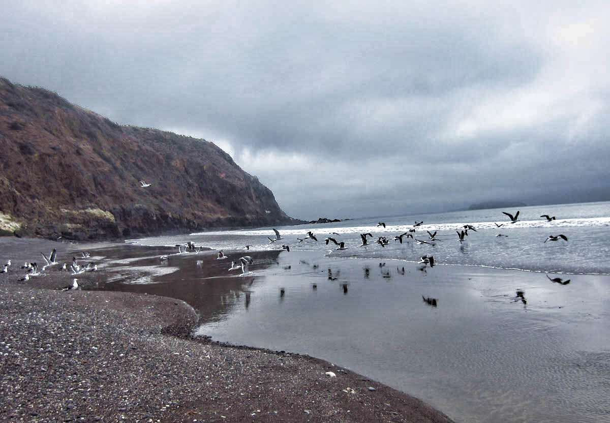
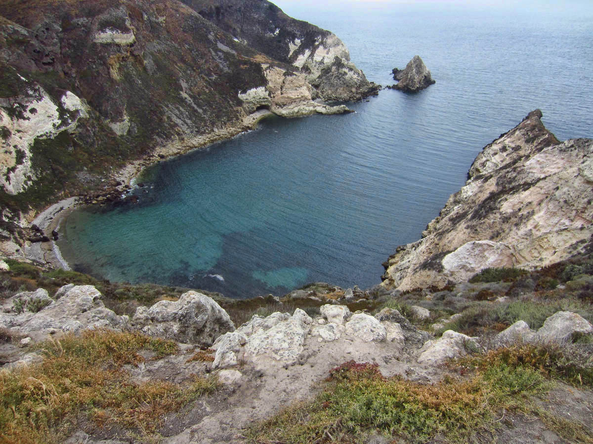
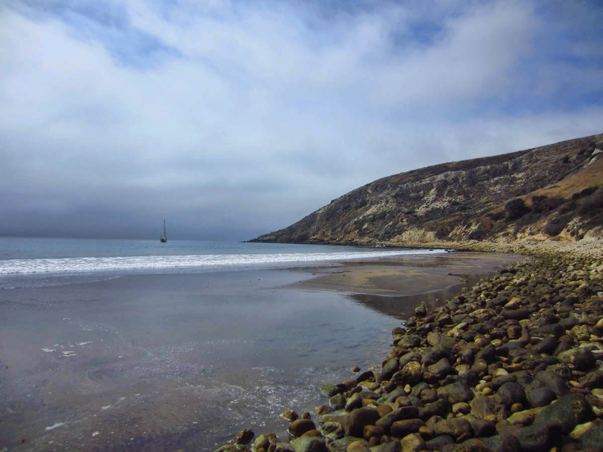
Smuggler’s Cove at low tide.
Named for smuggling known to take place, since cove is on the backside of the island.
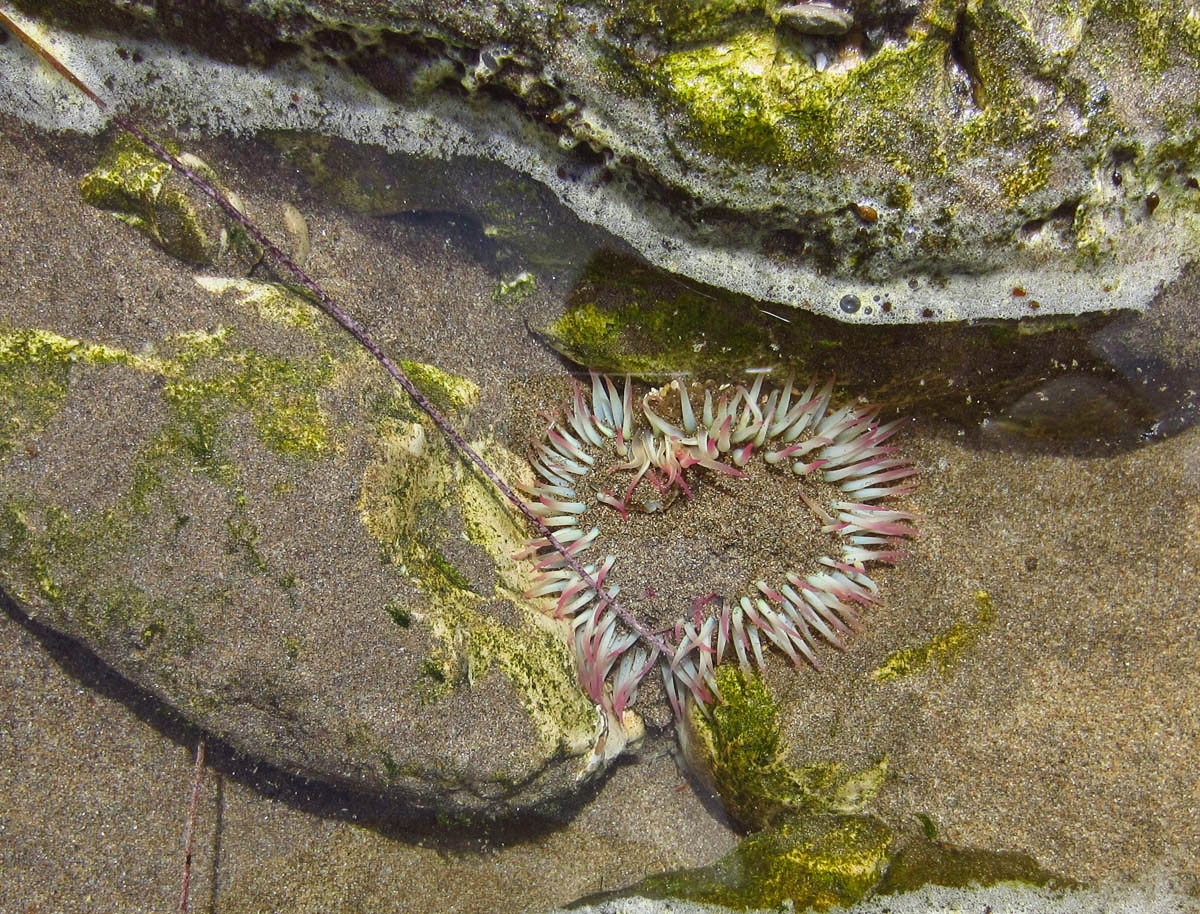
A little (very little!) tide pool.
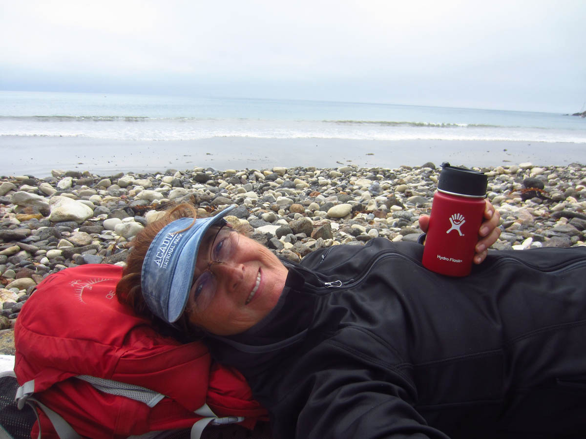
Taking a “coffee break” on a large driftwood log. A “selfie postcard” for my coffee-drinking hiking buddy, who inspired me to buy the thermos. 😉
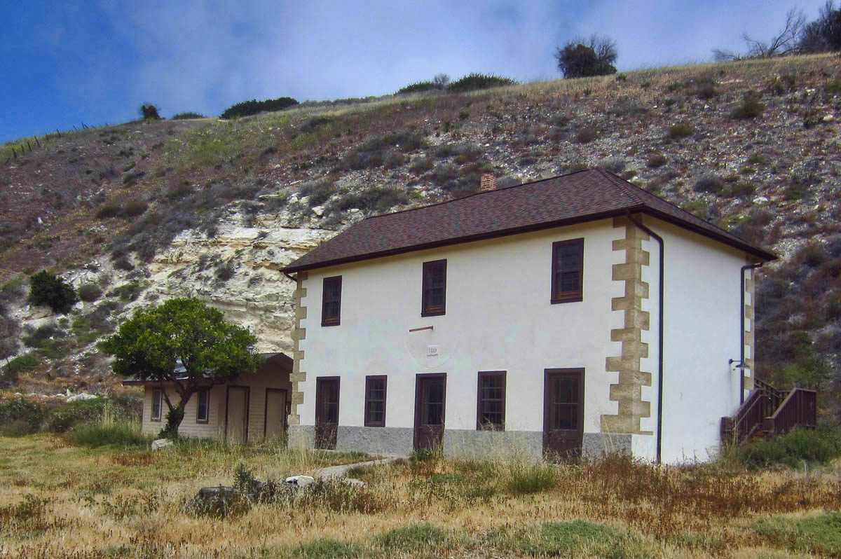
Smuggler’s Ranch House, built from adobe and plastered stone in 1889 by Italian laborers. Beneath upper center window is a sundial, and date “1889.”
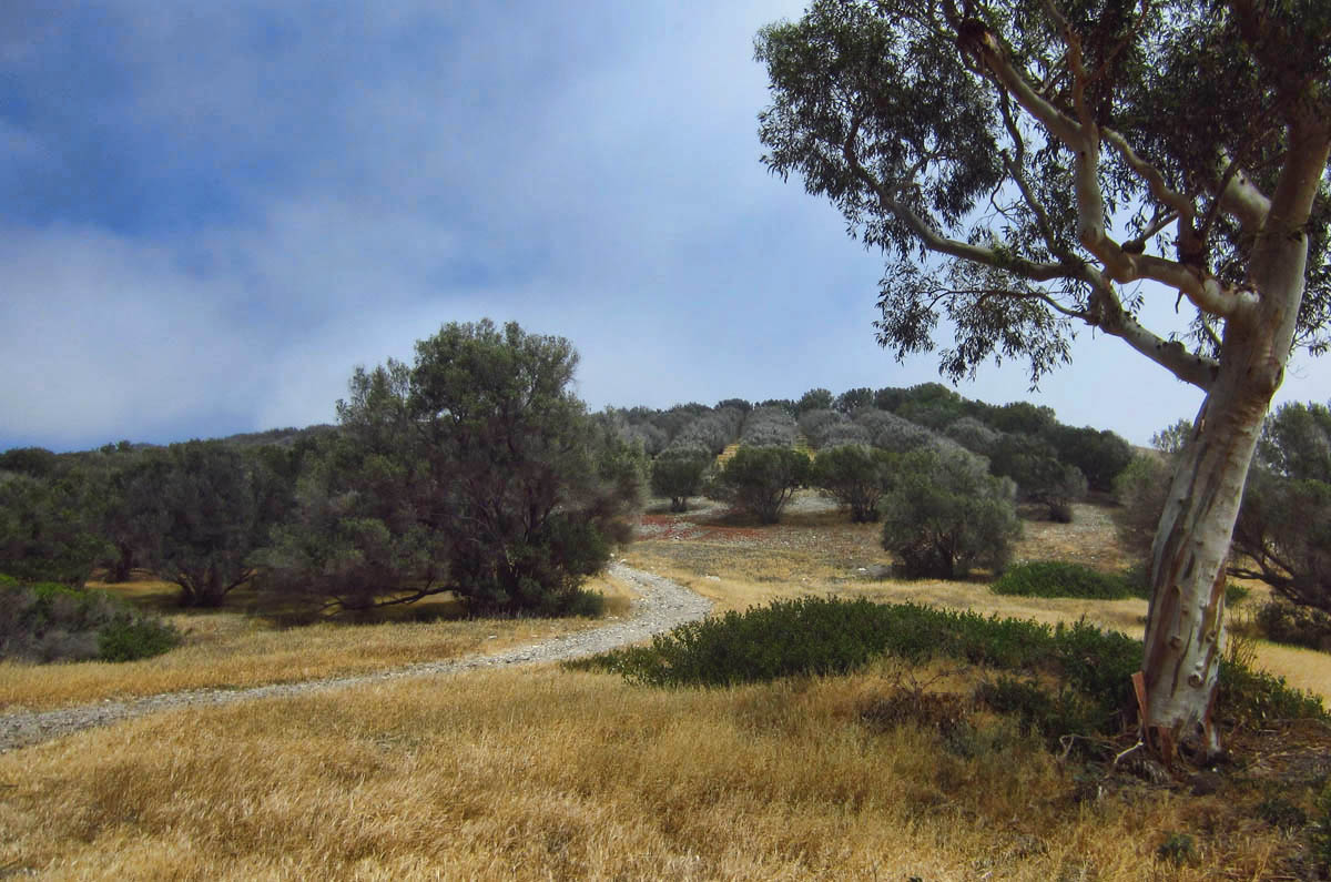
Olive orchards cover the hills around Smuggler’s Cove, also planted in late 1800’s.
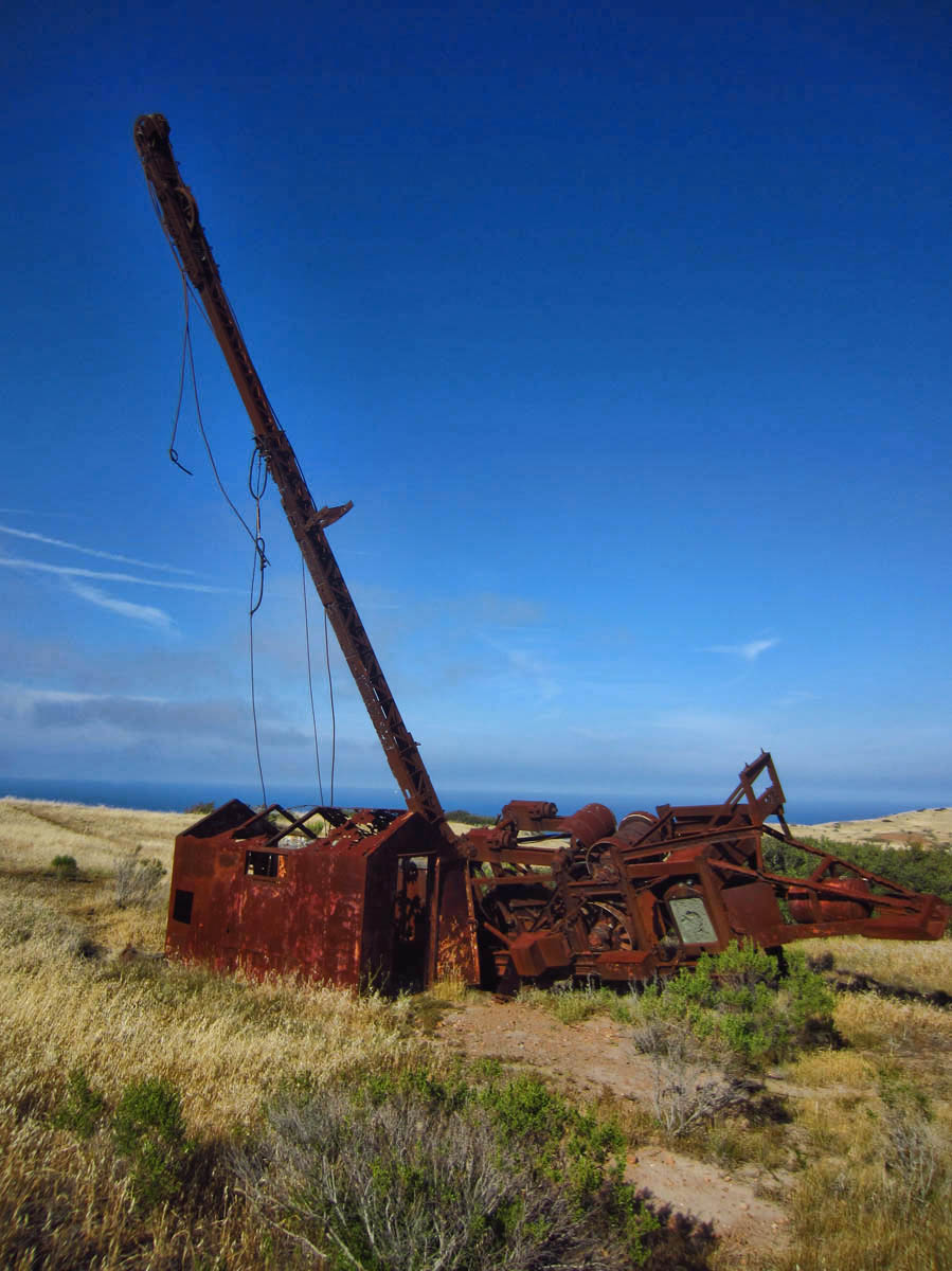
Abandoned oil well, initiated by Atlantic Richfield in 1966.

The well struck water, but never oil. Now a landmark for 3 trail intersections.
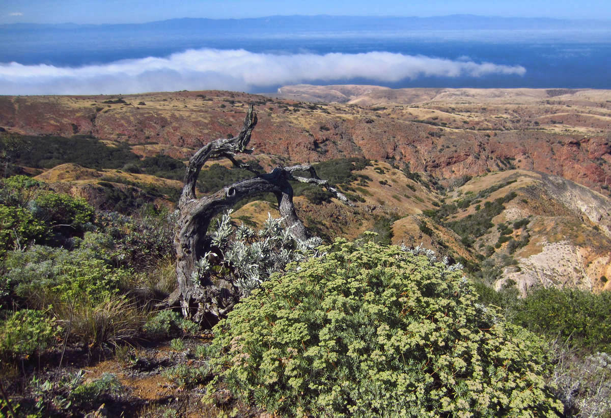
Heading up toward Montañon Peak, the vegetation changes dramatically.
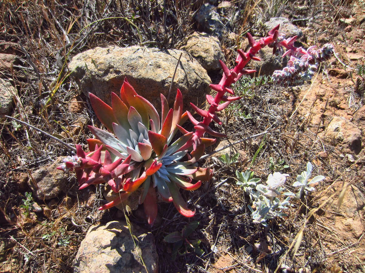
Lot’s more “Santa Cruz Island Live Forevers.”
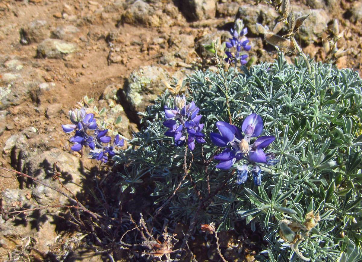
And for the first time on the island, I start seeing Lupine.
Once I pass the junction to Prisoner’s Harbor, the trail up to Montañon Peak gets a bit trickier…
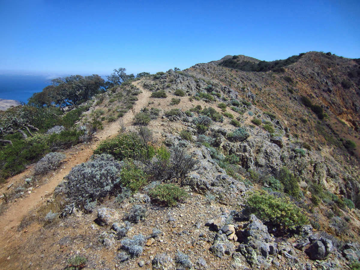
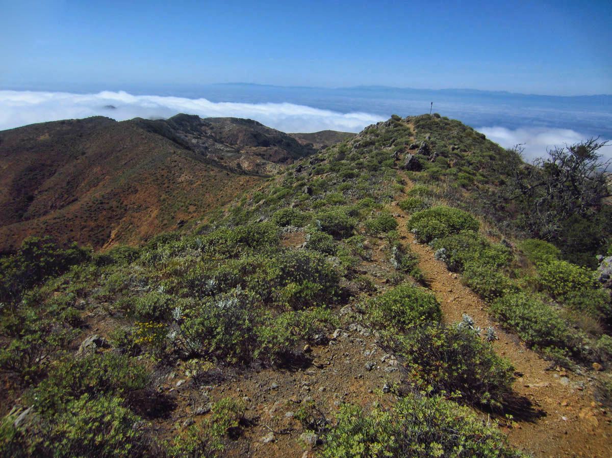
It’s a great “ridge line” hike with views of the ocean on both sides.
The further up I go, the rockier it gets. I am cursing my decision to not bring a hiking pole!
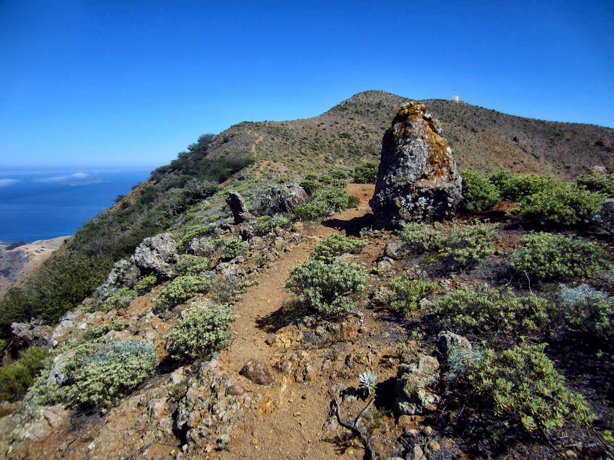
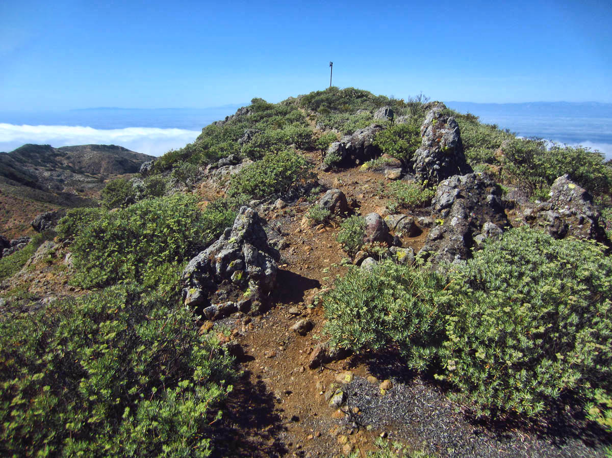
See that tiny yellow box on the ridge to the right of the big rock? That’s where I’m headed.
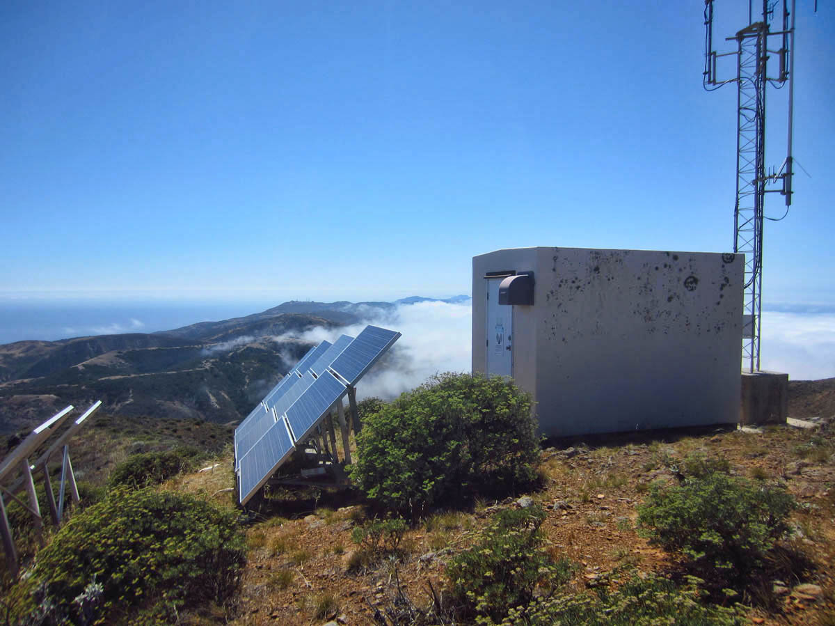
Sadly, it’s a radio tower, not a cell tower.
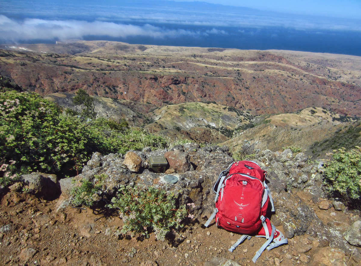
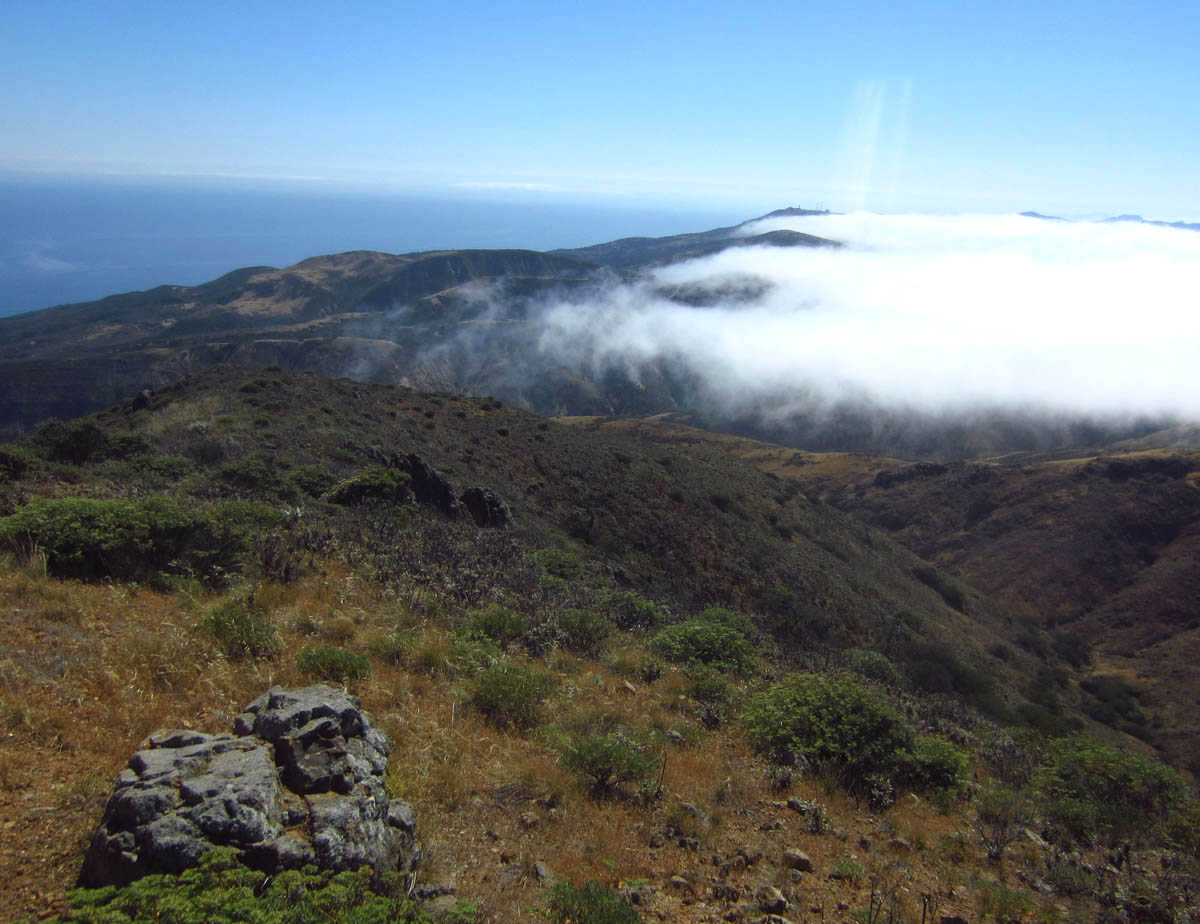
I reach the top of El Montañon, second tallest mountain in the islands at 1800 ft. The tallest, El Diablo, is deep inside the Nature Conservancy which is all off limits to visitors.
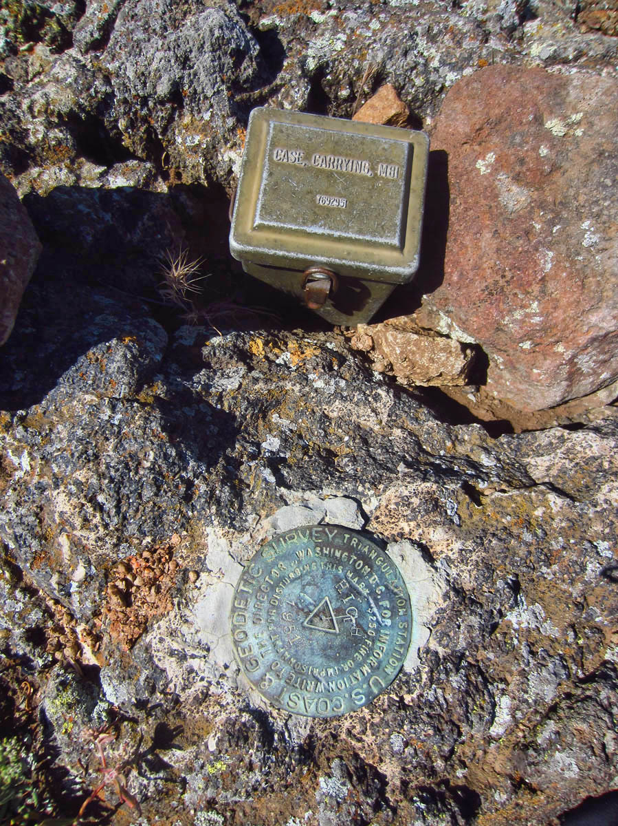
Inside the little box above the survey marker is a register. I put the URL of this blog, but so far, no one has come forth. haha!
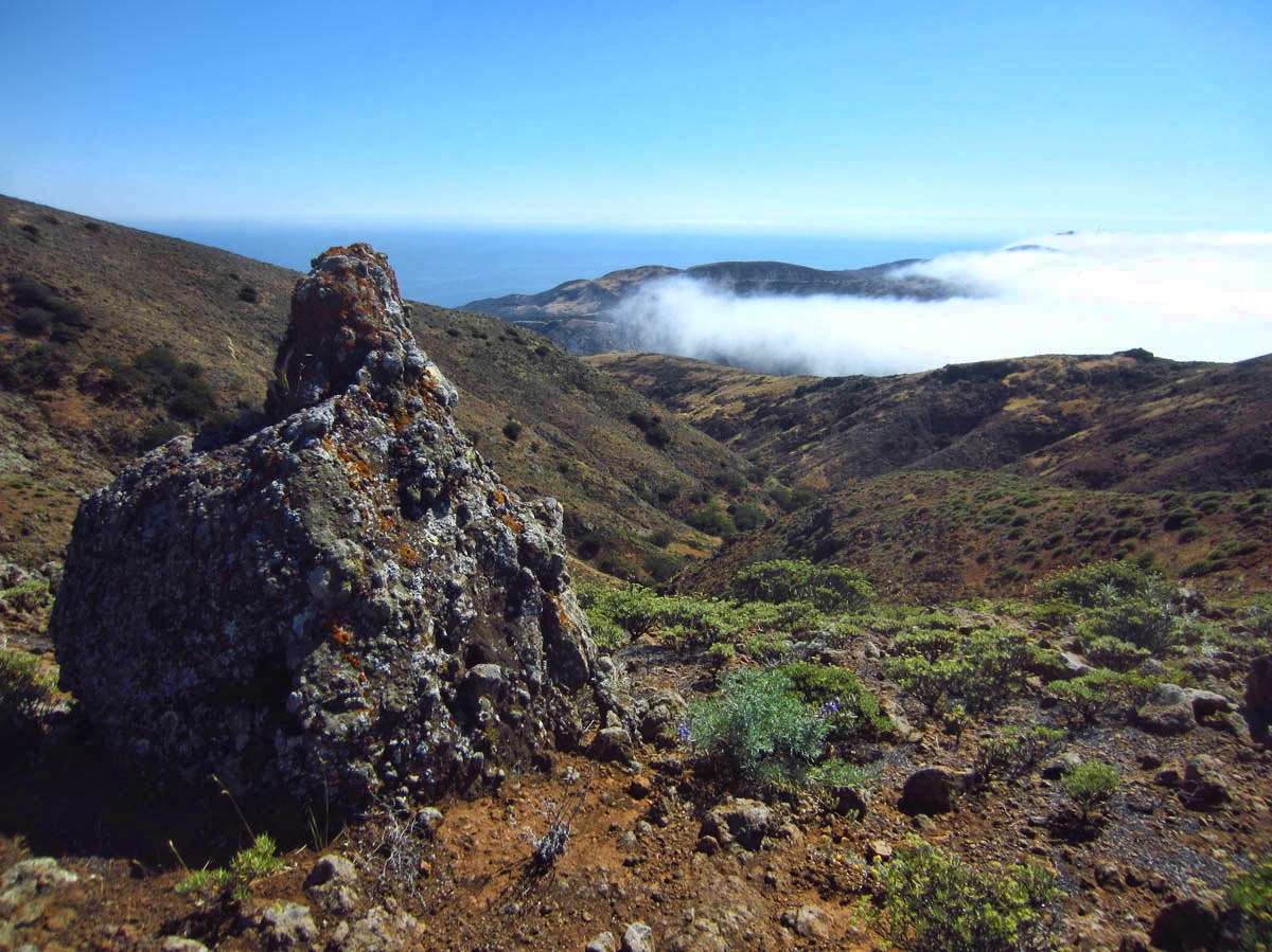
After a late lunch stop, I start back down El Montañon. Fog starts moving in.
Fingers of fog…
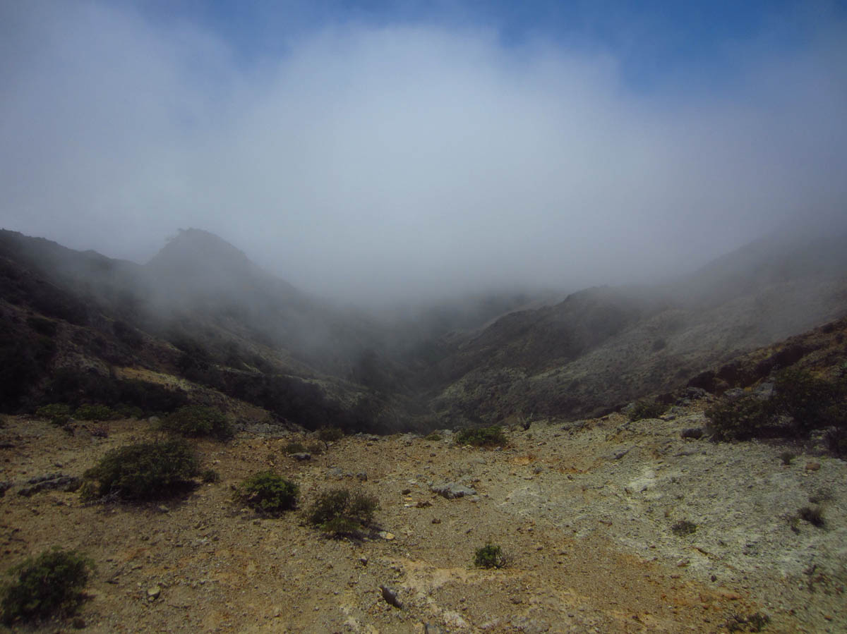
My head is now officially in the clouds. I pick up the pace a bit, and feel gratitude for my Backcountry Navigator, lest I lose the trail!
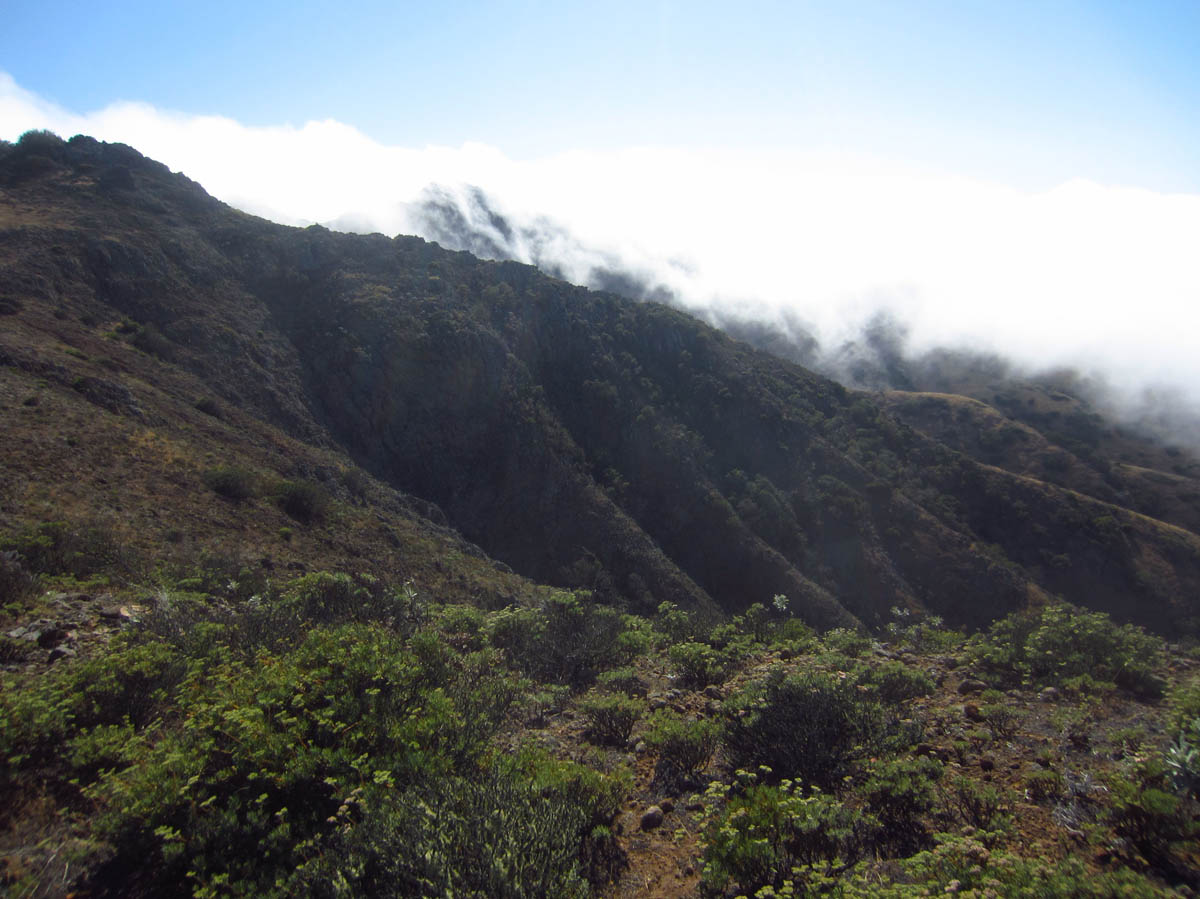
This is not a good photo, but I want to remember standing here watching this fog pour over that ridge. It was mesmerizing.
Closing my 14 mile loop back down to Scorpion Cove.
…More photos in this blog post than any other post on TTTH, but I wanted to share this extraordinary place, much of it which is rarely seen.
Thank you for the photos. You’ve showed us an amazing place.
Ditto! you’ve inspired me to visit.
Great photos enjoyed every one! When/if we make it to the islands I’m sure we’d one of those ‘day-trippers’, so thanks so much for showcasing this amazing place.
Your endurance astounds me! But look at all the great stuff you get to see!
Virtual hugs,
Judie
Wonderful pictures, Love ’em ! Is anybody living permanently in Santa Cruz ?
Wasn’t a bit worrisome to be all by yourself, what if you tripped & go hurt … would be no-one to rescue you, I’l be concerned. You are outstandily brave, wish I had your guts !!
Glad you enjoyed your hiking.
Her did you get your water supply from ?
Hi, Lucy. Thanks for the questions. One of the reasons I chose Scorpion Cove is because it has water faucets throughout the campground. The only people who live on the island permanently are the group of National Park Rangers. They have a permanent residence compound just up the hill from the campground. There is always someone there, and they are very accessible and helpful. And lastly, I now hike with a Delorme InReach device, which allows me to signal for help regardless of cell service. Of course, that won’t help me if I am unconscious, but it is a risk I am willing to assume. As the Jimmy Buffet song goes, “I’d rather die while I’m living than live while I’m dead.” 😉
Beautiful. Looks like a magical and challenging three days of hiking/kayaking/exploring — these are the adventures that sustain us for the rest of our lives.
All photos are pretty but the fog shots are especially beautiful….thank you for sharing your adventurous nature….:-)
So many wonderful photos! I can understand the spiritual experience here.
Thanks for sharing.
Pamelab in Houston
Okay, you are having way too much fun!! That hike along the North Bluff Trail must have been spectacular being so high and looking down and out…Wow! Scorpion Canyon is beautiful! So many colors!! Love the selfie with your coffee:) Great job getting to the top of El Montanan! Spectacular views…the fog coming in was amazing. Sorry you had to hurry but glad you were there to share it with us:) Congratulations on hiking 14 miles with a mountain as part of it!! We love photos…never too many:)
I can do a 5 or 6 mile hike now since I began my training. I hope to be ready for Alaska in a month. And I drew an elk permit to hunt in December, so I’m really going to have to step up my game!
You post such beautiful pictures that are inspiring me to continue my walking in my attempt to get in shape! There’s no other way to see these things!!!!
Hope to see you later this year.
Always, Reta
Suzanne, A wonderful place, small islands like this are fascinating as they can be a microcosm of the mainland.
From what you say I think we have more or less the same settings on the Canon ie Program and the distance setting but not infinity. I also have the ISO set to 800 so that I have as high an f stop as possible [smallest aperture] so that I get a good depth of field. Initially I left it on Auto but found that the settings it chose were not the best ones and some of the pictures were hazy. I always check before I take a shot that its not on Auto as its easy to hit the Auto button. Mine retails in the UK as the Canon IXUS which after Googling yours, I think it’s the same. I had one of the original IXUS 4mp cameras and that lasted for 12 years, I wonder if this one will last as long..
Thanks, Dave. My ELPHie has suffered quite a bit of abuse. The LED is even shattered, but somehow, it keeps on working! I am eager to get the S110 back, but Canon is taking their sweet time. They have decided to send me a “refurbished” in lieu of repair, so waiting for the factory to revert. It’s funny, I hated the S110 when I first got it. Now, I miss it dearly. 😉
Thanks for sharing those awesome photos and your wonderful experience!
Truly memorizing photos. So happy you went for it despite your Winnie circumstances. Another glorious destination to cross off your bucket list.
I’m really glad you posted photos of each hike in one post – it enriched my experience, like being able to read a book to the end in one sitting. I loved your “fingers of fog” photo – it really does look like fingers reaching out, doesn’t it? I’m constantly astounded at the trips you take, the places you go, the things you do. I always say, “What a life!” You get to say, “WHAT A LIFE!” 🙂
Just beautiful! Can’t believe you didn’t bring your hiking pole, but, hey, at least you had that thermos full of coffee 😉 Too bad Chris wasn’t there with his cookies!
Perfection! What a lucky, lucky girl you were to have all that beautiful country to yourself!
What a beautiful island. thanks for the great pictures, especially the fog ones. We really enjoyed seeing and reading of your hike.
It is amazing to me how far you have come in hiking endurance. It helps that you are able to set your own pace, but no one dare call you a straggler. I loved the pic of the fingers of fog. I remember out hike in the fog on the Washington Coast. Miss you, but love your adventures. Karen
That hike looks fascinating! Congratulations on the long march. I remember getting enveloped in fog when we hiked in the Channel Islands. Love that selfie of you…definitely a keeper!