Kings Canyon and Sequoia National Parks are two separate parks managed as one. They sit shoulder to shoulder along the edge of the Sierras. It’s tough to tell where one park ends and the other begins. In fact, it can be a bit confusing, as the first point of entry into Kings Canyon is Grant Grove, a large grove of sequoia trees, and home of the General Grant Tree, “third largest tree in the world.” To an analytical left brainer like myself, I think “Wait, shouldn’t you sequoias be over there in Sequoia National Park? 😉
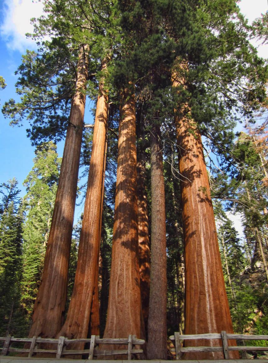
Grant Grove is just a short walk from the Azalea Campground. This group is called “Happy Family.” Don’t you love how the fence excludes the adopted child of the family, the pine?
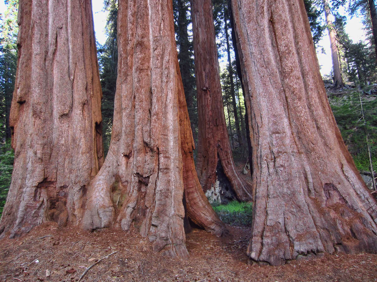
I just love the cinnamon-colored finely textured bark.
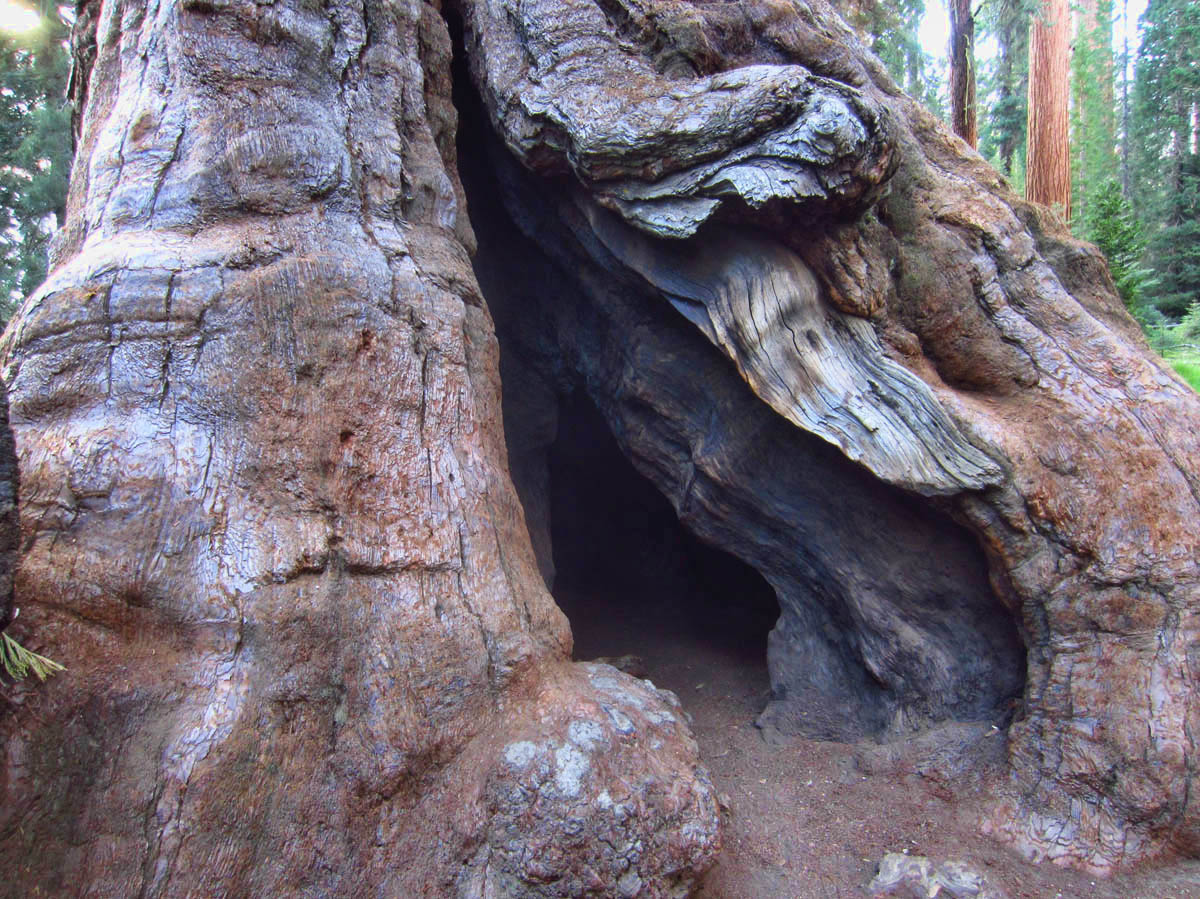
A burn scar can be a thing of beauty.
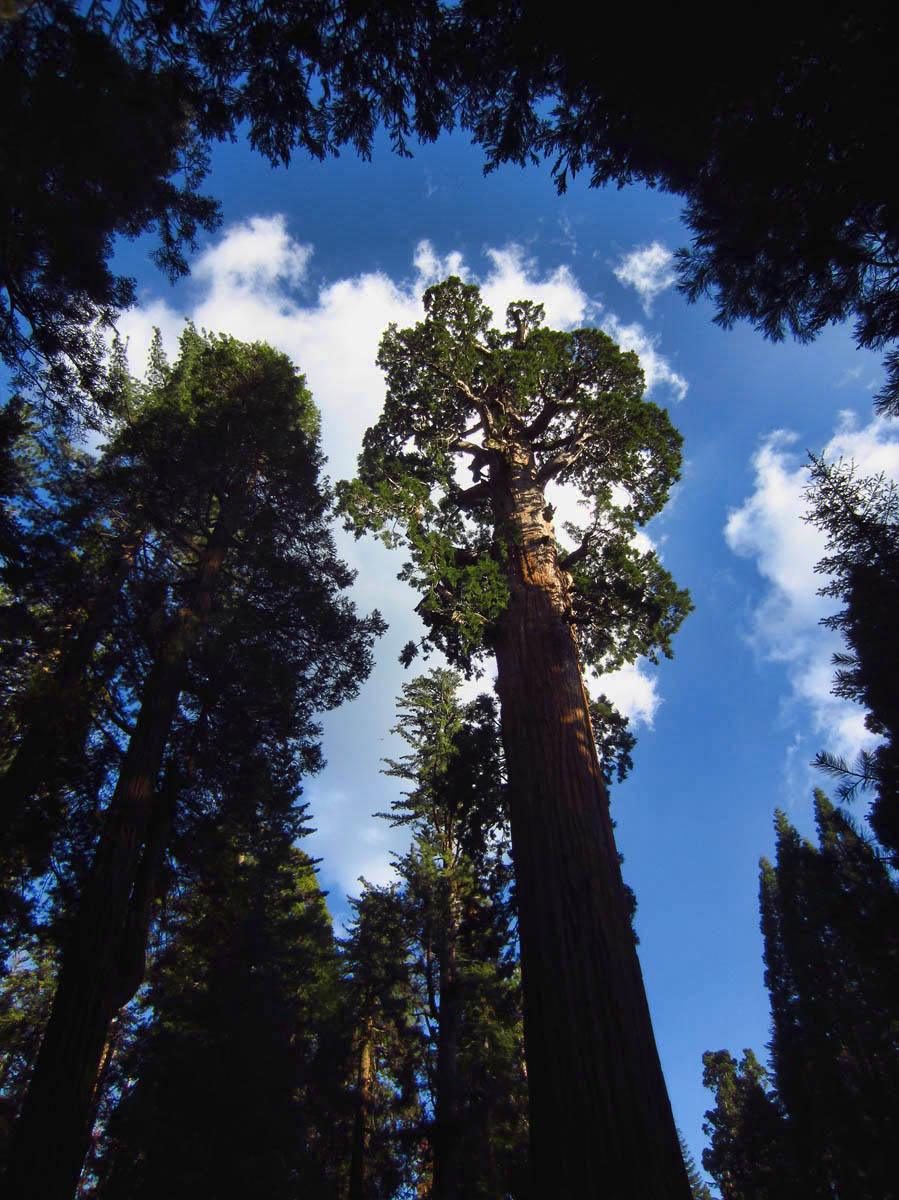
It’s impossible to photograph these giants, but if there is one thing the little $99 Canon ELPHie has, it’s a wide angle lens!
The Visitors Center, Gift Shop, Snack Stand and Market all reside less than a mile from one of the largest remaining groves of sequoias in the world, so it’s easy to think one has “done” Kings Canyon by visiting this area. But it has little to do with Kings Canyon….

The one mile trail passes several “downed” trees.
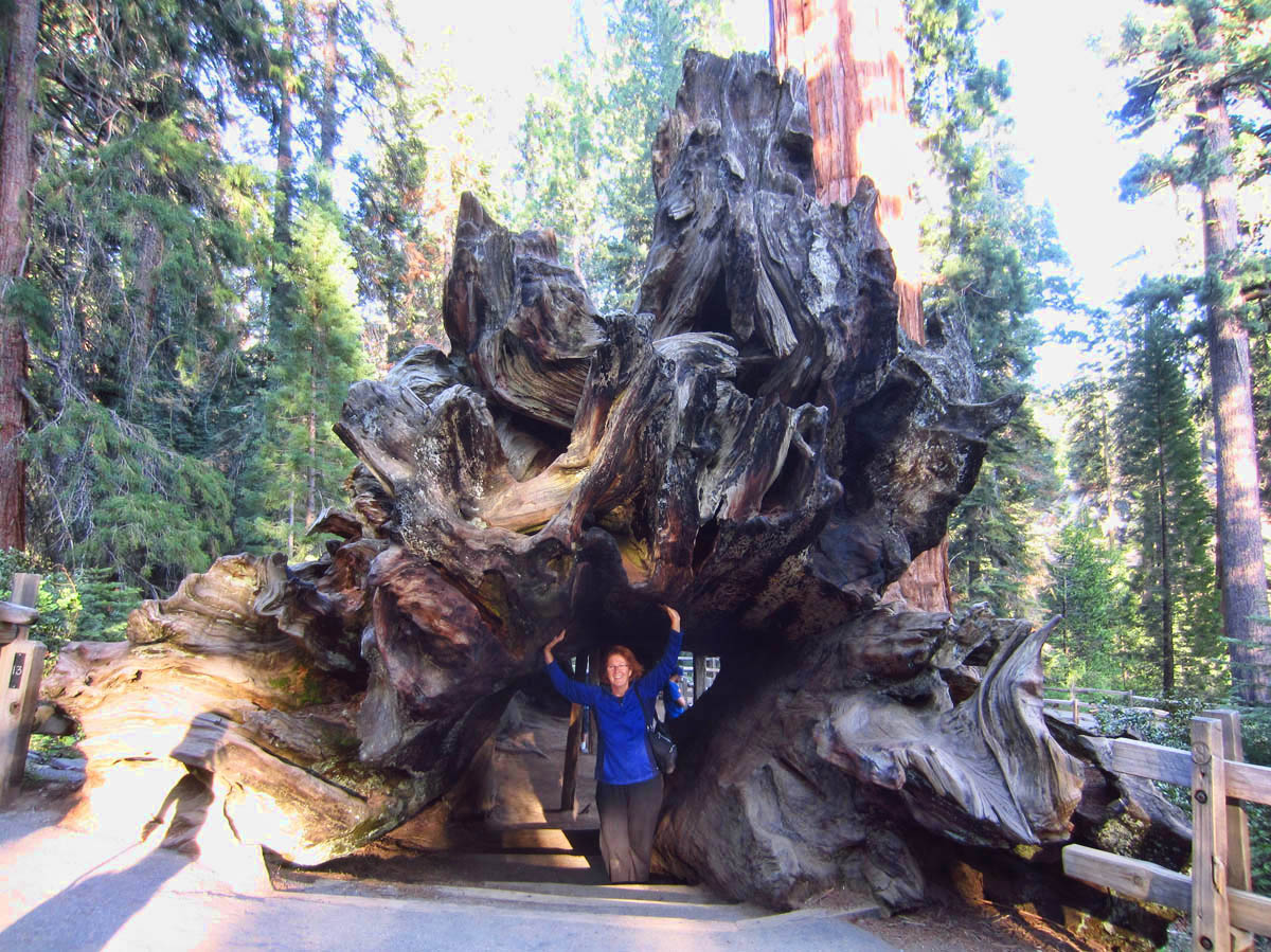
This one is called “Fallen Monarch.” Both ends are large enough to stand up in. (My feet are at the bottom of steps out of the log.)
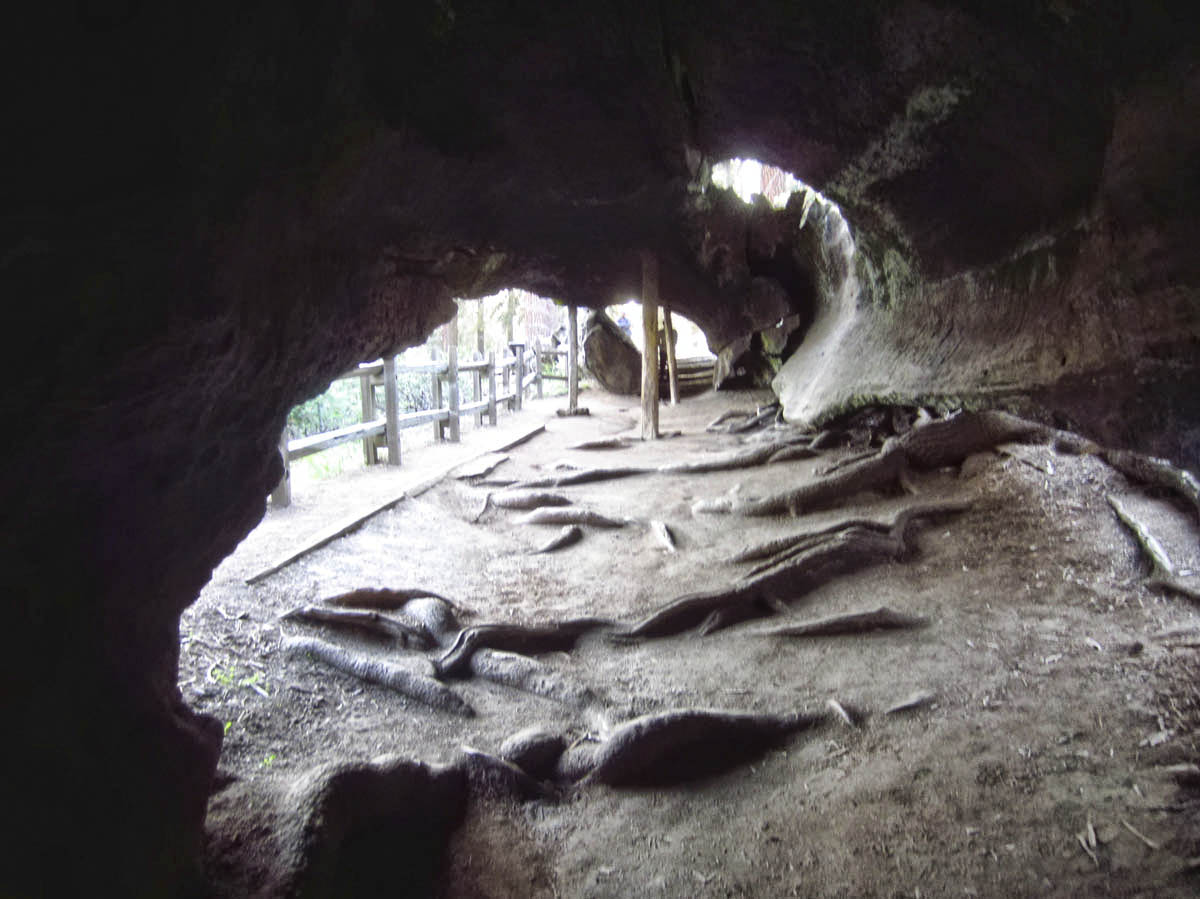
Inside the Fallen Monarch. This hollowed out giant sequoia has been used as temporary housing for loggers, a hotel and saloon, and shelter for 32 horses of the cavalry.

Bottom half of General Grant tree, “Third Largest in the World.” Forty ft in diameter, 268 ft high, 1,700 years old. Taller than a 27-story building, wider than a 3 lane freeway.
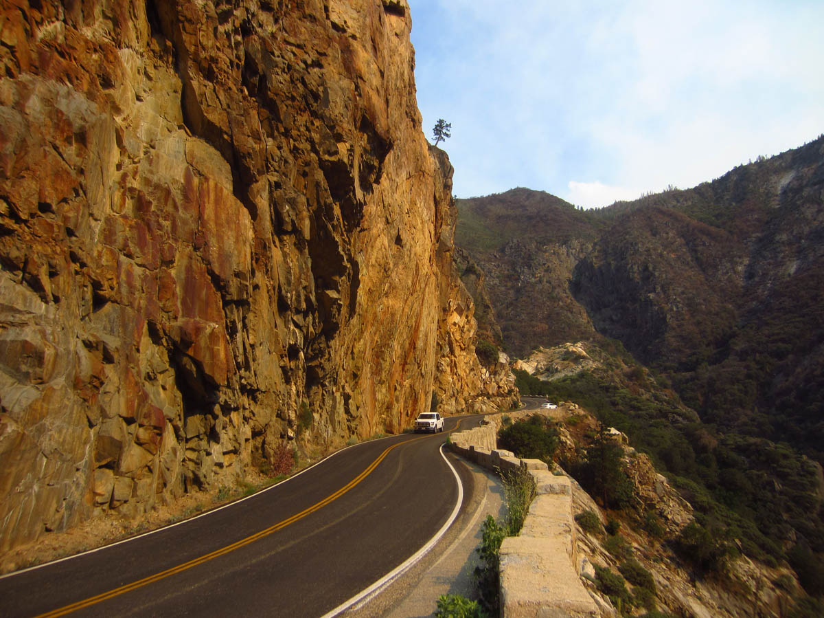
Though much less touristed and even slighted somewhat in the Park’s collateral material, the real heart of the park lies 3,000 ft below, down a sinuous, steep two lane road “not recommended for vehicles over 22 ft.” The roaring beast of the frothy white Kings River plunges 2,000 ft in only a couple of miles. It’s thunderous roar echos between 8,000 ft walls of granite overhead in what is one of the deepest canyons in the US. But the Kings River is not the culprit. Canyons carved by water, I learned, are V-shaped. Kings Canyon is hollowed out in a U-shaped profile, indicative of glacial gouging. This bold and beautiful river just happens to live there, and I want to go see it.
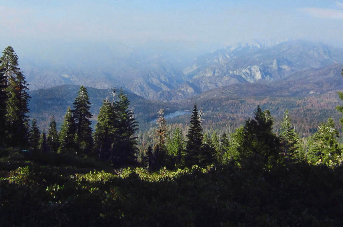
View of Kings Canyon from Panoramic Point is not so panoramic due to a “prescribed burn” in Redwood Canyon. (Note Hume Lake in the center. We’ll go there later.)
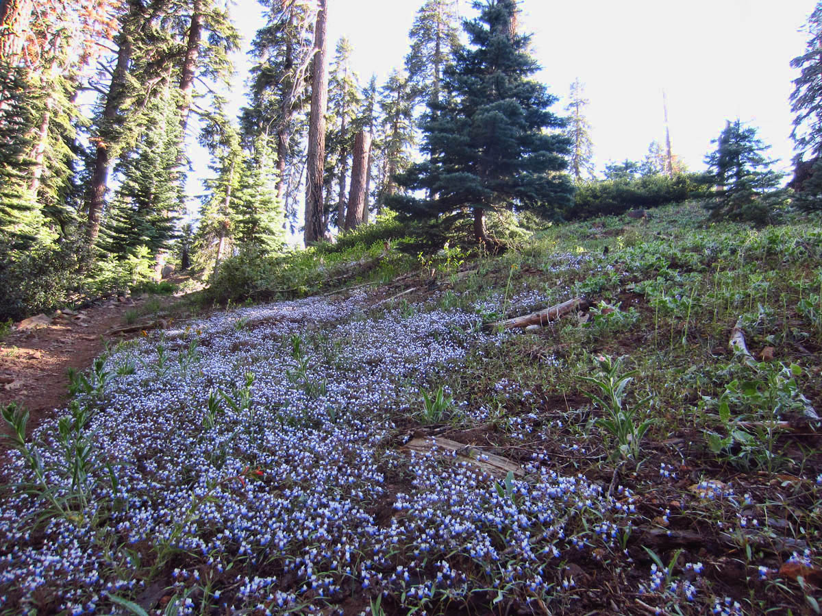
The forest near Panoramic Point, 7,500 ft, is carpeted in these tiny blue flowers.
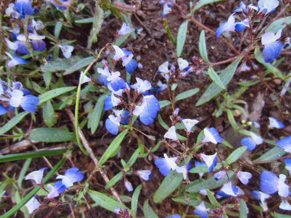
A closer look…
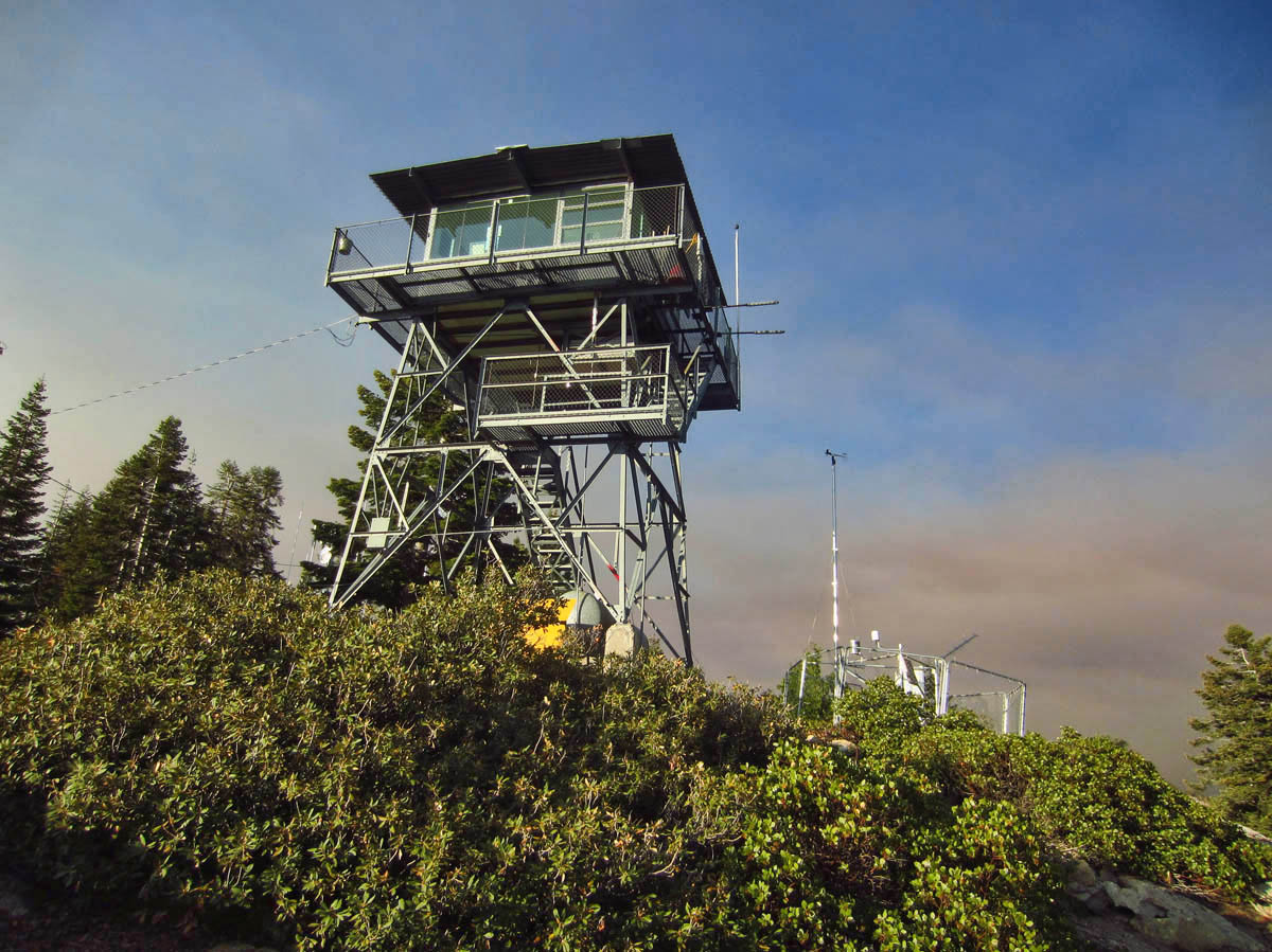
The 3 mile OW hike to the Fire Tower gets closer to the burn area.
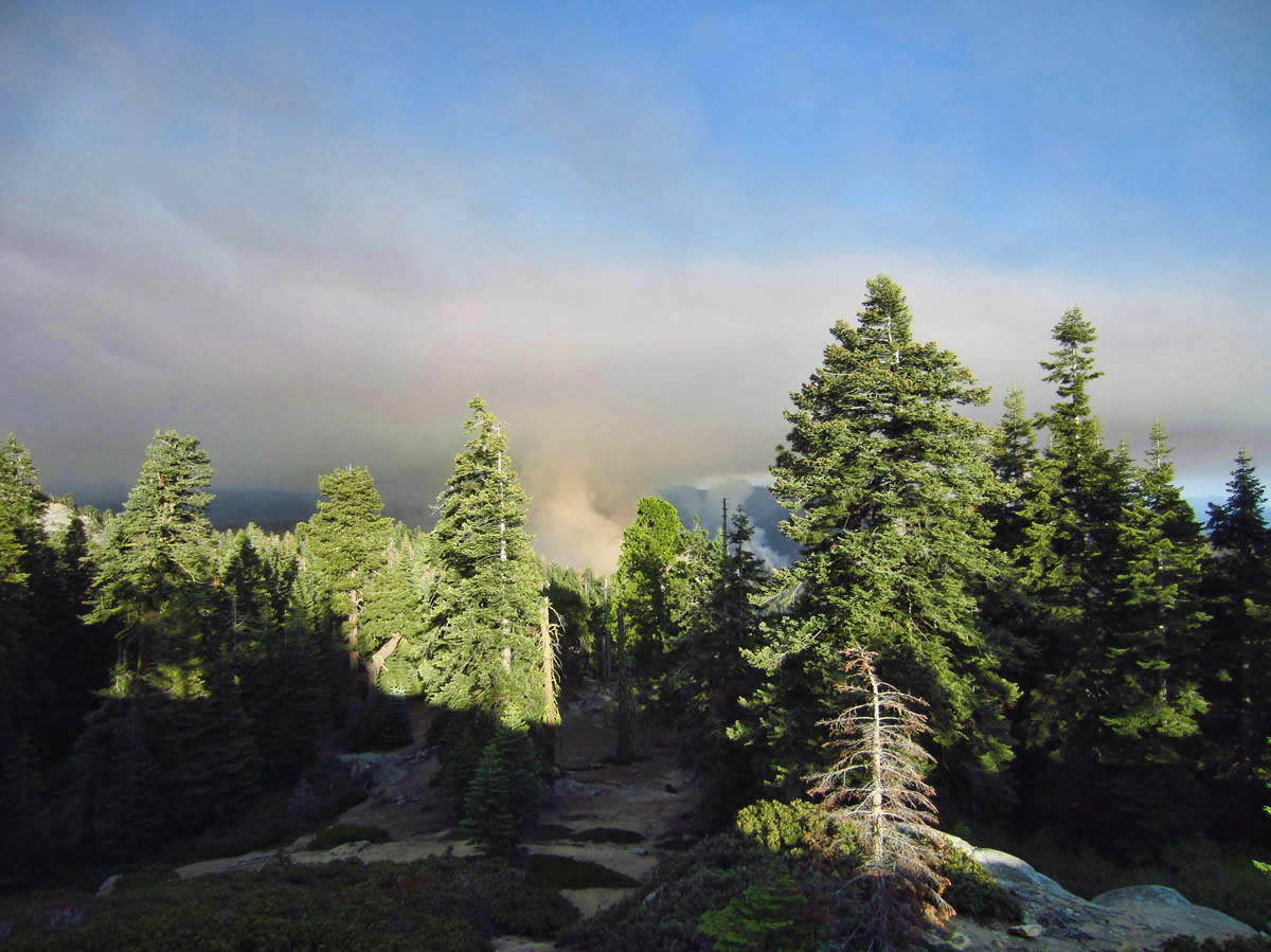
The prescribed burn is the only natural way to create a mineral soil seed bed which giant sequoias require to regenerate.
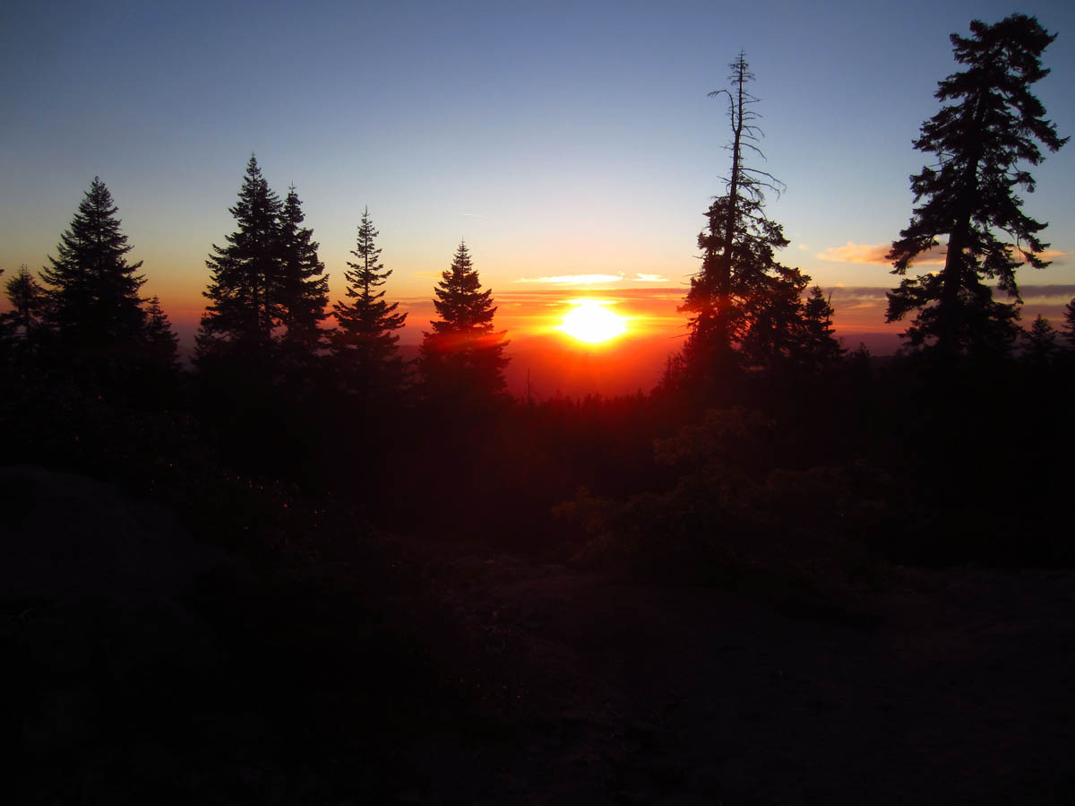
The silver lining to a forest fire is a gorgeous sunset.
Although the engine in the Little Tracker has not missed a beat since the day brother Don performed a heart transplant with a complete engine replacement back in 2014, it still doesn’t like to climb. For some reason, it has been known to emit smoke after a steep incline, though it does not appear to be radiator-related, nor does it appear to be overheating. I believe the culprit to be an oil leak. But still, I don’t like to over-tax him. But, if I don’t drive down this hellish road, I won’t get to see the namesake for “Kings Canyon.” It will just be another sequoia grove.
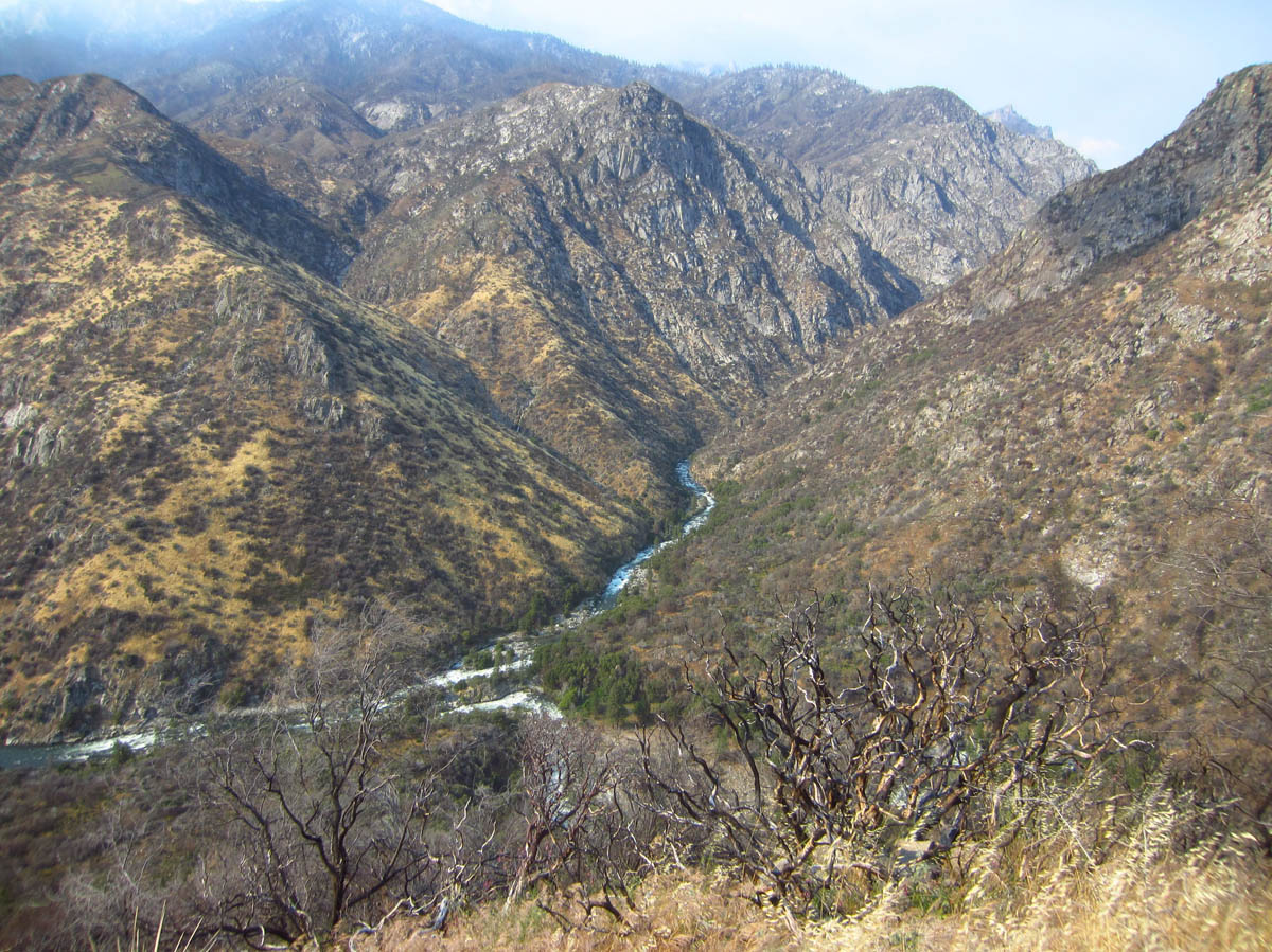
Looking down over Kings Canyon and the Kings River from the “Junction” where Middle Fork and South Fork meet.
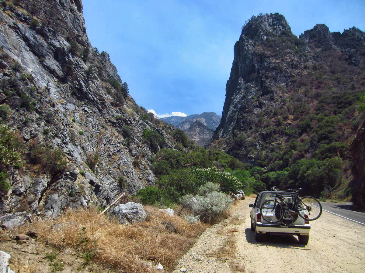
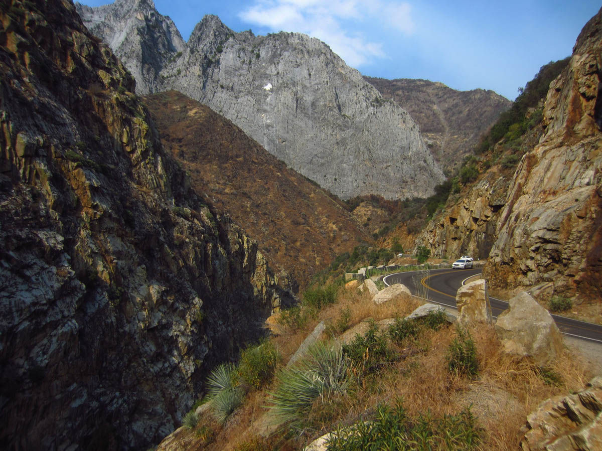
Heading down to the valley floor.
I decide I will just take it slow. I’ll get an early start so I can take all day to climb back up if necessary. The volunteer at the Visitors Center tells me there are plenty of turnoffs, and to just take my time! “It’s your park too! Go as slow as you need to!” She also tells me I can return back via Hume Lake, a gravel road not quite as steep as the Kings Canyon Scenic Byway.
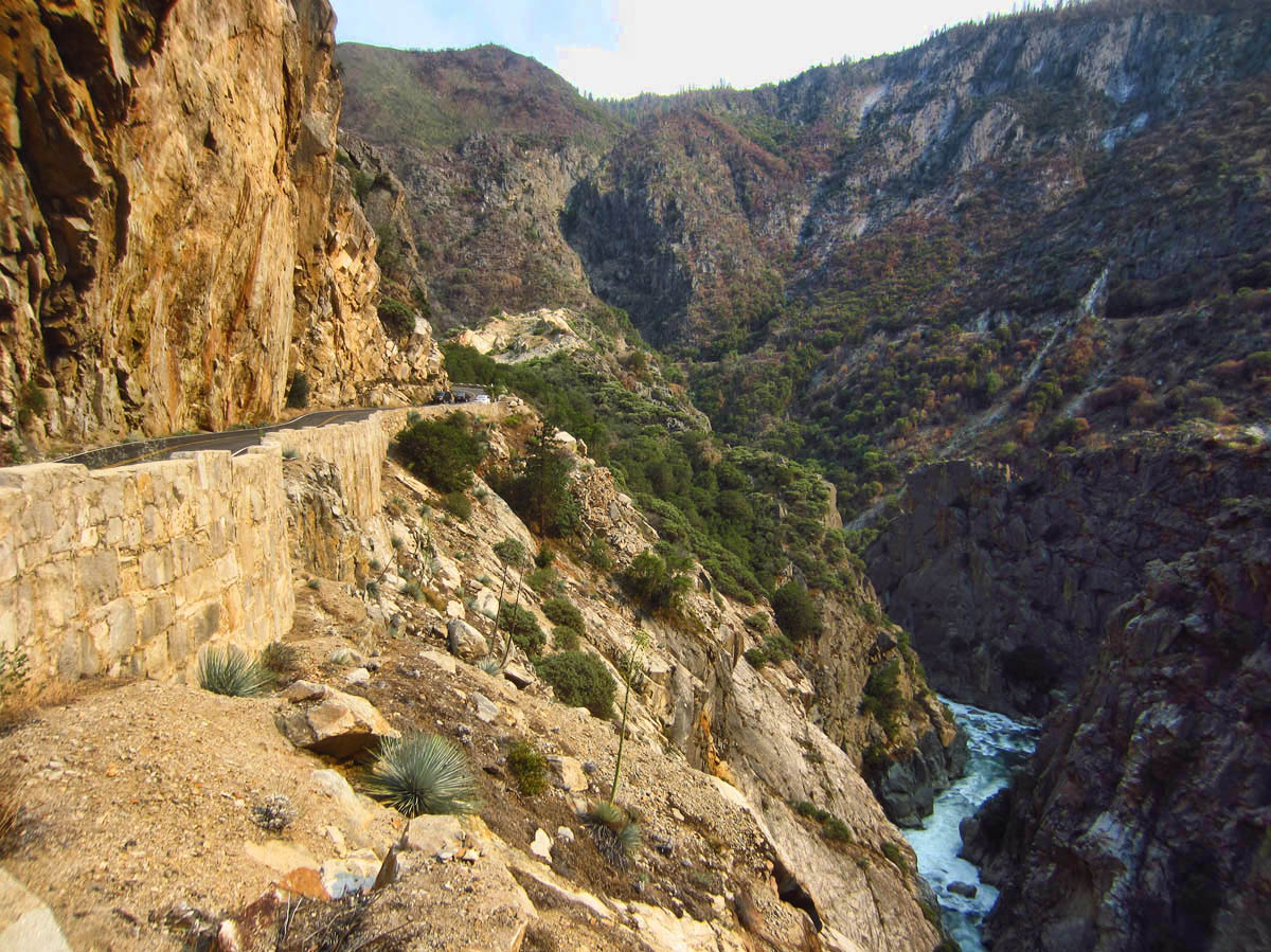
I head down down, down, down the hills, filled with dread knowing I will need to climb back up the way I came. I imagine several “self rescue” scenarios on what I would do should the Tracker fail in an area with no cell signal (SOS compliments of Delorme InReach!) There are several times when I pull out to take some photos and think I will turn around, it’s not worth the worry. But I so want to see that canyon!
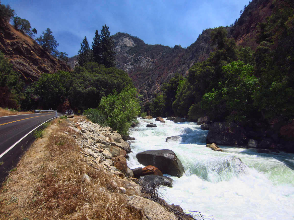
This is one of the loudest rivers I have ever heard, probably because of the granite walls.
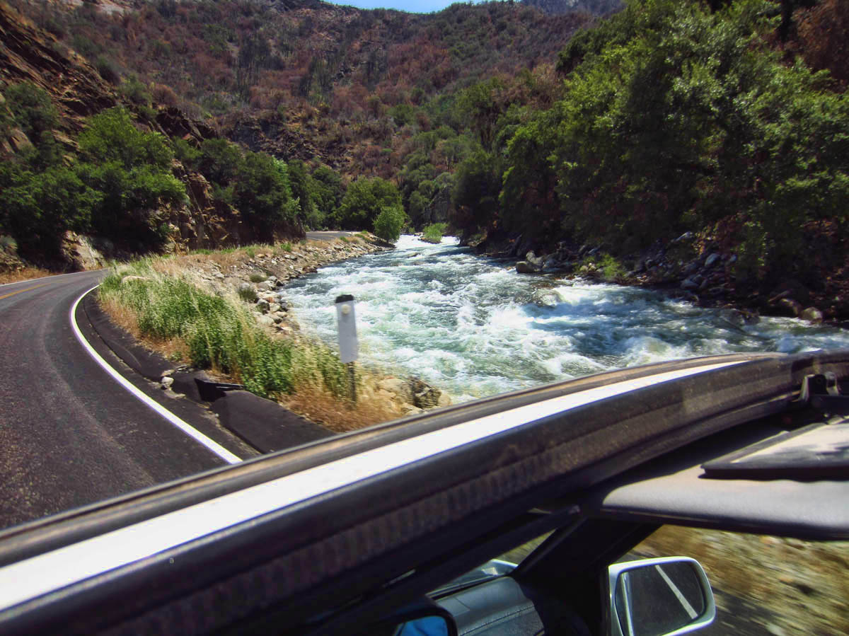
The Tracker’s version of a “selfie” out the open roof.
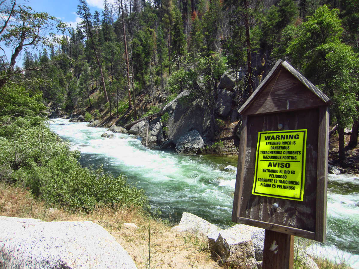
Frequent signage along the river.
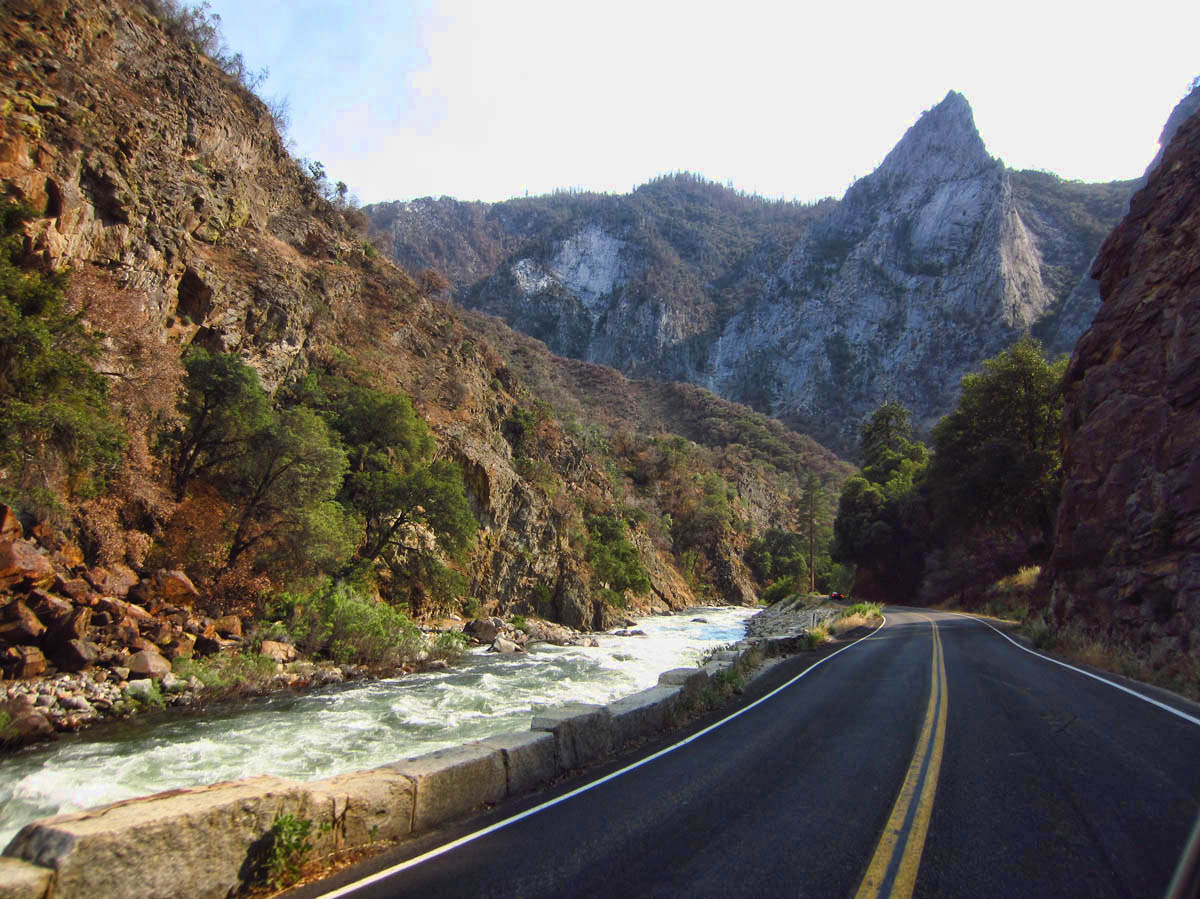
It was a spectacular drive alongside this river!
Then at one of the turnouts, I see a sign….”The Don and Suzanne Highway.” Rarely does anyone spell “Suzanne” correctly, but to see it on a highway sign along with “Don,” my brother’s name, it just feels eerily spooky. I take it as “a sign” and continue on. How can I possibly go wrong on the “Don and Suzanne Highway?” 😉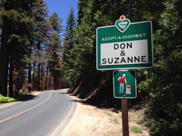

Beautiful Hume Lake, very serene (except for the Christian kids camp at one end.)
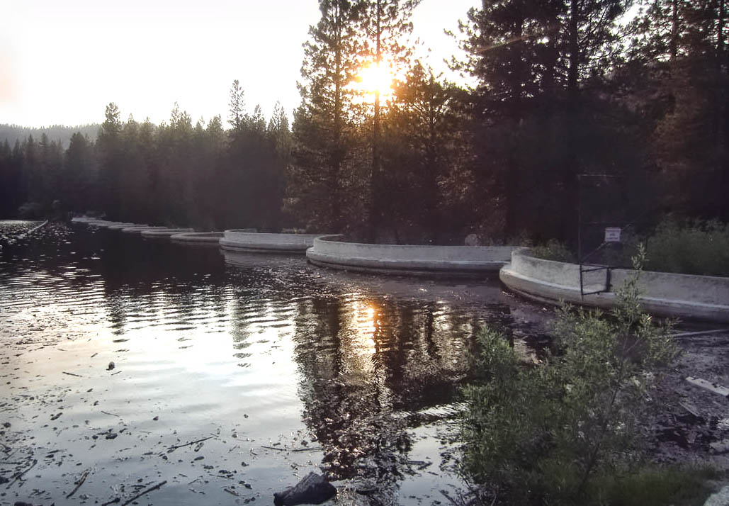
This is a terrible picture taken into the sun, but take a look at this interesting “scalloped” dam built in 1908. It took only 114 days and cost $45K. The “multi-arch” design is considered to be much stronger than conventional dam design.
I am grateful and relieved to report that the 22 year old Little Tracker was able to make the trip to the bottom of the canyon and back out without a single hiccup, let alone a belch of smoke.
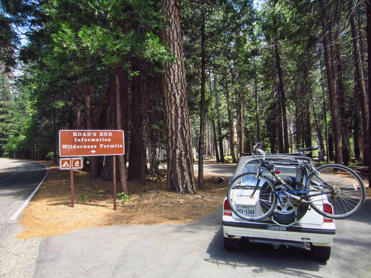
Roads End
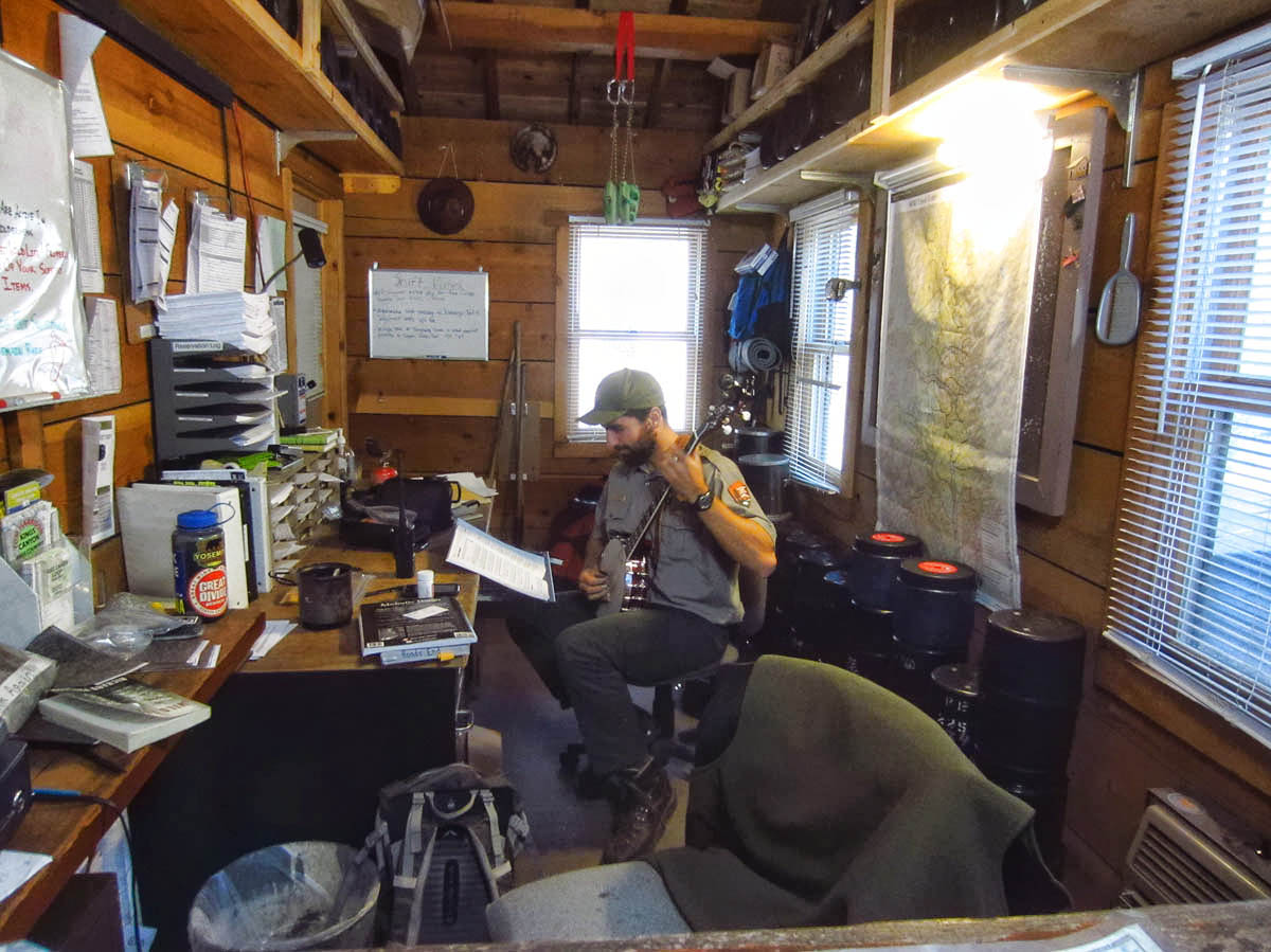
Look what else I found at “Roads End!” This very cool Ranger in the Wilderness Permit hut strumming his banjo.
But 97% of this glorious park is designated as “wilderness.” The Pacific Crest Trail and John Muir Trails run right through the heart of it. As you can see from the photo below, there are only three roads that lead in to the park. I have circled where those roads end.
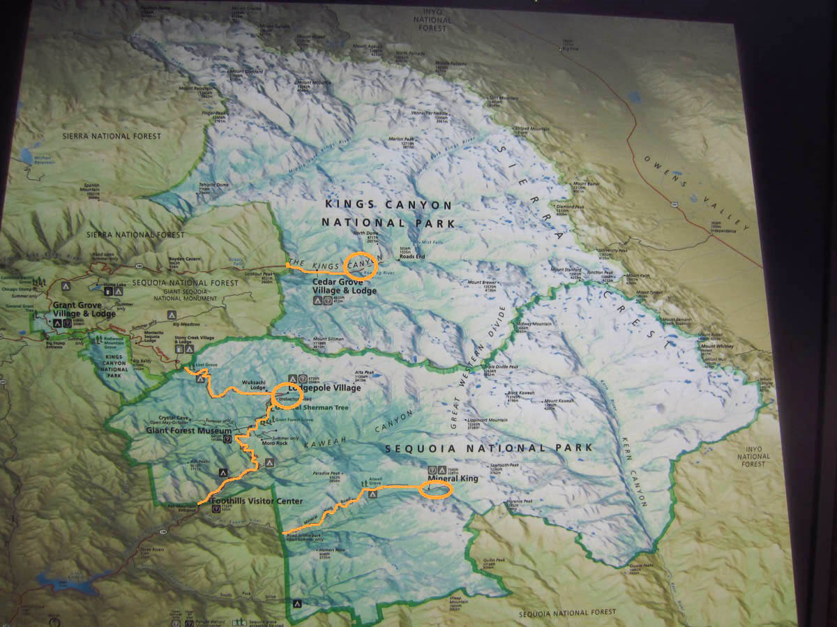
Both parks are only accessible from the west. Roads go only as far in as the circles.
All that beautiful mountainous territory on the right is inaccessible except by foot, which means we will never experience it fully unless we get out of our cars. The sign at Roads End reads, “Welcome to where roads end and trails begin. Walk a few hours or hike further into a glorious wilderness ruled by elevation and climate.” I can imagine I know exactly how John Muir felt when he said, “The mountains are calling, and I must go…”
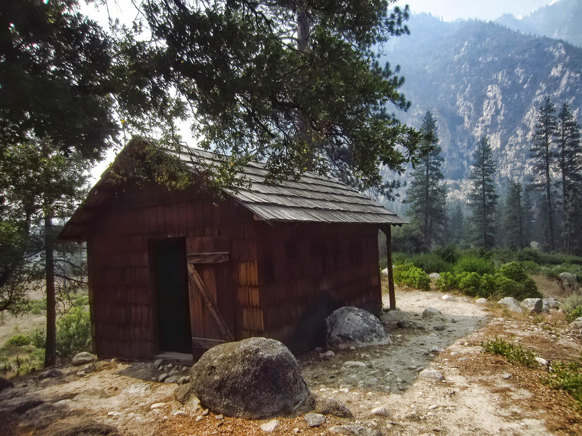
Knapp Cabin, used by wealthy businessman George Knapp as a storage shed for camping expeditions back in the “Roaring Twenties.”
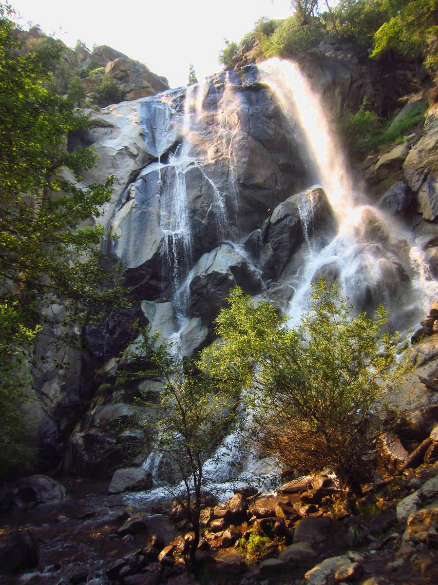
Grizzly Bear Falls

Roaring River Falls
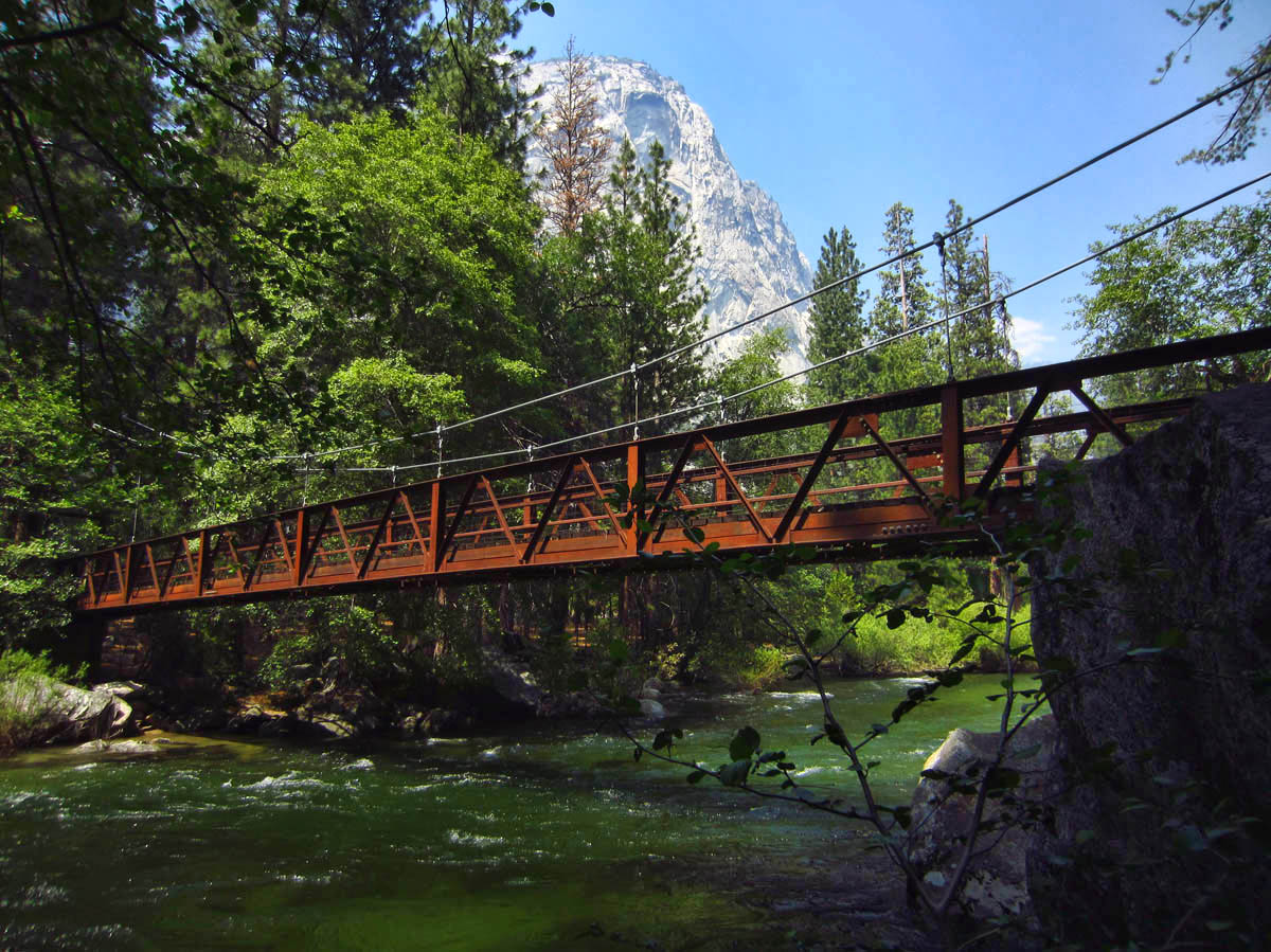
Suspension Bridge to Zumwalt Meadow

A 1.5 mile hike makes a loop around scenic Zumwalt Meadow on the valley floor of Kings Canyon.
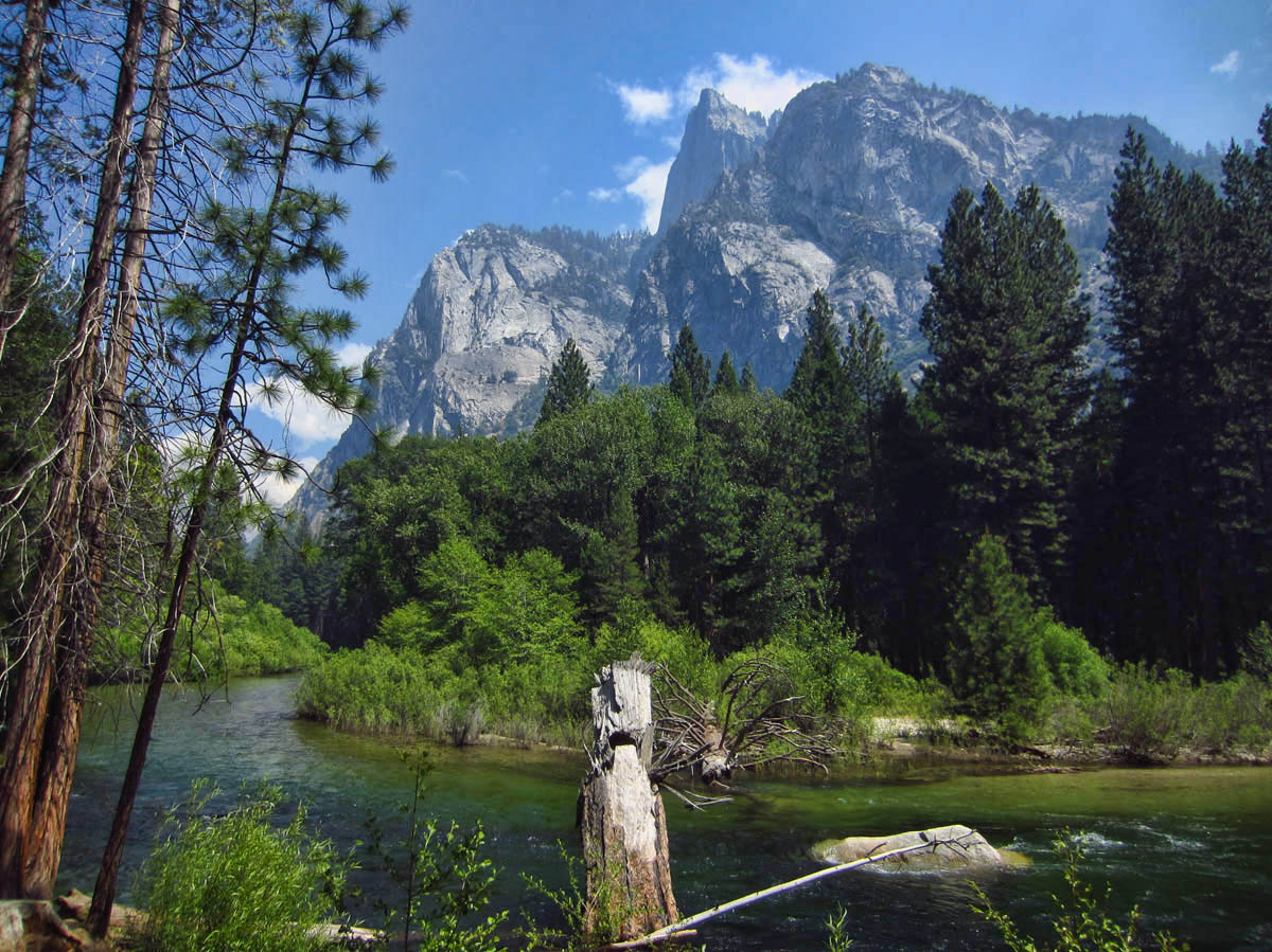
So beautiful. My kinda place.
Nina
Thanks for the pictures of my favorite place. I have camped there at least once a year since 1978.
Another place in my far distant memory . . . I wanna go back!!! Your photos are so very compelling.
Virtual hugs,
Judie
I think that drive down into King’s Canyon is one of the most spectacular scenic drives we’ve done anywhere. And we only saw a few other cars and people, such a contrast to the crowds at Yosemite.
So did you stop and pick up trash on “your” adopted part of the highway?
Seems to me that you and Don need to visit this amazing place together!
Gorgeous. We lived in California for many years and have visited a lot of National Parks in the West but never Sequoia. It’s on the list!
That is sooo gorgeous! I have never been to Kings Canyon, and as I’m sitting at the Westin in DFW I would live to be where you are right now!!! Amazing pics!!
Wow! Brings back some memories. I worked in Sequoia National park from 1972 to 1975 . Long time ago. Nothing glamorous. Just got out of High School and worked as a maid and then as a cashier in the diner. Have not been back for years ! Two of my best friends are girls I met there. We keep saying we need to go have a reunion trip there and now seeing these photos really affirms that for me !! Some great hiking in there too… Used to hike miles and miles on my days off. Sometimes backpacking in as far as we could in 2 days. Fun times. Happy memories.
Gorgeous pictures! An area we have never been, but hopefully someday!! I remember seeing the large old trees up in the Olympic National Park and was amazed how large those were.
Spectacular!
So glad your little Tracker made it down the road to the bottom. You are right, the Canyon is just a tiny taste of what Kings Canyon has to offer. We actually drove our 26 foot MoHo down that road, and camped there at road’s end, but it was late in the season and COLD. One of my favorite photos is the MoHo at one of those turnouts overlooking the very deep canyon.
Those sequoias are so frustrating to photograph, it is almost impossible to capture the enormity of these beasts! Love the “Don and Suazanne” sign as well as your waterfall pictures.
It seems your little Tracker took a liking to Kings Canyon. I found it to be a beautiful park. That little camera does a wonderful job and so does the eye behind the lens.
Great photos of some glorious trees and wonderful landscape.
Thank you.
Most amazing giants. And parks I haven’t been to yet. I love those curvy canyon roads for the obvious reasons you’ve shown in some amazing photos. I need to retire and get to some of these places. Especially like the idea of a not so crowded park. Nice Ranger gig.