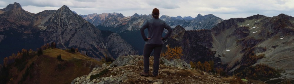
One of the sights in Idaho on my wish list is Hell’s Canyon, a 10-mile wide chasm carved by the Snake River, dividing Oregon, Washington and Idaho. At 7,993 feet, it is North America’s deepest river gorge. There are only three roads that reach the Snake River in the canyon – two from Oregon and one from Idaho. But the road in Idaho at Pittsburgh Landing is not in the steep canyon section. The only way to see the deepest sections are by boat or from a lookout. I originally envisioned myself careening down the Snake River wearing a helmet and wielding an oar over Class III and IV rapids. But I also envisioned myself here in August. At this time of year, the white water rafts are in dry dock while the River Rats scurry south for the winter. If I wanted to peer into Hell’s Canyon, I would have to resort to “Overlook.”
In moving south toward the canyon, Hell’s Gate State Park seems like the perfect overnight stop, just 4 miles south of Lewiston. In summer months, the Gate is the start of jetboat tours down the Snake River. I had hoped some of the tours would still be running, but like many of the attractions in Idaho, September appears to be “The End.” The park is still in full operation, however. As the lowest point in Idaho at only 733 ft above sea level, it makes a warmer spot to wait out the bands of rain that are now persistently following us.
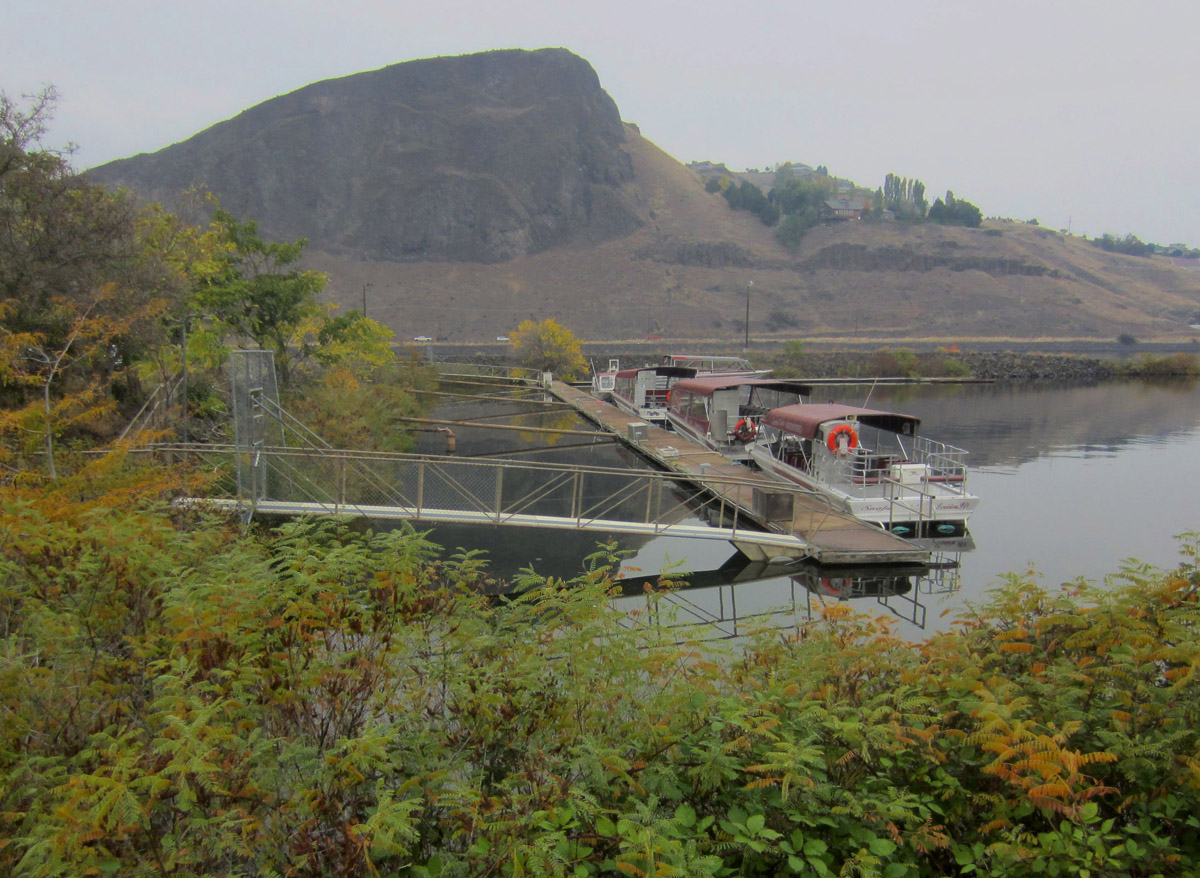
Hell’s Gate State Park is popular departure point for jetboat tours into Hell’s Canyon.
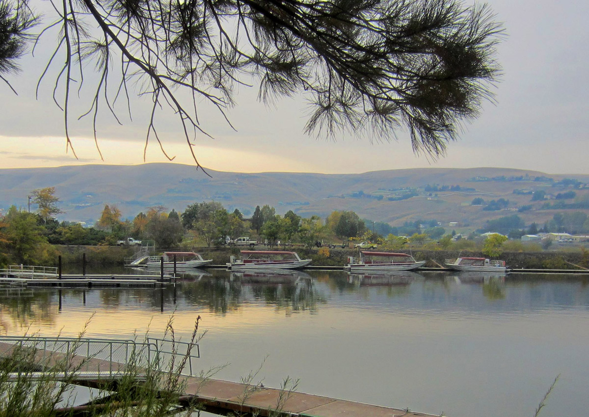
All boats are idle at this time of year. (blurry photos because it’s raining!)
Hell’s Gate State Park sits on what was once a Nez Perce village. Some depressions still remain, the remnants of their pit houses. It was also the site where “Chief Twisted Hair” assisted Lewis and Clark in building five canoes to continue their journey down the Columbia. It took 10 days to complete five canoes. Quite an elaborate Lewis and Clark Discovery Center marks the entrance to the park. I found it interesting to learn that Clark’s maps of their 8,000 mile journey were accurate within 40 miles.
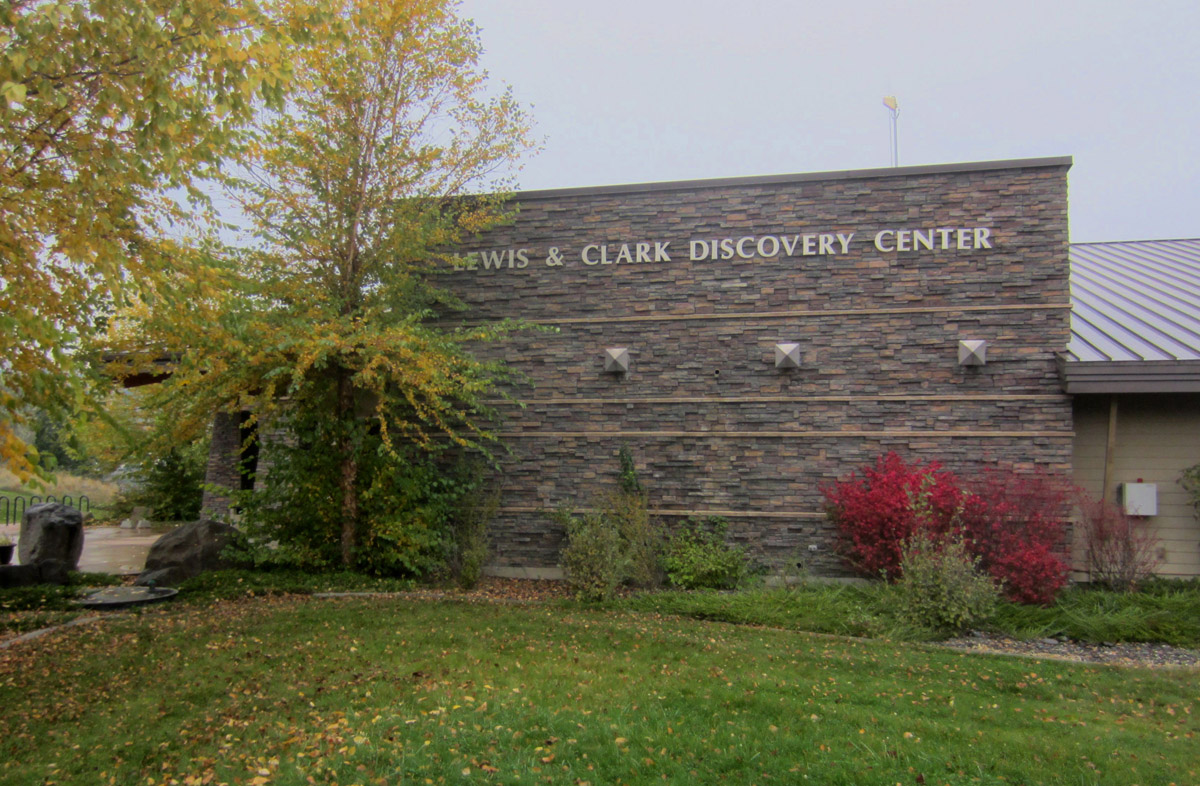
Impressive Lewis and Clark Discovery Center is on the State Park grounds.
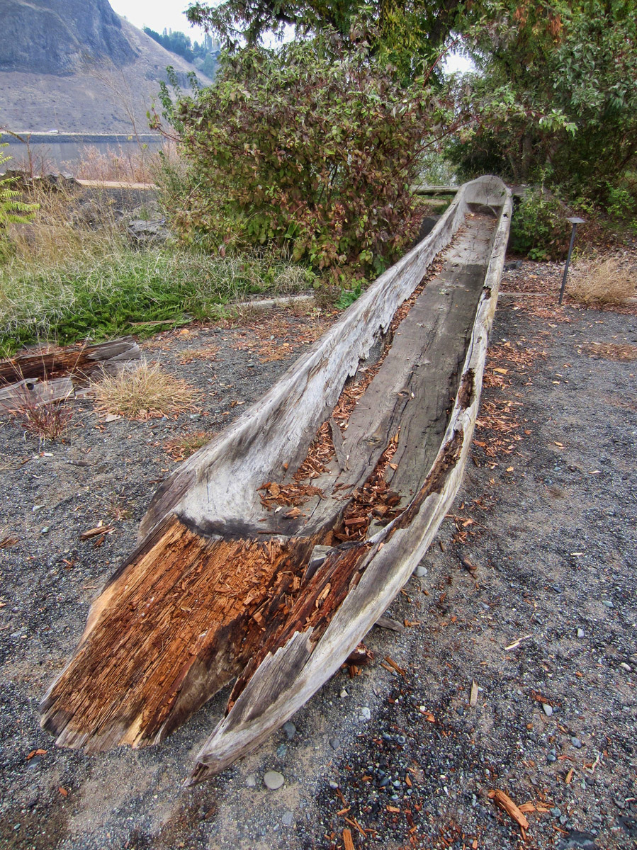
Replica of one of the five canoes built to continue the journey down the Columbia River.
Hell’s Gate State Park is my first time in an Idaho State Park, which charges taxes on their camping rates. This has the cost ending in odd amounts like fifty-seven cents. They don’t appear to take credit cards, and I am not sure you can even write a check. So if you plan to do any camping in Idaho State Park system, make sure you bring lots of small bills, or be prepared to say “keep the change.”
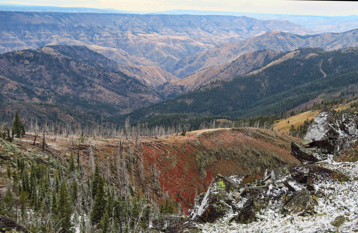
I am eager to move further south toward Riggins, the location of the 17 mile gravel road that travels up to the Hell’s Canyon Overlook, Heaven’s Gate. This winding, narrow gravel “Seven Devils Road” is the only overlook down into the canyon. Weather is changing rapidly for the worse due to a freak storm moving across the Pacific Northwest after Typhoon Songda hitched a ride on the gulf stream and slammed into the Washington and Oregon coasts. This weather system is now moving toward Idaho, determined to foil my plans for a Heaven’s Gate view!
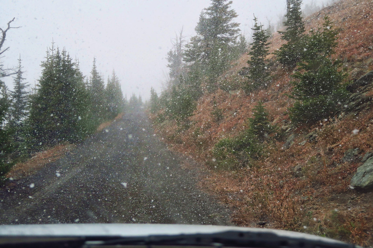
Drive up Seven Devils Road
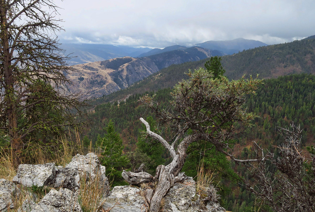
Though the road is steep and narrow, the views are rewarding.
Once in Riggins, we stop at the Hell’s Canyon National Recreation Area Field Office. I tell the woman behind the desk of our plans to drive the 17 mile road, to which she responds “I don’t recommend it.” My heart sinks. “Not even with a four wheel drive?” I ask. She tells me that snow and high winds with hurricane-force gusts are expected for the overlook later today. I look out the window, and not a limb is moving on the tree outside. I tell her we are gonna make a run for it. She says “Okay, but turn around at the first sign of snow.”
“Turn around at the first sign of snow!”
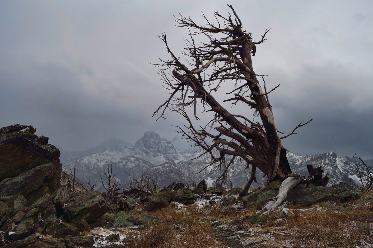
Getting our first glimpse of Seven Devils mountain range.
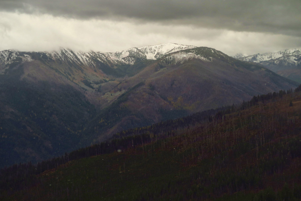
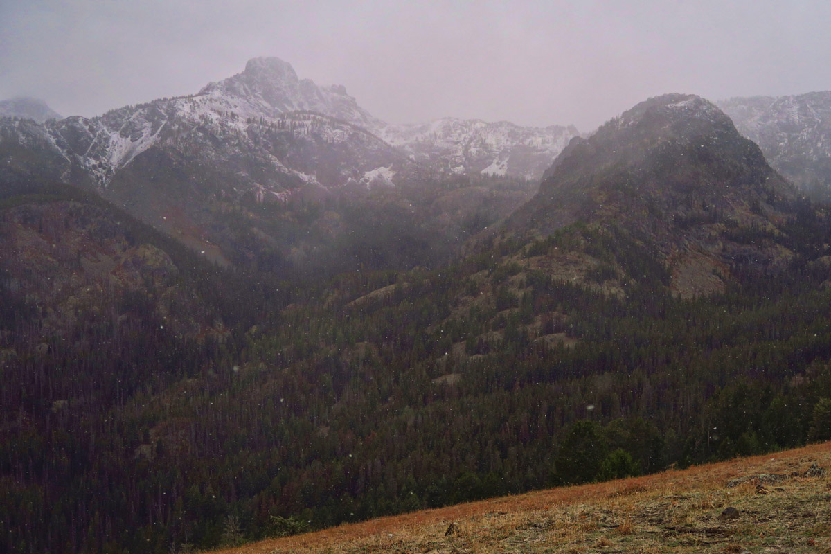
The road is in fairly good condition, though steep and narrow. With almost a 7,000 ft gain in elevation, I find myself apologizing to the Little Tracker more than usual these days. But he handles it like a champ, never missing a beat all the way to the summit.
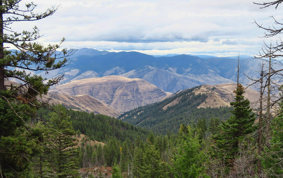
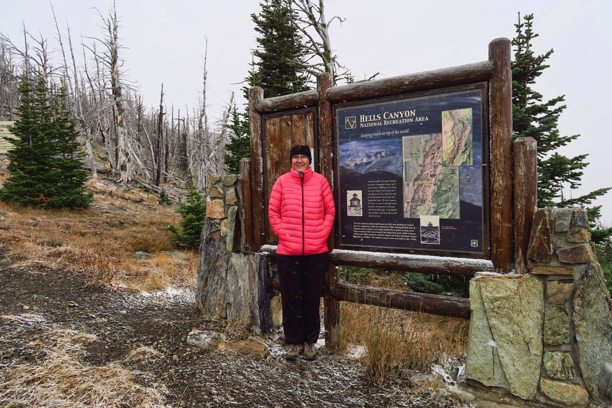
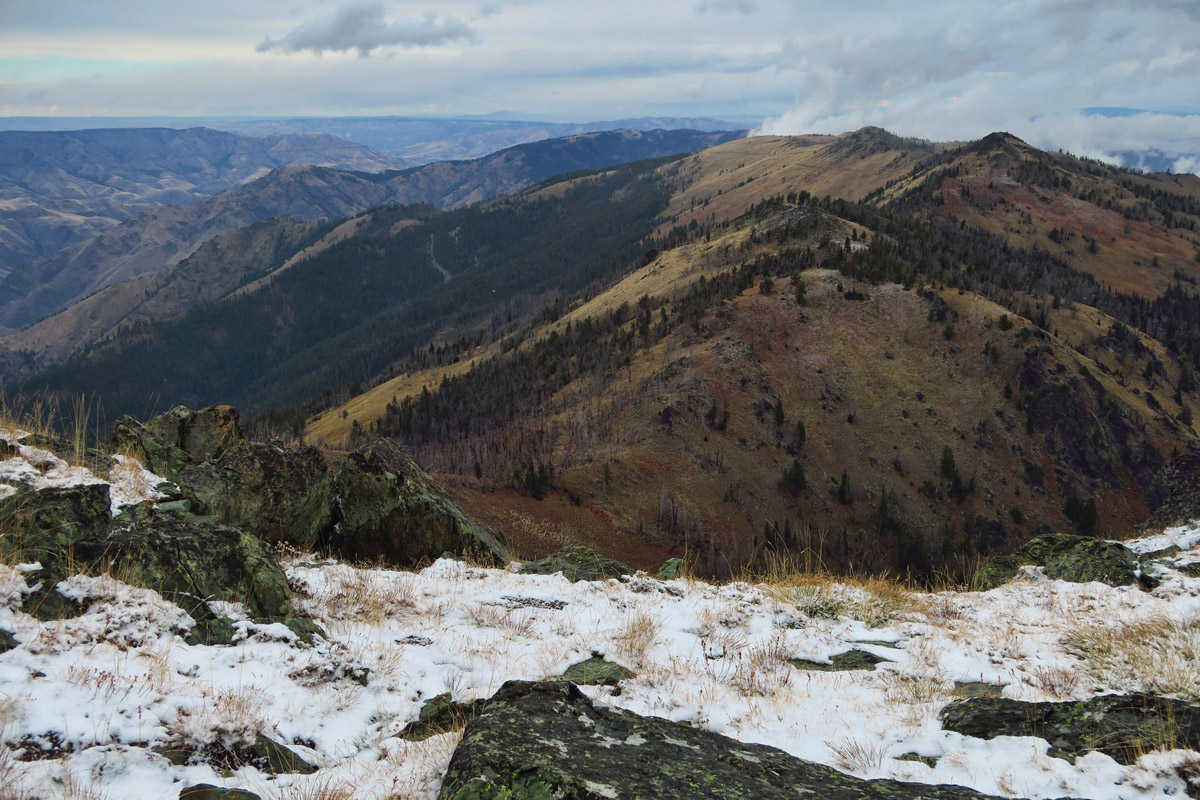
Check out our summit view!
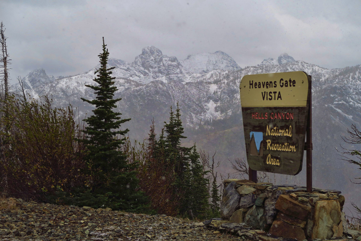
Clouds do eventually clear a bit…
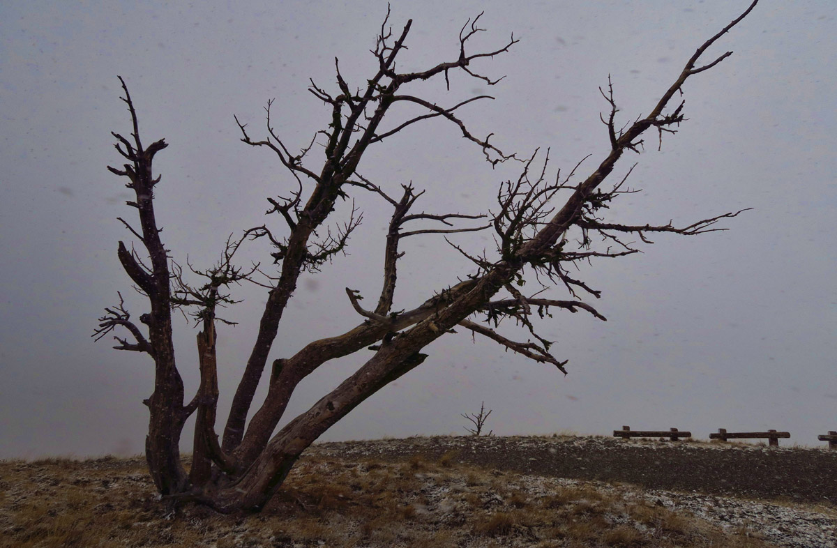
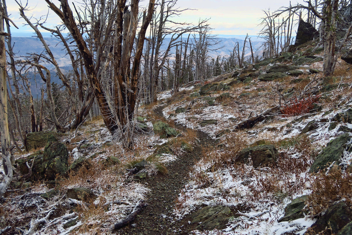
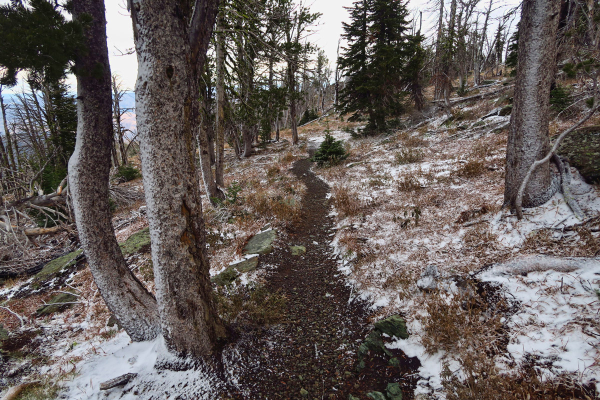
We can’t help but laugh, as we reach the final stage of the climb and the view is socked in. If we are approaching Heaven’s Gate, then this must be the “white tunnel” of death, because we can’t see a thing but a wall of white. After posing for a few humorous photos of the “overlook,” I tell Don I’m going for the 0.2 mile climb to the summit. Clouds be damned, I’m not coming all this way without “seeing” the top.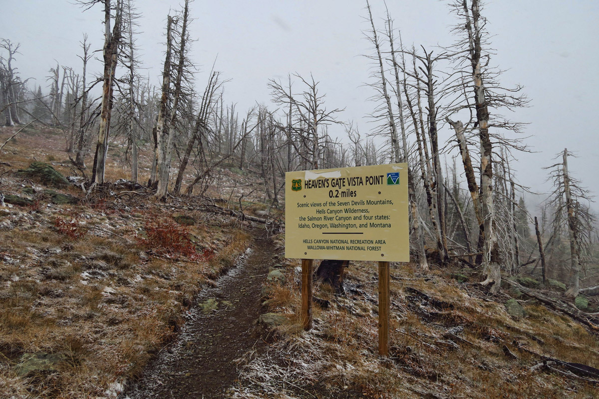
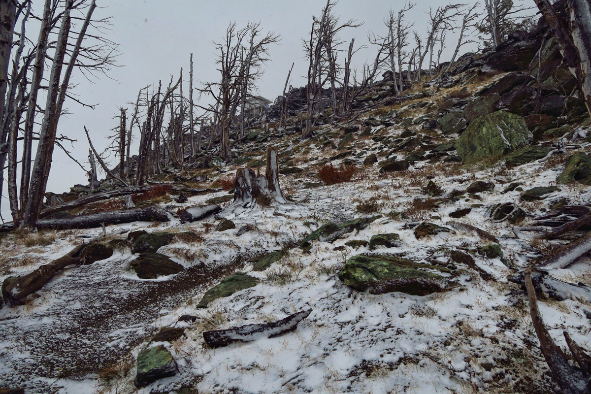
The trail is now under a light dusting of snow (so much for “turn around at the first sign of snow!”) and there is not another soul for miles around, except for my brother waiting patiently in the parking lot, the Tracker heater on full blast.
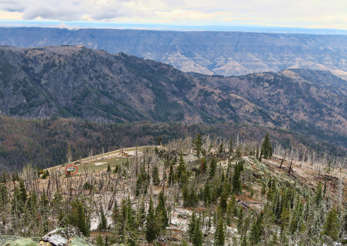
See the little red circle in the lower left? That’s Don patiently waiting…I have to hurry so he doesn’t worry. 😉

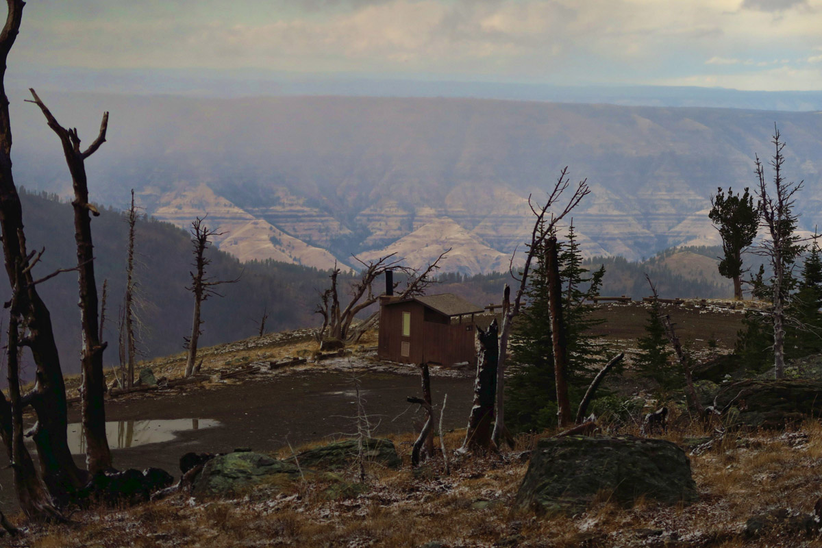
Fire tower at the summit, elev 8,429 ft.
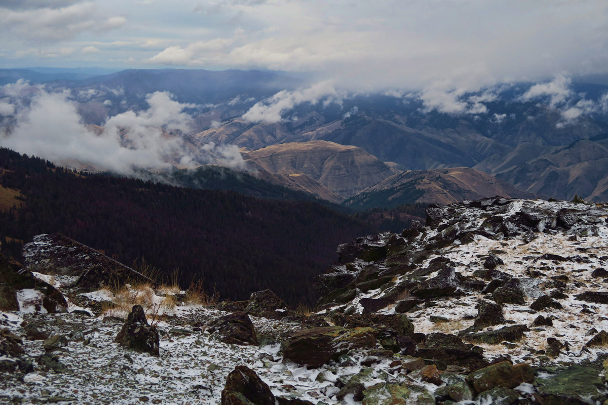
In the muffled snow, sounds become magnified. The crunch and squeak of the freshly fallen snow beneath my boots. The “tink, tink, tink” of the snowflakes landing on the branches overhead. The sound of my labored breath as I climb at an elevation my body has not experienced in a year. I reach the Fire Tower, elev 8,429, where supposedly you can see four states; Idaho, Washington, Oregon, and Montana. Today, I am lucky to see silhouettes of the Seven Devil Range and the undulating walls of the canyon below. But I don’t care. Being at the top all alone is my own version of Heaven!
“Heaven is under our feet as well as over our heads.”
― Henry David Thoreau
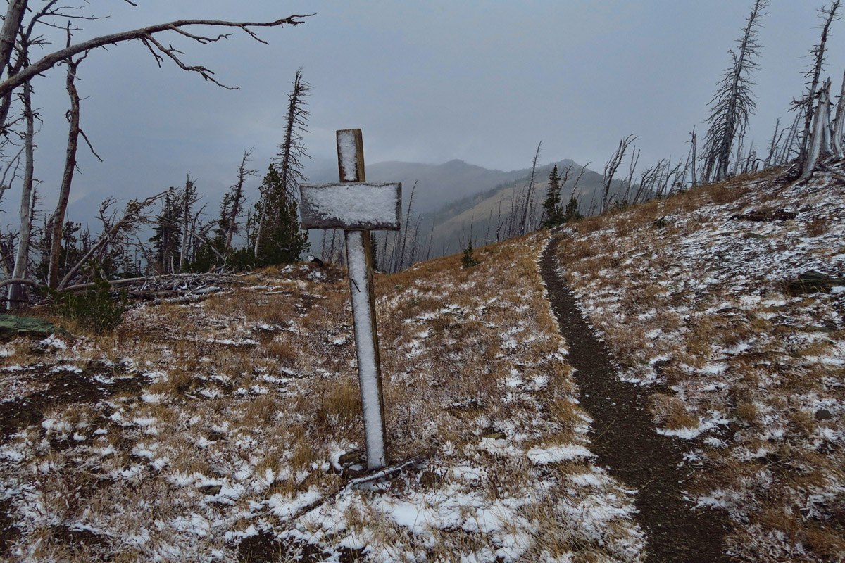
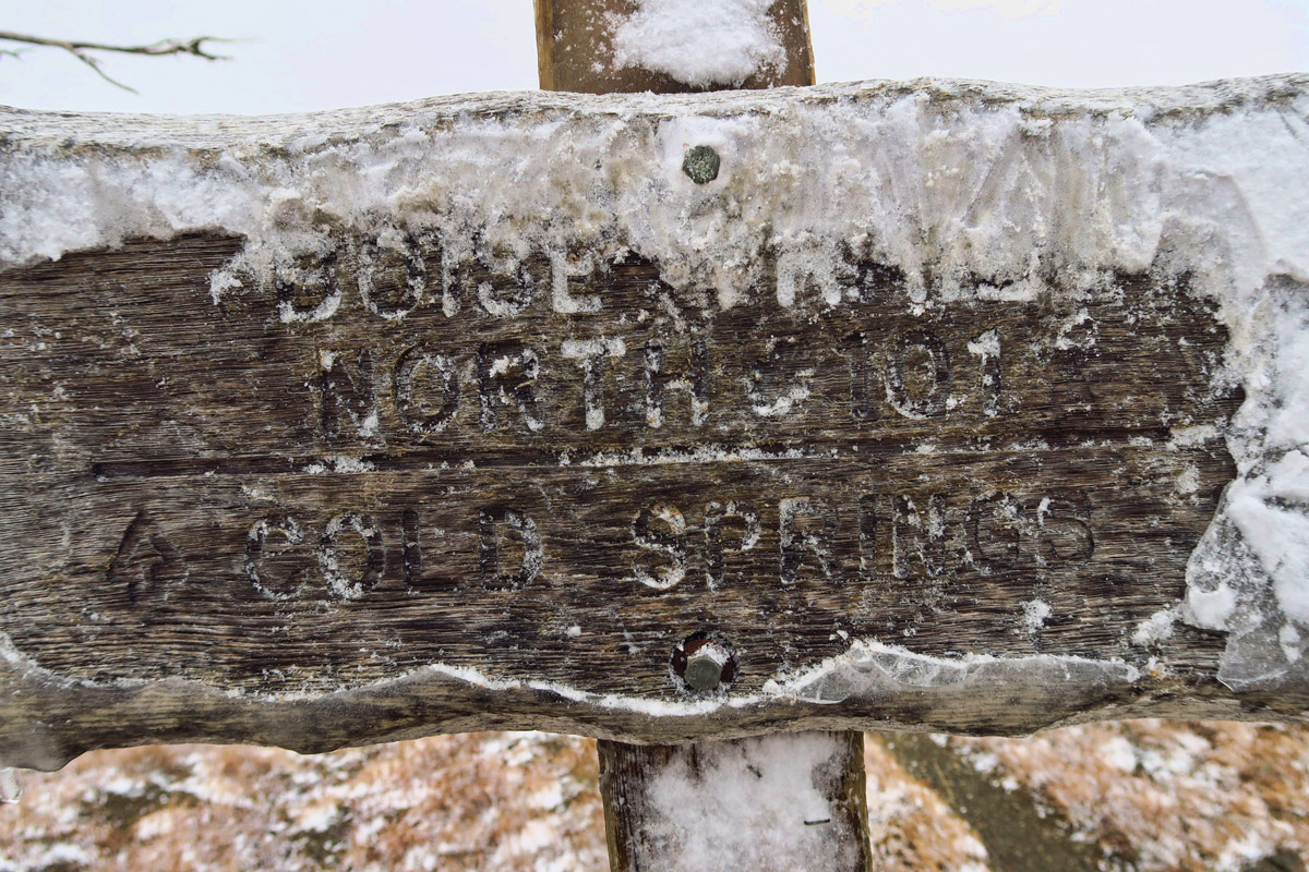
Boise Trail #101 North to Cold Springs
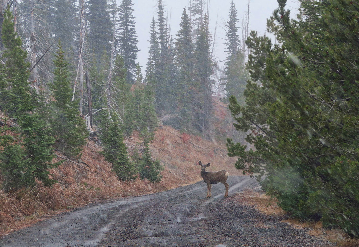
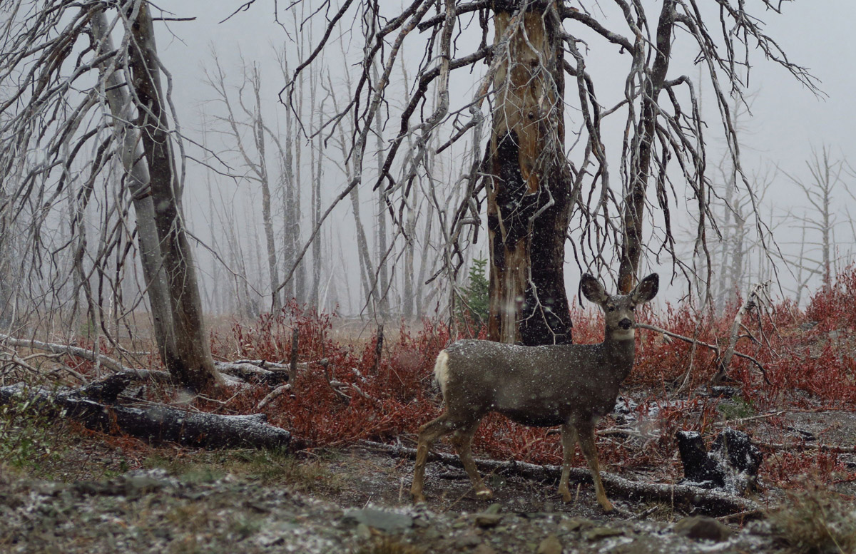
I so want to warn her…
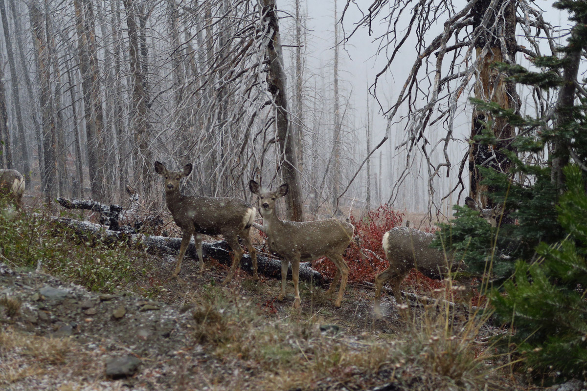
So well disguised, but not well enough…
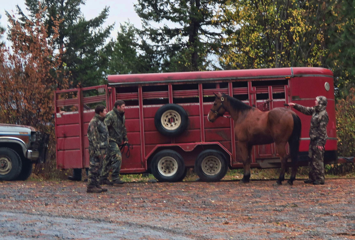
Many hunters are on horseback along this road.
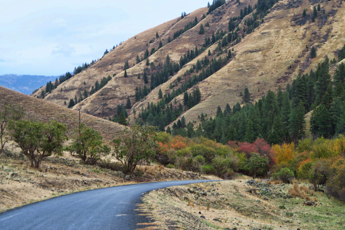
Leaving the snow behind….for now.
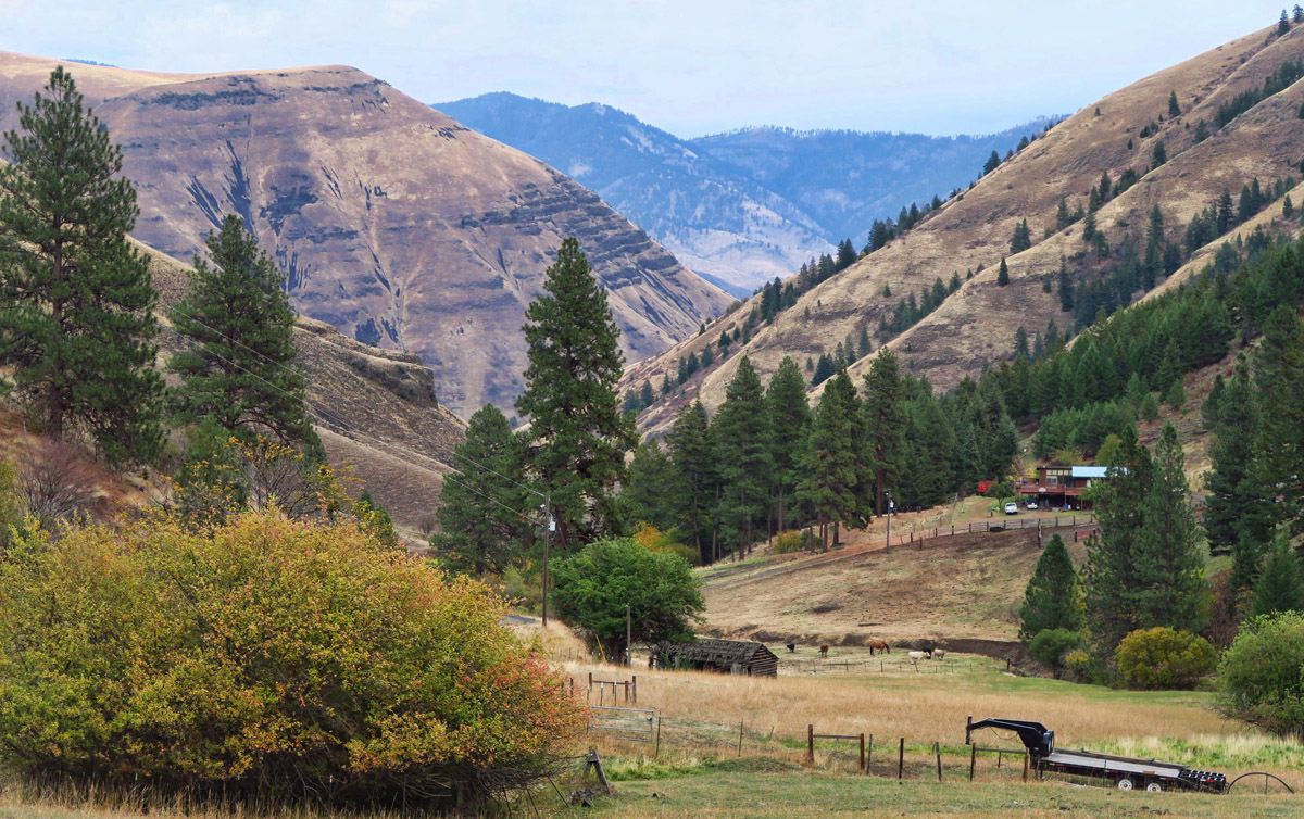
That’s the joy of living on a large continent is that you can experience all the seasons and then drive somewhere where you do fancy the climate.
Jim would have been waiting in the car with Don 😉 At least it cleared up a little bit at the summit.
Next time you definitely need to get down to the bottom of the Hell’s Canyon. You will love it!
Beautiful! Nice to have a loving bro’ waiting for ya too 🙂
I am so enjoying your posts about your travels through Idaho. My home for a few decades. As a soil scientist, I mapped Hells Canyon Wilderness during the heat of summer, camped on a ridge we were dropped into by helicopter, and spending 12 hours days mapping by helicopter, dropped to the ground on a ridge with an hour to hike and dig and get back to the copter pickup to take us to the next location. Navigating was my job, and choosing the sites, in addition to digging and describing the soil at those sites. I never saw the landscape in snow, so your photos were a treat. It is a wild wild country, it was one of the highlights of my career. Thanks for the wonderful reminders. And no. I would not have hiked to that summit in the snow! LOL. You are the one who lived in the city, working wall street, I worked in the woods for 30 years, wild and alone, and yet YOU are the one willing to hike in the snow!
Sue, I adore this comment! What a fascinating career you had! I often wonder what life would have been like had I lived it outside the cubicle, commuting in helicopters rather than subways. 😉 I am comfortable hiking in snow because that was my daily commute through “concrete canyons” for so many years…
You are one brave, or foolish, woman. Yet even with snow and fog the views are spectacular.
I believe Stanley Idaho is known to be the coldest point in the lower 48. I believe it. I don’t believe I would have been as brave as you going up this late in the season, especially on an unpaved road. I hit snow in June or July going to Wisdom MT from Salmon. Beautiful ride and a good road. For one reason or another (I think it was probably the pups (and Jack, for me), we didn’t get to Hells Canyon. I’d love to ride the boats and also the mail boats on the Rogue in Oregon. Both are on my bucket list–there’s a race to see if I make it! LOL
Thanks for sharing the pictures–I just love the way you capture the scenery. I can’t wait for your next post. There’s also a very pretty ride over to Stite and Ely City on an unpaved road that doesn’t look as “iffy” as the one you’re on. I’m trying to think whether it was near the pub…er campground in Grainger–at any rate , the terrain is not as rough–especially this tie of year.
I came down through forest fires up to the road–earlier in the year.
Wow! What a great day! Yes, I would have continued, as well, and taken the hike to the top. If you come all that way, you have to continue:) Good for you!! Looked amazing:)
Excellent story. As I can see you never doing half way, in any scenario you going from A to Z .
I reading all your post during the long time, but very seldom write to you,because English my secondary , hope you forgive my mistakes
Alex, thanks so much for the comment! Anyone who can speak a second language (I have tried several times and cannot!) is automatically forgiven of any and all mistakes! What is your primary language? I am guessing from the dot CA that it is French? Thanks for following along!
Suzanne
Once again you have provided us arm chair explorers with an exciting story with exquisite pictures. Thank you from afar.
I love this country and feel so at home in its wilderness. You drove right by my winter camping spot in White Bird. The last little village at the bottom of the White Bird Grade before go back up to Riggins. Each little hamlet has its own little culture, celebrations an ‘hot spots’. Riggins has boat races on the river that are really a wild time. Loved your snow trek! I so admire your tenacity!!
Beautiful! Sounds like the Tracker is having a resurgence.
The Seven Devils has some great backpacking and I explored much of the range in times past. Come back next year.
Love your determination! Also, that you got to experience this place in solitude.
What a great adventure you two had that day! We used to use walkie-talkies when we were on an adventure and had to separate for one reason or another. But they did have a limited range, unfortunately. How awesome that you did get to see some of the range even with the limited views!
Two years ago we had hoped to take a jetboat tour into Hell’s Canyon also but they were closed for the season. 🙁 How could you not go to the summit when so close?
“Determnation” “Tenacity” “Adventurous”…are fit descriptions for you with this climb. Such lovely photos…I can almost feel the chilled silence. I will admit, however, that Disco, be damned! I, too, would have probably been hanging out with Don in the warm Tracker as you made your way to the top…just because it’s there. I am truly an admirer. 🙂
Thanks for the tip on payment at the Idaho State Parks!