It’s eight degrees when I wake up in the Backcountry Information Office parking lot on the South Rim of the Grand Canyon. Even Siri says “brrrr!”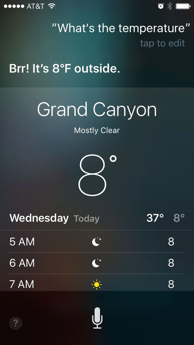
There are three Hiker’s Express shuttles that go directly from the Backcountry Information Office to the South Kaibab Trail at 7:00am, 8:00am, and 9:00am. I figure I will shoot for the middle shuttle, and that will still allow me one other chance if I miss it. Halfway through my morning routine, I vacillate between slowing down for the 9am or speeding up for the 8am. I am having a tough time cramming all my belongings for a two night stay into little more than a day pack, so I think maybe delaying another hour later won’t hurt. But then I remember the magnitude of the hike and shortness of the daylight, and put it in high gear, flying out the door, my hiking boots still unlaced. I make it just as the 8:00am shuttle pulls in. The ride down the Desert View drive is beautiful with the morning sun glinting on the blanket of snow lining the roads. Sounds are muffled, both outside from the snow drifts, and inside from the dozen hikers bundled tightly in puffy jackets, hats, gloves, face warmers, neck gaiters, etc. It’s 20 degrees when we unload at the South Kaibab trailhead.

Th.e information kiosk is covered in ice crystals
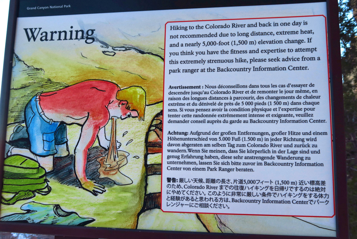
Nothing says “Turn around now” like a caricature of a man vomiting.
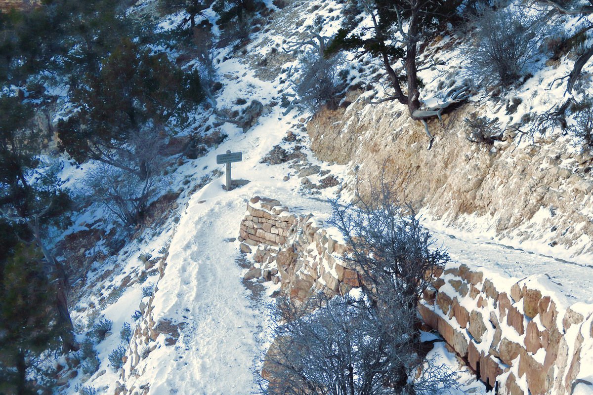
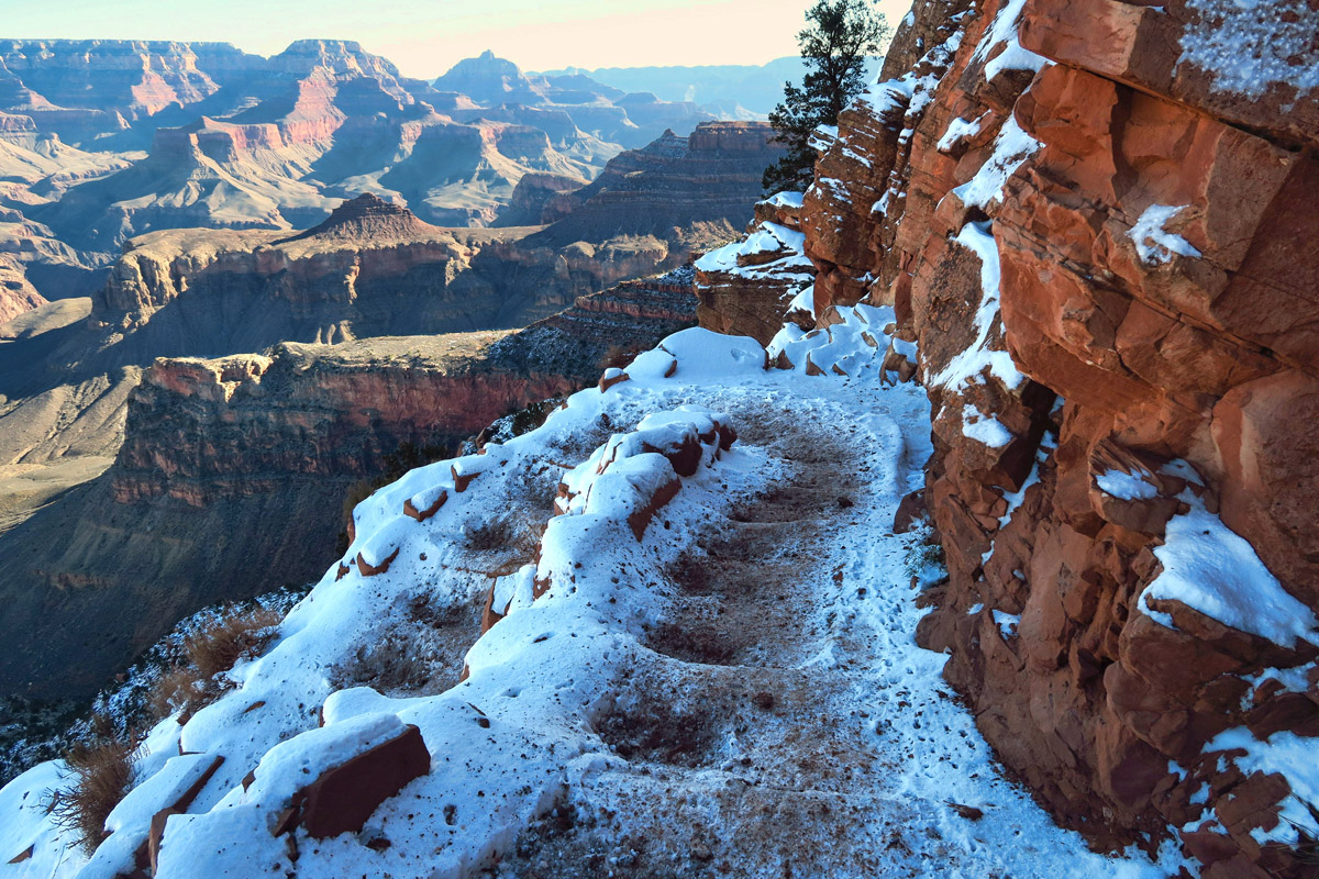
First of many snow-crusted switchbacks.
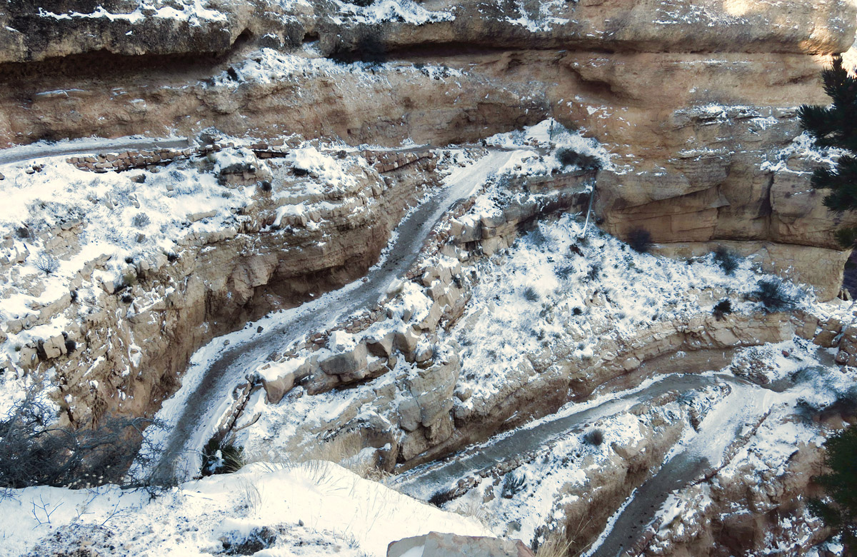
Here, you can make out the steps…
Hikers are hunched over their boots at the start of the trail, attaching their microspikes and crampons. I look around to survey the group, noticing that every single hiker is equipped. I reflect back while visiting Joel and Kathy in Lake Havasu, Joel and Jona make a run to Las Vegas to drop Jane at the airport. They plan to stop at REI on the way back. Joel asks, “Do you need me to pick anything up for you?” “Well, since you asked….yes! Please pick me up a pair of YakTraxs.” At the time, pushing 70 degrees in Lake Havasu, this seemed like a ridiculous request. But as I strap the wire-coiled mesh onto the bottom of my hiking boots, I am grateful for whatever inspired the notion. They literally saved my butt!
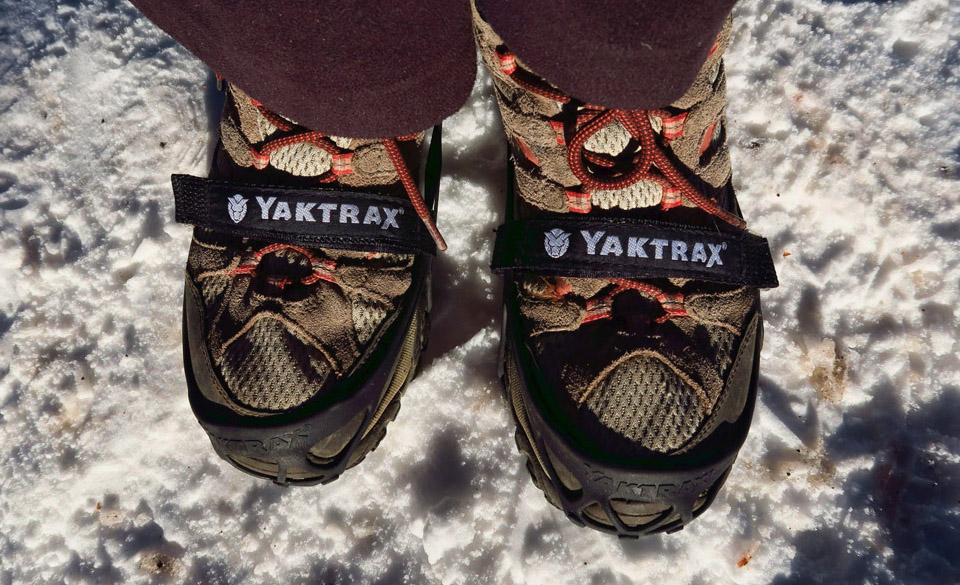
My trusty YakTraxs were a worthy purchase!
Most hikers choose to descend into the canyon via the South Kaibab Trail because at only 7.1 miles to Phantom Ranch, it’s a shorter route to the bottom. However, a drop of 4,860 ft in elevation also means a much steeper route than the longer Bright Angel Trail. It will be a steady day of switchbacks, stairs, and deep knee bends.
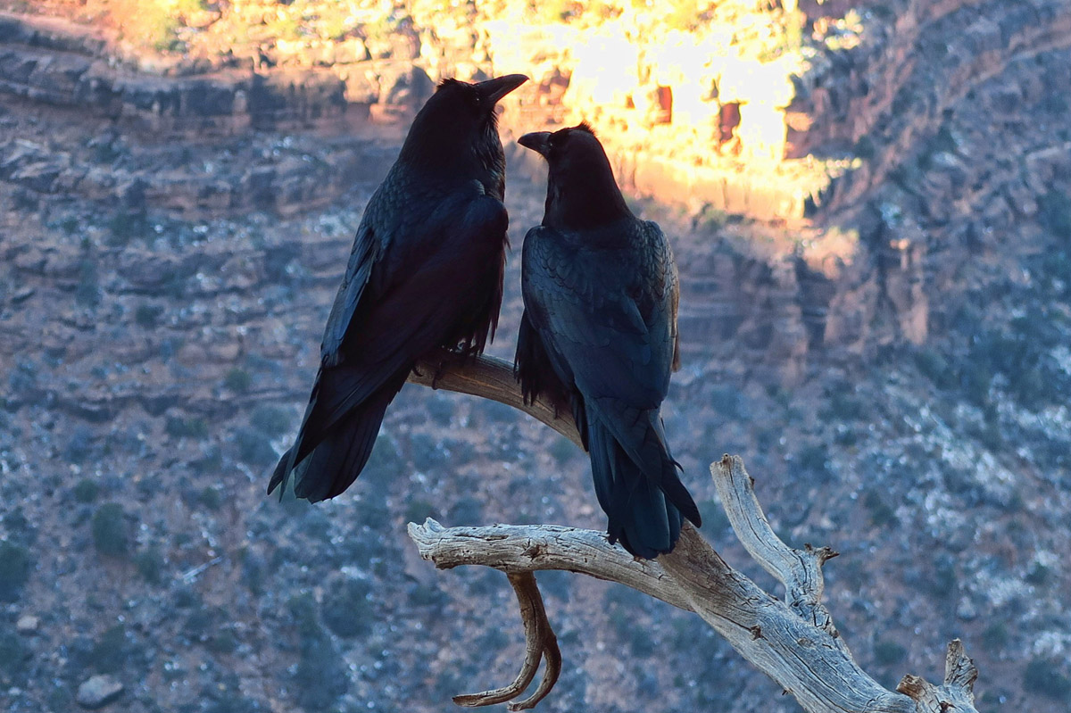
My canyon wildlife sightings.

Love must be in the air…
I’m on the trail by 8:20am, and already I can feel the sun warming my cheeks, the only exposed skin on my body. Vapor billows out with every exhale. There is no wind, and not a cloud in the sky. I barely feel the effects of the below-freezing temperature, and it’s not long before I shed my fleece headband and gloves.

Modeling my YakTraxs. I am a convert!
For many, the downhill is the most difficult part of the hike, simply because of the pounding and jarring on the knees. But the opposite is true for me. I am good at downhill or long distance hiking. But once the trail starts to climb, my lungs just can’t keep up with my legs. With each downhill step I take, it’s tough not to feel concern about the adage, “Going down is optional….Coming back up is mandatory.” Before I started the decent, I made a vow that I would turn around if I thought I couldn’t make it back up. But it’s easy to see how hikers and climbers can blur those lines of ability once adrenalin takes over. Going down, I feel good and don’t ever want to stop.
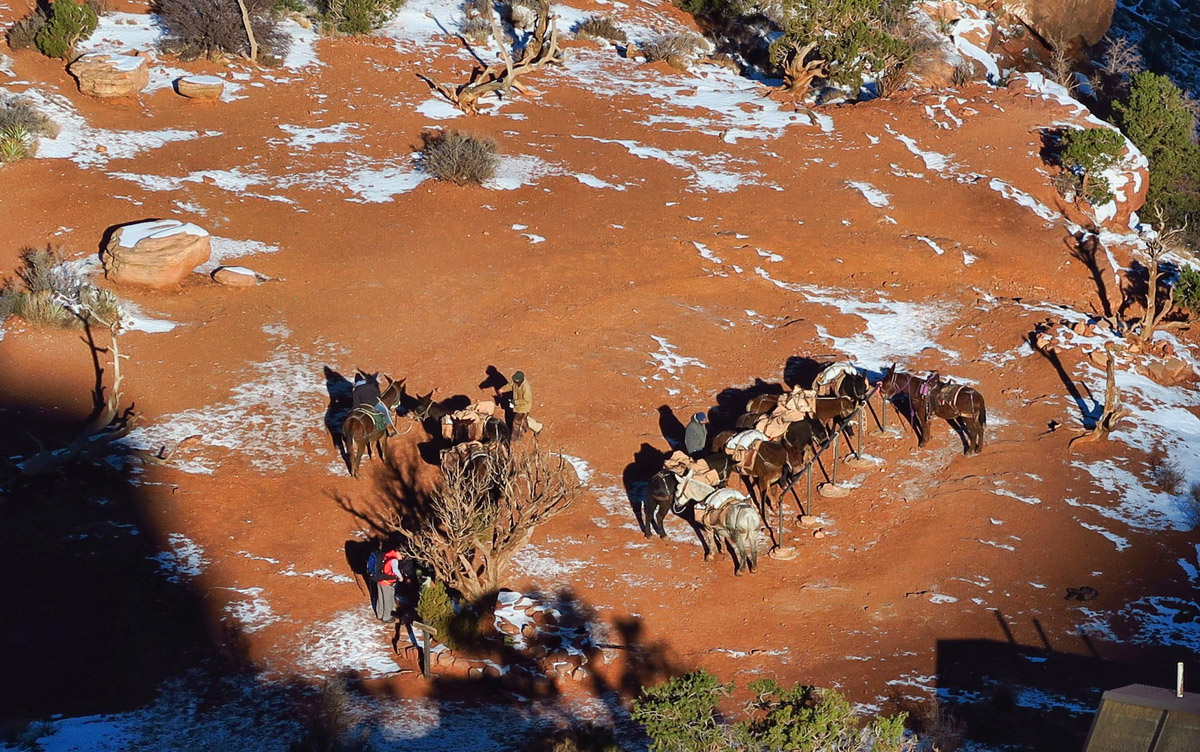
Overlooking mule rider stop at Cedar Ridge.
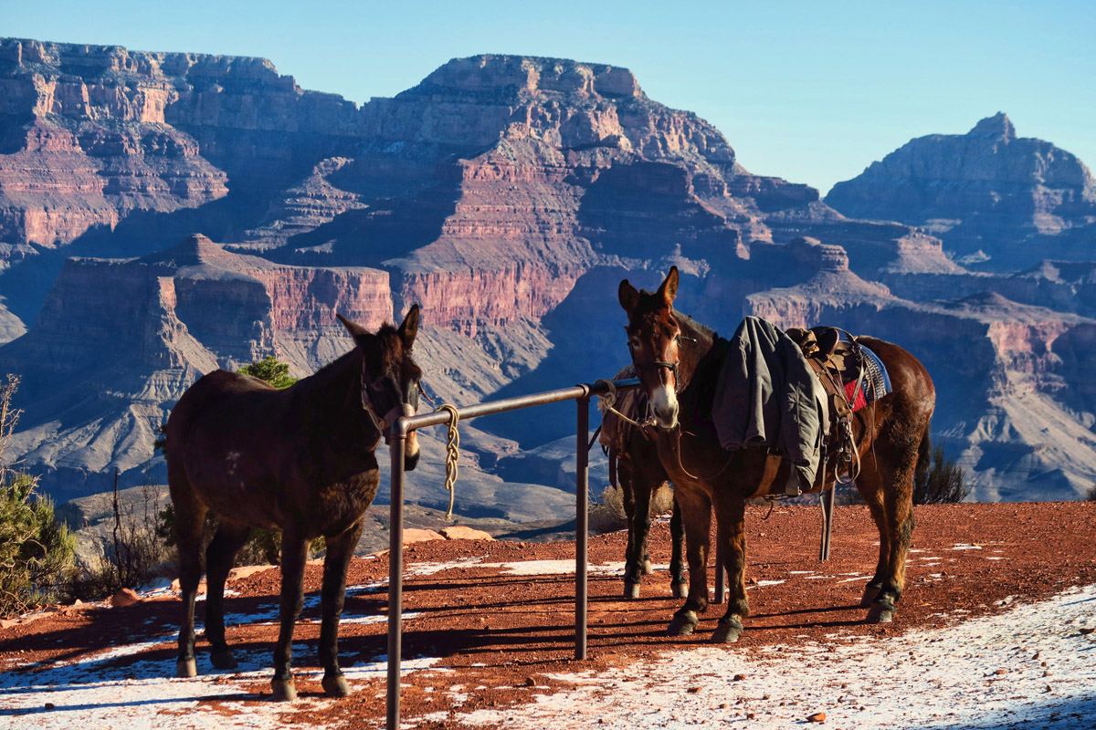
Mules play an important role in the Grand Canyon, as everything must be transported on their backs. A cross between a male donkey and a female horse, they are “sensitive spirits in robust bodies.”
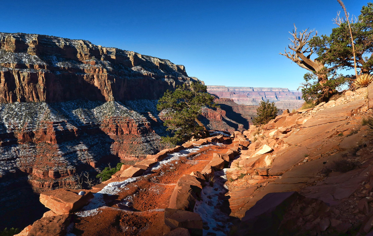
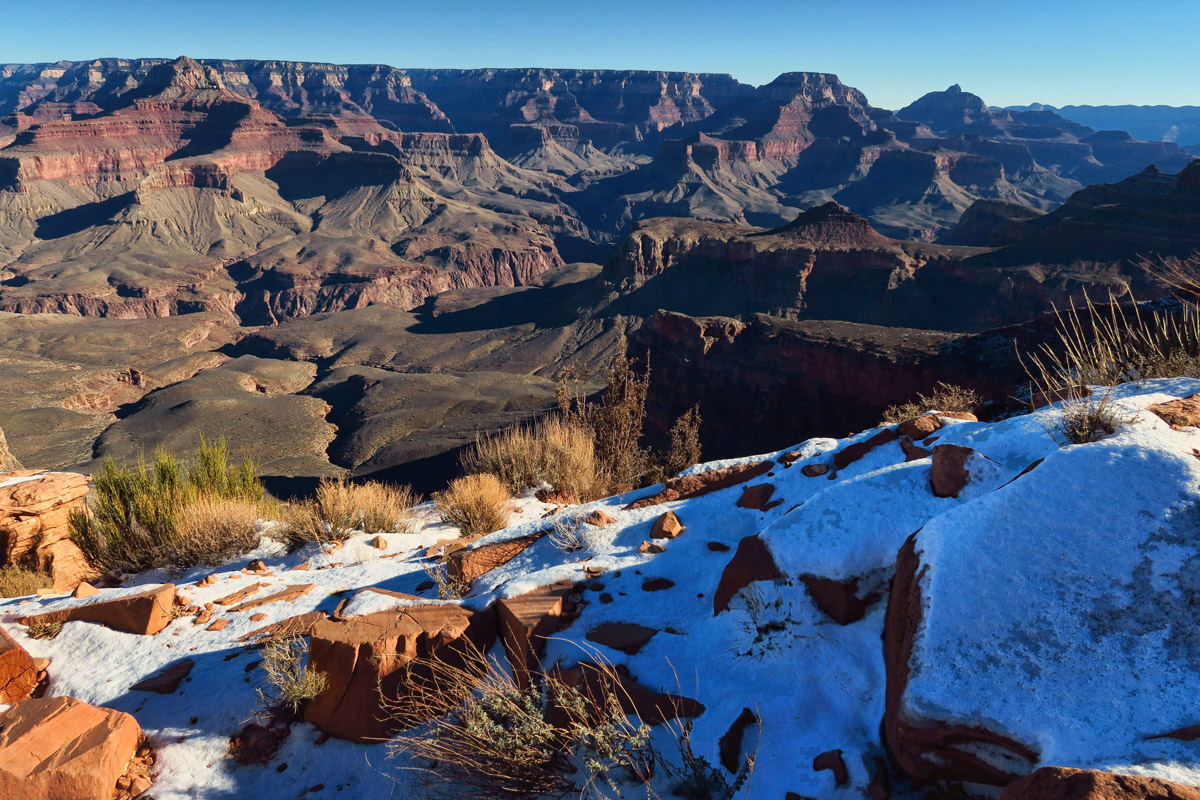
Leaving Cedar Ridge, I see the last of the ice and snow until the climb out.
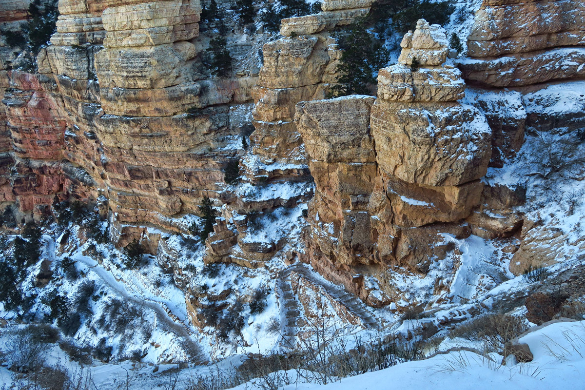
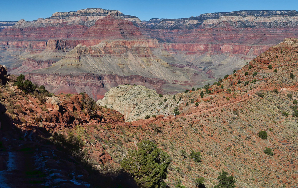
Follow the trail down along the switchbacks on the right…
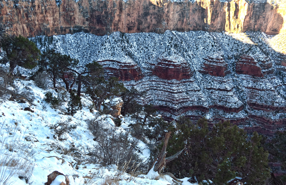
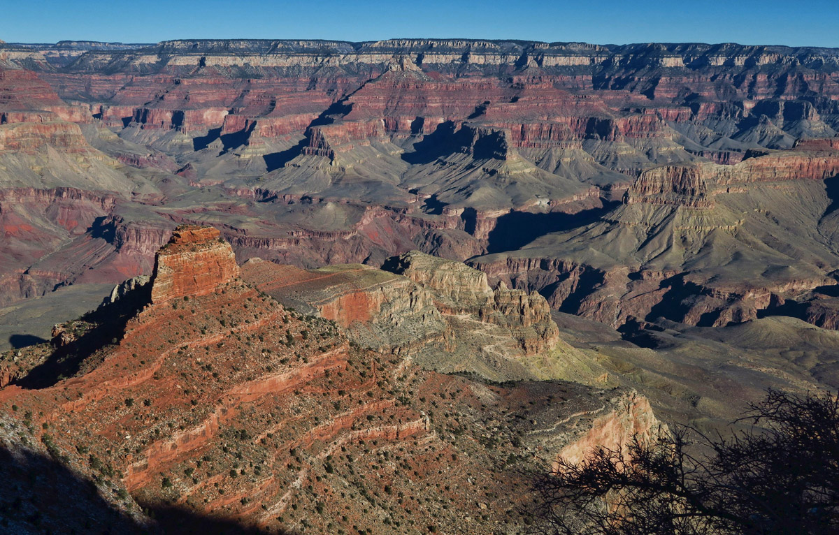
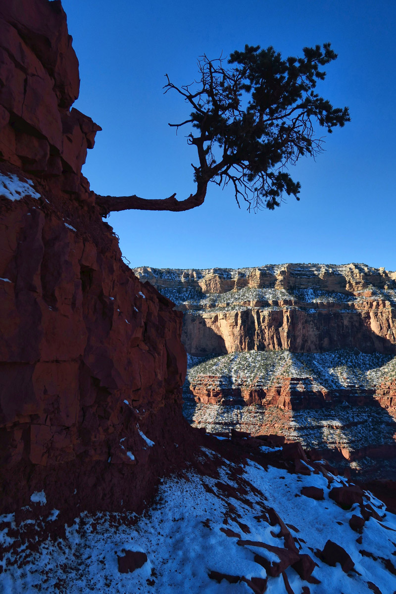
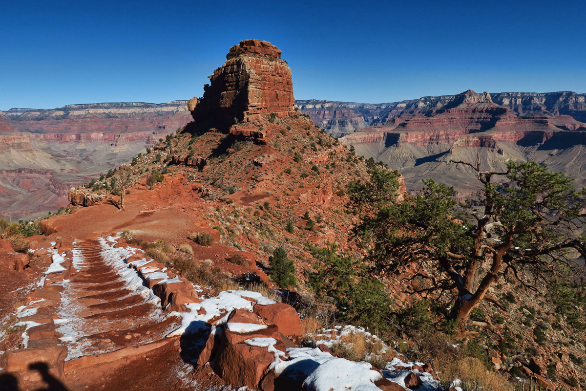
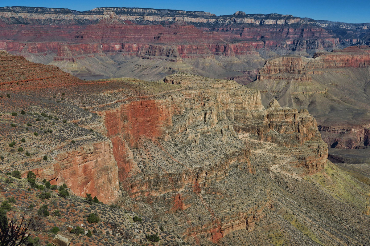
Another bonus of the South Kaibab Trail is that it descends along a ridgeline as opposed to a side canyon, offering unobstructed views that unfold at each turn. According to the NPS brochure, it offers “panoramic views unparalleled on any other Grand Canyon trail.” It does feel like I am walking down nature’s grand staircase into the vast, bottomless abyss. Descending “The Stairway to…”
This ridgeline was about the only “level” stretch on the trail.
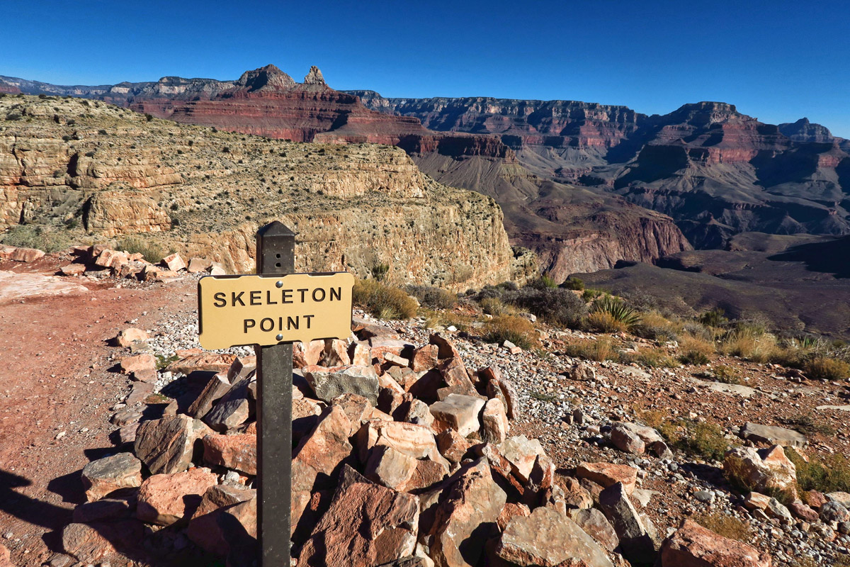
Skeleton Point — No skeletons, thankfully.
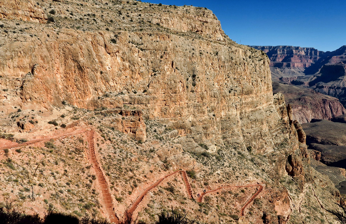
This was the only part of the entire hike that I really didn’t enjoy. Switchbacks and steep steps.
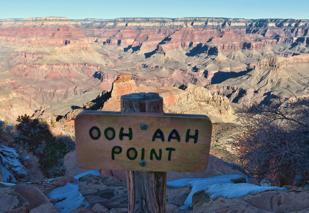
Landmarks along the way help me gauge my progress, the first being “Ooh Ahh Point,” the most dramatic panoramic view looking down into the canyon. Cedar Ridge is next at about 1.5 miles, a popular stop for the mule trains, and the last sign of any snow or ice along the trail. I stop here to remove my YakTraxs, already caked in mud. Skeleton Point marks the three mile point and the recommended maximum distance for the turn-around point as a day hike. From this point, the trail becomes a grueling set of steps down switchbacks that seemingly have no end, but eventually it levels out to the Tonto plateau, as indicated by the rest area, “Tip Off.”
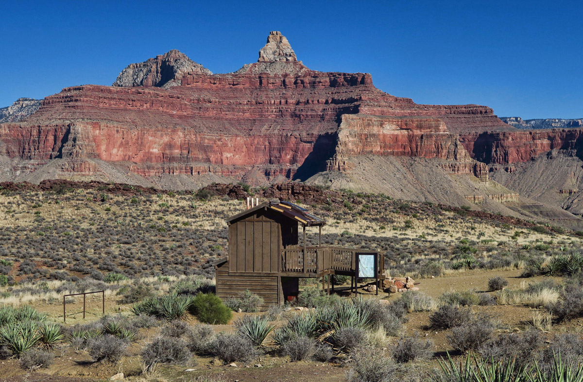
Rest Stop at “Tipoff.” This is also the intersection for the Tonto Trail, if you want to take the cut over to the Bright Angel Trail.
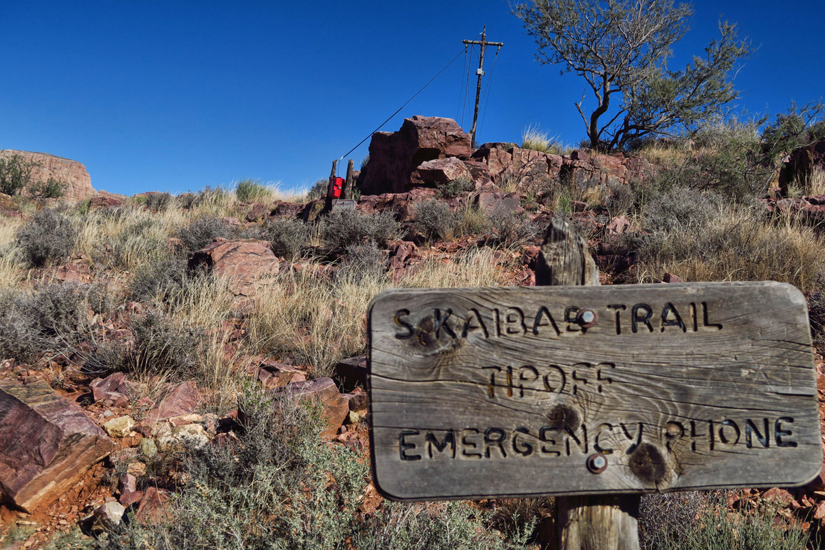
“Emergency Phone.” Don’t know if this is a comfort or concern since it’s the first one I’ve seen in 3 miles.

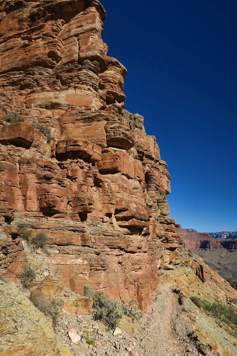
Here, the trail is cut into the rock.

Finally! I get my first glimpse of the Colorado River! It can’t be far now! Or can it??
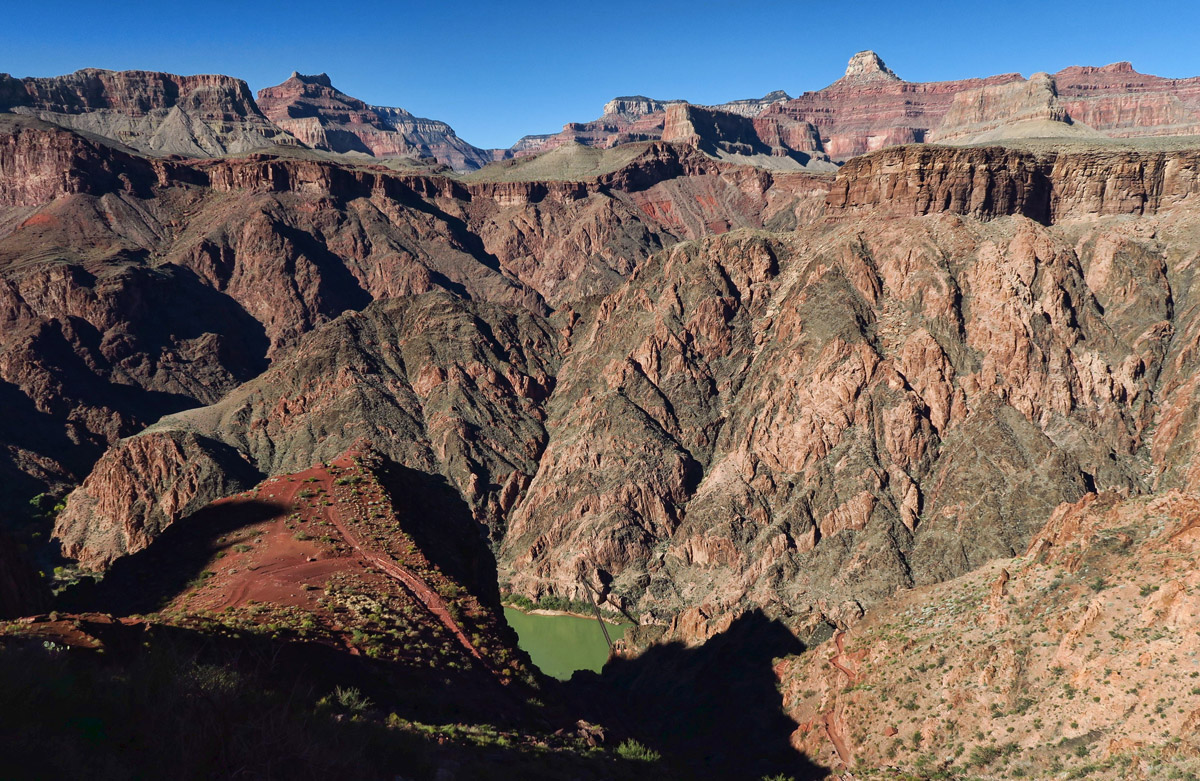
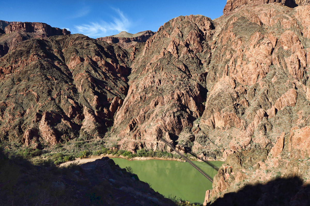
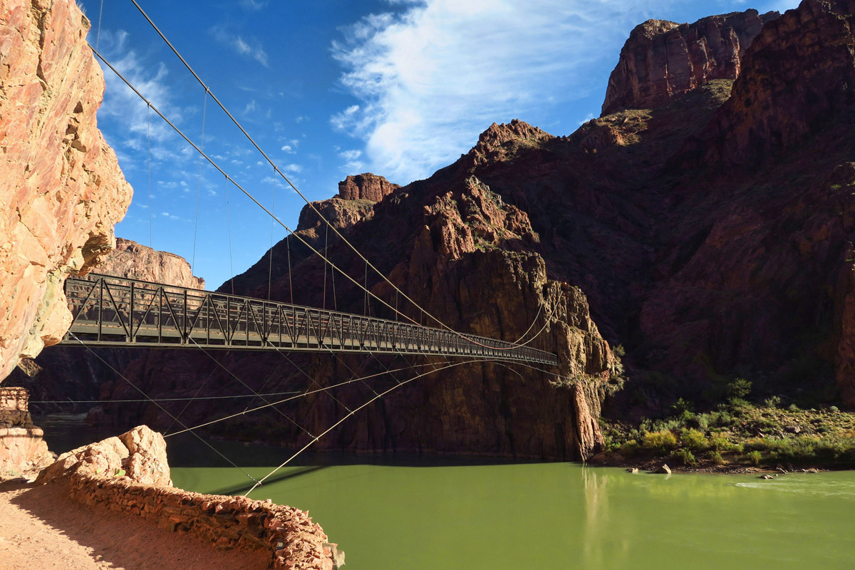
That tiny black “thread” across the river is the suspension bridge known as the “Black Bridge,” not to be confused with the “Silver Bridge” on the Bright Angel trail.
I reach an unmarked bend in the trail that a fellow hiker tells me is “Panorama Point.” I finally get a glimpse of that green sliver of a river, the Colorado. For the first time, I feel like I am getting close. Though a later view reveals a thread-like structure across the river, which is the suspension bridge. I still have a looooong way to go.

On the left is the Colorado River. The stretch of cottonwoods in the center is Bright Angel Campground. Phantom Ranch lies just beyond there, around the bend.
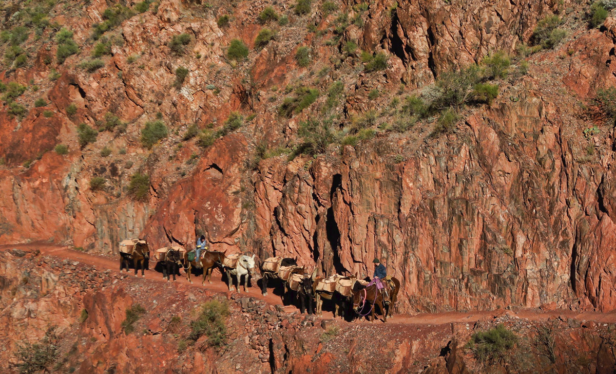
When meeting the mule trains, hikers are to yield, stopping on the inside edge of the trail, thankfully!
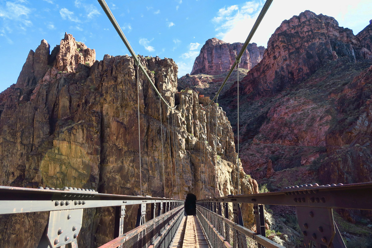
Still, reaching the river…the bottom of the canyon, and raison d’être for this massive geological cathedral that surrounds me, is emotionally overwhelming. I can hear it as soon as I see it, dodging shallow rocks while swirling around deep eddies. Once I finally reach the “black bridge,” accessed by a tunnel blasted in the rock, I am verklempt. An informational sign at the base tells about the bridge, built in 1928 to replace a cable car with a one-mule cage. “Much of the work was accomplished at night under floodlights in attempt to escape the summer heat. The eight main cables, each 550 ft, could not be loaded on mules. They were carried down on the shoulders of men.”
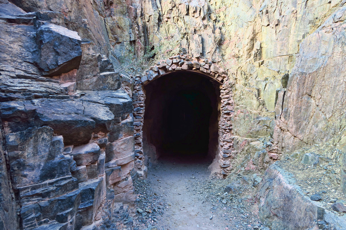
Entrance to the Black Bridge is blasted into the rock mountains.
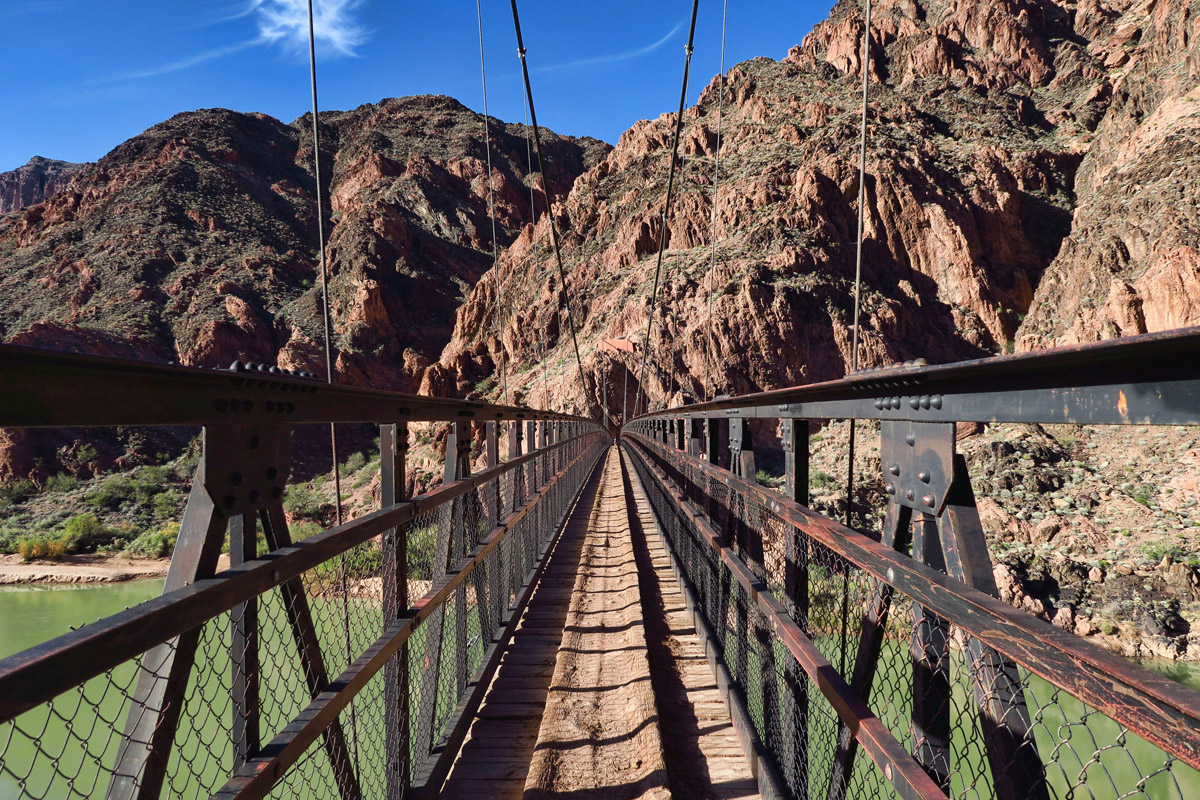
Mules use this bridge instead of the Silver Bridge, because it has a solid “floor” and the mules can’t see through the grate.
Once I reach Bright Angel Campground beneath the golden Cottonwood trees, I know I’m almost there, but I still have a ways to go to reach Phantom Ranch. It’s now 3:20pm. The time estimates for the South Kaibab descent are “4 to 6 hours.” It has taken me seven. But I have stopped to chat with hikers, mule drivers, taken over 200 photos, eaten two meals, and just stood and basked in the magnificence that surrounds me. Why would anyone want to hurry through this hallowed canyon?

Boat Beach. No swimming!

Ancestral Puebloan site near the Colorado River. Note round Kiva.
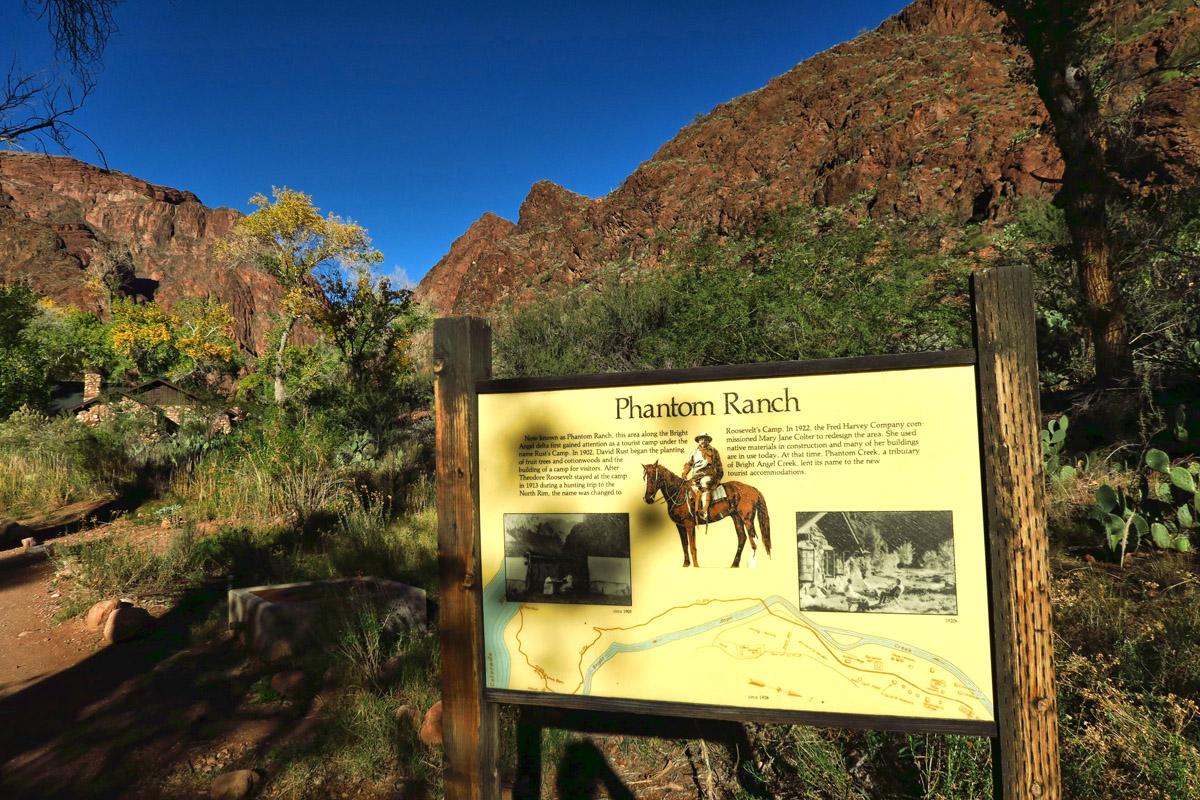
At last…we have arrived!
But! The Cantina closes at 4:00pm to prepare for dinner. I hasten along so as not to miss “last call” for Happy Hour…
Wow. That looks like an awesome trip.
Good Job. I concur, down is much easier then up and I’ll take that any day. Have akways hated seeing those poor mules…exploitation at its finest.
Your trek down brings back wonderful memories for me. I hiked down South Kaibab, along the river, then up Bright Angel in one day back in 2005…such an awesome experience. A lot for one day, but without reservations at Phantom Ranch. that was the best option at the time.
I have never been to the North Rim though, nor have I stayed at Phantom Ranch…can’t wait for the next installment! LOVE seeing parts of the canyon in snow!
I stayed at Phantom Ranch a number of times when going to school in Flagstaff and had a couple of icy winter descents on the Kaibab trail, unfortunately before there were yaktraks….lots of slipping. The dorm room was $10 a night then, which seemed high but still better than carrying camping gear down there. It looks like you have really made up for the time you “lost” this summer by getting to White Pocket and now the bottom of the Grand Canyon! Way to go.
Wow, you hiked down starting at 8 degrees. You are something Suzanne. I would have gone with you if you’d have me and I were there of course. What a fantastic day! Great pictures! Hope the hike out is not as much of a problem as you are anticipating. Do you then have to take the bus back around to the South Rim??
Hi, Sherry — The North Rim is closed at this time of the year. There are no services, and the only accommodation would have meant hiking back across, as there are no shuttles when that part of the park is officially closed. So I did not get to visit the North Rim. I’ll wait for you next time. 😉
Beautiful pictures and commentary Suzanne! You captured things I missed on the hike down. We were not far behind you, but it took us a lot longer as the descent was tough on the knees! Thanks!
Amazing photos and hike. Thanks for taking us along. Can’t wait to see what’s next.
Mary Lou
That is definitely on our bucket list! We looked into a mule ride and it was booked up for quite a ways out. We still might hike it one day but we need to figure out what to do with the dogs. There are dog sitting services throughout the area so we will probably look into that.
OMG – Another challenging hike. Attempted a Rim-to-Rim 40+ years ago, down Kiabab, up Bright Angel but never made it to the North Rim 🙁 We did it as a back-pack trip – can’t believe I was that ambitious then. You are indeed an example of Newton’s ‘object in motion …’!
Sure brings back fond memories under similar conditions on the South Kaibab. Never had problems going down until that hike when a knee twitched at the top of the tipoff. Took it slow and 7 hours. But oh those views!
So nice to see you finally run out of the snow. Good to know your feet were prepared for the winter path:) Gorgeous photos of the river and the bridge:) Yes, why hurry such a cool adventure!
Awesome post. I hiked the Bright Angel trail several years ago in early April. Down and back in the same day. The last 1.5 miles back up to the rim were torture. But I will say that the only way to really experience the canyon is to hike down into it. Hiking to Phantom Ranch was on my bucket list until I had to give up long distance hiking. Thanks for letting me share your adventure.
Jim
Going downwards can be hard on the knees, is it River to Rim next?
No, Dave Miles, I am going to drag the story out through Christmas. 😉
Sounds like you really lucked out with getting two nights on a cancellation. I fell in love with the Grand Canyon as a child on vacation just looking over the rim. I hiked it the first time on the South Kibab, Phantom Ranch bunkhouse back up the Bright Angel when I was 19 back in the 70’s. Since then I have done backpacking across, down and up the South rim, and then twice Rim to Rim to Rim with an overnight stay at the other rim. I still want to do it again as I just cannot get enough of it. Last time we started back from the North Rim at 2am with head lamps. About halfway down we turned off our lights and looked up……………………………the stars were amazing and there was not a man made light in sight. Your photos are really pretty and I hope you enjoy it as much as I have over the years.
Oh, I love this story, Ami! Now I want to go back and hike by starlight!
The reason to hike by starlight on a Rim to Rim day is because of that “Box” and the high temps at the bottom in the warmer months. If you start down in the dark you can be at the bottom before it gets too hot………………this is the thinking of the crazy (more like insane) people that go all the way across in one day. There are very few folks on the trail either. The training for that hike was quite something but so worth it. The stars in the remote areas of the American West are amazing!!!
I am chilled to the bone and my knees are aching but what an exciting adventure so far! Those steps look excruciating going down, down, down, but the views provide a significant reward from punishment of pain! Your canyon photos are lovely but my fav with this post is the Black Bridge shot, fourth from the bottom–oh! the colors and the shapes. I lost myself in that one. Thanks for the ride down! 🙂
Love that bridge, what an eventful hike down. Better in the cold than the heat I’d say.
Those Yak Trax saved us many a time when we lived in Yellowstone. Great photos Suzanne! So glad the weather cooperated with you.