One of the many things that makes Iceland’s scenery so spectacular is its unique geology. Exaggerated textures, shapes and definition can suddenly open up from an ordinary landscape into something ghostly, foreboding, or even “other worldly.” Due to these geological formations and years of erosion of the volcanic soil, canyons appear a little more dramatic, mountains a little more colorful, and mossy hillsides are reminiscent of hobbit holes.
Of all the unique geology I have seen throughout my time in Iceland, I am most fascinated by the basalt columns. Yes, I have seen these before, but never in abundance like in Iceland. They are in canyons, alongside waterfalls, and even beach cliff sides, reminding me of sticks glued together like the old game of “Magic Wood” that we played with as kids back in the fifties.
I am fascinated by what gives these basalt columns their hexagonal shape. Most answers are oversimplified, like “It’s how the lava cools.” But seriously, how does lava cooling make six sided columns that butt up to each other perfectly, often times cleaving off like string cheese? I understand as the rock cools, it pulls toward center, causing cracks to form. But how those cracks make such uniform hexagonal shapes continues to baffle me.
Stuðlagil Canyon
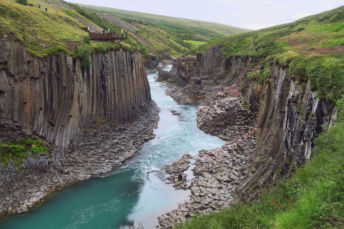
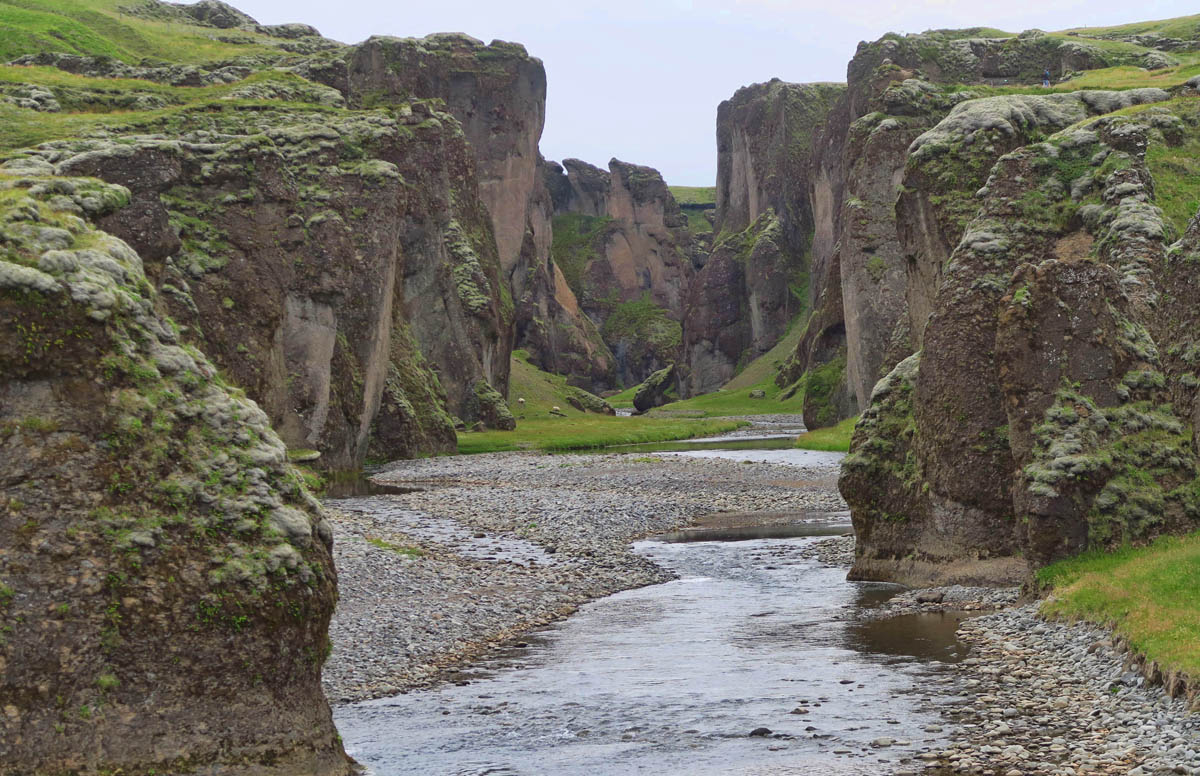
One of the best examples of a basalt colonnade in Iceland is the stunning Stuðlagil Canyon in east Iceland. It’s considered to have one of the largest collections of basalt columns in Iceland. But it’s a bit off the beaten path. Of all the places I have visited, directions on how to reach this canyon were the most vague. Landmarks are names of individual’s farms, for example, “Take a sharp left turn just past the Skjöldólfsstaðir farm.” Riiight…)
There are two ways to approach the canyon. If you go to the west side, you end up at a steep staircase leading down to a viewing platform where you can go no further. It’s not possible to descend into the canyon. Even worse, you are facing the least spectacular, shorter side. The most interesting massive colonnade is just out of sight beneath the cantilevered platform. To view the most scenic east side, one must cross the river and hike 10km (6 miles) to reach the canyon. (There is a new parking lot across the bridge, further down the road that cuts the hike down to 3 miles. But the road is pretty marginal, and I didn’t see any other camper vans on it.)
After a couple of wrong turns, I finally landed on the 14km gravel road leading to the canyon. But just before I got there, the road split. I went straight when I should have turned left. Once I saw the staircase, I realized I had missed my turn, and backtracked to the turn in the road that leads to the east side. This would mean a 6 mile RT hike to reach the canyon. My lucky streak with the weather having run out, I had two choices. Stick with the viewing platform. Or pull on my rain pants, my rain jacket, and slosh Onward! Through the bog!
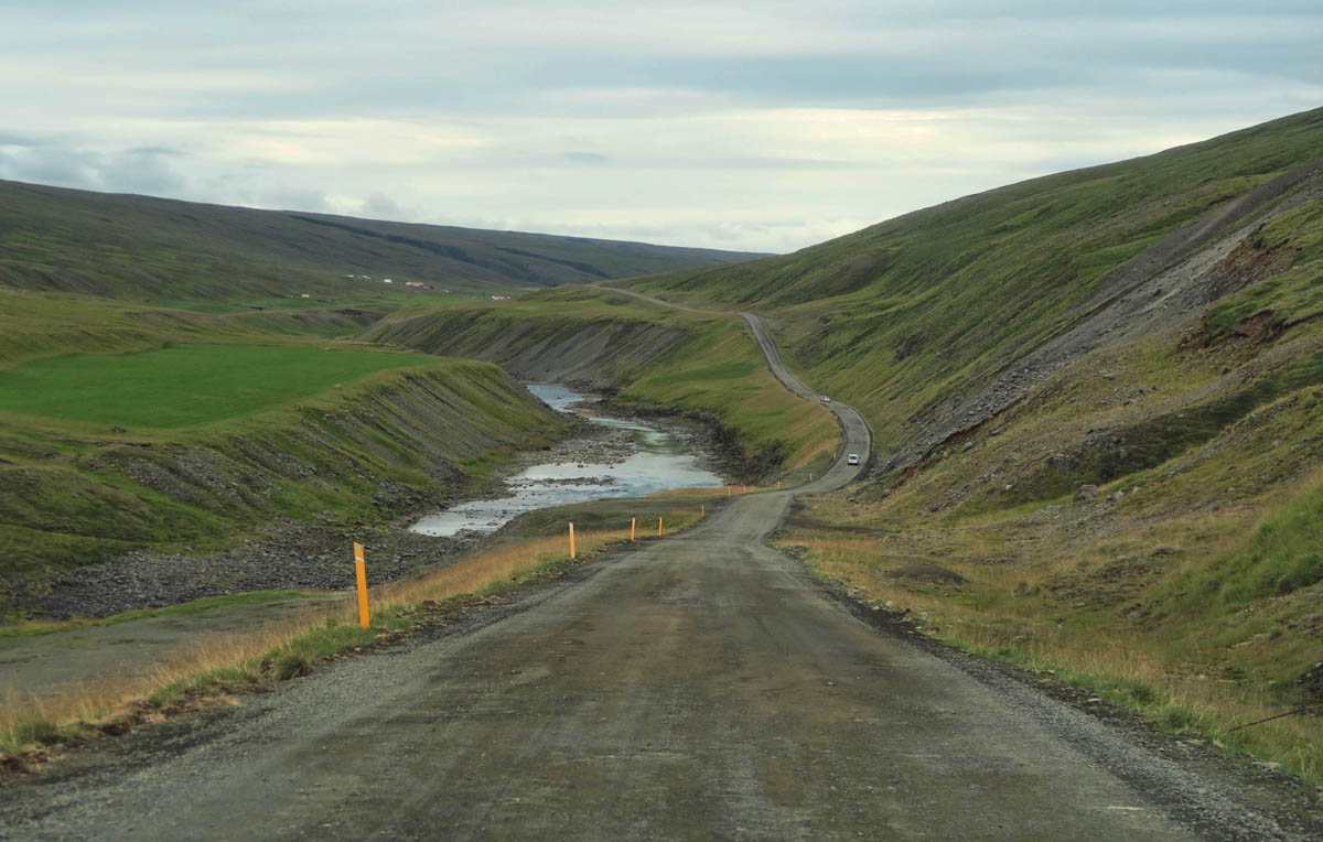
It’s a 14km (8.7mi) drive down a washboard gravel road to reach Stuðlagil Canyon.

I realized as soon as I pulled into the parking lot that I had missed my turn to the hike. On this side, the only views are from this steep and deep staircase.
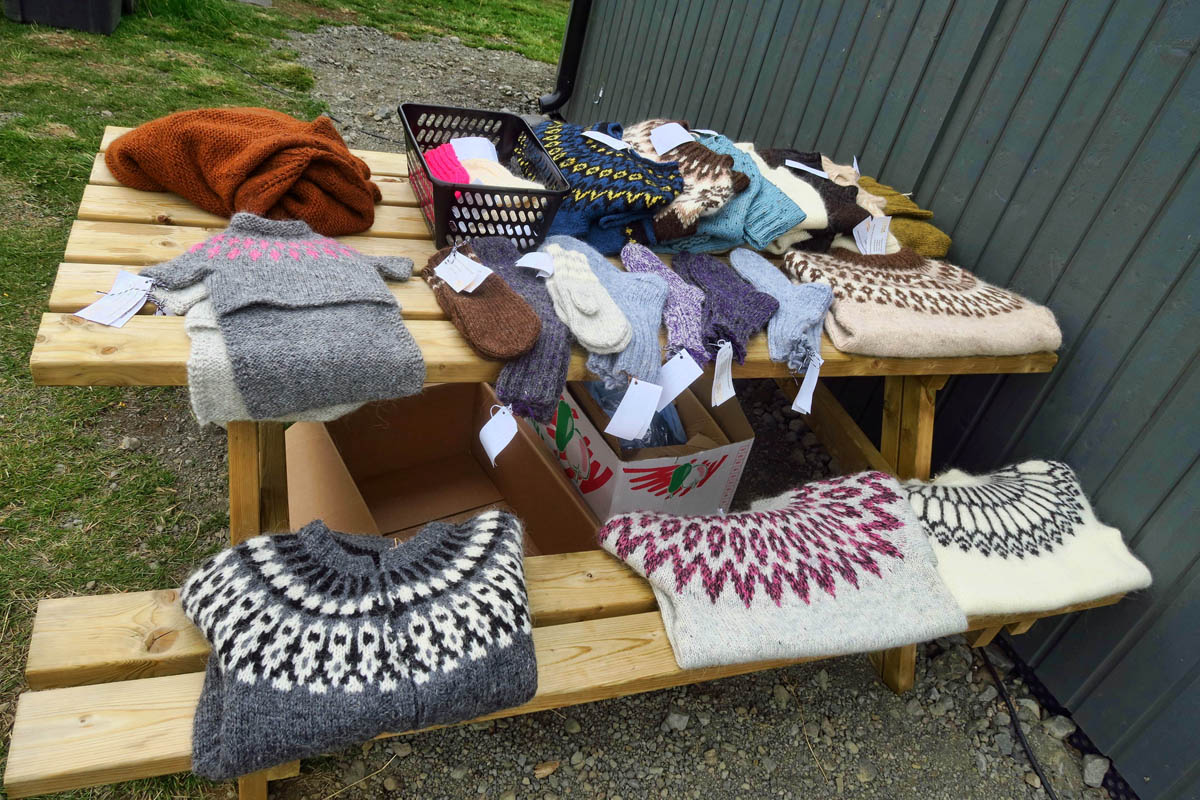
There are a few facilities on this side, though. A coffee truck, toilets, and handicrafts for sale. You won’t find any of these on the hike side of the canyon.
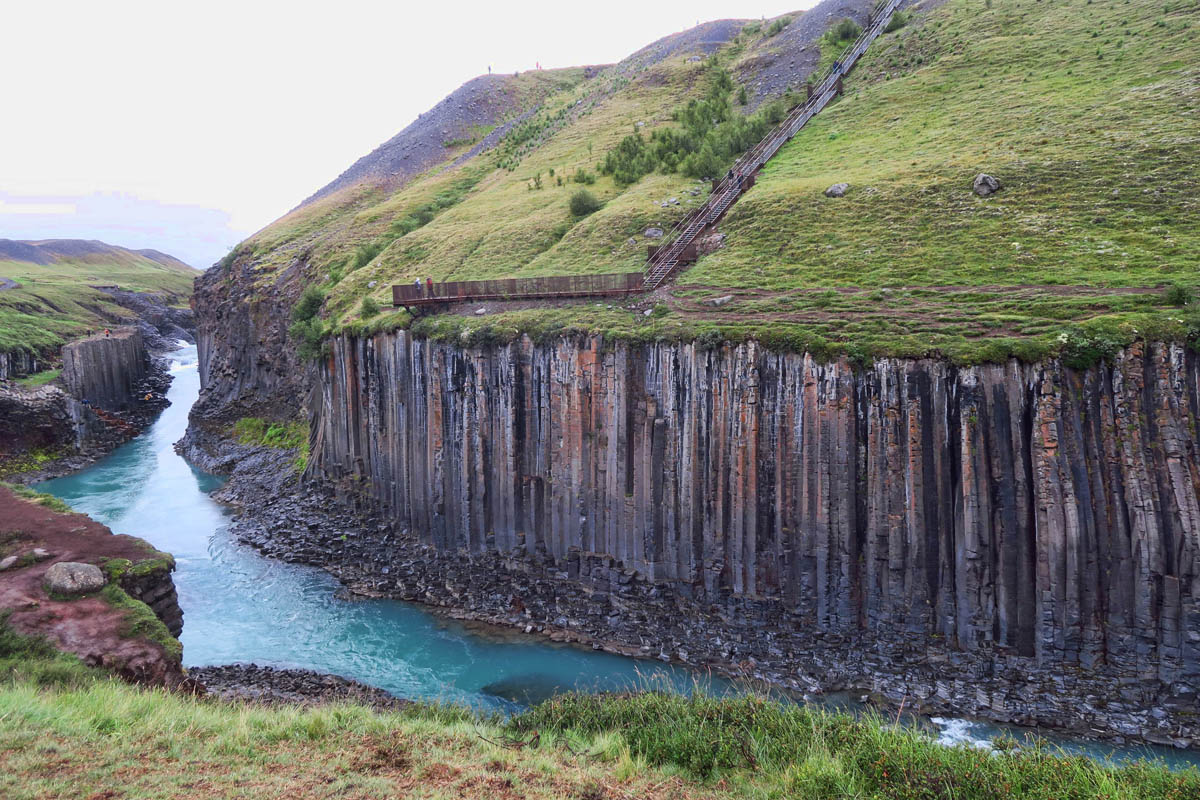
In the upper part of the photo is a look at the long staircase down to the edge of the canyon. You can see why it’s not the preferable approach, as you don’t see the best part…the tall walls of the basalt columns, because they are beneath the viewing platform.

If you do the 6 mile hike (on the left,) the tallest part of the canyon walls are right in view.

In spite of the rain, I couldn’t get enough of this place!
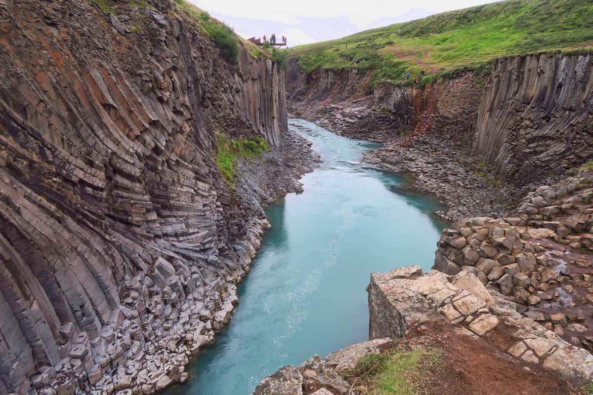
If you look at the very top of this photo, you will see the viewing platform, and another example of why the hike is the better view, as the viewing platform overlooks the shorter side of the canyon, with the basalt formations out of view.
I did make it down to the river’s edge, but honestly my photos were better from the hiking trail. Or maybe I just had “perceptual narrowing” down there because the rocks were so slick, so I was a bit limited by fear of not getting out!

The stunning aquamarine color of the water only occurs at certain times of the year when there is glacial melt.
Hengifoss and Litlanesfoss
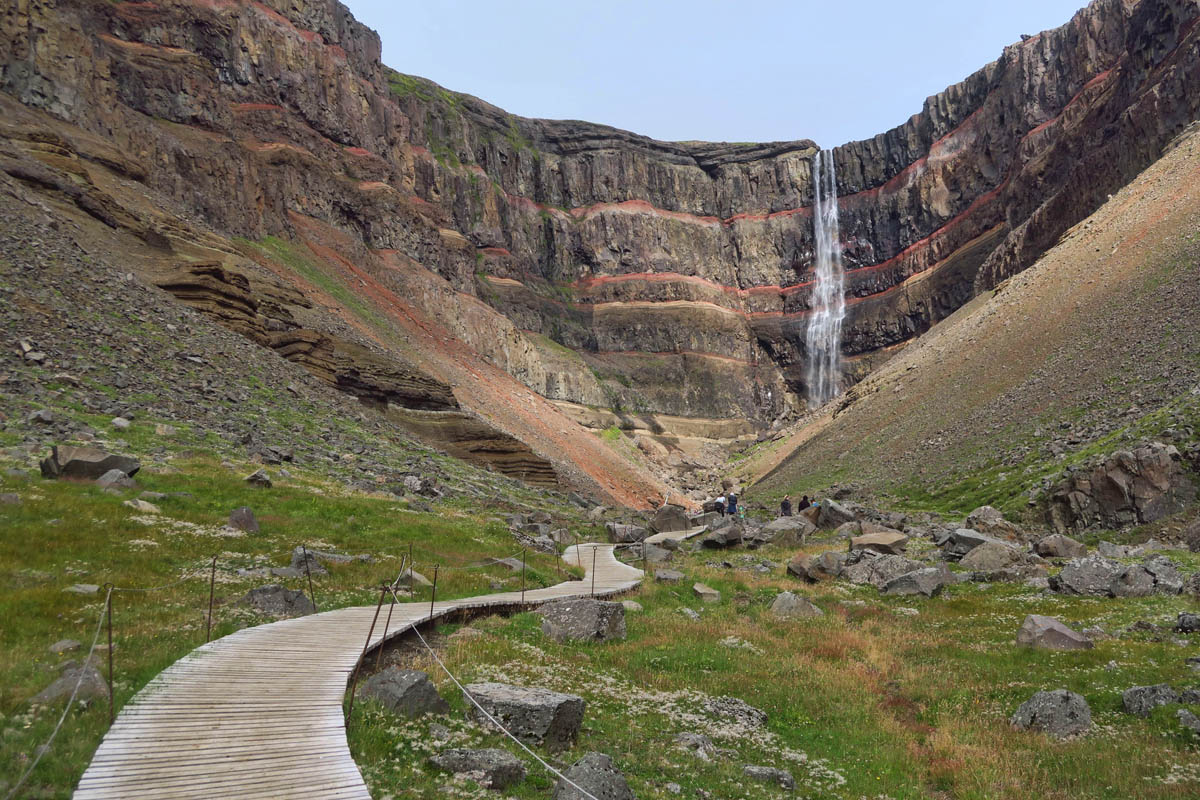
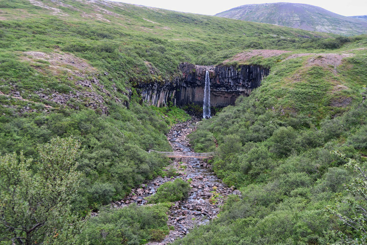
Another magnificent geological marvel is Hengifoss. At 118m (387ft,) it is one of the highest waterfalls in Iceland. What makes Hengifoss so spectacular are the symmetrically spaced layers of red clay sandwiched between the layers of black basalt.
On the path to Hengifoss, one passes a lesser known but equally beautiful waterfall, Litlanes. While at 98 ft it is not as high as Hengifoss, being flanked on both sides by an amphitheater of basalt columns makes it no less spectacular.
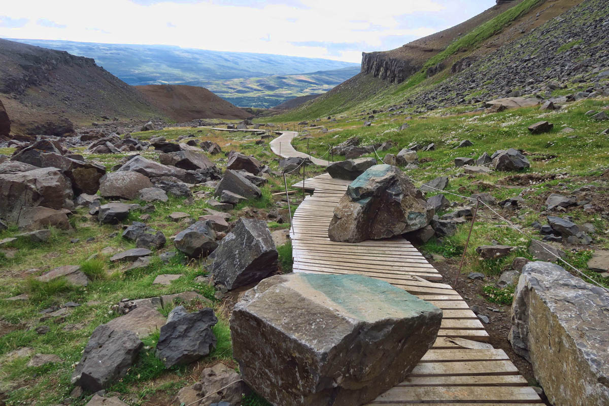
It’s less than a 3 mile hike to reach Hengifoss, so I foolishly expected a “cake walk.” But not only is it a steady climb the entire way, but the morning I hiked it, the sun was beating down on my back on the warmest, most humid day during my time in Iceland.. I was wearing black from head to toe, which caused me to swelter in sweat all the way up, and freeze all the way down. Still, it was worth every sweaty step.

Never my favorite way to start out a hike….with what looks like a Stairway to Heaven.

The sun came out on my way up the hill, and it was suddenly “short pants weather” in Iceland!
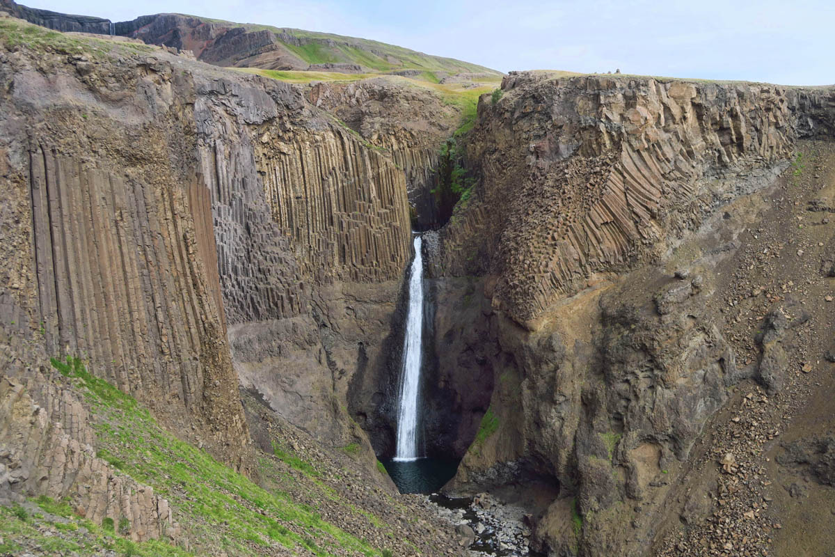
Before you reach Hengifoss, about halfway up you come to Litlanesfoss. A smaller waterfall, but no less spectacular due to the surrounding basalt “theater.”

Both Hengifoss and Litlanesfoss are located within Vatnajökull National Park, Europe’s largest national park which encompasses 13% of Iceland.
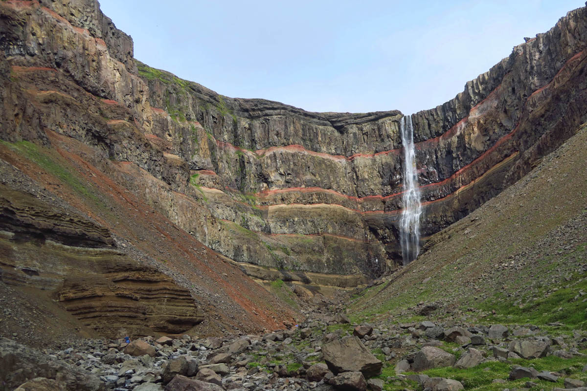
At 387ft, Hengifoss is Iceland’s third highest waterfall.
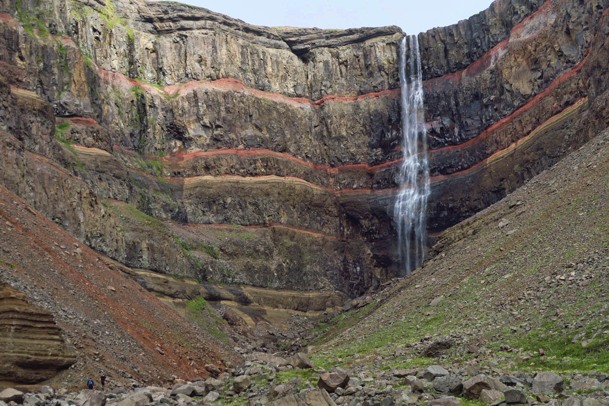
The bands of reddish sandy clay, or interbasaltic strata are formed from volcanic ash. When the next layer of lava flows over the acidic soil, the iron reacts with oxygen, resulting in the reddish coloring.
The Hengifoss trail was closed recently due to a rock slide. I was happy they got it reopened so quickly.
Another gorgeous spot that I didn’t want to leave.
Svartifoss
Within Iceland’s largest national park, Vatnajökull National Park, is the Skaftafell nature reserve, best known for another waterfall that stands out because of its “columnar jointing.” Svartifoss is one of Iceland’s most popular waterfalls, not because of its size (only 66 ft) but because of the beautiful black basalt columns that give Svartifoss its name in Icelandic, “Black Falls.”
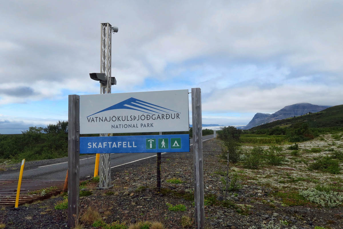
This national park has a fee (about $7) for entry. Here’s how Iceland collects these fees….your license plate is photographed upon entry, and you have 3 days after entry to go onto the PARKA App and pay the fee. (There are also vending machines in the parking lot.)

The Skaftafell Visitor Center located within Vatnajökull National Park which was inducted as a UNESCO World Heritage Site in 2019.
Stolen from Wikipedia, “The unique qualities of Vatnajökull National Park are primarily its great variety of landscape features, created by the combined forces of rivers, glacial ice, and volcanic and geothermal activity.”

There are warning signs around the falls that due to potential for falling basalt columns, getting off the designated path or viewpoint will lead to expulsion from the park.
Fjadrarglufur Canyon
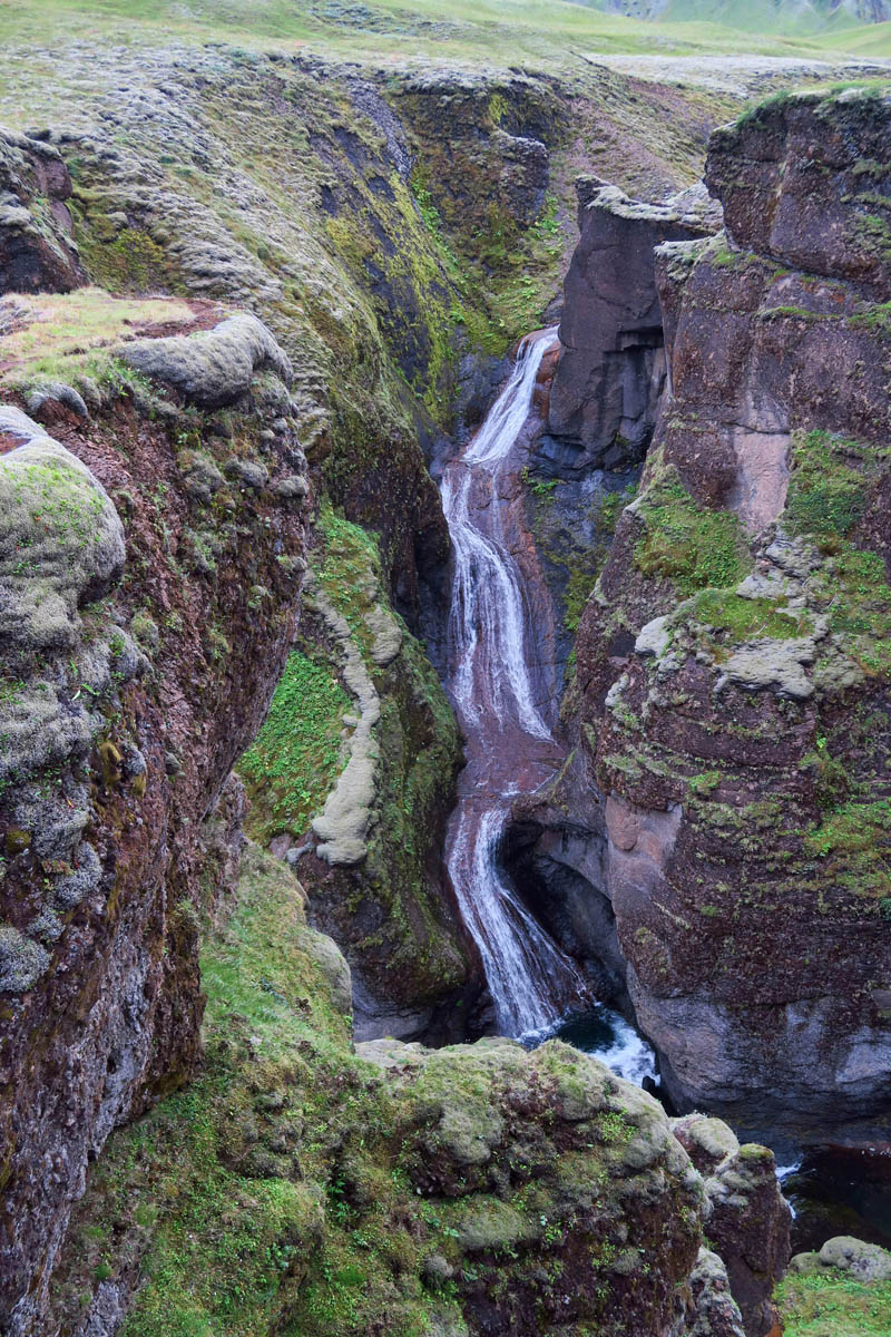
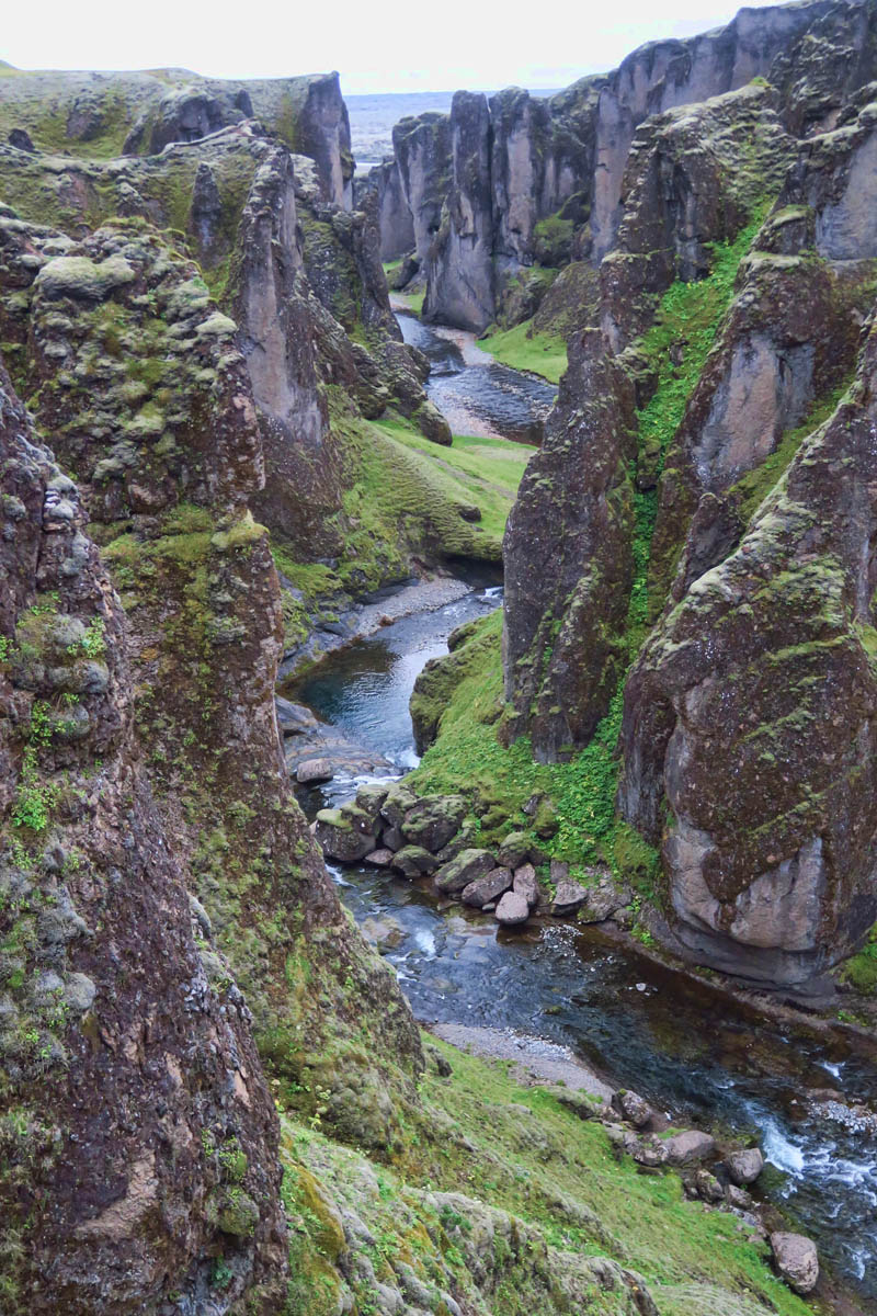
Next along this stretch is the Fjadrarglufur Canyon, another geological masterpiece known to be one of the most picturesque places in Iceland. It was believed to have formed at the end of the ice age when the glacier retreated, leaving a glacial river to carve a massive canyon 300 feet down. The verdant green moss growing on the hillsides is the kind of stuff movies are made of. Or in this case, music videos.
In 2015, Justin Bieber filmed a youtube music video, “I’ll show you” in then little known Fjadrarglufur Canyon. That video went viral, now having over 487 million views. In the following years, over two million tourists visited this area, many no doubt to reenact Bieber’s slow motion twirls and airy leaps, but hopefully not the part where he swims in the glacial river in his underwear.
What was once a place to frolic wild and free now must be viewed from a roped off path no more than 3 ft wide. It was closed off altogether back in April 2018 by the Icelandic Environment Agency due to damage from overtourism. After being closed for some time, it’s thankfully now reopened after construction of a roped off path connecting three viewing platforms.
Visiting here made me ponder my own tourism footprint, feeling a bit of shame for following the “influencers.” Hitting all the “instagramable” stops is not typically my style of travel. But then I also don’t typically follow a Ring Road dotted with so many geographical wonders all lined up in a row.

Fjaðrárgljúfur Canyon is just off the Ring Road.

Note the channel worn into the ridge where “the Biebs” stood on the overlook, proclaiming, “I’ll show you.”
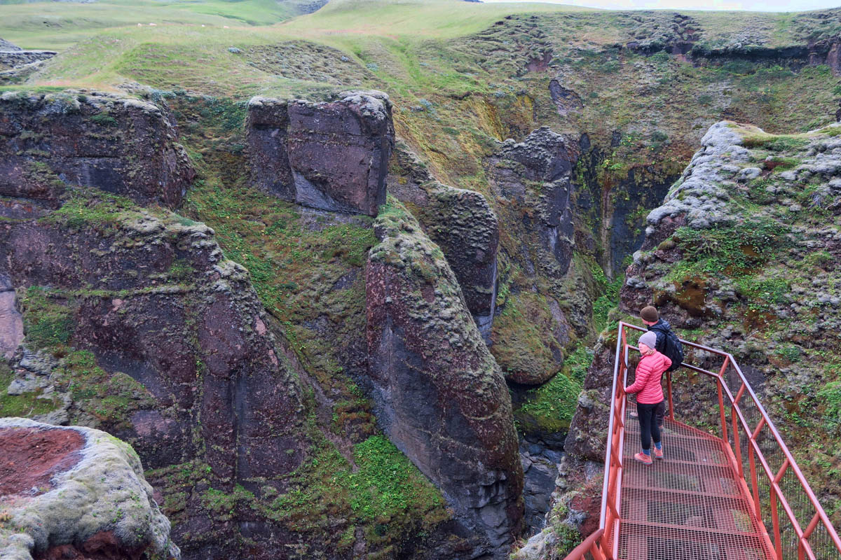
Those trails are all closed off now, with new access being via three viewing platforms.
The views from the three platforms are stunning, and a good compromise to having the entire canyon closed down.
Smithsonian magazine writes, “Still footprints in the spring mud show that every time the Ranger takes a break or has to leave their post to perform another duty, people hop the fences to dance on the canyon edge.”
View “up canyon” from the bridge.
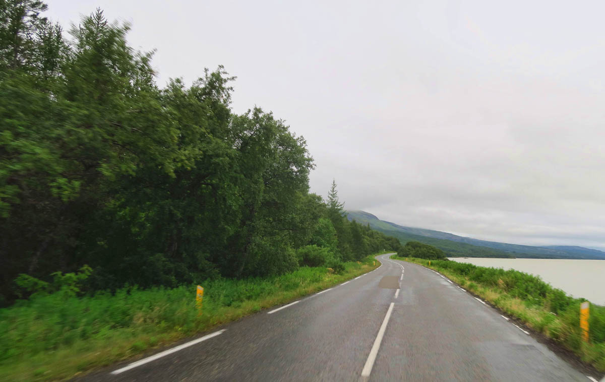
Campgrounds on this section: Atlavik in the national forest, and Camping Höfn in the town of Höfn.
While a forest is not a “geological wonder,” in Iceland, it might almost be considered as such. But chronologically, it fits in this section. I have not included many photos of my campgrounds, because most of them have been nothing more than grassy parking lots. But the exception to that was my favorite campsite, Atlavik, located inside Hallormsstaðarskógur National Forest on the shores of Lögurinn Lake.
Iceland is mostly a treeless, volcanic barren landscape, so this 286 sq mile national forest is quite an anomaly.
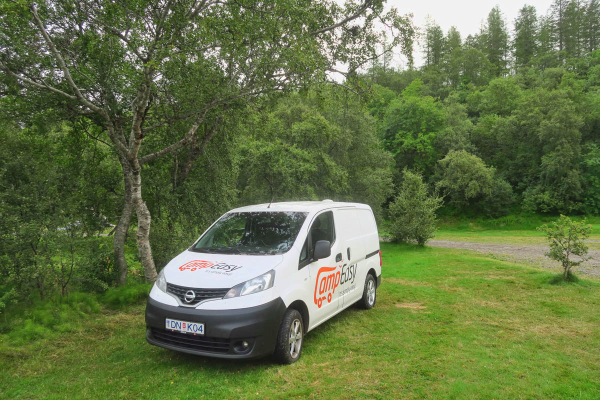
This was my favorite campsite. Nice to be surrounded by trees for a change rather than other camper vans.
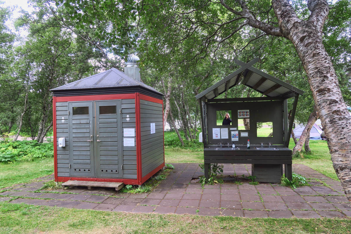
The campground is very basic, but has running hot and cold water, and a sink for dish washing. On the left are the toilets.
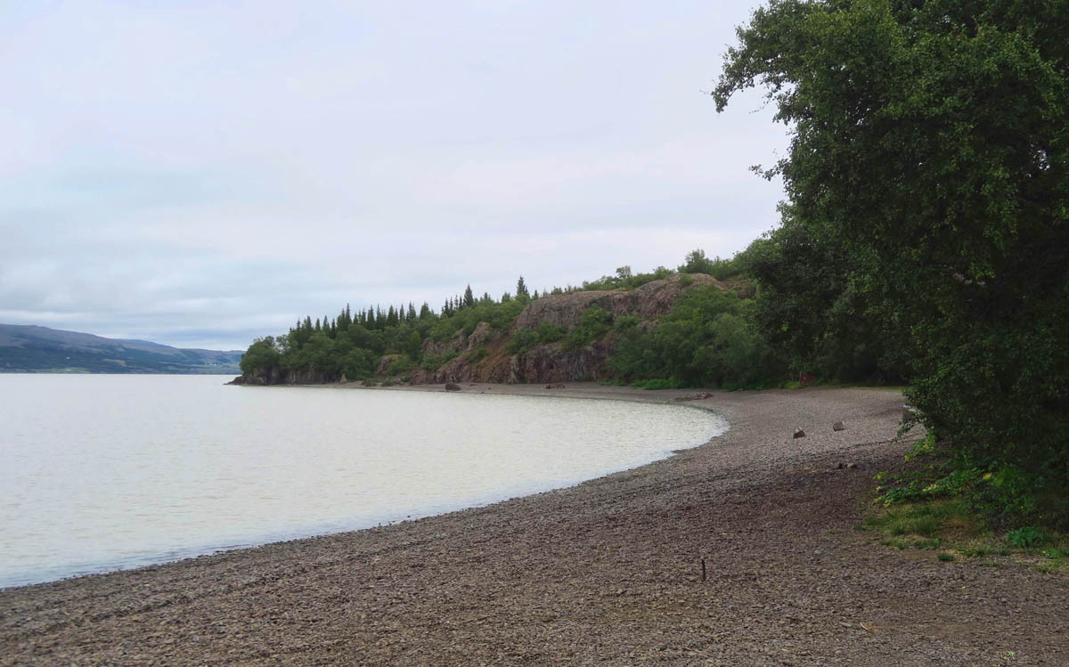
The campground was right on the shores of Lögurinn Lake, a long and narrow lake formed by the Lagarfljót River.

In spite of all the geographic wonders that make Iceland so unique, it’s just nice to see some flora for a change.
That certainly is a trip of a lifetime. Those columns and waterfalls are incredible!
Thanks, Jim and Barb! I am glad to have you along for the trip!
Stunning just doesn’t get it, does it? Can’t wait to visit!
I do admit running out of adjectives. Thanks for following along, Ed.
I wonder if its just the composition of your photographs ( great by the way) or if there just aren’t that many people present?
Hi, Jim. Thanks for the comment. These photos have all been of the northern region. Given the distance from the airport located in the south, not that many visitors venture up north due to time constraints, as well as a greater concentration of attractions in the southern region. As I moved on down the Ring Road toward the more popular areas, the crowds definitely picked up.
Oh, my! Again an unbelievable post. The waterfalls are spectacular, but those basalt columns are beyond words. I am so fascinated by them, as well. I, too, can’t begin to understand how they can be so perfectly symmetrical in every incidence. And the black basalt columns surrounding the falls are amazing. Thanks for sharing your trip.
Totally agree Pamela! this post and photos are unbelievably stunning! and Suzanne you are correct, the daily cold rain takes a back seat to the wonders of Iceland.
Yes, Terri, I just had to put on the rain gear and tell myself “This is my life now.” LOL!
Thanks for following along, Pam. I read somewhere that it is the same type of reaction that occurs in salt flats when the ground cracks in six-sided tiles. So fascinating!
What amazing stops these were…I can see why you’ve long wanted to visit Iceland. It is amazing how much of this land is treeless!
Thanks, Lisa,
I know like me, you enjoy a bit of “forest bathing.” I did miss seeing trees there, which was probably why I was so fond of the small national forest. Happy Belated to Hans!
Your pics of the basalt columns took me back to our bikes along the Columbia River Gorge. Stunning!
Thanks, Deborah. I drove “both sides now” of the Columbia River Gorge, but somehow I missed the basalt columns there. I’ll have to google them and see how I missed out.
The basalt columns backdrop to the aquamarine river provides such a beautiful landscape! With your reasoning of whether to take one side or the other to view the canyon walls, I found myself humming “Both Sides Now” all through this post. I so admire how you live life everyday, Suzanne…
“But now old friends are acting strange
They shake their heads, they say I’ve changed
Well something’s lost, but something’s gained
In living every day
I’ve looked at life from both sides now
From win and lose and still somehow
It’s life’s illusions I recall
I really don’t know life at all” ~ Joni Mitchell
Ahhh, Rhonda, you know how I do love Joni! There is so much to see in Iceland, one has to pick a side far too often!
Ahhh, the Biebs – saving the Icelandic economy with 1 video. Is there anything he can’t do? 🙂
Love the basalt columns. We saw some at Reynisfjara Beach – very cool. And all the town names just roll off the tongue, don’t they?!
Looking forward to your next post!
This made me LOL! I swear, Seyðisfjörður was my favorite town, because aside from Reykjavik, it was the only town I could actually pronounce! haha!